Appendix
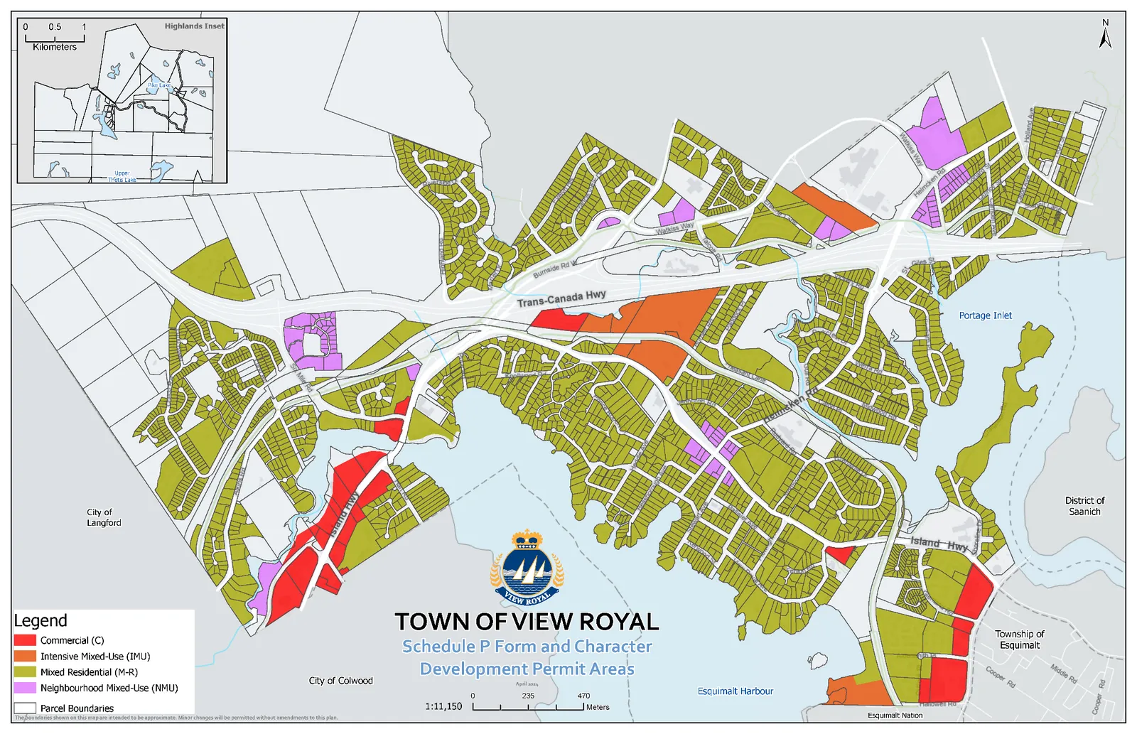
Bylaw 1139 Schedule 1: Form and Character Development Permit Areas
June 18, 2024Page 891 section
Map of Form and Character Development Permit Areas specifically attached to Bylaw 1139.
Identifies Mixed Residential and Commercial zones
Schedule 1
TOWN OF VIEW ROYAL
Schedule P Form and Character Development Permit Areas
Legend
- Commercial (C)
- Intensive Mixed-Use (IMU)
- Mixed Residential (M-R)
- Neighbourhood Mixed-Use (NMU)
- Parcel Boundaries
Scale 1:11,150
April 2024
The boundaries shown on this map are intended to be approximate. Minor changes will be permitted without amendments to this plan.
Page 89
Extracted from: 2024 06 18 Public Hearing Agenda - Agenda - Pdf