This site is in beta — data may be incomplete and features are still being added.
Public Hearing/Documents/Attachment 4: Estimated Tree Growth Visualizations
Appendix

Attachment 4: Estimated Tree Growth Visualizations

June 27, 2017Pages 82–855 sections

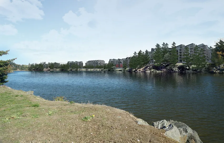
Visual simulations showing how the proposed tree plantings will mature over 30 years from various local viewpoints.

4.1.a Rezoning - 2951 Craigowan Road (Christie Point)
Viewpoints include Craigflower Bridge, E&N Rail Trail, Portage Inlet Linear Park, and Seabird ParkTime intervals shown: at planting, 10 years, 20 years, and 30 years

CHRISTIE POINT REDEVELOPMENT PLAN - REZONING

Page 82–85

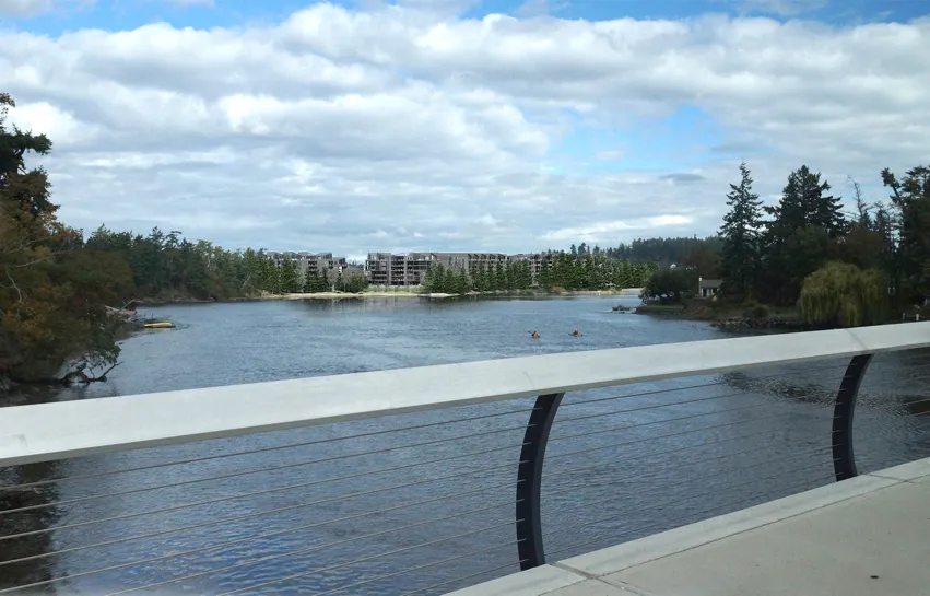
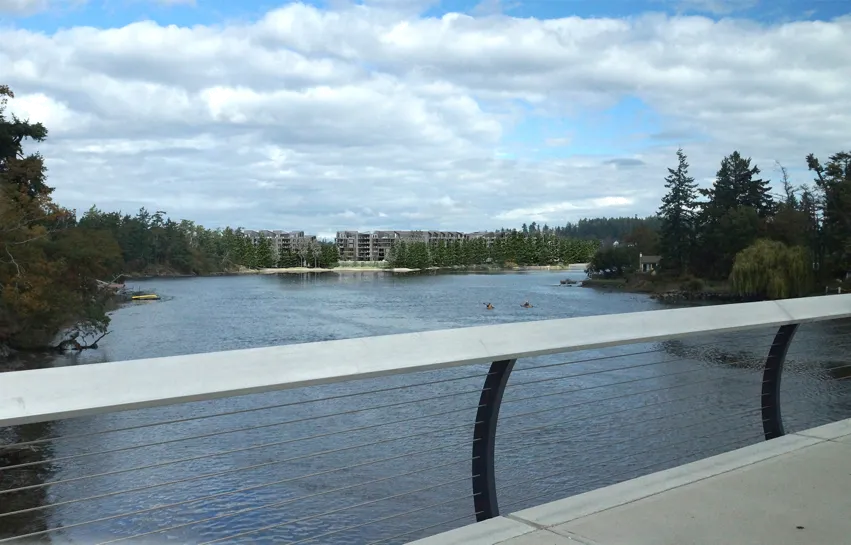
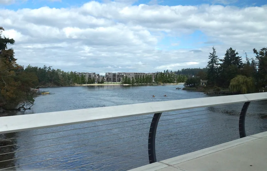
ESTIMATED TREE GROWTH: CRAIGFLOWER BRIDGE VIEW

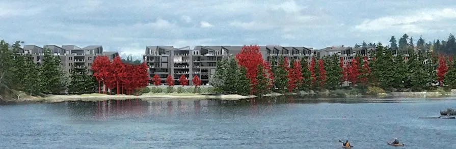
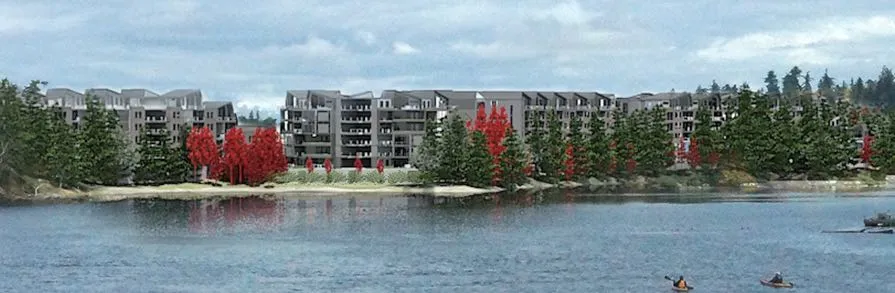
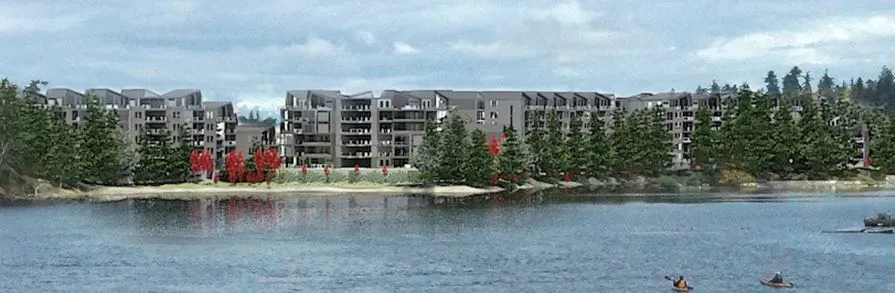
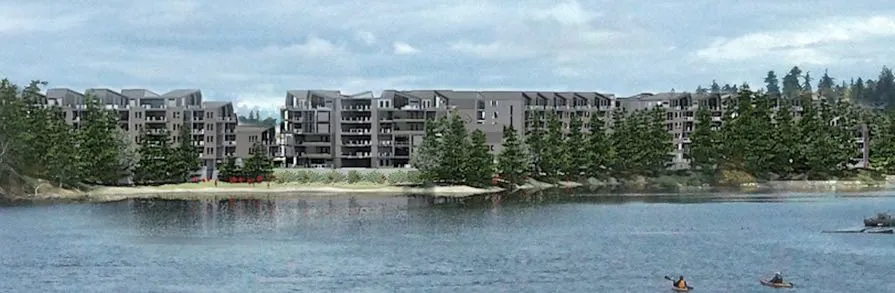
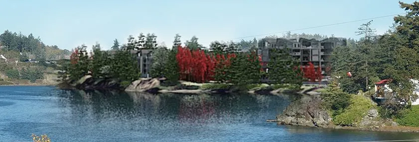
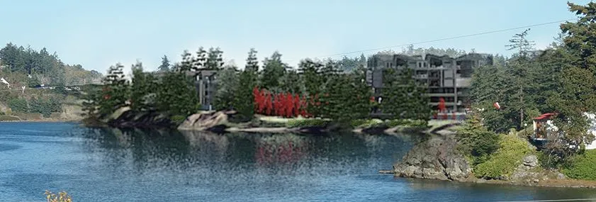
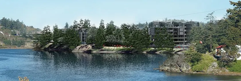
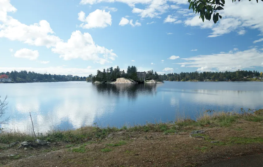
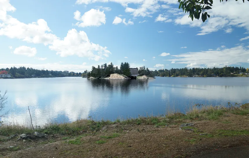
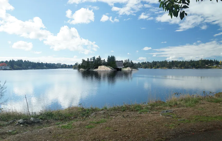
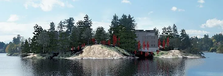
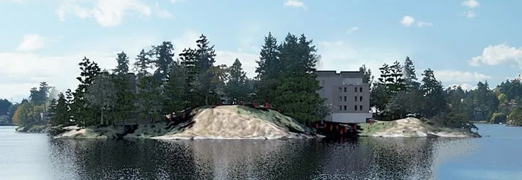
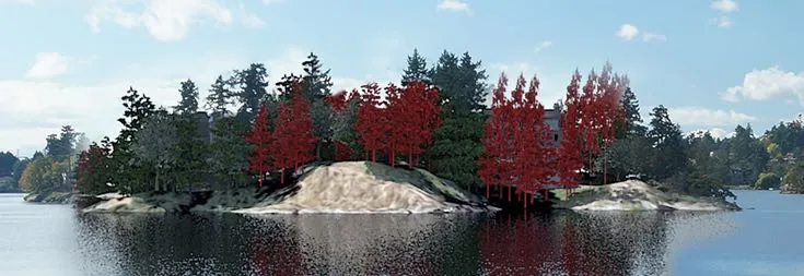
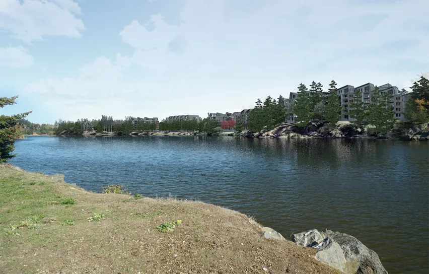
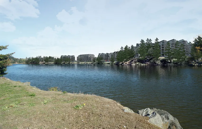
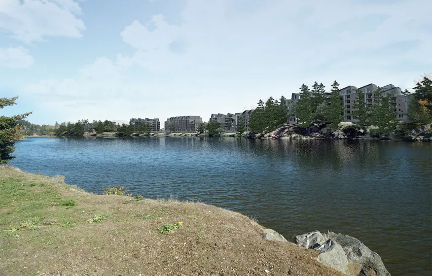
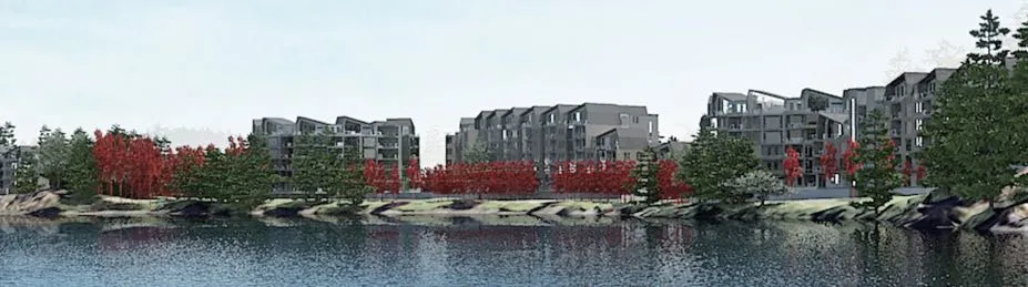
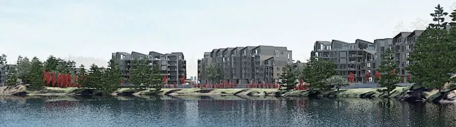
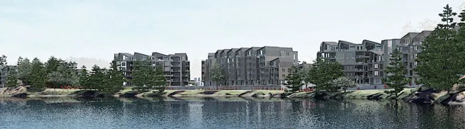
These illustrations show the approximate views toward Christie Point as new tree plantings grow and mature over time. Illustrations are based on a schematic plan for new trees to be planted as part of the redevelopment of Christie Point (see Christie Point Tree Planting & Growth Plan by LADR Landscape Architects for locations and species). Growth rates have been modeled based on each species' approximate anticipated annual height and canopy radius growth per Talbot Mackenzie & Associates Consulting Arborists. Note that growth rates and heights will be influenced by a number of environmental conditions and are therefore only approximate.

NOTE: DRAWINGS INDICATE SCHEMATIC MASSING CONCEPT ONLY. ALL VIEWS ARE APPROXIMATE AND BUILDING DESIGNS ARE SUBJECT TO FURTHER DESIGN REFINEMENT AND ENGINEERING INPUT.

AT TIME OF PLANTING
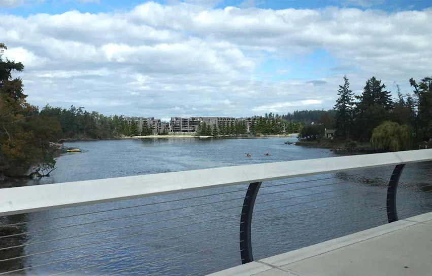
View from Craigflower Bridge toward Christie Point at the time of planting
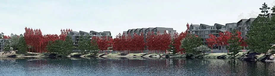
Zoom detail of Craigflower Bridge view at the time of planting, with new trees highlighted in red for clarity. A salt marsh/beach grass restoration area (no new tree plantings at shoreline) is indicated.

AT 10 YEARS

View from Craigflower Bridge toward Christie Point at 10 years of tree growth
Zoom detail of Craigflower Bridge view at 10 years, with new trees highlighted in red for clarity. A salt marsh/beach grass restoration area (no new tree plantings at shoreline) is indicated.

AT 20 YEARS

View from Craigflower Bridge toward Christie Point at 20 years of tree growth
Zoom detail of Craigflower Bridge view at 20 years, with new trees highlighted in red for clarity. A salt marsh/beach grass restoration area (no new tree plantings at shoreline) is indicated.

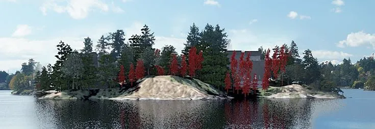
AT 30 YEARS

View from Craigflower Bridge toward Christie Point at 30 years of tree growth
Zoom detail of Craigflower Bridge view at 30 years, with new trees highlighted in red for clarity. A salt marsh/beach grass restoration area (no new tree plantings at shoreline) is indicated.

Project Information

  • Project Name: CHRISTIE POINT REDEVELOPMENT PLAN - REZONING
  • Sheet Title: ESTIMATED TREE GROWTH: CRAIGFLOWER BRIDGE VIEW
  • Location: CRAIGOWAN ROAD, VIEW ROYAL, BC
  • Architect: D’AMBROSIO architecture + urbanism
  • Address: 2960 Jutland Road, Victoria BC Canada V8T 5K2
  • Contact: tel: 250.384.2400 | fax: 250.384.7893 | eml: mail@fdarc.ca | web: www.fdarc.ca
  • Date: Mar 23, 2017
  • Project No.: 1505
  • Drawn by: NF
  • Checked by: FD
  • Scale: N/A

Page 82–85

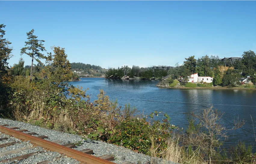
ESTIMATED TREE GROWTH: E&N RAIL TRAIL VIEW

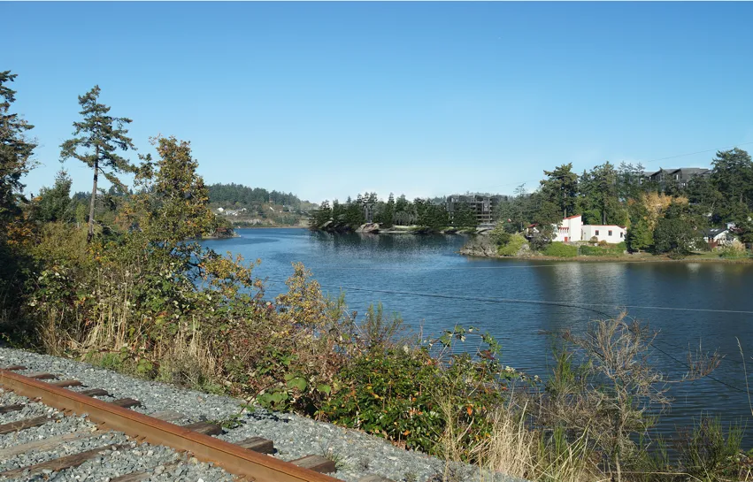
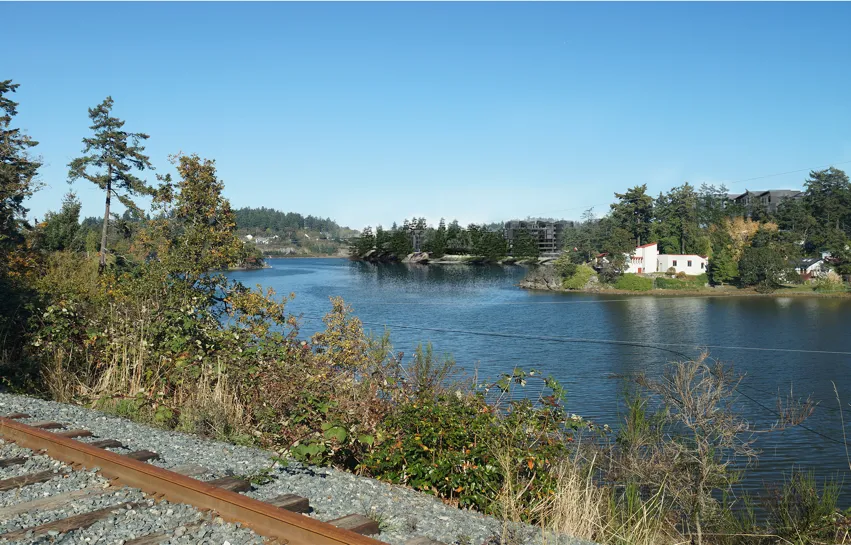
These illustrations show the approximate views toward Christie Point as new tree plantings grow and mature over time. Illustrations are based on a schematic plan for new trees to be planted as part of the redevelopment of Christie Point (see Christie Point Tree Planting & Growth Plan by LADR Landscape Architects for locations and species). Growth rates have been modeled based on each species' approximate anticipated annual height and canopy radius growth per Talbot Mackenzie & Associates Consulting Arborists. Note that growth rates and heights will be influenced by a number of environmental conditions and are therefore only approximate.

NOTE: DRAWINGS INDICATE SCHEMATIC MASSING CONCEPT ONLY. ALL VIEWS ARE APPROXIMATE AND BUILDING DESIGNS ARE SUBJECT TO FURTHER DESIGN REFINEMENT AND ENGINEERING INPUT.

AT TIME OF PLANTING
View from E&N Rail Trail toward Christie Point at the time of planting
Zoom detail of E&N Rail Trail view at the time of planting, with new trees highlighted in red for clarity

AT 10 YEARS

View from E&N Rail Trail toward Christie Point at 10 years of tree growth
Zoom detail of E&N Rail Trail view at 10 years, with new trees highlighted in red for clarity

AT 20 YEARS

View from E&N Rail Trail toward Christie Point at 20 years of tree growth
Zoom detail of E&N Rail Trail view at 20 years, with new trees highlighted in red for clarity

AT 30 YEARS

View from E&N Rail Trail toward Christie Point at 30 years of tree growth
Zoom detail of E&N Rail Trail view at 30 years, with new trees highlighted in red for clarity

Project Information

  • Project Name: CHRISTIE POINT REDEVELOPMENT PLAN - REZONING
  • Sheet Title: ESTIMATED TREE GROWTH: E&N RAIL TRAIL VIEW
  • Location: CRAIGOWAN ROAD, VIEW ROYAL, BC
  • Architect: D’AMBROSIO architecture + urbanism
  • Address: 2960 Jutland Road, Victoria BC Canada V8T 5K2
  • Contact: tel: 250.384.2400 | fax: 250.384.7893 | eml: mail@fdarc.ca | web: www.fdarc.ca
  • Date: Mar 23, 2017
  • Project No.: 1505
  • Drawn by: NF
  • Checked by: FD
  • Scale: N/A

Page 82–85

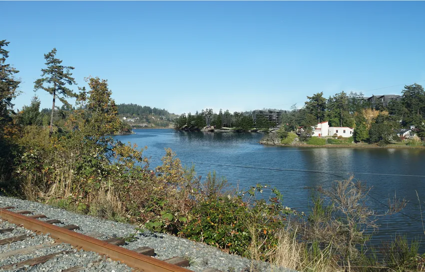
ESTIMATED TREE GROWTH: PORTAGE INLET LINEAR PARK VIEW

These illustrations show the approximate views toward Christie Point as new tree plantings grow and mature over time. Illustrations are based on a schematic plan for new trees to be planted as part of the redevelopment of Christie Point (see Christie Point Tree Planting & Growth Plan by LADR Landscape Architects for locations and species). Growth rates have been modeled based on each species' approximate anticipated annual height and canopy radius growth per Talbot Mackenzie & Associates Consulting Arborists. Note that growth rates and heights will be influenced by a number of environmental conditions and are therefore only approximate.

NOTE: DRAWINGS INDICATE SCHEMATIC MASSING CONCEPT ONLY. ALL VIEWS ARE APPROXIMATE AND BUILDING DESIGNS ARE SUBJECT TO FURTHER DESIGN REFINEMENT AND ENGINEERING INPUT.

AT TIME OF PLANTING
View from Portage Inlet Linear Park toward Christie Point at the time of planting
Zoom detail of Portage Inlet Linear Park view at the time of planting, with new trees highlighted in red for clarity

AT 10 YEARS

View from Portage Inlet Linear Park toward Christie Point at 10 years of tree growth
Zoom detail of Portage Inlet Linear Park view at 10 years, with new trees highlighted in red for clarity

AT 20 YEARS

View from Portage Inlet Linear Park toward Christie Point at 20 years of tree growth
Zoom detail of Portage Inlet Linear Park view at 20 years, with new trees highlighted in red for clarity

AT 30 YEARS

View from Portage Inlet Linear Park toward Christie Point at 30 years of tree growth
Zoom detail of Portage Inlet Linear Park view at 30 years, with new trees highlighted in red for clarity

Project Information

  • Project Name: CHRISTIE POINT REDEVELOPMENT PLAN - REZONING
  • Sheet Title: ESTIMATED TREE GROWTH: PORTAGE INLET LINEAR PARK VIEW
  • Location: CRAIGOWAN ROAD, VIEW ROYAL, BC
  • Architect: D’AMBROSIO architecture + urbanism
  • Address: 2960 Jutland Road, Victoria BC Canada V8T 5K2
  • Contact: tel: 250.384.2400 | fax: 250.384.7893 | eml: mail@fdarc.ca | web: www.fdarc.ca
  • Date: Mar 23, 2017
  • Project No.: 1505
  • Drawn by: NF
  • Checked by: FD
  • Scale: N/A

Page 82–85

ESTIMATED TREE GROWTH: SEABIRD PARK VIEW

These illustrations show the approximate views toward Christie Point as new tree plantings grow and mature over time. Illustrations are based on a schematic plan for new trees to be planted as part of the redevelopment of Christie Point (see Christie Point Tree Planting & Growth Plan by LADR Landscape Architects for locations and species). Growth rates have been modeled based on each species' approximate anticipated annual height and canopy radius growth per Talbot Mackenzie & Associates Consulting Arborists. Note that growth rates and heights will be influenced by a number of environmental conditions and are therefore only approximate.

NOTE: DRAWINGS INDICATE SCHEMATIC MASSING CONCEPT ONLY. ALL VIEWS ARE APPROXIMATE AND BUILDING DESIGNS ARE SUBJECT TO FURTHER DESIGN REFINEMENT AND ENGINEERING INPUT.

AT TIME OF PLANTING
View from Seabird Park toward Christie Point at the time of planting
Zoom detail of Seabird Park view at the time of planting, with new trees highlighted in red for clarity

AT 10 YEARS

View from Seabird Park toward Christie Point at 10 years of tree growth
Zoom detail of Seabird Park view at 10 years, with new trees highlighted in red for clarity

AT 20 YEARS

View from Seabird Park toward Christie Point at 20 years of tree growth
Zoom detail of Seabird Park view at 20 years, with new trees highlighted in red for clarity

AT 30 YEARS

View from Seabird Park toward Christie Point at 30 years of tree growth
Zoom detail of Seabird Park view at 30 years, with new trees highlighted in red for clarity

Project Information

  • Project Name: CHRISTIE POINT REDEVELOPMENT PLAN - REZONING
  • Sheet Title: ESTIMATED TREE GROWTH: SEABIRD PARK VIEW
  • Location: CRAIGOWAN ROAD, VIEW ROYAL, BC
  • Architect: D’AMBROSIO architecture + urbanism
  • Address: 2960 Jutland Road, Victoria BC Canada V8T 5K2
  • Contact: tel: 250.384.2400 | fax: 250.384.7893 | eml: mail@fdarc.ca | web: www.fdarc.ca
  • Date: Mar 23, 2017
  • Project No.: 1505
  • Drawn by: NF
  • Checked by: FD
  • Scale: N/A
Page 82–85
Extracted from: 2017 06 27 Public Hearing Agenda - Agenda - Pdf