Staff Presentation - OCP and Zoning Amendment - 298 Island Highway
Formal slide presentation by Town staff for the public hearing, outlining bylaw details, context, and project evaluations.
OCP2020/01 and REZONING 2020/04
298 Island Highway
Public hearing – February 2, 2021
OUTLINE
- Official Community Plan Bylaw Amendment Bylaw No. 1060, 2020
- Zoning Bylaw No. 900, 2014, Amendment Bylaw No. Bylaw No. 1061, 2020
- Development Concept
- Covenant
- Summary of Analysis and Discussion
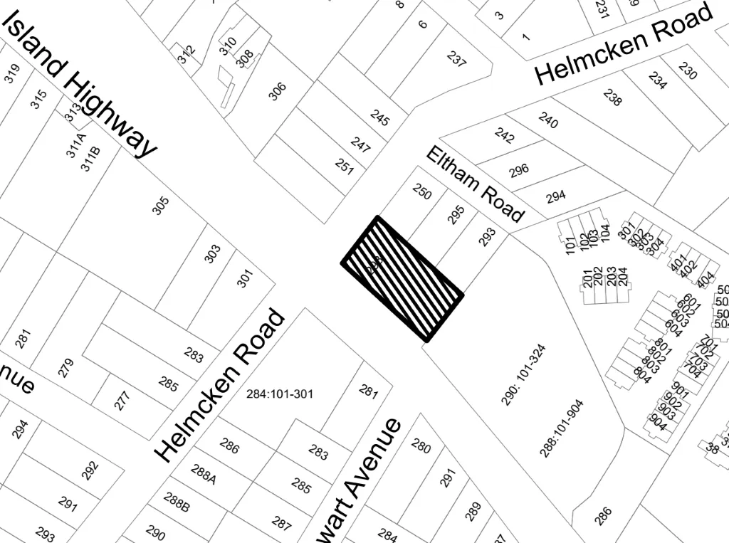
1. OCP Amendment Bylaw No. 1060, 2020 (1 of 2)
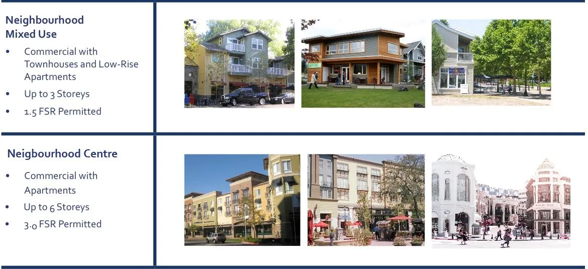
a. To change the Official Community Plan land use designation for the subject property from Neighbourhood Mixed Use (supporting commercial and residential use and 1.5:1 Floor Space Ratio) to a new Neighbourhood Centre land use designation that would support the following:
- commercial and residential use
- buildings up to six storeys
- 3.0:1 Floor Space Ratio.
| Category | Neighbourhood Mixed Use (Current) | Neighbourhood Centre (New) |
|---|---|---|
| Uses | Commercial with Townhouses and Low-Rise Apartments | Commercial with Apartments |
| Height | Up to 3 Storeys | Up to 6 Storeys |
| Density | 1.5 FSR Permitted | 3.0 FSR Permitted |
1. OCP Amendment Bylaw No. 1060, 2020 (2 of 2)
b. To amend the Neighbourhood Mixed Use Development Permit Area guidelines to include lands designated Neighbourhood Centre (form and character of multi-unit residential and commercial development).
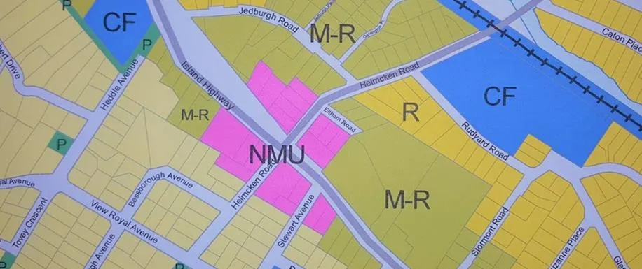
2. Zoning Bylaw No. 1061, 2020 (1 of 2)
Existing: 9.1. C-1: Community Commercial
a) Assembly Hall b) Bakery c) Café d) Civic Use e) Community Shopping Centre f) Financial Institution g) Licensed Retail Store h) Medical Clinic i) Mixed Commercial and Residential use j) Office k) Personal Service Establishment l) Pharmacy m) Restaurant, Full-Service
Proposed: CD-26: Island Highway/Helmcken Comprehensive Development zone
Principal Uses
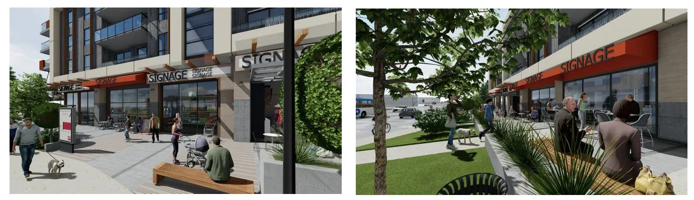
- Neighbourhood Grocery
- Residential, Apartment
Conditions of Use a. Neighbourhood Grocery use, with the exception of parking, may only be located on the first storey. b. The daily hours of operation for a Neighbourhood Grocery are limited to between 6:00am and 10:00pm.
Definition: Neighbourhood Grocery means a grocery with a leasable floor area of less than 700m². Neighbourhood Grocery may include, as an accessory uses only: bakery, café, and delicatessen.
2. Zoning Bylaw No. 1061, 2020 (2 of 2)
| Lot Size | Existing (C-1) | Proposed (CD-26) |
|---|---|---|
| Lot Size, minimum | 700m² | 1500 m² |
| Lot Width, minimum | 20m | - |
| Lot Density | Existing (C-1) | Proposed (CD-26) |
|---|---|---|
| Floor Space Ratio, Base Density | 0.6 | 3.0:1 |
| FSR with 80% underground parking | Base Density + 0.1 | - |
| FSR Bonus (75% green roof) | Base Density + 0.1 | - |
| Lot Coverage, maximum | 50% | 75% |
| Impermeable Surface Coverage, maximum | 80% | 80% |
| Building Size | Existing (C-1) | Proposed (CD-26) |
|---|---|---|
| Building Height, maximum | 9m | 21m and 6 storeys |
| Building Width, minimum | 6m | 6m |
| Accessory Building Height, maximum | 4.5m | - |
| Siting of Principal Buildings and Other Structures | Existing (C-1) | Proposed (CD-26) |
|---|---|---|
| Front Lot Line Setback, minimum | 7.5m | 0m (except 5th and 6th storeys) |
| Front Lot Line Setback, 5th and 6th storeys | - | 2.0m |
| Rear Lot Line Setback, minimum | 7.5m | 3.0m |
| Side Lot Line Setback | 6m | 3.0m |
| Flanking Lot Line Setback, minimum | 3m | 0m (except 5th and 6th storeys) |
| Flanking Lot Line Setback, 5th and 6th storeys | - | 2.0m |
Siting of Accessory Buildings and Other Structures
- All lot lines, minimum (Existing C-1): 1.2m
4. Covenant
a. Provision of a community amenity contribution of $3,500 per residential unit prior to issuance of a building permit b. The Neighbourhood Grocery will not be part of a franchise or corporation that operates internationally, nationally or inter-provincially. c. Road dedication for portion of sidewalk currently encroaching on to property
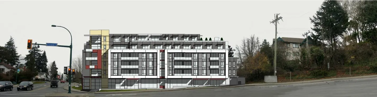
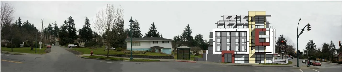
3. Development Concept (1 of 5)
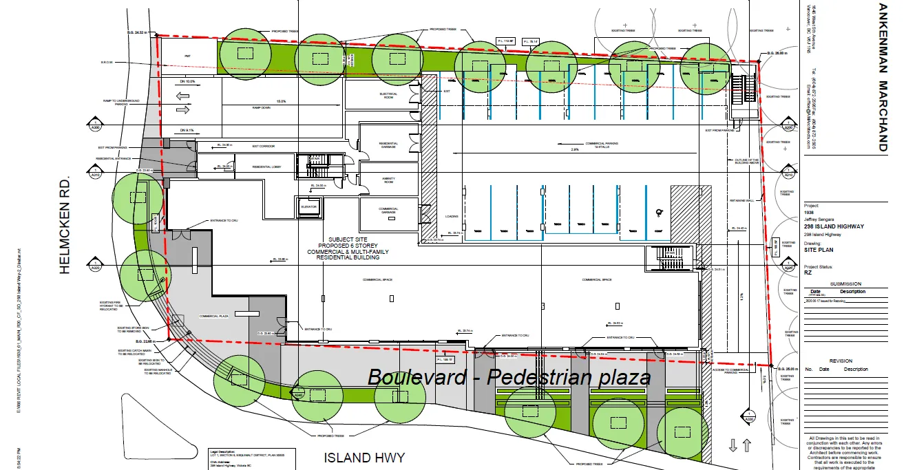
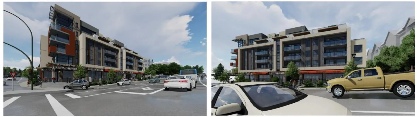
Development Concept (development permit stage)
- Six-storey building with the upper two storeys set back
- Ground floor: 560m² commercial use
- Upper floors: 54 apartment units
- 16 one-bedroom units
- 37 two-bedroom units
- 1 three-bedroom unit
- Two levels of underground parking.
| Feature | Specification |
|---|---|
| Lot Size | 1853m² |
| Floor Area | 5559 m² |
| Floor Space Ratio | 3.0:1 |
| Units/Hectare | 292 |
| Building Height | 20.3m |
| Storeys | 6 |
| Site Coverage | 75% |
| Units Proposed | 54 |
| Vehicle Parking | 103 (103 required) |
| Secure Bike Parking | 62 (56 required) |
3. Development Concept (2 of 5)
3. Development Concept (3 of 5)
3. Development Concept (4 of 5)
5. Summary of Analysis and Discussion
a. Official Community Plan context b. Traffic c. Servicing
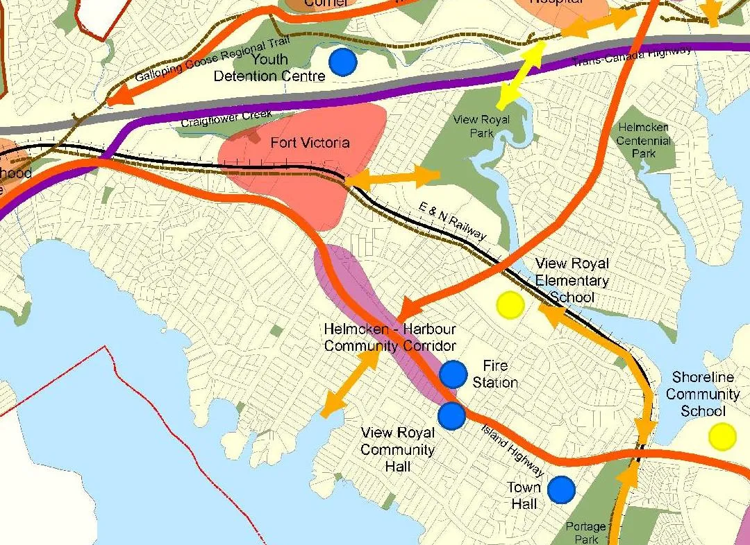
13 OCP land use designations
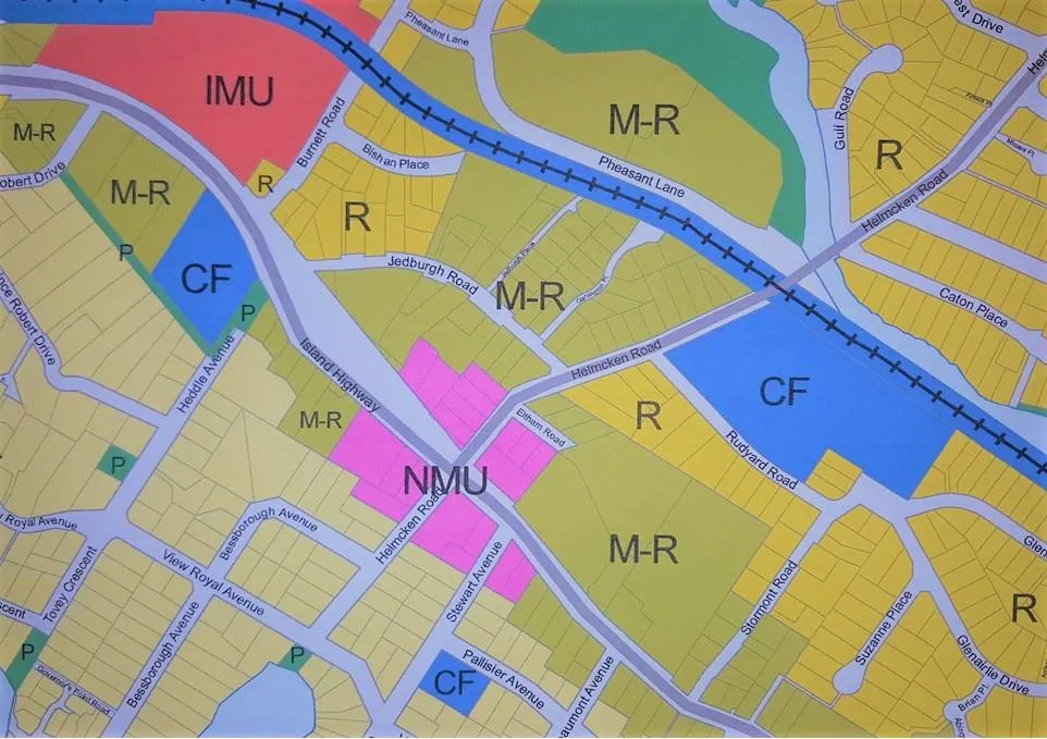
5a. Official Community Plan Context
- Consideration should be made on whether the mixed-use intensity would be appropriate for the corridor’s lots sizes and adjacent residential areas
| Development | Address | Units | Lot Area | Units per hectare |
|---|---|---|---|---|
| Current proposal | 298 Island Highway | 54 | 0.1853 ha | 291.4 |
| Lions Cove | 288/290 Island Highway | 66 | 0.8275 ha | 80.0 |
| Maia London | 280 Island Highway | 37 | 0.1677 ha | 220.6 |
| Skyview | 242-244 Island Highway | 37 | 0.1860 Ha | 198.9 |
5b. Traffic circulation
A. A Traffic Impact Assessment (TIA) was submitted by the developer.
- Traffic Counts performed and adjusted for accuracy.
- Site Trip Generation calculated.
- Concerns over increased neighbourhood "Cut-thru" traffic (see illustration)
- Traffic flow minimal compared to existing traffic volumes on Island Highway and Helmcken.
- Various mitigations considered.
- A roundabout at Eltham
- Not enough room
- Leg disparity of intersection too great
- Removing Right Lane on west bound Island Highway movement
- Would increase queue lengths significantly
- Would create more negative benefits than positive
- A roundabout at Eltham
5b. Traffic circulation (Continued)
- Reconfigure the Island Highway and Helmcken Intersection to increase traffic flow (Illustration to follow).
- Would create greater issues at other intersections east and west of the altered intersection.
- Would be less safe and would create merge lags and conflicts
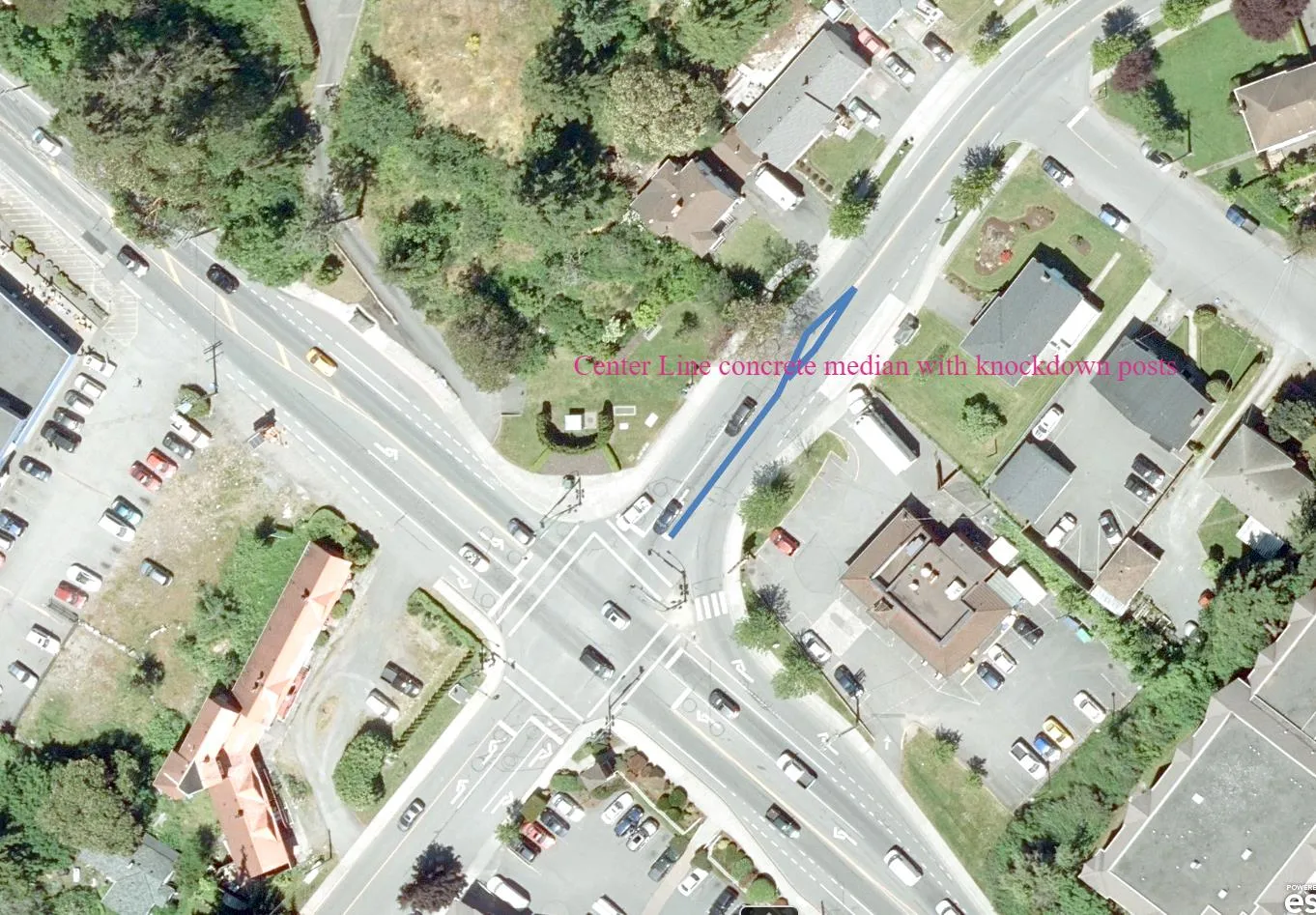
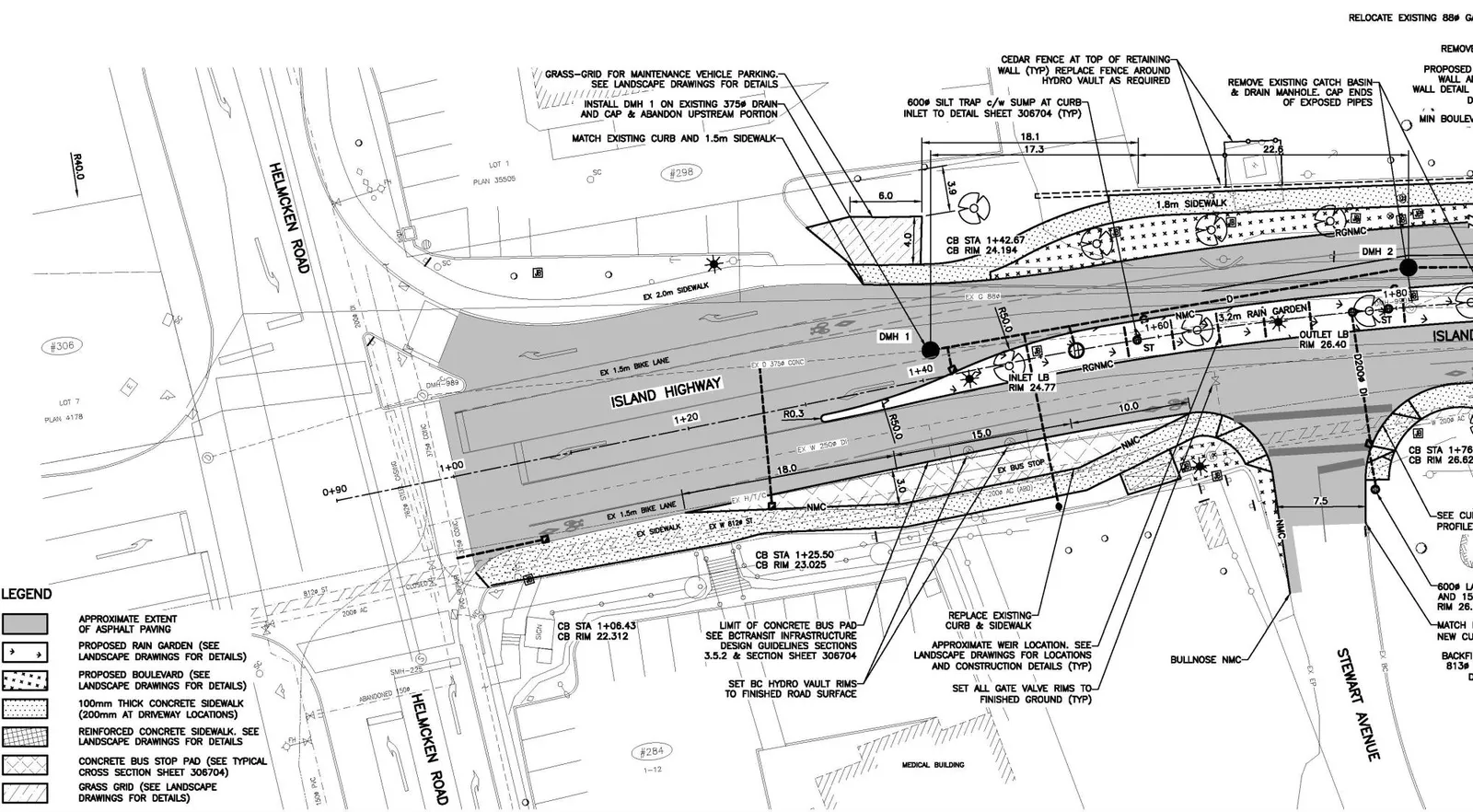
- No left turns in/out of site.
- Physically restricted on Helmcken (see illustration to follow)
- Ultimate design will restrict movement on Island Highway as well (see illustration to follow)
- TIA reviewed by third party on behalf of the Town of View Royal and validated the results and recommendations.
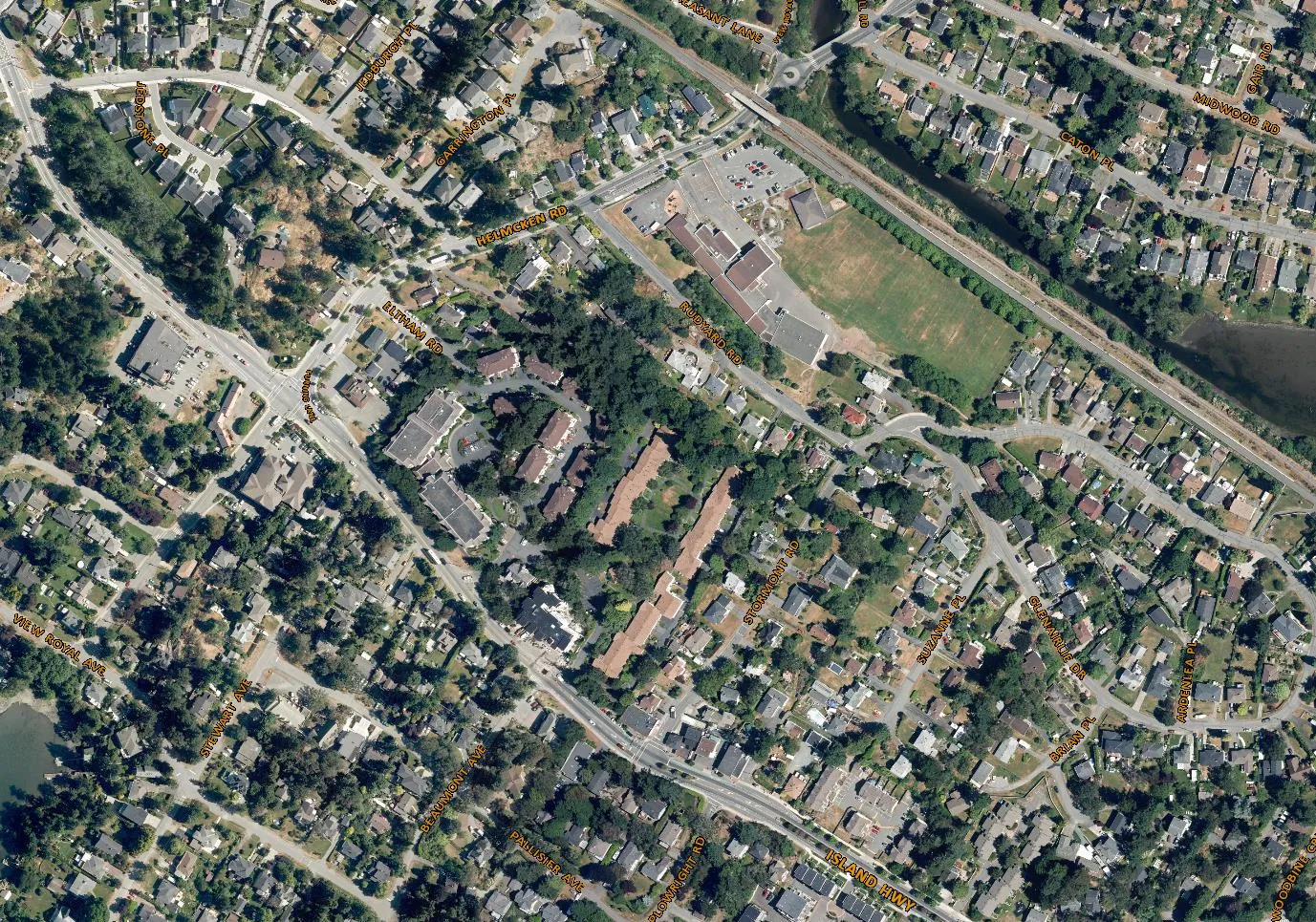
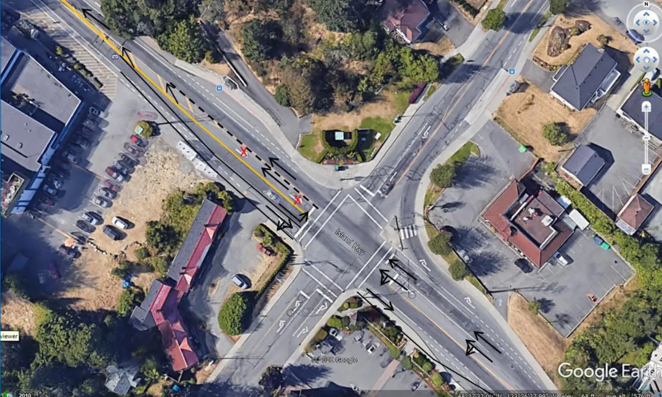
Subject Property
5c. Site Servicing
- Additional sewer demand would be within the Town’s allocation for discharge to the regional sanitary sewer system.
- Adequate capacity in the Helmcken Bay sanitary sewer lift station to accommodate the proposed development.
- A more detailed servicing concept will be required at the development permit stage if the bylaws are approved.
- Capacity concerns over existing sanitary Sewer pipe in Statutory Right of way in the rear lot line.
END
Document Images
(1)