Attachment 3: EAGLES NEST Rezoning Application Submission Summary Document
A design and planning rationale document submitted by the applicant detailing the project objectives, community engagement history, and site evolution.
EAGLES NEST Rezoning Application
Submission Summary Document 17 January 2020
CONTENTS
1.0 Introduction & Planning Context
Development Drivers & Objectives ............................ 2 Current Site Conditions .............................................. 3 Site Context................................................................. 4 Planning Framework ................................................... 5 Regional & Local Traffic .............................................. 6 Transportation Planning ............................................. 7
2.0 Community Engagement & Site Planning
Site Plan Evolution with Community Input ................. 9 Neighbours’ Workshops ............................................. 12
3.0 Proposed Development Plan
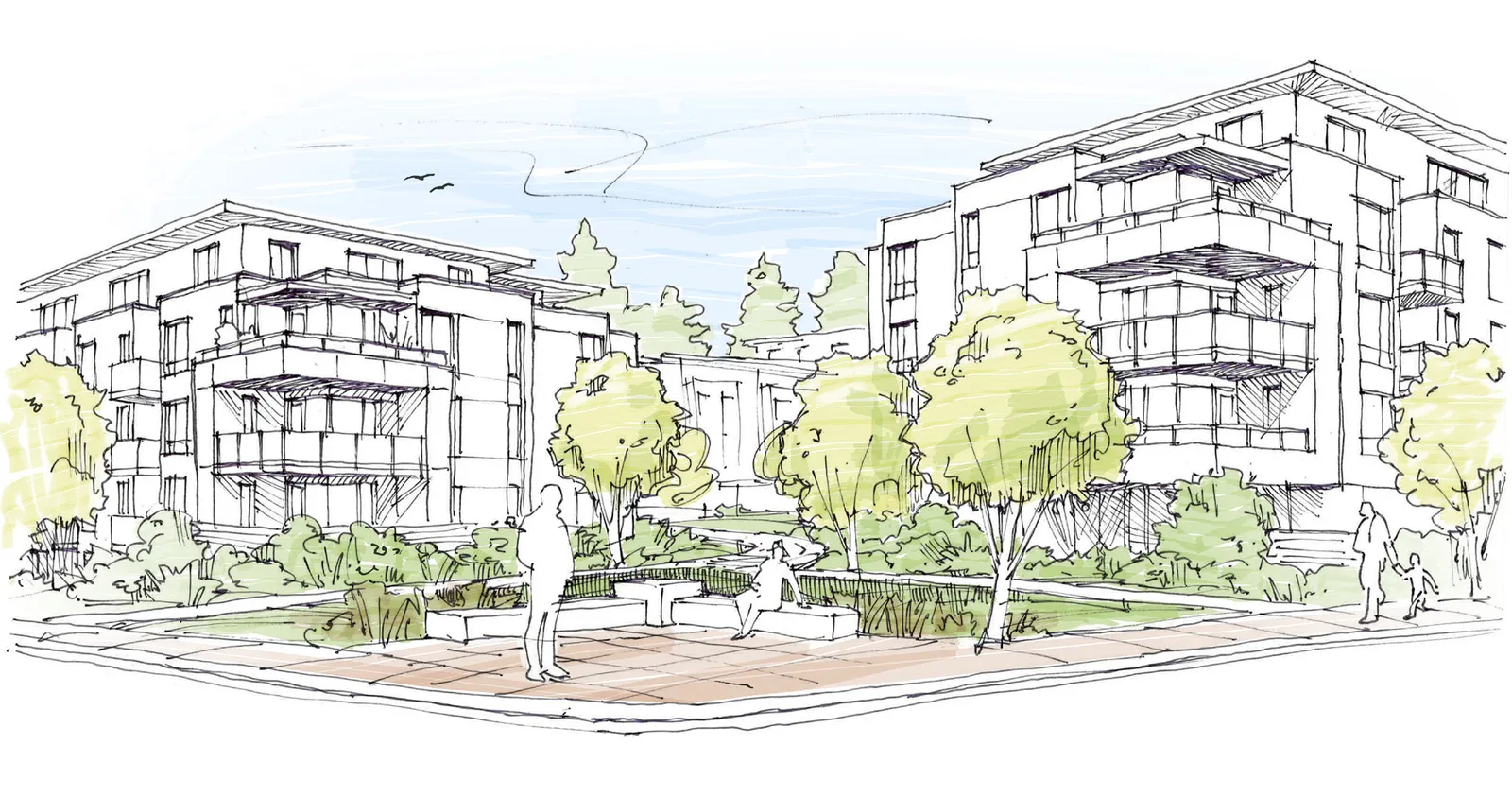
Proposed Site Plan & Development Statistics ............ 14 Site Analysis ................................................................ 15 Perspective Rendering & Site Sections ...................... 16 Aerial Perspective Rendering ..................................... 17 Site & Landscape Plan ................................................ 18 Landscape Site Sections .............................................. 19 Planning Timeline ....................................................... 20 Next Steps .................................................................. 21
1.0 Introduction & Planning Context
The Eagles Nest site is located at the corner of Helmcken Road and Burnside Road West, in the Town of View Royal’s ‘Northern Gateway’ area of the Hospital Neighbourhood. The site is designated in the Official Community Plan (OCP) for mixed residential development up to 1.6 Floor Space Ratio (FSR). With its close proximity to local shops, services and amenities at Eagle Creek Village and the regional employment centre of Victoria General Hospital, the site is well suited to redevelopment with multiple-residential development.
The planning framework within the OCP supports development of the Eagles Nest site and this section of the document summarizes the key planning policies and rationale. The proposed mixed-residential development is at a density below the maximum allowed in the OCP, but at a level that makes best use of land designated for mixed-residential development and that is required to ensure viability of the project.
In additional to providing much needed new housing that can support the viability of the mixed-use Hospital Neighbourhood, the Eagles Nest project will also be providing a Community Amenity Contribution that could fund additional important public amenities.
Development of this site will result in the contribution of approximately $850,000 to the Town of View Royal as a Community Amenity Contribution, and an additional $2.5 million in rezoning, DCC, building permit fees and off-site improvements. The Community Amenity Contribution funds could be used for a variety of amenities that serve the View Royal community as a whole.
Some ideas we have heard so far include:
- Playground improvements at Chancellor Park
- Pickle Ball Courts at Helmcken Centennial Park
- New fire truck
Development Drivers & Objectives
| Development Driver | Objective |
|---|---|
| Regional housing crisis | Create more housing choices within growth centre |
| Replace aging housing stock | Build new, and support existing tenants to relocate |
| Help implement the Official Community Plan | Site is designated for higher density housing |
| Climate action and better use of land | Locate new housing near where people work, shop and play |
| Demand for walkable, attractive neighbourhoods | Design for pedestrians, and to contribute to a sense of place |
| Celebrate the gateway to View Royal | Create a gateway feature at the corner |
| Regional traffic congestion | Support compact growth and alternative transportation modes |
| Local traffic movements | Design access and vehicle circulation patterns to maximize function |
| Sensitive, thoughtful infill development | Consider setbacks, screening, and landscaping along edges |
| Respect neighbours during construction | Implement a construction management plan |
| Viable development | Achieve density required to deliver project and amenities |
How? Strive to achieve objectives through a collaborative and iterative design process, including community input while balancing multiple interests.
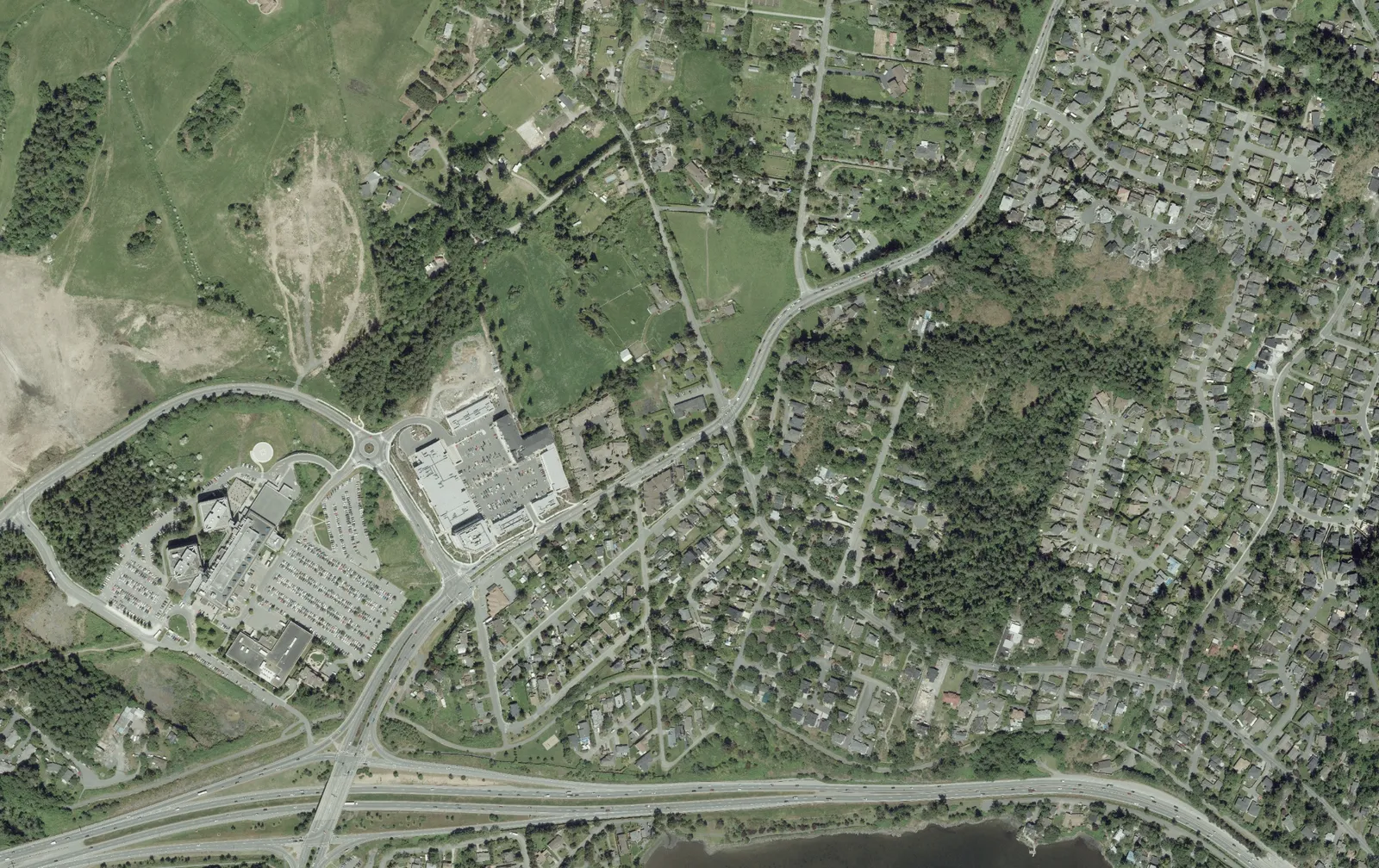
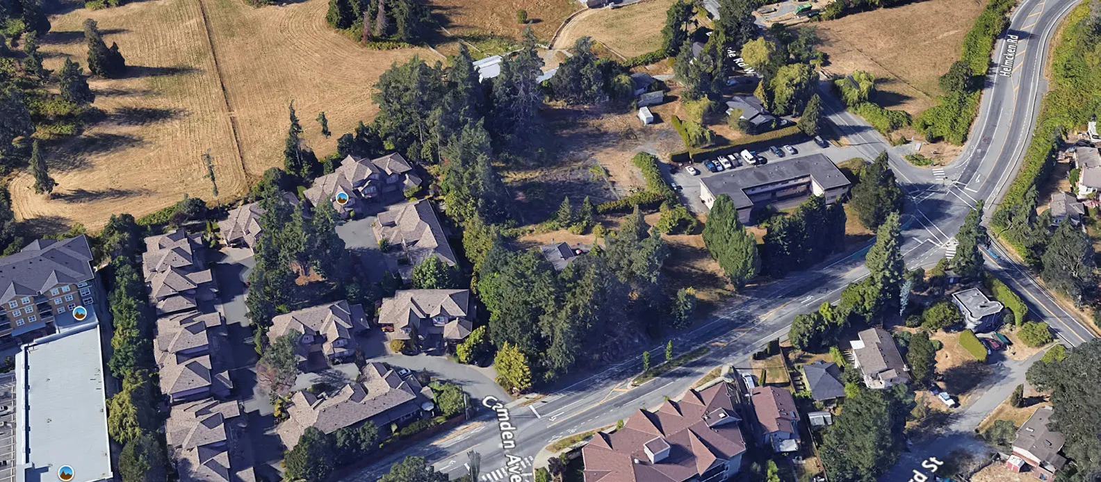
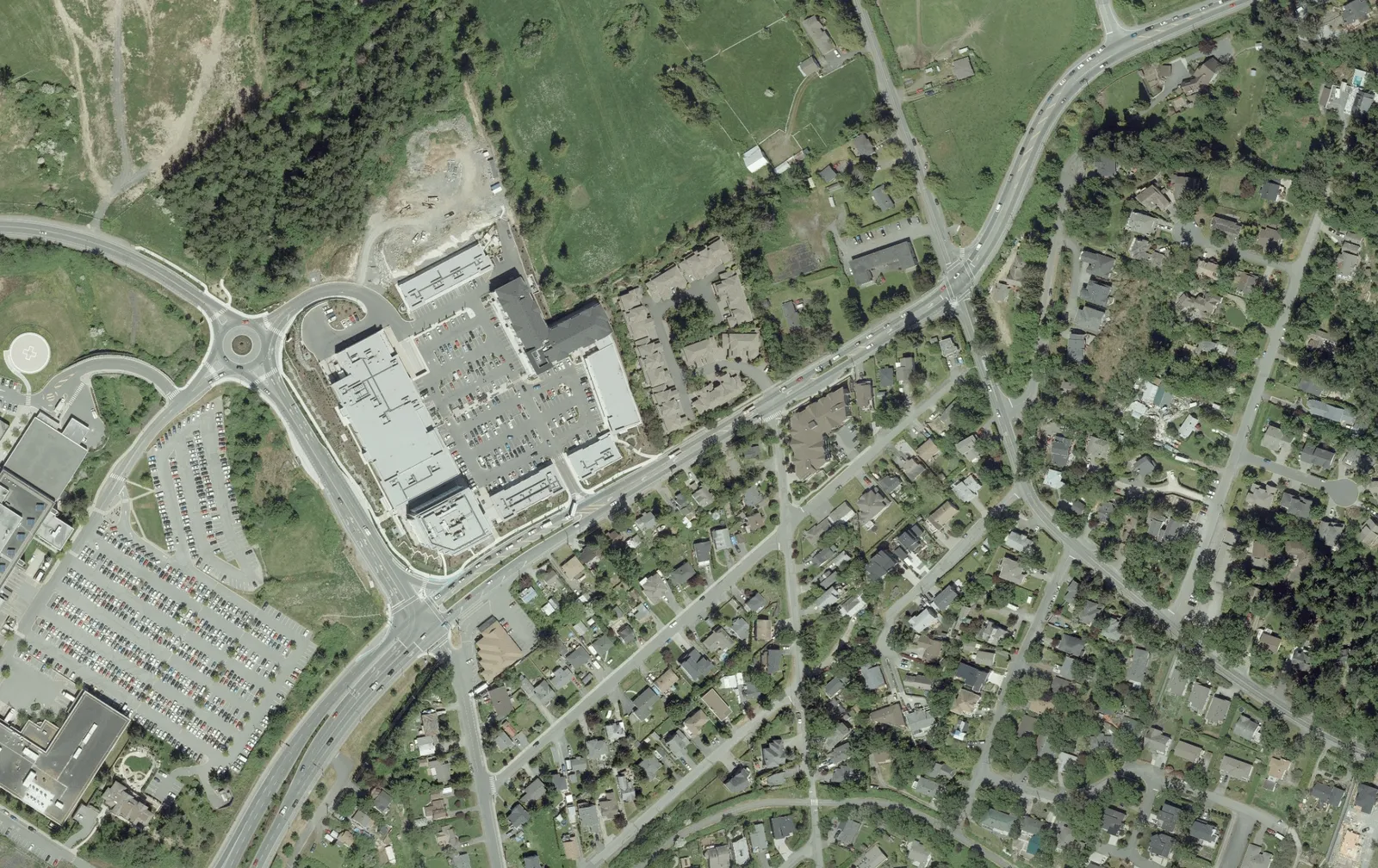
Current Site Conditions
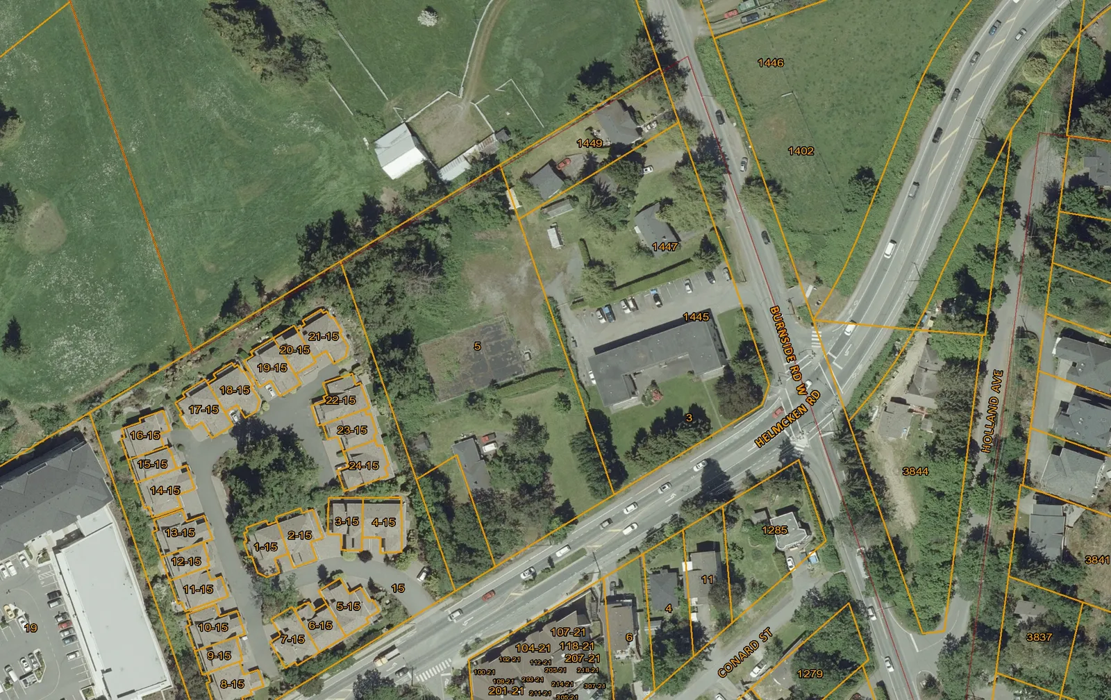
Current Conditions:
- 3.41 acre (13,800 m²) site, 4 legal lots
- 4 detached residential units
- 12-unit apartment building (Robilee Apartments)
Tenant Support:
The project will exceed the requirements of the BC Residential Tenancy Act to help support existing tenants in their relocation.
| Compensation for length of tenancy | BC Residential Tenancy Act | City of Victoria | City of Vancouver | Eagles Nest |
|---|---|---|---|---|
| Up to 5 years | 3 months | 2 months | 2 months | 4 months |
| Between 5-10 years | 4 months | 3 months | 3 months | 5 months |
| over 10 years | 5 months | 4 months | 4 months | 6 months |
| over 20 years | 6 months | 6 months | 6 months | 8 months |
Moving Expenses
| City of Victoria | City of Vancouver | BC Residential Tenancy Act | Eagles Nest | |
|---|---|---|---|---|
| Bachelor and One Bedroom | $ 500.00 | $ 750.00 | $ 750.00 | $ 1,000.00 |
| Two or more bedrooms | $ 750.00 | $ 1,000.00 | $ 1,000.00 | $ 1,250.00 |
Notice for Termination: 4 months Eligibility in all cases: minimum 1 year prior to rezoning application Exclusions in all cases: single family homes, duplexes, condos, secondary suites
Site Context
Neighbourhood Context:
- ‘Northern Gateway’ area of the Hospital Neighbourhood
- Directly adjacent to existing multiple-unit residential to the west (Hidden Oaks townhouses).
- Multi-unit residential and detached residential uses to the south.
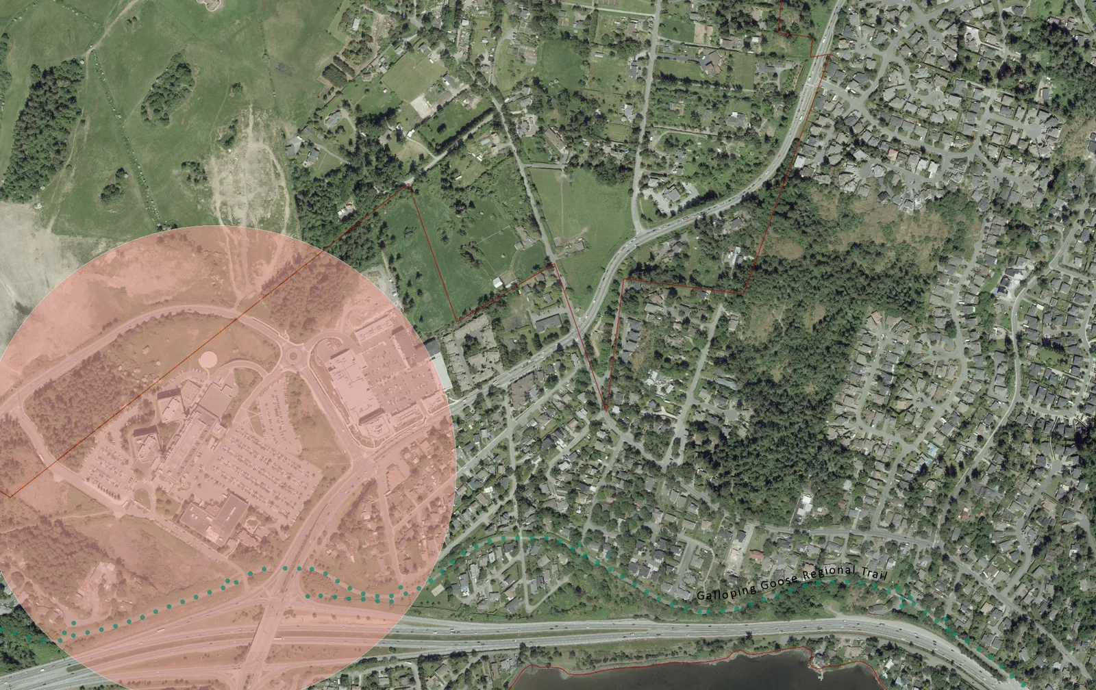
- Within the Urban Containment Boundary, with Agricultural Land Reserve (ALR) lands to the north and east.
- Close proximity to local shops, services and amenities at Eagle Creek Village.
Regional Context:
- Adjacent to regional draw of Victoria General Hospital, and identified regional ‘Node’.
- Close proximity to Galloping Goose Regional Trail.
- Affected by regional commuter traffic.
Planning Framework
View Royal Official Community Plan
- Designated as M-R: Mixed Residential.
- Allows small lot detached houses, townhouses and low-rise apartments up to 3 storeys and 1.25 FSR, and up to 4 storeys and 1.6 FSR for apartment dwellings.
- Regulated by the Mixed Residential Form and Character Development Permit Area.
- Strategically-located around regional node (VGH) and local services.
New Housing in the Right Place
Development of single detached dwellings on small lots, new duplexes, townhouses and low-rise apartments in new and established neighbourhoods provides a variety of housing types, styles and costs.
This variety ensures people of different ages, income levels and stage of life can find homes in View Royal. Small lot infill and multi-unit housing also serves to:
- Transition between single detached housing and areas of higher density;
- Maintain character of existing neighbourhoods while accommodating population growth;
- Incrementally replace aging housing stock; and
- Efficiently use land in an unobtrusive manner.
View Royal has set strong goals for shaping new growth and change.
“View Royal recognizes the impacts of climate change, and is responding by actively promoting energy-efficient, sustainable development, and environmental protection. Well-designed compact housing ensures choice, affordability and better use of land. Infill and redevelopment near neighbourhood centres and transit corridors provides jobs and services closer to where people live – minimizing the need for commuting, and creating pedestrian-friendly streets and destinations.”
- excerpt from View Royal OCP Vision Statement
Regional & Local Traffic
Regional Transportation & Traffic
- Helmcken Road is a vital connection for View Royal and the region providing access to educational and employment facilities such as Camosun College and Victoria General Hospital as well as direct access to Highway 1.
- Helmcken Road is also an important link for those who conduct business and travel between the Western Communities and the Saanich Peninsula.
- Helmcken Road near the site sees approximately 12,000 vehicles per day which is consistent with its function and classification as an arterial road.
- Burnside Road is an important connection for View Royal that provides access to residential neighbourhoods, a community center, parks and District of Saanich.
- Burnside Road parallels Highway 1 between Interurban Road and Helmcken Road and is used by some commuters as an alternative route to Highway 1, resulting in congested conditions during the AM and PM peak hours.
Local Transportation & Traffic
- Current traffic operations on Helmcken Road and Burnside Road near the site, particularly during the PM peak hour, are congested westbound on Helmcken Road from Watkiss Way to Wilkinson Road and northbound on Burnside Road from Helmcken Road to beyond High Street.
- There is potential for congestion to improve on Helmcken Road and Burnside Road near the site following the completion of the McKenzie Interchange. However, the impacts that the McKenzie Interchange may have on these roads can only be quantified once its construction is complete.
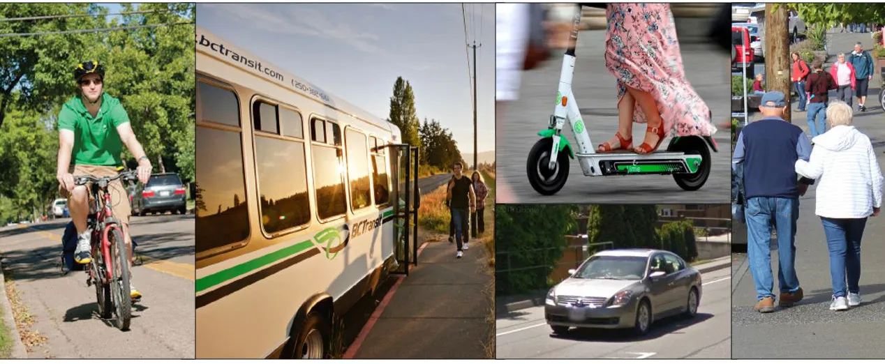
- New development should encourage alternate modes of transportation, including walking, cycling, car share and transit use.
Site Access
- The existing lots have access off of Helmcken Road and Burnside Road West.
- The most western property has a legal, shared access with the existing driveway for the Hidden Oaks townhouse development.
- The project is proposing to consolidate the access strategy to have only one access point, to be located off of Burnside Road West.
- This will provide access to the internal courtyard and underground parking garages.
Infill makes use of existing infrastructure and already disturbed land, reduces development pressure on natural areas, and can support increased walking, biking and transit use.
““The thrust of the plan is to provide additional capacity for alternative modes of transportation while making the existing road infrastructure work more effectively, but not at the expense of providing capacity for alternative modes of transportation. Rather, the Town has been consistently striving for a transportation network that reflects the desire of residents and businesses for increased travel choices. They see their roads as community resources for the benefit of all users and want to see additional infrastructure built to accommodate pedestrians as well as bicycle and transit users.”
- excerpt from View Royal Transportation Master Plan
Transportation Planning
Traffic Impact Assessment
WATT Consulting completed a Traffic Impact Assessment (TIA) for the project. The following summarizes the key findings:
- Existing conditions at the Helmcken / Watkiss / Chancellor intersection indicate unstable conditions for the eastbound left turn movement during the AM peak and severe westbound queuing and delay that spills back ~1 km beyond Burnside Road during the PM peak.
- Existing conditions at the Helmcken / Burnside intersection indicate failing conditions for northbound and southbound movements on Burnside Rd during the AM peak and failing conditions for northbound movements on Burnside Rd during the PM peak.
- Site generated traffic will add one vehicle to the study area road network approximately every 45 seconds during the AM peak and every 35 seconds during the PM peak.
- Site generated traffic will have a negligible impact on traffic operations at the Helmcken / Watkiss / Chancellor and Helmcken / Burnside intersections at buildout (2023) and 10 years beyond buildout (2033).
- The site access will operate well 10 years beyond full buildout and does not require a northbound left turn lane.
- Transportation Demand Management strategies may reduce the development’s impact on traffic operations at study area intersections.
- A sidewalk is recommended along the site’s frontage on Helmcken Road and Burnside Road West.
- The installation of bus bay on Helmcken Rd fronting the site should be discussed with BC Transit.
- Since December 2019 when the McKenzie / Highway 1 underpass was opened, media estimates indicate commute times between Langford and Victoria have been reduced 10 – 15 minutes. The McKenzie interchange project may in turn improve conditions on Helmcken Road and Burnside Road which should be reassessed once the interchange project is complete.
2.0 Community Engagement & Site Planning
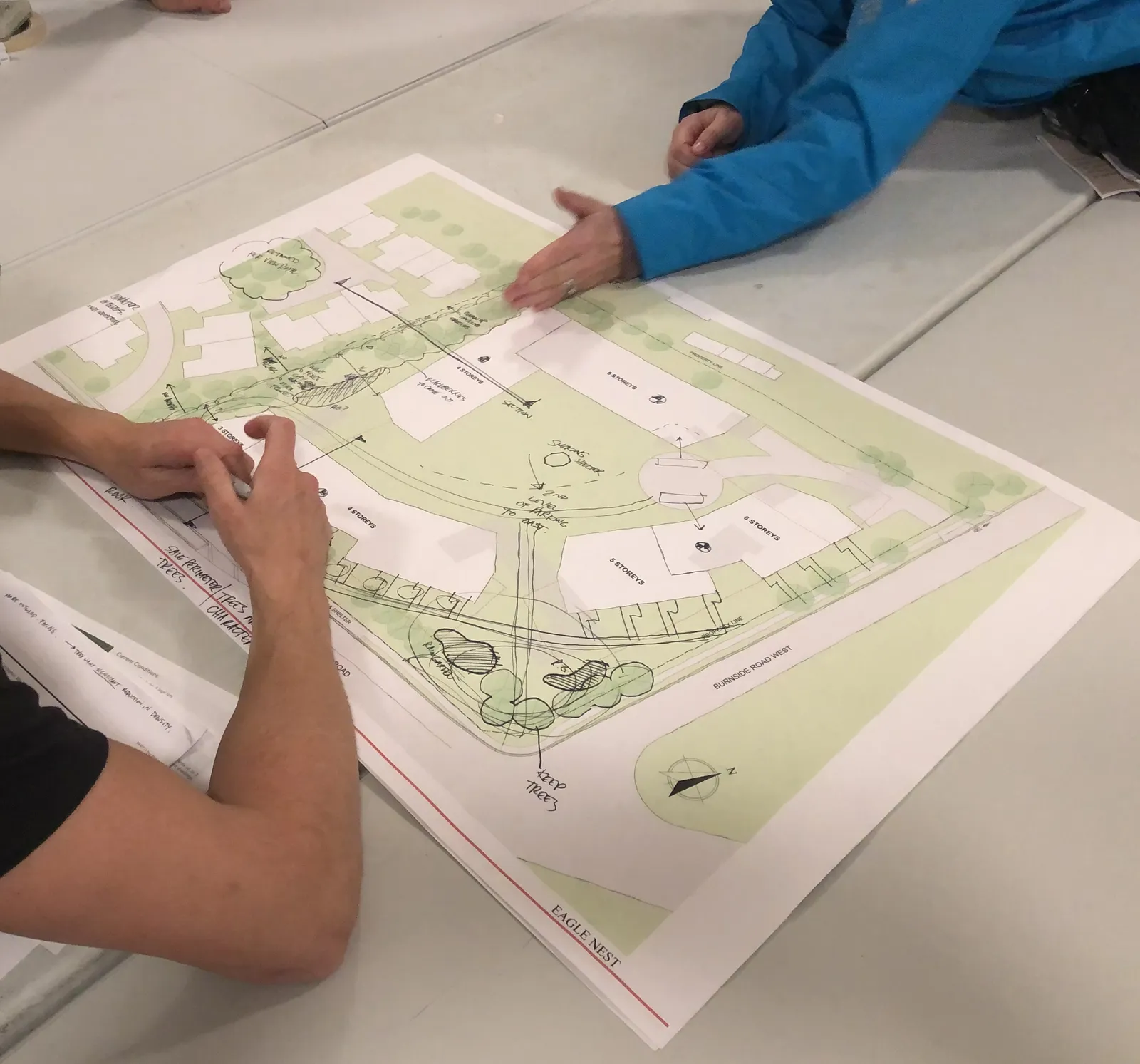
The site was the subject of a previous Rezoning Application, originally submitted in 2018 and withdrawn in 2019, to allow more community engagement and further site and technical analysis. This new application builds upon the input received during the original application process, and has benefited from collaborative consultation with the immediate neighbours to bring about a renewed and refined site plan.
At its core, however, the application remains committed to implementing the goals and objectives of the OCP and realizing a contribution to the regional housing needs with a site design that is respectful and responsive to its neighbourhood context.
The development planning team hosted two workshops with neighbours in November and December of 2019. The purpose of the workshops was to invite the immediate neighbours to participate in the planning process as the project reset and worked toward a new application. The workshop sessions were designed to allow collaborative discussion and engagement around the site plan to gather input and ideas to help shape the proposed buildings. A review of the View Royal planning policies for the site was shared, highlighting the community goal of achieving a greater variety of housing choice, affordability and better use of land. The team listened to gather input on issues and opportunities to be addressed by the plan.
The topics of traffic, transportation, tree retention, privacy, and building heights and stepping were discussed at the workshops. Input received during the first session in November informed refinement to the site plan, which was then brought forward for review and discussion at the second session in December.
A Community Meeting was scheduled to be hosted on January 15, 2020 to present the new plan and proposal prior to submission of this new Rezoning Application. Due to winter weather conditions, the Community Meeting had to be postponed, and is now scheduled for Monday, February 3, 2020.
The planning and design team believes the plan has been positively shaped by the community input and now better responds to a number of key issues raised.
Site Plan Evolution with Community Input
Site Plan Version 1
OCTOBER 23, 2018 Community Meeting +/- 70 attendees (52 signed-in)
What we heard:
Traffic
- concern about commuter traffic on Helmcken and capacity to accommodate proposed growth given regional traffic issues
- challenge getting in and out of residential driveways
- turnaround traffic into Hidden Oaks’ driveway
Building Height/Shadowing
- concern about potential overshadowing of Hidden Oaks townhouses
- question about the building massing/presence at the corner
Density
- some concern about density, particularly relative to traffic impacts
Streetscape
- questions about streetscape design - sidewalks?
Document Images
(3)