Appendix B: Select Aerial Photographs
Historical aerial imagery used in the Phase I ESA to track land use changes on the subject properties from 1932 to 1980.
Appendix B
Select Aerial Photographs
Photograph Reference: A 4517 66
- Photograph Year: 1932
- Interpreted by: SH
- Reviewed by: DC
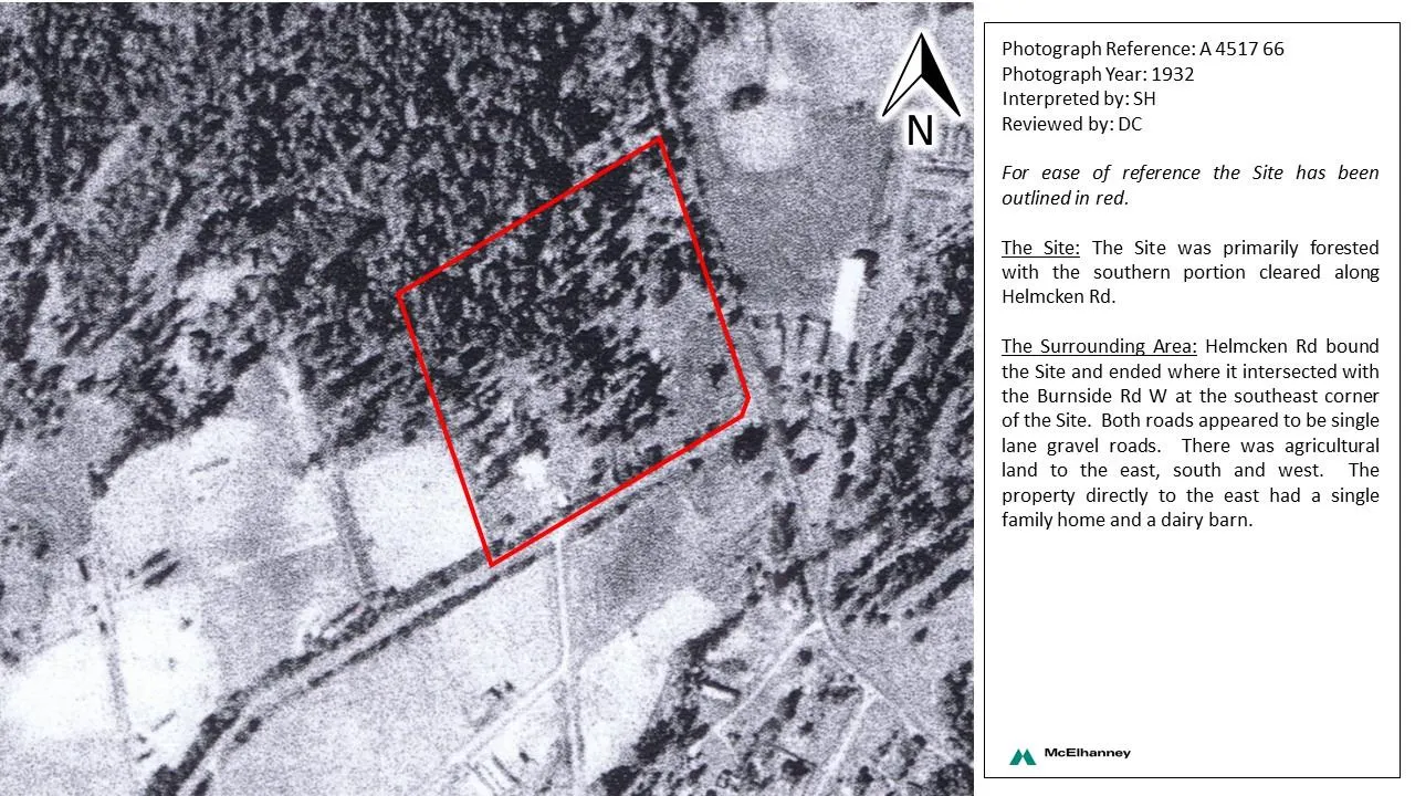
For ease of reference the Site has been outlined in red.
The Site: The Site was primarily forested with the southern portion cleared along Helmcken Rd.
The Surrounding Area: Helmcken Rd bound the Site and ended where it intersected with the Burnside Rd W at the southeast corner of the Site. Both roads appeared to be single lane gravel roads. There was agricultural land to the east, south and west. The property directly to the east had a single family home and a dairy barn.
Photograph Reference: BC 245 76
- Photograph Year: 1946
- Interpreted by: SH
- Reviewed by: DC
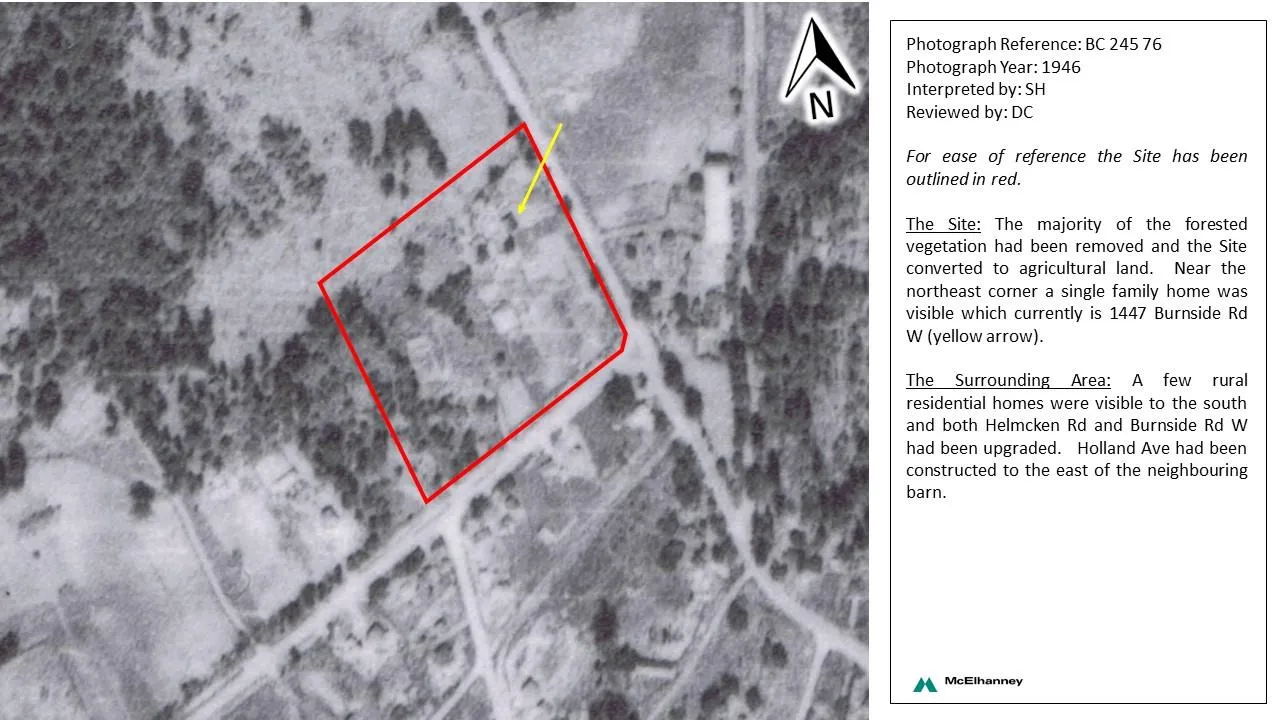
For ease of reference the Site has been outlined in red.
The Site: The majority of the forested vegetation had been removed and the Site converted to agricultural land. Near the northeast corner a single family home was visible which currently is 1447 Burnside Rd W (yellow arrow).
The Surrounding Area: A few rural residential homes were visible to the south and both Helmcken Rd and Burnside Rd W had been upgraded. Holland Ave had been constructed to the east of the neighbouring barn.
Photograph Reference: BC 2042 63
- Photograph Year: 1956
- Interpreted by: SH
- Reviewed by: DC
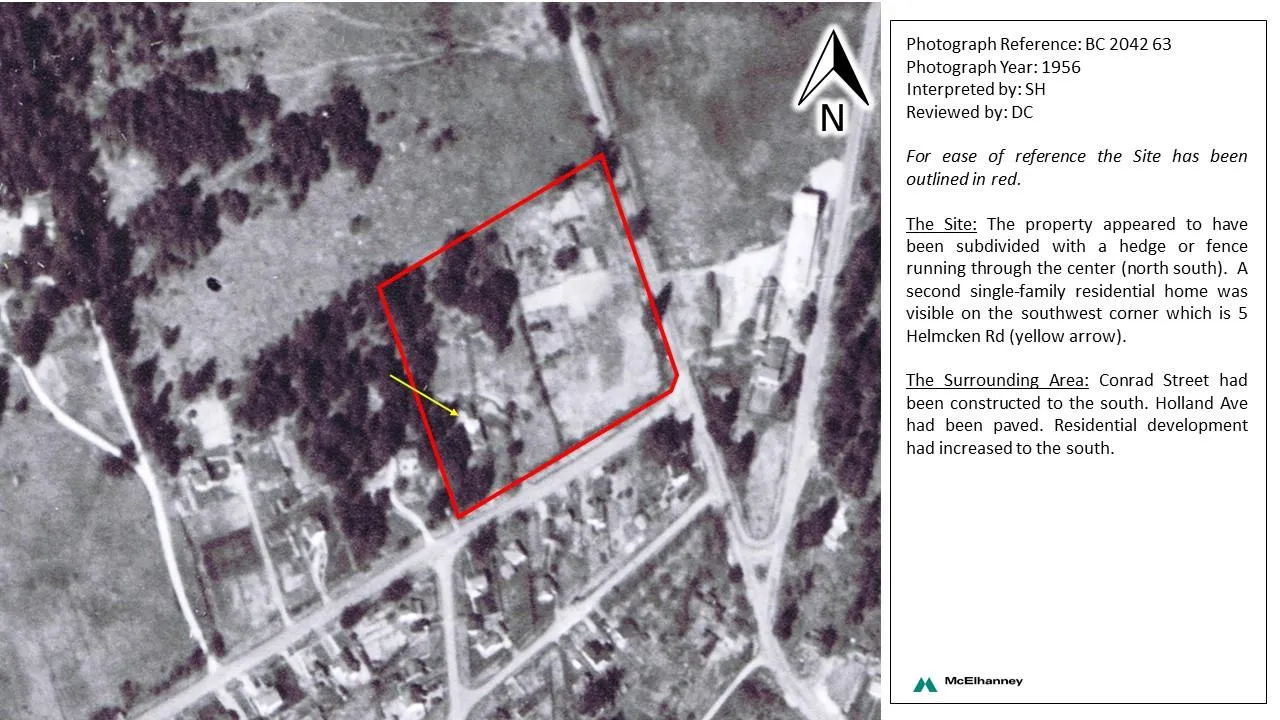
For ease of reference the Site has been outlined in red.
The Site: The property appeared to have been subdivided with a hedge or fence running through the center (north south). A second single-family residential home was visible on the southwest corner which is 5 Helmcken Rd (yellow arrow).
The Surrounding Area: Conrad Street had been constructed to the south. Holland Ave had been paved. Residential development had increased to the south.
Photograph Reference: BC 5284 153
- Photograph Year: 1968
- Interpreted by: SH
- Reviewed by: DC
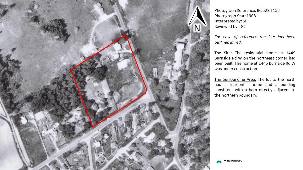
For ease of reference the Site has been outlined in red.
The Site: The residential home at 1449 Burnside Rd W on the northeast corner had been built. The home at 1445 Burnside Rd W was under construction.
The Surrounding Area: The lot to the north had a residential home and a building consistent with a barn directly adjacent to the northern boundary.
Photograph Reference: BC 5568 0082
- Photograph Year: 1974
- Interpreted by:
- Reviewed by:
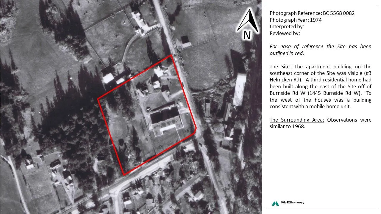
For ease of reference the Site has been outlined in red.
The Site: The apartment building on the southeast corner of the Site was visible (#3 Helmcken Rd). A third residential home had been built along the east of the Site off of Burnside Rd W (1445 Burnside Rd W). To the west of the houses was a building consistent with a mobile home unit.
The Surrounding Area: Observations were similar to 1968.
Photograph Reference: 15 BC 80005 272
- Photograph Year: 1980
- Interpreted by: SH
- Reviewed by: DC
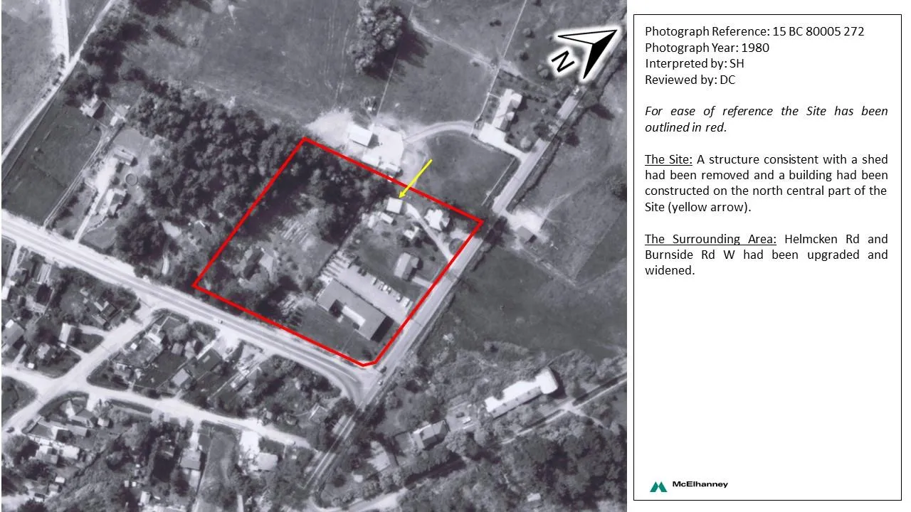
For ease of reference the Site has been outlined in red.
The Site: A structure consistent with a shed had been removed and a building had been constructed on the north central part of the Site (yellow arrow).
The Surrounding Area: Helmcken Rd and Burnside Rd W had been upgraded and widened.