Phase I ESA: Helmcken Rd & Burnside Rd W, View Royal, BC - Photographs
A collection of historical aerial and site photographs of the Eagles Nest project site from 1986 to 2017.
Phase I ESA: Helmcken Rd & Burnside Rd W, View Royal, BC
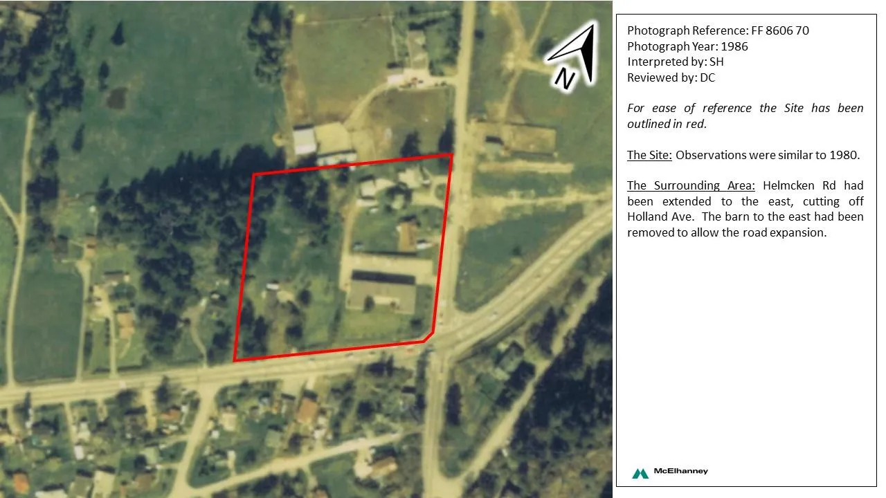
Photograph Reference: FF 8606 70 Photograph Year: 1986 Interpreted by: SH Reviewed by: DC
For ease of reference the Site has been outlined in red.
The Site: Observations were similar to 1980.
The Surrounding Area: Helmcken Rd had been extended to the east, cutting off Holland Ave. The barn to the east had been removed to allow the road expansion.
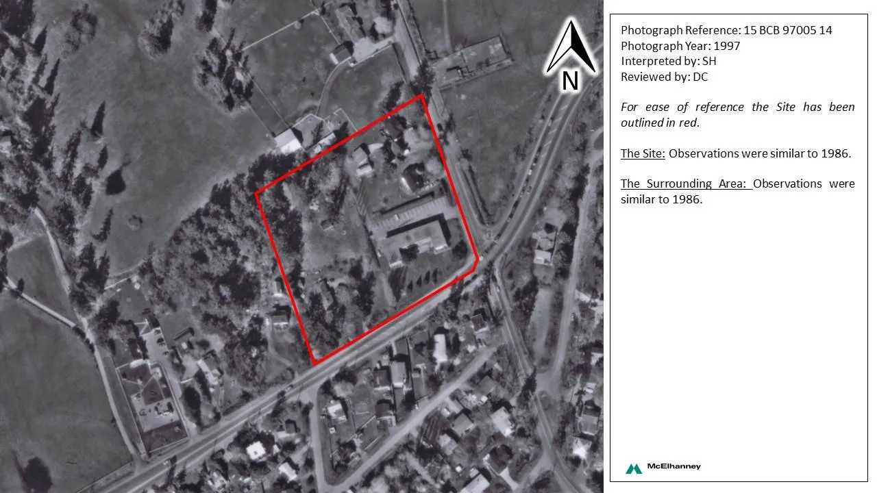
Photograph Reference: 15 BCB 97005 14 Photograph Year: 1997 Interpreted by: SH Reviewed by: DC
For ease of reference the Site has been outlined in red.
The Site: Observations were similar to 1986.
The Surrounding Area: Observations were similar to 1986.
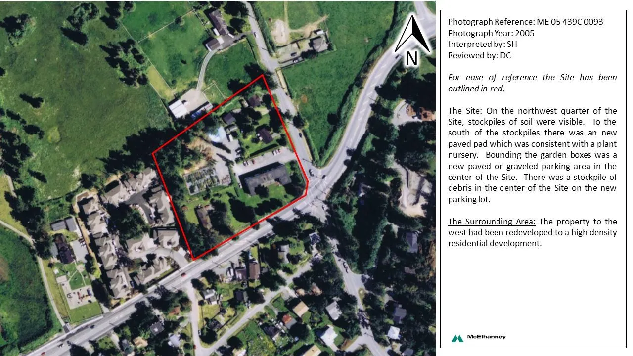
Photograph Reference: ME 05 439C 0093 Photograph Year: 2005 Interpreted by: SH Reviewed by: DC
For ease of reference the Site has been outlined in red.
The Site: On the northwest quarter of the Site, stockpiles of soil were visible. To the south of the stockpiles there was an new paved pad which was consistent with a plant nursery. Bounding the garden boxes was a new paved or graveled parking area in the center of the Site. There was a stockpile of debris in the center of the Site on the new parking lot.
The Surrounding Area: The property to the west had been redeveloped to a high density residential development.
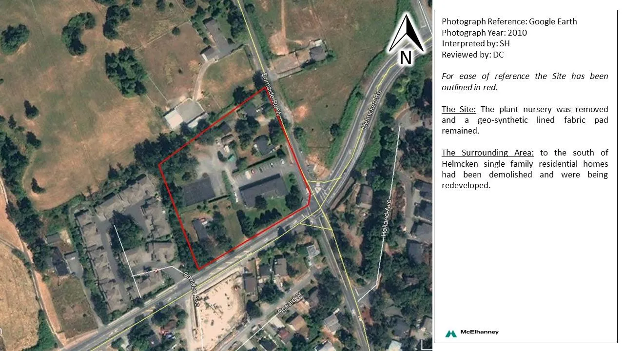
Photograph Reference: Google Earth Photograph Year: 2010 Interpreted by: SH Reviewed by: DC
For ease of reference the Site has been outlined in red.
The Site: The plant nursery was removed and a geo-synthetic lined fabric pad remained.
The Surrounding Area: to the south of Helmcken single family residential homes had been demolished and were being redeveloped.

Photograph Reference: Google Earth Photograph Year: 2014 Interpreted by: SH Reviewed by: DC
For ease of reference the Site has been outlined in red.
The Site: Observations were similar to 2010.
The Surrounding Area: To the west a large commercial development was under construction.
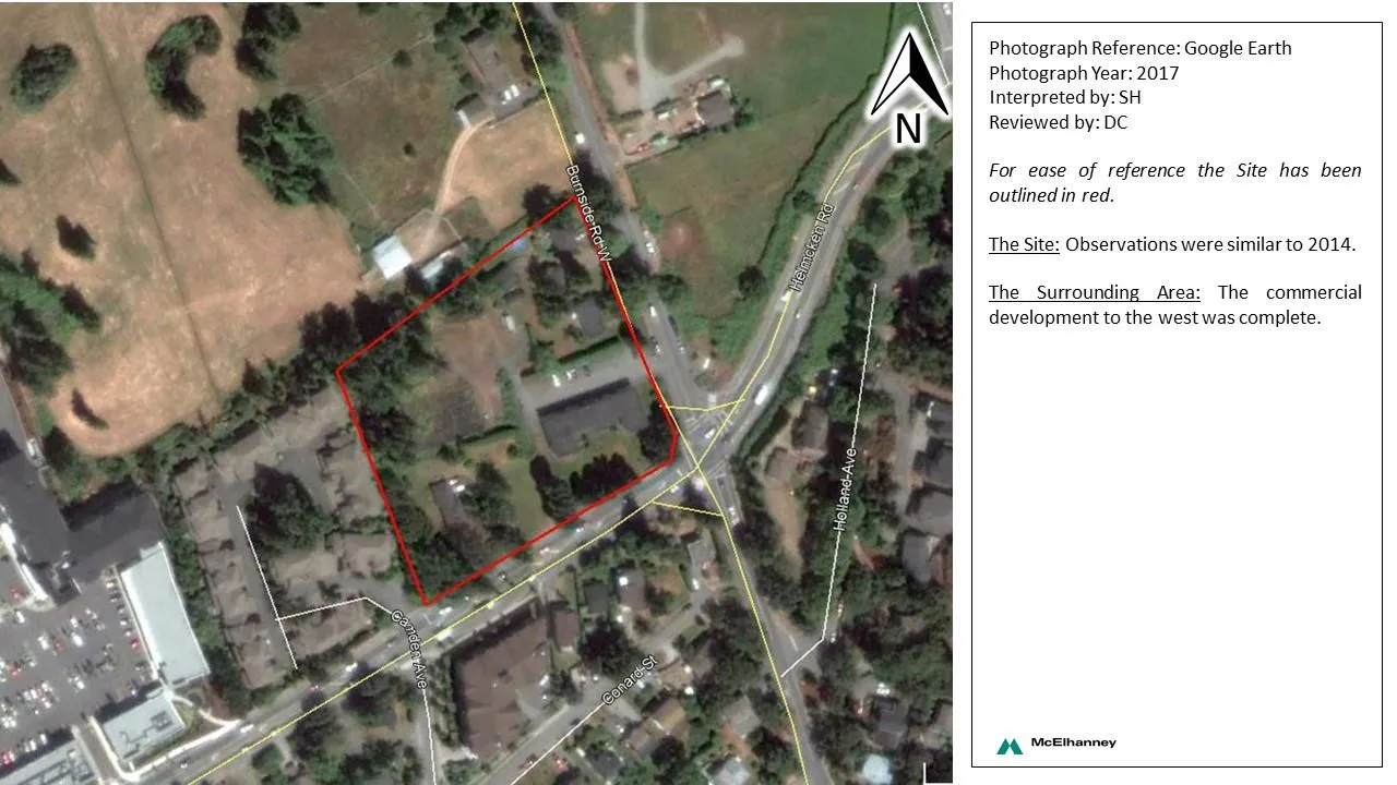
Photograph Reference: Google Earth Photograph Year: 2017 Interpreted by: SH Reviewed by: DC
For ease of reference the Site has been outlined in red.
The Site: Observations were similar to 2014.
The Surrounding Area: The commercial development to the west was complete.