Applicant Presentation - Rezoning - 3, 5 and 9 Helmcken Road and 1449 Burnside Road West (Eagles Nest)
A detailed project presentation for the Eagles Nest development proposal, covering site statistics, engagement history, transportation planning, and community benefits.
This document outlines the proposal for the Eagles Nest residential development.
10 Key Project Benefits
Implementing the Official Community Plan.
- Consistent with approved OCP policies - no amendments.
- Density of 1.5 FSR is lower than OCP maximum of 1.6 FSR.
- New housing for residents of all ages and stages, within walking distance of transit, trails, shops and employment.
Delivering Community Benefits. 4. Delivering over $3.1 million in fees and development contributions to View Royal, help offset tax increases. 5. New residents to support local businesses at Eagle Creek Village. 6. New sidewalks, boulevards, retained bike lane, rain gardens and bus lay-by on Helmcken to support transit and allow traffic to flow.
Balancing Multiple Interests and Inputs. 7. Responsive plan that balances multiple community inputs, with over 10 meetings and presentations to share ideas and receive feedback. 8. Stepped buildings from 3-6 storeys, preservation of mature trees, increased setback to neighbours and support for alternate modes of transportation.
Investing in a More Complete Community. 9. Commitment to quality and creation of highly livable homes in neighbourhood setting - walkable and access to services. 10. Assists fulfill View Royal Strategic Plan and commitment to Regional Growth Strategy.
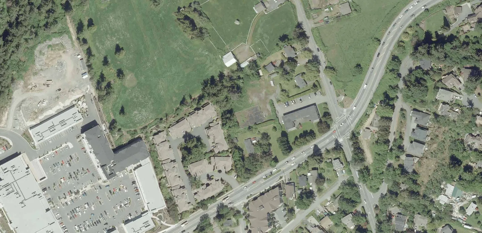
Current Site Conditions
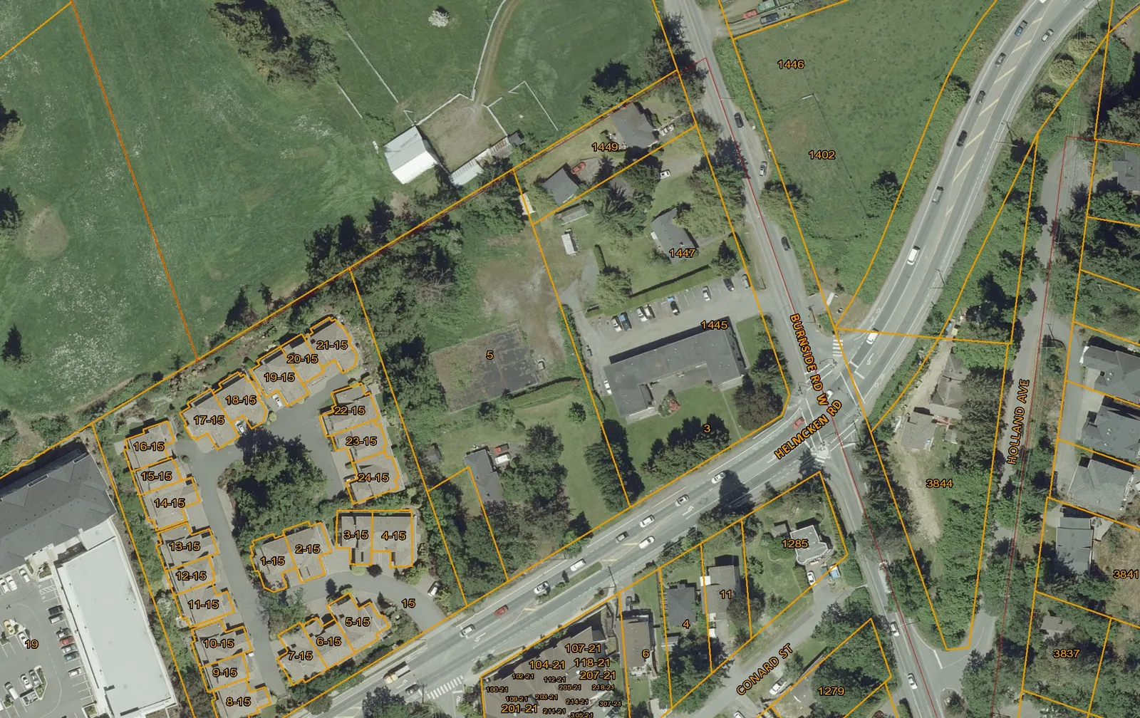
- 3.41 acre site, 4 legal lots
- 4 detached residential units
- 12-unit apartment building
Tenant Support
Compensation for length of tenancy
| Compensation for length of tenancy | BC Residential Tenancy Act | City of Victoria | City of Vancouver | Eagles Nest |
|---|---|---|---|---|
| Up to 5 years | 2 months | 3 months | 2 months | 4 months |
| Between 5-10 years | 3 months | 4 months | 3 months | 5 months |
| over 10 years | 4 months | 5 months | 4 months | 6 months |
| over 20 years | 6 months | 6 months | 6 months | 8 months |
Moving Expenses
| BC Residential Tenancy Act | City of Victoria | City of Vancouver | Eagles Nest | |
|---|---|---|---|---|
| Bachelor and One Bedroom | $ 750.00 | $ 500.00 | $ 750.00 | $ 1,000.00 |
| Two or more bedrooms | $ 1,000.00 | $ 750.00 | $ 1,000.00 | $ 1,250.00 |
- Notice for Termination: 4 months in all cases.
- Eligibility in all cases: minimum 1 year prior to rezoning application.
- Exclusions in all cases: single family homes, duplexes, condos, secondary suites.
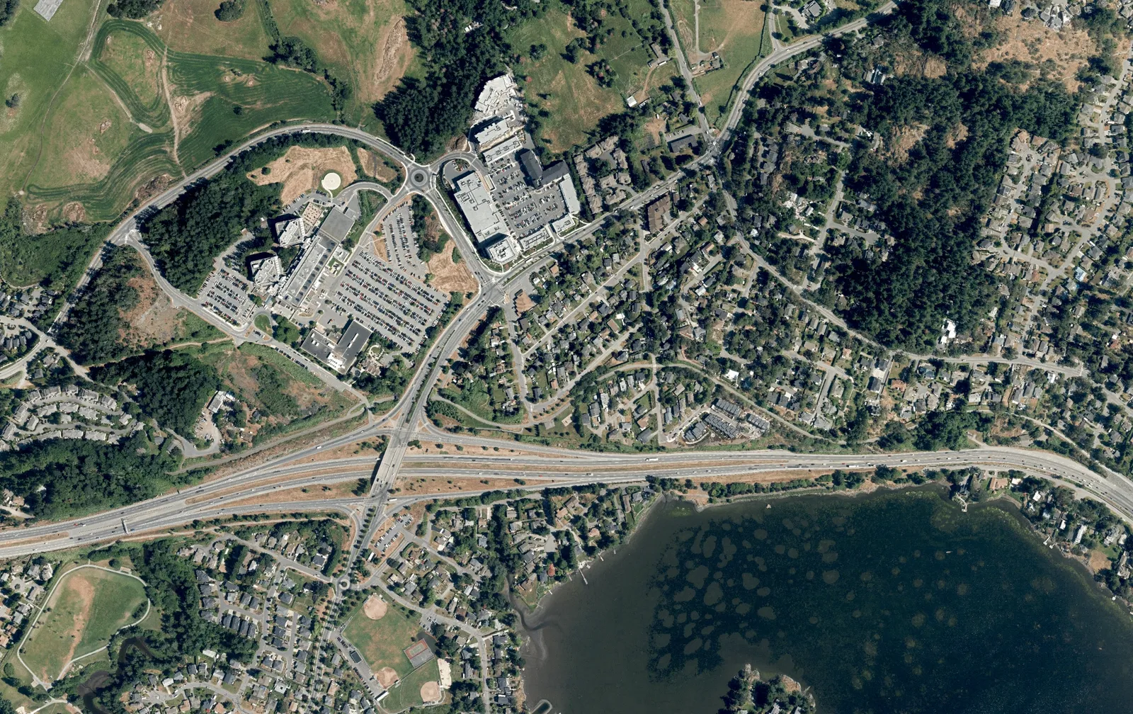
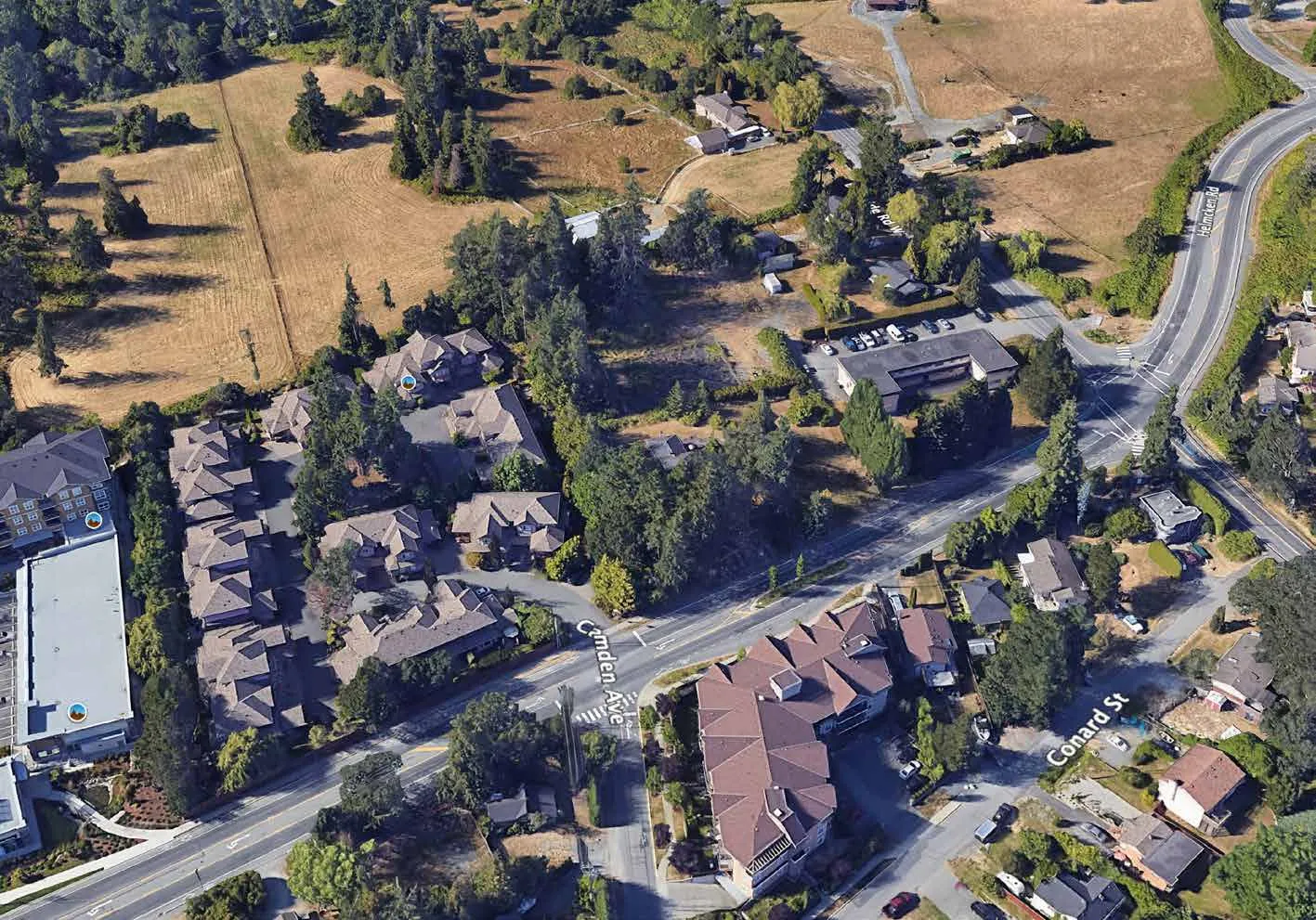
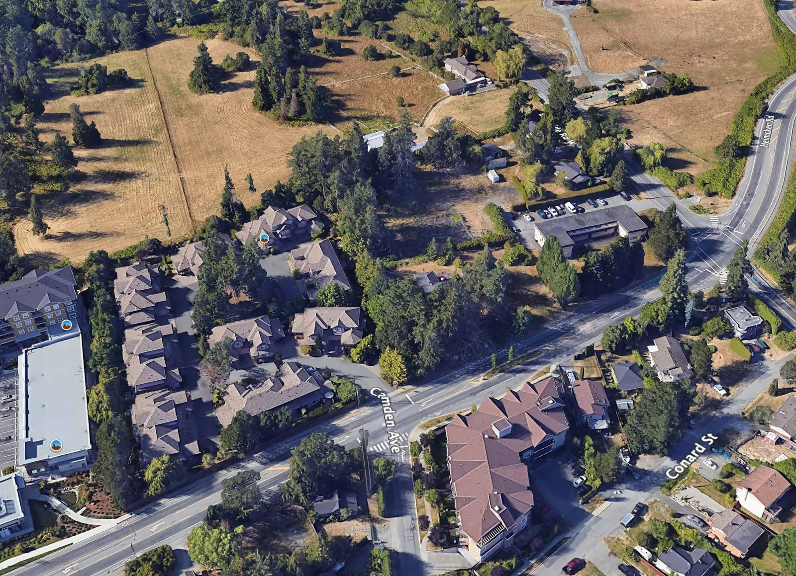
Site Context: An Identified Change Area
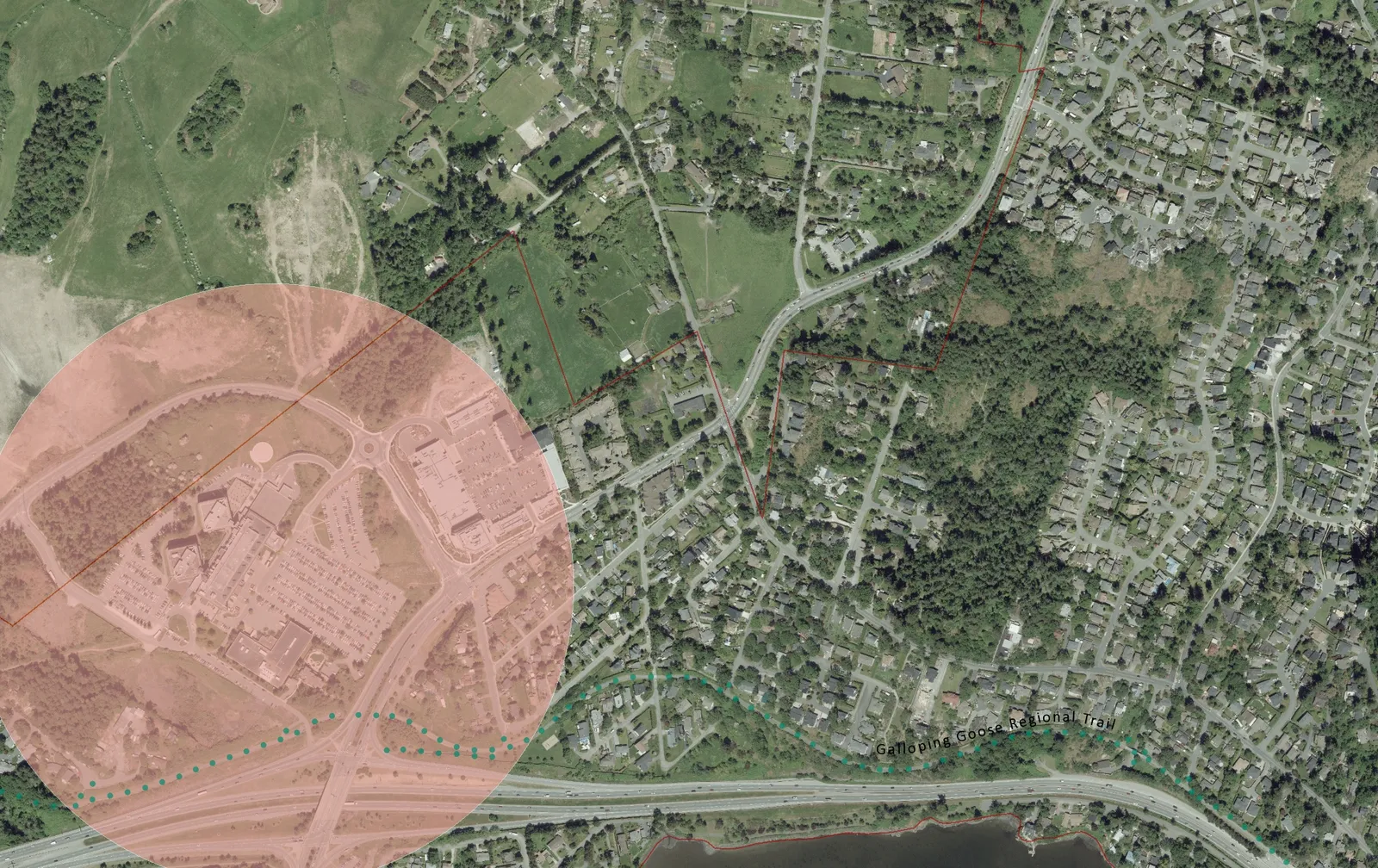
- Northern Gateway Hospital Neighbourhood
- Multiple-unit residential west and south.
- Within the Urban Containment Boundary.
- Close proximity to local shops, services and amenities at Eagle Creek Village.
- Adjacent to VGH - regional ‘Node’.
- Close proximity to Galloping Goose Regional Trail and transit.
Previous Concept Plans: 4 buildings, up to 8 storeys
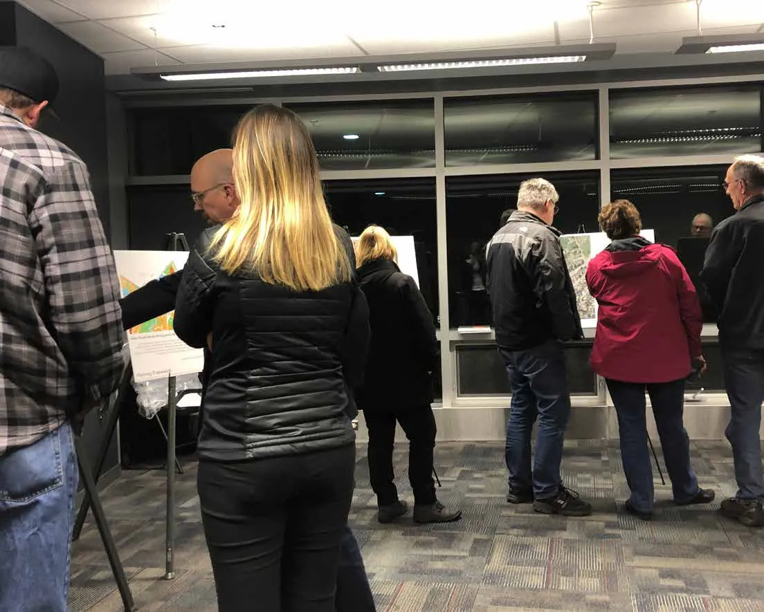
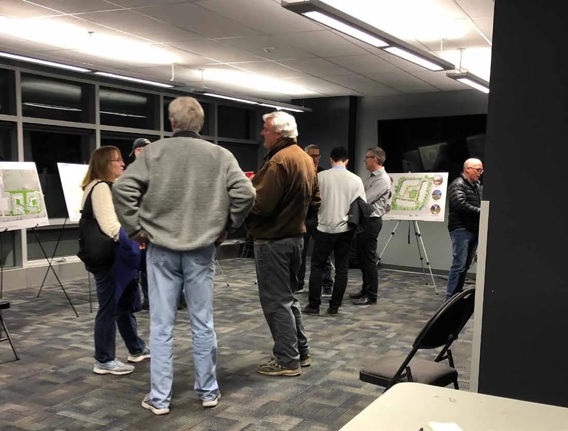
OCTOBER 23, 2018 - Community Meeting
+/- 70 attendees (52 signed-in)
JANUARY 9, 2019 - Hidden Oaks Resident Meeting
9 attendees
JULY 9, 2019 - Community Meeting
50 attendees (all signed-in)
Working with Neighbours - setbacks, density, height
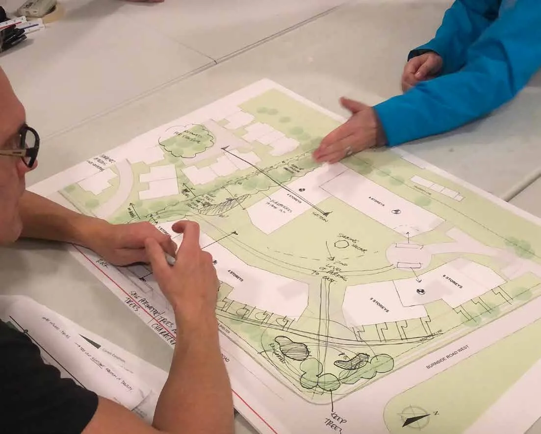
Revised Conceptual Site Plans and Workshop Sessions
NOVEMBER 18, 2019 - Neighbours’ Workshop #1
13 attendees Discussion Topics:
- Building heights & distribution
- Site access & circulation
- Edge conditions and screening / buffer
- Landscape design ideas
- Streetscape improvements
- Density, traffic impacts
DECEMBER 2, 2019 - Neighbours’ Workshop #2
8 attendees Discussion Topics:
- Traffic, speed and volume
- Density measurements and design
- Site access & circulation
- Edge conditions and screening / buffer
- Site grades and topography and stormwater management
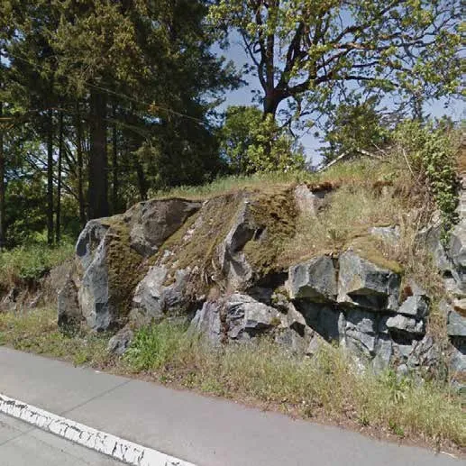
- Potential to retain some existing trees for privacy
- Potential to retain rocky outcropping at western edge of site
- Design of internal courtyard, on-site circulation
Open House & View Royal Community Association
FEBRUARY 3, 2020 - Community Meeting Open House
39 attendees signed in (+/- 6 more attended) Site Planning & Design
- Some concern about density and height, given the adjacent townhouses and ALR lands.
- Some support for revised heights (6 storey maximum vs. 8 storeys in previous plan).
- Support for new plan and building layout, noting that it looks much better than in previous iterations of the plan.
- Support for ground-floor units with individual entries.
- Support for tree retention.
- Support for stormwater management strategies and interior courtyard design. Transportation & Traffic
- Support for new housing at this location - good for the local shops at Eagle Creek Village and for employees of VGH - walkable to local services and work.
- Continued concern about traffic speed and volume.
Further Revised Conceptual Site Plans
MAY 7, 2020 - View Royal Community Association
Virtual Presentation via Zoom
- Hosted by Community Association
- Detailed project presentation followed by facilitated Q&A session.
Improvements for Immediate Neighbours
- Privacy/driveway fence at 6 Helmcken Road.
- Fence line along western property line (Hidden Oaks).
- Addressing stormwater runoff onto Hidden Oaks’ site.
- Site plan changes in response to input:
- tree preservation
- increased setbacks
- stepped buildings
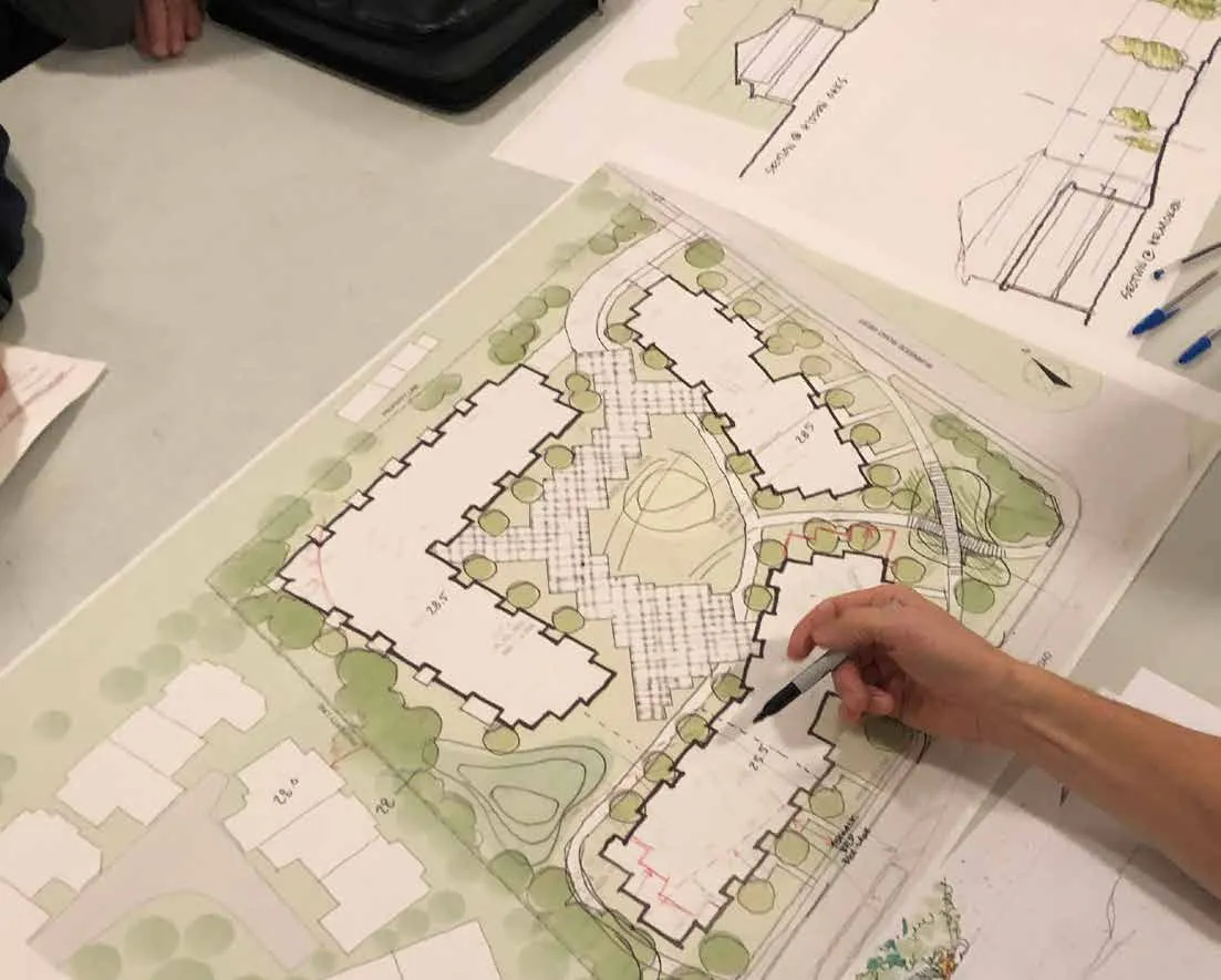
2.0 Proposal
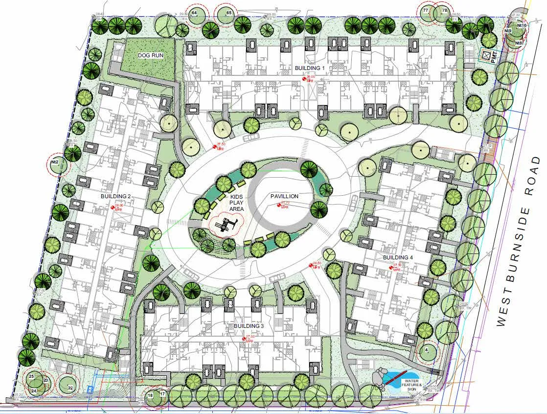
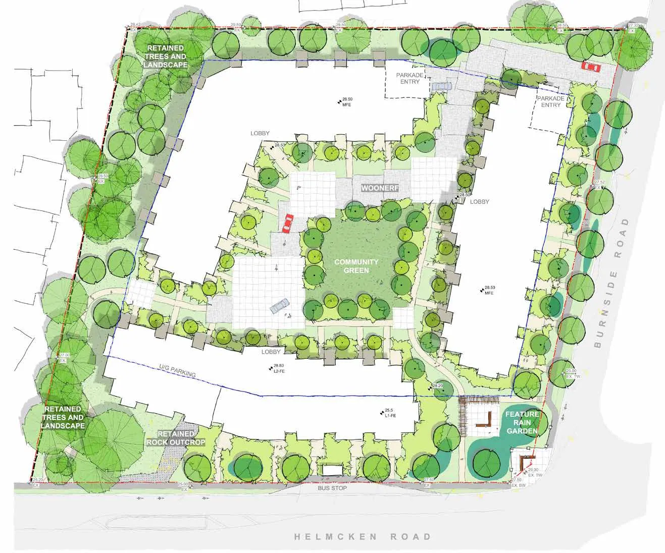
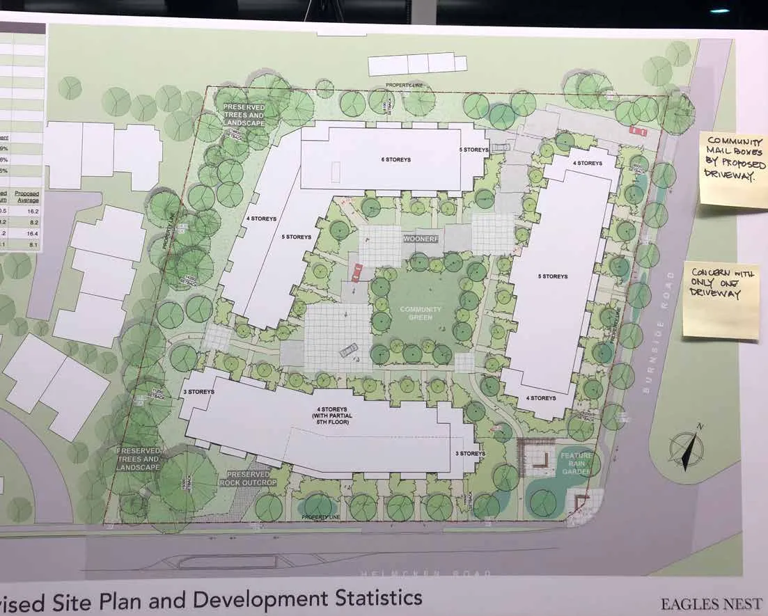
Proposed Site Plan & Development Statistics

Development Data
| Category | Value |
|---|---|
| Site Area (sf) | 148,120 |
| Total Units | 247 |
| Units Per Hectare | 179 |
| Gross Floor Area (sf) | 224,968 |
| FAR | 1.5 |
| Coverage | 33% |
| Max Height (ft) | 63.0 |
| Height (storeys) | 3 - 6 |
Unit Mix
| Unit Type | Count | Percent |
|---|---|---|
| 1-Bed (587 sf) | 85 | 34% |
| 2-Bed (878 sf) | 140 | 57% |
| 3-Bed (1,050 sf) | 22 | 9% |
Setbacks (m)
| Boundary | Required Min | Proposed Min | Proposed Average |
|---|---|---|---|
| Front (Helmcken) | 7.5 | 10.5 | 16.2 |
| Flanking (Burnside) | 4.0 | 8.2 | 8.2 |
| Side (West) | 4.0 | 11.2 | 16.4 |
| Side (North) | 4.0 | 8.0 | 8.0 |
- MAXIMUM SETBACK: 19.9 m
- MINIMUM SETBACK: 11.2 m
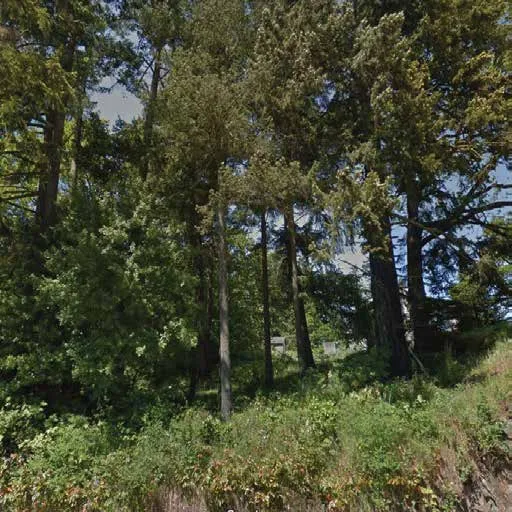
Tree Retention Approach
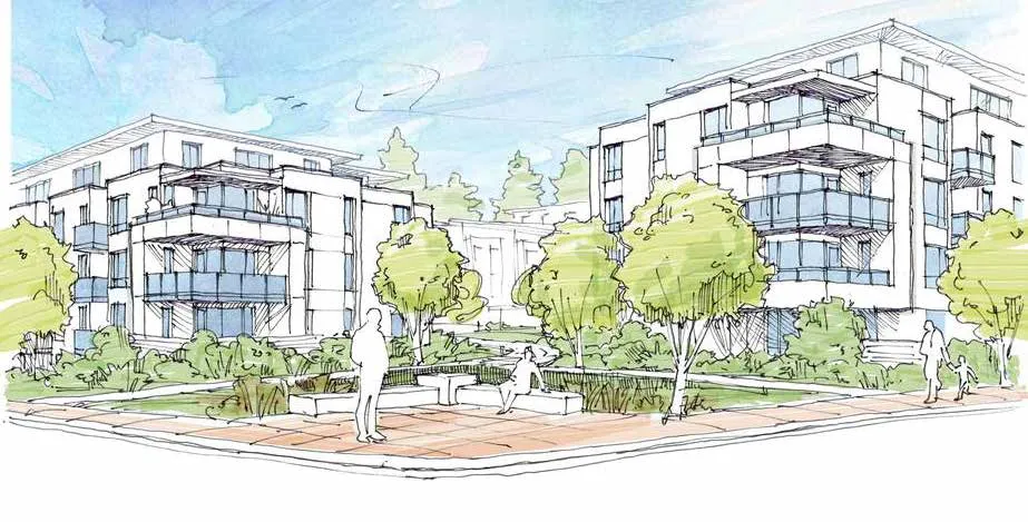
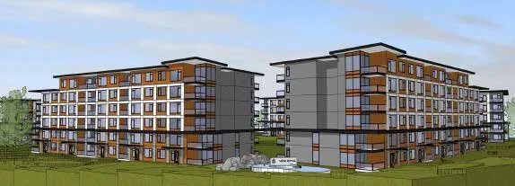
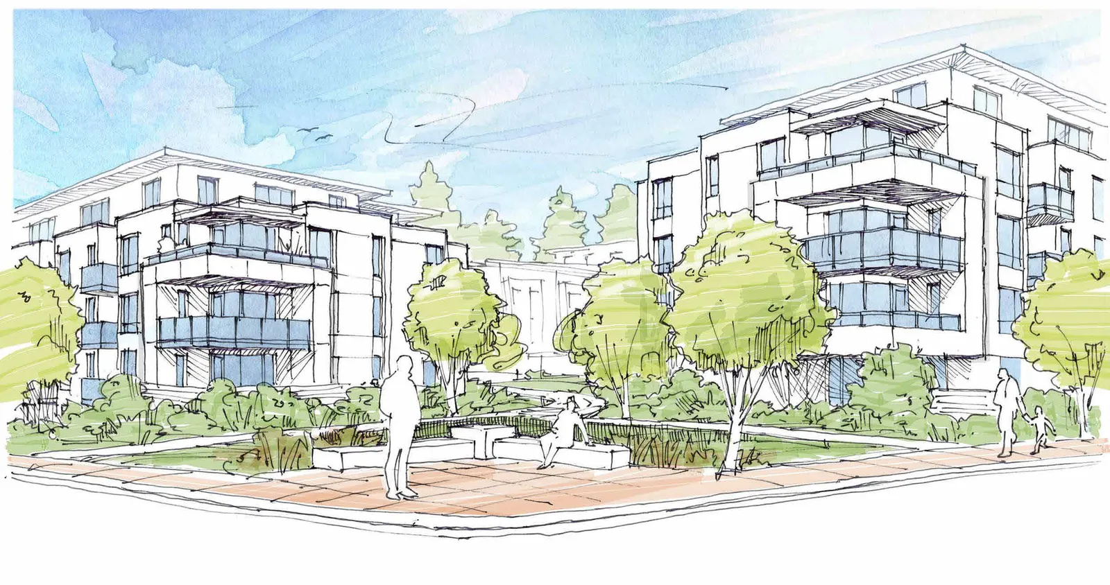
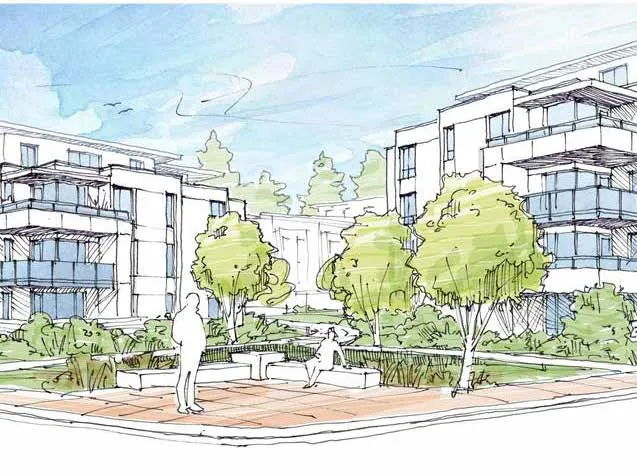
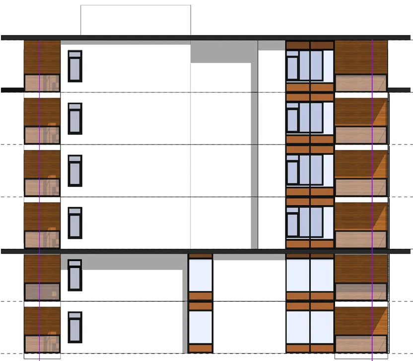
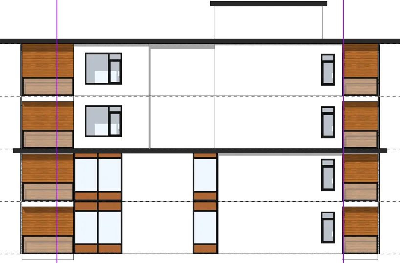
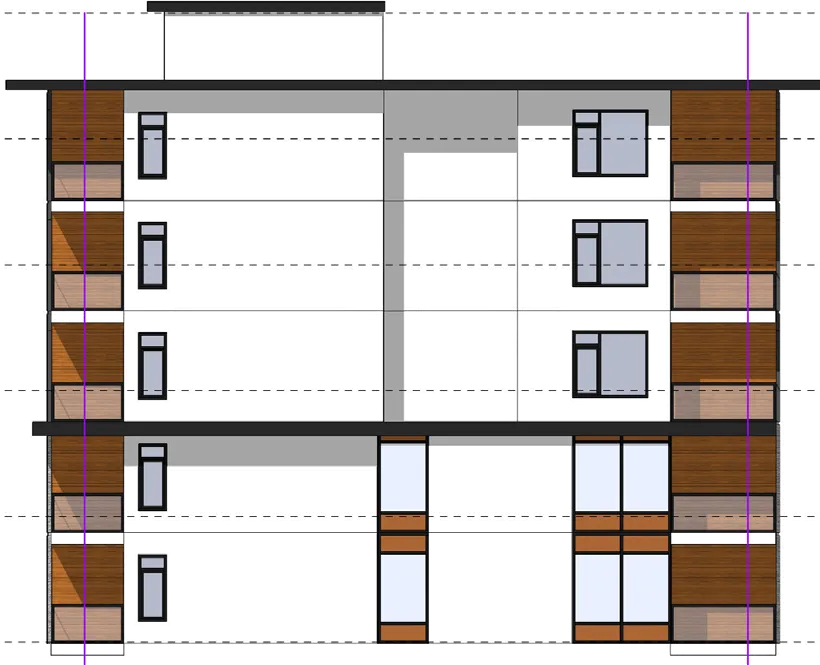
Perspective Rendering & Site Sections

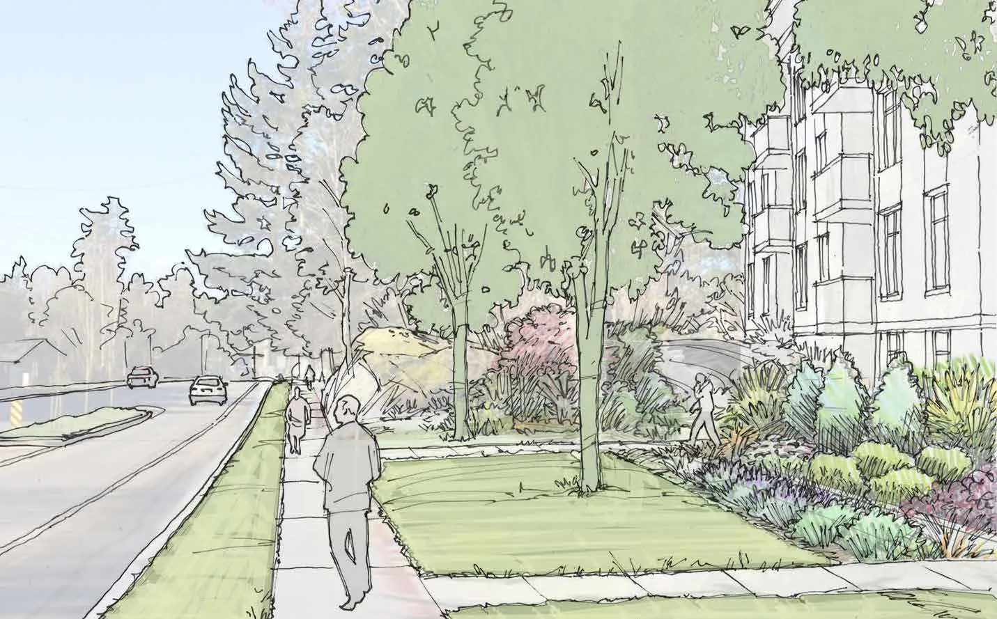
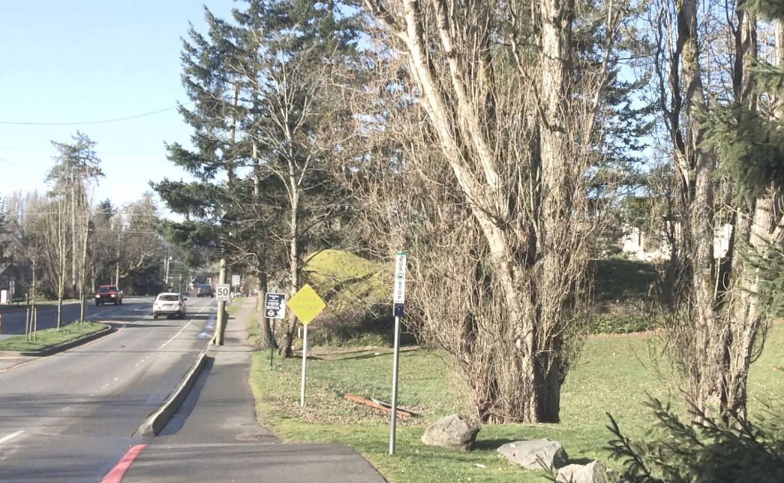
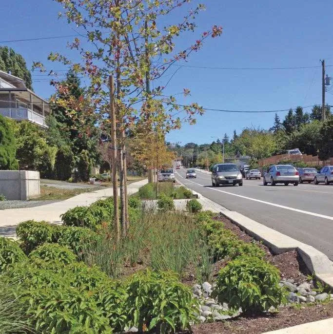
Helmcken Road Streetscape, Current
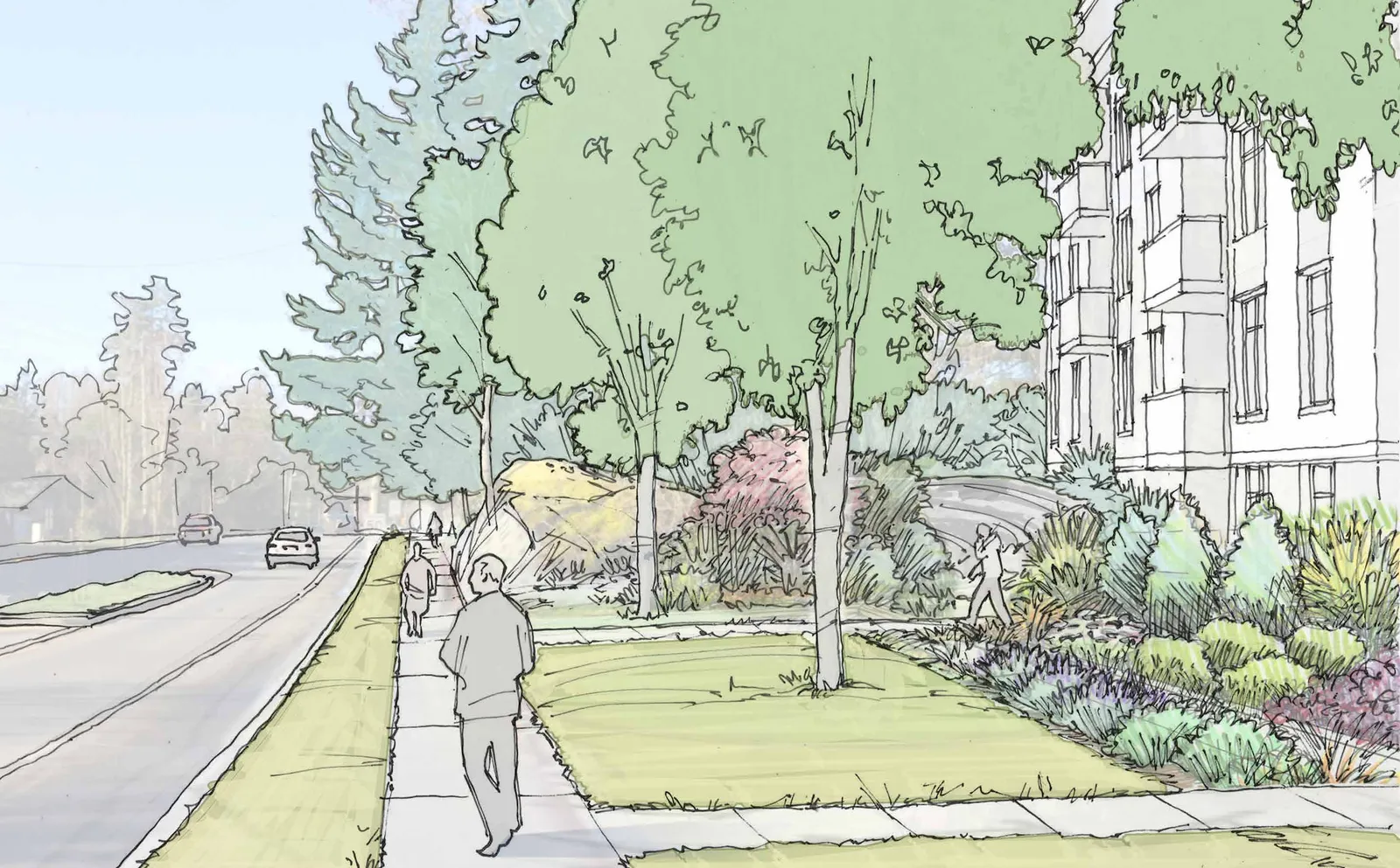
Helmcken Road Streetscape, Proposed
Aerial Perspective Rendering
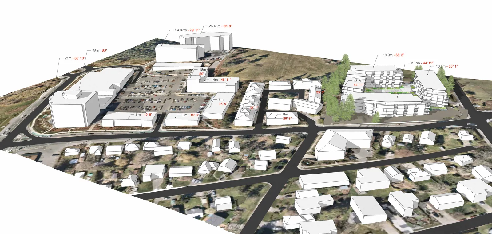
Building Heights in Context
Eagles Nest Relative to other Recent Developments
| PROPERTY NAME | Units | Coverage | Units/Acre | FSR | Parking | Variances |
|---|---|---|---|---|---|---|
| Eagles Nest | 247 | 33% | 75 | 1.5 | 100% UG | No |
| Eagles Creek Village Ph 2 | 114 | 50% | 51 | 1.6 | 0% UG | Yes |
| West Park Lane | 152 | 50% | 157 | 1.5 | 0% UG | Yes |
| Glentana (105-108) | 50 | ? | 66 | 1.5 | 0% UG | Yes |
| Island Highway (242-244) | 37 | 47% | 81 | 1.6 | 0% UG | Yes |
| #7 Erskine Lane | 70 | 33% | 53 | 1.5 | 80% UG | ? |
- The FSR and Number of Units per acre are based on the actual land parcel used for the building and not the combined site where single family or retail and office parking lots are factored in.
- Please note that the finished elevation of the rentals building now being finished at Eagles Creek is actually higher for the 6 storeys than the 8 stores at Eagles Nest.
- Also please note that the Units per acre is twice as high at Thetis Lake than at Eagles Nest. 242 island Highway is also higher.
Underground Parking, Low Site Coverage, More Green Space
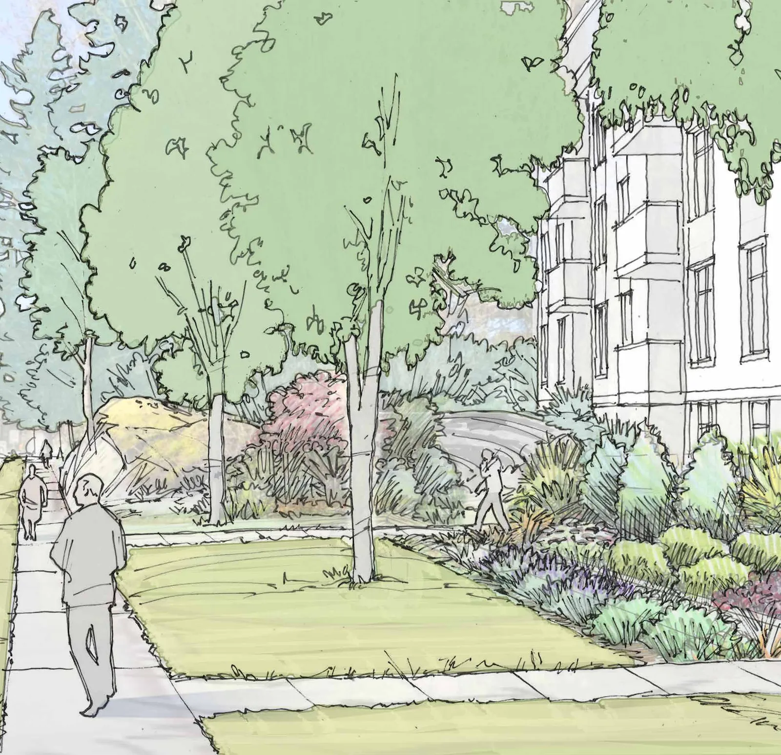
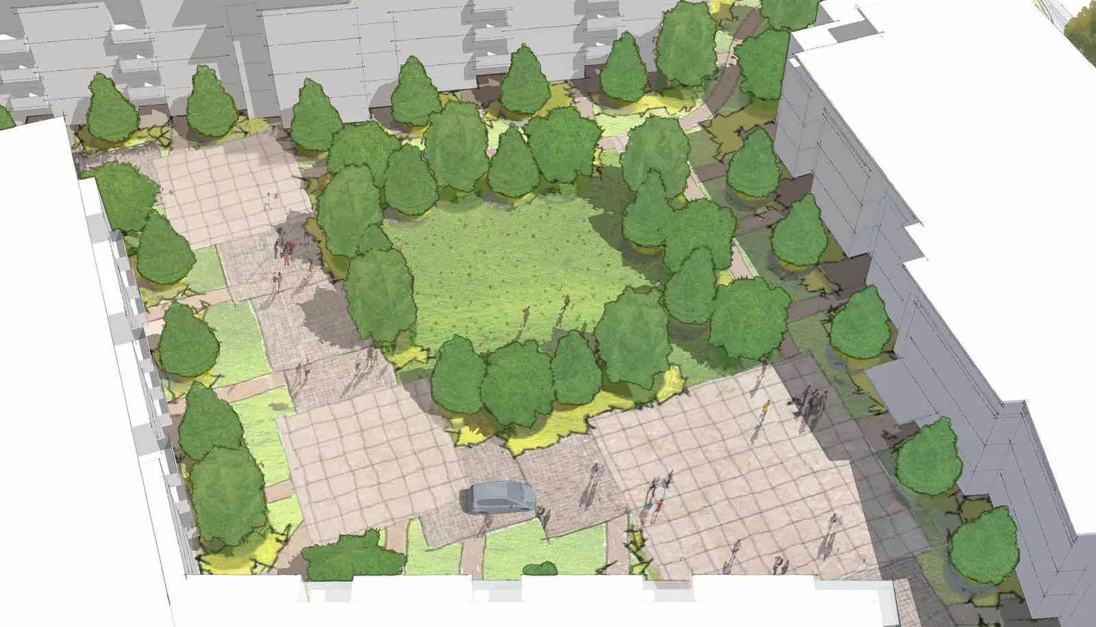
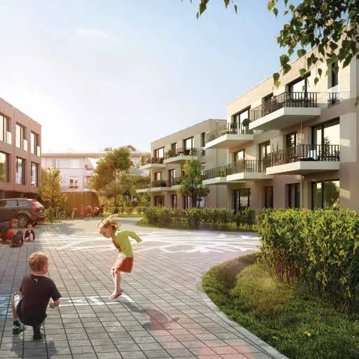
Central Green Space & Woonerf
Landscape Plan
- COMMUNITY GREEN - OPEN SPACE: Large central lawn area.
- PRESERVED TREES AND LANDSCAPE: Invasive species management; gaps filled with native trees; pedestrian path for residents.
- PRESERVED ROCK OUTCROP: Retention of existing natural feature.
- WOONERF STYLE SHARED SPACE: Slow zone, informal socializing, gathering and play.
- PLANTED BOULEVARD WITH RAIN GARDENS: Proposed street frontage treatment.
- FEATURE RAIN GARDEN: Located between small plazas with seating, railing and pergola.
Site Sections
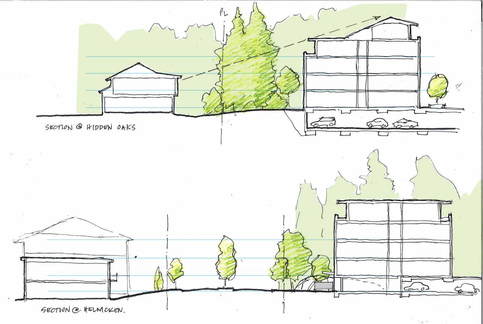
Significant Changes from Previous Application

More Considered Plan in Current Application
| Metric | ORIGINAL APPLICATION | CURRENT APPLICATION |
|---|---|---|
| NUMBER OF BUILDINGS | 4 | 3 |
| HEIGHTS (STOREYS) | ||
| Burnside Rd W | 6 | 4 & 5 |
| Helmcken Rd | 6 | 3 & 4 |
| Saanich Farmland | 5 | 6 (one building) |
| Hidden Oaks Townhouses | 4 | 4 |
| SETBACKS (METERS) | ||
| Burnside Rd W | 4 m | 8.2 m |
| Helmcken Rd | 7.5 m | 10.5 m |
| Saanich Farmland | 8 m | 8 m |
| Hidden Oaks Townhouses | 7.5 m | 11.2 - 19.98 m (Varies) |
| Number of Units | 260 | 247 |
3.0 Transportation
[Image depicting integrated transportation modes: cycling and BC Transit bus]
Regional & Local Traffic
[Image collage showing cyclist, bus, scooter, and traffic/pedestrian activity]
Regional Traffic
- Helmcken is a vital connection for View Royal and region - access to Camosun College, VGH and Highway 1.
- Helmcken Road near the site sees approximately 12,000 vehicles per day - functions as an arterial road.
- Burnside Road used by some commuters as an alternative route to Highway 1.
Local Traffic
- Congestion is largely regional traffic.
- Potential for improvements following the completion of the McKenzie Interchange.
- New development should encourage alternate modes of transportation, including walking, cycling, car share and transit use.
Infill makes use of existing infrastructure and already disturbed land, reduces development pressure on natural areas, and can support increased walking, biking and transit use.
Transportation Planning
- Site generated traffic will add one vehicle to the study area road network approximately every 45 seconds during the AM peak and every 35 seconds during the PM peak.
- Site generated traffic will have a negligible impact on traffic operations at the Helmcken / Watkiss / Chancelor and Helmcken / Burnside intersections at buildout.
- Project is proposing access off of Burnside Road West, and is not using the existing right of way across the Hidden Oaks’ driveway.
- The site access will operate well 10 years beyond full buildout and does not require a northbound left turn lane.
- Since December 2019 when the McKenzie / Highway 1 underpass was opened, media estimates indicate commute times between Langford and Victoria have been reduced 10 – 15 minutes. The McKenzie interchange project may in turn improve conditions on Helmcken Road and Burnside Road.
Transportation Demand Management & Amenities
- TDM strategies may reduce the development’s impact on traffic operations at study area intersections.
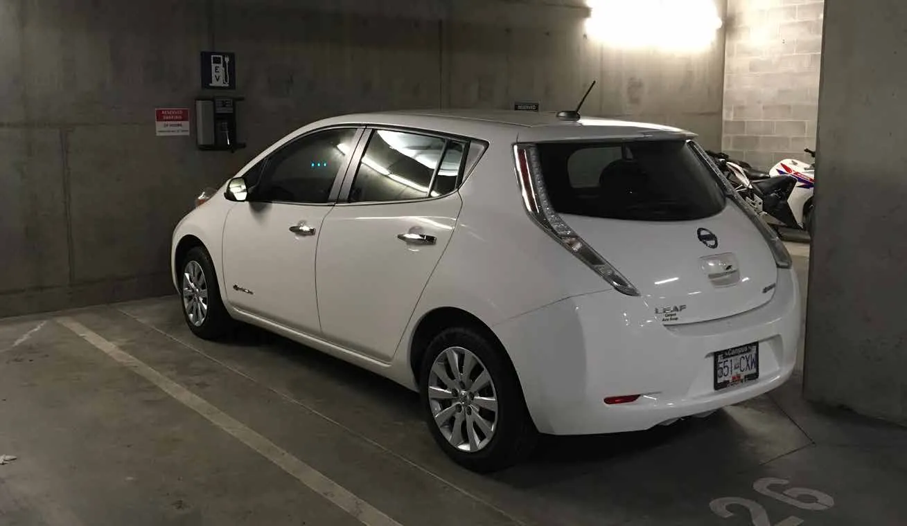
- Rebates for e-bike purchases ($500).
- Charging stations for e-vehicles.
- Working with Modo to encourage car share program expansion to View Royal.
- A sidewalk is proposed on Helmcken Road and Burnside Road West.
- Walkable connection to shops & services at Eagle Creek Village.
- Bus lay-by and shelter on Helmcken Rd proposed.
- Direct access to transit.
- Access to Galloping Goose Regional Trail.
4.0 Summary & Benefits

Timeline
- SUMMER 2018: Pre-Application - Site & Technical Analysis; Review of Planning Regulations/OCP; Initial Meetings with View Royal Staff; Conceptual Design.
- FALL 2018: Rezoning Application - Submission to View Royal; Technical review and feedback; Response to Staff comments.
- OCTOBER 23, 2018: Community Meeting - Site Plan Version 1.
- NOVEMBER 13, 2018: Committee of the Whole - Concern about density; Concern about massing at the corner.
- WINTER 2018/2019: Site Plan Revisions - Site & Technical Analysis; Response to community and COTW comments.
- JANUARY 9, 2019: Hidden Oaks Resident Meeting - Site Plan Version 2.
- SPRING/SUMMER 2019: Site Plan Revisions - Site plan revisions, response to community input; Committee of the Whole Delegation, April 9, 2019.
- JULY 9, 2019: Community Meeting - Site Plan Version 3.
- SEPTEMBER 17, 2019: Committee of the Whole - Withdrew application.
- NOVEMBER 18, 2019: Neighbours’ Workshop #1 - Site & Landscape Design.
- DECEMBER 2, 2019: Neighbours’ Workshop #2 - Site Plan Revision.
- NOVEMBER/DECEMBER 2019: Site Plan Revisions - Site plan revisions, response to neighbours’ input; Site analysis, technical analysis; Preparation of new site plan.
- FEBRUARY 3, 2020: Community Meeting - New Site Plan.
Next Steps
- JANUARY - MARCH 2020: Rezoning Application - Submission to View Royal; Technical review and feedback; Response to Staff comments; Committee of the Whole, March 10, 2020.
- SPRING 2020: Public Hearing.
- +2-3 MONTHS/SUMMER 2020: Rezoning Final Adoption.
- +3-4 MONTHS/FALL 2020: Development Permit Application - Submission to View Royal; The DP may run concurrently with the Rezoning, or could follow Final Adoption of the zoning; Technical review and feedback; Response to Staff comments.
- FALL/WINTER 2020: Development Permit Approval.
- SPRING 2021: Building Permit.
- SPRING 2021: Construction Start.
- SPRING 2023: Construction Finish.
Community Amenities
Implementing the View Royal OCP
Providing New Housing in the Right Place
Providing $3,500/unit or +/- $864,500 in Community Amenity Contributions
View Royal has set strong goals for shaping new growth and change. “Well-designed compact housing ensures choice, affordability and better use of land. Infill and redevelopment near neighbourhood centres and transit corridors provides jobs and services closer to where people live – minimizing the need for commuting, and creating pedestrian-friendly streets and destinations.” - excerpt from View Royal OCP Vision Statement
Community Benefits:
- An increased customer base for the shops and services at Eagle Creek Village.
- New bus lay-by to support transit and allow traffic to flow.
- Housing for all ages and stages - seniors, young professionals and families.
- Walkable services, 3 parks nearby, YMCA, close to VGH.
- Streetscape improvements with walk-up unit entrances and a welcoming plaza on the Helmcken / Burnside corner.
- Similar in scale and density to other recently approved developments in View Royal.
Benefits to View Royal

- Project application fees +/- $81,000
- Building permit fees +/- $337,500
- Development Cost Charges +/- $1,494,871
- CACs +/- $864,500
- Offsite costs for sidewalks, roads, transit shelter, service connections +/- $435,814
- Total capital benefit: +/- $3.1 M
- Increased tax base of +/- $275,000 from new residential units.
- New housing.
- New gateway to View Royal.
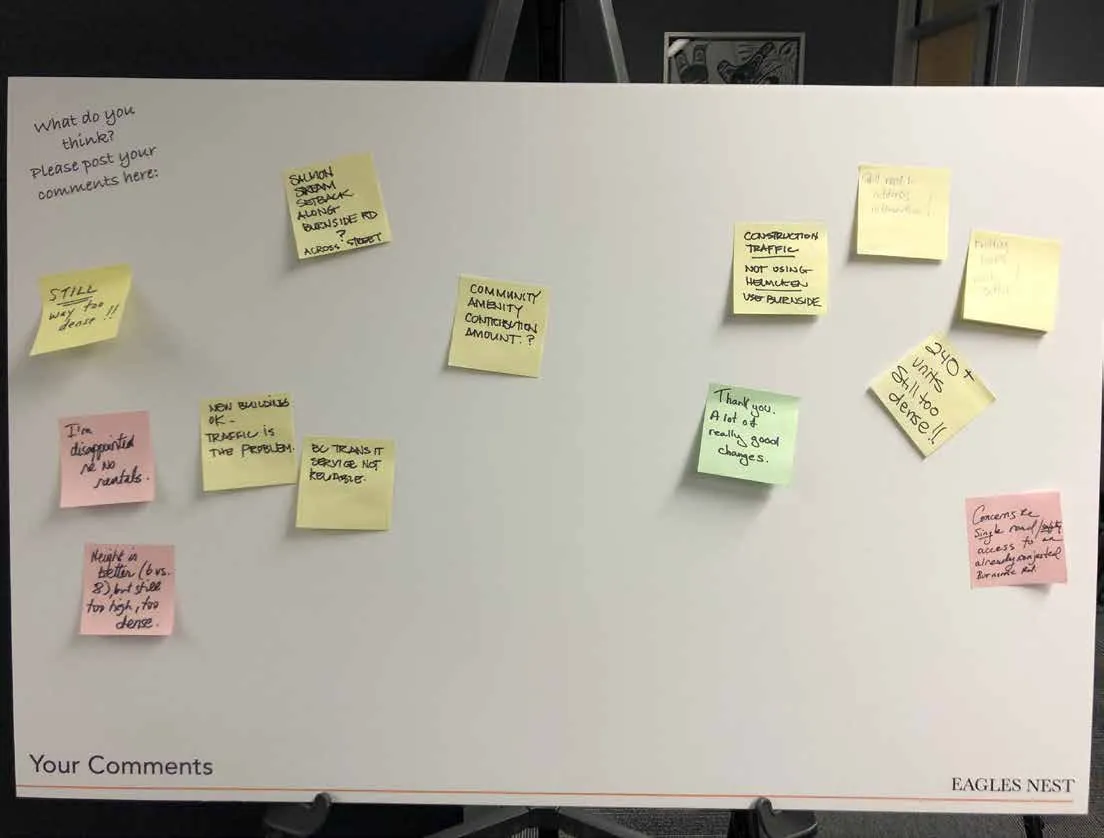
Questions & Comments

Thank you.