Appendix
Subdivision Plan of Part of Lot 1, Plan 24900 (Attachment 4)
May 6, 2014Page 791 section
Formal subdivision survey plan for the property on Wilfert Road.
March 2009 survey date
Subdivision Plan
Plan VIP 86689
Subdivision Plan of:
- Part of Lot 1, Plan 24900; Except Part in Plan 27155;
- Parcel A (DD 184242 I) of Lot 20, Plan 748; Both of Section 98, Esquimalt District.
BCGS: 92B.043 Scale: 1:500
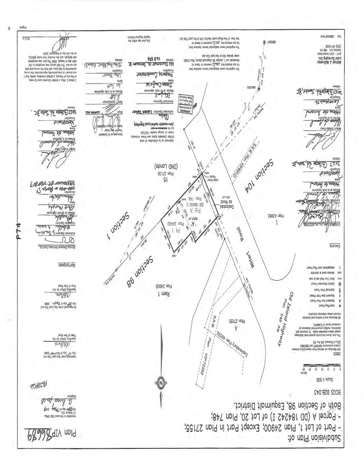
Legend
- Grid bearings are derived from observations between control monuments 87H2947 and 88H3051 (City of Colwood, ISA No. 40).
- This plan shows horizontal ground-level distances. To compute grid distances, multiply ground-level distances by combined factor of 0.999612.
- All distances are in metres and decimals thereof unless otherwise indicated.
- ● Lead Plug Found
- ○ Standard Iron Post Found
- ☉ Standard Iron Post Placed
- □ Aluminum Post Found
- ⊕ Control Monument Found
- rmk Short Iron Post set in rock
- conc denotes wood in concrete
- U Unregistered Lead Plug Found
Property and Area Details
- Lot Area (Pt 1 and Pd A combined): 828.5 m²
- Dedicated as Road: 18.4 m²
- Adjacent Roadways: Wilfert Road, Old Island Highway (Plan 649 RW)
- Property Address: 2027 Gillespie Rd., Sooke, BC
Owners and Mortgagees
- Owners: (Signatures present)
- Mortgagee: Sancora Balanced Mortgage Fund Ltd.
Approvals and Certifications
- Approved under the Land Title Act this 10th day of December, 2008.
- Re-approved under the Land Title Act this 31st day of March, 2009.
- Approving Officer for the Town of View Royal.
- Field survey was completed on the 25th day of August, 2008.
- Surveyed by: Kevin C. Riley, B.C.L.S.
- Deposited in the Land Title Office at Victoria, B.C. this 20th day of May, 2009.
Surveyor Contact Information
- Michael J. McIlvaney Land Surveying Inc.
- #12 - 2244 Sooke Road, Victoria, B.C. V9B 1X1
- Phone: (250) 474-5538
- File: 38882UB-Amd
Page 79
Extracted from: 2014 05 06 Council Agenda