Appendix
Attachment "B" - Explanatory Plan of Covenant
May 20, 2014Page 581 section
Plan identifying areas A and B for statutory right-of-way over Lot 1 and Lot A.
EXPLANATORY PLAN OF COVENANT UPON PART OF LOT 1, PLAN 11766 AND LOT A, PLAN 17320, ALL OF SECTION 2, ESQUIMALT DISTRICT, PURSUANT TO SECTION 99(1)(e) LAND TITLE ACT.
PLAN EPP33152 Attachment B
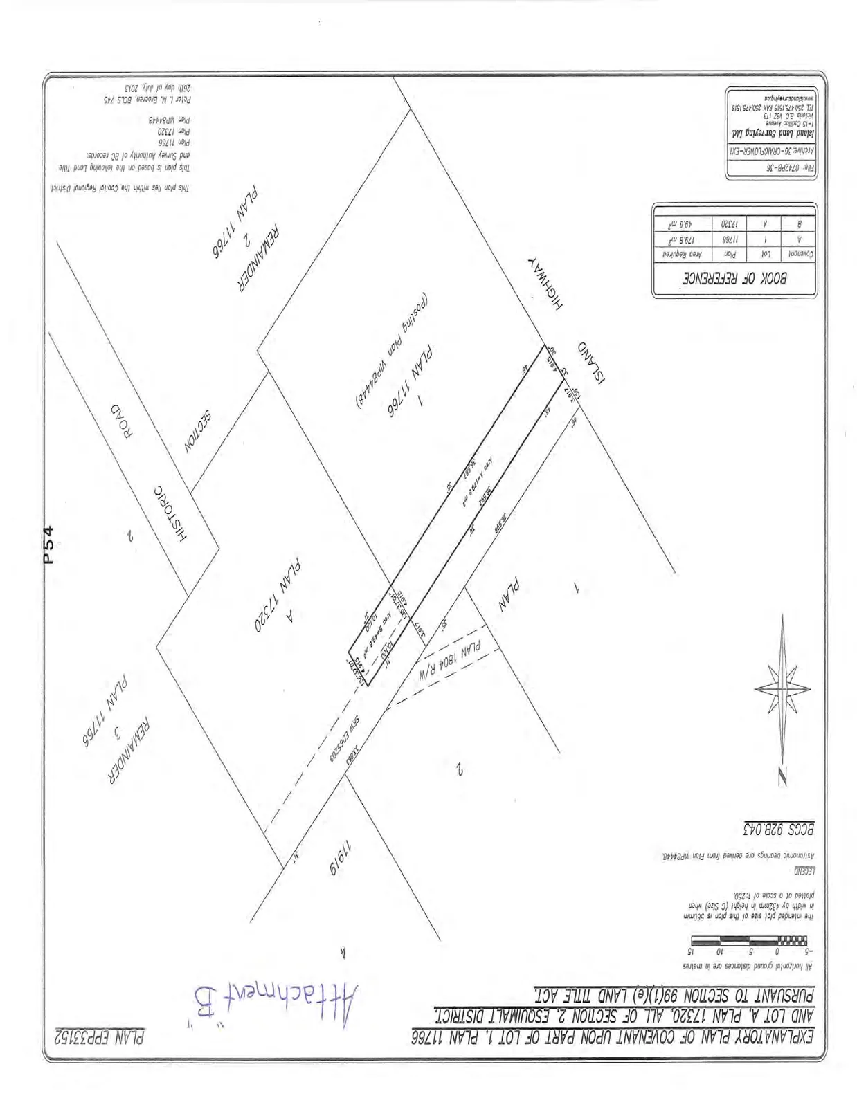
Legend and Notes
- The intended plot size of this plan is 560mm in width by 432mm in height (C Size) when plotted at a scale of 1:250.
- All horizontal ground distances are in metres.
- Astronomic bearings are derived from Plan VIP84448.
- BCGS 928.043
Book of Reference
| Covenant | Lot | Plan | Area Required |
|---|---|---|---|
| A | 1 | 11766 | 179.8 m² |
| B | A | 17320 | 49.6 m² |
Administrative Information
This plan lies within the Capital Regional District. This plan is based on the following Land Title and Survey Authority of BC records:
- Plan 11766
- Plan 17320
- Plan VIP84448
Peter L. M. Broeren, BCLS 745 26th day of July, 2013
File: 07429PR-36 Archive: 3G-CRAIGFLOWER-EX1 Island Land Surveying Ltd. 1-15 Cadillac Avenue Victoria, B.C. V8Z 1T3 TEL 250.475.1515 FAX 250.475.1516 www.islandsurveying.ca
Page 58
Extracted from: 2014 05 20 Council Agenda