Staff Report (Historical): Environmental Development Permit No. 2012/07 - July 13, 2012
Final report recommending approval for the initial development permit at 237 Anya Lane.
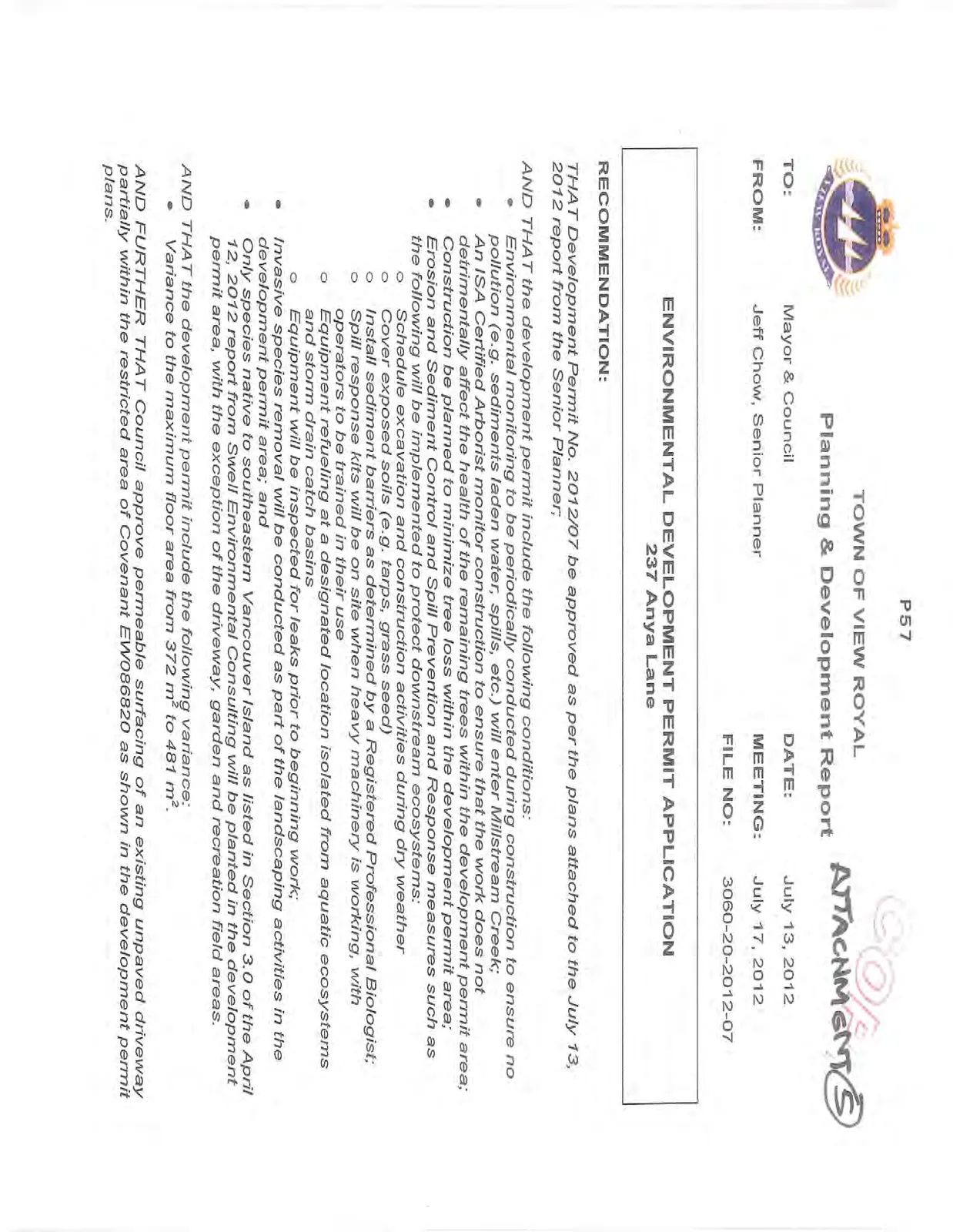
TOWN OF VIEW ROYAL
Planning & Development Report
TO: Mayor & Council DATE: July 13, 2012 FROM: Jeff Chow, Senior Planner MEETING: July 17, 2012 FILE NO: 3060-20-2012-07
ENVIRONMENTAL DEVELOPMENT PERMIT APPLICATION
237 Anya Lane
RECOMMENDATION:
THAT Development Permit No. 2012/07 be approved as per the plans attached to the July 13, 2012 report from the Senior Planner;
AND THAT the development permit include the following conditions:
- Environmental monitoring to be periodically conducted during construction to ensure no pollution (e.g. sediments laden water, spills, etc.) will enter Millstream Creek;
- An ISA Certified Arborist monitor construction to ensure that the work does not detrimentally affect the health of the remaining trees within the development permit area;
- Construction be planned to minimize tree loss within the development permit area;
- Erosion and Sediment Control and Spill Prevention and Response measures such as the following will be implemented to protect downstream ecosystems:
- Schedule excavation and construction activities during dry weather
- Cover exposed soils (e.g. tarps, grass seed)
- Install sediment barriers as determined by a Registered Professional Biologist;
- Spill response kits will be on site when heavy machinery is working, with operators to be trained in their use
- Equipment refueling at a designated location isolated from aquatic ecosystems and storm drain catch basins
- Equipment will be inspected for leaks prior to beginning work;
- Invasive species removal will be conducted as part of the landscaping activities in the development permit area; and
- Only species native to southeastern Vancouver Island as listed in Section 3.0 of the April 12, 2012 report from Swell Environmental Consulting will be planted in the development permit area, with the exception of the driveway, garden and recreation field areas.
AND THAT the development permit include the following variance:
- Variance to the maximum floor area from 372 m² to 481 m².
AND FURTHER THAT Council approve permeable surfacing of an existing unpaved driveway partially within the restricted area of Covenant EW086820 as shown in the development permit plans.
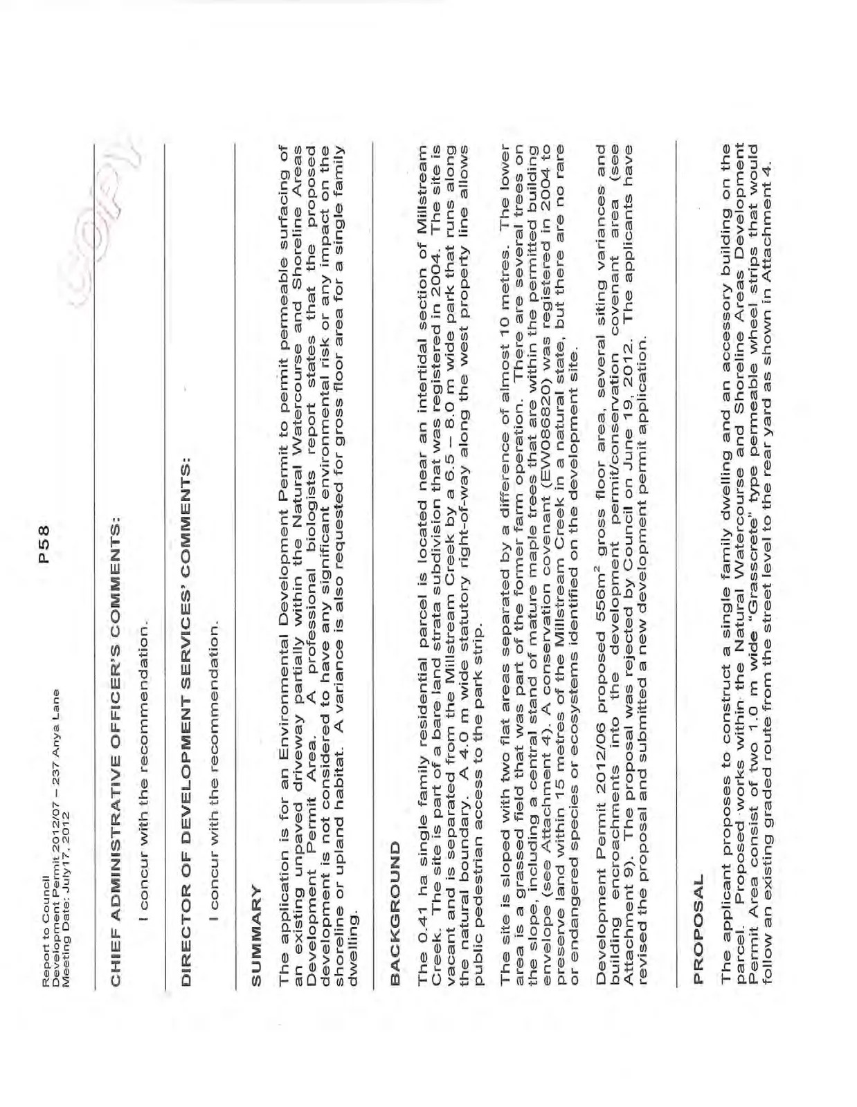
CHIEF ADMINISTRATIVE OFFICER’S COMMENTS:
I concur with the recommendation.
DIRECTOR OF DEVELOPMENT SERVICES’ COMMENTS:
I concur with the recommendation.
SUMMARY
The application is for an Environmental Development Permit to permit permeable surfacing of an existing unpaved driveway partially within the Natural Watercourse and Shoreline Areas Development Permit Area. A professional biologists report states that the proposed development is not considered to have any significant environmental risk or any impact on the shoreline or upland habitat. A variance is also requested for gross floor area for a single family dwelling.
BACKGROUND
The 0.41 ha single family residential parcel is located near an intertidal section of Millstream Creek. The site is part of a bare land strata subdivision that was registered in 2004. The site is vacant and is separated from the Millstream Creek by a 6.5 – 8.0 m wide park that runs along the natural boundary. A 4.0 m wide statutory right-of-way along the west property line allows public pedestrian access to the park strip.
The site is sloped with two flat areas separated by a difference of almost 10 metres. The lower area is a grassed field that was part of the former farm operation. There are several trees on the slope, including a central stand of mature maple trees that are within the permitted building envelope (see Attachment 4). A conservation covenant (EW086820) was registered in 2004 to preserve land within 15 metres of the Millstream Creek in a natural state, but there are no rare or endangered species or ecosystems identified on the development site.
Development Permit 2012/06 proposed 556m² gross floor area, several siting variances and building encroachments into the development permit/conservation covenant area (see Attachment 9). The proposal was rejected by Council on June 19, 2012. The applicants have revised the proposal and submitted a new development permit application.
PROPOSAL
The applicant proposes to construct a single family dwelling and an accessory building on the parcel. Proposed works within the Natural Watercourse and Shoreline Areas Development Permit Area consist of two 1.0 m wide "Grasscrete" type permeable wheel strips that would follow an existing graded route from the street level to the rear yard as shown in Attachment 4.
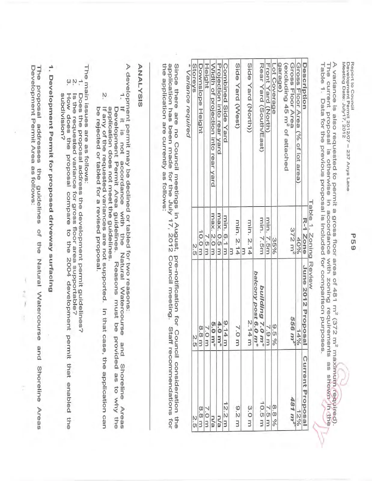
A variance is also requested to permit a gross floor area of 481 m² (372 m² maximum required). The current proposal is otherwise in accordance with zoning requirements as shown in the Table 1. Data for the previous proposal is included for comparison purposes.
Table 1. Zoning Review
| Description | R-1 Zone | June 2012 Proposal | Current Proposal |
|---|---|---|---|
| Gross Floor Area (% of lot area) | 40% | 14% | 12% |
| Gross Floor Area (excluding 45 m² of attached garage) | 372 m² | 556 m²* | 481 m²* |
| Lot Coverage | 35% | 9.5 % | 8.8 % |
| Front Yard (North) | min. 7.5m | 7.9 m | 7.5 m |
| Rear Yard (South/East) | min. 7.5m | building 7.0 m* balcony post 6.0 m* | 10.5 m |
| Side Yard (North) | min. 2.14 m | 2.14 m | 3.0 m |
| Side Yard (West) | min. 2.14 m | 7.0 m | 9.2 m |
| Combined Side Yard | min. 6.1 m | 9.14 m | 12.2 m |
| Projection into rear yard | max. 0.5 m | 4.0 m* | n/a |
| Width of projection into rear yard | max. 2.0 m | 5.0 m* | n/a |
| Height | 7.5 m | 7.0 m | 7.0 m |
| Downslope Height | 10.0 m | 8.8 m | 8.8 m |
| Storeys | 2.5 | 2.5 | 2.5 |
* Variance required
Since there are no Council meetings in August, pre-notification for Council consideration the application has been made for the July 17, 2012 Council meeting. Staff recommendations for the application are currently as follows:
ANALYSIS
A development permit may be declined or tabled for two reasons:
- If it is not accordance with the Natural Watercourse and Shoreline Areas Development Permit Area guidelines. Reasons must be provided as to why the application does not meet the guidelines.
- If any of the requested variances are not supported. In that case, the application can be rejected or tabled for a revised proposal.
The main issues are as follows:
- Does the proposal address the development permit guidelines?
- Is the requested variance for gross floor area supportable?
- How does the proposal compare to the 2004 development permit that enabled the subdivision?
1. Development Permit for proposed driveway surfacing
The proposal addresses the guidelines of the Natural Watercourse and Shoreline Areas Development Permit Area as follows:
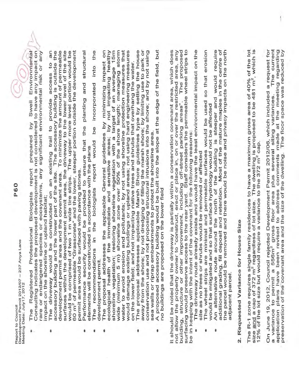
- The Registered Professional Biologists report prepared by Swell Environmental Consulting indicates the proposed development is not considered to have any impact on rare or endangered species or ecosystems, any significant environmental risk or any impact on the shoreline or upland habitat;
- The driveway would be constructed on an existing trail to provide access to an accessory building and the lower part of the site. The accessory building is outside the development permit area and the covenant area. To minimize the amount of permeable surfaces within the development permit area, the driveway to the lower level of the site would be comprised of two 1 m wide tire strips. The upper more level portion would be 60 m² of permeable "Grasscrete" and the lower, steeper portion outside the development permit area would be surfaced with paving stones.
- Performance security would be provided to ensure that the planting and structural elements will be constructed in accordance with the plans
- The recommendations in the biologists report would be incorporated into the development permit.
- The proposal addresses the applicable General guidelines by minimizing impact on ecological health of the immediate and sensitive areas; by not impacting healthy shoreline vegetation; restoring shoreline vegetation with a target of an average 15m wide (minimum 5 m) shoreline zone over 50% of the shore length; managing storm water to avoid erosion and pollutants; by not using shoreline protection measures that would damage existing buildings or upland areas; not using hard engineering measures on the lower field; and not impacting native trees and shrubs that overhang the water.
- The proposal addresses applicable Marsh Shore guidelines type by setting the house away from the shore; by not dredging or filling the marsh shore; by limiting use to park or conservation use and not proposing structural intrusions into the shore; and by not using sea walls or riprap embankments to protect the shoreline area.
- A proposed accessory building would be built into the slope at the edge of the field, but no buildings are proposed on the lower field
It should be noted that the driveway is partially within a conservation covenant area, which does not allow the property owner to "construct, erect or place in, on or over the restricted area, any building, structure or other improvement, including off-street parking areas". The proposed surfacing would preserve access to the rear yard. Staff considers the permeable wheel strips to be in keeping with the intent of the covenant for the following reasons:
- The driveway route already exists and would have the least environmental impact on the site as no trees or shrubs would be removed or affected
- The wheel strips are minimal and permeable surfaces would be used so that erosion would be mitigated and so that surface hydrology would not be affected
- An alternative route around the north of the building is steeper and would require additional grading, fill deposit and retention. Most of the mature maples in the centre of the parcel would be removed and there would be noise and privacy impacts on the north adjacent parcel.
2. Requested Variance for House Size
The R-1 zone requires single family residences to have a maximum gross area of 40% of the lot size and a cap of 372 m² regardless of lot size. The dwelling is proposed to be 481 m², which is 12% of the lot size but would require a variance to the 372 m² cap.
On June 19, 2012, Council rejected Development Permit 2012/06, which included a request for a variance to permit a 556m² gross floor area plus several siting variances. The current application plans have been revised to address comments made at the meeting regarding preservation of the covenant area and the size of the dwelling. The floor space was reduced by decreasing the garage from three bays to two and by making an upper floor office smaller. This allowed the building to shift away from the development permit area and covenant area at the rear of the parcel and require no variances for siting.
The requested variance can be supported for the following reasons:
a. The subject property is relatively large. The R-1 zone has a minimum parcel size of 1000m² and the subject property is more than four times the minimum parcel size, so the proposed dwelling size of 481m² would be 12% of the lot area (40% maximum).
b. The building would be set into the slope. As shown in Attachments 7 & 8, the building would appear be 1.5 storeys from the street because the lower floor would be sunk into the slope and not visible. 47.6 m² of the lower floor would be completely subterranean and is proposed for storage because it is foundation area for the main floor above. One option to reduce gross floor area would be to fill in the excavated space after construction, but that would not be an efficient use of resources.
c. The proposed building would not have a significant impact on adjacent dwellings. The site is at the end of the strata driveway and there are only two adjacent parcels. The building is laid out to maximize privacy and overlook. The building would be 10.0 m from the west property line (minimum 2.1 m required). The 3.0 m side yard would exceed the requirement of 2.14 m from the north property line. The building height and siting would meet zoning bylaw requirements.
3. Lower Field
At the July 10, 2012 Committee of the Whole meeting, members recalled a previous development permit application and staff was asked to provide some history. On March 16, 2004, Council considered environmental Development Permit No. 01-04 to permit a 25-lot subdivision. The plans showed a proposed covenant area over the entire lower field. A 24-unit subdivision was approved. Covenant EW086820 was subsequently registered in July 2004 to require land within 15.0 m of the natural boundary to be kept in a natural state. This is the minimum development permit area leave strip for this type of low density development as required by the development permit area guidelines.
ALTERNATIVES TO STAFF RECOMMENDATION:
Alternative #1
An alternative would be to receive the staff report and support a lesser variance to permit a gross floor area of 435 m² (372 m² permitted). This could be achieved by requiring the unfinished storage area on the lower floor to be filled in after construction.
Alternative #2
A second alternative would be to receive the staff report and decline the requested variance.
RECOMMENDATION:
THAT Development Permit No. 2012/07 be approved as per the plans attached to the July 13, 2012 report from the Senior Planner;
AND THAT the development permit include the following conditions:
- Environmental monitoring to be periodically conducted during construction to ensure no pollution (e.g. sediments laden water, spills, etc.) will enter Millstream Creek;
- An ISA Certified Arborist monitor construction to ensure that the work does not detrimentally affect the health of the remaining trees within the development permit area;
- Construction be planned to minimize tree loss within the development permit area;
- Erosion and Sediment Control and Spill Prevention and Response measures such as the following will be implemented to protect downstream ecosystems:
- Schedule excavation and construction activities during dry weather
- Cover exposed soils (e.g. tarps, grass seed)
- Install sediment barriers as determined by a Registered Professional Biologist;
- Spill response kits will be on site when heavy machinery is working, with operators to be trained in their use
- Equipment refueling at a designated location isolated from aquatic ecosystems and storm drain catch basins
- Equipment will be inspected for leaks prior to beginning work;
- Invasive species removal will be conducted as part of the landscaping activities in the development permit area; and
- Only species native to southeastern Vancouver Island as listed in Section 3.0 of the April 12, 2012 report from Swell Environmental Consulting will be planted in the development permit area, with the exception of the driveway, garden and recreation field areas.
AND THAT the development permit include the following variance:
- Variance to the maximum floor area from 372 m² to 481 m².
AND FURTHER THAT Council approve permeable surfacing of an existing unpaved driveway partially within the restricted area of Covenant EW086820 as shown in the development permit plans.
SUBMITTED BY: Jeff Chow, Senior Planner
REVIEWED BY: Lindsay Chase, Director of Development Services
ATTACHMENTS
- Location plan
- Environmental Review – Swell Environmental Consulting – April 12, 2012 (10 pages)
- Cover Sheet - Rodier Design, June 27, 2012
- A1.1 Site Plan and General Notes - Rodier Design, June 27, 2012
- A2.2 Lower Floor Plan - Rodier Design, June 27, 2012
- A2.3 Main Floor/Office Plan - Rodier Design, June 27, 2012
- A4.1 Front/Right Elevation - Rodier Design, June 27, 2012
- A4.2 Rear / Left Elevation - Rodier Design, June 27, 2012
- A1.1 Site and General Notes - Rodier Design, April 12, 2012 (Original Proposal declined June 19, 2012)
- E-mail from David Cung, applicant - June 26, 2012
Document Images
(6)