Riparian Areas Regulation: Assessment Report - 2427 Chilco Road
Formal assessment report determining the Streamside Protection and Enhancement Area (SPEA) width and protection measures.
Riparian Areas Regulation: Assessment Report
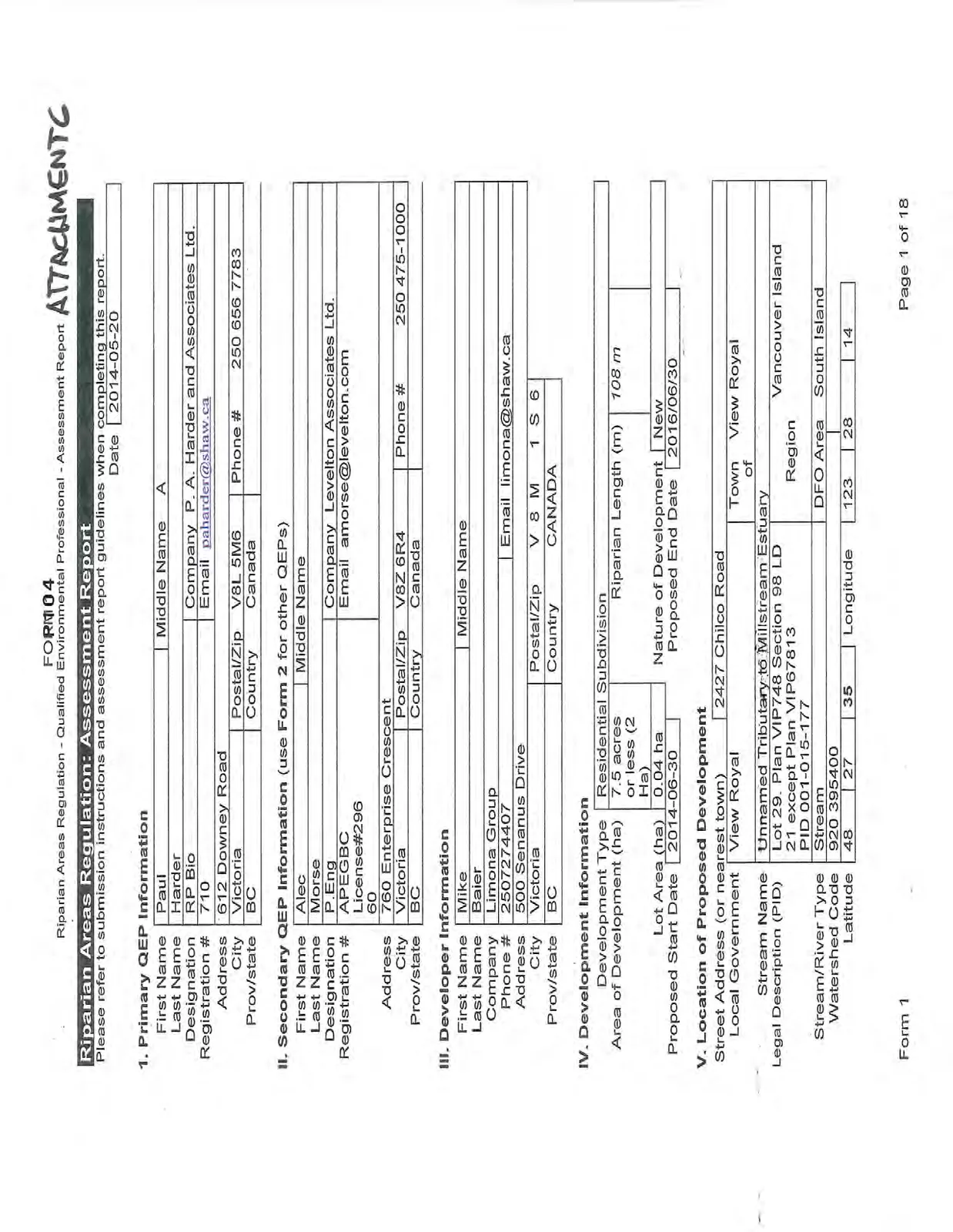
Date 2014-05-20
1. Primary QEP Information
| First Name | Paul | Middle Name A |
| Last Name | Harder | |
| Designation | RP Bio | Company P. A. Harder and Associates Ltd. |
| Registration # | 710 | Email paharder@shaw.ca |
| Address | 612 Downey Road | |
| City | Victoria | Postal/Zip V8L 5M6 |
| Prov/state | BC | Country Canada |
II. Secondary QEP Information (use Form 2 for other QEPs)
| First Name | Alec | Middle Name |
| Last Name | Morse | |
| Designation | P.Eng | Company Levelton Associates Ltd. |
| Registration # | APEGBC License#29660 | Email amorse@levelton.com |
| Address | 760 Enterprise Crescent | |
| City | Victoria | Postal/Zip V8Z 6R4 |
| Prov/state | BC | Country Canada |
III. Developer Information
| First Name | Mike | Middle Name |
| Last Name | Baier | |
| Company | Limona Group | |
| Phone # | 2507274407 | Email limona@shaw.ca |
| Address | 500 Senanus Drive | |
| City | Victoria | Postal/Zip V 8 M 1 S 6 |
| Prov/state | BC | Country CANADA |
IV. Development Information
| Development Type | Residential Subdivision | |
| Area of Development (ha) | 7.5 acres or less (2 Ha) | Riparian Length (m) |
| Lot Area (ha) | 0.04 ha | Nature of Development |
| Proposed Start Date | 2014-06-30 | Proposed End Date |
V. Location of Proposed Development
| Street Address (or nearest town) | 2427 Chilco Road | |
| Local Government | View Royal | Town of View Royal |
| Stream Name | Unnamed Tributary to Millstream Estuary | |
| Legal Description (PID) | Lot 29. Plan VIP748 Section 98 LD 21 except Plan VIP67813 PID 001-015-177 | Region Vancouver Island |
| Stream/River Type | Stream | DFO Area South Island |
| Watershed Code | 920 395400 | |
| Latitude | 48 27 35 | Longitude 123 28 14 |
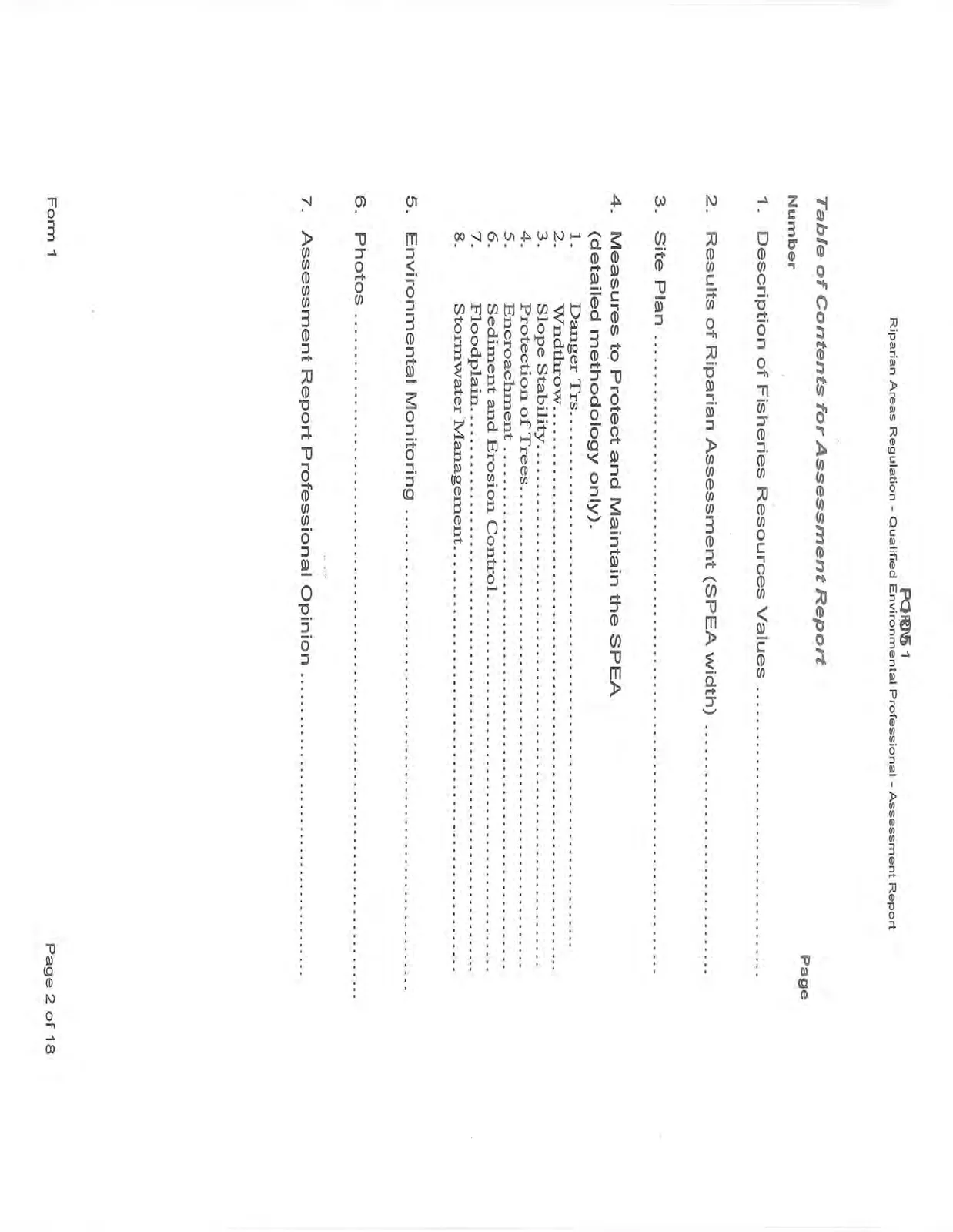
Table of Contents for Assessment Report
| Number | Page | |
|---|---|---|
| 1. | Description of Fisheries Resources Values | |
| 2. | Results of Riparian Assessment (SPEA width) | |
| 3. | Site Plan | |
| 4. | Measures to Protect and Maintain the SPEA (detailed methodology only). | |
| 1. Danger Trs. | ||
| 2. Wndthrow. | ||
| 3. Slope Stability. | ||
| 4. Protection of Trees. | ||
| 5. Encroachment. | ||
| 6. Sediment and Erosion Control. | ||
| 7. Floodplain. | ||
| 8. Stormwater Management. | ||
| 5. | Environmental Monitoring | |
| 6. | Photos | |
| 7. | Assessment Report Professional Opinion |
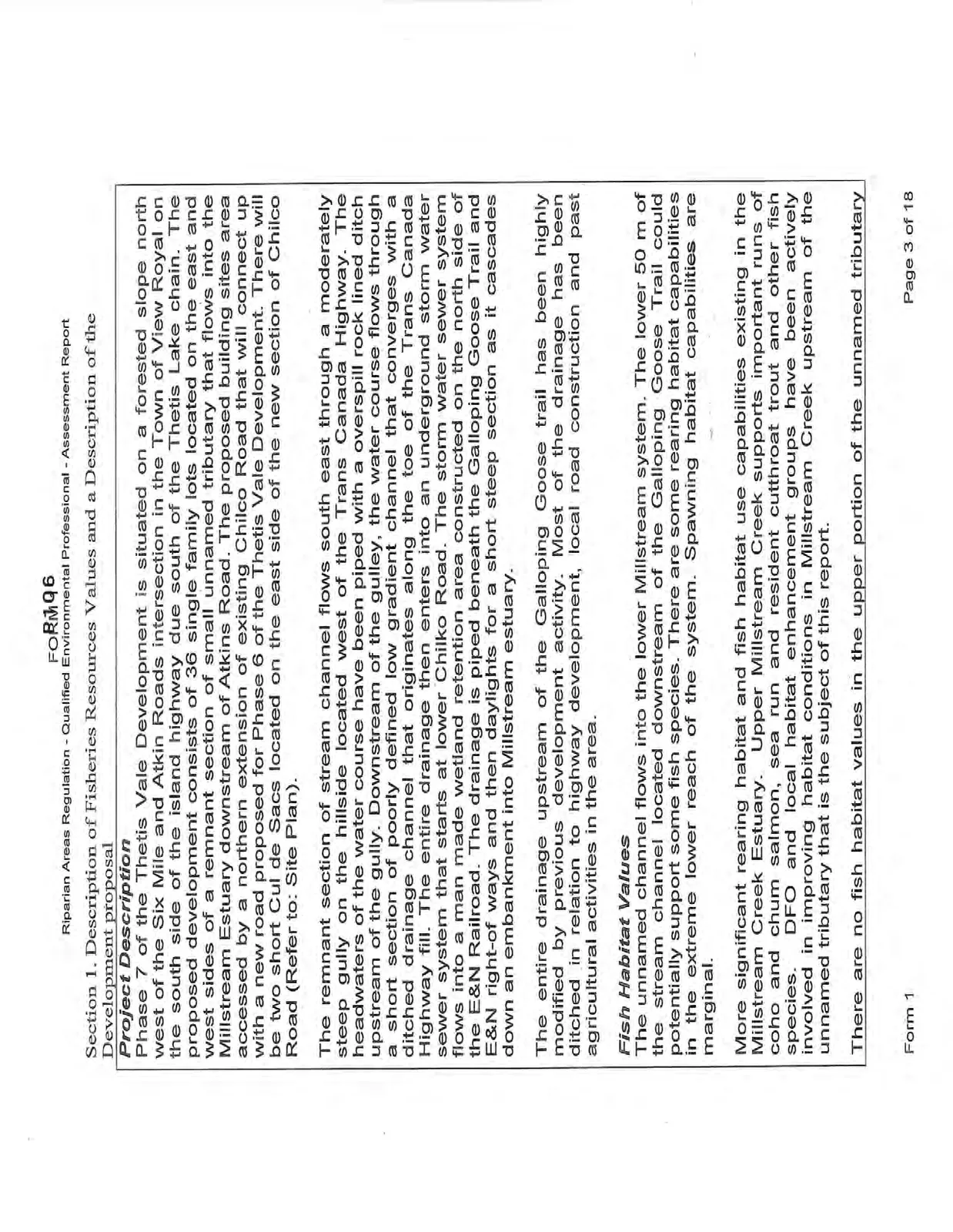
Section 1. Description of Fisheries Resources Values and a Description of the Development proposal
Project Description
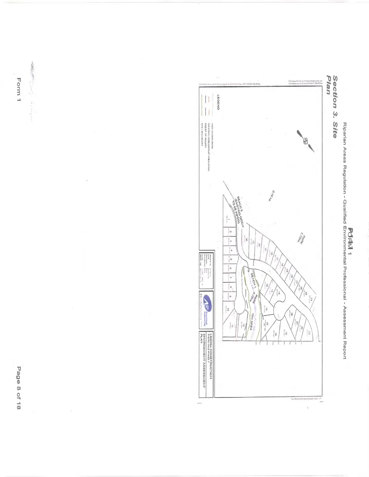
Phase 7 of the Thetis Vale Development is situated on a forested slope north west of the Six Mile and Atkin Roads intersection in the Town of View Royal on the south side of the island highway due south of the Thetis Lake chain. The proposed development consists of 36 single family lots located on the east and west sides of a remnant section of small unnamed tributary that flows into the Millstream Estuary downstream of Atkins Road. The proposed building sites area accessed by a northern extension of existing Chilco Road that will connect up with a new road proposed for Phase 6 of the Thetis Vale Development. There will be two short Cul de Sacs located on the east side of the new section of Chilco Road (Refer to: Site Plan).
The remnant section of stream channel flows south east through a moderately steep gully on the hillside located west of the Trans Canada Highway. The headwaters of the water course have been piped with a overspill rock lined ditch upstream of the gully. Downstream of the gulley, the water course flows through a short section of poorly defined low gradient channel that converges with a ditched drainage channel that originates along the toe of the Trans Canada Highway fill. The entire drainage then enters into an underground storm water sewer system that starts at lower Chilco Road. The storm water sewer system flows into a man made wetland retention area constructed on the north side of the E&N Railroad. The drainage is piped beneath the Galloping Goose Trail and E&N right-of ways and then daylights for a short steep section as it cascades down an embankment into Millstream estuary.
The entire drainage upstream of the Galloping Goose trail has been highly modified by previous development activity. Most of the drainage has been ditched in relation to highway development, local road construction and past agricultural activities in the area.
Fish Habitat Values
The unnamed channel flows into the lower Millstream system. The lower 50 m of the stream channel located downstream of the Galloping Goose Trail could potentially support some fish species. There are some rearing habitat capabilities in the extreme lower reach of the system. Spawning habitat capabilities are marginal.
More significant rearing habitat and fish habitat use capabilities existing in the Millstream Creek Estuary. Upper Millstream Creek supports important runs of coho and chum salmon, sea run and resident cutthroat trout and other fish species. DFO and local habitat enhancement groups have been actively involved in improving habitat conditions in Millstream Creek upstream of the unnamed tributary that is the subject of this report.
There are no fish habitat values in the upper portion of the unnamed tributary
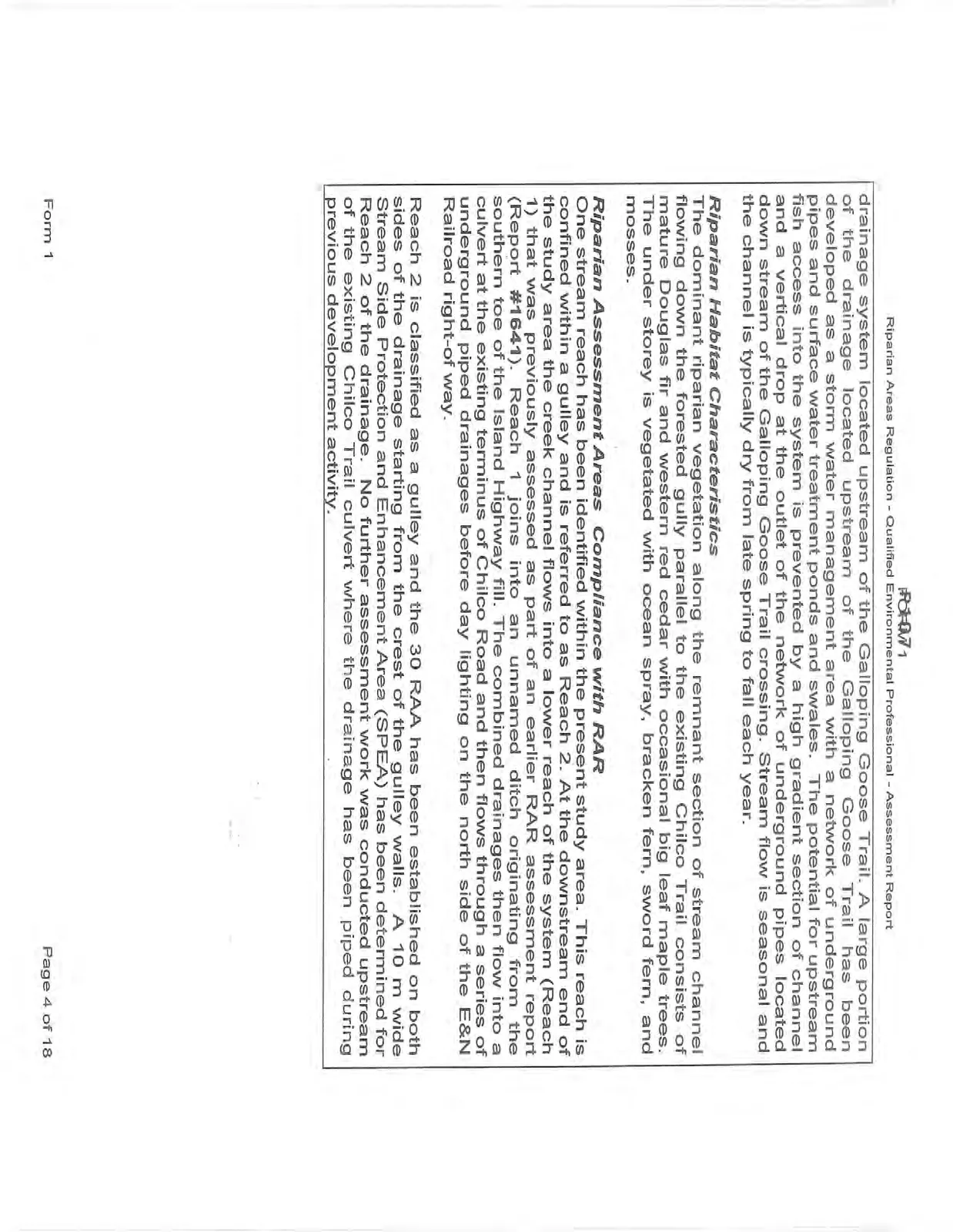
drainage system located upstream of the Galloping Goose Trail. A large portion of the drainage located upstream of the Galloping Goose Trail has been developed as a storm water management area with a network of underground pipes and surface water treatment ponds and swales. The potential for upstream fish access into the system is prevented by a high gradient section of channel and a vertical drop at the outlet of the network of underground pipes located down stream of the Galloping Goose Trail crossing. Stream flow is seasonal and the channel is typically dry from late spring to fall each year.
Riparian Habitat Characteristics
The dominant riparian vegetation along the remnant section of stream channel flowing down the forested gully parallel to the existing Chilco Trail consists of mature Douglas fir and western red cedar with occasional big leaf maple trees. The under storey is vegetated with ocean spray, bracken fern, sword fern, and mosses.
Riparian Assessment Areas Compliance with RAR
One stream reach has been identified within the present study area. This reach is confined within a gulley and is referred to as Reach 2. At the downstream end of the study area the creek channel flows into a lower reach of the system (Reach 1) that was previously assessed as part of an earlier RAR assessment report (Report #1641). Reach 1 joins into an unnamed ditch originating from the southern toe of the Island Highway fill. The combined drainages then flow into a culvert at the existing terminus of Chilco Road and then flows through a series of underground piped drainages before day lighting on the north side of the E&N Railroad right-of way.
Reach 2 is classified as a gulley and the 30 RAA has been established on both sides of the drainage starting from the crest of the gulley walls. A 10 m wide Stream Side Protection and Enhancement Area (SPEA) has been determined for Reach 2 of the drainage. No further assessment work was conducted upstream of the existing Chilco Trail culvert where the drainage has been piped during previous development activity.
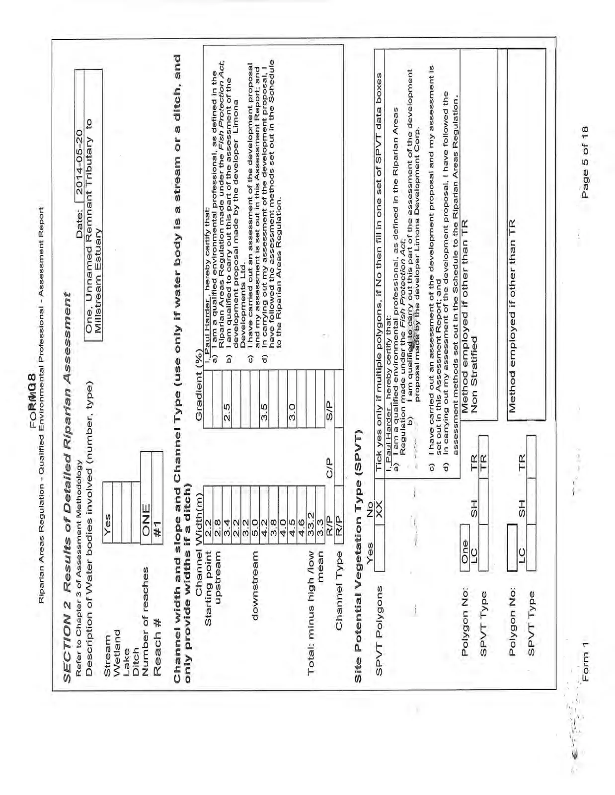
SECTION 2 Results of Detailed Riparian Assessment
Refer to Chapter 3 of Assessment Methodology
| Date: | 2014-05-20 |
|---|---|
| Description of Water bodies involved (number, type) | One, Unnamed Remnant Tributary to Millstream Estuary |
| Stream | Yes |
| Wetland | |
| Lake | |
| Ditch | |
| Number of reaches | ONE |
| Reach # | #1 |
Channel width and slope and Channel Type (use only if water body is a stream or a ditch, and only provide widths if a ditch)
| Channel Width(m) | Gradient (%) | ||
|---|---|---|---|
| Starting point | 2.2 | ||
| upstream | 2.8 | ||
| 3.4 | 2.5 | ||
| 2.2 | |||
| 3.2 | |||
| downstream | 5.0 | ||
| 4.2 | 3.5 | ||
| 3.8 | |||
| 4.0 | |||
| 4.5 | 3.0 | ||
| 4.6 | |||
| Total: minus high /low | 33.2 | ||
| mean | 3.3 | ||
| R/P | C/P | S/P | |
| Channel Type | R/P |
I, Paul Harder, hereby certify that: a) I am a qualified environmental professional, as defined in the Riparian Areas Regulation made under the Fish Protection Act; b) I am qualified to carry out this part of the assessment of the development proposal made by the developer Limona Developments Ltd. c) I have carried out an assessment of the development proposal and my assessment is set out in this Assessment Report; and d) In carrying out my assessment of the development proposal, I have followed the assessment methods set out in the Schedule to the Riparian Areas Regulation.
Site Potential Vegetation Type (SPVT)
| Yes | No | |
|---|---|---|
| SPVT Polygons | XX |
Tick yes only if multiple polygons, if No then fill in one set of SPVT data boxes I, Paul Harder, hereby certify that: a) I am a qualified environmental professional, as defined in the Riparian Areas Regulation made under the Fish Protection Act; b) I am qualified to carry out this part of the assessment of the development proposal made by the developer Limona Development Corp. c) I have carried out an assessment of the development proposal and my assessment is set out in this Assessment Report; and d) In carrying out my assessment of the development proposal, I have followed the assessment methods set out in the Schedule to the Riparian Areas Regulation.
| Polygon No: | One | Method employed if other than TR | ||||
| LC | SH | TR | Non Stratified | |||
| SPVT Type | TR |
| Polygon No: | Method employed if other than TR | |||||
| LC | SH | TR | ||||
| SPVT Type |
| Polygon No: | Method employed if other than TR | |||||
| SPVT Type |
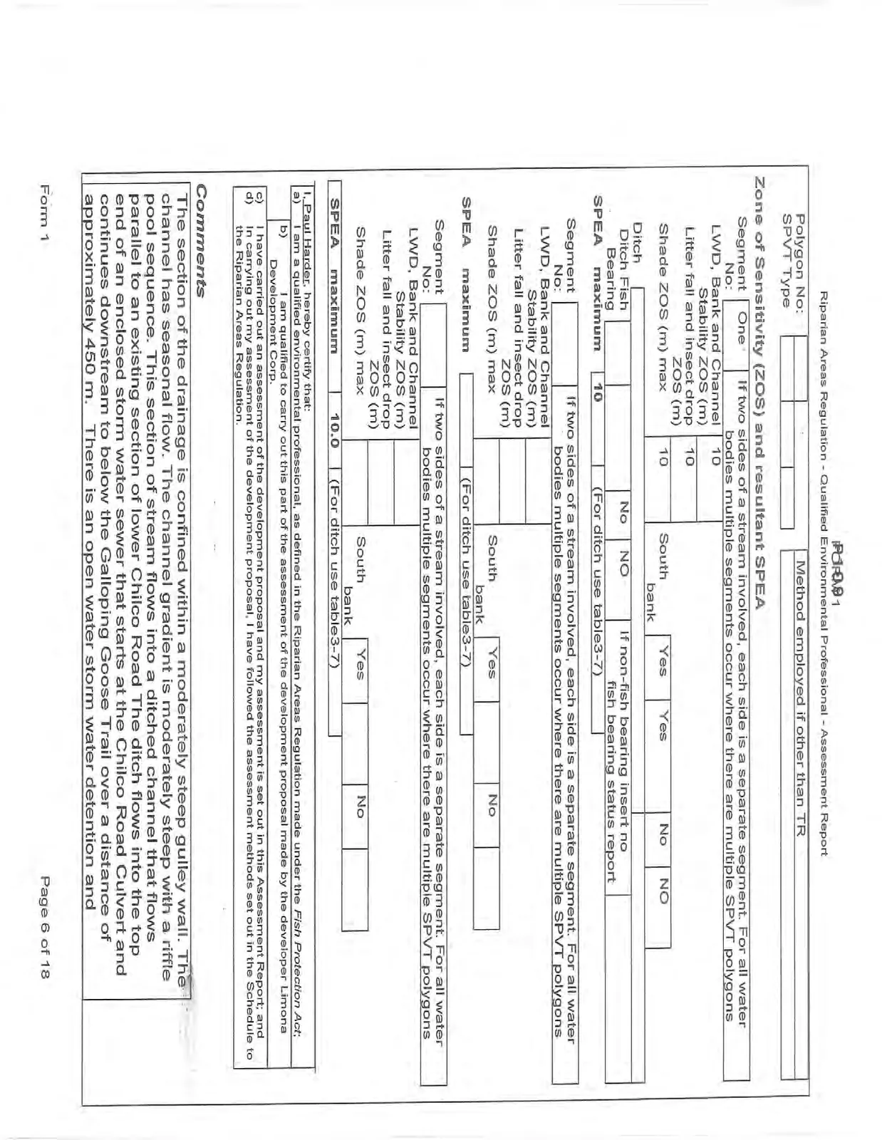
Zone of Sensitivity (ZOS) and resultant SPEA
| Segment No: | One | If two sides of a stream involved, each side is a separate segment. For all water bodies multiple segments occur where there are multiple SPVT polygons |
|---|---|---|
| LWD, Bank and Channel Stability ZOS (m) | 10 | |
| Litter fall and insect drop ZOS (m) | 10 | |
| Shade ZOS (m) max | 10 | South bank |
| Ditch | ||||
|---|---|---|---|---|
| Ditch Fish Bearing | No | NO | If non-fish bearing insert no fish bearing status report | |
| SPEA maximum | 10 | (For ditch use table3-7) |
| Segment No: | If two sides of a stream involved, each side is a separate segment. For all water bodies multiple segments occur where there are multiple SPVT polygons | |
|---|---|---|
| LWD, Bank and Channel Stability ZOS (m) | ||
| Litter fall and insect drop ZOS (m) | ||
| Shade ZOS (m) max | South bank | |
| SPEA maximum | (For ditch use table3-7) |
| Segment No: | If two sides of a stream involved, each side is a separate segment. For all water bodies multiple segments occur where there are multiple SPVT polygons | |
|---|---|---|
| LWD, Bank and Channel Stability ZOS (m) | ||
| Litter fall and insect drop ZOS (m) | ||
| Shade ZOS (m) max | South bank | |
| SPEA maximum | 10.0 | (For ditch use table3-7) |
I, Paul Harder, hereby certify that: a) I am a qualified environmental professional, as defined in the Riparian Areas Regulation made under the Fish Protection Act; b) I am qualified to carry out this part of the assessment of the development proposal made by the developer Limona Development Corp. c) I have carried out an assessment of the development proposal and my assessment is set out in this Assessment Report; and d) In carrying out my assessment of the development proposal, I have followed the assessment methods set out in the Schedule to the Riparian Areas Regulation.
Comments
The section of the drainage is confined within a moderately steep gulley wall. The channel has seasonal flow. The channel gradient is moderately steep with a riffle pool sequence. This section of stream flows into a ditched channel that flows parallel to an existing section of lower Chilco Road The ditch flows into the top end of an enclosed storm water sewer that starts at the Chilco Road Culvert and continues downstream to below the Galloping Goose Trail over a distance of approximately 450 m. There is an open water storm water detention and
treatment pond on the up slope side of the E&N Railroad; the rest of the lower drainage is enclosed in pipes.
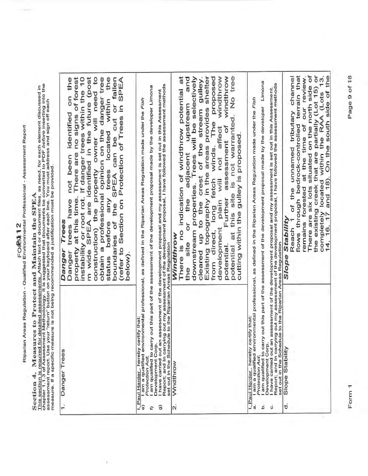
Section 4. Measures to Protect and Maintain the SPEA
This section is required for detailed assessments. Attach text or document files, as need, for each element discussed in chapter 1.1.3 of Assessment Methodology. It is suggested that documents be converted to PDF before inserting into the assessment report. Use your "return" button on your keyboard after each line. You must address and sign off each measure. If a specific measure is not being recommended a justification must be provided.
| 1. Danger Trees | Danger Trees Danger trees have not been identified on the property at this time. There are no signs of forest instability or root rot. If danger trees within the 10 m wide SPEA are identified in the future (post construction) the property owner will need to obtain a professional opinion on the danger tree status before any trees located within the boundaries of the SPEA can be cut or fallen (refer to Section on Protection of Trees in SPEA below). |
|---|
I, Paul Harder, hereby certify that: e) I am a qualified environmental professional, as defined in the Riparian Areas Regulation made under the Fish Protection Act; f) I am qualified to carry out this part of the assessment of the development proposal made by the developer Limona Development Corp. g) I have carried out an assessment of the development proposal and my assessment is set out in this Assessment Report; and In carrying out my assessment of the development proposal, I have followed the assessment methods set out in the Schedule to the Riparian Areas Regulation
| 2. Wndthrow | Windthrow There is no indication of windthrow potential at the site or the adjacent upstream and downstream properties. Trees will be selectively cleared up to the crest of the stream gulley. Existing topography in the areas provides shelter from direct, long fetch winds. The proposed development plain will not affect windthrow potential. Further assessment of windthrow potential at this site is not warranted. No tree cutting within the gulley is proposed. |
|---|
I, Paul Harder, hereby certify that: a. I am a qualified environmental professional, as defined in the Riparian Areas Regulation made under the Fish Protection Act; b. I am qualified to carry out this part of the assessment of the development proposal made by the developer Limona Development Corp. c. I have carried out an assessment of the development proposal and my assessment is set out in this Assessment Report; and In carrying out my assessment of the development proposal, I have followed the assessment methods set out in the Schedule to the Riparian Areas Regulation
| d. Slope Stability | Slope Stability Reach 1 of the unnamed tributary channel flows through bedrock-controlled terrain that remains forested at the time of our review. There are six lots situated on the north side of the existing creek that are partially (Lot 15) or completely located within the RAA (Lots 13, 14, 16, 17 and 18). On the south side of the |
|---|
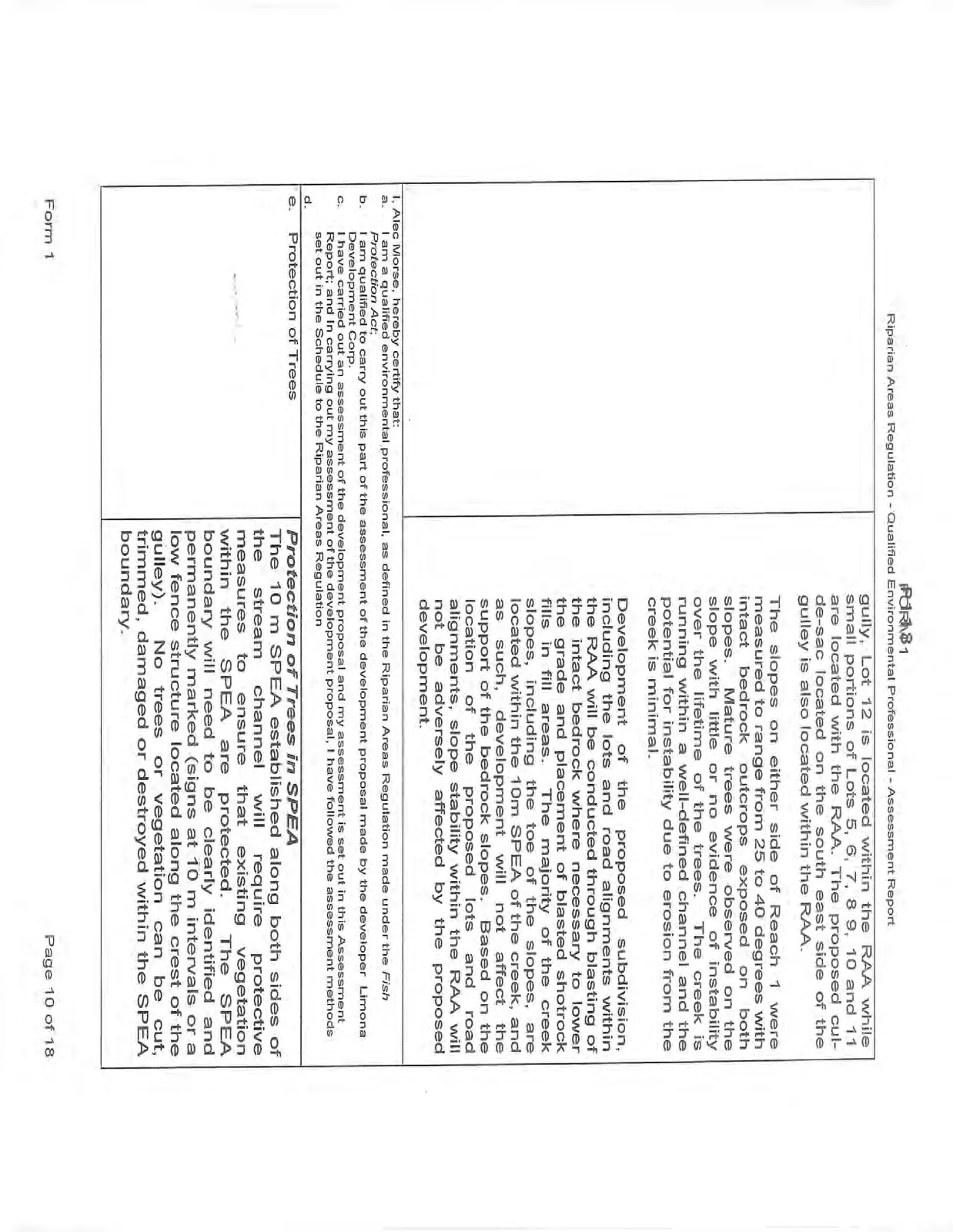
| gully, Lot 12 is located within the RAA while small portions of Lots 5, 6, 7, 8 9, 10 and 11 are located with the RAA. The proposed cul-de-sac located on the south east side of the gulley is also located within the RAA. The slopes on either side of Reach 1 were measured to range from 25 to 40 degrees with intact bedrock outcrops exposed on both slopes. Mature trees were observed on the slope with little or no evidence of instability over the lifetime of the trees. The creek is running within a well-defined channel and the potential for instability due to erosion from the creek is minimal. Development of the proposed subdivision, including the lots and road alignments within the RAA will be conducted through blasting of the intact bedrock where necessary to lower the grade and placement of blasted shotrock fills in fill areas. The majority of the creek slopes, including the toe of the slopes, are located within the 10m SPEA of the creek, and as such, development will not affect the support of the bedrock slopes. Based on the location of the proposed lots and road alignments, slope stability within the RAA will not be adversely affected by the proposed development. |
|---|
I, Alec Morse, hereby certify that: a. I am a qualified environmental professional, as defined in the Riparian Areas Regulation made under the Fish Protection Act; b. I am qualified to carry out this part of the assessment of the development proposal made by the developer Limona Development Corp. c. I have carried out an assessment of the development proposal and my assessment is set out in this Assessment Report; and In carrying out my assessment of the development proposal, I have followed the assessment methods set out in the Schedule to the Riparian Areas Regulation d.
| e. Protection of Trees | Protection of Trees in SPEA The 10 m SPEA established along both sides of the stream channel will require protective measures to ensure that existing vegetation within the SPEA are protected. The SPEA boundary will need to be clearly identified and permanently marked (signs at 10 m intervals or a low fence structure located along the crest of the gulley). No trees or vegetation can be cut, trimmed, damaged or destroyed within the SPEA boundary. |
|---|
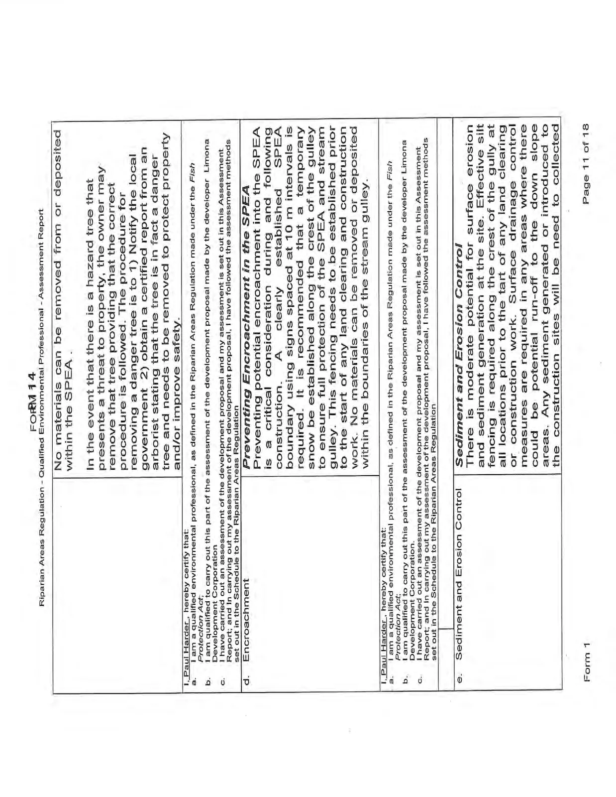
| No materials can be removed from or deposited within the SPEA. In the event that there is a hazard tree that presents a threat to property, the owner may remove that tree providing that the correct procedure is followed. The procedure for removing a danger tree is to 1) Notify the local government 2) obtain a certified report from an arborist stating that the tree is in fact a danger tree and needs to be removed to protect property and/or improve safety. |
|---|
I, Paul Harder, hereby certify that: a. I am a qualified environmental professional, as defined in the Riparian Areas Regulation made under the Fish Protection Act; b. I am qualified to carry out this part of the assessment of the development proposal made by the developer Limona Development Corporation c. I have carried out an assessment of the development proposal and my assessment is set out in this Assessment Report; and In carrying out my assessment of the development proposal, I have followed the assessment methods set out in the Schedule to the Riparian Areas Regulation
| d. Encroachment | Preventing Encroachment in the SPEA Preventing potential encroachment into the SPEA is a critical consideration during and following construction. A clearly established SPEA boundary using signs spaced at 10 m intervals is required. It is recommended that a temporary snow be established along the crest of the gulley to ensure full protection of the SPEA and stream gulley. This fencing needs to be established prior to the start of any land clearing and construction work. No materials can be removed or deposited within the boundaries of the stream gulley. |
|---|
I, Paul Harder, hereby certify that: a. I am a qualified environmental professional, as defined in the Riparian Areas Regulation made under the Fish Protection Act; b. I am qualified to carry out this part of the assessment of the development proposal made by the developer Limona Development Corporation c. I have carried out an assessment of the development proposal and my assessment is set out in this Assessment Report; and In carrying out my assessment of the development proposal, I have followed the assessment methods set out in the Schedule to the Riparian Areas Regulation
| e. Sediment and Erosion Control | Sediment and Erosion Control There is moderate potential for surface erosion and sediment generation at the site. Effective silt fencing is required along the crest of the gully at all locations prior to the tart of any land clearing or construction work. Surface drainage control measures are required in any areas where there could be potential run-off to the down slope areas. Any sediment generated or introduced to the construction sites will be need to collected |
|---|
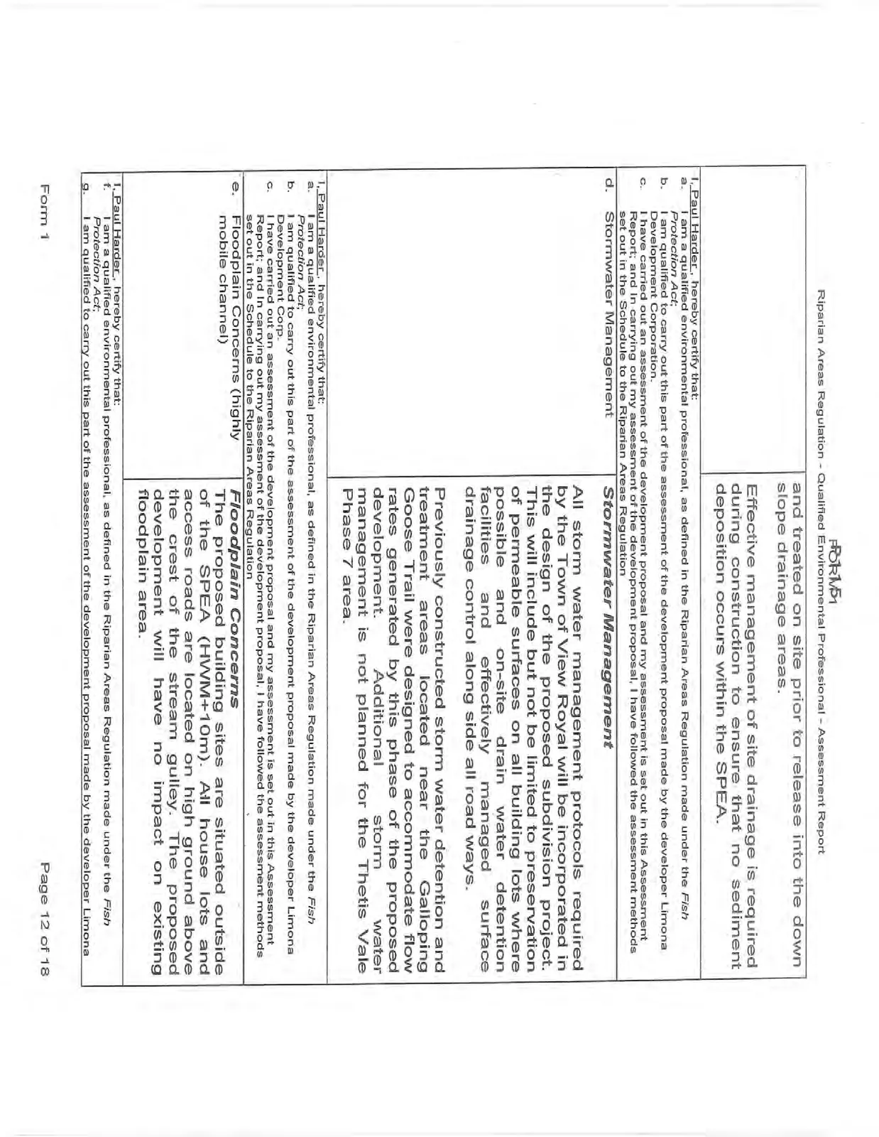
| and treated on site prior to release into the down slope drainage areas. Effective management of site drainage is required during construction to ensure that no sediment deposition occurs within the SPEA. |
|---|
I, Paul Harder, hereby certify that: a. I am a qualified environmental professional, as defined in the Riparian Areas Regulation made under the Fish Protection Act; b. I am qualified to carry out this part of the assessment of the development proposal made by the developer Limona Development Corporation c. I have carried out an assessment of the development proposal and my assessment is set out in this Assessment Report; and In carrying out my assessment of the development proposal, I have followed the assessment methods set out in the Schedule to the Riparian Areas Regulation
| d. Stormwater Management | Stormwater Management All storm water management protocols required by the Town of View Royal will be incorporated in the design of the proposed subdivision project. This will include but not be limited to preservation of permeable surfaces on all building lots where possible and on-site drain water detention facilities and effectively managed surface drainage control along side all road ways. Previously constructed storm water detention and treatment areas located near the Galloping Goose Trail were designed to accommodate flow rates generated by this phase of the proposed development. Additional storm water management is not planned for the Thetis Vale Phase 7 area. |
|---|
I, Paul Harder, hereby certify that: a. I am a qualified environmental professional, as defined in the Riparian Areas Regulation made under the Fish Protection Act; b. I am qualified to carry out this part of the assessment of the development proposal made by the developer Limona Development Corp. c. I have carried out an assessment of the development proposal and my assessment is set out in this Assessment Report; and In carrying out my assessment of the development proposal, I have followed the assessment methods set out in the Schedule to the Riparian Areas Regulation
| e. Floodplain Concerns (highly mobile channel) | Floodplain Concerns The proposed building sites are situated outside of the SPEA (HWM+10m). All house lots and access roads are located on high ground above the crest of the stream gulley. The proposed development will have no impact on existing floodplain area. |
|---|
I, Paul Harder, hereby certify that: f. I am a qualified environmental professional, as defined in the Riparian Areas Regulation made under the Fish Protection Act; g. I am qualified to carry out this part of the assessment of the development proposal made by the developer Limona
h. Development Corporation. I have carried out an assessment of the development proposal and my assessment is set out in this Assessment Report; and In carrying out my assessment of the development proposal, I have followed the assessment methods set out in the Schedule to the Riparian Areas Regulation
Section 5. Environmental Monitoring
Attach text or document files explaining the monitoring regimen Use your "return" button on your keyboard after each line. It is suggested that all document be converted to PDF before inserting into the PDF version of the assessment report. Include actions required, monitoring schedule, communications plan, and requirement for a post development report.
ENVIRONMENTAL MONITORING
The property owner is obligated to undertake the following inspections, assessments and report submissions as a condition of RAR compliance and approval for this project.
Actions Required
- Verification that the SPEA Boundary is adequately marked prior to the start of construction.
- Review of storm water drainage and management plan prior to the start of construction.
- Effective surface flow and sediment control measures during construction
Monitoring Schedule
- Pre construction verification of SPEA boundary delineation and marking.
- Periodic site inspections during construction to ensure that adequate surface drainage control and treatment measures are in place during construction.
Periodic site inspections to be made during construction coinciding with any heavy rainfall events
Communications Plan The District of View Royal and Department of Fisheries and Oceans need to be contacted immediately if there are any activities on the site that threaten the integrity of the SPEA or downstream water quality in the Millstream estuary.
Any accidental spills on the site must be reported to appropriate authorities immediately.
Post Development Report A post development assessment report is required by the RAR administrators. The goals of the reports are to:
- Establish that there have been no encroachments into the SPEA, and
- Ensure that adequate and effective surface water drainage and treatment measures have been implemented during and following construction.
Section 6. Photos
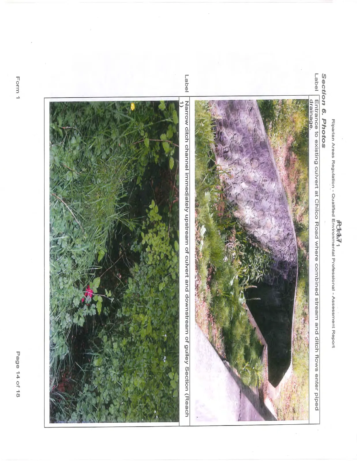
Label: Entrance to existing culvert at Chilco Road where combined stream and ditch flows enter piped drainage.
Label: Narrow ditch channel immediately upstream of culvert and downstream of gulley Section (Reach 1)
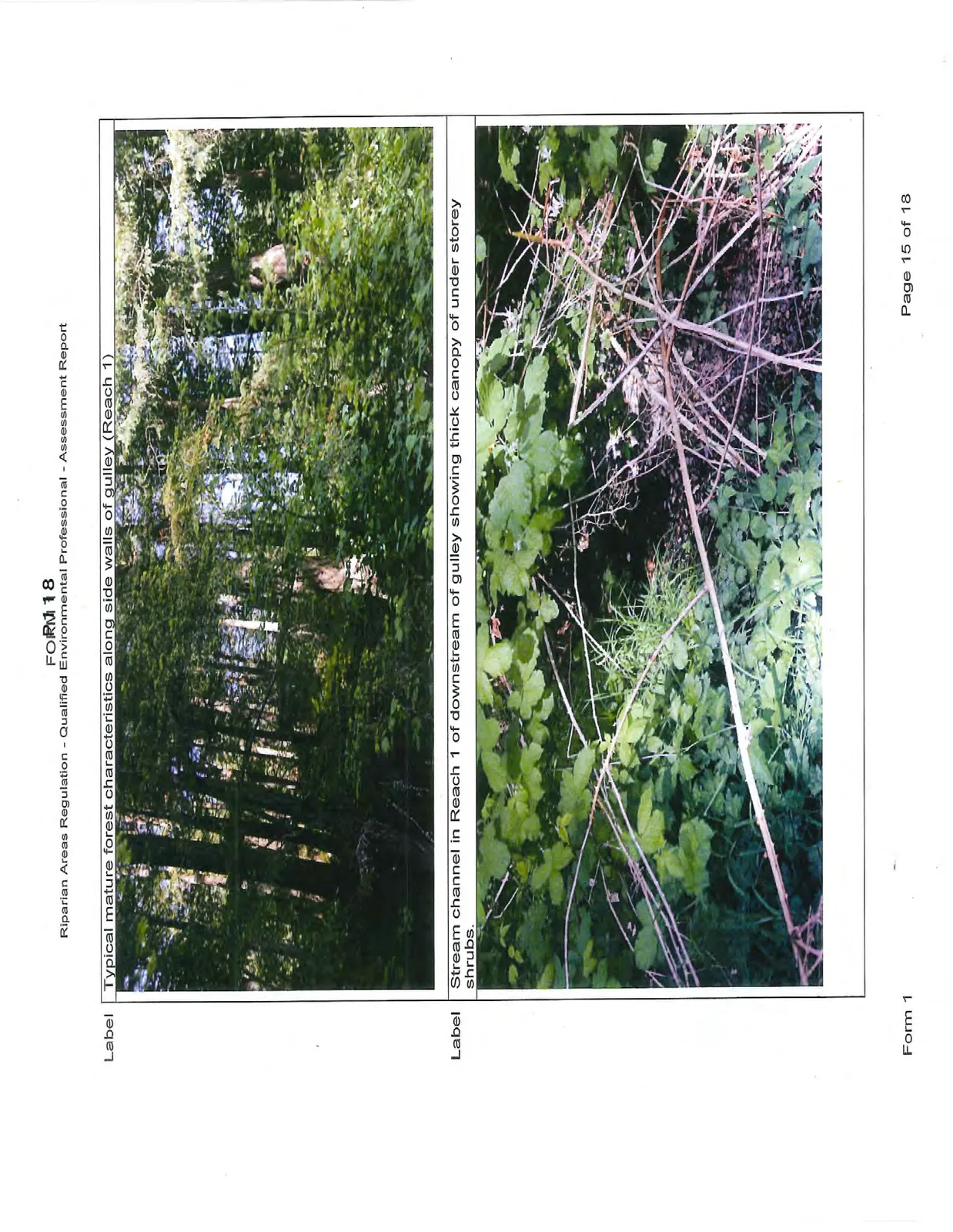
Label: Typical mature forest characteristics along side walls of gulley (Reach 1)
Label: Stream channel in Reach 1 of downstream of gulley showing thick canopy of under storey shrubs.
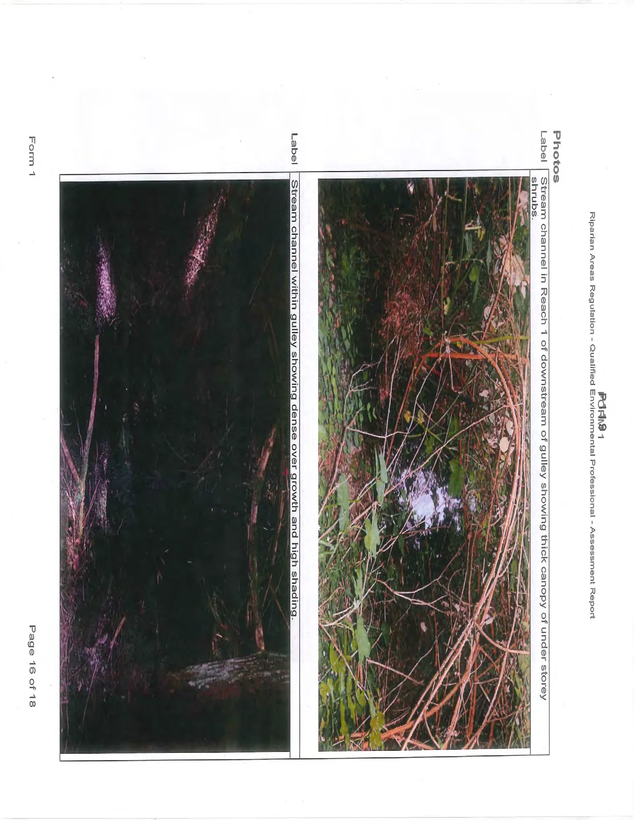
Label: Stream channel in Reach 1 of downstream of gulley showing thick canopy of under storey shrubs.
Label: Stream channel within gulley showing dense over growth and high shading.
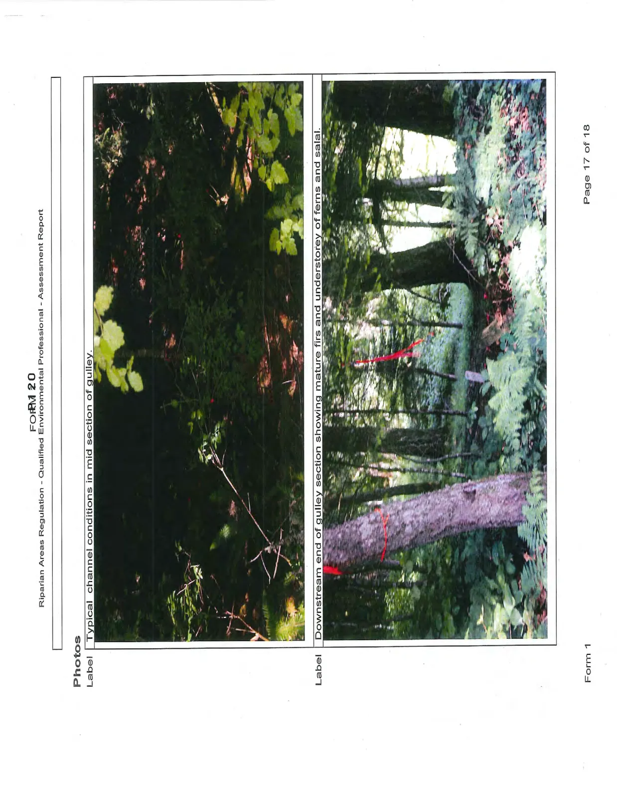
Label: Typical channel conditions in mid section of gulley.
Label: Downstream end of gulley section showing mature firs and understorey of ferns and salal.
Section 7. Professional Opinion
Assessment Report Professional Opinion on the Development Proposal's riparian area.
Date 2014-05-20
- I, Paul Harder, R.P. Bio and Alex Morse, P. Eng.
hereby certify that: a) I am/We are qualified environmental professional(s), as defined in the Riparian Areas Regulation made under the Fish Protection Act; b) I am/We are qualified to carry out the assessment of the proposal made by the developer Limona Development Corporation_which proposal is described in section 3 of this Assessment Report (the "development proposal"), c) I have/We have carried out an assessment of the development proposal and my/our assessment is set out in this Assessment Report; and d) In carrying out my/our assessment of the development proposal, I have/We have followed the assessment methods set out in the Schedule to the Riparian Areas Regulation; AND
- As qualified environmental professional(s), I/we hereby provide my/our professional opinion that: a) if the development is implemented as proposed by the development proposal there will be no harmful alteration, disruption or destruction of natural features, functions and conditions that support fish life processes in the riparian assessment area in which the development is proposed, OR (Note: include local government flex letter, DFO Letter of Advice, or description of how DFO local variance protocol is being addressed)
b) XXX if the streamside protection and enhancement areas identified in this Assessment Report are protected from the development proposed by the development proposal and the measures identified in this Assessment Report as necessary to protect the integrity of those areas from the effects of the development are implemented by the developer, there will be no harmful alteration, disruption or destruction of natural features, functions and conditions that support fish life processes in the riparian assessment area in which the development is proposed.
Document Images
(1)