Appendix
Attachment 6 - Site Plan of the Remainder of Lot 22
July 2, 2014Page 351 section
A legal site survey showing property boundaries and existing structures.
April 4, 2014Plan 748
Site Plan of the Remainder of Lot 22, Section 98, Esquimalt District, Plan 748
Scale 1 : 250 All distances are shown in metres. Elevations indicated are in metres, to geodetic datum.
Legend
- wm - denotes water meter
- wv - denotes water valve
- icv - denotes irrigation control valve
- gm - denotes gas meter
- mh - denotes manhole
- mls - denotes metal light standard
- up - denotes utility pole
- cb - denotes catch basin drain
- co - denotes clean out
- s/c - denotes service cover
- inv - denotes invert
* * Restrictive Covenants on all except Part in Lease Plan VIP60554 * *
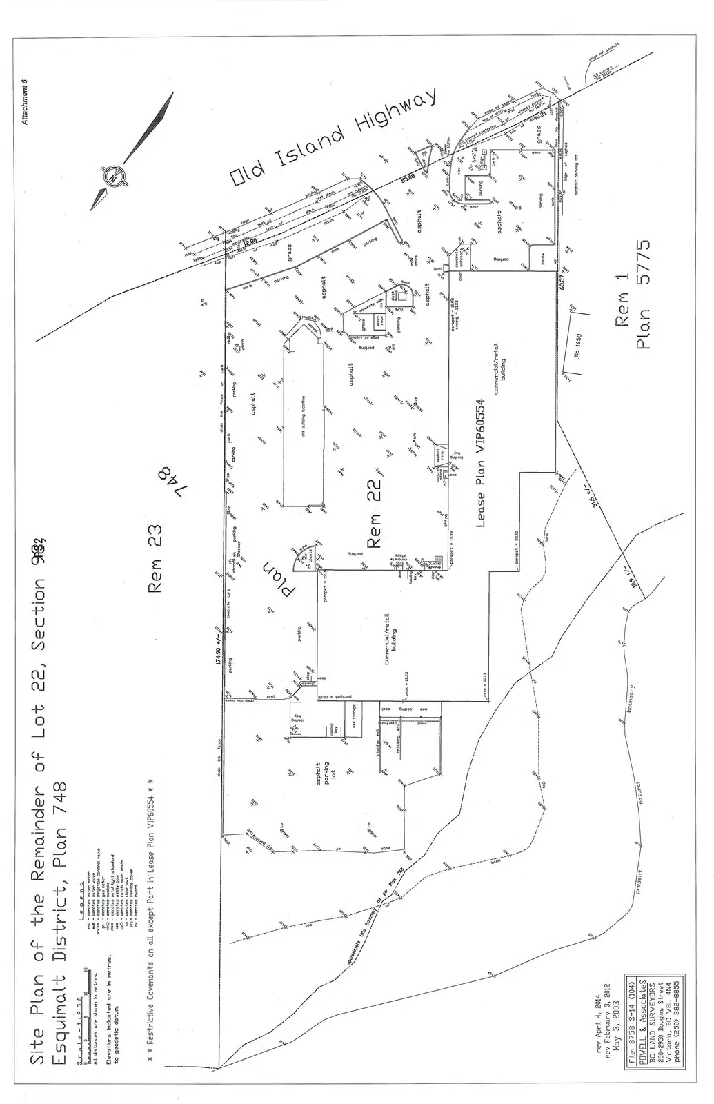
Site Plan Details
The plan depicts the following areas and features:
- Properties: Rem 23 Plan 748, Rem 22 Lease Plan VIP60554, and Rem 1 Plan 5775.
- Roadways: Old Island Highway.
- Buildings and Structures:
- Commercial/retail building
- Loading bay
- New storage area
- Old building location
- Retaining walls
- Ground Cover: Asphalt parking lots, asphalt surfaces, and grass areas.
- Survey Measurements and Annotations:
- North boundary of Lot 22: 174.90 +/-
- South boundaries: 31.6 +/-, 18.9 +/-, and 68.27
- East boundary along Old Island Highway: 55.08
- Building heights/elevations: peak = 22.25, parapet = 20.10, parapet = 19.99, parapet = 21.02, parapet = 20.40, eave = 20.73.
- Address reference: No 1658
Revision and Surveyor Information
rev April 4, 2014 rev February 3, 2012 May 3, 2003
File: 8758 S-14 (104) POWELL & Associates BC LAND SURVEYORS 250-2950 Douglas Street Victoria, BC V8L 4N4 phone (250) 382-8855
Page 35
Extracted from: 2014 07 02 Council Agenda