Appendix
Geotechnical Location Plans (South and North)
June 17, 2014Pages 30–312 sections
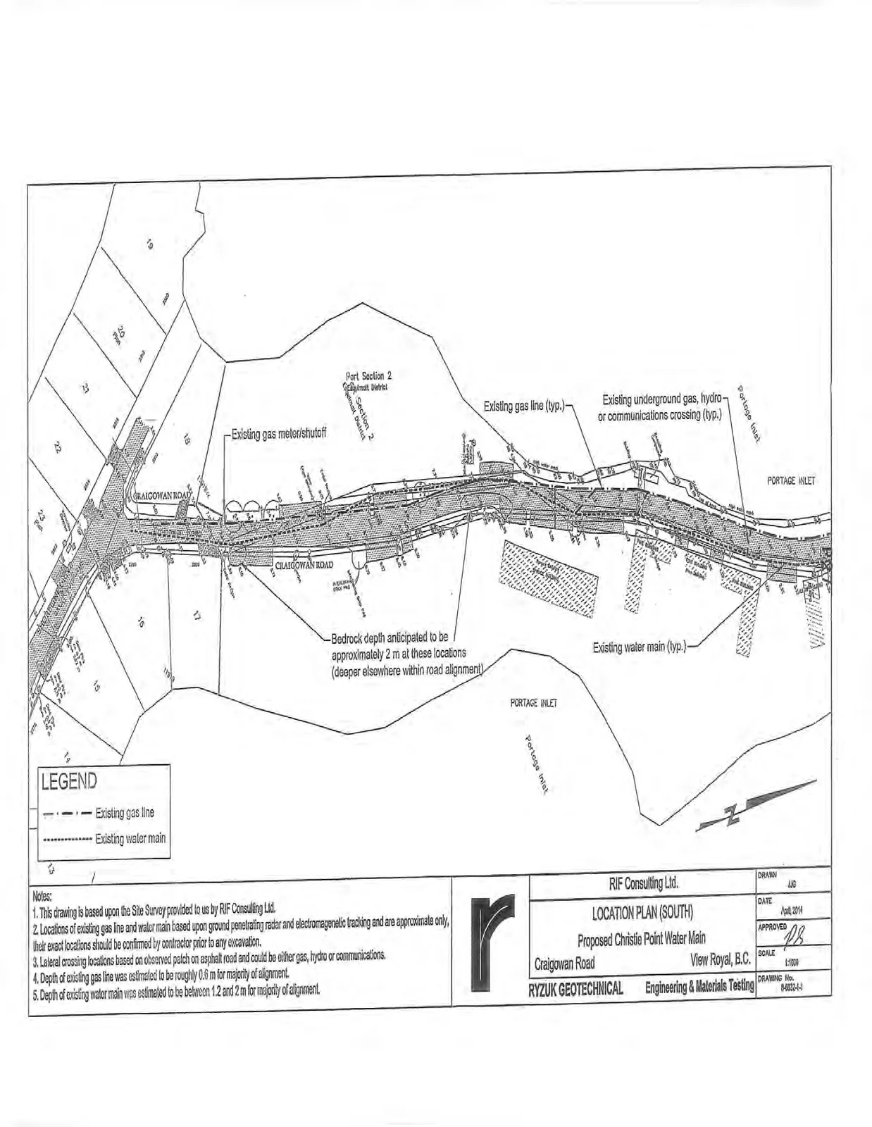
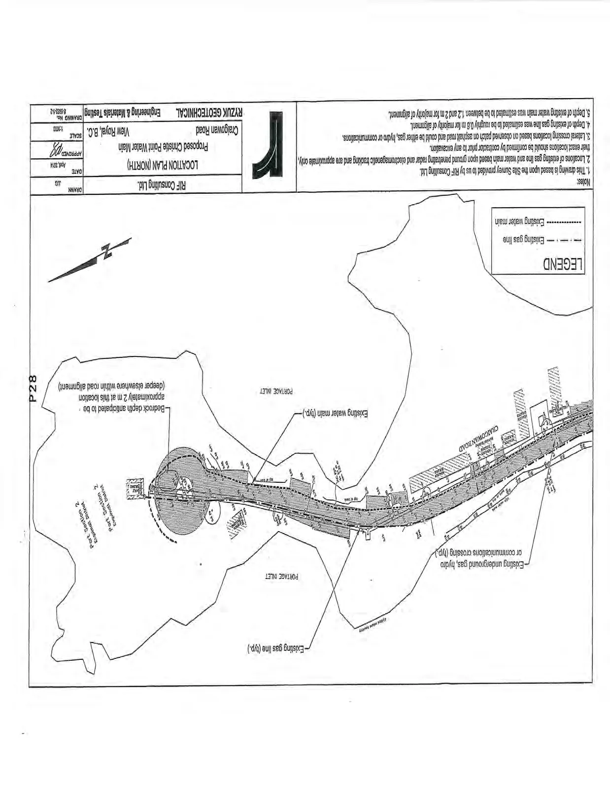
Mapping identifying bedrock depth expectations and existing utilities along the project alignment.
Bedrock depth estimated at 1.2 to 2 m for most of the alignment
LOCATION PLAN (SOUTH)
Proposed Christie Point Water Main
Craigowan Road, View Royal, B.C.
| Information | Details |
|---|---|
| Client | RIF Consulting Ltd. |
| Project Title | LOCATION PLAN (SOUTH) Proposed Christie Point Water Main |
| Location | Craigowan Road, View Royal, B.C. |
| Consultant | RYZUK GEOTECHNICAL Engineering & Materials Testing |
| Drawn | JJD |
| Date | April, 2014 |
| Approved | PB |
| Scale | 1:1000 |
| Drawing No. | 8-8032-1-1 |
Legend
- - - - - - Existing gas line
- .......... Existing water main
Map Labels
- Craigowan Road
- Portage Inlet
- Esquimalt District, Part Section 2
- Existing gas meter/shutoff
- Existing gas line (typ.)
- Existing underground gas, hydro or communications crossing (typ.)
- Existing water main (typ.)
- Bedrock depth anticipated to be approximately 2 m at these locations (deeper elsewhere within road alignment)
Notes:
- This drawing is based upon the Site Survey provided to us by RIF Consulting Ltd.
- Locations of existing gas line and water main based upon ground penetrating radar and electromagnetic tracking and are approximate only, their exact locations should be confirmed by contractor prior to any excavation.
- Lateral crossing locations based on observed patch on asphalt road and could be either gas, hydro or communications.
- Depth of existing gas line was estimated to be roughly 0.6 m for majority of alignment.
- Depth of existing water main was estimated to be between 1.2 and 2 m for majority of alignment.
Page 30–31
LOCATION PLAN (NORTH)
Proposed Christie Point Water Main
Craigowan Road, View Royal, B.C.
| Information | Details |
|---|---|
| Client | RIF Consulting Ltd. |
| Project Title | LOCATION PLAN (NORTH) Proposed Christie Point Water Main |
| Location | Craigowan Road, View Royal, B.C. |
| Consultant | RYZUK GEOTECHNICAL Engineering & Materials Testing |
| Drawn | JJD |
| Date | April, 2014 |
| Approved | PB |
| Scale | 1:1000 |
| Drawing No. | 8-8032-1-2 |
Legend
- - - - - - Existing gas line
- .......... Existing water main
Map Labels
- Craigowan Road
- Portage Inlet
- Esquimalt District, Part Section 2
- Existing gas line (typ.)
- Existing underground gas, hydro or communications crossing (typ.)
- Existing water main (typ.)
- Bedrock depth anticipated to be approximately 2 m at these locations (deeper elsewhere within road alignment)
Notes:
- This drawing is based upon the Site Survey provided to us by RIF Consulting Ltd.
- Locations of existing gas line and water main based upon ground penetrating radar and electromagnetic tracking and are approximate only, their exact locations should be confirmed by contractor prior to any excavation.
- Lateral crossing locations based on observed patch on asphalt road and could be either gas, hydro or communications.
- Depth of existing gas line was estimated to be roughly 0.6 m for majority of alignment.
- Depth of existing water main was estimated to be between 1.2 and 2 m for majority of alignment.
Page 30–31
Extracted from: 2014 06 17 Council Agenda