Appendix
Significant Site Features Map
June 17, 2014Pages 49–513 sections
Figures showing the project boundary and photographic documentation of environmental features like Garry Oaks and shoreline.
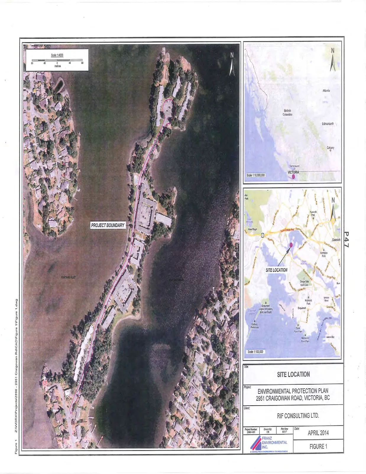
Project boundary includes 15m corridor of environmentally sensitive area
FIGURES
Page 49–51
SITE LOCATION
Project: ENVIRONMENTAL PROTECTION PLAN
Location: 2951 CRAIGOWAN ROAD, VICTORIA, BC
Client: RIF CONSULTING LTD.
Date: APRIL 2014
Figure: FIGURE 1
Page 49–51
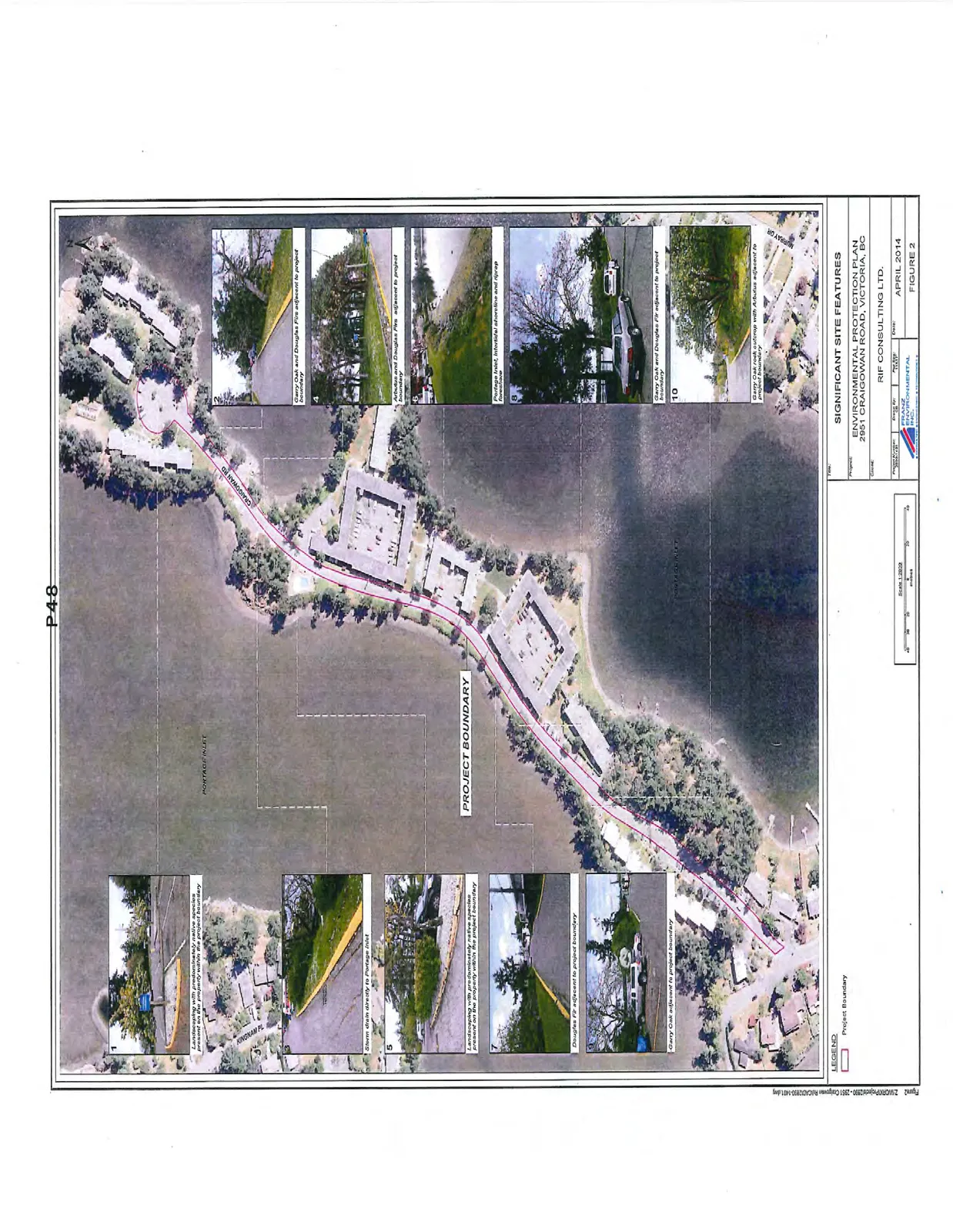
SIGNIFICANT SITE FEATURES
Project: ENVIRONMENTAL PROTECTION PLAN
Location: 2951 CRAIGOWAN ROAD, VICTORIA, BC
Client: RIF CONSULTING LTD.
Date: APRIL 2014
Figure: FIGURE 2
Legend
- Project Boundary (indicated by a dashed red line)
Keyed Site Features
- Landscaping with predominantly native species present on the property within the project boundary
- Garry Oak and Douglas Firs adjacent to project boundary
- Storm drain directly to Portage Inlet
- Arbutus and Douglas Firs adjacent to project boundary
- Landscaping with predominantly native species present on the property within the project boundary
- Portage Inlet, intertidal shoreline and riprap foreshore
- Douglas Fir adjacent to project boundary
- Garry Oak and Douglas Fir adjacent to project boundary
- Garry Oak adjacent to project boundary
- Garry Oak rock outcrop with Arbutus adjacent to project boundary
Page 49–51
Extracted from: 2014 06 17 Council Agenda