Appendix
Appendix: Map of Shoreline Trail area
October 7, 2014Page 1421 section
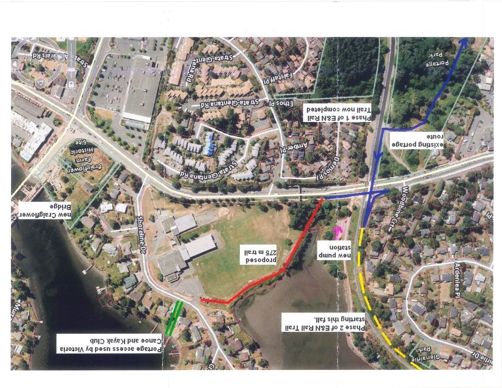
Annotated map showing the proposed 275m trail connector and existing portage routes.
Connects Shoreline Drive to the E&N Rail Trail
Aerial Map of E&N Rail Trail and Proposed Connections
Trail and Infrastructure Details
- Phase 1 of E&N Rail Trail now completed: Indicated by a solid blue line.
- Phase 2 of E&N Rail Trail starting this fall: Indicated by a yellow dashed line.
- Proposed 275 m trail: Indicated by a red line connecting Shoreline Dr to the E&N Rail Trail.
- Existing portage route: Indicated by a blue line with arrows leading toward Portage Park.
- New pump station: Indicated by a pink arrow.
- Portage access used by Victoria Canoe and Kayak Club: Indicated by two green parallel lines at the waterfront.
- New Craigflower Bridge: Bridge crossing the waterway on the western side of the map.
- Craigflower Farm Historic Site: Located south of Shoreline Dr.
Parks and Landmarks
- Portage Park
- Glenairlie Park
- Craigflower Farm Historic Site
Local Road Network
- Admirals Rd
- Amber Pl
- Ardenlea Pl
- Demos Pl
- Ethos Pl
- Fairie Dr
- Falstaff Pl
- Shoreline Dr
- Strata-Glentana Rd
- Woodbine Crt
Page 142
Extracted from: 2014 10 07 Council Agenda