FORM AND CHARACTER DEVELOPMENT PERMIT - 3 Helmcken Road
Presentation slides summarizing the development permit application for a 234-unit rental apartment complex at 3 Helmcken Road, including site data and proposed variances.
FORM AND CHARACTER DEVELOPMENT PERMIT
3 Helmcken Road
Council – April 5, 2022
PURPOSE OF REPORT
To consider a Form and Character Development Permit for a multifamily development with three buildings and underground parking.
BACKGROUND
The four parcels (referred to as 3 Helmcken for convenience) were rezoned to CD-24 in 2020, with three subzones delineated by maximum height of buildings.
The zone permits both townhouse and apartment residential at a maximum FSR of 1.5.
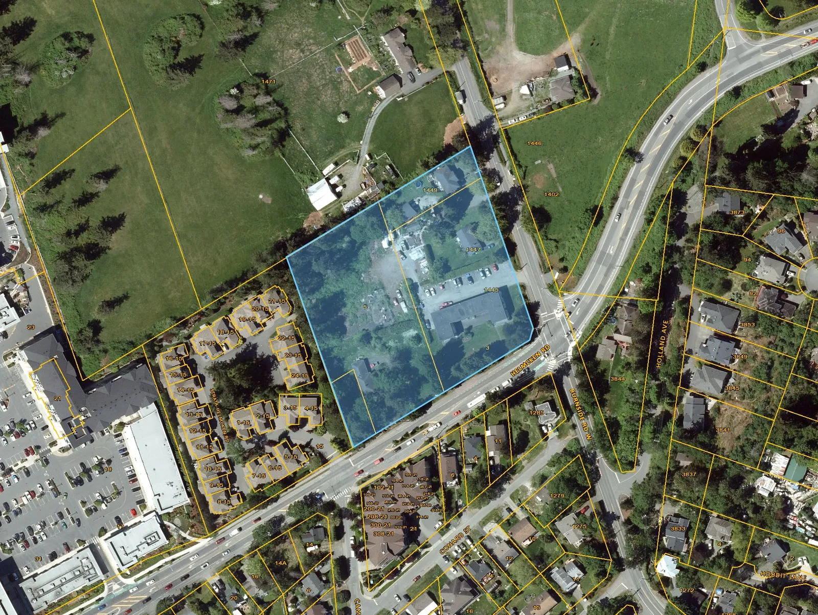
COVENANTS REGISTERED AT TIME OF REZONING
CAC Covenant
Community Amenity Contribution for $3,500 per dwelling unit ($819,000 based on the proposed 234 units) prior to building permit issuance.
Consolidation Covenant
Lands must be consolidated, only existing uses can be continued, no sale or transfer of parcels separately.
Tenant Covenant
Four months notice for demolition, requires the payment of the Tenant Relocation Package.
234 units of rental apartment development in 1, 2 and 3-bedroom configurations. Currently proposed as purpose-built rental, but no covenant secures this.
Since rezoning:
- unit number has been reduced from 247 to 234
- the mix has changed to include more three-bedroom units (26 from 22)
- The provided vehicle parking has also been reduced, with a supporting Parking Study performed by WATT Consulting Group. Requested variance of 26 spaces.
SITE DATA SUMMARY
| Zoning Proposal | DP Proposal | |
|---|---|---|
| Building 1 Subzone A Height | 15m and 5 storeys | 12.11m |
| Building 1 Subzone B Height | 17m and 5 storeys | 15.11m |
| Building 1 Subzone C Height | 19.5m and 6 storeys | 18.82m |
| Building 2 Subzone A Height | 15m and 5 storeys | 14.22m |
| Building 3 Subzone B Height | 17m and 5 storeys | 16.56m |
| Site Coverage | 35% | 34.20% |
| Impervious Area | 60% | 56% |
| FSR | 1.5 | 1.49 |
| Front (Helmcken) | 10m | 10.4m |
| Rear (North) | 8m | 8.2m* |
| Side (Burnside) | 8m | 8.1m |
| Side (West) | 11m | 11.1m |
| 1 Br Units | 85 | 76 |
| 2 Br Units | 140 | 132 |
| 3 Br Units | 22 | 26 |
| Total Units | 247 | 234 |
| Vehicle Parking | 340 | 300* |
| Bicycle Parking | 246 Class 1 18 Class 2 | 234 Class 1 18 Class 2 |
*variance required, 326 required spaces, 300 proposed *variance for width of balcony projections
ISSUES AND ANALYSIS
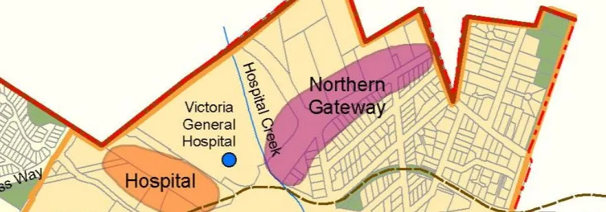
Addressing the Northern Gateway Community Corridor
The subject property (on the map below in blue) is identified within the Town’s Official Community Plan as an important gateway site for the Town of View Royal.
The design of the Northern Gateway Community Corridor requires the creation of “…a strong sense of place in the area surrounding the hospital and leading into the southern areas of the Town”.
ADDRESSING THE NORTHERN GATEWAY COMMUNITY CORRIDOR
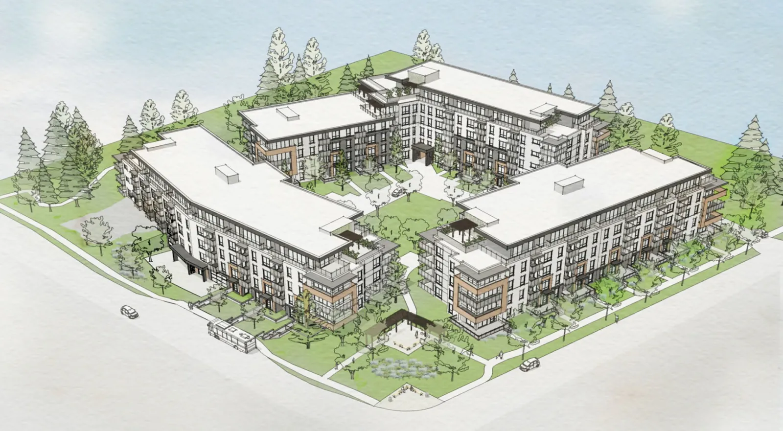
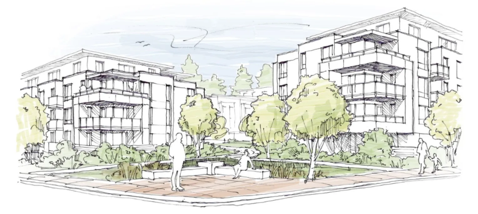
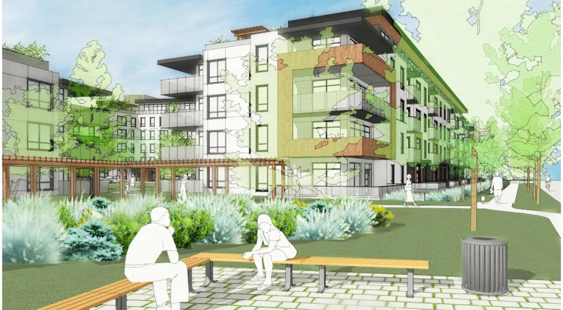
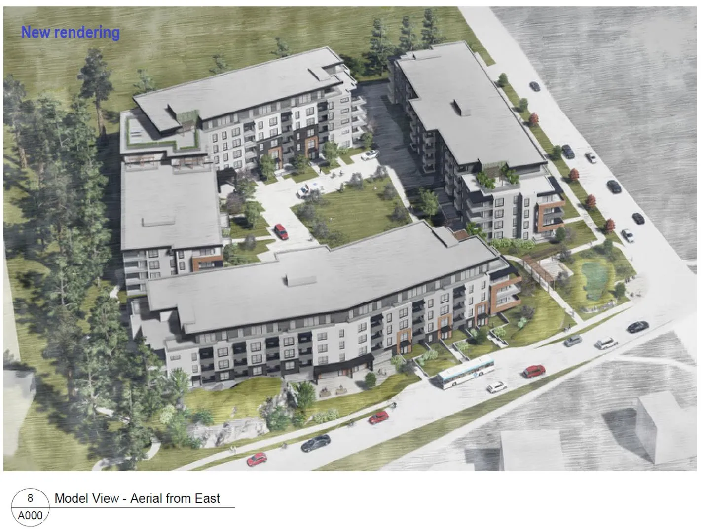
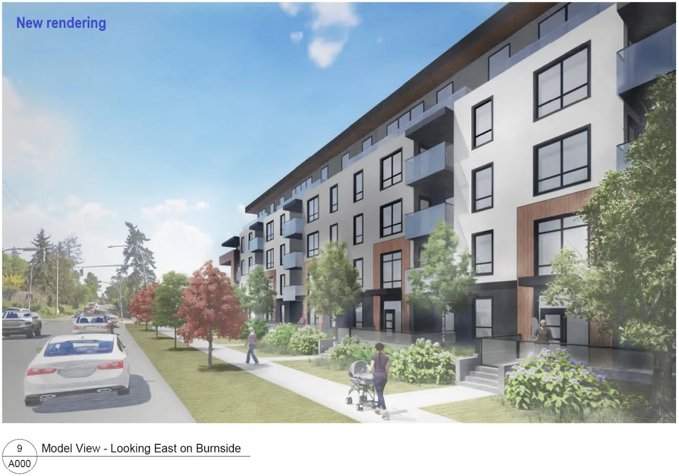
The fully realized building facades have at-grade building entrances along the extent of the frontage and address the street corner in an attractive fashion.
DESIGN CHARACTER
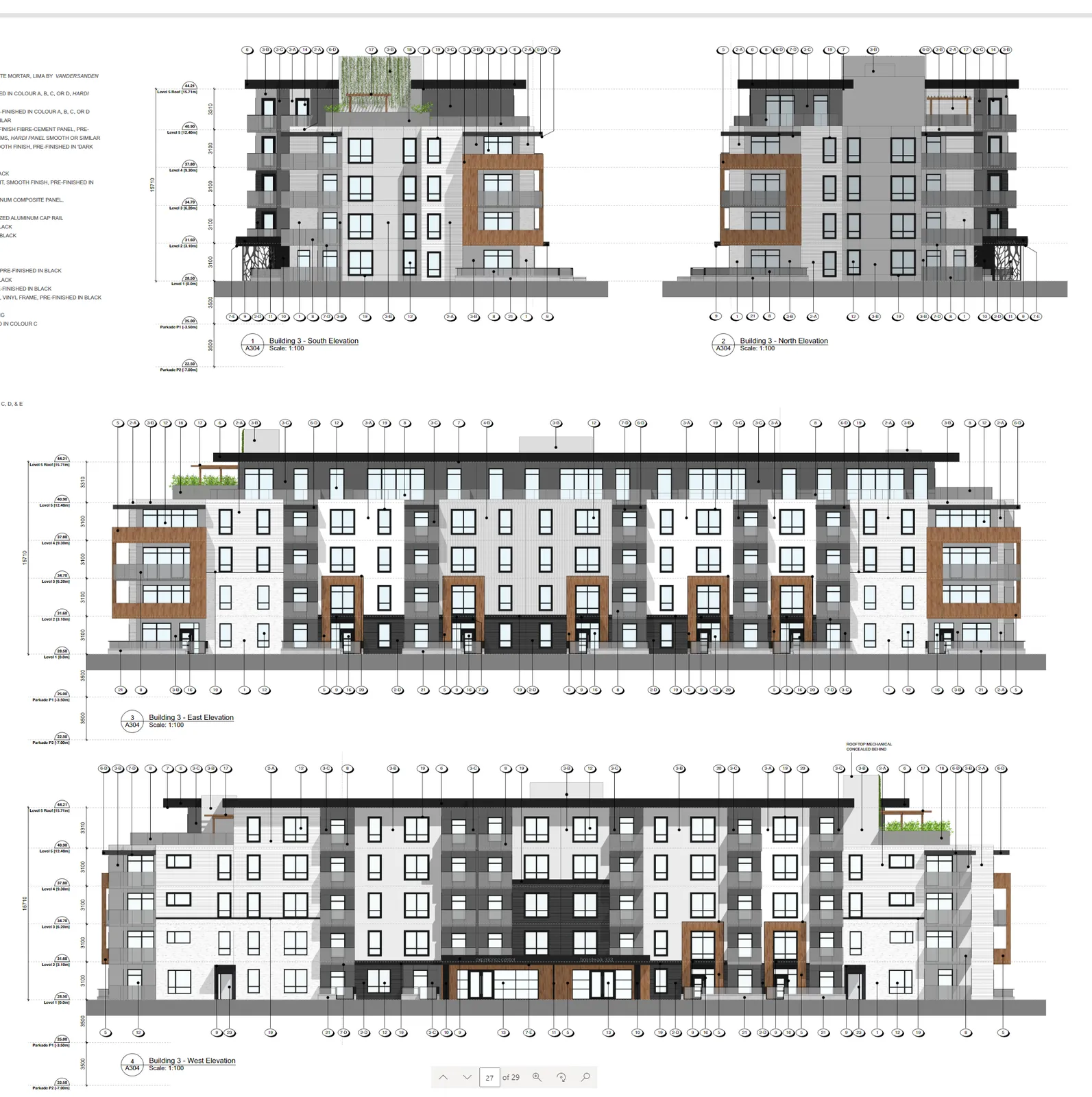
There are at-grade entrances at street level, an open pedestrian-friendly plaza at the intersection, and no blank walls along the building facades.
The buildings step down at significant locations, especially near the entrance plaza and the Hidden Oaks interface to the west.
DESIGN CHARACTER
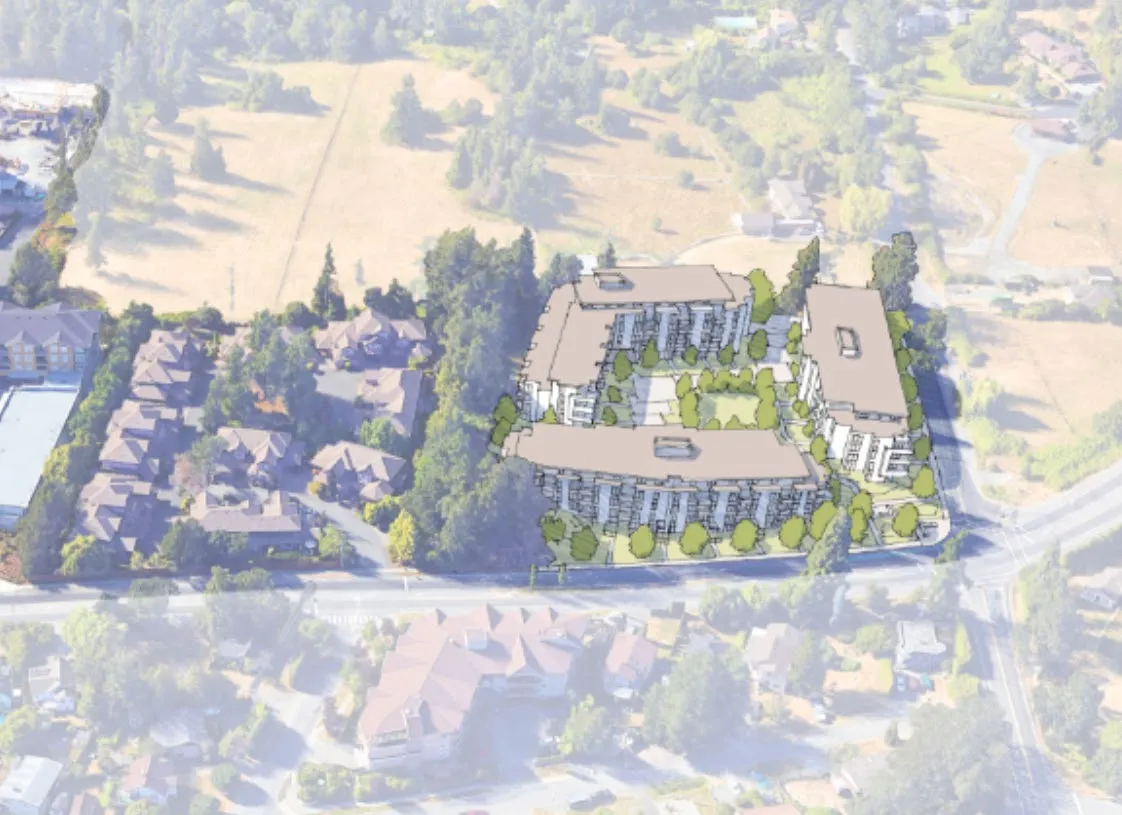
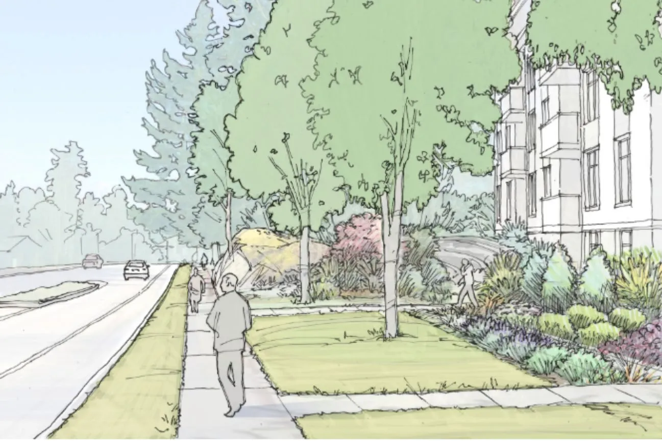
The design steps the top floors back from the building facades.
There is visual interest in the building articulations from all external angles.
The western interface between the Hidden Oaks development, especially, is configured in a positive manner.
There is a focus on reducing visual and physical impact on the Hidden Oaks townhouses to the west.
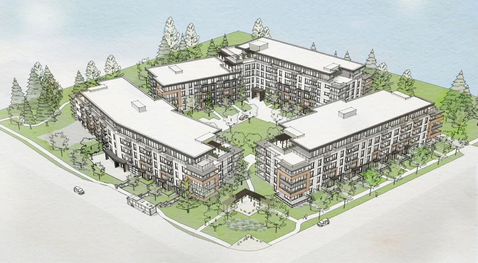
The terracing of the building, partial storeys and the open space between the two buildings provide space and visual relief.
The buildings are pulled back from the property line, providing varied, treed open space for screening the adjacent properties.
BUILDING DESIGN
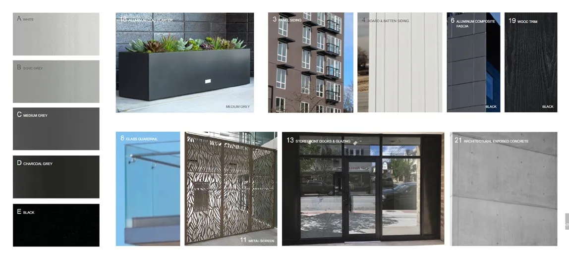
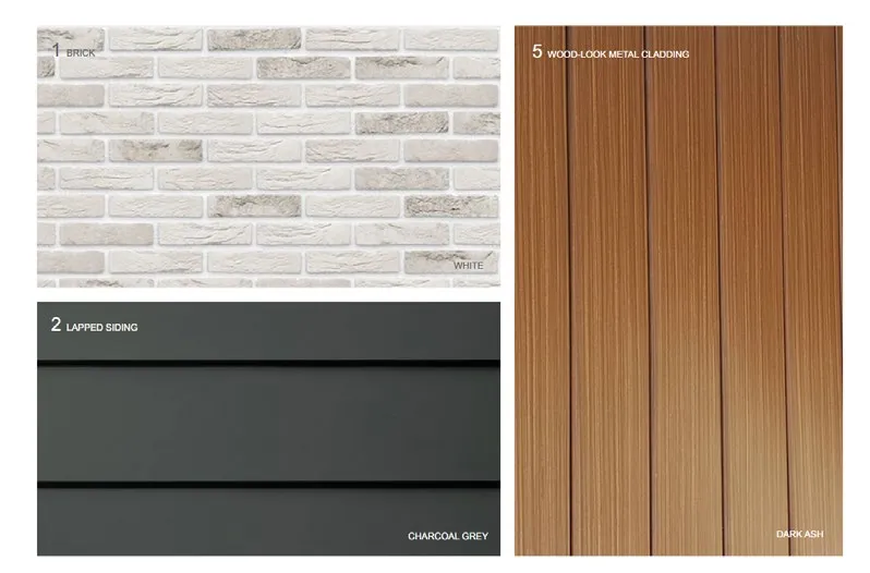
The design is of the ‘west coast contemporary’ style identified in the Mixed Residential Form and Character guidelines. The architectural style is very similar to that of recent developments in the community. The proposed materials are a mix of neutral tones and natural textures.
LANDSCAPING
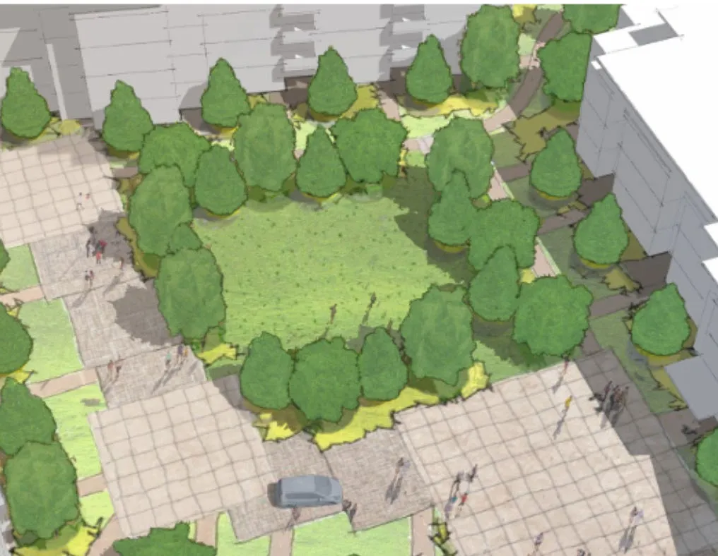
The interior common space proposal provides a multi-use feel in the courtyard with a proposed ‘woonerf’ (literally: ‘living street’ in Dutch) which emphasizes shared space and traffic calming while still permitting traffic flow.
Concept is to design a functional roadway with non-traditional road surfaces that resemble pedestrian-friendly squares and plazas. This invites pedestrian and bicycle traffic and indicates to drivers that it is a shared space and not a dedicated roadway.
The design complies with all Protective Services requirements. Also proposed is a central greenspace, providing a gathering and recreational opportunity.
TREE PRESERVATION
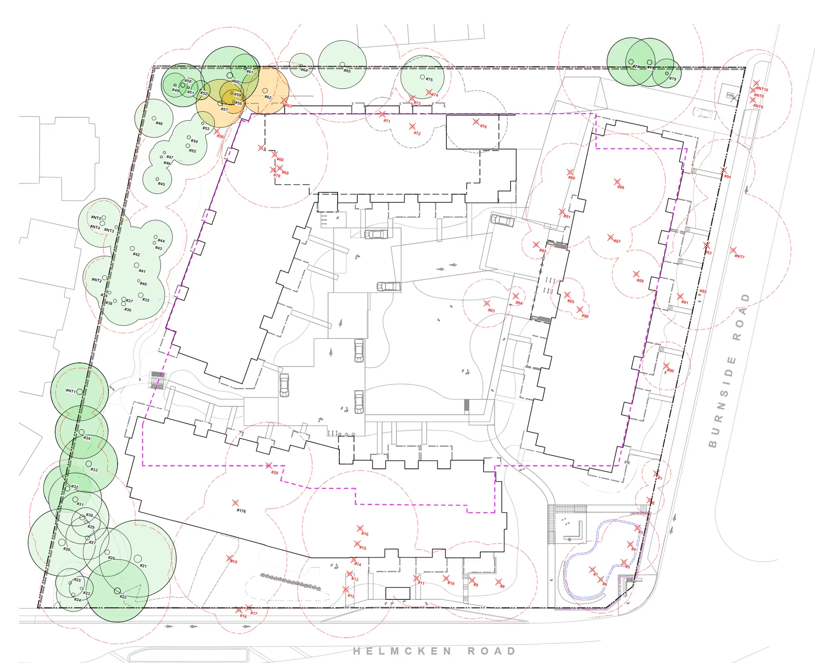
The applicant has provided a tree preservation plan which identifies 107 trees on the site.
Approximately 50 of those trees can be preserved (in green, below), with those potentially retained in orange and those removed in red.
There is a requirement for a 2:1 replacement of trees removed, which can be on-site.
Note that this application is being processed under the previous tree bylaw.
[Detailed site map showing tree preservation plan with individual trees marked by color-coded circles and symbols]
LIGHTING
Dark skies friendly lighting proposed.
ACCESS, CIRCULATION
The site is well designed with easy pedestrian access, 6 surface parking spaces and three loading areas; one for each building. There are five accessible spaces, all located on the first underground parking level closest to the elevator accesses.
The unique ‘woonerf’ design of the circulation is certainly a major and welcome feature of the project and prioritizes pedestrian circulation over vehicular at surface level.
Crime Prevention Through Environmental Design (CPTED) principles have been closely followed and adhered to in the design, including highly visible outdoor spaces and entrances with complimentary lighting design.
Garbage and recycling collection is on the first parking level.
Document Images
(2)