Transit - Victoria Route Overview and Ferry Routes
Documentation of existing bus and proposed ferry routes to highlight transit gaps the gondola would address.
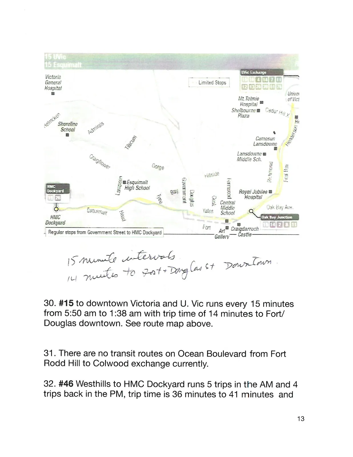
15 minute intervals. 14 minutes to Fort + Douglas st Downtown.
#15 to downtown Victoria and U. Vic runs every 15 minutes from 5:50 am to 1:38 am with trip time of 14 minutes to Fort/Douglas downtown. See route map above.
There are no transit routes on Ocean Boulevard from Fort Rodd Hill to Colwood exchange currently.
#46 Westhills to HMC Dockyard runs 5 trips in the AM and 4 trips back in the PM, trip time is 36 minutes to 41 minutes and
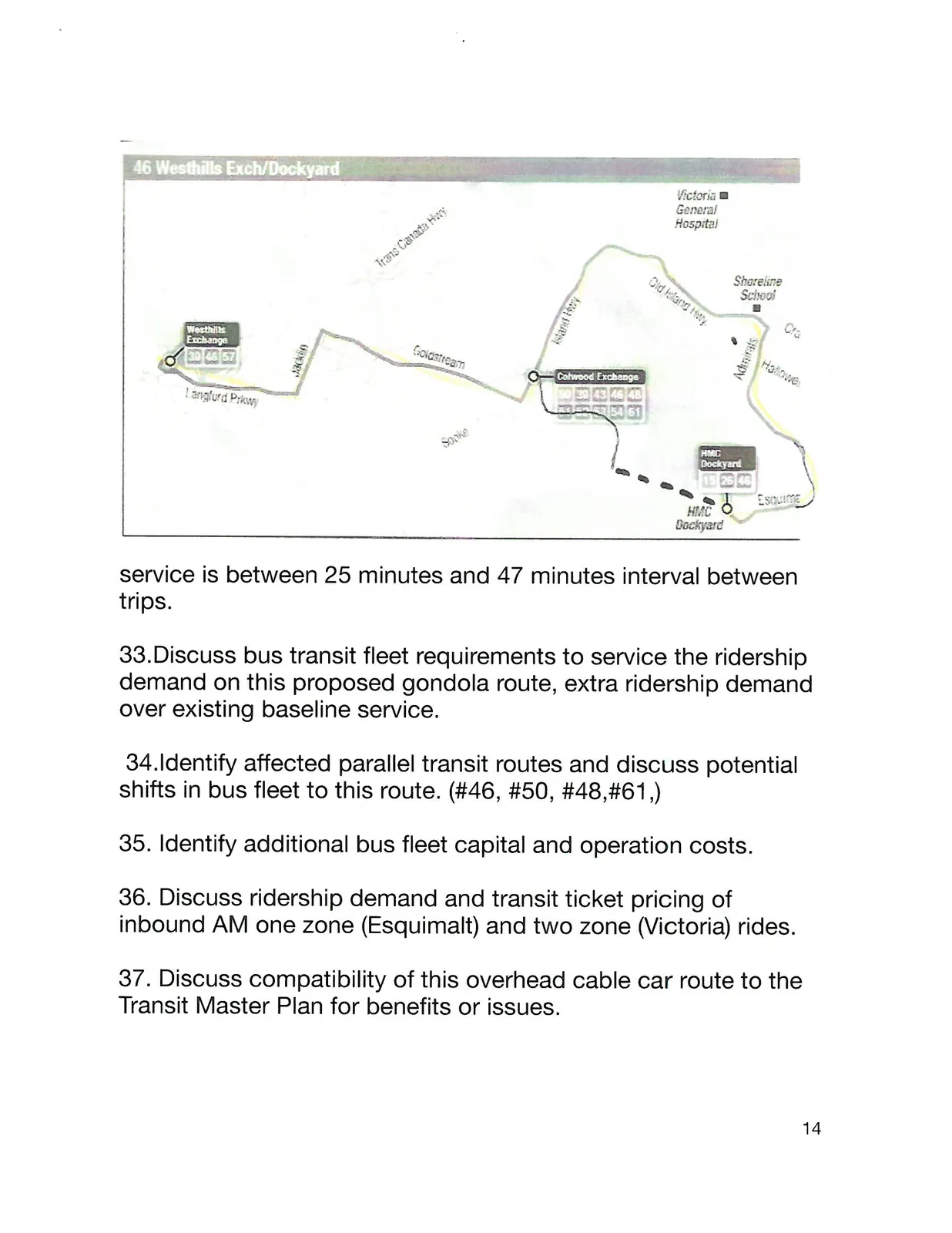
service is between 25 minutes and 47 minutes interval between trips.
Discuss bus transit fleet requirements to service the ridership demand on this proposed gondola route, extra ridership demand over existing baseline service.
Identify affected parallel transit routes and discuss potential shifts in bus fleet to this route. (#46, #50, #48,#61,)
Identify additional bus fleet capital and operation costs.
Discuss ridership demand and transit ticket pricing of inbound AM one zone (Esquimalt) and two zone (Victoria) rides.
Discuss compatibility of this overhead cable car route to the Transit Master Plan for benefits or issues.
Estimate the number of employees and contractors working at the CF Navy Base and Public Works Canada Graving Dock who might take this cable car transit service instead of driving their private vehicles to/from work. (about 40% over the workers
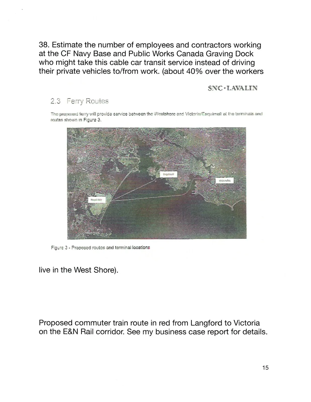
2.3 Ferry Routes
The proposed ferry will provide service between the Westshore and Victoria/Esquimalt at the terminals and routes shown in Figure 3.
live in the West Shore).
Proposed commuter train route in red from Langford to Victoria on the E&N Rail corridor. See my business case report for details.