Other
West Shore Commuter Train Map
May 17, 2022Page 831 section
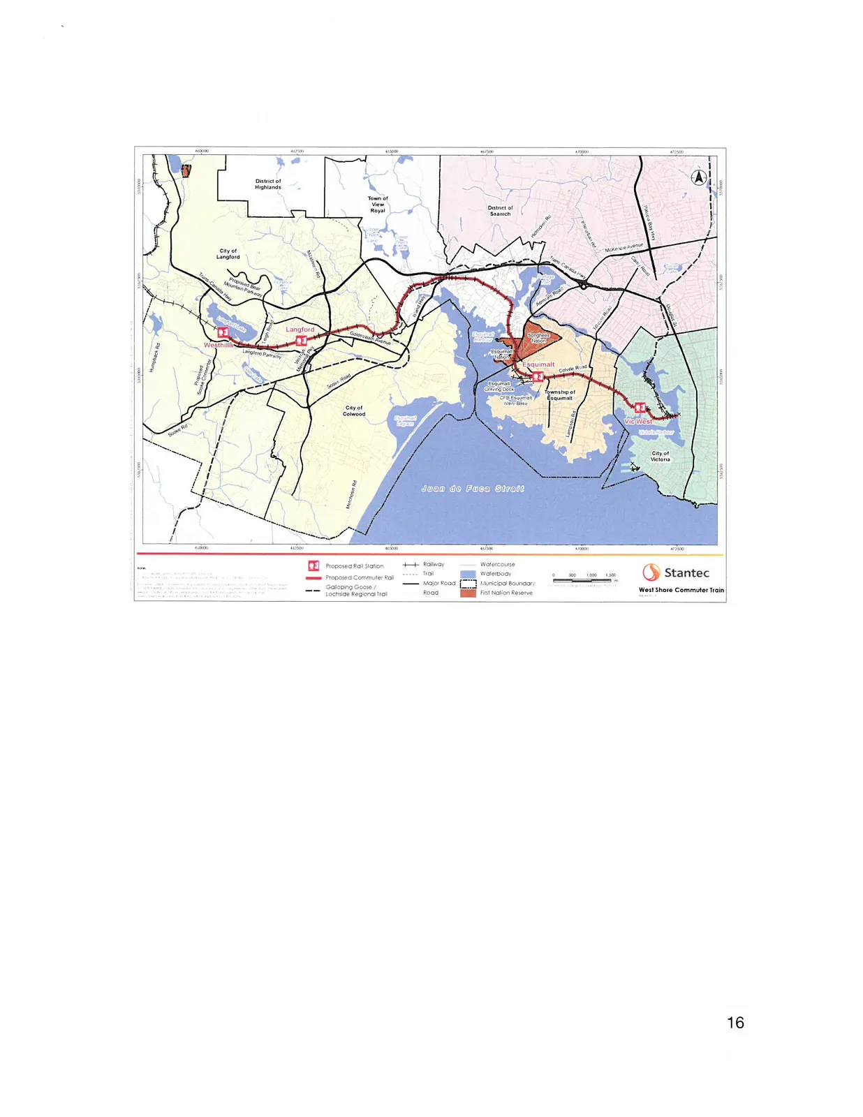
A map by Stantec showing the proposed West Shore Commuter Train route and its relation to the region.
StantecProposed rail corridor through Langford and Esquimalt
West Shore Commuter Train
Map Legend
- Proposed Rail Station: Red icon
- Proposed Commuter Rail: Red dashed line
- Galloping Goose / Lochside Regional Trail: Black dashed line
- Railway: Black line with cross-ticks
- Trail: Dotted line
- Major Road: Solid black line
- Road: Solid thin line
- Watercourse: Blue line
- Waterbody: Solid blue shading
- Municipal Boundary: Dashed and dotted line
- First Nation Reserve: Red hatched area
Scale: 0 to 1,500 meters
Map Details and Labels
Municipalities and Regions:
- District of Highlands
- Town of View Royal
- District of Saanich
- City of Langford
- City of Colwood
- Township of Esquimalt
- City of Victoria (Vic West)
Proposed Rail Stations:
- Westhills
- Langford
- Esquimalt
- Vic West
Geographic Features:
- Juan de Fuca Strait
- Esquimalt Lagoon
- Victoria Harbour
- Thetis Lake
Roads and Infrastructure:
- Humpback Rd
- Sooke Rd
- Metchosin Rd
- Trans-Canada Hwy
- Island Hwy
- Old Island Hwy
- Admirals Rd
- Craigflower Rd
- Colville Rd
- Esquimalt Rd
- Lampson St
- Tyee Rd
- Bay St
- Pandora Ave
- McKenzie Avenue
- Pat Bay Hwy
Other Areas of Interest:
- Songhees Nation
- Esquimalt Nation
- CFB Esquimalt Navy Base
- Esquimalt Graving Dock
- Royal Roads University
- Lochside Regional Trail
- Galloping Goose Trail
Page 83
Extracted from: 2022 05 17 Council Agenda - Agenda - Pdf