Supplemental Information and Photos for Gondola Proposal
May 17, 2022Pages 88–921 section
Supporting imagery including photos of the London Cable Car and site-specific transit maps.
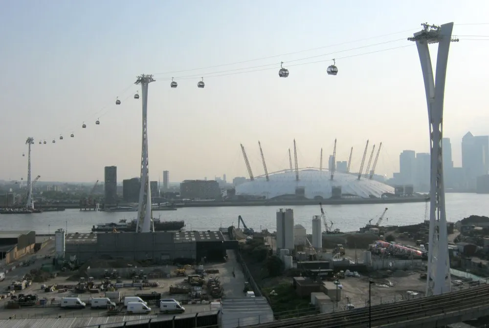
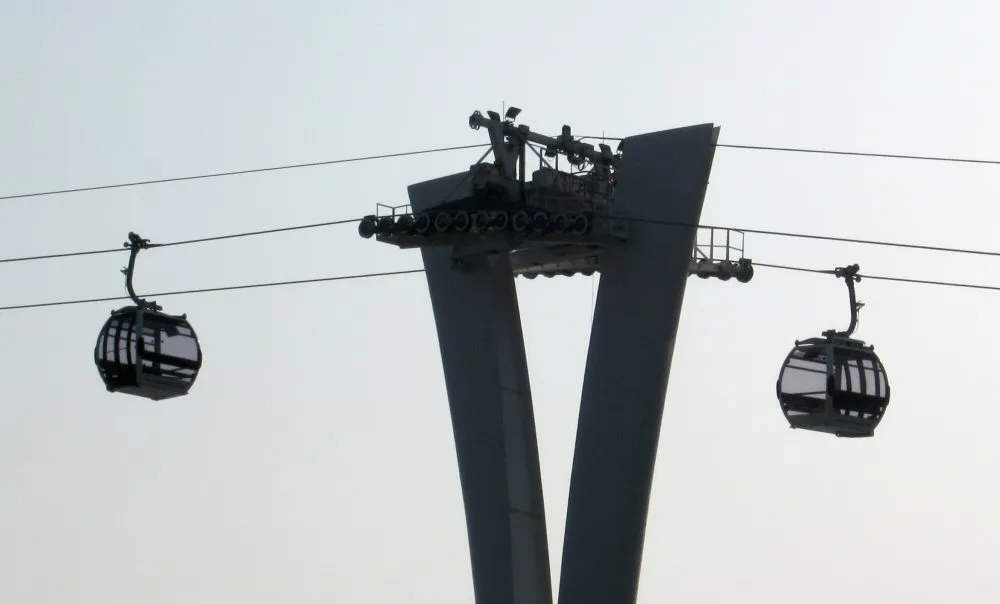
London Cable Car over Thames RiverHMC Dockyard aerial photo
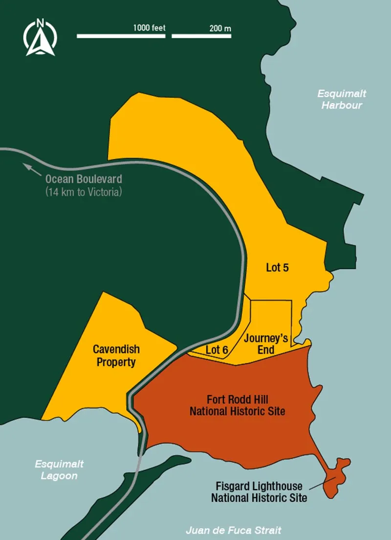
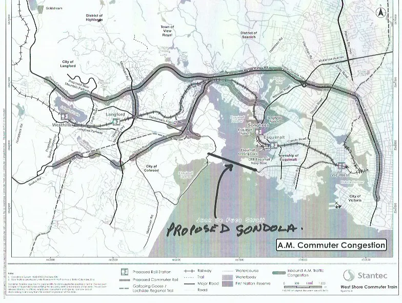
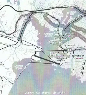
Wide view of an urban gondola system crossing a body of water with a large dome structure and city skyline in the backgroundClose-up view of a gondola support tower and two passenger cabins on cablesMap of the Colwood coastal area showing property boundaries for Lot 5, Lot 6, Journey's End, Cavendish Property, Fort Rodd Hill National Historic Site, and Fisgard Lighthouse National Historic Site. The map also indicates Ocean Boulevard (14 km to Victoria), Esquimalt Harbour, Esquimalt Lagoon, and Juan de Fuca Strait.Detail view of a map showing a proposed gondola route connecting the Colwood area near Esquimalt Lagoon across the water to the CFB Esquimalt Navy Base and the Township of Esquimalt.
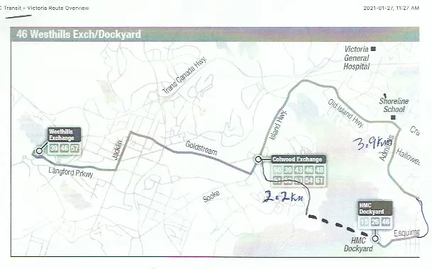
46 Westhills Exch/Dockyard
Transit - Victoria Route Overview
2021-01-27, 11:27 AM
Aerial photograph of a naval dockyard and industrial facility situated on a peninsula, featuring multiple piers, ships, and large buildings.Ground-level photograph of a curving two-lane road with yellow crosshatch markings, a transit bus in the distance, and a stop sign on the right near a rocky embankment.
Page 88–92
Extracted from: 2022 05 17 Council Agenda - Agenda - Pdf