Staff Report
GYE + ASSOCIATES SITE WORK REPORT – PROJECT 22-018
March 4, 2025Pages 281–2832 sections
Arborist field report (Attachment 4) documenting site conditions and root impacts during geotechnical test pit excavations at the hospital.
July 11, 2022Bill Stephen, G&A ArboristNo significant root damage reported
SITE WORK REPORT
| Project: | 22-018 (Victoria General Hospital, View Royal + Saanich) |
| Date/Time: | July 11, 2022 |
| Purpose of Work: | Ryzuk Geotechnical Consultants wished to determine the below ground profile of existing bedrock conditions to assist with design of auxiliary power plant. |
| G&A Arborist: | Bill Stephen |
| Distribution list: | Gye and Associates |
WORK OBJECTIVES:
- Dig test pits throughout property to attempt to map the subterranean surface. Utilizing bedrock in the construction of the structure will provide seismic advantages that can be incorporated into structure design improvements.
OBSERVATIONS/COMMENTS (equipment/techniques used, results etc.):
- A mini excavator was used to dig sample pits down to bedrock for measurement.
- Sample pits were selected by the Engineering technician on site, with advice from the project arborist to avoid unnecessarily impacting trees.
- All pits were greater than 6 metres from the nearest trees.
- Bedrock was found in only one of the six sample pits attempted.
- The project arborist actively supervised the digging in order to further minimize roor disturbance. The project arborist also supervised the routing of the machine as it moved between pits.
- No significant roots or above tree damage occurred during the course of this work.
- Site conditions were dry, enhancing the trafficability of the soil.
Page 281–283
FURTHER ACTIONS REQUIRED
None
Photographic Images
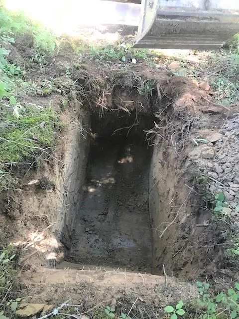
All the soil pits looked similar to this one. No roots over 2 cm were cut. Roots were concentrated in the up 40cm LFH layer and A horizons. Width was 36”, length 8 ‘, depth to 6 ‘. Soil was silty sand near the top (root horizon), with silty-clay in the lower layer (free of roots).
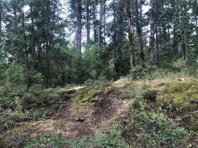
Despite an upland condition with some exposed bedrock, most of the area exhibited over 6 ‘of soil depth. Dominant tree species include a preponderance of Douglas fir with minor elements of Arbutus, Garry oak, Grand fir, and Bigleaf maple.
Page 281–283
Document Images
(1)
Extracted from: 2025 03 04 Council Agenda - Agenda - Pdf