Attachment 2: Lot 1 and Lot 2 3500 Highland Road Wildfire Hazard Assessment
Comprehensive wildfire hazard assessment report for the subject properties, providing risk ratings and FireSmart mitigation recommendations.
Strathcona Forestry Consulting
Lot 1 and Lot 2 3500 Highland Road
Wildfire Hazard Assessment
Prepared for: Deborah Todd via Pamela Ubeda at Coast and Beam Pamela@coastandbeam.com
Prepared by: Strathcona Forestry Consulting PO Box 387 Stn Mn Duncan BC V9L 3X5 strathcona.fc@shaw.ca
27 September 2021
Executive Summary
In accordance with the Town of View Royal’s Development Permit Guidelines for Wildfire, Pamela Ubeda, Principle/Architect, Coast and Beam Architecture, on behalf of Deborah Todd, Ashley Freeman and Dale Van Mol, property owners, 2800 Barker Road, retained Strathcona Forestry Consulting to conduct a wildfire hazard assessment of two new homes proposed at Parcel A, Sec. 2, Land District 24 (hereafter Lot 1) and Lot 1, Plan VIP 13849, Sec. 2, Land District 24 (hereafter Lot 2; 3500 Highland Road).
Assessment determined that the wildfire threat at the subject property is currently High. Main contributing factors are fuel loading (forest vegetation) loading in the general area, delayed response and lack of community fireflow at the site, elevated HeadFire Intensity, and intermix (> 1 structure/ha). Under the provincial Wildfire Threat Rating system, ratings must be moderate or less to be considered acceptable.
Living in a fire-prone ecosystem involves taking the necessary steps to protect homes, property, and community from wildfire. Development standards play a significant role in reducing the potential impact of wildfire. FireSmart strategies for wildfire prevention and preparedness are proven to prevent risk related losses to wildfire (FireSmartCanada.ca; FireSmartBC.ca).
In my professional opinion, compliance with the FireSmart strategies and recommendations contained in this report will ensure the risk of wildfire can be reduced to a level acceptable to ensure the safety of the intended development. The property owners recognize the importance of FireSmart plans, and having already undertaken a number of actions to reduce fire risk.
Fire prevention and protection in the interface zone are ongoing processes. Long-term implementation of FireSmart mitigation is essential to ensure protection for life, property, and ecological processes at the Town of View Royal’s wildland interface.
Introduction
In accordance with the Town of View Royals’ Development Permit Guidelines for Wildfire, Pamela Ubeda, Architect/Principle, Coast and Beam Architecture, on behalf of property owner, Deborah Todd, Ashley Freeman and Dale Van Mol retained Strathcona Forestry Consulting to conduct a wildfire hazard assessment of two new homes proposed at Lot 1 and Lot 2 (3500 Highland Road). (Lot 1 does not yet have a civic address.)
The interface (wildland urban interface/wildland residential interface) describes any area where combustible wildland fuels are found adjacent to homes or other buildings. Under Section 919.1(1) (a) of the Local Government Act, development permits may be designated where protection of Natural Hazard Lands is justified. Natural hazards, including wildfires, may put life and property, and local biodiversity, at risk if development is inappropriately situated and not well planned. Areas rated at high or extreme risk from wildfire are designated in a Development Permit Area (DPA). The objective of the DPA is to properly manage the risks associated with the hazard (interface wildfires).
Hazard Assessment
This report describes the vegetation, terrain, and infrastructure on and around the subject property, and provides recommendations to reduce the risk of wildfire. Assessment criteria are based on Rating Interface Wildfire Threats in British Columbia (https://www2.gov.bc.ca/), FireSmart (FireSmart, Protecting Your Community From Wildfire (Second Edition. Partners in Protection Partners in Protection, 2003 (https://www.firesmartcanada.ca/), and the Home Owners FireSmart Manual (BC Edition (https://www2.gov.bc.ca/assets/gov/public-safety-and.../homeowner-firesmart.pdf). Fire behavior modeling is standardized after the Canadian Forest Fire Danger Rating System (CFFDRS). Fuel Types listed in this assessment are customized from the CFFDRS Fuel Type list for applicability in south coastal BC. Wildfire threat assessment was conducted through an analysis of fuel threats in and adjacent to the proposed development, as described in the 2017 Wildfire Threat Assessment Guide and Worksheets (MFLNRO, 2017). This process, used by qualified environmental professionals, employs physical and biophysical factors, combined with fuel hazards, to determine the wildfire threat (low, moderate, high, or extreme). Fire risk is based on four classes: low, moderate, high, and extreme. Recommendations in this report conform to BC Building Code standards and fire hazard planning authorized by Section 3(2) of the BC Fire Services Act.
Field Inspection: Deborah Todd and Dale Van Mol provided a site tour on August 12, 2021. Weather was warm and dry. Field investigation entailed an analysis of the interface fire hazard that the land is exposed to, from the perspective of the general area, local site, and proposed and existing structures in the general vicinity, up to 100+ m from property boundaries, where feasible.
Location and Description of Proposal: The subject property, which has been in the family for over a century, comprises two adjacent lots on Pike Lake. Two new, single-level homes are planned to accommodate the family, one on each lot (see Site Plan and maps next pages). An existing older home at Lot 2 is to be replaced by a new home. Lot 1 is a new lot (approx. 12 acres), where a new single family home is proposed. The existing home and property are very well maintained. The property is private, with no public access.
Construction plans include fire resistant roofing (e.g., metal) and noncombustible siding (e.g. metal). Driveway access will include adequate turnaround.
Committed to maintaining the integrity of the lakeshore habitat, the owners are in the process of engaging a biologist and landscaper to rehabilitate a small foreshore area where vegetation has been negatively impacted due to the fluctuating water table at Pike Lake as a result of beaver activity. A number of dead/dying trees were observed along the shoreline of Pike Lake.
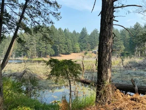
Lot 1 (left background) and Lot 2 (right background), viewed from Pike Lake shoreline. Beaver activity at Pike Lake has impacted aquatic and shoreline vegetation. The foreshore area in centre background is being rehabilitated.
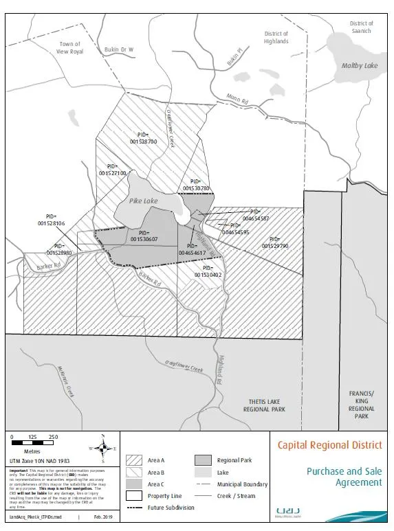
CRD Cadastral Map: Subject property is on east/north side of Pike Lake.
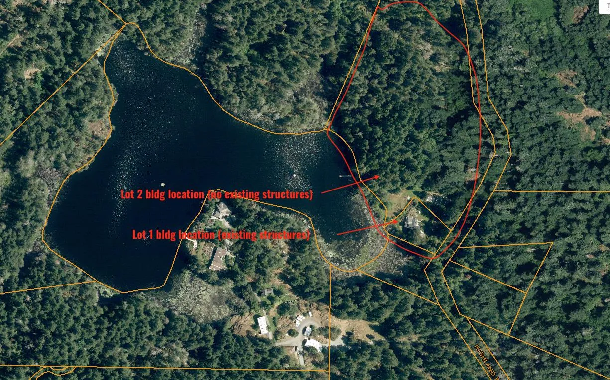
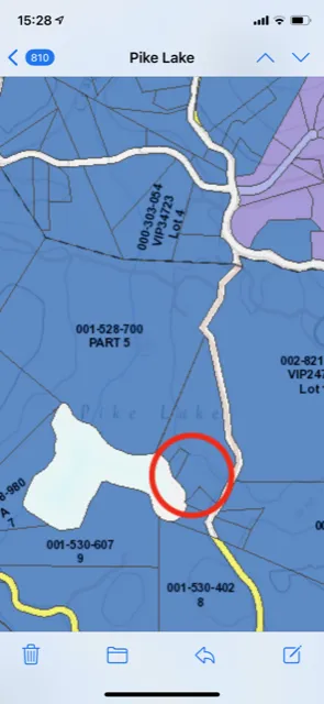
Top: Location map, showing Lot 1 and Lot 2. Bottom: CRD Location map.
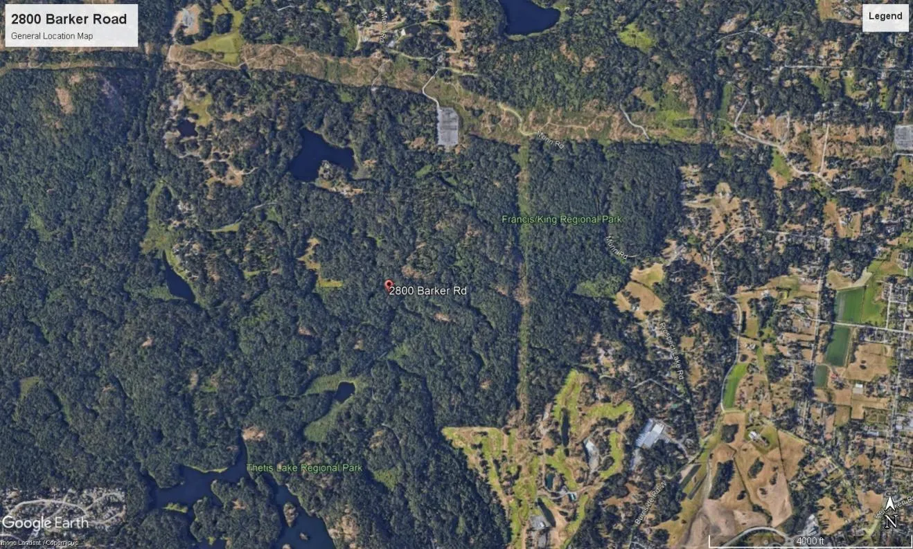
Subject property is located on the north/east side of Pike Lake in the Town of View Royal.
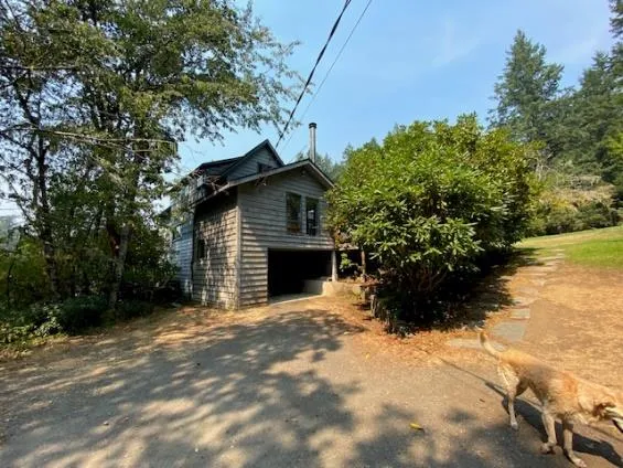
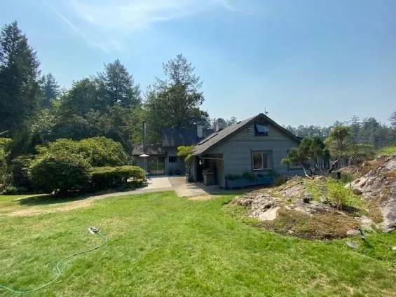

Top photos: Old home at Lot 2 will be replaced by new home. Bottom left: A new home is proposed at new Lot 1.
Wildfire Hazard and Risk
Wildfire hazard is a process, a phenomenon or a human activity that may cause loss of life, injury, or other health impacts, property damage, social and economic disruption or environmental degradation. Wildfire hazard can be described qualitatively as a fire environment—fuel, weather, topography, and ignitions.
Risk assessment for wildfire and its impacts to communities considers both the likelihood of a wildfire and the potential consequence associated with that likelihood. For example, if the fuel (i.e. the hazard) ignites and the fire spreads towards the community (probability), the wildfire can become a threat to life and property (consequence) with an associated risk of loss.
Determination of the wildfire hazard and risk involves a detailed assessment of potential fire behaviour, field reviewed fuel characteristics, proximity of fuel to the community, local fire spread patterns, topographical considerations and local factors.
Fire Behaviour. Fire behaviour has three components: weather, topography, and fuel. Fire behavior predicts how forest and wildland vegetation (fuel) will burn under different conditions. Weather and topography cannot be changed; alteration of fuels across the landscape is the only way to lower fire intensity and change fire behaviour.
Biogeoclimatic Classification. The subject proposal is located in the moist maritime Coastal Douglas-fir (CDFmm) biogeoclimatic subzone. Summers are warm and dry, while winters are moist and mild. Growing seasons are long, and often feature pronounced water deficits on zonal (average) and drier sites. Fire Danger Ratings (i.e., the risk of a fire starting) often reach High and Extreme in summer. During the summer of 2021, south east Vancouver Island was in an Extreme Fire Rating category for an extended time.
Prevailing winds in summer at the local area are typically westerly (from the lake).
Topography. Physical site characteristics impact fire behavior by affecting ignition potential and the rate of fire spread. The assessment area occupies a gentle gradient.
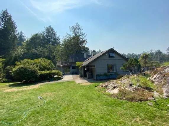
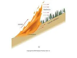
Wildfires typically burn uphill. Warmer aspects tend to burn “hotter.”
Vegetation. Fire behavior predicts how forest and wildland fuels (vegetation) will burn under different conditions. Fuel hazard means the potential fire behaviour, without regard to the state of weather or topography, based on the physical fuel characteristics, including fuel arrangement, fuel load, condition of herbaceous vegetation and the presence of ladder fuels.
Benchmark vegetative fuel types developed by the Canadian Forest Fire Danger Rating System Fire Behavior System (CFFDRS) are used to forecast how a wildfire will react (cwfis.cfs.nrcan.gc.ca) (refer to Appendix 2).
Left: grassed yard surrounding existing old home to be replaced at Lot 2; right: forest understorey surrounding location of proposed home at Lot 1 has light surface and ladder fuels
Major Fuel Types at Subject Proposal at Lot 1 and Lot 2:
| Fuel Types | Description | Forest Floor & Surface Fuels | Ladder Fuels | Wildfire Behaviour (why and how a fire spreads) |
|---|---|---|---|---|
| C-5 Coniferous forest / mixed forest | Coniferous 2nd-growth forest (Fd leading) with secondary mixed forest (bigleaf maple/red alder & minor western redcedar) | Moderate fuel loading: property owners regularly maintain understorey to reduce downed woody debris and invasives. Understorey comprised of salal, Oregon grape, ferns | Vertical CF continuity; light to moderate understorey dead/dying. Lower branches of tall trees in this forest stand have been largely pruned. | Fire start during warm, dry windy weather could result in High potential for Crown Fire Initiation due to continuity and extent of surrounding forested lands |
| C-2/3 & 0-1 Brush / Grass/ Ornamental shrubs/trees | Localized areas of maintained lawn, intermixed with ornamental and/or native shrubs/trees | Light to moderate fuel loading in open areas | Localized ladder fuels associated with established specimens. | Fire spread could be rapid in warm dry, windy weather due to continuity and extent of forest fuels in surrounding lands |
The property owner’s family is vigilant about cleaning up surface and ladder fuels at forested areas of the subject proposal.
Risk of Ignition. Risk of ignition represents the potential for fire starts. Risk of ignition could come from property owners in the area, work activities associated with the new home construction, and/or public use of trails/roads in the general area. The property owners said the subject property is very private with no public trespass. Risk of ignition at the subject proposal is rated low to moderate.
Fire Spread and Intensity. Head fire intensity is a numerical ranking of difficulty of control for specific fuel types. Flame length is a main visual manifestation. Head fire intensity is a major determinant of certain fire effects and difficulty of control. Numerically, it is equal to the product of the net heat of combustion, quantity of fuel consumed in the flaming front, and the linear rate of spread. Under warm, dry conditions, there is currently sufficient continuity of surface and ladder fuels in local forest stands to enable a fire to spread. Dry, windy conditions would increase the rate of spread.
The goal of Wildfire Risk Reduction (WRR) is to reduce HeadFire Intensity from 4 to 5 to less than 2000 kW/m (< 3, HFI column Moderate) (see chart following).
Fire Weather Indices
| Hazard Rating | FFMC Fine Fuel Moisture Code | DMC Duff Moisture Code | DC Drought Code | ISI Initial Spread Index | BUI Build Up Index | FWI Fire Weather Index | HFI Head Fire Intensity |
|---|---|---|---|---|---|---|---|
| Low | 0-76 | 0-21 | 0-79 | 0-1.5 | 0-24 | 0-4.5 | 1-2 |
| Moderate | 77-84 | 22-27 | 80-189 | 2-4 | 25-40 | 4.5-10.5 | 3 |
| High | 85-88 | 28-40 | 190-299 | 5-8 | 41-60 | 10.5-18.5 | 4 |
| Very High | 89-91 | 41-60 | 300-424 | 9-15 | 61-89 | 18.5-29.5 | 5 |
| Extreme | 92+ | 61+ | 425+ | 16+ | 90+ | 29.5+ | 6 |
Spotting Potential. Spotting is a fire behavior characteristic in which sparks or embers are carried up by the wind and/or convective column and fall into other downwind fuels to ignite additional fires beyond the zone of direct ignition by the main fire (Firewise.org). Fire spotting is one of the major ways that fires spread and homes are ignited and destroyed in wildland/urban interface fires. Firebrands can come down on and ignite combustible roofs, combustible items stored adjacent to homes, and other nearby combustible fuels. The resulting spot fires may go unnoticed and thus unsuppressed when an area has been evacuated of residents, when firefighters are spread too thin, or when spot fires are too numerous.
The maximum spotting distance in a particular fire varies according to several factors, including overall fire intensity, wind speed, fuel type, initial size of the ember when lofted up, and how rapidly it is burning (Firewise.org). If a fire start occurred during very warm dry, weather (High/Extreme Fire Danger Ratings), there is high potential for spotting in the area.
Fire Protection. The subject site is located within the service area of View Royal Fire Rescue (VRFR), located at 333 Island Highway. View Royal Fire Rescue provides a high level of service to the community plays a key role in the protection of the West Shore. The department is committed and dedicated to meeting the demands of the growing Town.
VRFR stated (Sept. 15, 2021) response time to the subject address is 15-18 minutes. Response to a structural fire at the property would be “autoaid” – additional support would be necessitated from Colwood and Langford (tanker/engine). The fire department also said the last hydrant is at 2497 Highland Road.
Fire department response time is the elapsed time, in minutes, from when the first firefighting unit is dispatched to when the first fire fighting unit arrives at the emergency scene. Fire department intervention time is crucial in determining the consequences of a fire in terms of deaths, injuries, and loss of property and damage to the environment. An early aggressive and offensive primary interior attack on a working fire is usually the most effective strategy to reduce the loss of lives and property damage.
The British Columbia Building Code addresses situations where the firefighter response time ‘exceeds 10 minutes in 10% or more of all calls’ by requiring higher levels of non combustible construction and reductions on allowable areas of unprotected openings.
Response can be delayed depending on the time of day/wk, and if there are multiple simultaneous calls.
Mutual Aid. Fire Departments within the CRD operate under a mutual aid agreement with other fire departments within (and outside) the region. In the case of a serious fire, mutual aid from adjoining fire departments can benefit fire suppression by pooling manpower and resources (water supply, water tenders, etc.,). Mutual aid, however, may not always available.
Wildfires. View Royal Fire Rescue automatically responds to structure fires and small, easily accessible bush fires inside the fire service protection area (FPA). The Wildfire Management Branch generally responds to forested areas outside a FPA.
Water Supply. As per Town of View Royal Bylaw No. 500, “within any building to be constructed in a location that does not permit proper access for fire fighting personnel and fire fighting equipment as defined by the British Columbia Building Code,” interior sprinklering will be required at the two new proposed homes.
Interior sprinklering will require a buried cistern and pump system to supply water for both homes.
Access. Safe access increases safety for both residents and firefighters, and also facilitates quick response by firefighters. Highland Road provides access to Lot 1 and Lot 2. Barker Road could provide emergency egress.
Fire departments generally require a turnaround location of a specific dimension for long driveways (exceeding 295 ft.).
Wildfire Threat Assessment Results
Scoring from the FireSmart assessment and fire behavior analyses determined the subject property currently has a High Fuel Assessment rating (see chart next page), contributing to a High Local Wildfire Threat Rating (below). Factors contributing to the elevated rating include: continuity and extent of fuel loading in the general area; delayed response; sloping topography and warm aspect; elevated HeadFire intensity; lack of existing fireflow; and intermix >1 structure/ha. Threat ratings must be low/moderate to ensure an area and/or structure(s) are safe.
LOCAL WILDFIRE THREAT SUMMARY: Lot and Lot 2
| System: | Subcomponents | CURRENT ratings | Projected Ratings post-development* |
|---|---|---|---|
| MFLNRO Wildfire Threat Assessment | Fire Behaviour: Fuel, Weather, Topography | Fuel Assessment Class: High (see chart next pg.) | Moderate |
| Structural (incl vicinity) | High | Moderate | |
| Overall Rating: | HIGH | ||
| HIRV Model | Hazard Impact Risk Vulnerability | High High High High | Moderate Moderate Moderate Moderate |
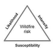
| Wildfire Risk | Likelihood Intensity Susceptibility | High | Moderate |
*Projected ratings conditional upon compliance with recommendations contained in this report.

Wildfire risk triangle. (Scott et al. 2013).
Implementation of recommended FireSmart mitigation will help to reduce the Wilfdfire Threat to acceptable.
Generalized Descriptions of the “Fuel Assessment Rating” classes:
| Rating | Description |
|---|---|
| Low | Fires may start and spread slowly. There will be minimal involvement of deeper fuel layers or larger fuels. |
| Moderate | Forest fuels are drier and there is an increased risk of surface fires starting. There will be involvement of the organic layer but larger dead material will not readily combust. |
| High | Forest fuels are very dry, new fires may start easily, burn vigorously; aerial fuel will be engaged in the flaming front. Most fuel in the organic layer will be consumed and larger dead fuel will be consumed in the smoldering combustion. |
| Extreme | Extremely dry forest fuel, new fires will start easily, burn vigorously; all aerial fuel will be engaged in the flaming front. Most fuel in the organic layer will be consumed and larger dead fuel will be consumed in the smoldering combustion. |
FMC (Fuel Moisture Content) 95% value based on 90th percentile drought conditions.
Fuel reduction targets should be sufficient to be effective to meet treatment objectives of reduced fire behaviour under 90th Percentile Fire Weather Index (FWI) Conditions (FFMC, ISI, BUI) from the BCWS weather network.
Recommendations
Living in a fire-prone ecosystem involves taking the necessary steps to protect homes, property, and community from wildfire. FireSmart principles and best practices (wildfire prevention, mitigation, and preparedness) are advised to manage wildfire risk and impact (FireSmartCanada.ca; FireSmartBC.ca).
The subject property is well maintained; the property owner and family are committed to FireSmart actions. Application of the following recommendations will ensure the safety of the intended development of two new homes at Lot 1 and Lot 2.
Vegetation Management
General Precautions During Land Clearing and Construction
- Ensure any land clearing activities are conducted in compliance with BC’s Wildfire Act local bylaws.
- As per the BC Wildfire Act, if a high risk activity (i.e., land clearing) is taking place between 1 April and 31 October, the operator must keep at the activity site fire fighting hand tools, in a combination and type to properly equip each person who works at the site with a minimum of one fire fighting hand tool, and an adequate fire suppression system (onsite portable water tanker and fire fighting tools – shovels, pulaskis, portable water backpacks). In addition, efforts must be made to maintain an adequate fire break between any high risk activity and areas of continuous forest to ensure a fire originating at the site does not escape the site.
- During landclearing, develop an Emergency Plan of Action, listing key contact information in case of fire and/or other emergency at the site.
- Hazard abatement (removal of slash/disposal of debris piles) must take place in compliance with Town of View Royal bylaws.
- Ensure construction workers are made aware of the risk of fire in the interface zone, especially during dry summer weather.
Hazard Tree Management
- Prior to commencement of work at the site, potential hazard trees to be inspected by a certified Danger Tree Assessor. Trees identified as Danger Trees will require removal. Where safely practical, hazard trees could be modified (i.e., pruned, topped [deciduous trees] to provide wildlife habitat).
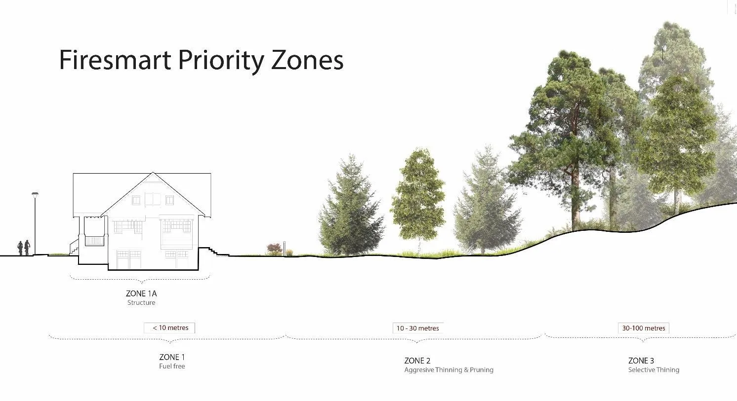
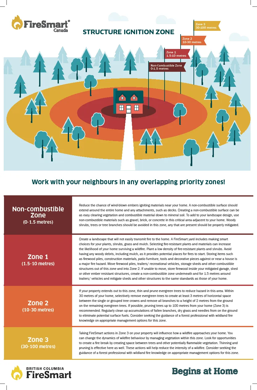
FireSmart Zones – (see Appendix 1)
Home Ignition Zone: Zone 1a: 0-1.5 m A noncombustible surface should extend for 1.5 m around homes, accessory structures, and any attachments, such as decks. Avoid storing flammable outdoor items, such as wicker or wooden patio furniture, cushions, doormats, window boxes and planters, garbage cans without lids and BBQ propane tanks, which are all places where embers can land and start a fire, in this critical area adjacent to the home.
- Landscape with noncombustible landscaping materials, such as gravel, brick, or concrete
- Avoid woody shrubs, trees, or tree branches in this zone
- Create a noncombustible zone underneath and for 1.5 m around any RVs/vehicles
- Mitigate any auxiliary structures to same standards as those of home
FireSmart Priority Zone 1: 0-10 m Establish and maintain an environment around homes and accessory structures that will not support fire. Focus on fuel removal, conversion, and reduction. As discussed with the owner and family at the site visit, well-maintained, well-spaced deciduous trees and shrubs are acceptable within Zone 1. Within this zone, the owners plan to remove several trees, including pines, a sycamore, and a spruce. The chestnut tree and ash tree can be pruned and retained. A singular Douglas-fir tree can be pruned. The owners plan to replace the heather plantings with a vegetable garden.
- Landscaping should feature a low density of fire resistant plants and shrubs. Avoid the use of coniferous hedging.
- Maintain landscapes with regular irrigation, mowing, pruning, raking, weeding and dead plant removal.
- Create non-flammable hardscapes, such as rock, gravel, and water features, which, function as firebreaks by breaking up areas of fuel. Rock can provide a natural looking, low-maintenance and water-efficient mulch and as well as a fire-resistant buffer zone.
- Group fire resistant plant materials in islands. Group plants in islands surrounded by nonflammable materials, such as rock; employ landscape elements together to create breaks between fuels.
- Limb (prune) trees 1.5 to 2m from the ground. Create space between trees and shrubs – a general rule is twice the height of what the plant will be at maturity. Remove tree limbs closer than 15-feet from power lines and any touching the house or other structures.
- Avoid using woody debris, including bark mulch, as it provides potential places for fires to start
- Store items such as firewood piles, construction materials, patio furniture, tools and decorative pieces at least 10 m from the homes and any structures
FireSmart Priority Zone 2: 10-30 m (where applicable) Extend the fuel modified area 10-30 m around structures. Conduct FireSmart thinning, pruning, and fuel reduction strategies in this zone to reduce fuel loading.
- Thin and prune evergreen trees to reduce hazard in this area
- Within 30 m of home and any other structures, selectively remove evergreen trees to create at least 3 m of horizontal space between the single or grouped tree crowns, and remove all branches to a height of at least 2.5 m from the ground on the remaining evergreen trees. (For smaller evergreen trees; general rule of thumb is prune branches up to a third the height of the tree)
- Regularly clean up accumulations of fallen branches, dry grass, dried arbutus leaves, and conifer needles from the ground to eliminate potential surface fires
FireSmart Priority Zone 3: 30-100 m (where applicable) Where fuel modification in PZ1 and PZ2 is insufficient to protect structures and/or property, and where property boundaries permit, thin and prune trees in order to create an environment that will not support high-intensity crown fires.
- Look for opportunities to create a fire break by creating spaces between trees and other potentially flammable vegetation
- If possible, prune the trees located up to 100 m from the homes
- Thin and prune overgrown trees to reduce hazard
- Regularly clean up accumulations of fallen branches, dry grass, and needles from the ground to eliminate potential surface fires
General Principles of FireSmart Landscaping
- Incorporate FireSmart landscaping by using fire-resistive, widely spaced trees, native shrubs and groundcover in combination with stone and/or water features and/or maintained lawn areas. See FireSmart Guide to Landscaping. https://www.firesmartcanada.ca/resources-library/firesmart-guide-to-landscaping
- Promptly re-vegetate any areas of soil disturbed during clearing and construction with approved landscaping materials and/or native plant species to prevent encroachment from invasive plant species (i.e., broom, etc.).
- Powerlines should be clear of branches and other vegetation.
Lakeshore Habitat
- As is planned, ensure new home construction is out of the lakeshore zone.
Construction
The roof is the most vulnerable component of a structure. Sparks and burning embers from a wildfire can travel long distances and quickly ignite flammable roofing material. Siding material is also vulnerable to wildfire. Combustible debris can accumulate at the vents and openings on your home and be ignited by embers during a wildfire.
- As is planned, use fire-retardant roof covering assemblies rated Class A, B, or C (i.e., metal, tile, ULC- rated asphalt) and non-combustible siding materials (i.e., stucco, metal siding, brick, cement shingles or cementitious materials, poured concrete, or ULC-rated wood siding) on new structures. Metal, clay tile, and rated asphalt shingles are the most fire resistant roofing materials. Siding materials such as stucco, metal brick and concrete offer superior fire resistance to wildfire. Logs and heavy timbers are less effective, while wood and vinyl siding offer very little protection.
- Follow FireSmart guidelines for design, construction, and maintenance of window and door glazing, eaves and vents, and decking. Install noncombustible material for all vents (should be 3 mm screening or ASTM fire rated vents). Metal products are recommended for vents and vent flashing. https://www.firesmartcanada.ca/
- Ensure structures are equipped with working smoke alarm(s).
- Do not allow wood burning fire pits.
- Chimneys must have approved spark arrestors.
- Sheath in the base of decks, balconies and homes with fire-resistant material to reduce the risk of sparks and embers igniting the home. Use metal railings or tempered glass for decks and balconies. Select noncombustible patio furniture and decorations.
- If wood fences are installed, ensure at least a 1.5 m noncombustible break between the fence and a structure (i.e., a metal gate with a stone wall to break up combustible fence).
- Roof top sprinklers are strongly recommended.
Maintenance
- Regularly inspect siding for locations where embers could accumulate and lodge.
- Maintain and remove combustible debris near exterior walls to reduce a building’s vulnerability to ignition during a wildfire.
- Regularly remove debris from gutters – sparks and easily ignite these dry materials.
- Inspect vents and openings regularly to ensure vents are in good repair, and remove any accumulated combustible debris.
Water Supply / Fire Protection
- Town of View Royal Bylaw No. 10 requires interior sprinklering at new builds at the subject property.
- Ensure homes/property is equipped with basic firefighting tools: shovel, hose(s), exterior (roof top) sprinkler(s), bucket(s).
Access
- Ensure driveway accesses meet BC Building Code and municipal Engineering requirements.
- Ensure address signage is clearly evident. Letters, numbers, and symbols should be at least 10 cm high, with a 12 mm stroke, contrast with the background colour of the sign, and be reflective.
- Ensure new structures are mapped on fire department “pre-org” (fire planning) maps.
Regulatory Provisions
- Conduct follow-up assessment (at building permit) to ensure appropriate mitigation measures have been implemented.
Appendix 1. FireSmart Interface Priority Zones
In interface areas, FireSmart advocates the establishment and maintenance of Fuel Management Zones* extending outward from structures and along access routes: Zone 1 a (0-1.5m) Zone 1 (0-10 m). Zone 2 (10-30 m). Zone 3 (30-100 m). (FireSmart, 2003; updated 2018)
Zone 1a (0-1.5 m): This is the noncombustible zone, where it is very important not to have any combustibles next to buildings.
Zone 1 (0-10 m): The main objective of vegetation management is to create an environment that will not support fire. Vegetation management focuses on fuel removal, conversion, and reduction.
Zone 2 (10-30 m): Where treatment in PZ 1 is not sufficient to significantly reduce the fire hazard due to fuel loading, extend the fuel modified area with a variety of thinning and pruning actions.
Zone 3 (30-100 m): Where fuel modification in PZ1 and PZ2 is insufficient to protect structures and/or property, FireSmart advocates treatment in Priority Zone 3 with a variety of thinning and pruning actions in order to create an environment that will not support high-intensity crown fires.
*Setback Zone distances may be extended depending on aspect, slope, fuel loading, etc.
Appendix 2. Generic Fuel Types (adopted from CFFDRS).
| Fuel Type | Description | Wildfire Behaviour Under High Wildfire Danger |
|---|---|---|
| Coniferous: | ||
| C1 | Terrestrial herbaceous ecosystem: mossy rock outcroppings | High potential for surface fire, especially if high moss/lichen |
| C2 | Dense regeneration to pole-sapling (immature) forest with crowns almost to ground | High potential for crown fires; low to very high fire intensity and rate of spread |
| C3 | Fully stocked, mature forest, crowns separated from ground; sparse understorey | Surface and crown fire, low to very high fire intensity and rate of spread |
| C4 | Dense, pole-sapling (immature) forest, heavy standing dead and down, dead woody fuel; continuous needle litter; continuous vertical crown fuel continuity | High potential for crown fires, high to very high fire intensity and rate of spread |
| C5 | Moderately well-stocked, mature forest, moderate dense understorey crowns well separated from ground; continuous needle litter | Low to moderately fast-spreading, low to moderate intensity surface fire |
| C6 | Fully stocked conifer plantation; absent understorey; tree crowns separated from ground; continuous needle litter | Surface fire may spread rapidly to become high intensity fire with high rate of spread |
| C7 | Open, mature coniferous stand; uneven-aged; discontinuous understorey; tree crowns mostly separated from ground | Surface, torching, rarely crowning (except on steeper slopes), moderate to high intensity and rate of spread |
| D (Deciduous) | Moderately well-stocked deciduous stands; moderate medium to tall shrubs and herb layers D-1 Leafless D-2 In leaf |
Typically a surface fire; low to moderate rate of spread and fire intensity |
| M (Mixed Forest) | Moderately well-stocked mixed stand of conifers and deciduous tree species; moderate shrub understorey; conifer crowns extend nearly to ground M-1 Leafless M-2 in Leaf |
Surface, torching and crowning; moderate to very high intensity and spread rate (varies with slope and % vegetation cover) |
| Slash from logging and land clearing | Fine fuel % and cedar foliage retention will result in faster ignition and spread | |
| S (Slash) | Rapid spreading, moderate to high intensity surface fire | |
| 01-Long | Continuous standing grass – fuel loading is 0.3 kg/m2; scattered trees 01-a Matted 01-b Tall |
The taller, and more cured the grass, the more rapid spread; low to moderate intensity surface fire |
| 01-Short | Continuous human modified short grass | Typically low rate and spread and low fire intensity. |
Appendix 3. Fire Risk Classes.
Fire Risk Classes
Low (Green): The combination of the local fuel hazard, weather influences, topography, proximity to the community, fuel position in relation to fire spread patterns, and known local wildfire threat factors make it a lower potential for threatening a community. These stands will support surface fires, single tree or small groups of conifer trees could torch/ candle in extreme fire weather conditions. Fuel type spot potential is very low, low risk to any values at risk.
Moderate (Yellow): The combination of the local fuel hazard, weather influences, topography, proximity to the community, fuel position in relation to fire spread patterns and known local wildfire threat factors make it possible that a wildfire in this area would threaten the community. Areas of matted grass, slash, conifer plantations, mature conifer stands with very high crown base height, and deciduous stands with 26 to 49% conifers. These stands will support surface fires, single tree or small groups of conifer trees could torch/ candle. Rates of spread would average between 2-5 meters/ minute. Forest stands would have potential to impact values in extreme weather conditions. Fuel type spot potential is unlikely to impact values at a long distance (<400m).
High (Orange): The combination of the local fuel hazard, weather influences, topography, proximity to the community, fuel position in relation to fire spread patterns, and known local wildfire threat factors make it likely that a wildfire in this area would threaten the community. This includes stands with continuous surface/ crown fuel that will support regular torching/ candling, intermittent crown and/or continuous crown fires. Rates of spread would average 6 -10 meters/ minute. Fuel type spot potential is likely to impact values at a long distance (400 -1 000m).
Extreme (Red): The combination of the local fuel hazard, weather influences, topography, proximity to the community, fuel position in relation to fire spread patterns, and known local wildfire threat factors make it very likely that a wildfire in this area would threaten the community. Stands with continuous surface/ crown fuel and fuel characteristics that tend to support the development of intermittent or continuous crown fires. Rates of spread would average >10 meters/ minute. Fuel type spot potential is probable to impact values at a long distance (400 -1 000m or greater).These forest stands have the greater potential to produce extreme fire behaviour (long range spotting, fire whirls and other fire behaviour phenomena.
Limitations
This report provides an assessment of site conditions. Evaluation is based on professional judgment. The investigation involved field observation. Recommended treatment pertains only to the particular site as disclosed at the time of inspection. The report was prepared considering site-specific circumstances and conditions. It is intended only for use by the client for the purpose for which it was commissioned and for use by local government regulating the activities to which it pertains.