Council Meeting/Documents/Official Community Plan Update – Land Economics Study Update & Housing Capacity Analysis and Land Use Scenarios Presentation
Presentation
Official Community Plan Update – Land Economics Study Update & Housing Capacity Analysis and Land Use Scenarios Presentation
May 13, 2025Pages 238–25619 sections
Staff presentation explaining the OCP studies, key findings on land viability, and comparisons between the two proposed land use options.
9,255 maximum potential SSMUH unitsMay 13, 2025Option 1 vs Option 2 comparison
Official Community Plan Update – Land Economics Study Update & Housing Capacity Analysis and Land Use Scenarios
Council – May 13, 2025
Page 238–256
Background
- In January 2025, the Town launched Phase 1 of the review and update of the Official Community Plan.
- Phase 1 focusses on OCP vision statement and goals, land use, housing and special planning areas.
- From February to April, an inclusive and extensive engagement process took place to seek feedback from the public on the draft vision statement and goals, and community growth and development.
Page 238–256
OCP Studies
- Land Economics Update Study
- Updated data and projections in the 2021 Land Economics Study.
- Housing Capacity Analysis
- Assessment of the community’s ability to meet its estimated housing need for 2050 based on current and projected development trends
- Market conditions
- Small-scale multi-unit housing provisions
- Land Use Scenarios
- Proposed two land use scenarios to implement the vision and aspirations for growth and development.
Page 238–256
Land Economics Study
- Updates to the commercial space demand projections for View Royal for 2025 to 2050.
- Updates to the office space demand projections for View Royal for 2025 to 2050.
- Updates to the hotel demand projections for 2025 to 2050.
- Assess the development viability of different mixed-use scenarios (retail, office and light industrial) across case study sites in View Royal.
Page 238–256
Key Findings
- Projected average annual retail and service growth of about 5,032 ft² to 8,450 ft².
- Projected average annual office floor space growth of about 3,400 ft² to 5,080 ft².
- Light industrial developments are challenging to build in this current market because of high inventory. Stacked light industrial-office buildings perform better.
- Projected demand for hotel rooms in View Royal is approximately 63 rooms between 2025 to 2050. Up to 101 rooms if growth continues at a similar pace based on previous projections.
Page 238–256
Key Findings cont’d
- Increase permitted building heights of wood-frame mixed-use developments to six-storeys to make them financially viable to build.
- Out of the three mixed-use redevelopment options (office, retail and light industrial), ground floor office has the least viable results unless mixed with retail.
- Lower parking requirements to be consistent with market demand can alleviate cost burdens.
- Ensure new retail space emerges in quantities and locations where it is most supportable, instead of a blanket retail floor area requirement for mixed-use development.
Page 238–256
Housing Capacity Analysis
- Town’s 5- year housing need forecasted from 2021 – 2026 is 842 units.
- Town’s 20- year housing need forecasted from 2021 – 2041 is 2889 units.
- Town’s projected housing need to 2050 is 4,189 units.
Page 238–256
Housing Capacity Analysis
Factors considered to meet housing need:
- Compared the maximum potential uptake of small-scale multi-unit housing.
- Evaluated anticipated residential development from current instream development applications for residential units.
- Studied additional potential development from identified viable test sites with higher densities (up to six-storeys).
Page 238–256
Housing Capacity Analysis
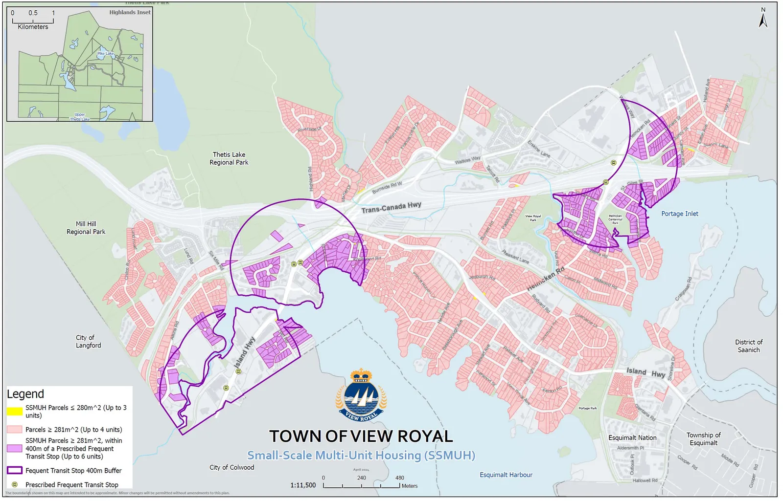
- If every single SSMUH parcel in the Town were to develop into 3 to 6 units then the total number of SSMUH units would be 9255 units. The 2050 projection is much less.
Page 238–256
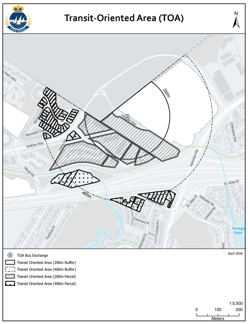
Transit-Oriented Area (TOA)
Page 238–256
Development between 2011 and 2025
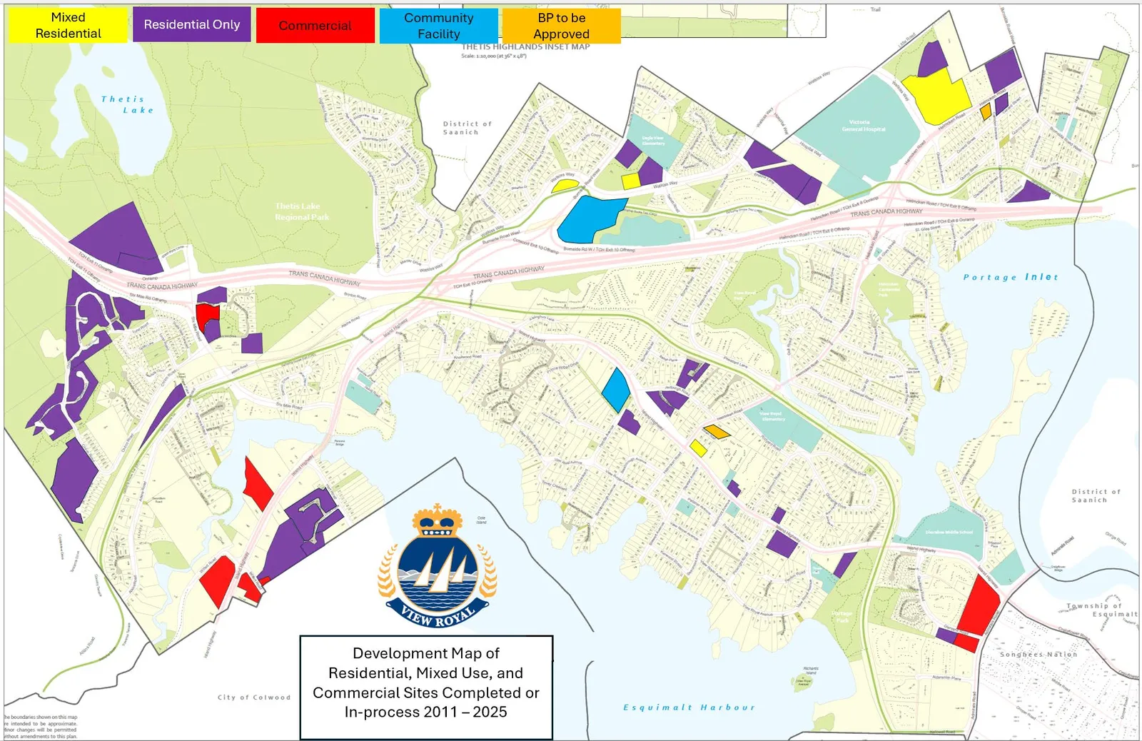
- Approximately 1,384 dwelling units (single-family dwellings, townhouses and multi-unit residential buildings) have been built since 2011.
- There are approximately 548 units currently under construction.
Page 238–256
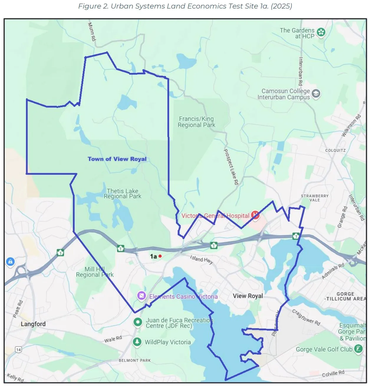
Viable test sites with higher densities (up to six-storeys)
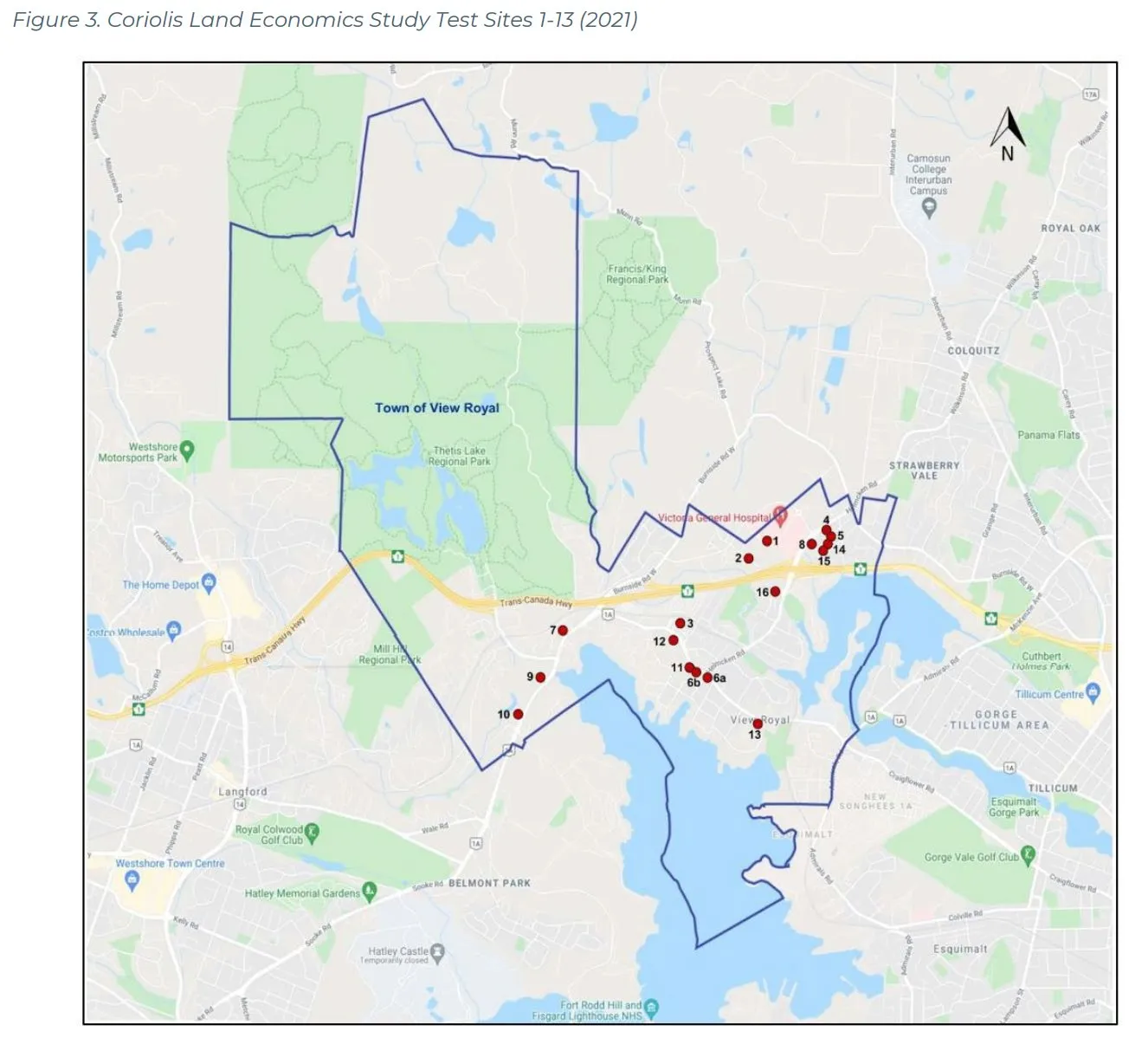
Page 238–256
Housing Capacity Analysis
Table 4. Analysis of Housing Needs versus Anticipated Housing Development
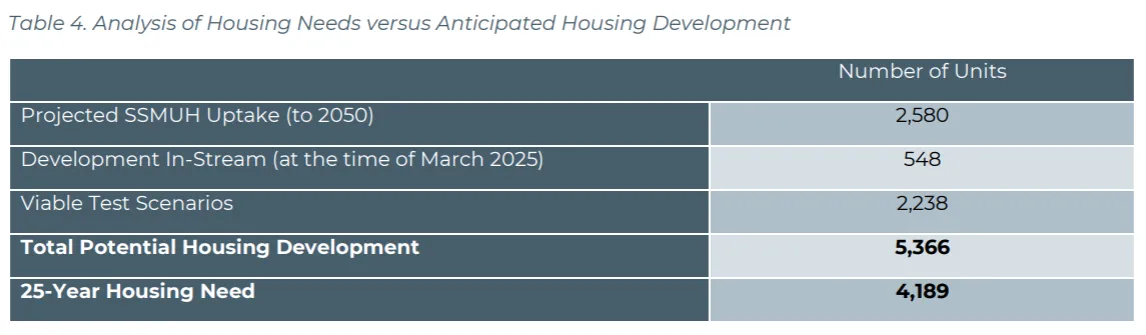
| Number of Units | |
|---|---|
| Projected SSMUH Uptake (to 2050) | 2,580 |
| Development In-Stream (at the time of March 2025) | 548 |
| Viable Test Scenarios | 2,238 |
| Total Potential Housing Development | 5,366 |
| 25-Year Housing Need | 4,189 |
Page 238–256
Proposed Land Use Scenarios
- Reflect initial feedback received from residents through surveys, open houses and workshops
- Past direction from Council and Town staff
- Legislative requirements
- Existing market conditions and development activity
- Existing land use patterns and infrastructure servicing capacity
Page 238–256
Proposed Land Use Scenarios
- The following key themes that emerged in the visioning survey were considered:
- Parks, Trails and Greenspace
- Commercial Services and Mixed-Use Development
- Improved Transportation Connections
- Community Spaces
- Walkable Neighbourhoods
- Other consideration: survey respondents demonstrated support for diversifying land use within existing neighbourhood villages and along corridors to provide more community amenities and housing options.
Page 238–256
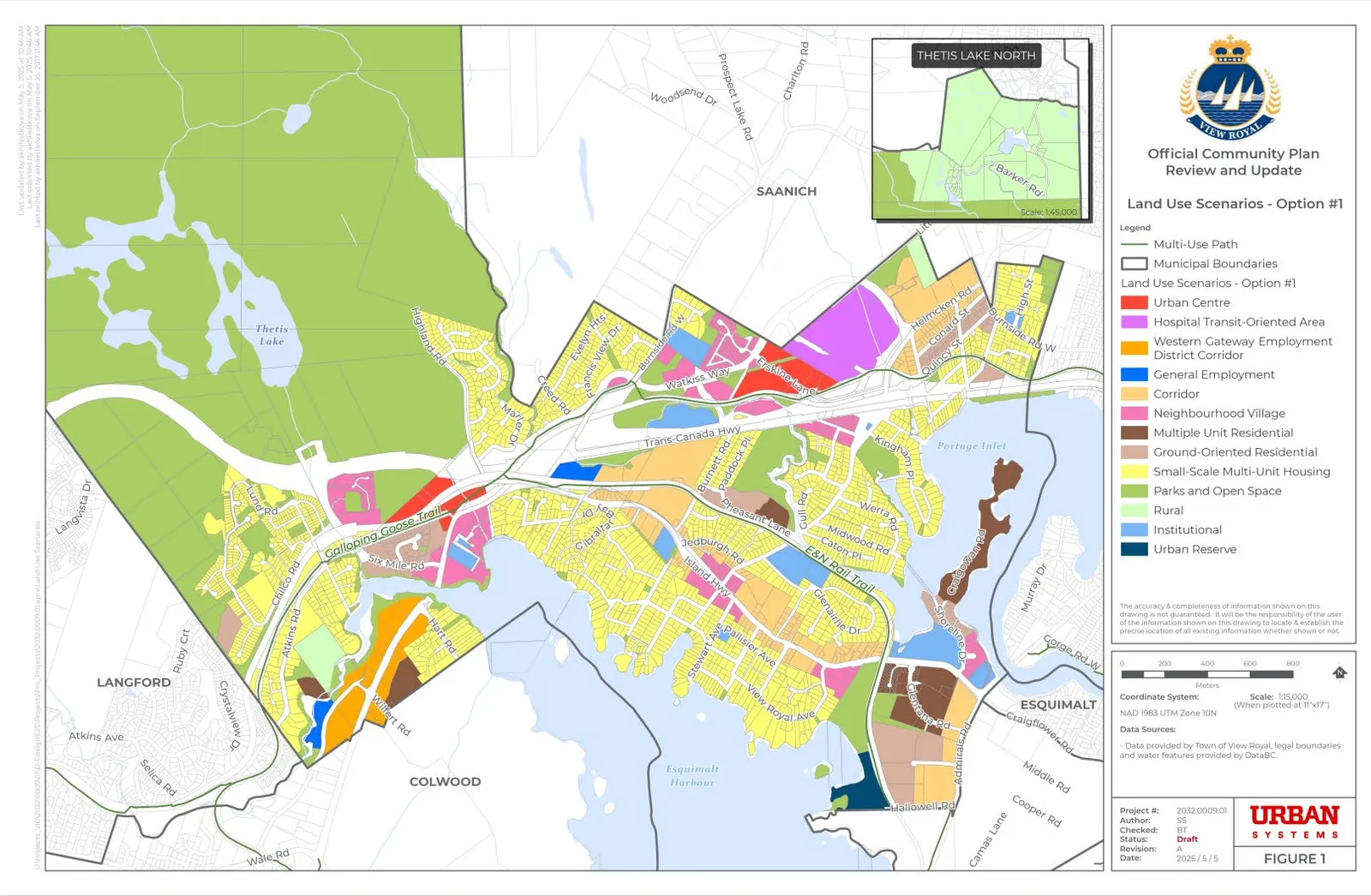
Land Use Scenario – Option #1
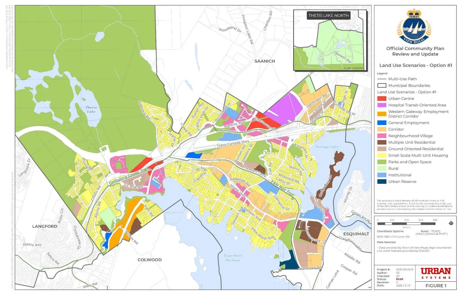
- Hospital TOA
- Urban Centre
- Western Gateway Employment District Corridor
- General Employment
- Neighbourhood Village
- Corridor
- Multiple-Unit Residential
- Ground-Oriented Residential
- Urban Reserve *Small-Scale Multi-Unit Housing *Park
Page 238–256
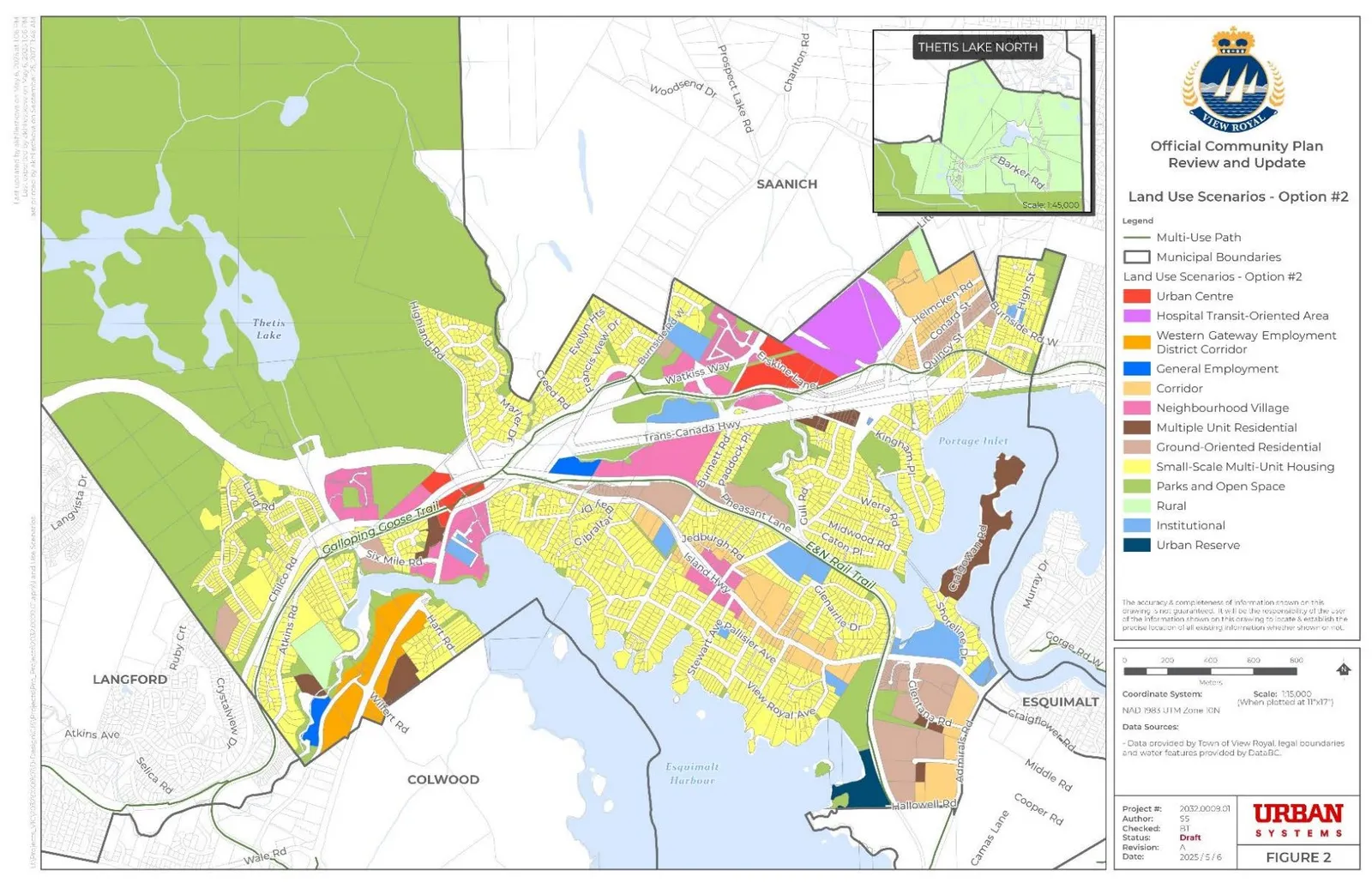
Land Use Scenario – Option #2
Page 238–256
Differences between Option 1 and 2
Option 1
Option 2
Page 238–256
Next Steps
- Conduct engagement on the proposed land use scenarios – Ask the public questions related to “Did we get it right?”
- Prepare a “What We Heard” Report and report back to the OCP Advisory Committee and Council.
- Following feedback from the public, Council, OCP Advisory Committee and staff, work through revisions and finalize a draft land use scenario for the 50% draft for further review and engagement.
Page 238–256
Document Images
(1)
Extracted from: 2025 05 13 Council Agenda - Agenda - Pdf