Vancouver Island Rail Transit Presentation
A proposal by Gwyer Webber advocating for passenger rail service on the Island Rail Corridor, including phase-in costs and proposed transit times.
Vancouver Island Rail Transit
Written by Gwyer Webber (2018-2024) www.railtransit.ca
- The Island Rail Corridor would be preserved for Passenger Rail Service and a Multi-Use Trail alongside the rail line.
- The rail line would be upgraded with new rail and concrete ties to allow for scheduled passenger rail service throughout the day.
- The rail line would be built in phases when funding is available.
[Map: Stylized overview of the Vancouver Island Rail Transit system showing station names and distances from Victoria (0km) to Campbell River (264km) and Port Alberni (63.4km)]
Phase 1: Victoria - Duncan
- Negotiate with the Songhees, Esquimalt, and Cowichan Tribes First Nations to allow Passenger Rail to run through the reserve.
- Stations at Duncan, Cobble Hill, Shawnigan Lake, Langford Exchange, Thetis Lake (Six Mile Rd), View Royal (Portage Park), Esquimalt (Lampson St), and Victoria (Douglas St/View St). Station platform length at 225m.
- Initially two trains would run every 90 to 120 minutes in each direction with both vehicles starting in Duncan.
- Two additional trains would allow for a frequency of every 30 minute from Langford to Victoria.
- Four additional trains would allow for a frequency of every 15 minute from Langford to Victoria
- The travel time between Duncan and Victoria is approximately 60 minutes.
- Travel time from Langford Exchange to Victoria is approximately 20 minutes.
- Travel time from View Royal to Victoria is approximately 10 minutes.
[Diagram: Linear station map for Phase 1 from Duncan to Victoria]
Phase 1 Cost
- The cost of the Ultimate Phase in the IRCCA Report from Victoria to Duncan was $151 million dollars prior to Covid.
- Additional cost for stations, rail vehicles, a maintenance building near Duncan, a signaling system, overhead power from Victoria to Langford, and a tunnel to downtown Victoria.
Island Rail Corridor Condition Assessment Report (Table 24, Page 74)
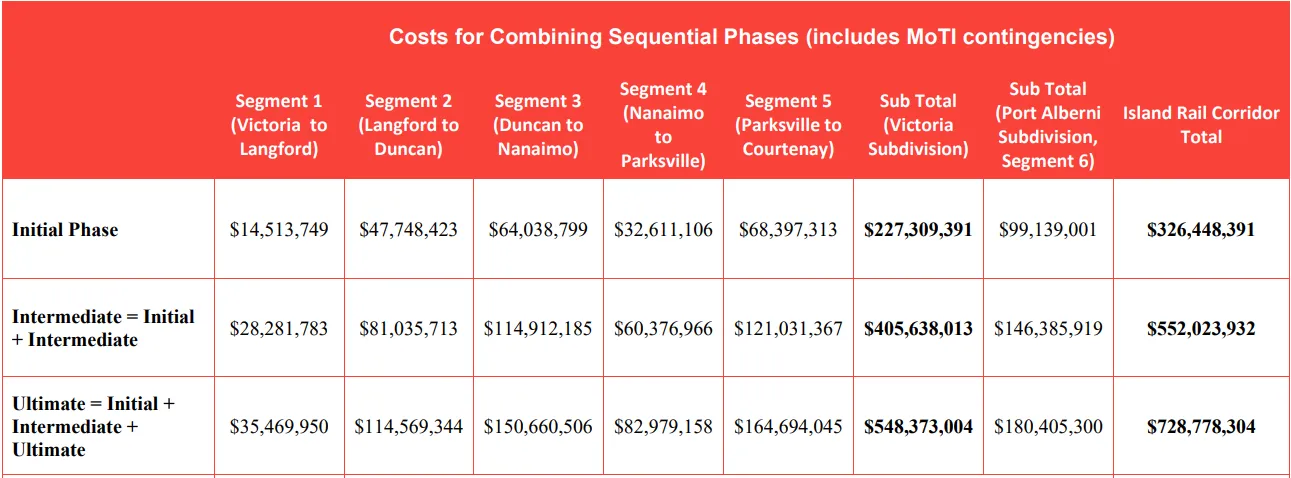
| Phase | Segment 1 (Victoria to Langford) | Segment 2 (Langford to Duncan) | Segment 3 (Duncan to Nanaimo) | Segment 4 (Nanaimo to Parksville) | Segment 5 (Parksville to Courtenay) | Sub Total (Victoria Subdivision) | Sub Total (Port Alberni Subdivision, Segment 6) | Island Rail Corridor Total |
|---|---|---|---|---|---|---|---|---|
| Initial Phase | $14,513,749 | $47,748,423 | $64,038,799 | $32,611,106 | $68,397,313 | $227,309,391 | $99,139,001 | $326,448,391 |
| Intermediate = Initial + Intermediate | $28,281,783 | $81,035,713 | $114,912,185 | $60,376,966 | $121,031,367 | $405,638,013 | $146,385,919 | $552,023,932 |
| Ultimate = Initial + Intermediate + Ultimate | $35,469,950 | $114,569,344 | $150,660,506 | $82,979,158 | $164,694,045 | $548,373,004 | $180,405,300 | $728,778,304 |
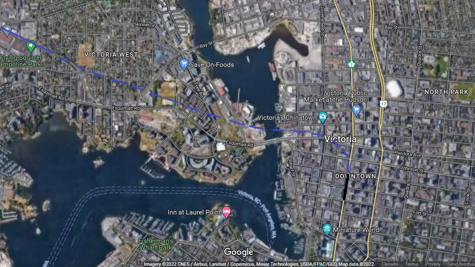
Downtown Victoria Station
A single-bore single track underground tunnel to a double track with centre platform would eliminate 7 level crossings and reduce travel time. The platform length would be 225m and the tunnel diameter would accommodate Bi Level EMUs with overhead power.
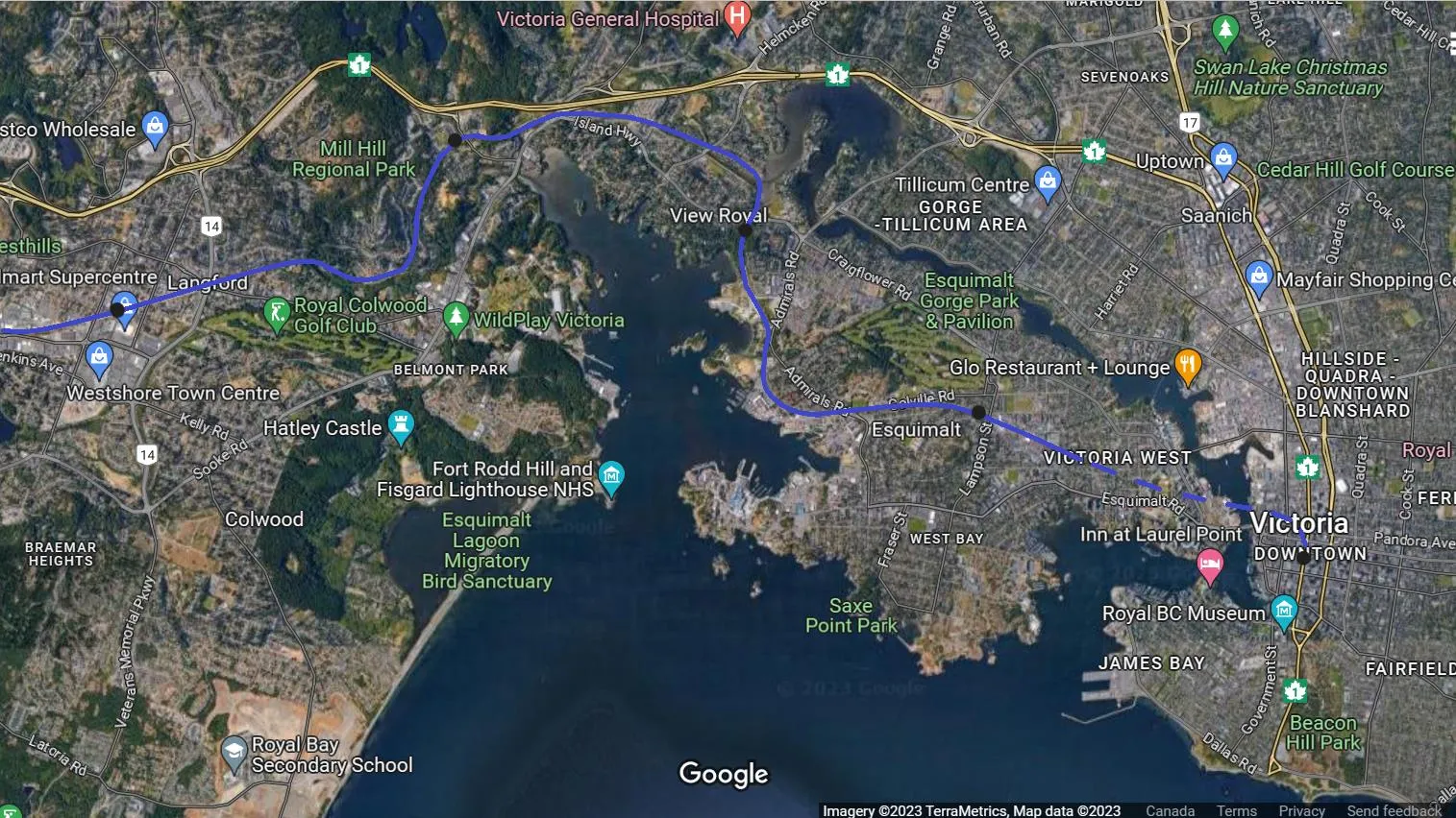
Victoria Area Stations
The stations in the Victoria area would be the passing sidings and located at Langford Exchange, Six Mile Rd, Portage Park, Lampson St, and Downtown Victoria. Overhead power from Langford Exchange to Downtown Victoria.
Rolling Stock
The picture below shows a Stadler FLIRT single-level DEMU. The Battery Electric Multiple Unit (BEMU) would be similar and include pantographs. Overhead power from Langford to Victoria and at the station platform in Duncan would be used to charge the trains.
[Rendering: Stadler FLIRT single-level train]
Bi-Level EMU
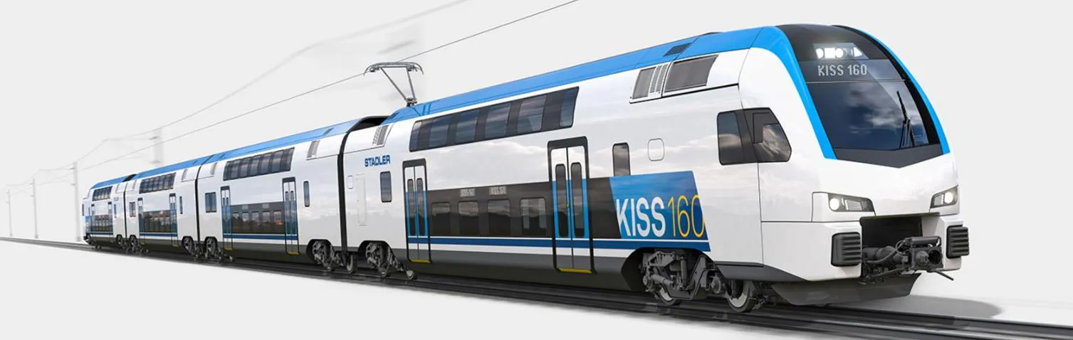
The picture below shows a Stadler KISS Bi-Level EMU. Caltrain has ordered a battery electric version with pantographs to test on sections with no overhead power.
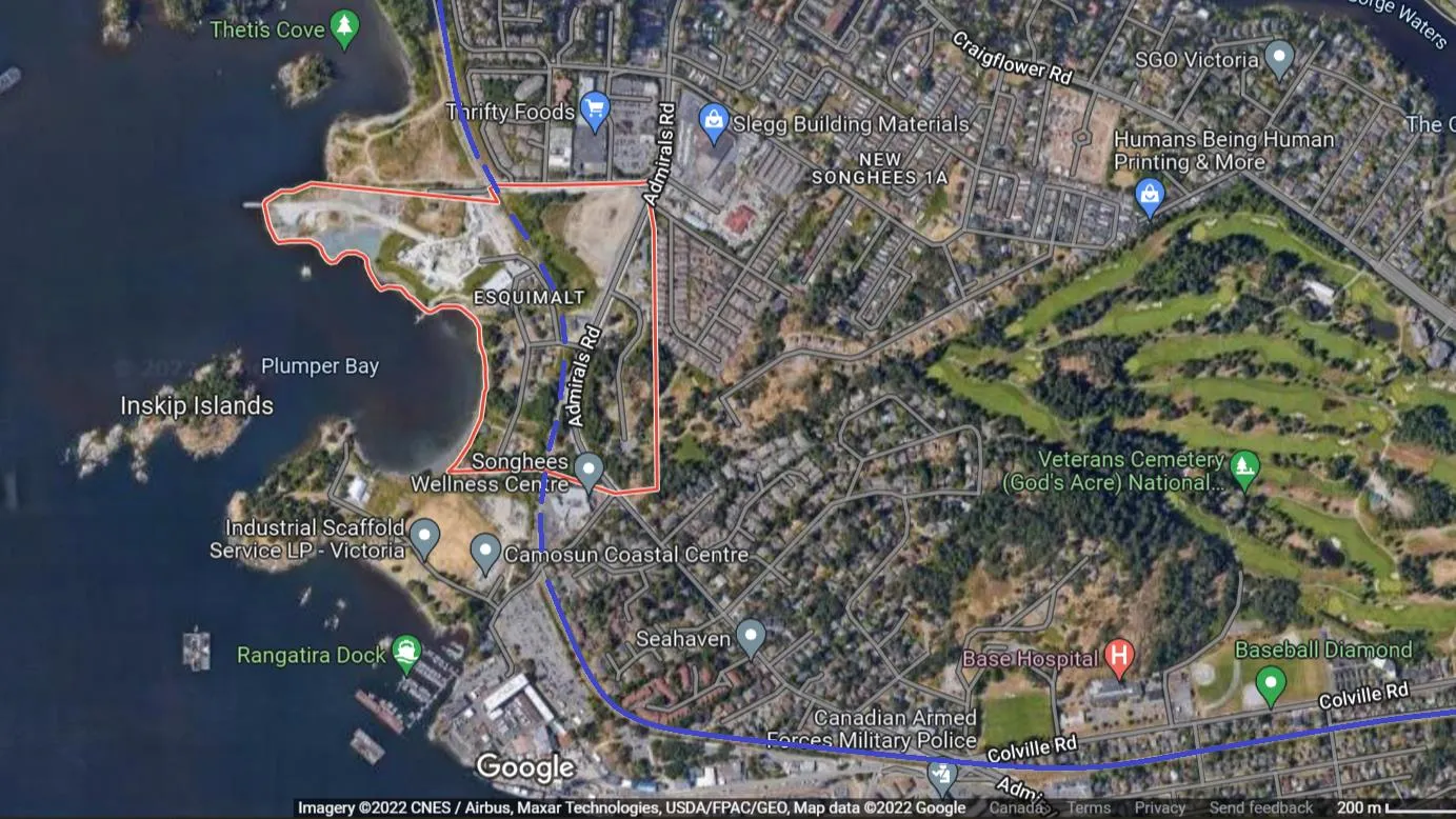
Esquimalt and Songhees First Nation Reserve
If required, the line would run underground (cut and cover) through Esquimalt and Songhees First Nations reserves.
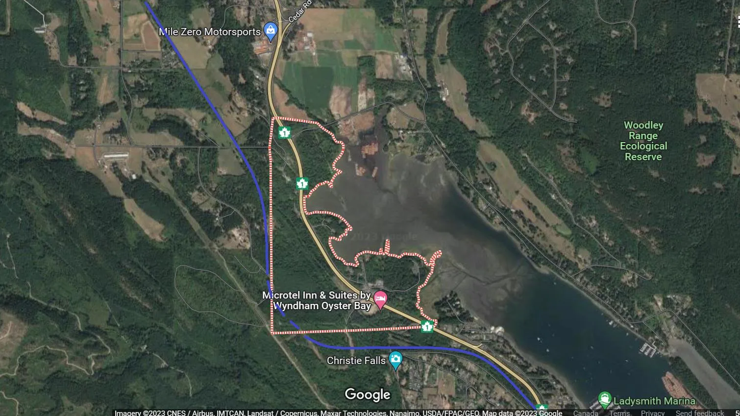
Halalt First Nation Reserve
The existing right of way can be returned to the Halalt First Nations and a new right of way built to the west of the reserve.
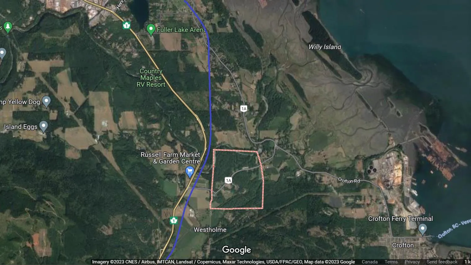
Stz’uminus First Nation Reserve
- Negotiate with the Stz’uminus First Nations to allow or move the existing right of way farther west.
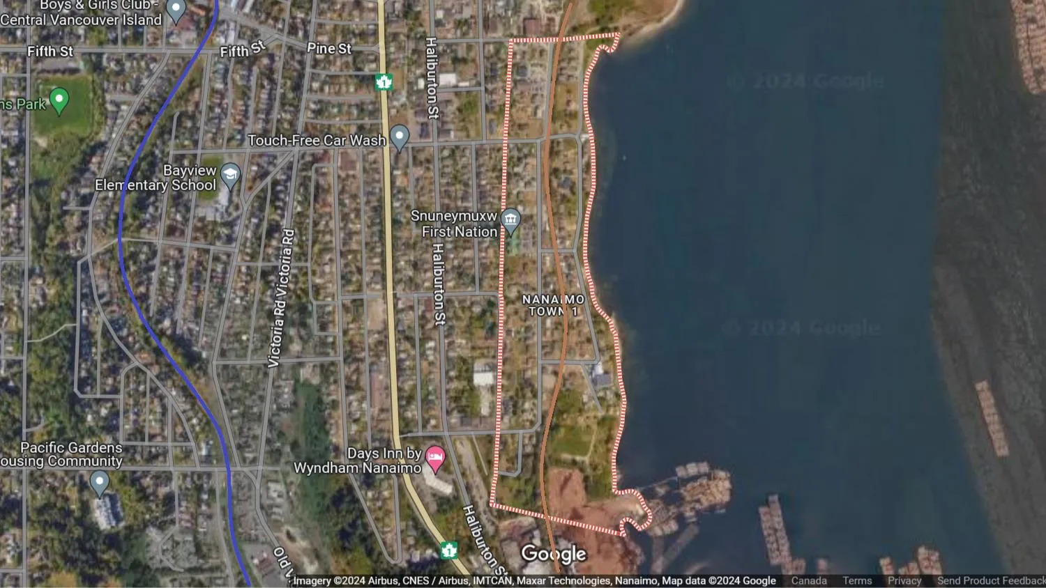
Snuneymuxw First Nations Reserve
- The existing freight rail operations would be moved to Duke Point including the propane depot.
- A rail link from Duke Point to the mainline is not required initially and could be done at a later date. When the link is built, freight would run at night only so as not to interfere with passenger rail service.
- The right of way can then be returned to Snuneymuxw First Nations and the Nanaimo Waterfront can be redeveloped.
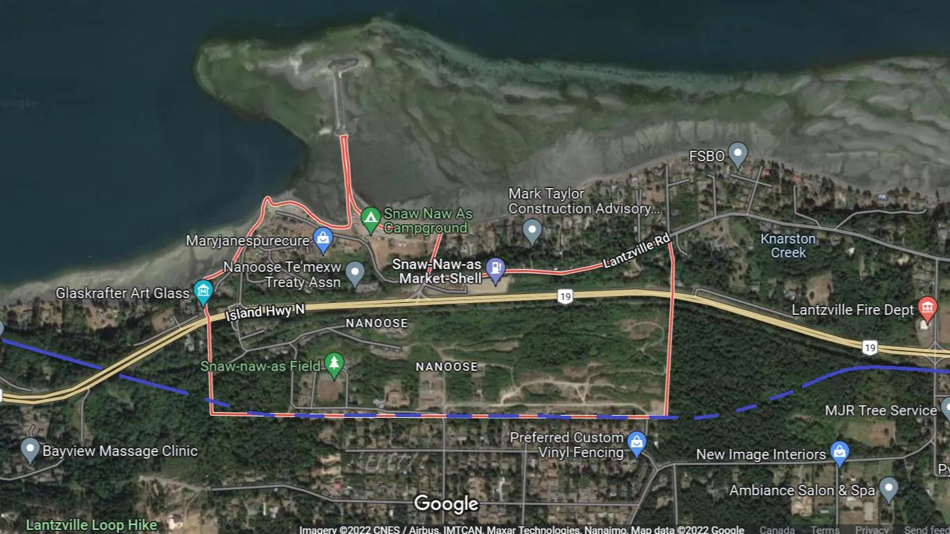
Snaw-Naw-As First Nation Reserve
The line would be underground around the reserve.
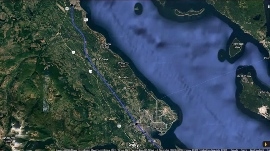
Extension to Campbell River
Campbell River Station
Parksville Station
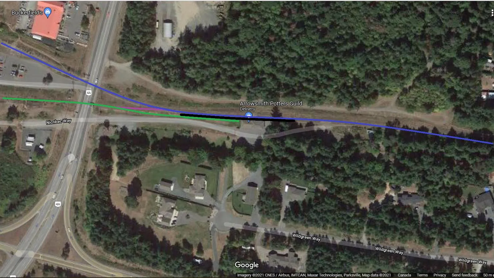
Blue denotes Victoria Sub and Green denotes Port Alberni Sub. Purple denotes Maintenance and Freight Link.
All Fare Zones
Fares are based on BC Transit Victoria single ticket price. BC Transit is proposing a single ticket price of $3 by 2025.
| Zone | 1 | 2 | 3 | 4 | 5 | 6 | 7 |
|---|---|---|---|---|---|---|---|
| City | CRD | Shawnigan, Cobble Hill, Duncan | Chemainus, Ladysmith, YCD | Nanaimo, Lantzville | Parksville, Qualicum, Coombs | Buckley Bay, Courtenay, Pt Alberni | Campbell River |
| Zones | 1 | 2 | 3 | 4 | 5 | 6 | 7 |
|---|---|---|---|---|---|---|---|
| Fares | $3.00 | $6.00 | $9.00 | $12.00 | $15.00 | $18.00 | $21.00 |
| Monthly Pass | $90 | $130 | $170 | $210 | $250 | $290 | $330 |
Note: Children 12 years and under ride free. Children 5 years and under must be accompanied by someone 12 years and older.
Example
Individual Ticket: Courtenay-Victoria $18.00 / Nanaimo-Victoria $12.00 / Parksville-Duncan $12.00
Colwood Rapid Transit
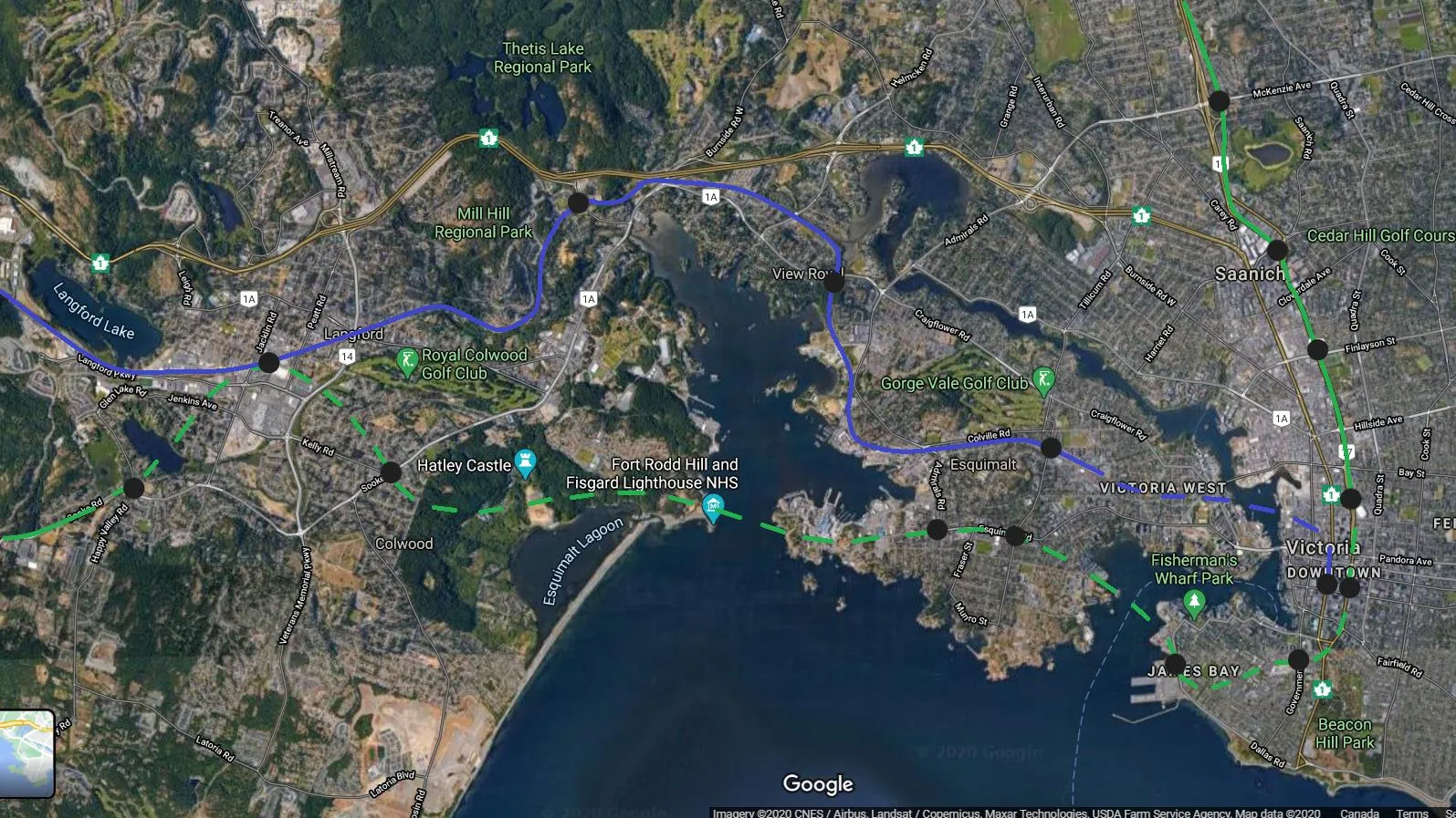
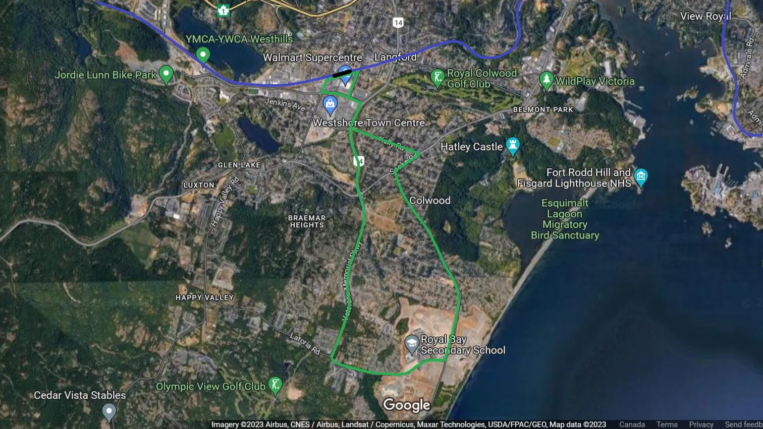
This is an option for a Colwood Rapid Bus when the E&N is upgraded and running a train every 15 minutes from Langford Exchange to Downtown Victoria. The roads would be upgraded to allow for bus only lanes.
Future Victoria Metro
The line would eventually extend from Sooke to Sidney. Travel time from Langford Exchange to Downtown Victoria (13.5km) would be approximately 18 minutes. Travel time from Kelly Rd/Sooke Rd to Downtown Victoria (11.5km) would be approximately 15 minutes.