This site is in beta — data may be incomplete and features are still being added.
Council Meeting/Documents/Highway 1 McKenzie I/C to Colwood I/C Bus On Shoulder Project Update
Presentation

Highway 1 McKenzie I/C to Colwood I/C Bus On Shoulder Project Update

February 6, 2024Pages 37–5010 sections

Presentation slides detailing the scope, status, and planned improvements for the Highway 1 transit priority project.

5.b) T. Stevens, McElhanney Ltd., Re: Highway 1 Bus on Shoulder - Helmcken to Colwood Project
90% Detailed Design Underway as of January 2024Detailed Design Complete target: June 2024Includes plans for Galloping Goose Trail Bridge improvementsProject covers areas from McKenzie Avenue to the Colwood interchange

Highway 1 McKenzie I/C to Colwood I/C Bus On Shoulder Project

Project Update Meeting for Town of View Royal Council

February 6, 2023

Page 37–50

What’s Covered

  • Background
  • Project scope
  • Project schedule
  • Current status
  • Potential impacts on the Town of View Royal
  • Town of View Royal concerns
  • Next steps
Page 37–50

Background

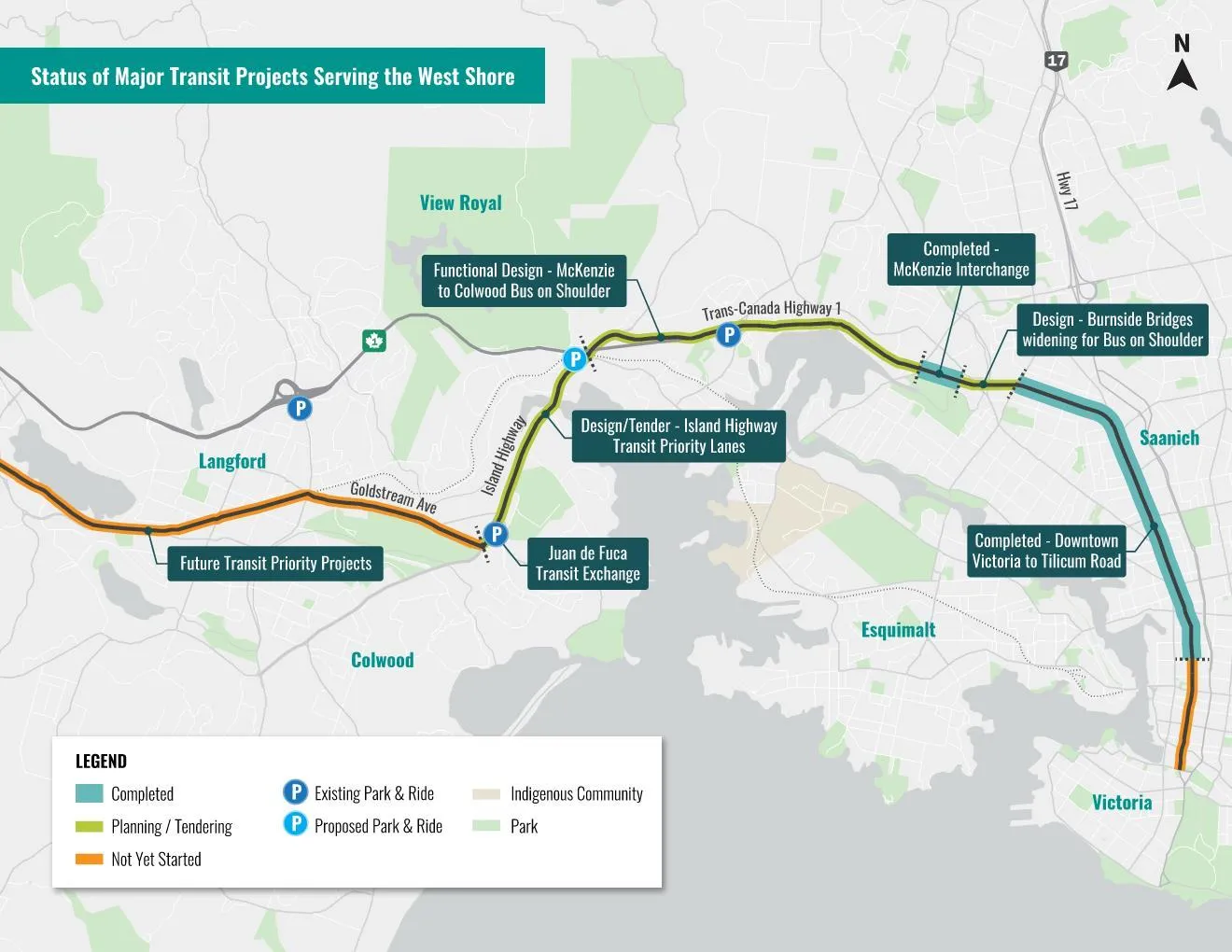
Map showing the status of major transit projects serving the West Shore area, including completed, planning/tendering, and not yet started phases.
Page 37–50

PROJECT SCOPE

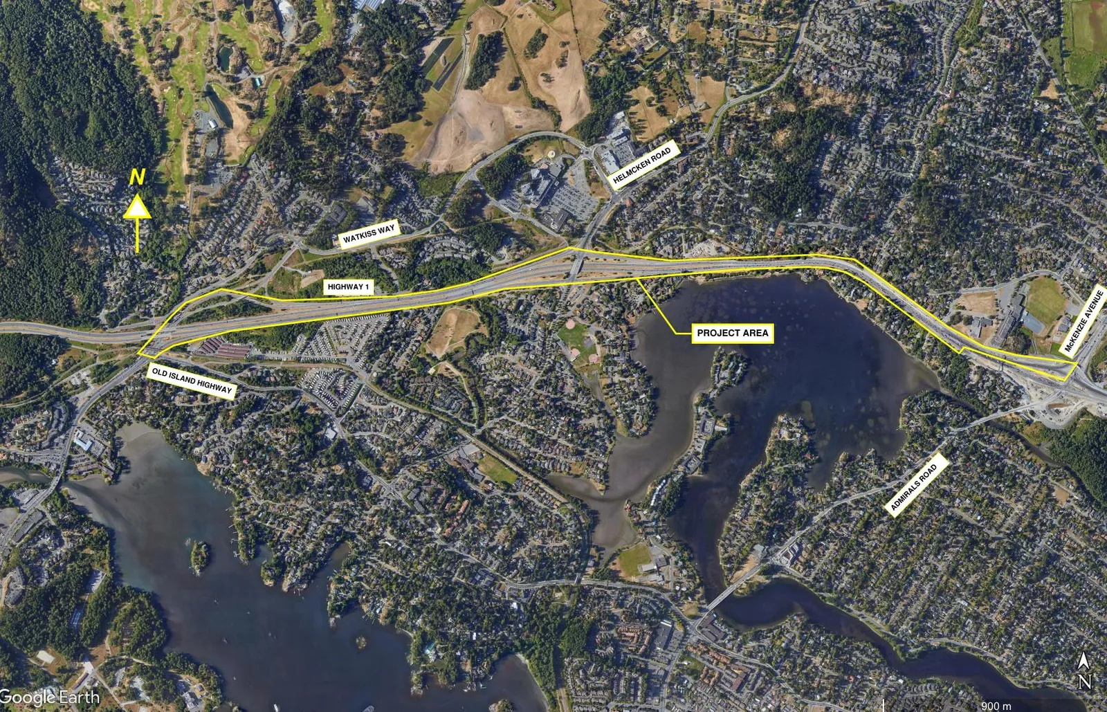
Satellite aerial view map outlining the project area along Highway 1, between McKenzie Avenue and the Old Island Highway.

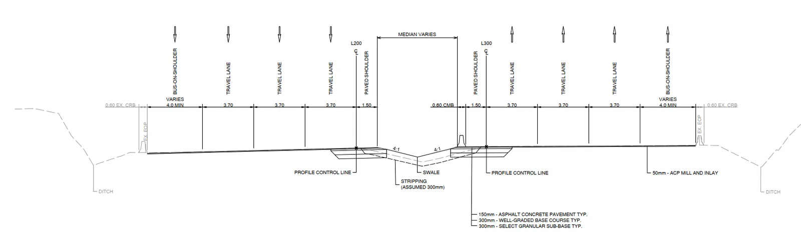
CROSS SECTION HELMCKEN TO COLWOOD

Engineering cross-section diagram of the highway from Helmcken to Colwood, showing travel lanes, paved shoulders, and bus-on-shoulder lanes.

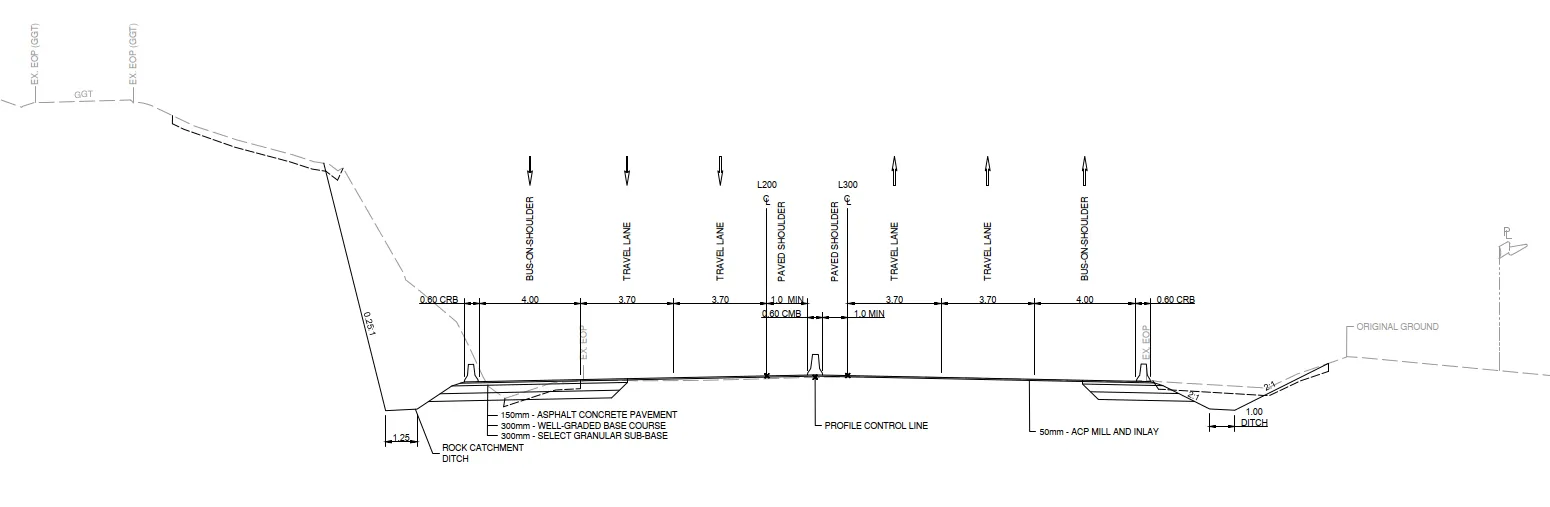
CROSS SECTION EAST OF HELCKEN

Engineering cross-section diagram of the highway east of Helmcken, detailing the bus-on-shoulder lanes, travel lanes, and rock catchment ditch.
Page 37–50

CURRENT PROJECT STATUS

  • Preliminary Design Complete – May 2022
  • Functional Design Complete – September 2022
  • Geotechnical Investigations – 90% Complete
  • 50% Detailed Design – Complete
  • 90% Detailed Design Underway – January 2024
  • Detailed Design Complete – June 2024
Page 37–50

PLANNED IMPROVEMENTS AT BURNSIDE ROAD WEST
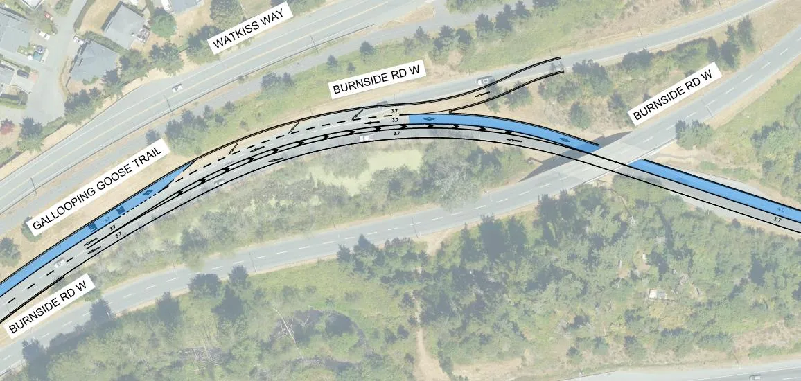
Plan view map of planned improvements at the intersection of Burnside Road West and the Galloping Goose Trail, showing new lane alignments.
Page 37–50

PLANNED IMPROVEMENTS AT HELMCKEN I/C

PROPOSED
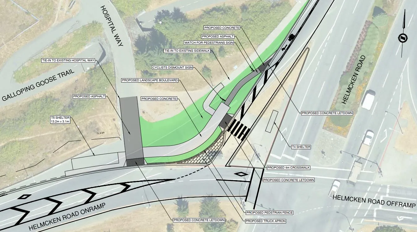
Detailed site plan of proposed transit and pedestrian improvements at the Helmcken Interchange, including new shelters, crosswalks, and sidewalk tie-ins.

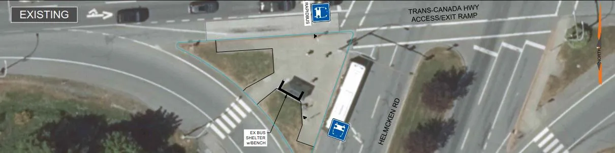
EXISTING

Detail aerial view showing the existing bus shelter and pedestrian configuration at the Helmcken Interchange.

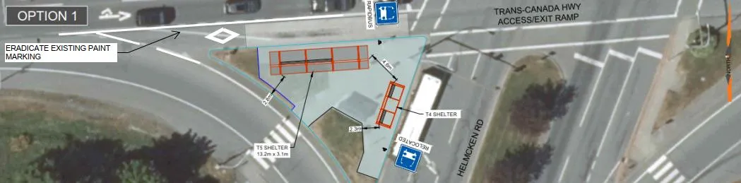
PROPOSED

Detail plan view of proposed transit stop enhancements at Helmcken Interchange, featuring a T4 shelter and a 13.2m x 3.1m T5 shelter.
Page 37–50

GALLOPING GOOSE TRAIL BRIDGE
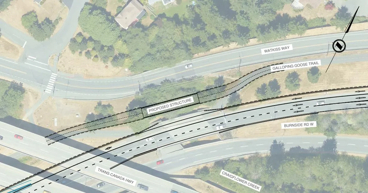
Map showing the location and alignment of the proposed Galloping Goose Trail Bridge structure near Burnside Road West and Highway 1.

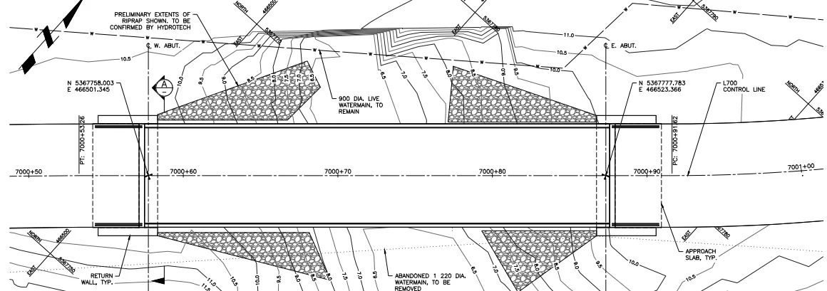
General Arrangement

Engineering plan view drawing of the general arrangement for the Galloping Goose Trail Bridge.
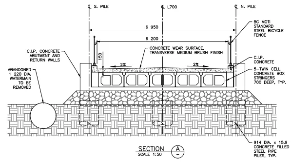
Engineering drawing of "Section A" for the bridge structure, detailing the concrete wear surface, steel bicycle fence, and concrete filled steel pipe piles.
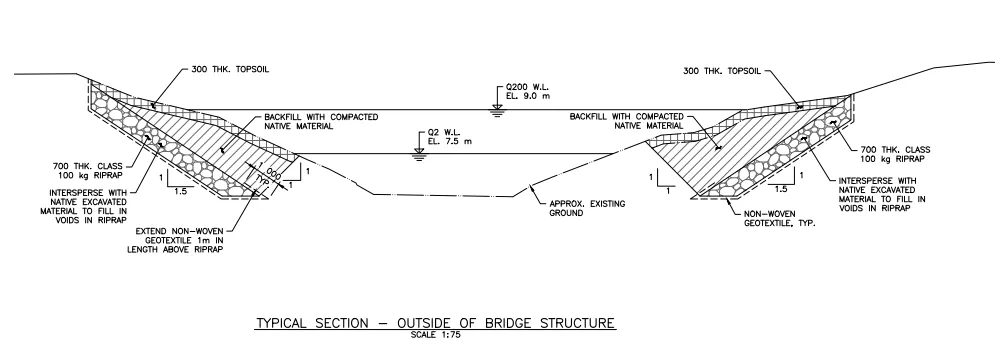
Engineering drawing showing a typical section of the landscape and riprap configuration outside of the bridge structure.
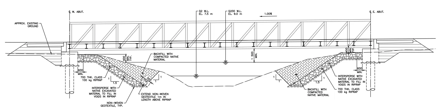
Engineering elevation drawing of the bridge structure, showing its height above the creek and existing ground levels.
Page 37–50

TOWN OF VIEW ROYAL QUESTIONS

Page 37–50

THANK YOU

Page 37–50

Document Images

(2)

Document image
Document image
Extracted from: 2024 02 06 Council Agenda - Agenda - Pdf