Appendix: Seismic hazard investigations at select DND facilities
Excerpts from a 2022 Geological Survey of Canada report investigating seismic risks in southwestern British Columbia.
GEOLOGICAL SURVEY OF CANADA OPEN FILE 8934
Seismic hazard investigations at select DND facilities in southwestern British Columbia: subduction, in-slab, and crustal scenarios
C. Paul and J.F. Cassidy
2022
Additional information for Notice of Motion
The Leech River fault line runs east / west, just 5 km south of Thetis Lake historic dam 3
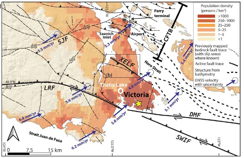
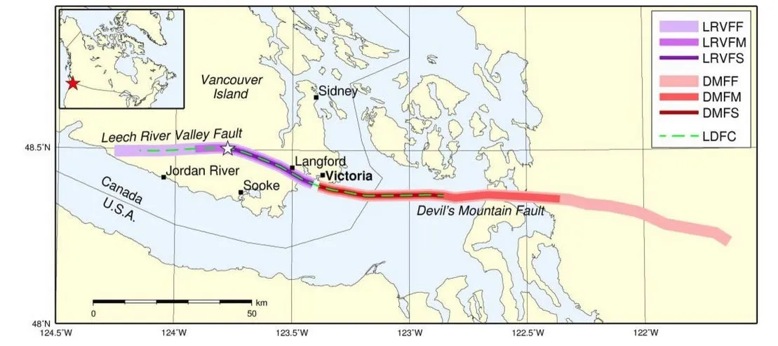
The Leech River and Devil’s Mountain are connected
2022 report for the DND Page 16
“… the smallest magnitude event, the proximity to Greater Victoria yields the highest amplitude of shaking”
6.3 CRUSTAL
The Leech River Valley – Devil’s Mountain Fault scenario was the smallest magnitude of our three scenarios at $M_w$ 6.4. This scenario occurs along a shallow rupture plane (1 to 30 km deep) following the LRV-DMF trace offshore of Greater Victoria towards the Leech River Valley. The PGA map (Figure 14) shows that although it is the smallest magnitude event, the proximity to greater Victoria yields the highest amplitude of shaking (maximum PGA of 0.58g experienced in Langford). The ground-shaking drops off to modest shaking at ~75 km from the rupture plane and light shaking within 150 km. The quick attenuation of the shaking intensities means that only light shaking is experienced in most of Greater Vancouver and central Vancouver Island (including Comox). The amplification due to the soft soils of the Fraser River Delta generates modest shaking in Richmond.
Like the other two scenarios, we calculated the SA at differing periods (0.1, 0.2, 0.3, 0.5, 0.6, 1.0, 2.0, 5.0 and 10.0 seconds). Additionally, we calculated the Peak Ground Velocity (PGV). The hazard spectra display the extreme localization of shaking (Figure 15), as the peak amplitude in Victoria is five times that felt in Vancouver on similar soil and more than ten times that in Nanaimo.
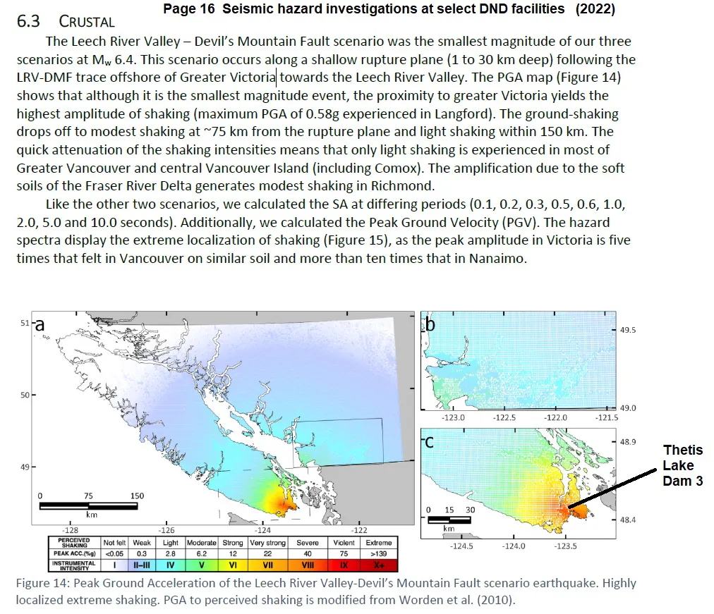
| PERCEIVED SHAKING | Not felt | Weak | Light | Moderate | Strong | Very strong | Severe | Violent | Extreme |
|---|---|---|---|---|---|---|---|---|---|
| PEAK ACC.(%g) | <0.05 | 0.3 | 2.8 | 6.2 | 12 | 22 | 40 | 75 | >139 |
| INSTRUMENTAL INTENSITY | I | II–III | IV | V | VI | VII | VIII | IX | X+ |
Figure 14: Peak Ground Acceleration of the Leech River Valley-Devil’s Mountain Fault scenario earthquake. Highly localized extreme shaking. PGA to perceived shaking is modified from Worden et al. (2010).