TOWN OF VIEW ROYAL COUNCIL REPORT: ENVIRONMENTAL DEVELOPMENT PERMIT WITH VARIANCE 2022/11 – 302 BESSBOROUGH AVENUE
Staff report recommending approval of a Development Permit with Variance to replace a wooden stair platform with a new stairway, gangway, and floating dock.
TOWN OF VIEW ROYAL COUNCIL REPORT
TO: Council DATE: March 27, 2023 FROM: Stirling Scory, RPP, MCIP MEETING DATE: April 4, 2023 Community Planner
ENVIRONMENTAL DEVELOPMENT PERMIT WITH VARIANCE 2022/11 – 302 BESSBOROUGH AVENUE
RECOMMENDATION:
THAT Development Permit 2022/11 be approved as per the March 27, 2023 report titled “Environmental Development Permit with Variance 2022/11 – 302 Bessborough Avenue”;
AND THAT Development Permit 2022/11 include the following variance:
- variance to Section 3.8.2 of Zoning Bylaw No. 900, 2014 to reduce the minimum required setback from the Present Natural Boundary of the Sea for any structure from 15.0m to 0.0m.
PURPOSE:
To consider a Development Permit with Variance, first introduced to the Committee on February 14, 2023, for consideration that would permit the construction of a staircase and decking, a new gangway, and new floating dock within the Natural Watercourse and Shoreline Areas Development Permit Area.
TIME CRITICAL:
The applicant’s installation time approved by the Department of Fisheries and Oceans (DFO) is between July 1 and October 1 or December 1 and February 15 of any year.
EXECUTIVE SUMMARY:
The proposal is to replace an existing wooden stair platform structure with a new stairway with platformed tiers (two in total), a new gangway ramp, and a new floating dock to provide more accessible, useable access to the waterfront. The new structure is smaller in size but requires a variance to permit construction of such a structure within 15 m of the natural boundary of the sea.
BACKGROUND:
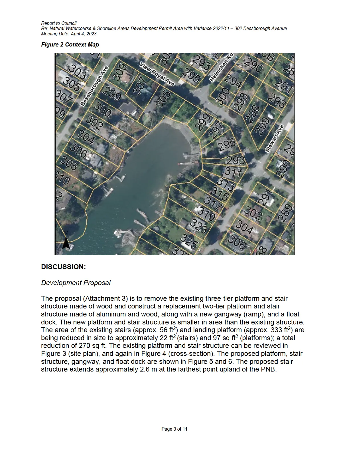
The 1415 m² waterfront property (Figure 1 and 2), accessible from Limekiln Cove, is currently zoned R-1 Detached Residential (Large Lot) and designated Residential Large Lot in the Official Community Plan (OCP). A portion of the property is designated to be within the Natural Watercourse and Shorelines Areas Development Permit Area. The property is presently occupied by an existing single-family dwelling and wooden staircase/platform structure made up of three tiers.
Figure 1 Survey Plan, 302 Bessborough Ave
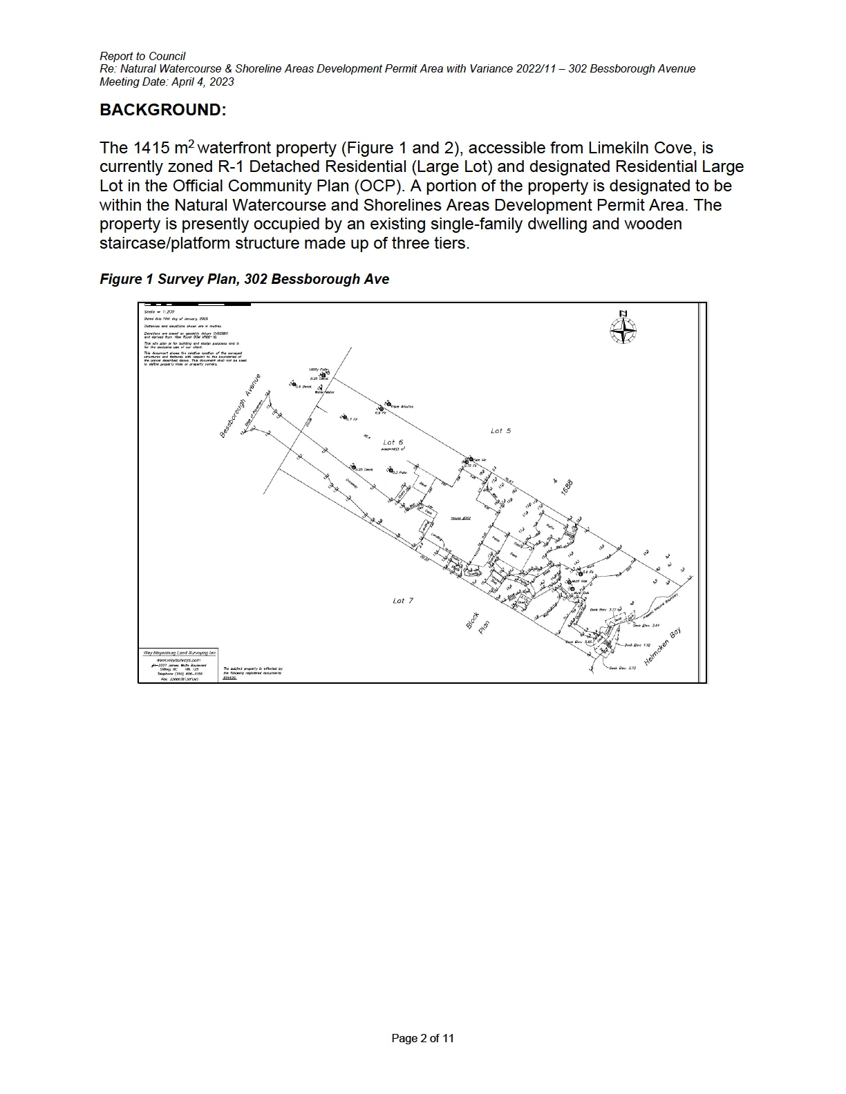
Figure 2 Context Map
DISCUSSION:
Development Proposal
The proposal (Attachment 3) is to remove the existing three-tier platform and stair structure made of wood and construct a replacement two-tier platform and stair structure made of aluminum and wood, along with a new gangway (ramp), and a float dock. The new platform and stair structure is smaller in area than the existing structure. The area of the existing stairs (approx. 56 ft²) and landing platform (approx. 333 ft²) are being reduced in size to approximately 22 ft² (stairs) and 97 sq ft² (platforms); a total reduction of 270 sq ft. The existing platform and stair structure can be reviewed in Figure 3 (site plan), and again in Figure 4 (cross-section). The proposed platform, stair structure, gangway, and float dock are shown in Figure 5 and 6. The proposed stair structure extends approximately 2.6 m at the farthest point upland of the PNB.
Figure 3 Existing Structure Site Plan
Figure 4 Existing Structure Cross Section
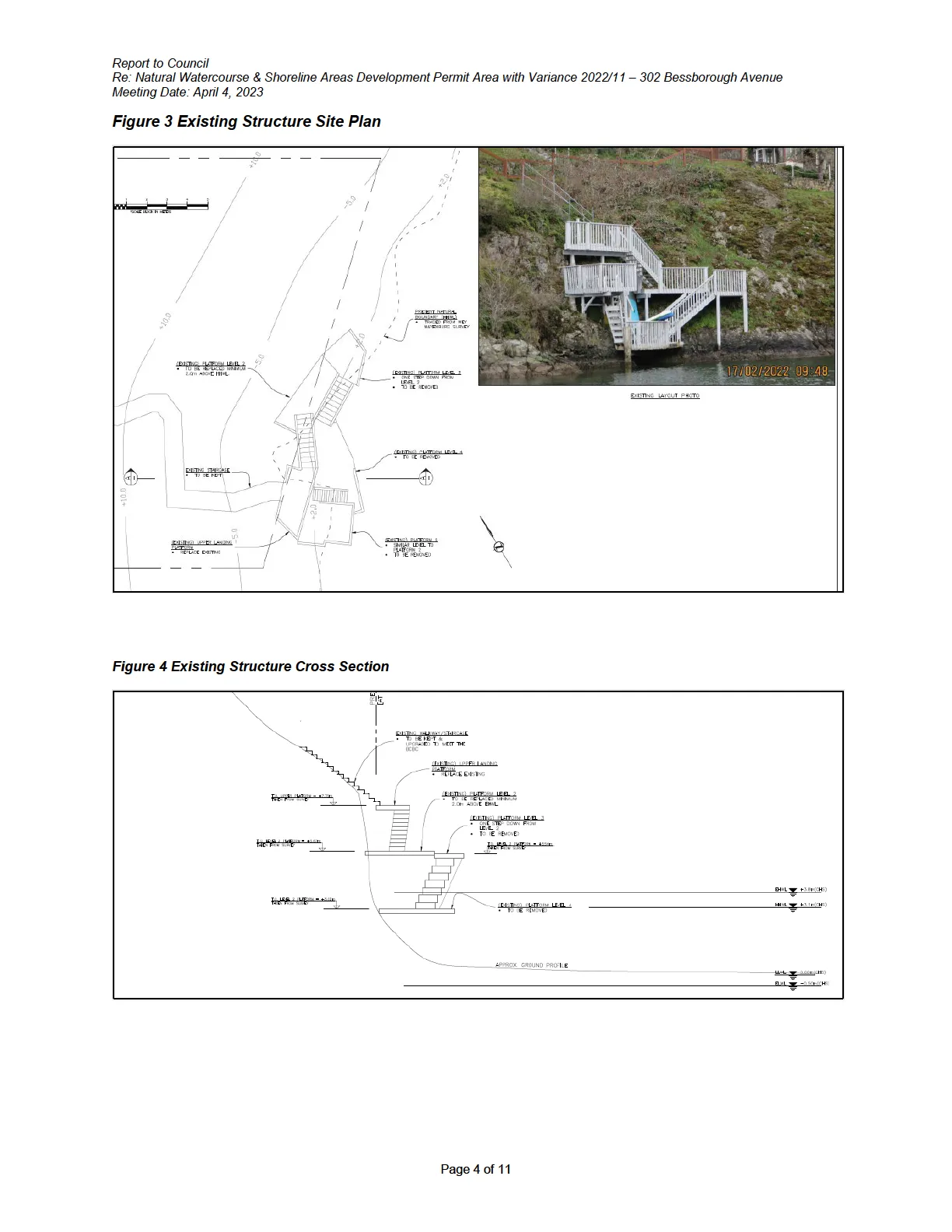
Figure 5 Proposed Structure Site Plan
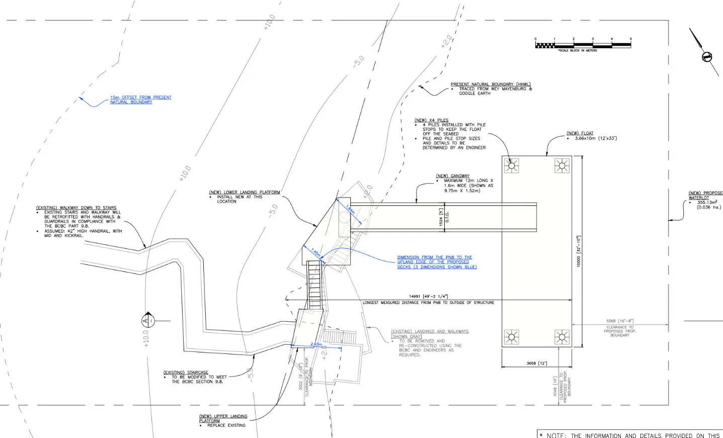
Figure 6 Propose Structure Cross Section
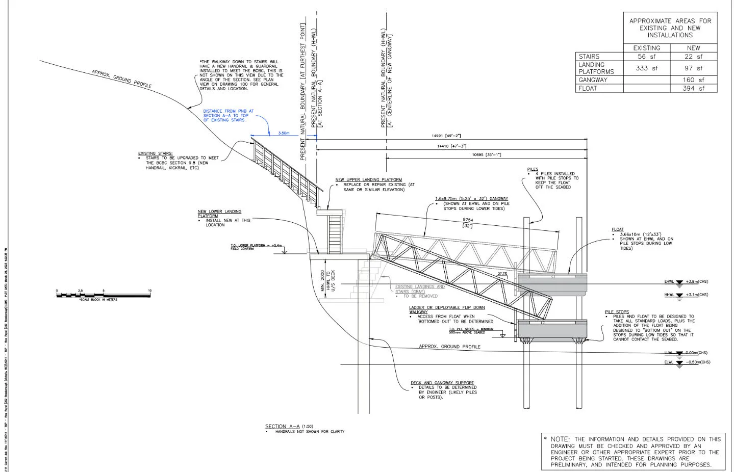
APPROXIMATE AREAS FOR EXISTING AND NEW INSTALLATIONS
| EXISTING | NEW | |
|---|---|---|
| STAIRS | 56 sf | 22 sf |
| LANDING PLATFORMS | 333 sf | 97 sf |
| GANGWAY | 160 sf | |
| FLOAT | 394 sf |
Site Review
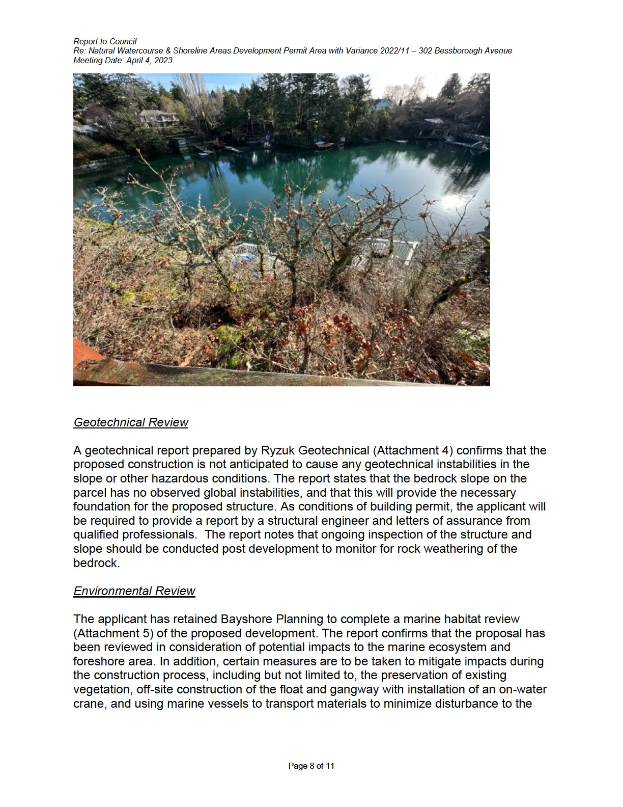
Staff visited the site and took some photos (see below) of the existing platform and stair structure, and vegetation. Development of the site is constrained by the steep bedrock slope in the rear yard. Constructing smaller platforms in the same location will reduce further disturbance to the slope area, and the reduced size in structure area will encourage regrowth and natural restoration of vegetation on the rock slope. There is a small Garry oak cluster within the vicinity of the rock slope.
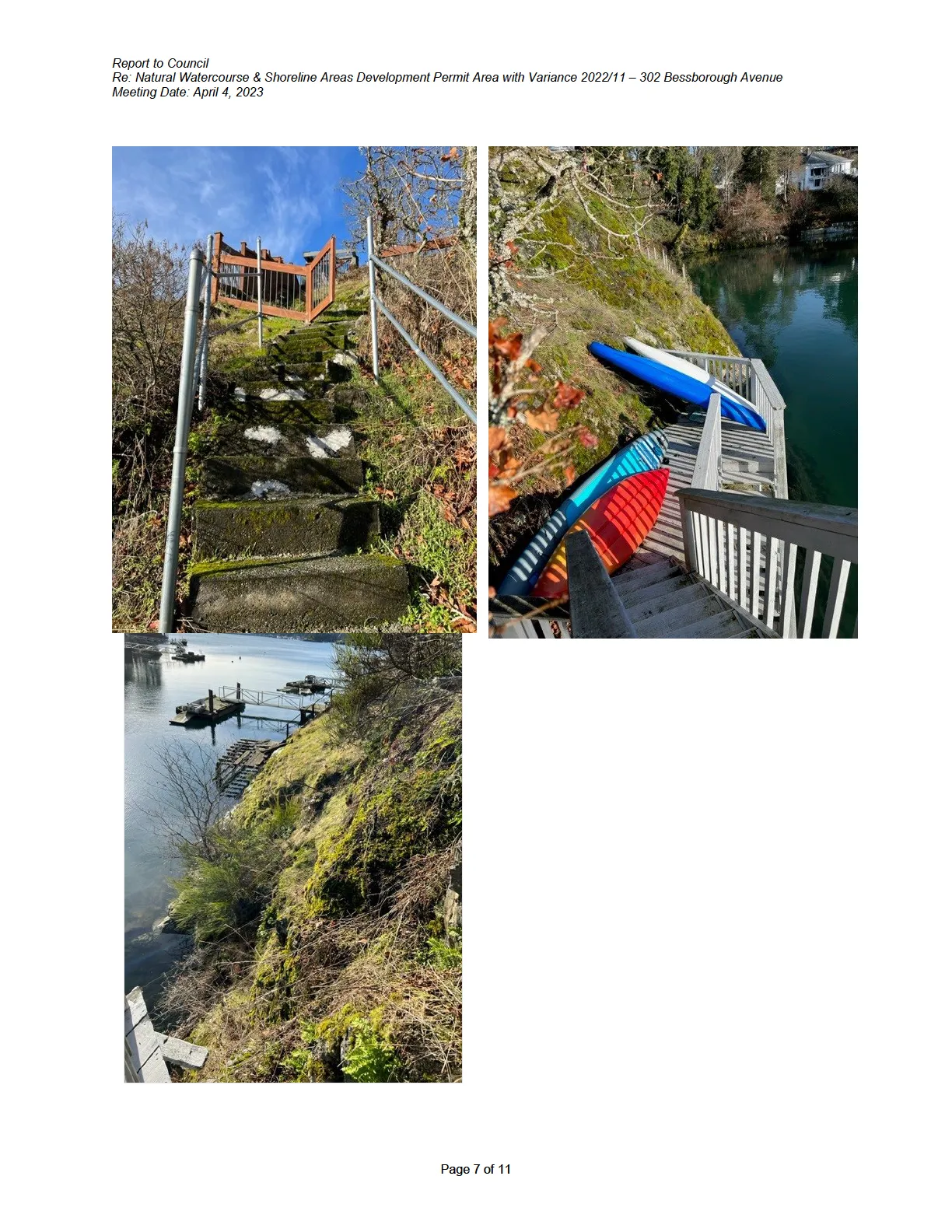
Geotechnical Review
A geotechnical report prepared by Ryzuk Geotechnical (Attachment 4) confirms that the proposed construction is not anticipated to cause any geotechnical instabilities in the slope or other hazardous conditions. The report states that the bedrock slope on the parcel has no observed global instabilities, and that this will provide the necessary foundation for the proposed structure. As conditions of building permit, the applicant will be required to provide a report by a structural engineer and letters of assurance from qualified professionals. The report notes that ongoing inspection of the structure and slope should be conducted post development to monitor for rock weathering of the bedrock.
Environmental Review
The applicant has retained Bayshore Planning to complete a marine habitat review (Attachment 5) of the proposed development. The report confirms that the proposal has been reviewed in consideration of potential impacts to the marine ecosystem and foreshore area. In addition, certain measures are to be taken to mitigate impacts during the construction process, including but not limited to, the preservation of existing vegetation, off-site construction of the float and gangway with installation of an on-water crane, and using marine vessels to transport materials to minimize disturbance to the foreshore and seabed areas. The applicants will also follow the proposed period of construction provided by the Department of Fisheries and Oceans.
While the habitat review does confirm that all efforts will be made to limit the impact of flora/habitat during the removal of the stairways, the applicant will likely need to apply for a tree permit, complete with a tree protection plan, to ensure that the Garry oak cluster near these stairways are protected.
DFO and DND Review
The Departments of Fisheries and Oceans and National Defence have reviewed the proposal and confirm that the proposal meets the federal requirements as per their review process; no concerns were raised (see Attachments 6 and 7).
Official Community Plan Review
Under the Official Community Plan (OCP), proposed development on lands and in waters within the Development Permit Area (DPA): Natural Watercourse and Shoreline Area is reviewed against specific environmental guidelines. The proposal meets the intent and guidelines of the OCP Natural Watercourse and Shoreline Area Development Permit guidelines, including but not limited to the following:
General Environmental Design Guidelines:
- Retention of existing vegetation and limited impact to the upland area of the present natural boundary.
- Shoreline development impacts are mitigated through prevention and mitigation efforts (further details in the environmental report).
In addition, the construction of the new gangway and float dock provides the following environmental benefits:
- proposed gangway and dock are located within the proposed water lot license area of the property and do not inhibit the use of the cove for other watercraft
- the proposal reduces the overall site coverage and should allow for greater vegetation recovery and restoration on the slope
- the proposal avoids the use of a solid core pier and instead opts for a floating dock structure and pilings which reduces impact to the seabed, currents, and marine ecosystem.
View Royal Dock Guidelines Policy
The Town has a View Royal Dock Guidelines Policy, which specifies the general design and building practices for the installation, repair, or replacement of docks and ramps. The proposal meets the intent of the Policy. At the February 14, 2023, Committee of the Whole meeting, it was highlighted that the proposed float dock and ramp exceeded the maximum length and width identified in the policy. The applicant has revised the size of the proposed dock and ramp to comply with the guidelines in the Policy.
Zoning Bylaw Review
The applicant requests a variance to Section 3.8.2 of the Zoning Bylaw, to construct a structure within 15 m of the natural boundary of the sea (the present natural boundary).
The variance can be supported because DND and DFO have no concerns with the proposed work in the DPA as the proposal would unlikely cause negative impacts on the marine environment. The proposal also complies with the Natural Watercourse and Shoreline Areas Development Permit Area guidelines.
Public Correspondence and Comment
At the time of writing this report, staff have not received any comments from the public regarding the application. In January of 2023, the homeowners prepared a survey to petition their neighbours for support for the proposal and received a total of 22 signatures of support (Attachment 8).
SUSTAINABILITY/CLIMATE CHANGE IMPACTS:
The proposal meets the environmental design guidelines for the Natural Watercourse and Shoreline Areas Development Permit Area. The environmental report provided by the applicant confirms that the works to be completed would not negatively impact the foreshore area.
FINANCIAL IMPLICATIONS:
The application does not have any financial implication on the Town.
ALTERNATIVES:
There are no alternative recommendations.
CONCLUSION:
The proposal for the construction of a new platform and stair structure, gangway, and floating dock and associated variance can be supported because it complies with the applicable development permit area guidelines and View Royal Dock Guidelines Policy. It is recommended that Council approve the Development Permit with Variance application.
| CONCURRENCE: | Initials | Comments |
|---|---|---|
| Chief Administrative Officer | Ka | Recommend Approval |
| REVIEWED BY: | Initials |
|---|---|
| Director of Corporate Administration | NA |
| Director of Finance | NA |
| Director of Development Services | LT |
| Director of Engineering and Parks | IL |
| Director of Protective Services | NA |
ATTACHMENTS:
- Letter to Mayor and Council
- Survey Plan
- Project Plans
- Geotechnical Review Report
- Marine Habitat Review Report
- Approval from DND
- Approval from DFO
- Letters of Support (Neighbours)
Document Images
(3)