This site is in beta — data may be incomplete and features are still being added.
Council Meeting/Documents/Appendix B. Project Site shoreline photographs
Appendix

Appendix B. Project Site shoreline photographs

April 4, 2023Pages 185–1871 section

Photographic documentation of the current shoreline, vegetation, and existing stairs/landings at the project site in Limekiln Cove.

8.1b Environmental Development Permit with Variance 2022/11 - 302 Bessborough Avenue
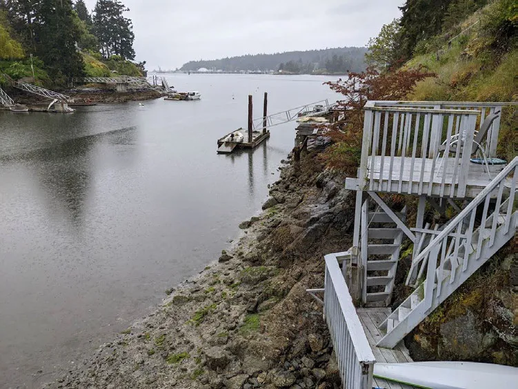
Photo 1: View of Project Site facing southPhoto 5: View of muddy substrate facing eastLimekiln Cove

Appendix B. Project Site shoreline photographs
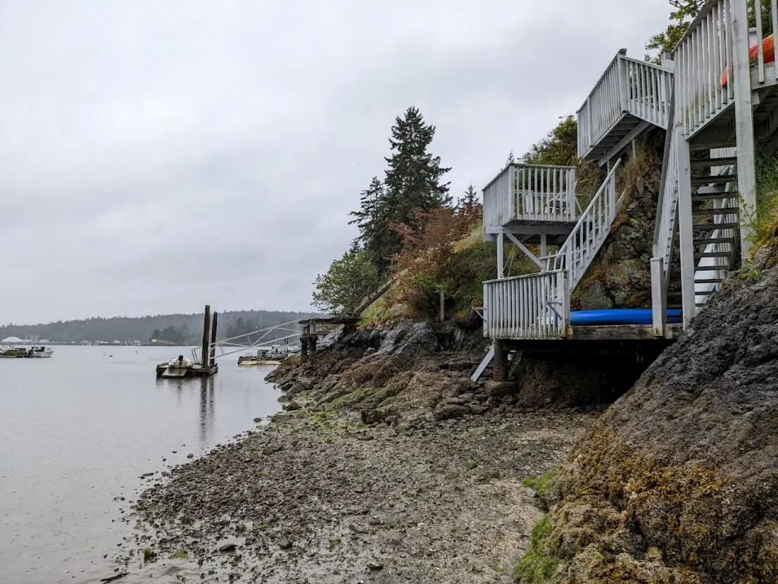
View of Project Site with current stairs and landings (facing south)
Photo 1. View of Project Site with current stairs and landings (facing south).
View of upper stairs at Project Site and rocky bluff within Limekiln Cove (facing south)
Photo 2. View of upper stairs at Project Site and rocky bluff within Limekiln Cove (facing south).
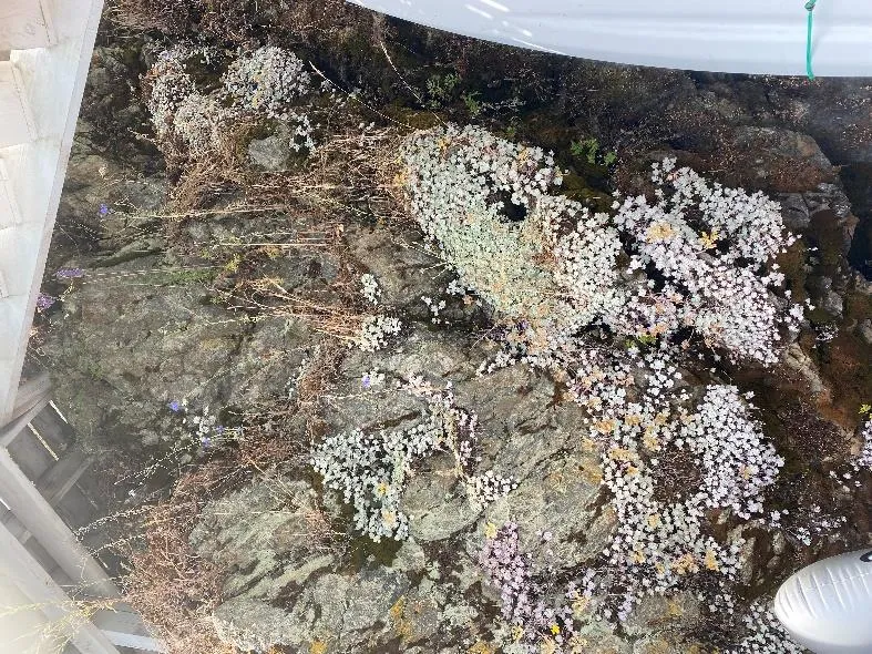
View of vegetation along rocky bluff below landings
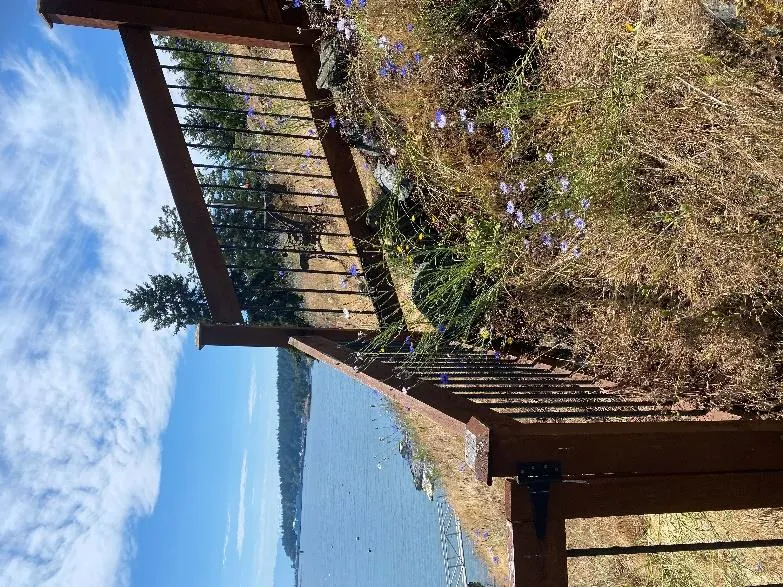
View of vegetation on upland portion of property above the Project Site (facing south)

Photo 3. View of vegetaiton along rocky bluff below landings.

Photo 4. View of vegitation on upland portion of property above the Project Site (facing south).
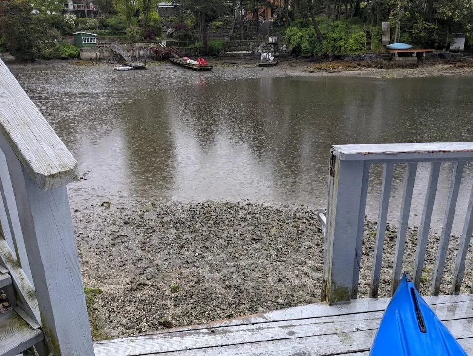
View from landing of foreshore area and muddy substrate below proposed dock location (facing east)
Photo 5. View from landing of foreshore area and muddy substrate below proposed dock location (facing east).
Page 185–187
Extracted from: 2023 04 04 Council Agenda - Agenda - Pdf