Appendix
Appendix D. Eelgrass Beds Map- Archipelago Marine Research Ltd.
April 4, 2023Pages 192–1932 sections
A technical map showing the distribution and density of eelgrass beds (Zostera marina) within Esquimalt Harbour.
February 5, 2004Esquimalt HarbourScale 1 : 12,000
Marine Habitat Review Esquimalt Harbour
Private Recreational Dock August 2022
Appendix D. Eelgrass Beds Map- Archipelago Marine Research Ltd.
Page 192–193
A Subtidal Survey of the Physical and Biological Features of Esquimalt Harbour
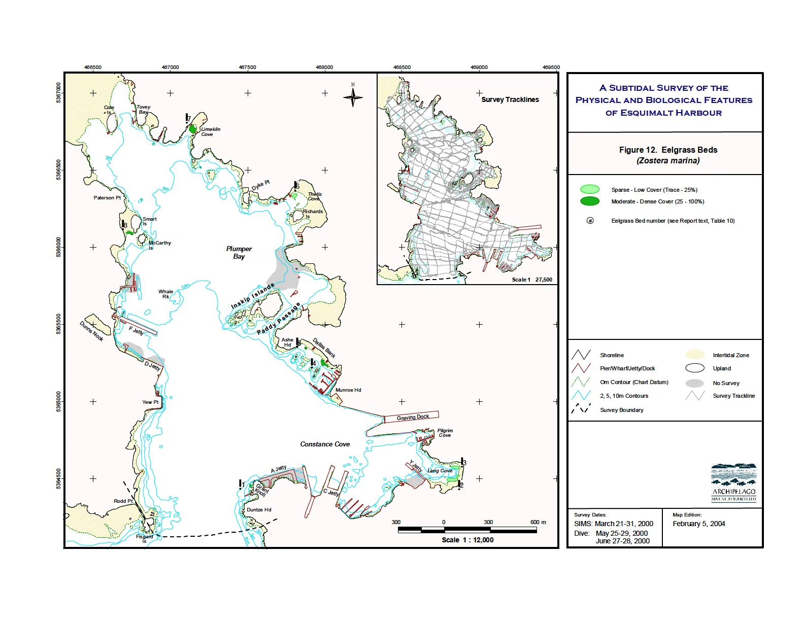
Figure 12. Eelgrass Beds (Zostera marina)
Legend
- Sparse - Low Cover (Trace - 25%)
- Moderate - Dense Cover (25 - 100%)
- Eelgrass Bed number (see Report text, Table 10)
Map Features
- Shoreline
- Pier/Wharf/Jetty/Dock
- 0m Contour (Chart Datum)
- 2, 5, 10m Contours
- Survey Boundary
- Intertidal Zone
- Upland
- No Survey
- Survey Trackline
Survey Details
- Survey Dates:
- SIMS: March 21-31, 2000
- Dive: May 25-29, 2000; June 27-28, 2000
- Map Edition: February 5, 2004
- Scale: 1:12,000 (Main Map); 1:27,500 (Survey Tracklines Inset)
Page 192–193
Extracted from: 2023 04 04 Council Agenda - Agenda - Pdf