STEP 1: CONTEMPLATING CROWN CONDUCT - Proposed Activity Description
A mandatory assessment form describing the proposed private dock construction at 302 Bessborough Avenue and evaluating its proximity to Department of National Defence lands and potential impact on Indigenous rights.
STEP 1: CONTEMPLATING CROWN CONDUCT
Proposed Activity Description
*ALL NUMBERED QUESTIONS ARE MANDATORY
| 1. Activity Information | |
|---|---|
| Name of Activity: | Private Dock Construction at 302 Bessborough Ave, View Royal, BC |
| Lead Directorate, Base, Unit: | Private Property Owners |
| Location of Activity: | Victoria |
| Province: | BC |
| Defence Establishment (specify): | CFB Esquimalt |
| Latitude and Longitude Coordinates of Activity: | Lat: 48.45384, Long: -123.44411 |
| If outside a Defence establishment, attach Map(s) with Activity boundaries and other information or Satellite views | |
| Activity OPI | |
| a) Name, rank, title: | Kevin and Amy Senn – Property Owners |
| b) Email address: | Kevin.senn@gmail.com, amysenn1@gmail.com |
| c) Phone: | 519-880-6137 |
| d) Cell phone: | N/A |
| Schedule: Activity Start Date: | TBD |
| Activity End Date: | TBD |
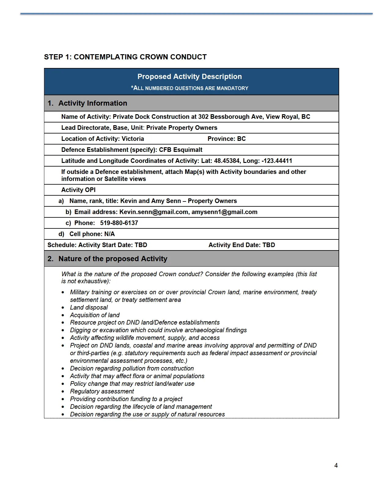
2. Nature of the proposed Activity
What is the nature of the proposed Crown conduct? Consider the following examples (this list is not exhaustive):
- Military training or exercises on or over provincial Crown land, marine environment, treaty settlement land, or treaty settlement area
- Land disposal
- Acquisition of land
- Resource project on DND land/Defence establishments
- Digging or excavation which could involve archaeological findings
- Activity affecting wildlife movement, supply, and access
- Project on DND lands, coastal and marine areas involving approval and permitting of DND or third-parties (e.g. statutory requirements such as federal impact assessment or provincial environmental assessment processes, etc.)
- Decision regarding pollution from construction
- Activity that may affect flora or animal populations
- Policy change that may restrict land/water use
- Regulatory assessment
- Providing contribution funding to a project
- Decision regarding the lifecycle of land management
- Decision regarding the use or supply of natural resources
Response: The scope of work comprises the decommissioning of a current set of stairs and wooden landings followed by the construction of access stairs and new landings with a gangway and raised float on pilings in the licensed area.
3. Description and Purpose of the Activity
Consider the following questions to guide you in formulating your response:
- What is the purpose of the Activity?
- What are the details of the Activity?
- What is the Activity’s geographic scope? Include a description of what area is affected.
- Identify the steps or stages or components of the Activity.
- Is there more information that is needed to fully understand the Activity?
- Where the proponent is a third party, has the proponent provided a detailed description of the Activity?
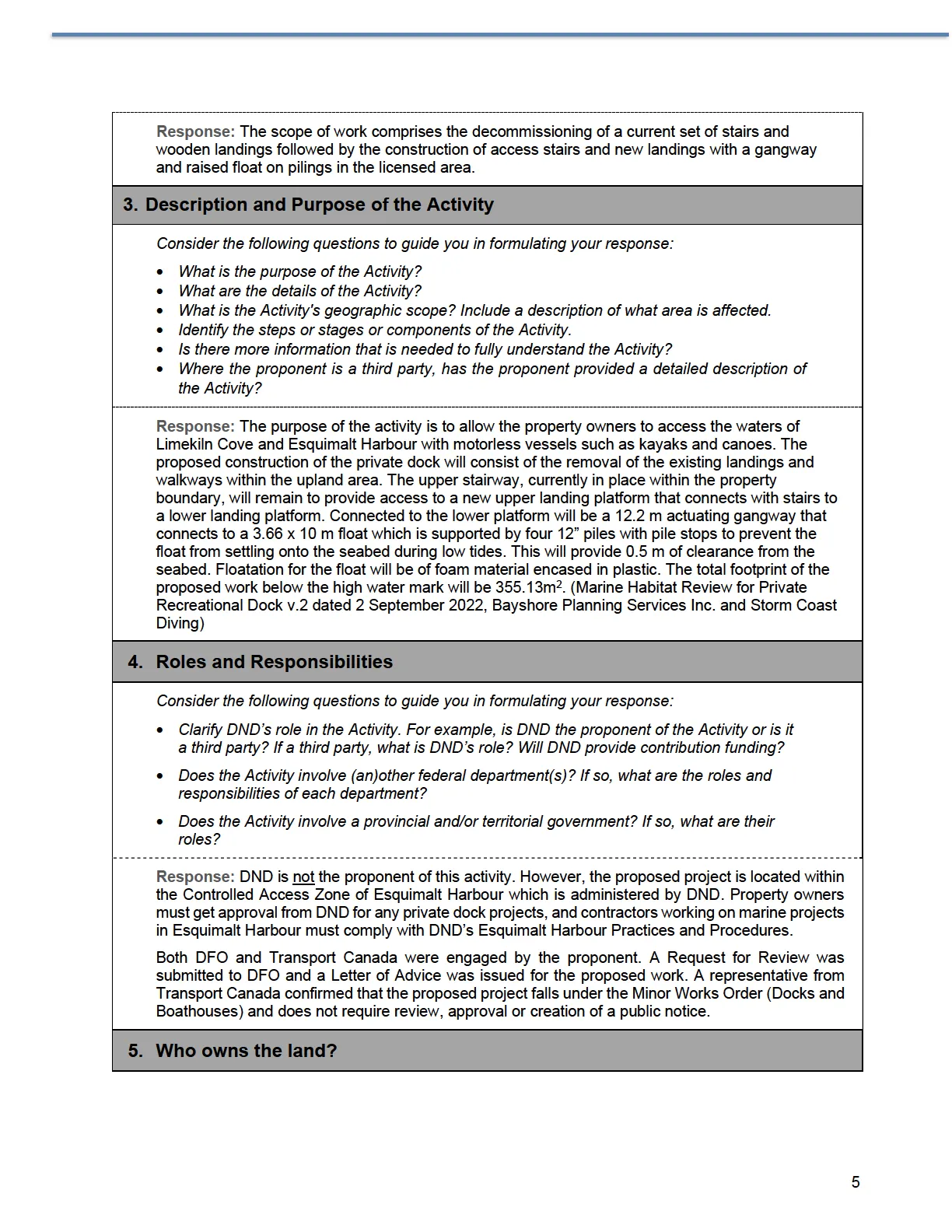
Response: The purpose of the activity is to allow the property owners to access the waters of Limekiln Cove and Esquimalt Harbour with motorless vessels such as kayaks and canoes. The proposed construction of the private dock will consist of the removal of the existing landings and walkways within the upland area. The upper stairway, currently in place within the property boundary, will remain to provide access to a new upper landing platform that connects with stairs to a lower landing platform. Connected to the lower platform will be a 12.2 m actuating gangway that connects to a 3.66 x 10 m float which is supported by four 12” piles with pile stops to prevent the float from settling onto the seabed during low tides. This will provide 0.5 m of clearance from the seabed. Floatation for the float will be of foam material encased in plastic. The total footprint of the proposed work below the high water mark will be 355.13m². (Marine Habitat Review for Private Recreational Dock v.2 dated 2 September 2022, Bayshore Planning Services Inc. and Storm Coast Diving)
4. Roles and Responsibilities
Consider the following questions to guide you in formulating your response:
- Clarify DND’s role in the Activity. For example, is DND the proponent of the Activity or is it a third party? If a third party, what is DND’s role? Will DND provide contribution funding?
- Does the Activity involve (an)other federal department(s)? If so, what are the roles and responsibilities of each department?
- Does the Activity involve a provincial and/or territorial government? If so, what are their roles?
Response: DND is not the proponent of this activity. However, the proposed project is located within the Controlled Access Zone of Esquimalt Harbour which is administered by DND. Property owners must get approval from DND for any private dock projects, and contractors working on marine projects in Esquimalt Harbour must comply with DND’s Esquimalt Harbour Practices and Procedures.
Both DFO and Transport Canada were engaged by the proponent. A Request for Review was submitted to DFO and a Letter of Advice was issued for the proposed work. A representative from Transport Canada confirmed that the proposed project falls under the Minor Works Order (Docks and Boathouses) and does not require review, approval or creation of a public notice.
5. Who owns the land?
Who owns the land where the Activity is planned to take place? Depending on the range of the Activity, there may be more than one.
Response (indicate in bold and underline all that apply):
- Federal Crown (e.g. DND, Other Government Department)
- Provincial Crown
- Territorial Crown
- First Nation reserve
- Other (specify) :
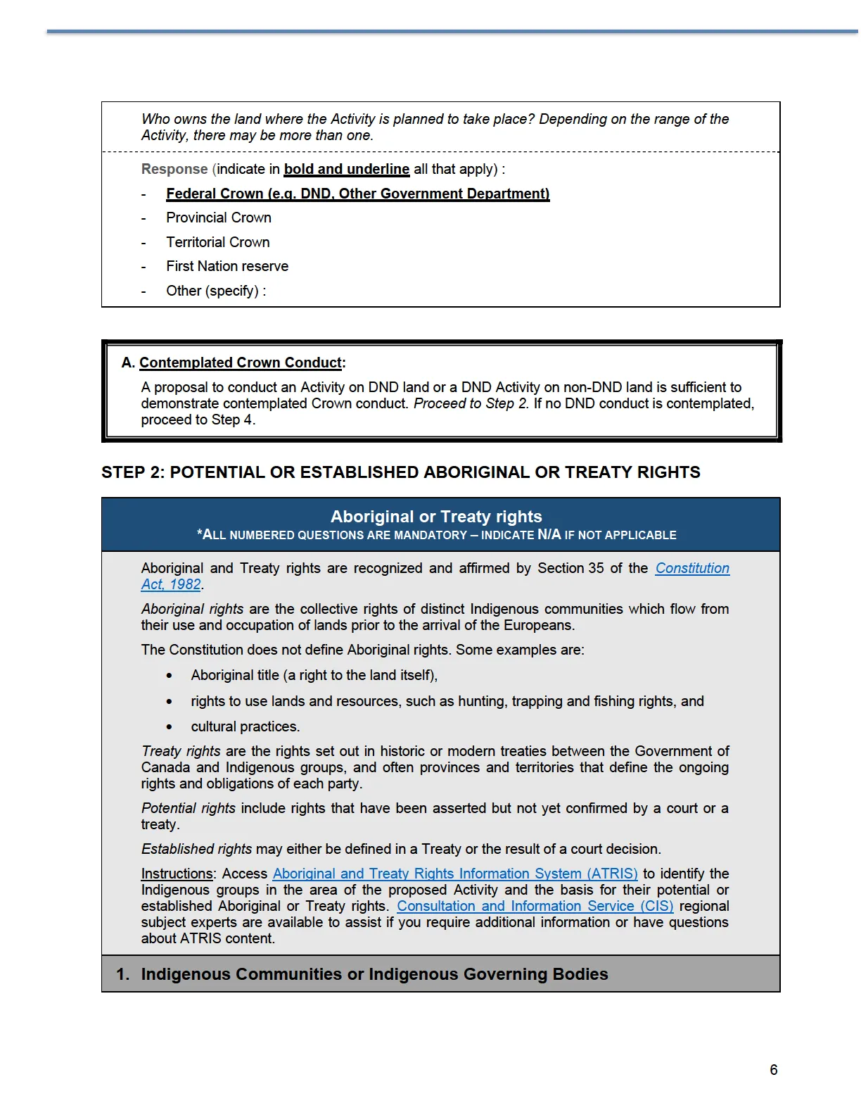
A. Contemplated Crown Conduct: A proposal to conduct an Activity on DND land or a DND Activity on non-DND land is sufficient to demonstrate contemplated Crown conduct. Proceed to Step 2. If no DND conduct is contemplated, proceed to Step 4.
STEP 2: POTENTIAL OR ESTABLISHED ABORIGINAL OR TREATY RIGHTS
Aboriginal or Treaty rights
*ALL NUMBERED QUESTIONS ARE MANDATORY – INDICATE N/A IF NOT APPLICABLE
Aboriginal and Treaty rights are recognized and affirmed by Section 35 of the Constitution Act, 1982.
Aboriginal rights are the collective rights of distinct Indigenous communities which flow from their use and occupation of lands prior to the arrival of the Europeans.
The Constitution does not define Aboriginal rights. Some examples are:
- Aboriginal title (a right to the land itself),
- rights to use lands and resources, such as hunting, trapping and fishing rights, and
- cultural practices.
Treaty rights are the rights set out in historic or modern treaties between the Government of Canada and Indigenous groups, and often provinces and territories that define the ongoing rights and obligations of each party.
Potential rights include rights that have been asserted but not yet confirmed by a court or a treaty.
Established rights may either be defined in a Treaty or the result of a court decision.
Instructions: Access Aboriginal and Treaty Rights Information System (ATRIS) to identify the Indigenous groups in the area of the proposed Activity and the basis for their potential or established Aboriginal or Treaty rights. Consultation and Information Service (CIS) regional subject experts are available to assist if you require additional information or have questions about ATRIS content.
1. Indigenous Communities or Indigenous Governing Bodies
Answer all of the following: a) Specify the date ATRIS was accessed for this preliminary research. b) Specify the radius used in the search. The nature of the Activity will change the radius you will want to consider. For example, will the Activity have any effects only on the immediate area or will it impact a larger radius i.e. affects flowing water and an entire watershed? (This may help to determine the ATRIS radius to consider. For example, is it a water treatment facility that will impact surrounding waterways? (50-100k) Removing a swatch of untouched land that is currently used by migratory species? (50-100k) Is it small building construction project on base that won't have any impacts outside of the base? (5-10k) c) Are there Indigenous communities and/or Indigenous Governing Bodies in the area of proposed Activity. d) If yes, list them and continue with Step 2. If the answer is no, proceed to Step 4.
Note: There may be alternative spellings or different names for an Indigenous group. For example, the Sliammon First Nation of BC is now known as the Tla’amin First Nation.
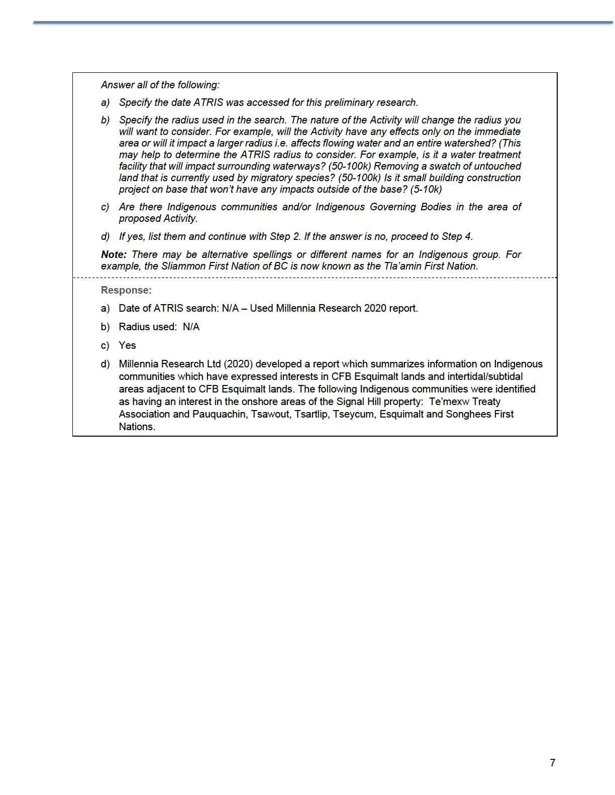
Response: a) Date of ATRIS search: N/A – Used Millennia Research 2020 report. b) Radius used: N/A c) Yes d) Millennia Research Ltd (2020) developed a report which summarizes information on Indigenous communities which have expressed interests in CFB Esquimalt lands and intertidal/subtidal areas adjacent to CFB Esquimalt lands. The following Indigenous communities were identified as having an interest in the onshore areas of the Signal Hill property: Te'mexw Treaty Association and Pauquachin, Tsawout, Tsartlip, Tseycum, Esquimalt and Songhees First Nations.
2. Potential or Established Rights
The preliminary ATRIS research may have indicated potential and/or established Aboriginal or Treaty rights in the immediate and surrounding area of the proposed DND/CAF Activity. In addition to searching on ATRIS, provincial, territorial and community websites may provide additional information.
From your understanding of the preliminary research, what is the basis of the established or potential rights?
If you are uncertain, contact Director General Indigenous Affairs, a local knowledgeable DND subject matter expert on Indigenous rights and interests, or regional subject matter experts of Consultation and Information Service (CIS).
Response (indicate in bold and underline all that apply):
- Historic Treaty
- Modern Treaty
- Land Claims Agreement
- Self-Government Agreement
- Treaty Land Entitlement Agreements
- Access Agreements
- Consultation Agreements or Protocols
- Recognition of Indigenous Rights and Self-Determination (RIRSD) discussion tables
- Comprehensive Claim and Self-Government Agreement negotiations
- Claims or assertions, including overlapping claims by multiple Indigenous groups (For example: two or more First Nations may claim to have Aboriginal title over the same area; a Métis group may claim to have Aboriginal rights in an area where several First Nations also have established Treaty rights.)
- There is uncertainty about the legal status of a known or potential rights-holding group or individuals claiming Aboriginal or Treaty rights in the relevant area
- Other (specify): Indigenous communities located in south Vancouver Island have a unique treaty relationship with the Crown. Unlike First Nations across Canada who signed treaties with the British Crown, most of the First Nations in British Columbia never formally ceded their land to the Crown.
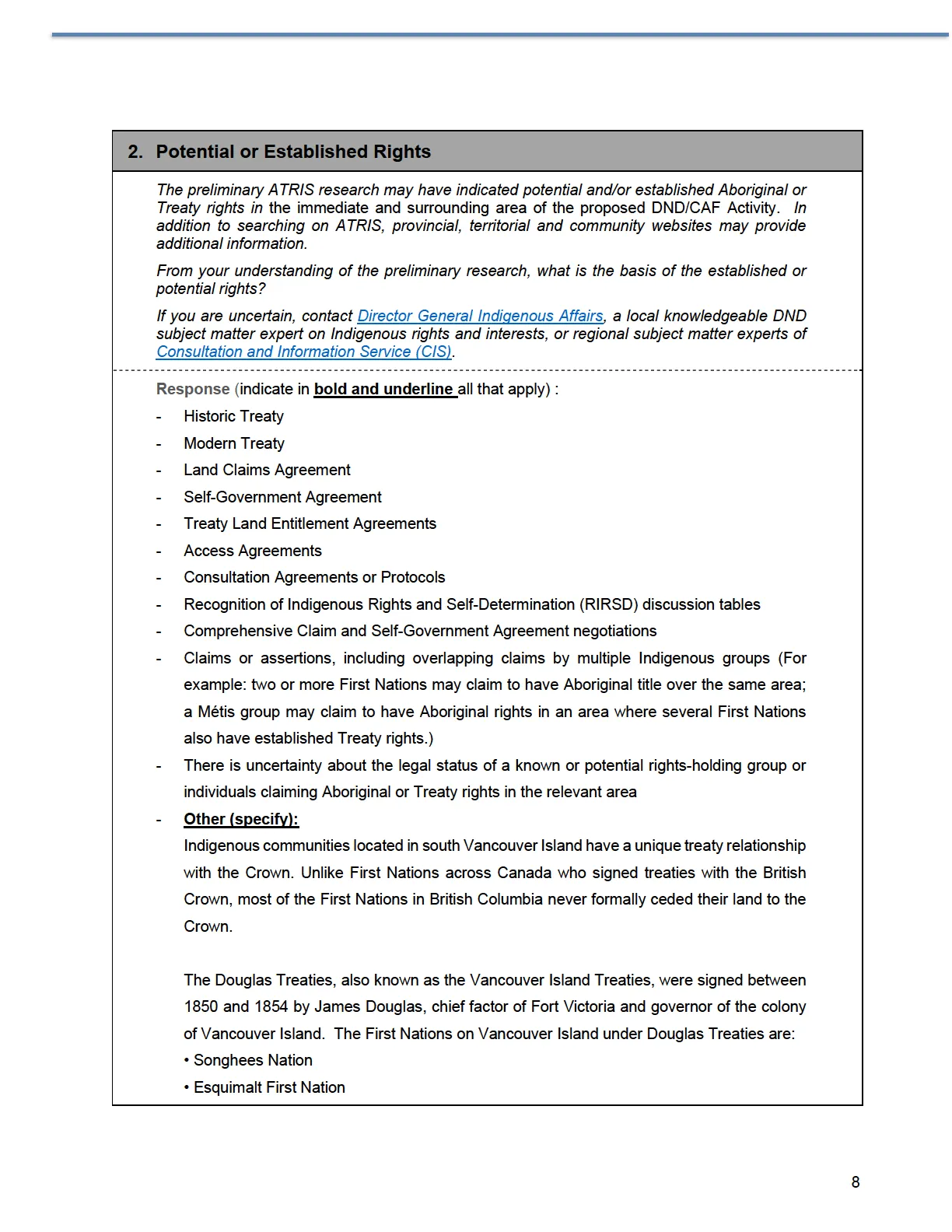
The Douglas Treaties, also known as the Vancouver Island Treaties, were signed between 1850 and 1854 by James Douglas, chief factor of Fort Victoria and governor of the colony of Vancouver Island. The First Nations on Vancouver Island under Douglas Treaties are:
- Songhees Nation
- Esquimalt First Nation
- Sc’ianew First Nation (Beecher Bay)
- Tsawout First Nation
- Tsartlip First Nation
- Pauquachin First Nation
- Tseycum First Nation
- Snuneymuxw First Nation
- T’Sou-ke First Nation
- Snaw-Naw-As (Nanoose) First Nation
- Kwakiutl First Nation
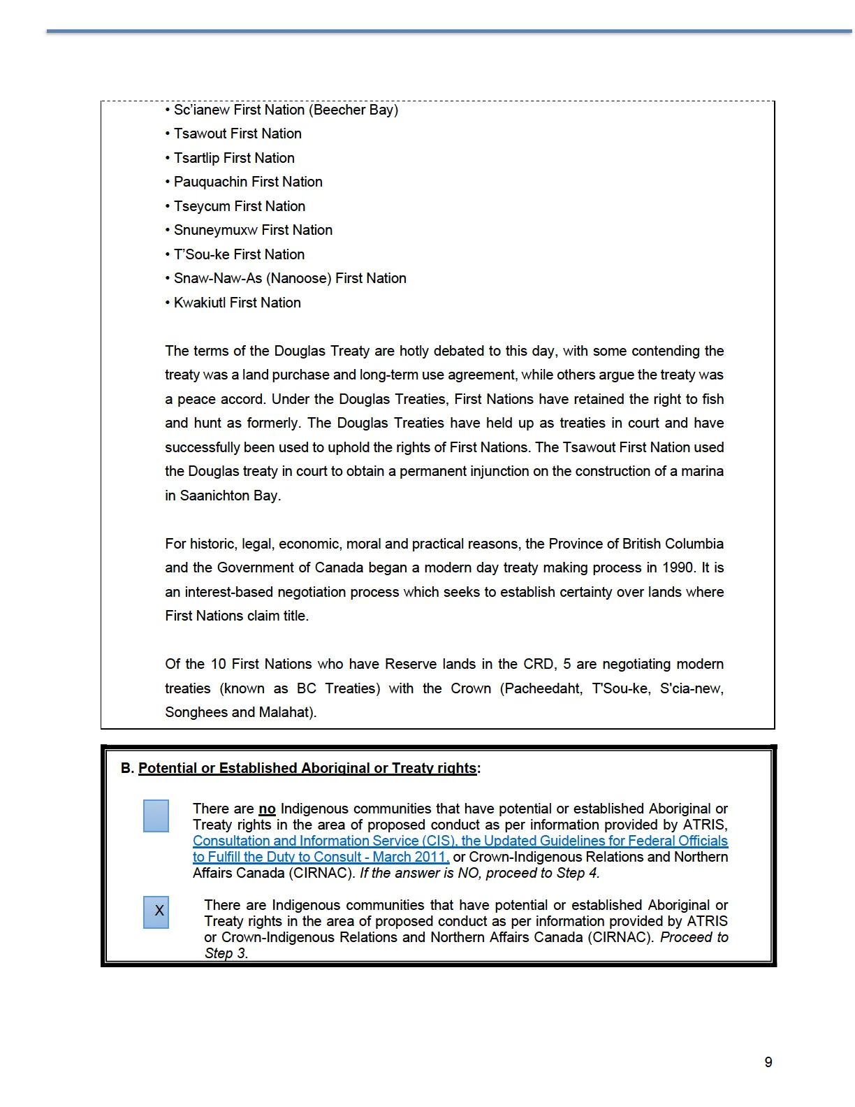
The terms of the Douglas Treaty are hotly debated to this day, with some contending the treaty was a land purchase and long-term use agreement, while others argue the treaty was a peace accord. Under the Douglas Treaties, First Nations have retained the right to fish and hunt as formerly. The Douglas Treaties have held up as treaties in court and have successfully been used to uphold the rights of First Nations. The Tsawout First Nation used the Douglas treaty in court to obtain a permanent injunction on the construction of a marina in Saanichton Bay.
For historic, legal, economic, moral and practical reasons, the Province of British Columbia and the Government of Canada began a modern day treaty making process in 1990. It is an interest-based negotiation process which seeks to establish certainty over lands where First Nations claim title.
Of the 10 First Nations who have Reserve lands in the CRD, 5 are negotiating modern treaties (known as BC Treaties) with the Crown (Pacheedaht, T’Sou-ke, S’cia-new, Songhees and Malahat).
B. Potential or Established Aboriginal or Treaty rights:
- There are no Indigenous communities that have potential or established Aboriginal or Treaty rights in the area of proposed conduct as per information provided by ATRIS, Consultation and Information Service (CIS), the Updated Guidelines for Federal Officials to Fulfill the Duty to Consult - March 2011, or Crown-Indigenous Relations and Northern Affairs Canada (CIRNAC). If the answer is NO, proceed to Step 4.
- There are Indigenous communities that have potential or established Aboriginal or Treaty rights in the area of proposed conduct as per information provided by ATRIS or Crown-Indigenous Relations and Northern Affairs Canada (CIRNAC). Proceed to Step 3.
STEP 3: POTENTIAL ADVERSE IMPACTS OF CROWN CONDUCT
Potential Adverse Impact
*ALL NUMBERED QUESTIONS ARE MANDATORY – INDICATE N/A IF NOT APPLICABLE
In general, adverse impacts can be anything that may limit or negatively affect the exercise of an Aboriginal or Treaty right or an Aboriginal claim. This can include both immediate or future impacts on the land, (including coastal and marine areas), water, air and resources. However, impacts are not restricted to physical impacts and can include any adverse effect on the ability of Indigenous peoples to exercise their rights, protected under s.35 of the Constitution.
A variety of factors will be relevant to this determination, including the scope and size of the Activity, the environmental and/or socioeconomic effects, and whether the impact(s) are permanent or temporary.
Instructions: Identify the likely or potential adverse impact of the proposed Activity.
1. Change to the current condition or use of land (including coastal and marine areas), air, water and resources
What is the likely or potential impact of the proposed Activity on the land (including coastal and marine areas), air, water and resources? If there are any impacts, what changes to the current condition or use of lands, air, water or resources are likely to occur as a result of the Activity? Are these changes significant?
Consider the following questions to guide you in formulating your response:
- Is the Activity multi-phase and/or complex? (Consider: Activity size and expense, timelines, statutory requirements such as impact and environmental assessments, etc.)
- Are the potential adverse impacts likely to be of a temporary or permanent nature? If permanent, could there be any barriers to remediation? How so?
- What kind of land is being used – previously untouched? Building on previously excavated/developed land?
- Is there any past or present access to the relevant area by Indigenous groups? Will the Activity change land use or access to the relevant area? If so, explain.
- Are there any aspects of the proposed Activity that could have an impact on any structure, site or thing that is of historical, archaeological, paleontological or architectural significance? If so, explain.
- Are there any other Activities occurring in the same area? Is this Activity likely to have any cumulative effects in combination with other Activities in the same or surrounding area?
- Have any environmental or other assessments of the proposed Activity or for similar activities in the vicinity of the proposed Activity been carried out? If so, what adverse impacts on rights are revealed, if any, by these assessments?
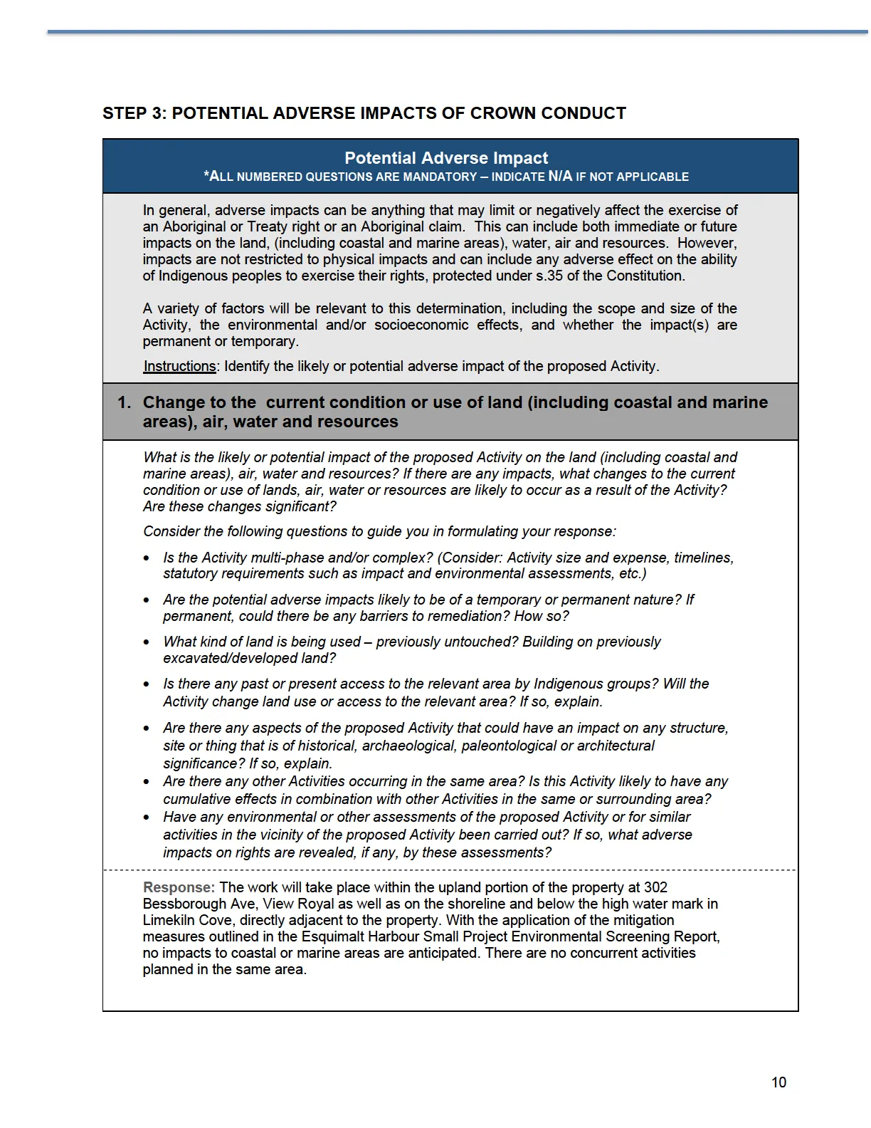
Response: The work will take place within the upland portion of the property at 302 Bessborough Ave, View Royal as well as on the shoreline and below the high water mark in Limekiln Cove, directly adjacent to the property. With the application of the mitigation measures outlined in the Esquimalt Harbour Small Project Environmental Screening Report, no impacts to coastal or marine areas are anticipated. There are no concurrent activities planned in the same area.
2. Other factors indicating potential impacts on rights
If only for broader awareness at this pre-consultation stage, consider the following questions to guide you in formulating your response:
- Is there any active litigation in which an Indigenous group claims Aboriginal rights, title or Treaty rights with respect to the relevant area?
- Is there a real or actual prospect of litigation in the relevant area?
- Are ongoing consultations with Indigenous groups taking place in relation to other DND/CAF Activities in the relevant area?
- Are you aware of any consultation processes underway involving the same Indigenous group about another Crown Activity or one where the Crown is engaged?
- Are you aware of how the consultation is proceeding, i.e., is the relationship between DND/OGDs and the Indigenous group positive, strained, or adversarial?
Note: If you are uncertain, contact Director General Indigenous Affairs, a local knowledgeable DND subject matter expert on Indigenous rights and interests, or regional subject matter experts of Consultation and Information Service (CIS).
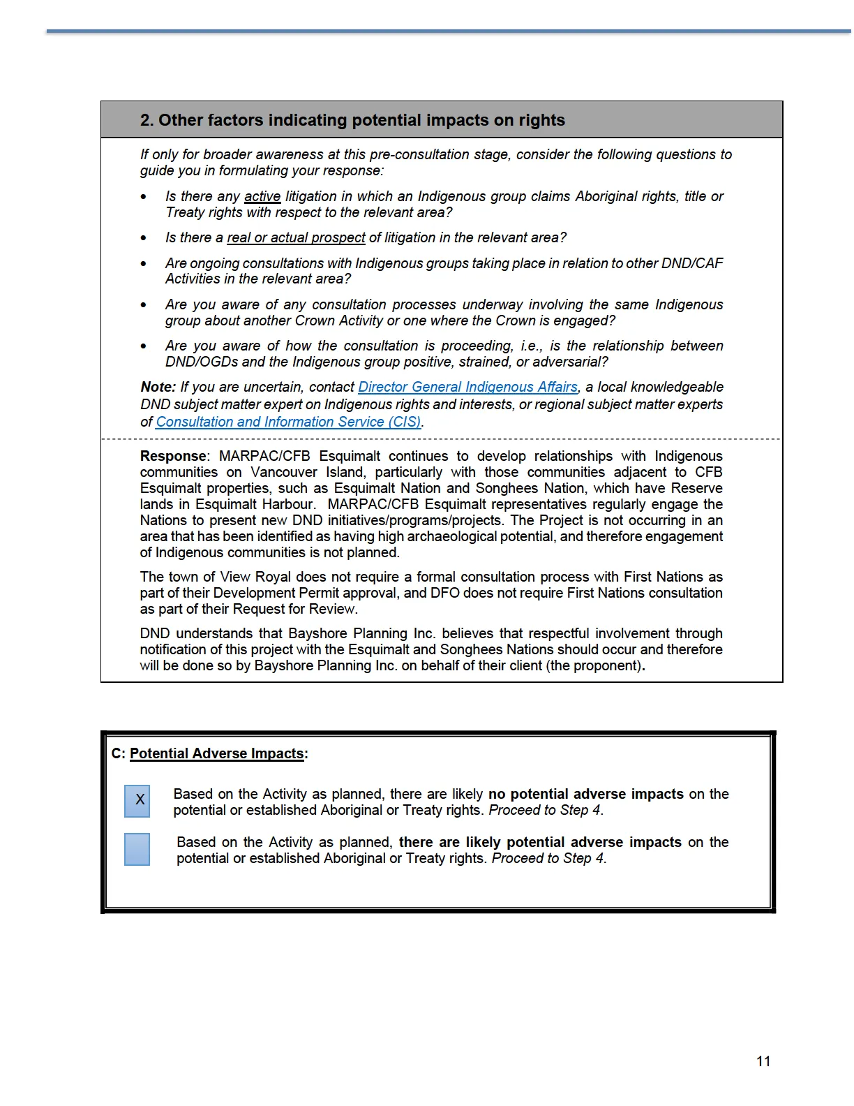
Response: MARPAC/CFB Esquimalt continues to develop relationships with Indigenous communities on Vancouver Island, particularly with those communities adjacent to CFB Esquimalt properties, such as Esquimalt Nation and Songhees Nation, which have Reserve lands in Esquimalt Harbour. MARPAC/CFB Esquimalt representatives regularly engage the Nations to present new DND initiatives/programs/projects. The Project is not occurring in an area that has been identified as having high archaeological potential, and therefore engagement of Indigenous communities is not planned.
The town of View Royal does not require a formal consultation process with First Nations as part of their Development Permit approval, and DFO does not require First Nations consultation as part of their Request for Review.
DND understands that Bayshore Planning Inc. believes that respectful involvement through notification of this project with the Esquimalt and Songhees Nations should occur and therefore will be done so by Bayshore Planning Inc. on behalf of their client (the proponent).
C: Potential Adverse Impacts:
- Based on the Activity as planned, there are likely no potential adverse impacts on the potential or established Aboriginal or Treaty rights. Proceed to Step 4.
- Based on the Activity as planned, there are likely potential adverse impacts on the potential or established Aboriginal or Treaty rights. Proceed to Step 4.
STEP 4: DUTY TO CONSULT DETERMINATION
On the basis of this initial analysis and research, it has been determined that: [Select one of the following]
- Unlikely that a duty to consult will be triggered. For example, no adverse impact is anticipated. (NOTE: Even if this is the determination, DND will have to reassess as the project moves forward in case the situation changes).
- A duty to consult does exist or likely exists: the Contemplated Crown conduct, as planned, may adversely impact potential or established Aboriginal or Treaty rights.
Duty to Consult Determination Prepared by MARPAC ESS: Name: Becky MacInnis Title: MARPAC ESS Date (dd-mm-yyyy): 26-01-2023