Town of View Royal Active Transportation Network Plan
A comprehensive strategic document outlining the vision, objectives, and specific priority projects to improve walking, cycling, and rolling infrastructure within the town over a 10-year horizon.
| Plan | Description |
|---|---|
| Parks Master Plan (2017) | It identifies the most frequented parks in View Royal. Includes actions for the pedestrian and cycling networks that have not yet been implemented and will be considered in the ATNP process.  |
| Traffic Calming Policy (2014) | The policy supports the use of several traffic calming measures that could support the cycling network. |
| Transportation Master Plan (2008) | Contains several recommended actions for the pedestrian and cycling networks that have not yet been implemented. The Town also completed a technical update to the Transportation Master Plan in 2016. These actions were reviewed as part of developing the ATNP. |
Neighbouring Jurisdictions
| Plan | Description |
|---|---|
| Township of Esquimalt Active Transportation Plan (2022) | The Esquimalt ATNP identifies improvements to the cycling network that provide several critical connections to View Royal. These include protected bike facilities for the entire Admirals Road and Craigflower Road corridors, linking Esquimalt, Saanich, and Victoria to View Royal.  |
| City of Colwood Draft Active Transportation Network Plan (2022) | A key target of the draft plan is to ensure that all cycling connections to surrounding communities, including View Royal, are constructed to AAA (all ages and abilities) standards to provide safe regional connections for all. |
| District of Saanich Active Transportation Plan (2018) | The District’s pedestrian and bicycle network priorities connecting to View Royal include pedestrian improvements and cycling infrastructure on Burnside Road West and Watkiss Way, as well as All Ages and Abilities cycling infrastructure on Admirals Road crossing the bridge and connecting to View Royal and Esquimalt. |
Regional Documents
| Plan | Description |
|---|---|
| BC Transit Esquimalt – View Royal Local Area Transit Plan (2021) | While the plan is focused on transit related improvements, it recognizes the important connection between transit and active transportation. The plan indicates that all active transportation infrastructure recommendations need to consider the potential impacts on transit service delivery.  |
| MOTI South Island Transportation Strategy (2020) | The high-level strategy document provides two improvement opportunities relevant for View Royal: overall improvements to the Galloping Goose Regional Trail and a Park and Ride facility at Six Mile where Highway 1, Old Island Highway and Burnside Road meet and where the Galloping Goose and E&N Trails converge. A Park and Ride would facilitate cycling and vehicle trips to access public transportation and carpooling.  |
| BC Active Transportation Design Guide (2019) | The BC Active Transportation Design Guide (BCATDG) was released by the BC government in June 2019. The guide is a comprehensive set of planning and engineering guidelines offering recommendations for the planning, selection, design, implementation, and maintenance of active transportation facilities across the province. It contains engineering principles and best practices from the municipal, provincial, national, and international levels. Several of the recommendations from the BCATDG have been incorporated into the View Royal ATNP including Section 5.3 (Design Guidelines).  |
| CRD Regional Transportation Plan (2014) | An outcome identified in the Regional Transportation Plan directs the CRD to work with municipalities to establish ‘mobility hubs’, one being in the View Royal Town Centre. These are locations of regional activity and regional destinations where transportation modes will integrate seamlessly and efficiently, and where both the traveler environment and urban form will encourage transit, active transportation, and other alternatives to driving alone.  |
| CRD EV & E-bike Infrastructure Planning Guide (2018) | This guide provides strategies for local governments to expand EV and E-Bike charging infrastructure in the Capital Region. It provides detailed direction on several topics including e-bike parking design guidelines for new developments. Currently, the Town’s Zoning Bylaw contains requirements for energizing Class 1 bicycle parking spaces but does not provide direction on parking design guidelines for non-standard bicycles such as electric bikes.  |
2.7 Existing Active Transportation Facilities
The View Royal ATNP Baseline Conditions Report provides a detailed overview of the Town’s existing active transportation conditions. This section provides a summary of the Town’s existing active transportation facilities and are illustrated in Map 3 and Map 4.
2.7.1 Pedestrian Facilities
There are several different types of pedestrian facilities within the Town with concrete sidewalks being the most common. There are currently 26.3 kilometres of sidewalks across the community with most found on all arterial and collector roads including Helmcken Road, Island Highway, and parts of Watkiss Way. However, most local (residential) roads do not have a sidewalk. Beyond the sidewalk, other pedestrian facilities include multi-use pathways / trails and local trails. Each facility type is described in more detail below.
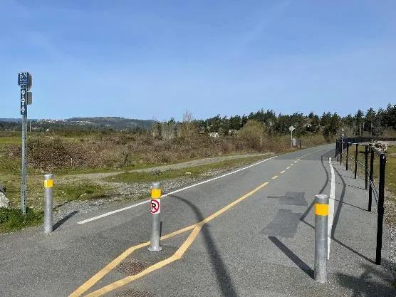
Multi-use Pathway The BC Active Transportation Design Guide (BCATDG) defines multi-use pathways as off-street facilities that are physically separated from motor vehicle traffic and can be used by any non-motorized user. Examples include the E&N Rail Trail and the Galloping Goose.
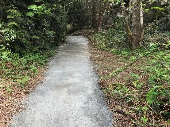
Local Trail Local trails are off-street facilities that are physically separated from motor vehicle traffic and are primarily designed for pedestrians but can also accommodate bicycles. They come in varying widths and can be paved or not.
Separated Sidewalk A separated sidewalk has a ‘furnishing zone’ or boulevard that separates the sidewalk from the roadway. The furnishing zone acts like a buffer and enhances pedestrian safety and comfort while providing a space for sidewalk amenities and utilities. Separated sidewalks are found on Helmcken Road, Island Highway, and parts of Watkiss Way, for example.
The BCATDG recommends separated sidewalks along all arterial roads, areas with high pedestrian activity, and along collector roads that are near health care facilities and school zones.
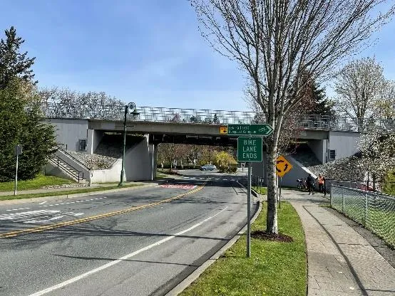
Non-separated Sidewalk A sidewalk that is located directly next to the roadway but is physically separated from the roadway by a curb. According to the BCATDG, streets like Admirals Road should have a separated sidewalk to improve walking conditions for all ages and abilities. Admirals Road is a busy vehicle corridor with over 12,000 vehicles per day.
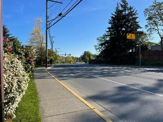
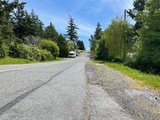
Unimproved Roads without Sidewalks While some local / residential roads have sidewalks on one or both sides, there are many such as Midwood Road and parts of View Royal Avenue that do not have any pedestrian facility. This results in pedestrians having to share the road with vehicles. These roads also present challenges for transit service as they are not accessible and do not always provide a safe place for passengers to wait. The BCATDG recommends that in urban environments, all local roads should have a sidewalk on at least one side.
2.7.2 Cycling Facilities
There are three main cycling facilities in the Town with bicycle lanes being the most common, followed by multi-use pathways and shared-use lanes. Combined, they represent 29.3 kilometres of cycling facilities. All multi-use pathways are off-street facilities whereas most of the on-street cycling facilities (bicycle lanes and shared-use lanes) are found on arterial roads such as Helmcken Road and Island Highway. Burnside Road West, Watkiss Way, and Six Mile Road have either a bicycle lane or a shared-use lane for part of the corridors.
Table 3 – Existing Cycling Network Inventory
| Type | Length (km) | Percentage |
|---|---|---|
| Multi-Use Pathway | 10.6 | 36.1% |
| Bicycle Lane | 14.7 | 50.2% |
| Shared-Use Lane | 4 | 13.7% |
| Total | 29.3 | 100% |
Multi-use Pathway The BC Active Transportation Design Guide defines multi-use pathways as off-street facilities that are physically separated from motor vehicle traffic and can be used by any non-motorized user. Examples include the E&N Rail Trail and the Galloping Goose. According to the Design Guide, they can be considered a comfortable facility appropriate for people of all ages and abilities. However, they may feel less comfortable if there is a high volume and a diverse mix of users, as this can make the pathway feel congested and can be uncomfortable if the speed differential between users is high.
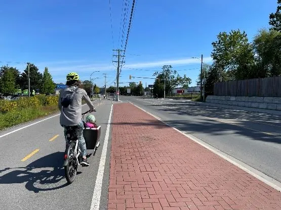
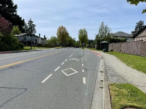
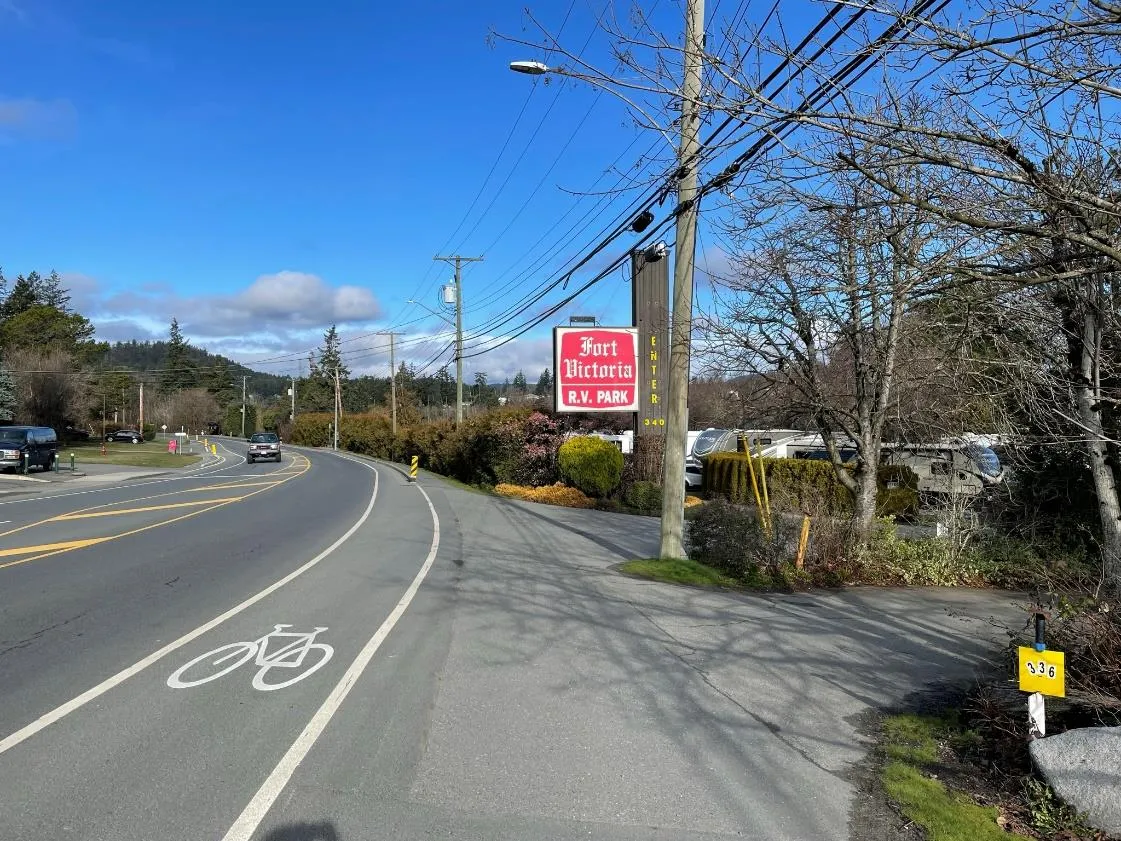
Bicycle Lane A bicycle lane is defined by the BC Active Transportation Design Guide as a lane that includes only a white longitudinal line running parallel to the alignment of the road to visually separate the bicycle lane from the motor vehicle and/or parking lanes. Bicycle lanes represent most of the cycling facilities in Town and are found on Helmcken Road, Island Highway, Six Mile Road, Watkiss Way, Admirals Road, and Burnside Road West. A bicycle lane is not considered an all ages and abilities cycling facility and is no longer recommended on major roads with more than 4,000 vehicles/day.
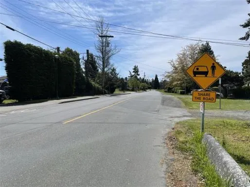
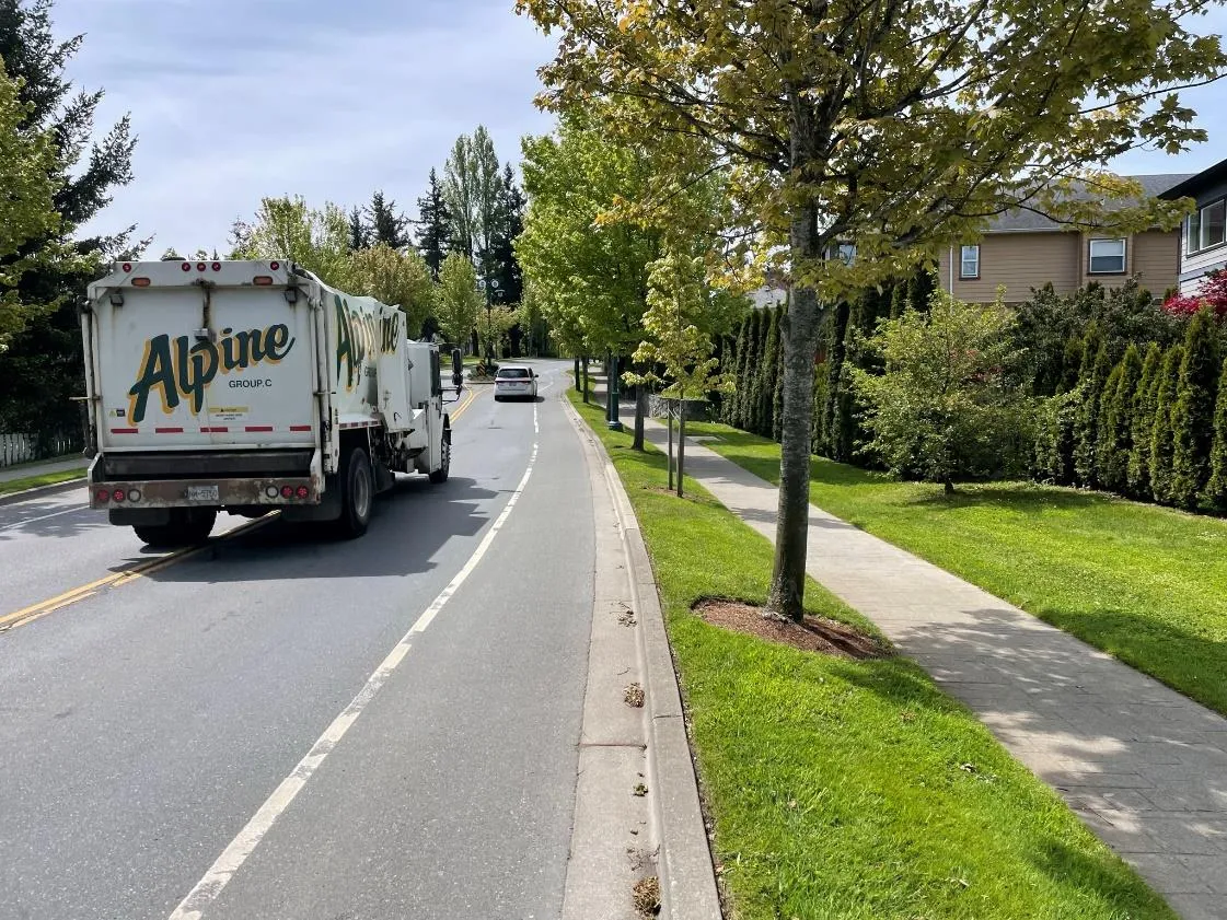
Shared-Use Lane A shared-use lane is a general purpose lane that has enough space to accommodate the use of the lane by both motor vehicles and cyclists. The intent of these lanes is to provide sufficient space for a motor vehicle to safely overtake a cyclist. Shared-use lanes are found on Helmcken Road, Admirals Road, Island Highway, Six Mile Road, Chancellor Avenue, and Burnside Road West. A shared-use lane is not considered an all ages and abilities cycling facility and people cycling do not feel comfortable using these facilities. Shared-use lanes are no longer recommended from both BC Active Transportation Design Guide and TAC, unless it is a lower speed/lower volume local road.
Section 3 – Public Engagement
3.0 PUBLIC ENGAGEMENT
3.1 Overview
The public engagement process involved various methods to participate within two rounds of feedback:
- Round 1 invited the View Royal community to share their thoughts on barriers, issues and opportunities surrounding the existing active transportation network. This round introduced the community to the project, worked toward promoting understanding and support for active transportation, and obtained specific feedback regarding barriers and challenges faced when using active transportation.
- Round 2 invited the View Royal community to provide feedback on the draft vision, goals, and priorities for active transportation improvements developed based on what was heard in Round 1.
3.2 What Was Done
The public was invited to participate using several virtual and in-person activities, outlined below.
Online Survey #1 – Feedback on Barriers and Opportunities The online survey was hosted on the survey platform Alchemer. It was primarily targeted towards View Royal residents and those who work in the Town; however, other members of Greater Victoria were able to provide feedback. The survey was available from June 25 to July 29, 2022. It included several close-ended questions and some open-ended questions intended to better understand the existing barriers, issues, and opportunities surrounding the community’s existing active transportation network.
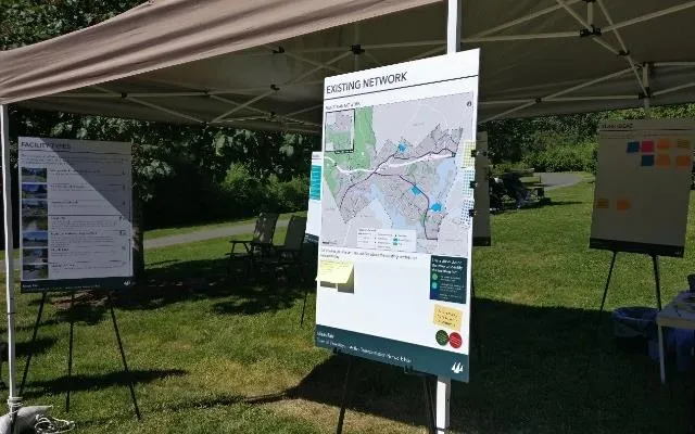
Ideas Fair Two outdoor, in-person ideas fair events were held on June 25, 2022 at Portage Park and Chancellor Park in View Royal. Each event was three hours long and invited the public to learn about the project and provide feedback via a series of interactive display boards and by talking to members of the project team. Participants could leave comments on sticky notes and use sticky dots to vote on different ideas, as well as identify specific locations on a map where they would like to see improvements. Additional project information and opportunities to fill out a survey were also available at the events. Portage Park and Chancellor Park are located alongside regional trails (the E&N and the Galloping Goose, respectively) that see high volumes of active transportation users.
Stakeholder Interviews Throughout July and August 2022, interviews were conducted virtually via Microsoft Teams with representatives from key stakeholder groups. Each interview was approximately 30 minutes long and included questions to help further understand the barriers and issues facing active transportation users as well as specific changes / improvements the stakeholders would like to see in the active transportation network.
A total of 13 stakeholder groups were invited to participate. In the end, eight interviews were completed in total with the organizations listed below:
- BC Transit
- Capital Bike
- Capital Regional District (CRD) Parks
- Capital Regional District (CRD) Transportation Planning
- Island Corridor Foundation
- Shoreline Middle School
- View Royal Elementary School
- West Shore Parks and Recreation
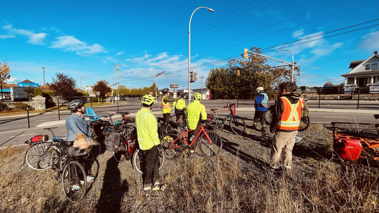
Bikeshops Three bikeshops were held in November 2022 that involved community members participating in a bicycle tour, guided by members of the consulting team, of where higher priority active transportation improvements are recommended. The bikeshops offered the community an opportunity to explore the state of transportation infrastructure across View Royal. Ultimately, the purpose of the bikeshops was to present elements of the network analysis including different improvement options for the pedestrian and cycling infrastructure that were being considered in the draft ATNP.
Online Survey #2 – Feedback on Vision, Goals & Draft Options Similar to the first survey, the second was offered to the public via the Alchemer platform and was primarily targeted towards View Royal residents and those who work in the Town. The survey was available from November 24 to December 15, 2022. It included several close-ended questions and some open-ended questions about draft goals, vision, and the proposed short-term infrastructure improvements.
General Feedback on the ATNP Throughout the development of the ATNP, Town staff also received comments from the Town of View Royal Advisory Committee, Capital Bike, and members of the public.
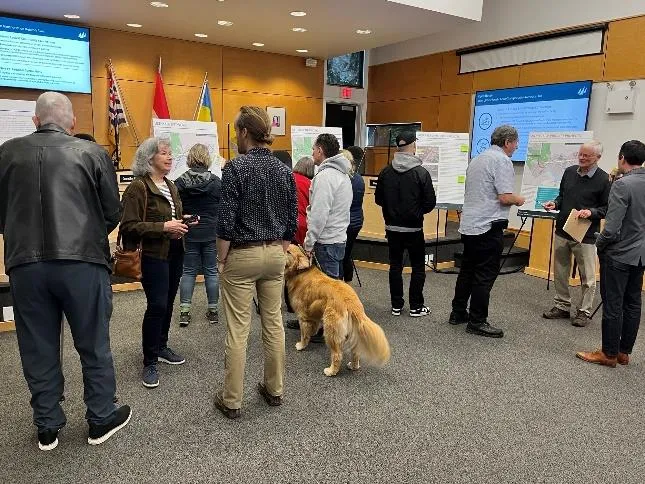
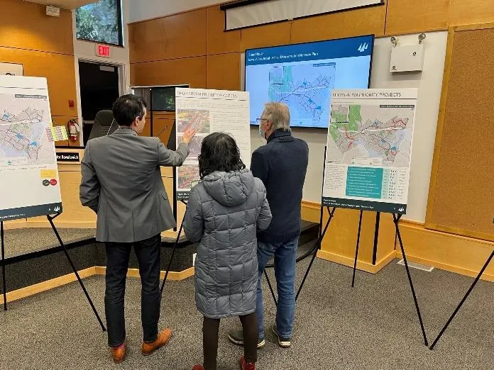
Draft ATNP Public Open House On April 3, 2023, residents of View Royal and the greater community were invited to review the draft ATNP at a public open house. Hosted at the Town Hall, main highlights of the draft plan, including the ultimate pedestrian network, ultimate cycling network, and short-term priority projects, were presented on boards for attendees to review and provide comments using sticky notes.

Promotional Tools Each of the engagement activities were promoted using several tools, including the following:
- Project Webpage
- Social Media (Facebook, Instagram, and Twitter)
- Eventbrite (bikeshop invitations)
- Local media outreach
- Posters around the community
- Emails to key stakeholders
By the numbers:
- 706 total survey responses
- 76 ideas fair participants
- 8 stakeholder interviews
- 29 bikeshop participants
- 60 open house attendees
3.3 What We Heard
A high-level summary of what we heard in the first round of engagement is presented below.
3.3.1 Walking and Rolling
Barriers The top barriers to walking and rolling in View Royal were identified by participants in the following order of priority:
- Poor quality sidewalks and other pedestrian facilities (i.e. gaps in the network)
- Speed of motor vehicle traffic on Major Roads (i.e. arterials, collectors)
- Getting across the Trans-Canada Highway in a safe and convenient way
- Vehicles not yielding / stopping at designated crosswalks
- Speed of motor vehicle traffic on Local Roads
Participants of the ideas fair provided a few additional barriers to walking and rolling:
- More sidewalk space and protection are needed for pedestrians
- Many road crossings feel unsafe due to vehicle traffic and the length of time needed to cross
Improvements The most desired improvements for walking and rolling in View Royal were identified by participants in the following order of priority:
- Filling in gaps in the network to improve connections to local destinations
- More separation from motor vehicle traffic (e.g. street trees / boulevards / bike lanes)
- Improve sidewalk condition (e.g. fixing cracks, trip hazards)
- Increase sidewalk widths
- Better amenities at bus stops (e.g. seating, lighting, secure bike parking, real-time transit information)
Participants of the ideas fair indicated a few additional improvements to prioritize for walking and rolling:
- Crossing improvements including shorter distances and advance signals for pedestrians (referred to as ‘leading pedestrian interval’)
- Safer routes to schools
- Greater protection for pedestrians, with a focus on all ages and abilities
3.3.2 Cycling
Barriers The top barriers to cycling in the Town were identified by participants in the following order of priority:
- Uncomfortable cycling on arterial roads without painted bike lanes (e.g., parts of Island Highway, Six Mile Road, Admirals Road)
- Poor connections to key destinations
- Speed of motor vehicle traffic on Major Roads
- Inadequate protection at intersections (e.g., conflicts with people driving, walking, biking)
- Uncomfortable cycling on arterial and collector roads with painted bike lanes (e.g., Helmcken Road, Watkiss Way, Island Highway)
Ideas fair participants provided additional feedback regarding barriers to cycling:
- The intersection at Island Highway and Admirals Road is not comfortable for people cycling
- Connectivity and continuity of the cycling network is lacking
- Different modes, abilities, and speeds on trails (especially the E&N) creates conflict between users
Improvements The most desired improvements for cycling in the Town were identified by participants in the following order of priority:
- More separation / protection from vehicles along corridors
- Better separation / protection from vehicles at intersections
- Traffic calming measures (e.g., curb extensions, rumble strips, narrower lanes etc.)
Ideas fair participants expressed additional improvements needed to the cycling network:
- Education on bike etiquette / speeds on multi-use trails (especially the E&N Trail) to reduce conflicts between different modes and abilities
- Better lighting on trails
3.3.3 Connections
Satisfaction with Trail Connections Survey respondents rated their level of satisfaction regarding connections between the Town’s neighbourhoods and the E&N and Galloping Goose regional trails. Survey respondents were the most satisfied with amenities, location of access points / trail heads, availability of bike parking at key destinations, and safety / comfort and road crossings.
Survey respondents were the least satisfied with separation between cyclists and pedestrians, connections between trails / pathways and other bike routes, signage and pavement markings, and maintenance of pathway / trail connections.
Regional Connections The surrounding communities that survey respondents reported to be the most challenging to access via active transportation are Colwood, Langford and Saanich, respectively.
3.3.4 Road Safety
The top three roads in View Royal that were identified to be the most unsafe to walk, roll and cycle on are as follows:
- Island Highway
- Admirals Road
- Helmcken Road
3.3.5 Level of Investment
Survey respondents selected the types of projects or initiatives that should have more investment. The projects with the highest proportion of respondents that indicated more investment include:
- Increase separation between people cycling and motor vehicles (e.g., protected bike lanes)
- Provide protected cycling facilities on Major Road (e.g., Arterials and Collectors)
- Improve safety of roadway crossings for people walking and biking
- Work with the CRD to widen Regional Trails to separate people walking from people cycling
- Increase separation between sidewalks and motor vehicles (e.g., vegetation, landscaping, bike lanes)
- Those want to spend less on these measures were in the minority (ranging from 2 to 9%)
Section 4 – Plan Framework
4.0 PLAN FRAMEWORK
4.1 Vision
View Royal is a dynamic, inclusive, and connected community that recognizes the impacts of climate change. Its active transportation network allows residents and visitors alike to move around the community safely by walking, cycling, or rolling. The active transportation network connects neighbourhoods, schools, employment destinations, transit stops, natural environments including parks and green spaces, and with regional trails and neighbouring communities. A connected, compact, and safe network of active transportation facilities make driving the least attractive option and change the culture of transportation in View Royal, helping the town reduce GHG emissions, boost its local economy, and enhance its overall resilience—meeting the needs of the present and future generations.
4.2 Objectives
Four distinct objectives have been identified as part of this plan, which aim to provide tangible targets so that View Royal can achieve its active transportation vision.
Objective #1: The Culture of Active Transportation Embed active transportation culture into all decisions related to transportation.
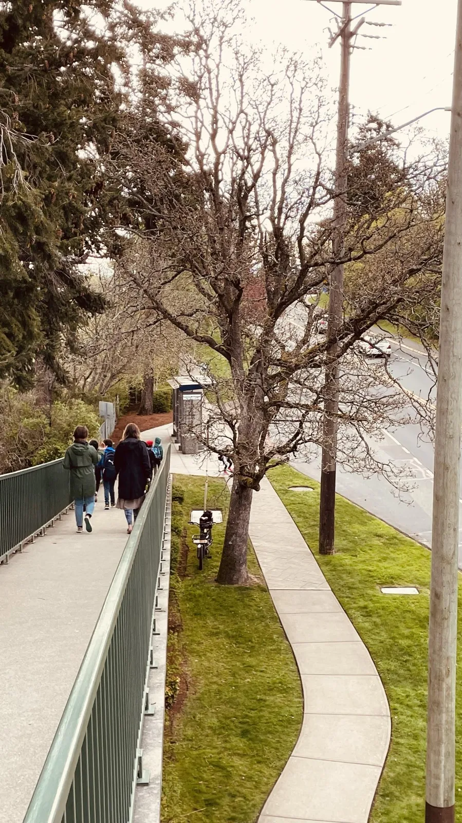
Objective #2: All Ages & Abilities Facilities Create an extensive active transportation network of all ages and abilities facilities that supports walking, rolling, and cycling.
Targets:
- A physically protected cycling facility is constructed on one east-west arterial corridor and one north-south arterial corridor
- All upgrades to major intersections are designed to be universally accessible
- There are zero injuries and/or fatalities for those who use active transportation modes
- Bus stops with at least 10 boardings / alightings per day are connected to pedestrian facilities that are universally accessible
Objective #3: Local & Community Connections Strengthen the connections of the active transportation to the Town’s key natural and community destinations including parks, regional trails, schools, and commercial centres.
Targets:
- Regional trails are accessible by an all ages and abilities facility
- All Town parks provide short-term bicycle parking
- All designated OCP Growth Areas (i.e., Future Town Centre, Neighbourhood centres, Community Corridors) are accessible by an all ages and abilities cycling facility
Objective #4: Regional Connections Take a regional approach to active transportation planning by collaborating with neighbouring municipalities and the Capital Regional District to improve walking and cycling connections to and from View Royal.
Targets:
- All regional trail crossings are designed to the same standard
- All active transportation connections to neighbouring jurisdictions must be coordinated and conform to all ages and abilities standards
Section 5 – Future Active Transportation Network
5.0 FUTURE ACTIVE TRANSPORTATION NETWORK
5.1 Network Analysis
The development of View Royal’s future active transportation network followed a multifaceted approach to capture the public interest and meet the needs of View Royal residents and visitors. Specifically, the approach to the network development process was three-fold:
- A technical analysis as part of the baseline conditions and review of the community profile, policy & planning context, and existing transportation network;
- Public engagement through an online survey, Ideas Fair, and interviews with key stakeholders; and
- A transportation needs assessment that relied on several weighted criteria using spatial analysis including proximity to schools, bus stops, parks, trails, future growth, and other factors.
The project prioritization criteria used in the transportation needs assessment included:
Pedestrian Network
- Roads with high traffic speeds and volumes
- Connections to schools
- Sidewalks in or near future land growth
- Sidewalks in proximity to lower income areas
- Connections to bus stops
- Connections to parks
- Connections to trails
Cycling Network
- Roads with high traffic speeds and volumes
- Connections to schools
- Facilities in or near future land growth
- Facilities in proximity to lower income areas
- Facilities on high activity cycling corridors
- Connections to bus stops
- Connections to parks
- Connections to trails
5.2 Ultimate Network
The ultimate network is intended to meet the vision of this plan and identifies the general location of all future active transportation facilities in the Town. Achieving the ultimate network may take several years, require significant financial resources, and continued engagement with the public and key stakeholders.
The ATNP is a 10-year plan and it may not be possible for the Town to achieve its ultimate network within this time horizon. The intent is to provide an aspirational network and guide for future development of the active transportation network.
5.2.1 Pedestrian Network
View Royal is a compact community with a high proportion of its residents walking and rolling (e.g., using a wheelchair, skateboard) within the Town. The pedestrian network is the cornerstone of transportation as all trips start or end with walking or rolling and as such it is important that the pedestrian network be comfortable, convenient, and safe for everyone.
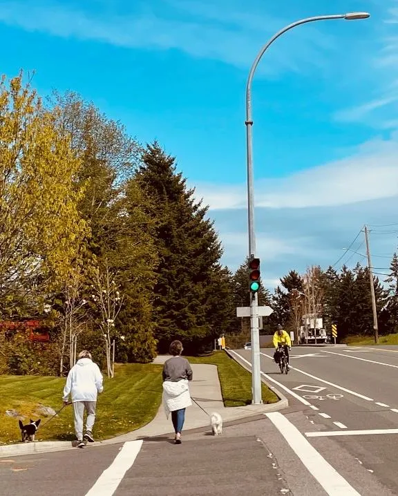
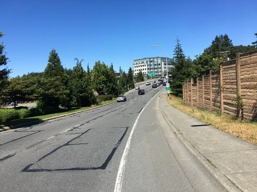
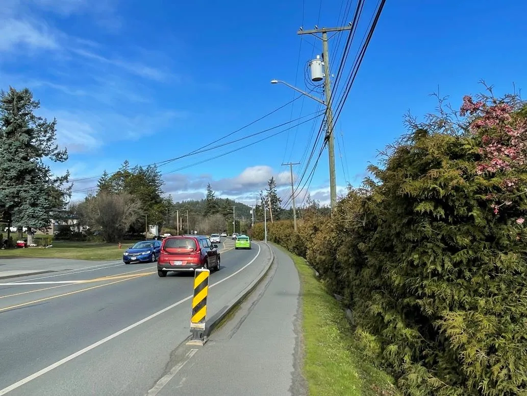
Map 5 identifies the Town’s future pedestrian network. Ultimately, the future pedestrian network should consist of sidewalks on both sides of arterial and collector roads, or any road that is in proximity to schools, parks, or other key community destinations.
The map also identifies three locations for future “pedestrian and cyclist overpasses” over the Trans-Canada Highway. The three locations—and their rationale for an overpass—include:
- Chancellor Avenue / Trans-Canada Highway | would provide a safe and more direct connection for those living in the residential neighbourhood around Helmcken Centennial Park to access Eagle Creek, the Galloping Goose Regional Trail, and other destinations.
- Talcott Road / Burnett Road / Trans-Canada Highway | would provide a more direct connection for residents trying to access the Galloping Goose (to the north) or the E&N Rail Trail (to the south).
- Lund Road / West Park Lane / Trans-Canada Highway | would facilitate a safer and more direct connection to Thetis Lake Regional Park for residents living in west View Royal.
What we heard from the community on the ultimate pedestrian network
Based on the open house feedback, the ATNP was updated to include the following:
- A specific recommendation on how the Town could address speeding and road safety concerns (Section 5.5.6)
- More discussion on the intent of the ultimate network and the criteria that were used to develop it
- A specific recommendation on where bus stops should be upgraded in the network based on existing and future pedestrian facilities (Section 5.4.4)
- A specific recommendation for the Town to work with the CRD to widen regional trails to address user conflicts (Section 5.5.2)
5.2.2 Cycling Network
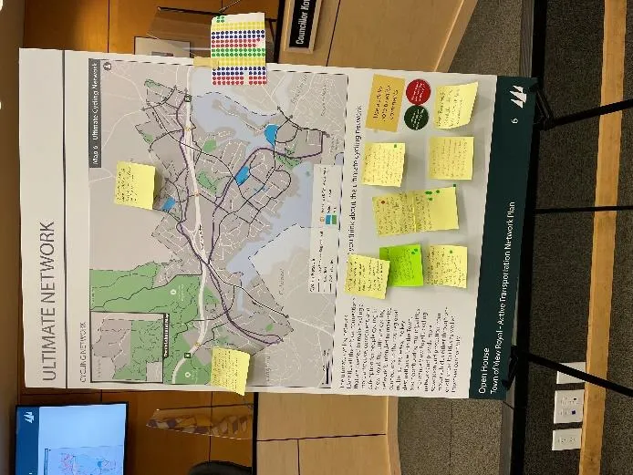
The ultimate cycling network identifies all the critical connections that are needed to make cycling a more attractive, convenient, and safe option for people cycling in View Royal.
What we heard from the community on the ultimate cycling network
Among the feedback provided, the main themes on the ultimate cycling network included concerns around bidirectional cycling facilities and the need to improve cycling safety by eliminating right turn slip lanes at major intersections.
Based on the open house feedback, the ATNP was updated to include the following:
- More specific language clarifying that the ATNP is not intended to prescribe the exact facility type for the short-term priority projects and the ultimate network. The exact facility type will be determined through detailed design and will require further engagement with the community.
- More specific language on the need to remove slip lanes and channelized right turn lanes as part of intersection upgrades to improve cycling safety.
5.3 Design Guidelines
This section provides the framework for implementation of the active transportation network in View Royal. The intent of establishing active transportation design guidelines is to enable the Town to select appropriate facility types when moving forward to the detailed design stage.
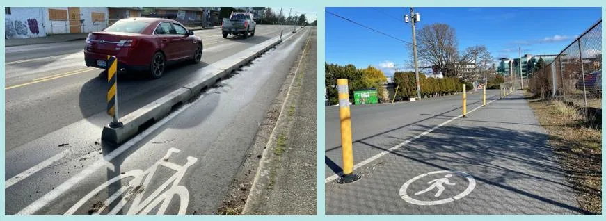
What is quick-build active transportation infrastructure? Quick-build active transportation refers to facilities that are temporary in nature and often treated as a pilot project to gauge community interest and utilization.
5.3.1 Facility Types
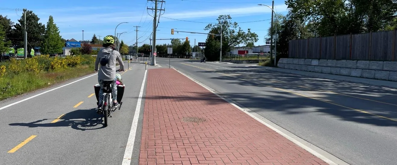
Multi-Use Pathway
Sidewalk
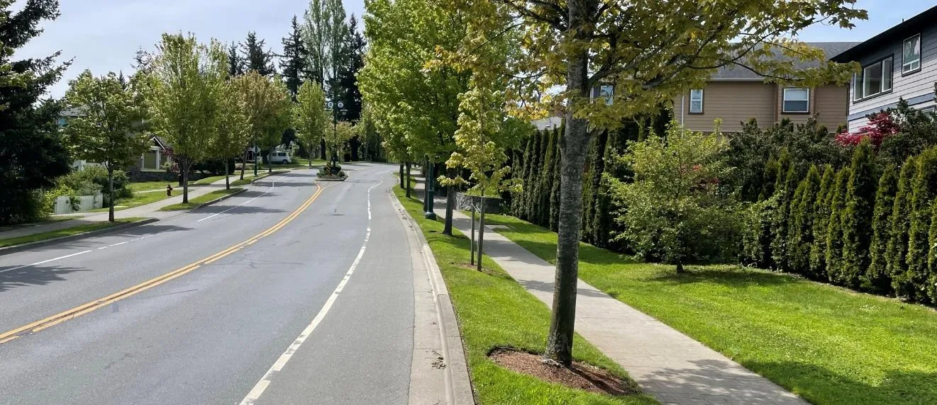
- Definition: A sidewalk is a facility dedicated to people walking and rolling and is adjacent to the roadway.
- Pedestrian Facility Selection: Typically, a separated sidewalk should be preferred when one of the following conditions is met: (1) motor vehicle speeds exceed 30 km/h (2) located near a school zone, (3) the facility is located nearby commercial, mixed use and other key community destinations.
- Surface Material: Concrete is the standard material used for sidewalks.
- Slope: Less than 5% to ensure accessibility for people using mobility aids. A maximum of 8.3% could be accepted as long as intermittent landings are provided every 9.0 m.
Table 4. Recommended Sidewalk Facility Widths
| Land Use / OCP Designations | Road Type | Separation | Side | Desirable Width (m) | Constrained Width (m) |
|---|---|---|---|---|---|
| Low – Medium Density Residential | Local | Non-separated or Separated | One side | 1.8 | 1.8 |
| Low – Medium Density Residential | Collector / Arterial | Separated | Both sides | 1.8 | 1.8 |
| High Density Residential | Local | Non-separated or Separated | One side | 2.1 | 1.8 |
| High Density Residential | Collector / Arterial | Separated | Both sides | 2.4 | 1.8 |
| Commercial Mixed Use / Community Corridor / Neighbourhood Centre / Town Centre | Any | Separated | Both sides | 2.4 – 3.0 | 2.1 |
Table 5. Recommended Furnishing Zones for Sidewalk Facilities
| Furnishing Zone Type | Land Use | Desirable Width (m) | Constrained Width (m) | Comments |
|---|---|---|---|---|
| Basic | Any | 2.0 | 0.6 | 0.75 m minimum if parking is provided; 0.9 m minimum for streetlight/utility poles; 1.5 m minimum for street trees. |
| Enhanced | Commercial Mixed Use / Town Centre | 3.0 – 5.0 | 3.0 | 3.0 m minimum if transit stop with high activity; Larger width when speeds > 50 km/h and volumes > 4,000 per day. |
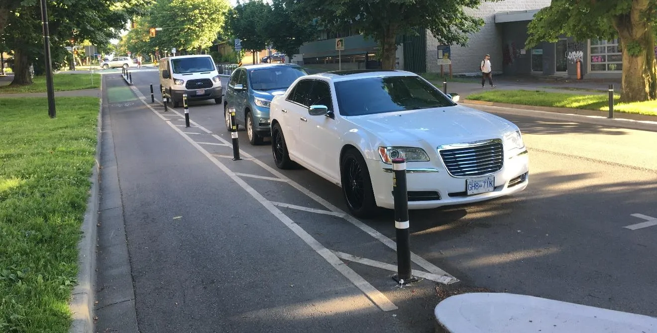
Protected Bike Lane
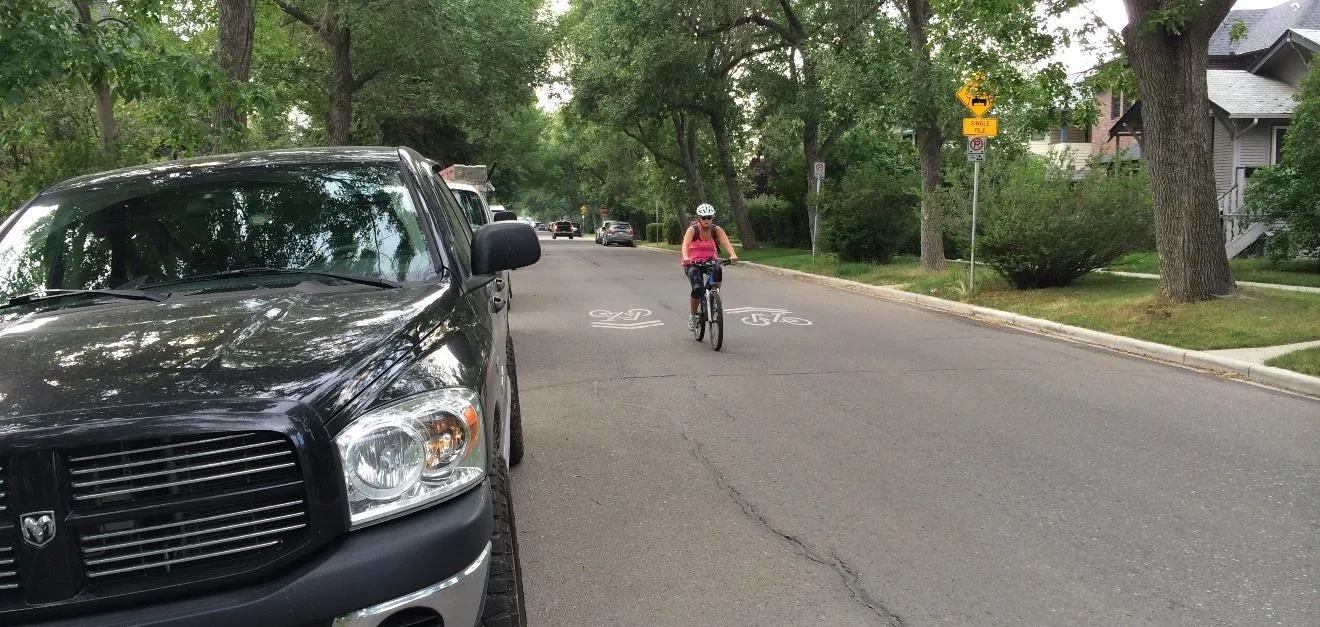
Table 6. Protected Bike Lane Width Options
| Zone Type | Desirable Width (m) | Constrained Width (m) | Comments |
|---|---|---|---|
| Uni-directional Bike Lane | 2.5 | 1.8 | If no adjacent parking, desirable width > 0.9 m. |
| Bi-directional Bike Lane | 4.0 | 3.0 | If buffer zone cannot be achieved, consider raising bike lane to sidewalk level. |
| Street Buffer Zone | 0.9 | 0.6 |
Bicycle Boulevard
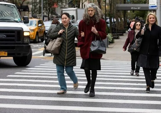
Table 7. Bicycle Boulevard Levels of Treatment
| Average Annual Daily Traffic | Posted Speed Limit | Level 1: Required Treatments | Level 2: Traffic Calming | Level 3: Traffic Diversion |
|---|---|---|---|---|
| <1,000 | ≤30 km/h | √ | ||
| <1,000 | 30 - 50 km/h | √ | √ | |
| 1,000 – 2,500 | ≤30 km/h | √ | √ | |
| 1,000 – 2,500 | 30 - 50 km/h | √ | √ | √ |
5.3.2 Intersections & Crossings
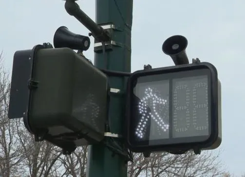
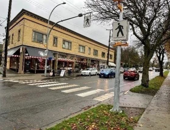
Pedestrian Signalized Crossings & Accessibility
- Leading Pedestrian Interval: A Leading Pedestrian Interval (LPI) typically gives pedestrians a 3–7 second head start when entering an intersection.
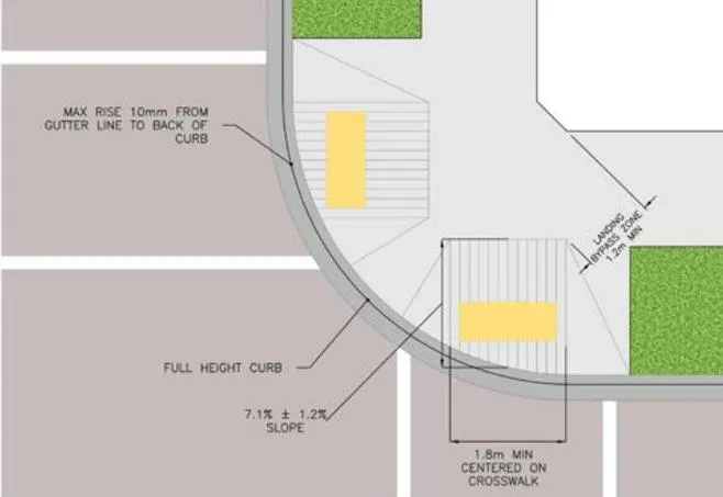
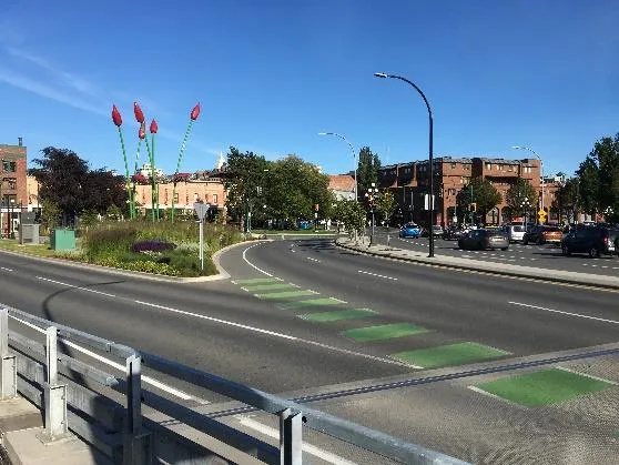
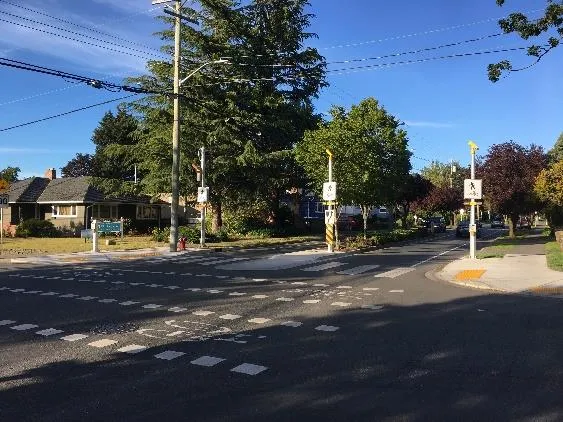
On-street Bikeway Crossings
- Conflict Zone Markings: Green coloured pavement is typically used to indicate conflict zones.
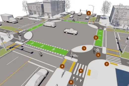
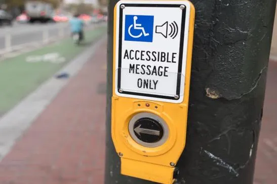
5.3.3 Universal Design
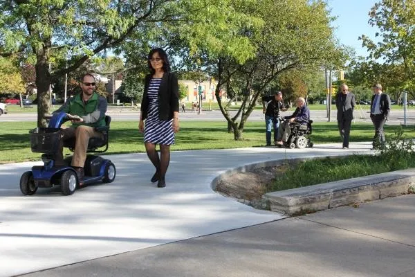
Seven Principles of Universal Design
- Equitable Use: The design is useful and marketable to people with diverse abilities.
- Flexibility in Use: The design accommodates a wide range of individual preferences and abilities.
- Simple and Intuitive Use: Use of the design is easy to understand.
- Perceptible Information: The design communicates necessary information effectively to the user.
- Tolerance for Error: The design minimizes hazards and the adverse consequences of accidental or unintended actions.
- Low Physical Effort: The design can be used efficiently and comfortably and with a minimum of fatigue.
- Size and Space for Approach and Use: Appropriate size and space is provided for approach, reach, manipulation, and use.
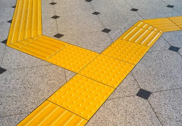
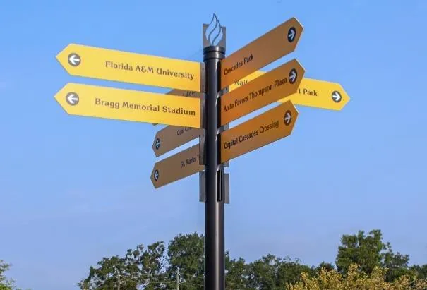
Universal Design Toolbox
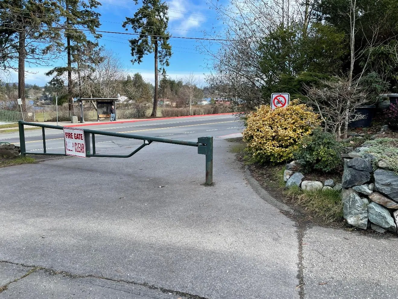
5.4 Short-term Priority Projects
A total of 13 priority infrastructure projects are recommended for the near term (1-10 year time horizon). They were informed by criteria including:
- Location highlighted as unsafe in public engagement.
- Traffic volumes and speeds too high for all ages and abilities.
- Filling a gap in the network or providing a critical connection.
- Proximity to schools, transit, recreational facilities, or lower income areas.
- Location within an identified growth centre.
5.4.1 Critical Corridor Improvements
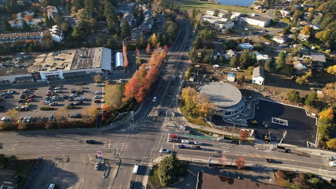
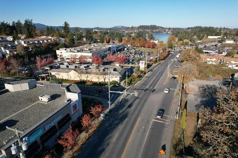
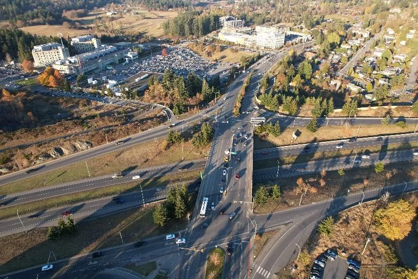
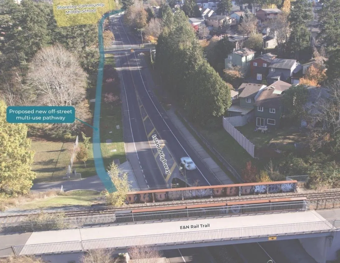
Three critical corridor improvement projects are recommended: A. Admirals Road (Island Highway to Hallowell Road) B. Island Highway (E&N Rail Trail to Admirals Road) C. Helmcken Interchange (Vickery Road to Watkiss Way)
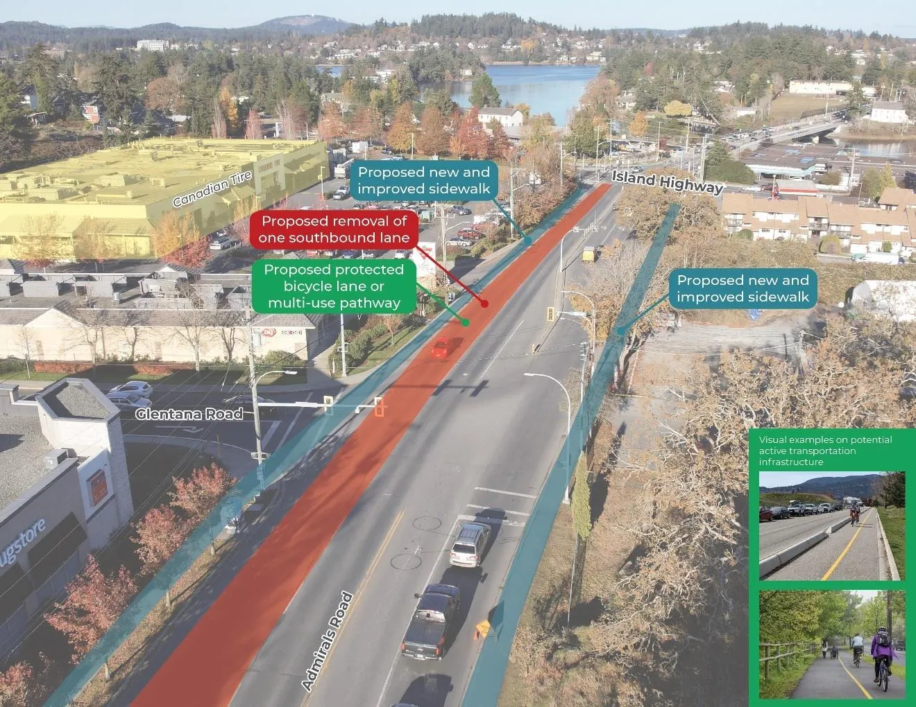
Admirals Road Proposed improvements include:
- Removal of a southbound travel lane
- Removal of the channelized right-turn lane at Admirals Road / Hallowell Road
- A bi-directional cycling facility or multi-use pathway on the west side
- Concrete curb sidewalks on both sides of the road
- New traffic signals at the Glentana Road and Aldersmith Place intersections
Public feedback on Admirals Road: Most respondents (72%) were supportive of improvements. Concerns were expressed about the removal of the southbound travel lane.
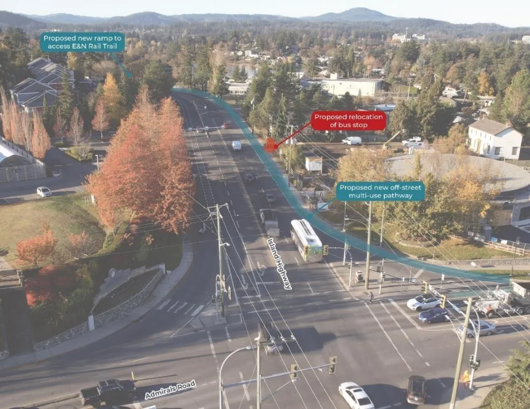
Island Highway Proposed improvements include an on-street multi-use pathway on the north side of the road transitioning off-street further west. This would result in the relocation of the bus stop on the north side.
Public feedback on Island Highway: Most respondents (84%) were supportive. Concerns included the loss of trees and pedestrian safety on multi-use pathways.
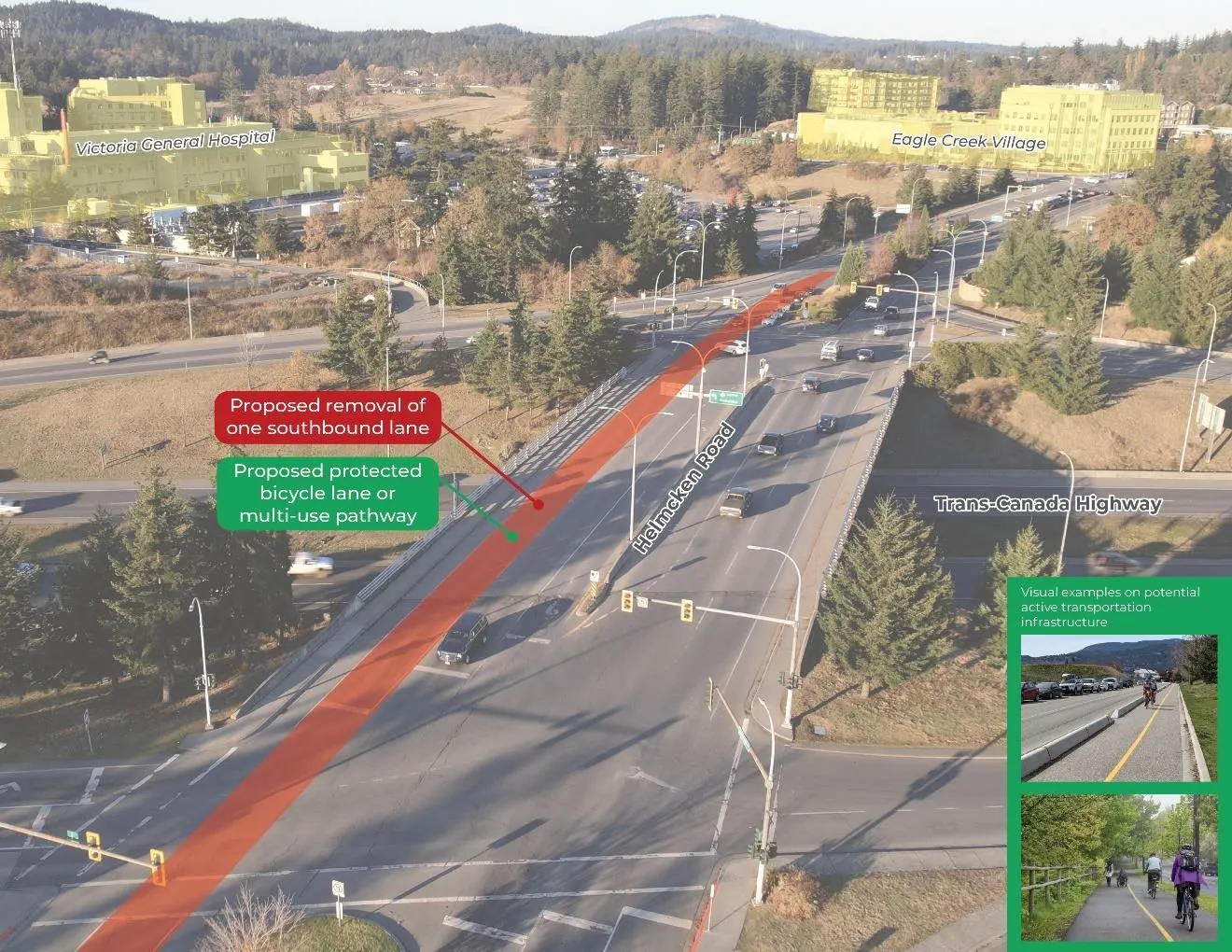
Helmcken Interchange Proposed improvements include:
- Removal of a southbound travel lane at the interchange (bridge deck)
- A bi-directional cycling facility or multi-use pathway on the west side
Public feedback on Helmcken Interchange: 65% supportive. Concerns included the removal of the travel lane and safety for on and off ramps connecting to the TCH.
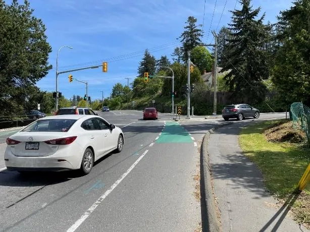
5.4.2 Other Corridor Improvements
Table 8. Other Short-term Corridor Improvements
| Project Location / Description | Length | Intended For |
|---|---|---|
| A. Helmcken Road (Watkiss Way to Burnside Rd). Install curb concrete sidewalks both sides, protected bike lanes, and a mid-block crossing at Camden Avenue. | 210m | 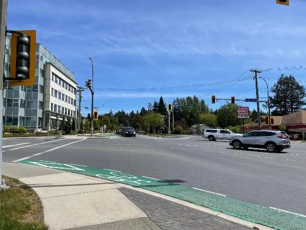 |
| B. Watkiss Way (roundabout to Helmcken Rd). Install protected bike lanes both sides. Widen existing sidewalks at the roundabout. | 185m | 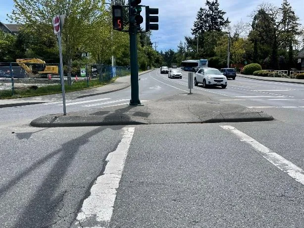 |
| C. Burnside Road (Helmcken Rd to Saanich border). Install curb concrete sidewalks on both sides. | 260m | 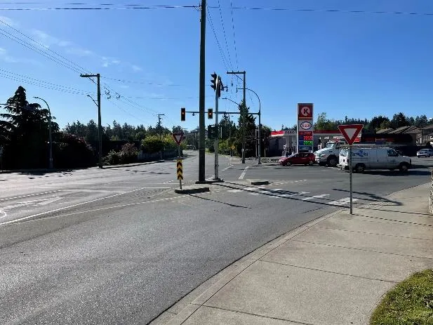 |
| D. Vickery Road / St. Giles Road. Install a Level 1 bicycle boulevard (30 km/h limit and markings). | 650m | 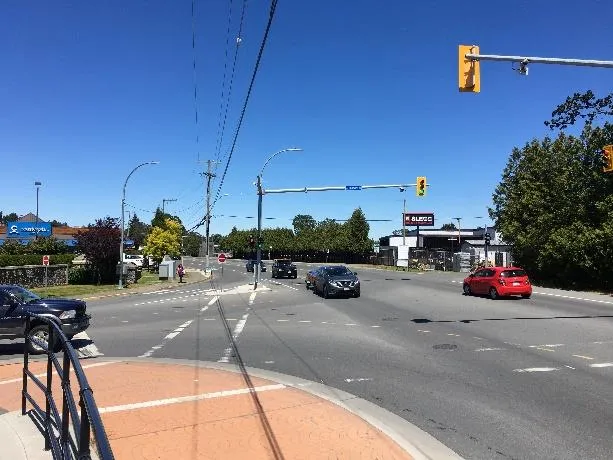 |
| E. Six Mile Road (Island Hwy to Thetis Lake). Install a multi-use pathway on the north side. | 900m | 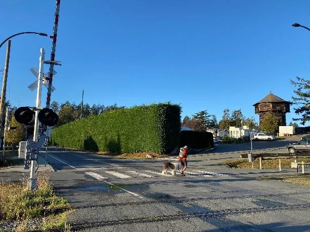 |
| F. Jedburgh Road (12 Jedburgh Rd to Helmcken Rd). Install curb concrete sidewalk on south side. | 135m | 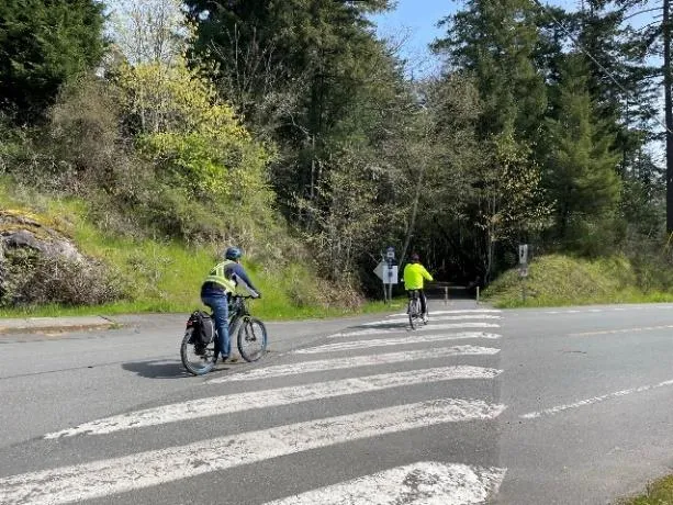 |
| G. Chancellor Avenue (Helmcken Rd to Galloping Goose Regional Trail). Install curb concrete sidewalk and protected bicycle lanes. | 175m | 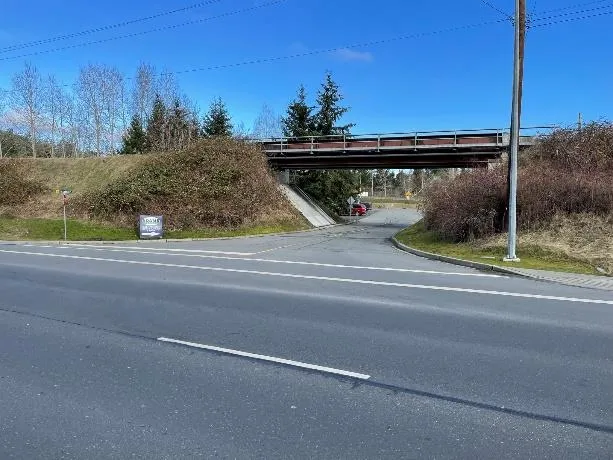 |
| H. Glentana Road (Island Hwy to Admirals Rd). Install a multi-use pathway on the northeast side. | 300m | 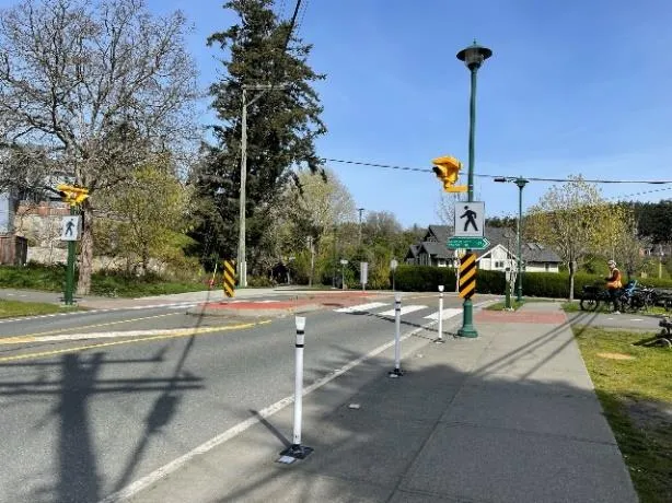 |
| I. Talcott Road (Galloping Goose Regional Trail to Eagle View Elementary). Install a multi-use pathway on the east side. | 125m | 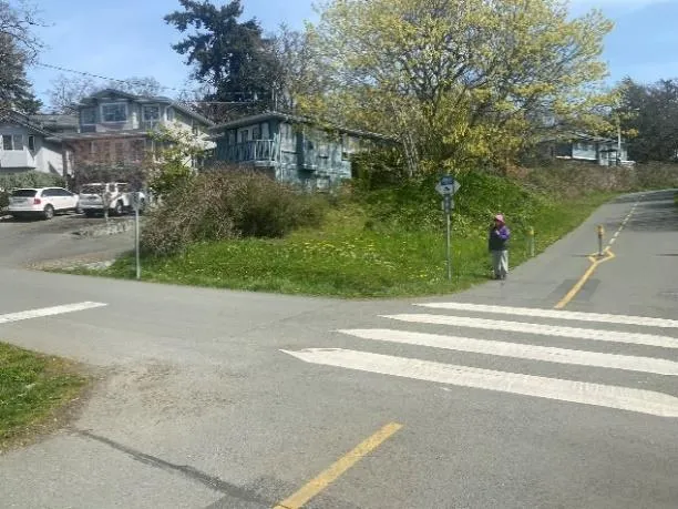 |
| J. Island Highway (Wilfert Rd to Hart Rd). Install curb concrete sidewalk on north side. | 115m | 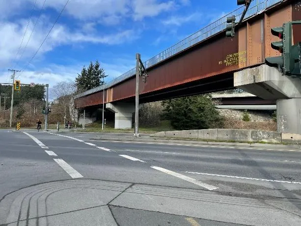 |
5.4.3 Intersection Improvement Reviews
Major Intersection Improvement Reviews
- (A) Burnside Road W / Helmcken Road: Ranked second as a “cycling incident hotspot”. Prioritize removal or redesign of the channelized right-turn. Partnership with the District of Saanich is required.
- (B) Helmcken Road / Watkiss Way: Short-term improvements include Leading Pedestrian Interval (LPI).
- (C) Helmcken Road / Island Highway: Improvements include audible signals, LPI, and curb ramp changes.
- (D) Admirals Road / Island Highway: High priority to remove or redesign channelized right-turn lanes.
- (E) Admirals Road / Hallowell Road: Improvements include audible signals, LPI, and removal of northwest leg right-turn lane.
5.4.4 Bus Stop Upgrades
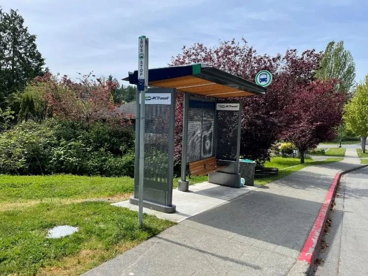
To achieve ambitious mode share targets, active transportation must be integrated with public transit. Two stations are proposed for the medium-term (next 3-5 years) as part of RapidBus implementation:
- Helmcken: RapidBus stations on the interchange featuring larger shelters and passenger amenities.
- Six Mile: Relocated stations on Island Highway at Atkins Road connecting to a Park & Ride.
Priority stops for passenger amenity improvements:
- Outlook @ Aldersmith (SB) [100881]
- Watkiss @ Helmcken (SB) [101080]
- Helmcken @ Westbound TCH Offramp (NB) [101064]
- Helmcken @ Midwood (NB) [101026]
- Helmcken @ Westbound TCH Offramp (SB) [101069]
- Helmcken @ Helmcken Park and Ride (NB) [101046]
5.5 Supporting Programs + Policies
5.5.1 Programs & Education
Table 9 – Potential Programs for Consideration
| Program | Description | Key Audience |
|---|---|---|
| Ready, Step, Roll | Annual CRD active school travel planning initiative. Town currently partnering with Eagle Creek Elementary School. | Families |
| Bicycle Skills Training | Funding support to advocacy organizations to offer skills training courses and incentives. | Residents, Employees, Visitors |
| Bike to Work/School Week | Campaign for employees and students to participate on teams and log cycling commute trips. | Primarily Employees & Students |
| Dedicated Active Transportation Webpage | Centralized source for sustainable travel information to support behavior change. | Residents, Employees, Visitors |
| ‘Amazing Places’ Walking Tour | Series of themed tours highlighting pedestrian-friendly destinations. | Residents, Visitors |
| BikeMaps & WalkRollMap | Crowdsourcing tools for mapping active transportation barriers and safety hazards. | Residents, Visitors |
5.5.2 Regional Trail Advocacy
With close to 17 kilometres of trails, View Royal has the greatest access to regional trails among CRD municipalities. Even though regional trails are under CRD jurisdiction, the Town could advocate for separation of trail users as a longer-term strategy.
The decision to separate bicycle users from other users is based on:
- Right-of-way available
- Total volume of current and anticipated pathway or trail users
- Ratio of pedestrians to all daily pathway or trail users
Separation should be explored at:
- Galloping Goose & Atkins Road: 1,360 daily users; 23% pedestrians.
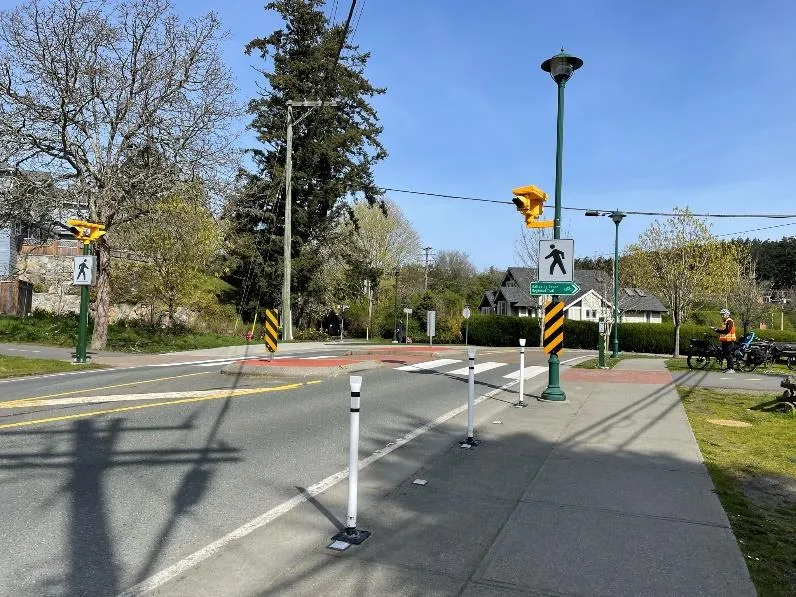
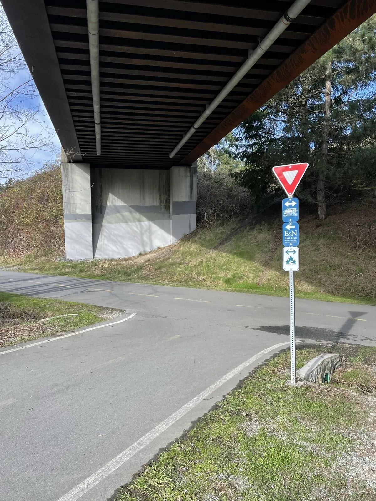
Signage at the Galloping Goose / Atkins Road crossing - E&N Rail Trail & Hallowell Road / Rail Crossing: 1,300 daily users; 38% pedestrians.
5.5.3 Staffing for Active Transportation Coordination
Staff Recommendation: With all of the recommended short-term priority projects—and the other policies and programs needed to support active transportation—it is recommended that the Town adopt a full time (equivalent to 1.0 FTE) Active Transportation Coordinator to oversee implementation.