Town of View Royal OFFICIAL COMMUNITY PLAN DRAFT JUNE 2022
The comprehensive draft of the new Official Community Plan, covering vision, land use, transportation, housing, economic development, and environmental policies.
This is the full content extracted from pages 1 to 105 of the provided document.
Town of View Royal
OFFICIAL COMMUNITY PLAN
DRAFT
JUNE 2022
TABLE OF CONTENTS
PART 1: INTRODUCTION.............................................................................................. 5
OVERVIEW ............................................................................................................................6 PLANNING PROCESS ............................................................................................................8 ABOUT VIEW ROYAL ...........................................................................................................11 COMMUNITY VISION STATEMENT.......................................................................................19 UNDERSTANDING VIEW ROYAL’S LOW-CARBON FUTURE .................................................22 REGIONAL CONTEXT STATEMENT......................................................................................23
PART 2: THEMATIC POLICIES................................................................................... 25
1 | LAND USE AND URBAN DESIGN......................................................................................26 OVERVIEW ..........................................................................................................................26 VIEW ROYAL TODAY ...........................................................................................................27 COMMUNITY DEVELOPMENT FRAMEWORK........................................................................32 LAND USE DESIGNATIONS..................................................................................................42 COMMUNITY-WIDE OBJECTIVES AND POLICIES................................................................. 48
2 | TRANSPORTATION AND MOBILITY ...............................................................................61 OVERVIEW ..........................................................................................................................61 VIEW ROYAL TODAY ...........................................................................................................62 OBJECTIVES AND POLICIES ...............................................................................................69
3 | HOUSING ............................................................................................................................76 OVERVIEW ..........................................................................................................................76 VIEW ROYAL TODAY ...........................................................................................................77 OBJECTIVES AND POLICIES ...............................................................................................81
4 | ECONOMIC DEVELOPMENT .............................................................................................86 OVERVIEW ..........................................................................................................................86 VIEW ROYAL TODAY ...........................................................................................................87 OBJECTIVES AND POLICIES ...............................................................................................92
5 | NATURAL ENVIRONMENT, ENERGY AND CLIMATE CHANGE......................................97 OVERVIEW ..........................................................................................................................97 VIEW ROYAL TODAY ...........................................................................................................99 NATURAL ENVIRONMENT OBJECTIVES AND POLICIES .................................................... 103 ENERGY AND CLIMATE CHANGE OBJECTIVES AND POLICIES......................................... 110
6 | PARKS AND RECREATION .............................................................................................113 OVERVIEW ........................................................................................................................ 113 VIEW ROYAL TODAY ......................................................................................................... 114 OBJECTIVES AND POLICIES ............................................................................................. 123
7 | COMMUNITY INFRASTRUCTURE AND SERVICES........................................................131 OVERVIEW ........................................................................................................................ 131 VIEW ROYAL TODAY ......................................................................................................... 132 OBJECTIVES AND POLICIES ............................................................................................. 138
8 | COMMUNITY FACILITIES AND WELLBEING..................................................................145 OVERVIEW ........................................................................................................................ 145 OBJECTIVES AND POLICIES ............................................................................................. 149
PART 3: DEVELOPMENT PERMIT AREAS.............................................................. 157
JUSTIFICATION AND AUTHORITY ..................................................................................... 160 FORM AND CHARACTER OF DEVELOPMENT .................................................................... 162 DEVELOPMENT PERMIT AREA: MIXED RESIDENTIAL ....................................................... 167 DEVELOPMENT PERMIT AREA: INTENSIVE RESIDENTIAL ................................................ 172 DEVELOPMENT PERMIT AREA: NEIGHBOURHOOD MIXED RESIDENTIAL USE ................. 177 DEVELOPMENT PERMIT AREA: INTENSIVE MIXED-USE ................................................... 182 DEVELOPMENT PERMIT AREA: COMMERCIAL .................................................................. 187 DEVELOPMENT PERMIT AREA: NATURAL WATERCOURSE AND SHORELINE AREAS ..... 191 DEVELOPMENT PERMIT AREA: SENSITIVE TERRESTRIAL ECOSYSTEMS........................ 201 DEVELOPMENT PERMIT AREA: NATURAL HAZARAD FIRE INTERFACE ZONE .................. 206 GLOSSARY OF TERMS............................................................................................. 209 APPENDIX.................................................................................................................. 220 APPENDIX A: REGIONAL CONTEXT STATEMENT POLICY ANALYSIS ................................ 220 SCHEDULES.............................................................................................................. 227
PART 1: INTRODUCTION
- OVERVIEW
- PLANNING PROCESS
- COMMUNITY VISION STATEMENT
- ABOUT VIEW ROYAL
- COMMUNITY VISION STATEMENT
- CLIMATE ACTION PLAN
- REGIONAL CONTEXT STATEMENT
OVERVIEW
WHAT IS AN OCP AND WHO IS IT FOR?
This Official Community Plan (OCP) is the culmination of a year of work with community members across View Royal. The OCP sets a course of what View Royal will be like in 10 years and beyond, and the steps that will be taken to get there. The OCP also sets the stage for the continued evolution of View Royal, as the community transitions from a suburban community to more urban future that adapts to change and protects what is cherished. This plan recognizes that there will be a need to rise to the significant challenges and opportunities of our time and is grounded in realistic climate actions for View Royal’s future. A commitment to long-term action is reflected in this plan.
THE OCP INFLUENCES HOW RESIDENTS LIVE, WORK, SHOP, PLAY, ACCESS SERVICES AND MOVE AROUND THE COMMUNITY, AND WITHIN THE REGION. THE OCP REFLECTS VIEW ROYAL’S DESIRED FUTURE DIRECTIONS, AND ITS GREATER REGIONAL CONTEXT IN THE CAPITAL REGION.
The OCP is a bylaw, prepared and adopted by Town of View Royal Council in compliance with the Local Government Act. It is a long-range policy plan that guides View Royal’s decision-making related to growth and development approvals, as well as other community interests such as housing, transportation, climate change¹, and infrastructure. The plan considers that View Royal is expected to be home to 4,000 more residents – from today’s population of ~11,000 to ~15,000 - by 2036 (BC Stats Population Projections, 2016).
The OCP is a policy document for the Town of View Royal and is to be implemented by all departments. This plan provides strategic direction for Town Council and staff, who apply the OCP vision and policies to a wide range of municipal decisions such as budgeting, servicing, capital projects, and in the review of land use and development applications and proposals. The OCP builds on the Town’s Master Plans and policies to provide higher level strategic direction.
1- Terms in bold are further explained in the glossary of terms.
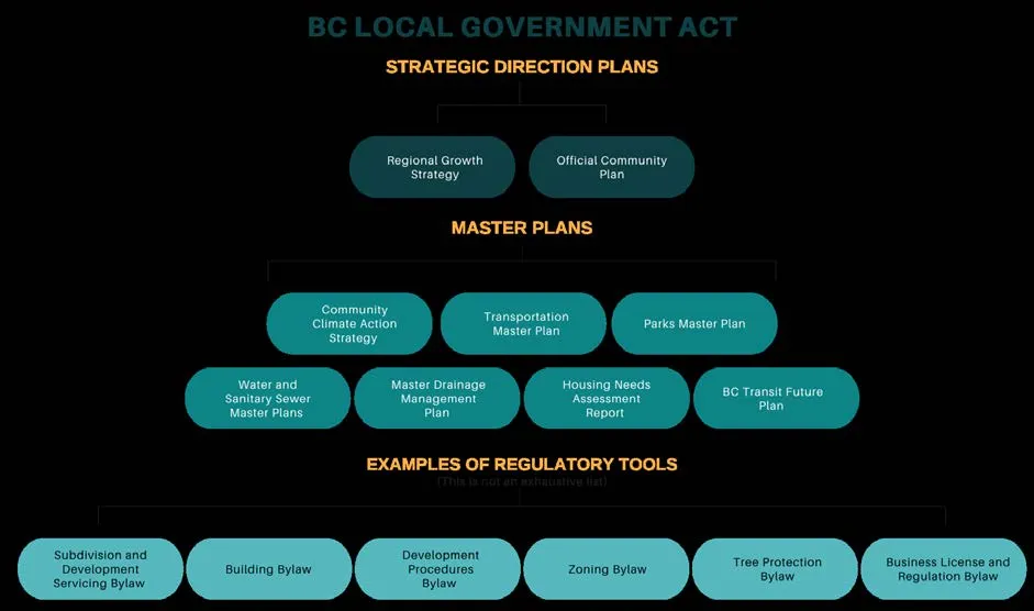
HOW DOES THE OCP FIT INTO THE TOWN OF VIEW ROYAL PLANS AND REGULATORY TOOLS?
The illustration below summarizes the OCP’s context and where it fits in with other plans and regulatory tools:
CREATING THIS PLAN
The Town of View Royal thanks all who contributed their voices, perspectives, lived experiences, and time to the OCP review process.
The OCP update was featured on the Town of View Royal’s website and throughout the review, there were social media posts, advertisements, direct mail, signs at park entrances and notices sent through stakeholder networks.
The OCP review occurred over the course of one year, starting in June 2021. Various adjustments were made in the delivery of the consultations to follow current COVID-19 health protocols.
CREATING THIS PLAN
The Town of View Royal communicated with other levels of government including First Nations, federal, provincial, and regional governments.
2021/2022
SEPT 2021 Topic focused 2-page primers on key issues were prepared to support shared understanding in the public consultations. Primers were posted on View Royal’s OCP update website and were included in communications with community members and consultation participants. Topics included:
- Housing Matters – Housing Needs, Diversity & Density
- Where’s the Heart – Placemaking & Design that Connects
- Moving Through & Around – Transportation Matters
- Building Better – Sustainable Economy & Redevelopment
- Nature Connection – Shorelines, Protected Areas
- Preparing for Change – Climate Change, Coastal Adaption
- Wildfire Interface
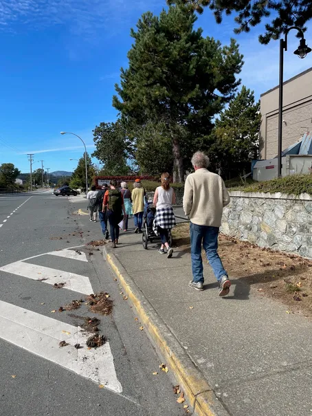
From September 12-29, 10 walkshops were held in 5 neighbourhoods:
- Admirals Portage
- Harbour/ Firehall
- Helmcken
- Hospital
- Island Hwy/ Casino
During 1-hour walks with Town planning staff, there were 75 participants and 42 completed worksheets which summarized what they wish to see protected, change and wish for the future of these neighbourhoods.
OCT/NOV 2021 169 community members participated in Phase 2 online survey, which was accessed through the View Royal OCP update webpage from October 25 to November 12.
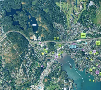
NOV 2021 29 people participated in 3 online workshops. Between November 8-10, the workshops were held via Zoom with presentation and online engagement using Mentimeter for polling and Mural for map-oriented inputs.
DEC 2021 What we Heard Phase 1 Consultation Report was competed and posted on project website.
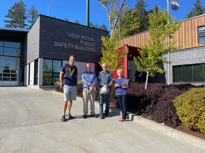
The project team met Town of View Royal Advisory Committees: Parks & Recreation and Community Advisory Committee to discuss Phase 1 engagement and seek input on Phase 2 consultation approaches outreach.
CREATING THIS PLAN
JAN 2022 Newsletters were mailed to all residents via Canada Post & signs were place in View Royal Parks to advertise Phase 2 consultation.
FEB 2022 308 community members participated in Phase 2 online survey.
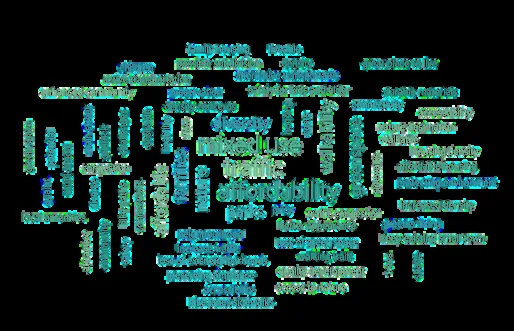
JAN/ FEB 2022 Between January 31 and February 2nd, a total of 51 people participated in 3 online workshops. This phase of consultation was focused on gathering views on design and transitions to direct future growth in neighbourhood nodes and corridors. The workshops were held via zoom, with presentation and online engagement using Mentimeter for participant polling inputs.
MAR 2022 Meeting with Town Council Committee of the Whole to seek guidance on key directions for updating the OCP.
MAR/APR 2022 Drafting the OCP.
JUNE 2022 Draft OCP for Referrals and Legal Review.
TBD Final OCP adopted by Council.
ABOUT VIEW ROYAL
This is the homeland of the lək̓ʷəŋən speaking peoples, known today as the Esquimalt Nation and Songhees Nation. Their original village sites and later Reserve lands were in Victoria’s Inner Harbour, but were “moved” to View Royal in 1911. Lək̓ʷəŋən families have gathered and harvested in the area now known as View Royal, since time immemorial, crossing an isthmus, now Portage Park, to harvest seafood in Portage Inlet. Lək̓ʷəŋən is the word for “a place to smoke herring” (Source: www.songheesnation.com).
Today, View Royal is a largely residential community of ~11,000 people in the centre-west part of the Capital Region. The Town shares boundaries with several other jurisdictions – Esquimalt Nation and Songhees Nation, Saanich, Langford, Colwood, Highlands (Map 1). The municipality was incorporated in December 1988; previously, it had been an Electoral Area of the Capital Regional District (CRD).
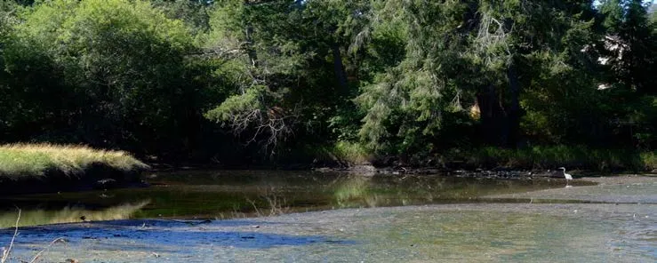
The form and character of View Royal has been shaped by a rich variety of ecosystems and natural environments. Today, close to 40% of the Town’s land base is parks - the largest being Thetis Lake and Mill Hill Regional Parks. View Royal has diverse shorelines including the salt-water environment of Esquimalt Harbour and Portage Inlet, the blending of salt and fresh waters in Craigflower and Millstream Creeks and their estuaries, and the freshwater ecosystems of Thetis, Prior and McKenzie Lakes. Terrestrial environments are equally varied, ranging from the moist Douglas Fir Forest habitat to the drier, rockier areas that produce the unique and rich Garry Oak meadows.
The Town is traversed by three major transportation routes – Highway 1 (Trans-Canada Highway), the Island Highway, and the E & N (Esquimalt and Nanaimo) rail line. These routes have significantly impacted the development patterns of View Royal for several decades. View Royal has historically referred to being formed by 8 neighbourhoods, who’s boundaries are often defined by natural features and roadways (Map 2).
Urban development in View Royal dates from the 1930’s when homes and cottages were built along Esquimalt Harbour and Portage Inlet. Much of View Royal was developed in the 1960s and 1970s. The lack of sewers postponed development during the late 1980s and early 1990s. In 1998, trunk sewers were extended through View Royal, to Colwood and Langford, as part of a major infrastructure program coordinated through the CRD, with significant federal and provincial funding. The extension of services provided opportunity for new development and redevelopment at higher densities in some parts of View Royal.
Victoria General Hospital is centrally located in View Royal. This regional facility is one of the largest employers on Vancouver Island and accounts for at least one-third of the approximately 4,000 jobs in View Royal. Despite the high number of jobs in View Royal, relatively few people (7.5% of the population) live and work in the Town. This means that most of the working population commutes to other municipalities for their jobs.
The tax base in View Royal is mostly residential. The residential sector accounts for 74% of the municipal tax base. The business sector accounts for 25%.
The adoption of the 2011 OCP allowed View Royal to manage substantial residential growth and many of the impacts of being part of a changing region. Like many communities, the Town is facing significant housing pressures due to population growth, a rapidly escalating housing market, and changing demographics.
Although View Royal is identified as part of the regional “Core” – which is expected to experience gradual and moderate growth over the coming decades – it borders the West Shore communities of Colwood and Langford: where most new regional growth has been focused and is anticipated to continue to grow.
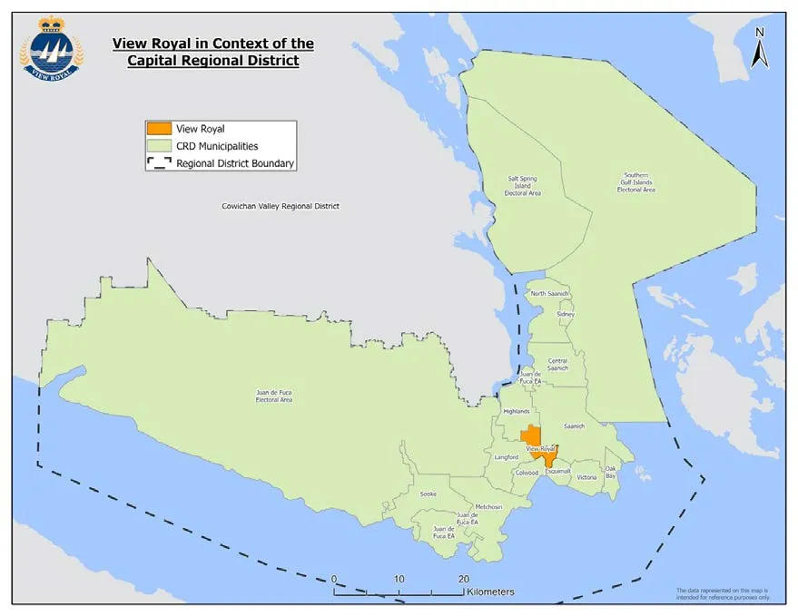
MAP 1: TOWN OF VIEW ROYAL’S LOCATION IN THE CAPITAL REGIONAL DISTRICT
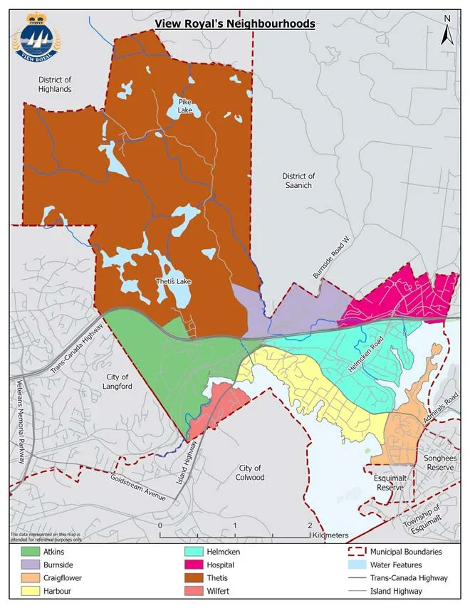
MAP 2: VIEW ROYAL’S NEIGHBOURHOODS
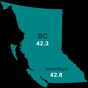
VIEW ROYAL AT A GLANCE
POPULATION, EMPLOYMENT, HOUSING & LAND
Please note: Information in this section is from Statistics Canada, 2016 and 2021; View Royal Housing Needs Assessment 2020; Capital Regional District Projections 2019; BC Stats 2021 and BC Assessment. Statistics Canada released the first of seven schedules of 2021 census data on February 9, 2022 (basic population and dwelling counts). More detailed 2021 census data will be released throughout 2022. This section reflects the most current information available at the time of OCP drafting in May 2022.
POPULATION AND DEMOGRAPHICS
The 2021 census data has View Royal’s population at 11,575 people. The Capital Regional District (CRD) estimates that View Royal’s population will keep growing over the next 20 years at an average growth rate of 1.9%, estimated using BC Stats data for the CRD.
Figure 2: The population in View Royal including Projections (2016-2036). (The line chart shows a steady upward trend from roughly 9,000 people in 2006 to over 13,000 by 2036)
POPULATION AGE
- Average age of the population in View Royal is 42.8 years old compared to 42.3 in the province.
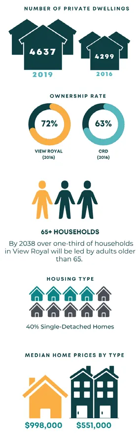
- The Town of View Royal has an aging population— projections show that by 2038 over one-third of households in View Royal will be led by adults 65+.
- Indicates a strong need to continue to support the development of housing that will allow seniors to age in place, including considerations for accessibility of homes, access to transit and services, and more compact forms of growth.
DEMOGRAPHICS
- Approximately 16% of the population has indicated they are immigrants.
- 20% of the population have indicated they are a visible minority, which is significantly lower than the 30% of visible minority populations in BC.
- Of that 20%, 5% have indicated they are First Nations, Inuit, or Métis.
HOUSEHOLD SIZE
- Average household size in View Royal was 2.36 people in 2019 and is expected to decrease to 2.08 people by 2036.
- ½ of new households by 2040 are expected to be non-family households, which is consistent with an aging population that has more single-person households.
- These changes in household size indicate there will be increasing demands for changes in housing type, with 1-to-2-bedroom homes anticipated to be in higher demand.
EMPLOYMENT
- There is a 66% participation rate in the labour force with a total working population in View Royal of 5550.
- 64% of View Royal residents are employed, with an unemployment rate of 3.8% compared to than the province’s rate of 6.7% (2016).
- Median household income has increased in View Royal from $79,534 in 2006 to $83,968 in 2016, representing a 5.6% increase.
HOUSING
- View Royal had 4637 private dwellings in 2019, with an increase of 338 dwellings from 4299 in 2016.
- The Town of View Royal has a high ownership rate of 72% (2016), compared to 63% in the CRD.
- There were an estimated 1,191 renter households in the Town in 2019, accounting for approximately 28% of households.
- There was a shift towards more rental households with an increase of 250 households from 2006 to 2016, an increase of 3%.
- Rental housing is a key area of need for the Town, including purpose-built rental, secondary market rental options (such as secondary suites, lock off suites, carriage houses), and non-market affordable rental housing units.
- The Town has a rental housing availability rate of 0.7%. A healthy vacancy rate is 3-5%, and View Royal’s vacancy rate has remained below this since 2013.
- 52% of dwellings are three or more bedrooms; however, only over a third (35%) of all households have three or more people. This indicates that smaller households, particularly older households may be ‘over-housed’ which can impact the ability to age in place for older seniors.
- View Royal’s dominant housing stock is single-detached homes at 40%. 83% of View Royal’s housing stock is ground-oriented, meaning that the front doors open to the outdoors rather than to a corridor, which excludes apartment buildings.
- The increased cost of housing is outpacing income growth in View Royal. Median-earning households are increasingly experiencing issues finding or renting housing in View Royal.
- The median single detached home cost in View Royal is $998,000 and condo/ townhouse median price is $551,000 (2021 BC Assessment).
Note: For further information on housing, refer to the 2020 Housing Needs Assessment.
LAND
- The land area of View Royal is 16.2 square kilometres, which includes Thetis Lake Regional Park and portions of Esquimalt Harbour and Portage Inlet. Over 40% of the Town land area is protected natural areas or parks.
- The population density was 807.6 people per square kilometre in 2021. View Royal has limited land space to grow. Future development of lands is required to be within the CRD Urban Containment Boundary. Undeveloped and un-serviced lands identified in the 2011 OCP have now been mostly developed.
- Future development will largely be redevelopment and infill to stay within the urban containment boundary. View Royal is a community in transition, from being a suburban community toward becoming more urban.
Outline of View Royal shown on a map of the region. Source: Capital Regional District Areas Atlas.
COMMUNITY VISION STATEMENT
The following statement sets out the community’s aspirations for what type of place View Royal wishes to be in 10 years and beyond. It describes the state of the community that residents wish for View Royal to evolve to in the future. The vision was developed through consultation with the community and is the guiding force behind the policies of this plan.
VIEW ROYAL IS A DYNAMIC AND INCLUSIVE COMMUNITY THAT MANAGES GROWTH, WHILE RETAINING THE CHARM OF ITS NEIGHBOURHOODS. It is home and workplace to people from all walks of life. Its neighbourhoods are attractive, affordable, walkable and safe. Each neighbourhood has an identifiable character and is connected to nearby centres through parks, greenspaces, and pedestrian/cyclist-friendly streets. Some neighbourhood centres have parks for families to gather and youth to play sports. Others are bustling places with a range of services, amenities, businesses, and housing in proximity to vibrant places, that retain the small community feeling.
VIEW ROYAL RECOGNIZES THE IMPACTS OF CLIMATE CHANGE. The Town, developers, residents, and partners respond collectively by advancing energy-efficient buildings, improving sustainable transportation options, and protecting View Royal’s urban forests, parks, and shoreline environments. Environmental stewardship, thoughtful and careful use of resources – such as alternative energy generation and enhanced waste management – are pursued.
Infill redevelopment, mixed-use developments, increased transit accessibility, and transportation alternative investments will support View Royal in advancing meaningful climate actions. Getting around safely by foot, bike, bus, and train is convenient and enjoyable, and a viable alternative to car travel. Train, light rail, and other forms of rapid transit are supported by development that facilitates ridership and walkability.
THE LOCAL ECONOMY IS DIVERSIFIED AND STRONG, PROVIDING EMPLOYMENT, SHOPPING, AND SERVICE OPTIONS TO LOCAL AND REGIONAL RESIDENTS. The areas around the hospital and the casino continue to evolve to provide local employment and service opportunities.
THE TOWN IS ENDOWED WITH UNIQUE NATURAL ENVIRONMENTS – Thetis Lake Park, Millstream Creek, Craigflower Creek, Esquimalt Harbour and Portage Inlet. The integrity and beauty of these natural amenities are protected and enhanced, while public access to recreation and natural areas is improved. The Town’s vast recreation assets are integrated into the community with linked trails and support residents’ quality of life.
VIEW ROYAL, IN EMBRACING FISCAL SUSTAINABILITY AND ECONOMIC WELLNESS, “LIVES WITHIN ITS MEANS” AND ADAPTS TO CHANGE. THE COMMUNITY IS HEALTHY, DIVERSE, INNOVATIVE, AND WELL PREPARED TO MEET THE NEEDS OF THE PRESENT AND PLAN FOR FUTURE CHALLENGES AND OPPORTUNITIES.
TEN GOALS EXPAND ON THE VISION AND SET THE FRAMEWORK FOR THE OFFICIAL COMMUNITY PLAN:
- Promote a strong sense of community in all areas and neighbourhoods of the Town and create an enhanced sense of place and identity.
- Create an inclusive community that provides housing, transportation and healthy living options and services, and facilities for families and individuals of diverse backgrounds, cultures, ages, and economic means.
- As the community grows, recognize the unique relationship between the highly valued natural and residential characteristics of View Royal, and maintain these values.
- Confirm View Royal as an environmentally responsible community committed to becoming a more sustainable place, taking meaningful actions to address climate change.
- With humility, continue to build trust, meaningful relations and reconciliation with friends and neighbours, Esquimalt Nation and Songhees Nation.
- Recognize, preserve, and protect the substantial historic and cultural resources in View Royal.
- Ensure that community services and amenities can be provided within the financial means of the municipality and strengthen partnerships with regional service providers to increase local opportunities.
- Identify suitable land areas and development incentives for commercial, institutional, and mixed-use activities as a means of supplying local employment opportunities, broadening the municipal tax base, and promoting View Royal as a business-friendly community.
- Recognize the community’s role in the region as a link in major transportation and environmental systems and cooperate with other municipalities and governments to both address regional issues and protect and promote local values and long-term sustainability.
- Ensure all citizens of View Royal have opportunities to be informed and meaningfully involved in planning and decision-making processes.
UNDERSTANDING VIEW ROYAL’S LOW-CARBON FUTURE
The Town of View Royal has joined over 1,500 jurisdictions around the world in declaring a climate emergency. This declaration reflects the urgency of actions needed to address a changing climate that is attributed to human actions. In 2022, View Royal completed a Climate Action Strategy. OCP policies are integrated through a lens of climate actions.
In addition to voluntarily declaring a climate emergency, Provincial legislation – the Local Government (Green Communities) Statutes Amendment Act (Bill 27, 2008) – also requires that each local government establish targets, plans, and strategies to do their part to mitigate climate change.
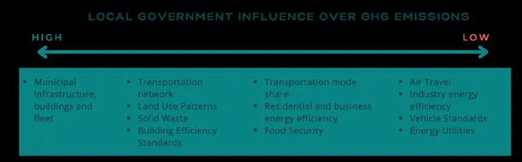
View Royal’s greatest influence over reducing greenhouse gas emissions (GHG) and advancing meaningful climate actions is in influencing municipal infrastructure and waste-management, setting buildings energy efficiency standards, and guiding future land use and transportation choices.
View Royal can reduce its GHG emissions by an estimated 36% below 2007 levels by 2030, and work towards the new long-term target of a reduction of 100% below 2007 levels by 2050. With a focus on View Royal’s future buildings and transportation, these ambitious targets can be realized. The following climate action strategies with highest impact will be embedded throughout this OCP’s policies.
View Royal is using tools to reduce emissions and vulnerability, while simultaneously seizing opportunities that build community health and well-being.
HOW WE WORK TOGETHER
REGIONAL CONTEXT STATEMENT
The Capital Regional District (CRD) Regional Growth Strategy (RGS) was adopted March 2018 (Bylaw 4017). The RGS guides decisions on regional issues such as transportation, growth, and settlement patterns. The 2018 RGS provides population projections to the year 2038 and updates policy regarding water servicing, growth management, the environment, infrastructure, housing, community, transportation, and economic development, as well as food systems and climate action. The View Royal Official Community Plan (OCP) must be consistent with the RGS through its vision, goals, objectives, and policies.
As required under Sections 446 and 447 of the Local Government Act, the View Royal OCP must include a regional context statement. The RGS regional context statement must describe the specific OCP content that relates to the RGS. This section provides a summary of relevant RGS content that is included in this OCP, to meet statutory requirements. Appendix A – Regional Context Statement Policy Analysis, contains a detailed comparison of the alignment with the RGS growth management policies. This section provides an overview of the relationship between the RGS and this OCP.
ALIGNMENT WITH THE REGIONAL GROWTH STRATEGY
The CRD RGS vision is that,
“In 2038, Capital Regional District residents enjoy a healthy and rewarding quality of life. We have a vital economy, livable communities and steward our environment and natural resources with care. Our choices reflect our commitment to collective action on climate change”.
Within the RGS, the Town of View Royal has a community profile/vision statement described as follows:
“View Royal will have a series of economic centres providing expanded retail, professional financial and convenience services. Single family detached housing will remain the predominant housing form with some provision made for other types of housing. A network of foot and cycle paths will provide neighbourhoods with access to shopping, recreation, and natural open space. Natural amenities associated with shorelines, streams, estuaries, hillsides, and forested areas will be protected.”
Within the RGS, View Royal is identified as a community within the Urban Containment Boundary, and a node that should provide for a wide diversity of housing and employment opportunities. Many of the region’s growth management objectives are directly relevant to the Town of View Royal OCP and are shared principles including:
- Significantly reduce community-based greenhouse gas emissions;
- Keep urban settlement compact;
- Protect the integrity of rural communities;
- Protect, conserve and manage ecosystem health;
- Deliver services consistent with RGS objectives;
- Create safe and complete communities;
- Improve housing affordability;
- Increase transportation choice;
- Strengthen the regional economy; and
- Foster a resilient food and agriculture system.
The regional principles complement the interrelated OCP growth management related goals of growing within the urban containment boundary. The direction is to focus future growth in neighbourhood centres and community corridors, located within the urban containment boundary. The OCP encourages transitions to higher density and diversity of housing in neighbourhood centres that are supported by transit service and alternative means to get around (walk/bike/scooter). Future growth is also directed along community corridors, where employment areas, services and mixed uses can support living and working in View Royal.
See Appendix A - Regional Context Statement Policy Analysis, for a detailed comparison of the alignment with the RGS growth management policies.
PART 2: THEMATIC POLICIES
- LAND USE AND URBAN DESIGN Community Development Framework; Neighbourhood Centres and Community Corridors
- TRANSPORTATION AND MOBILITY Transportation linkages for priority of movement – pedestrian, cycling, transit, and vehicles
- HOUSING Neighbourhood centres – directing future residential growth, with services and transit.
- ECONOMIC DEVELOPMENT Community corridors – where future businesses opportunities and employment areas will grow.
- NATURAL ENVIRONMENT, ENERGY AND CLIMATE CHANGE Ecological assets. Greenhouse gas emission reduction targets and adapting to changing climate.
- PARKS AND RECREATION Parks and community gathering places. Access to forests and waterfronts.
- COMMUNITY INFRASTRUCTURE AND SERVICES Infrastructure - water, sanitary sewer, drainage, waste management, fire protection and policing.
- COMMUNITY FACILITIES AND SOCIAL WELL-BEING Community and heritage resources. Reflecting diversity of cultures, ages, health, and well-being.
1 | Land Use & Urban Design
OVERVIEW
The Land Use and Urban Design chapter of the OCP sets out a framework for decision-making on land use and community placemaking in View Royal. The chapter establishes objectives, policies and implementing actions for a new approach to development in View Royal that focuses growth and development around mixed-use centres, transit, and trails. It also describes preferred outcomes for the scale and character of public and private development, favouring compact and people-friendly design that contributes to an increasingly sustainable and dynamic community.
Note that Section 3: Housing contains future development directions for increased housing diversity. Redevelopment directions for commercial areas and corridors are in the Section 4: Economic Development.
GOALS
- Create an inclusive community that provides housing and transportation options and services and facilities for families and individuals of diverse backgrounds, cultures, ages, and economic means.
- Encourage high-quality public space design that supports community gathering and enhances sense of place and identity throughout View Royal.
- As the community grows, protect the unique relationships between the highly valued natural environments and residential characteristics of View Royal.
VIEW ROYAL TODAY
View Royal’s approximate 16.2 square kilometres includes Thetis Lake Regional Park and portions of Esquimalt Harbour and Portage Inlet. Much of the Town is covered in water or protected natural areas. Undeveloped and protected land is concentrated in the north half of the community, outside the region’s Urban Containment Boundary. View Royal Park and Portage Park, located in the southern half of View Royal, are two of the community's largest local parks, with over 50 parks and green spaces spread out through View Royal.
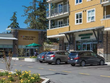
View Royal has distinct neighbourhoods with some smaller commercial activity; however, it does not have an identifiable town core. View Royal is located between the City of Victoria and the western communities and has been largely a residential community for those who work elsewhere in the Greater Victoria region. Currently, commercial uses in View Royal are limited to more auto-oriented locations along the Island Highway, Admirals Road, and at major intersections. There are some small pockets of neighbourhood services which offer good opportunities to build upon, and corridor commercial uses with potential for further development and infill. There is a limited mix of housing options like apartments or condos in-and-around existing commercial nodes to attract a broader range of residents and local businesses.
With changing demographics, market conditions, and regional growth, View Royal is beginning to change from a suburban community to a more urban community, which requires thoughtful attention to well-designed buildings and public spaces. View Royal wishes to support sensitive development that fits well with the existing community, and transitions are thoughtfully considered to benefit existing and future residents’ needs.
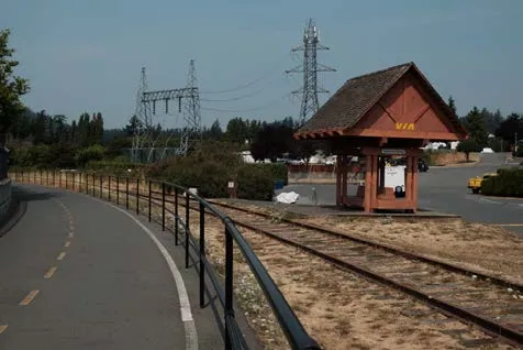
Currently, commercial development is low-intensity and auto-oriented, typified by single-level buildings with large parking areas, often set back or oriented away from the road. Commercial uses are mainly limited to locations along the Island Highway, Admirals Road, and major intersections. View Royal anticipates there will be a shift and redevelopment of these lands along the Island Highway and western gateway of the community to light industrial uses that will serve as important employment lands and take advantage of future investments in bus rapid transit along this corridor.
Unlike many communities in the CRD, View Royal does not have an identifiable commercial town centre or central gathering place for civic and cultural activities. In the long-term, a town centre is desired. However, that may be realized many decades in the future. Within the next decade, View Royal will direct investments to high-quality public spaces and redevelopment to neighbourhood centres, community corridors, and gateways.
Schools, community halls, municipal buildings, and the hospital account for most of the Town’s public facilities. Victoria General Hospital is anticipated to physically expand and expand its services in the coming decade. Ideally, the hospital would be co-located with primary care facilities and ancillary medical service providers.
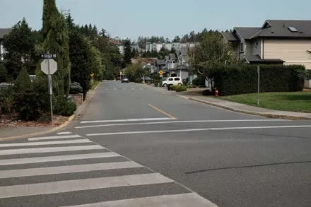
Today most of the developed land in View Royal is designated as residential and can be characterized as suburban neighbourhoods. View Royal has no remaining ‘greenfield’ sites for development within the Urban Containment Boundary. Future development will be redevelopment and infill of developed lands, or ‘brownfield’ sites.
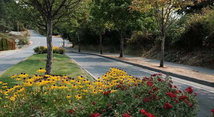
Pockets of View Royal can be considered “walkable,” but, as a whole community, the Town is not currently well designed for pedestrians. Most of the development is suburban in character and caters to people who get around by car. However, this is changing as more people are drawn to this part of the region, alternative transportation infrastructure is developed, and the Town encourages compact, sustainable development and placemaking.
View Royal’s adoption of a secondary suites bylaw was an initial and important step in responding to the changing planning context. The OCP identifies further steps to move the Town to a more sustainable future.
The area between the Island Highway and the Trans-Canada Highway includes a wide range of suburban housing types, low-intensity strip commercial, local parks, the Galloping Goose Regional Trail, and two schools. Many detached homes and buildings date back to the early- and mid-20th century. There are also several newer residential developments, including townhomes and apartments.
Thetis Lake Regional Park and the Victoria General Hospital dominate the section of View Royal north of the Trans-Canada Highway. The park and adjacent lands provide a large natural recreation area with sparse rural housing. Newer residential subdivisions connect along Burnside Road and Watkiss Way. The eastern part of this area includes some undeveloped and small agricultural parcels in the area known as Strawberry Vale. There are several small older homes in this area and limited convenience commercial and community facilities.
INFILL DEVELOPMENT
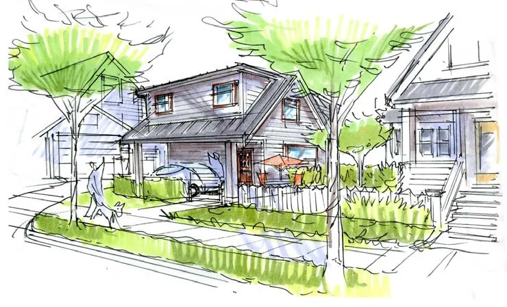
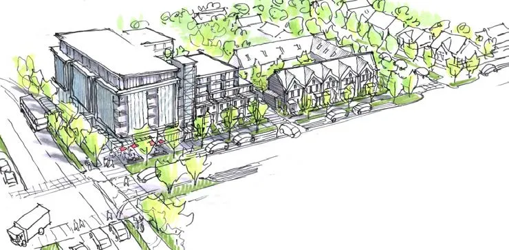
Infill Development – or Infill – is a term used to describe new development constructed in an already developed area. Infill can come in different forms, scales, and characters. Placing additional housing units on a residential lot, dividing detached homes into multiple units, building on a vacant lot, redeveloping a surface parking area, and demolishing and replacing an entire shopping mall are all forms of infill.
Infill makes use of existing servicing infrastructure and already disturbed land, reduces development pressure on natural areas, and can support increased walking, biking, and transit use. In View Royal, infill has the added benefit of bringing more people closer to existing and planned mixed-use and commercial centres, increasing the viability and vitality of these important activity hubs. Infill needs to be thoughtfully planned and well designed to be sensitive to existing conditions. Potential impacts on neighbourhood character, traffic safety, and property values are often concerns raised by existing residents, which need careful design considerations to ensure a good neighbourhood fit.
INTEGRATING LAND USE AND TRANSPORTATION
The distribution and form of the built environment are deeply connected to the design of transportation and servicing infrastructure. Just as past development was shaped by suburban streets, View Royal’s future development will be dictated by how, where and what type of infrastructure is planned and built.
To become a more sustainable community and reduce greenhouse gas emissions, View Royal must plan land use, infrastructure, and transportation systems together in a manner that is designed to decrease reliance on private vehicle travel and support compact, complete neighbourhoods that are walkable. This means expanding bike and pedestrian facilities; improving/ expanding rapid transit service; locating housing close to jobs and amenities; supporting higher density and mixed‐use development; and creating vibrant places that entice people to walk, bike and ride the bus.
In View Royal, there is a unique opportunity to integrate higher land use and transportation at nodes along the main east-west transportation routes – rapid transit along the Trans-Canada Highway and Old Island Highway. See also Section 2, Transportation and Mobility.
COMMUNITY DEVELOPMENT FRAMEWORK
The Community Vision lays out a future for View Royal that places the Town on a path to becoming a more sustainable and inclusive community. Key to achieving the Vision is a new framework for community development that promotes compact and walkable places, respects the character of established residential areas, while adding density that accommodates more diverse housing types, revitalizes commercial areas, and protects natural areas, green spaces, and environmental resources. The community development framework brings attention and focus to the transitions between properties and the different building forms and uses.
There are several urban design strategies that can be used when considering new development typologies within recognized Neighbourhood Centres and along Community Corridors. When implemented correctly, they can effectively integrate the future growth and anticipated density into adjacent existing neighbourhoods with minimal impacts. These strategies can contribute to the community’s livability with new and improved amenities and services and by enhancing the ecological and green infrastructure.
These design strategies range in scale and size starting with infill housing or hidden density. This typology is effective in incorporating small dwelling units into primary homes as secondary suites or as separate cottages, lane, or coach homes within a residential lot where the primary home can be retained.
TRANSITION AREAS
A fundamental component of the Community Development Framework is the recognition of areas where land use and design character transition from one type to another.
Transition Areas are seen as desirable and encouraged throughout the framework. They are mostly located along or near major roads in Community Corridors, including transit servicing and mixed-use commercial services, or along Neighbourhood Centres.
TRANSITION AREAS
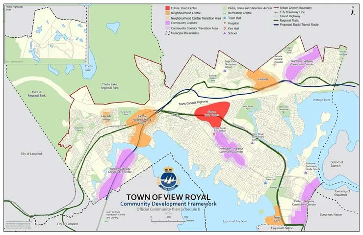
Development and improvement in Transition Areas must also respond to the unique economic, environmental, and social context of the individual locations and fit within the Community Vision, and therefore is more likely to be implemented with site-specific development proposal or local area planning rather than the zoning bylaw. The OCP Transition Areas are identified on Schedule B Community Development Framework.
- Lakeside Village
- Eastern Gateway Community Corridor (Admirals)
- Western Gateway Corridor
- 6 Mile Neighbourhood Centre
- Town Centre (Fort Victoria)
- Harbour-Helmcken Community Corridor
- Hospital
- Northern Gateway Corridor
- Thetis Cove
The Community Vision describes View Royal as:
A community of neighbourhoods, with identifiable neighbourhood centres connected by greenspace, trails, and multimodal streets.
The Community Vision also contemplates the development of a community-serving Town Centre and revitalized Community Corridors. Both Neighbourhood Centres and Community Corridors have surrounding Transition areas. Neighbourhood Centres and Community Corridors are the strength of the Community Development Framework. They enable View Royal to continue to grow and flourish despite existing land constraints and lack of greenfield developable lands. They offer an opportunity to promote better urban design and encourages infill developments. Neighbourhood Centres and Community Corridors are listed and described in the following OCP sections and are presented in Schedule B - Community Development Framework.
SCHEDULE B COMMUNITY DEVELOPMENT FRAMEWORK
COMMUNITY DEVELOPMENT FRAMEWORK – NEIGHBOURHOOD CENTRES
Neighbourhood Centres are local-serving mixed-use centres – activity hubs that fit well within the scale and character of their surroundings. These centres support the established residential areas by providing services, shops, and employment opportunities closer to where people live. These centres also allow for more diverse and higher-density housing forms. While the scale and character of the Neighbourhood Centres will be context-driven, each is intended to be a walkable, people-friendly place where neighbours and visitors have opportunities to come together and interact.
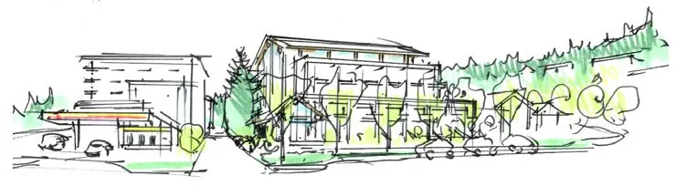
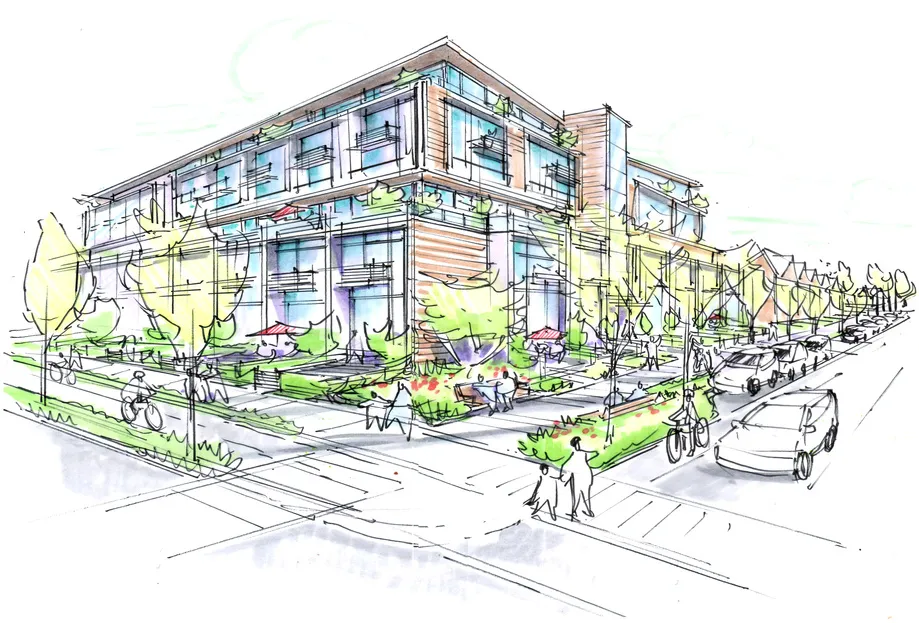
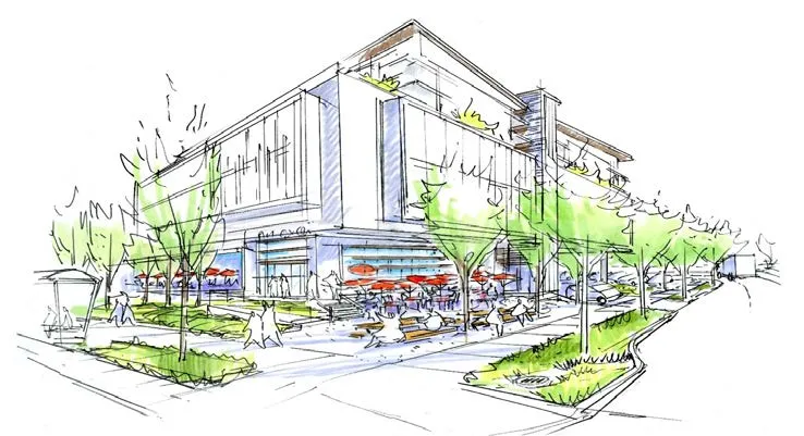
Mixed-use development typologies can accommodate a variety of retail and commercial units located on the ground level and lower floors and positioned with clear visual and physical access from the public realm. Retail units integrated into mixed-use developments provide conveniently located amenities and services that are easily accessed by foot within a neighbourhood and contribute to the important social connections made among community members and visitors to the area. Improvements to the streetscape with small seating terraces attached to a local café, deli, or restaurant and well-placed furnishings under new street trees also help activate the public realm and further build the community’s social capacity and livability.
Residential units typically occupy the floors above street level and have a building design setback to diminish the perceived height from adjacent dwellings by stepping the upper floors back. However, residential units can also be located on the street level as townhomes with ground-level access and small gardens or terraces adjacent to and engaging with the public realm. These also help create a ‘neighbourly’ condition and contribute to the social aspect of a neighbourhood and a sense of safety with ‘eyes onto the street.’
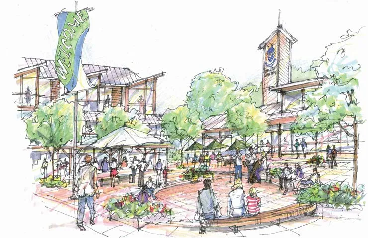
These urban design strategies are combined with the associated improvements to transportation and social amenities to create more walkable and bikeable neighbourhoods. Along with opportunities to improve the transit infrastructure, made viable by increased density and ridership, there are several recognized benefits supporting the community’s overall health and wellness. Environmental benefits can also be realized as integrated stormwater strategies are incorporated, improving water quality within nearby fish bearing watercourses, and additional soil volumes within boulevards that help increase biodiversity and enhance tree canopies. These provide healthy habitats for wildlife as well as enhancing the urban environment for communities, with improved air quality and by helping to reduce seasonal heat island effect.
The OCP identifies four mixed-use Neighbourhood Centres:
- Lakeside Village
- Six Mile
- Hospital
- Thetis Cove
Two types of Neighbourhood Centres are supported in the OCP, local-serving Neighbourhood Centres and a community-serving Town Centre. Neighbourhood Centres include areas where there is existing development or active development interest and areas where the Town will encourage more interest and planning.
LAKESIDE VILLAGE
The Lakeside Village Neighbourhood Centre is located on the east side of Six Mile Road between Nursery Hill Drive and the Trans-Canada Highway. Uses at Lakeside Village include apartment dwellings and ground-level commercial. The Neighbourhood Centre incorporates a small, walkable activity hub. It provides amenities for the newer residential developments across Six Mile Road and Chilco Road and visitors to Thetis Lake Regional Park.
SIX MILE
The Six Mile Neighbourhood Centre is planned for the Six Mile Neighbourhood in the area between the Trans-Canada Highway and the Island Highway, where the E&N Rail corridor and Galloping Goose Regional Trail cross. One of three regional rapid transit exchanges is planned for this area. A transit-oriented Neighbourhood Centre is envisioned to maximize the benefit of the rapid transit infrastructure to the Six Mile Neighbourhood and the entire View Royal community. This means creating an appealing place for people to come together, live and work rather than simply providing a park-and-ride facility. Uses may include commercial and attached housing designed to support transit and trail use. The Neighbourhood Centre will be oriented to the Island Highway, E&N, and the Galloping Goose.
HOSPITAL
The Hospital Neighbourhood Centre is planned for the lands surrounding the Victoria General Hospital. The lands to the east have developed as Eagle Creek, and lands to the south-east and west are likely to redevelop in the future. New development in this area aims to create and support synergies between the hospital, a planned rapid transit stop, Galloping Goose trail, and existing and future housing. Uses may include attached housing and hospital-related commercial such as offices, accommodations, and restaurants. Improving connections to trails and transit will take precedent over providing facilities for cars. As is the case with the Six Mile Centre, this area is planned to be a vibrant and appealing activity hub rather than a park-and-ride.
THETIS COVE
The province has acquired this site to support its efforts toward Reconciliation with First Nations. While the long-term tenure arrangements have not been settled, the Town acknowledges the site will eventually be under the administration of the Esquimalt Nation. The Town supports Esquimalt Nation in determining the future of this land and encourages development that takes advantage of waterfront views, shoreline access and adjacencies to Portage Park and the E&N Rail Trail. New attached housing and supporting commercial uses will complement and support the Admirals Walk Neighbourhood Centre. The Town has a strong interest in supporting development that will create a new publicly accessible park and waterfront areas for walking, sitting, and gathering.
TOWN CENTRE
There is a desire to plan for a central community gathering place to be the civic and cultural heart of View Royal, however, it is understood that it may take several decades to realize this goal.
The Fort Victoria RV Park site is identified in the OCP as the preferred location for the View Royal Town Centre. The community selected this site for its large land area; central location; and excellent proximity to transportation infrastructure, including the planned regional rapid transit corridor, two regional highways, two regional trails, and the E&N Rail corridor. In articulating a vision for this site, the community has consistently described compact, high-density, transit-oriented development with a diverse mix of residential, commercial, civic, and cultural uses. The community has also expressed the need for the Town Centre to include a great public gathering space, a transit station or exchange, connections to the neighbourhoods in north and south View Royal, and a strong link with View Royal Park.
The OCP goals and policies support the development of the Fort Victoria RV Park as the View Royal Town Centre, if and when, the land becomes available for this use. It is understood that current conditions do not allow for immediate planning but that Town planning decisions will recognize the Community Vision and not preclude the eventual development of the Town Centre. The Neighbourhood Centres will remain the underpinning of the Community Development Framework and will be pursued as an OCP priority.
COMMUNITY DEVELOPMENT FRAMEWORK - COMMUNITY CORRIDORS
The planning context in View Royal is defined by existing roads and rights-of-ways. These transportation routes represent both significant planning challenges and opportunities. While the role of major transportation corridors is addressed in Section 2: Transportation and Mobility chapter, Community Corridors – major transportation corridors that are change areas or major activity hubs – are described in this section because of the need to plan for land use and transportation in tandem.
Community Corridors have similar roles in the Community Development Framework as Neighbourhood Centres. The major differences are the linear structure of these areas and their inherent relationships to the major arterial roads that they border. Community Corridors function both as centres and destinations and connectors within and between neighbourhoods and Neighbourhood Centres. Moving between the economic and transportation hubs of Community Corridors and Neighbourhood Centres should be thought of as transition areas that allow for greater access to services and employment opportunities.
The OCP identifies four mixed-use Community Corridors:
- Western Gateway Community Corridor
- Northern Gateway Community Corridor
- Helmcken-Harbour Corridor
- Eastern Gateway Community Corridor
The Western Gateway, Northern Gateway and Eastern Gateway Community Corridors are particularly unique in that they serve as major entries into the Town. These corridors also have the potential to draw both local and regional visitors and will need to be planned to accommodate regional access.
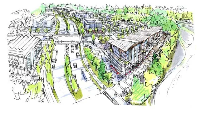
The anticipated growth along the Commercial Corridors also requires a degree of urban design and effective planning to ensure the successful integration of commercial services and amenities within, or close to, established neighbourhoods. Fostering a diverse range of co-located retail and light industrial services not only creates a more resilient economic hub, it also provides the required services and amenities within the growing community as well as diverse employment opportunities with View Royal.
Like the Neighborhood Centres, these mixed-use and light industrial developments may evolve from larger auto service oriented light industrial, to neighbourhood retail positioned adjacent to the street frontages and closer to future transit stops. These future commercial hubs are more walkable with attractive defined street edges, with the opportunity to include space for designated bike network and integrated stormwater management systems.
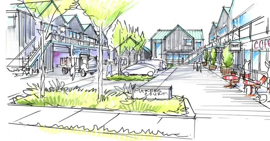
Like townhomes in the neighborhood nodes, low level, mixed-use models could also be effective as transitional uses between commercial activities and existing residential neighbourhoods. Figure 9 illustrates ground level ‘maker spaces or commercial studios’ with an associated residential above. These provide a degree of affordability for small upstart businesses as well as a sense of community and level of interest with the diversity of enterprise.
WESTERN GATEWAY COMMUNITY CORRIDOR
The Western Gateway Community Corridor includes all the land fronting the Island Highway in the Wilfert Neighbourhood and stretches from the City of Colwood boundary to Parsons Bridge. This is the western gateway to View Royal and a well-traveled section of the Island Highway. The vision for the Western Gateway Community Corridor includes intensive commercial of a scale appropriate to a major arterial roadway and designed to create an attractive activity hub. Commercial uses may include high tech, research and development, light manufacturing, and offices. Buildings should be planned to relate to and enhance the street-level environment and connect with surrounding residential areas, trails, bike routes and transit.
NORTHERN GATEWAY COMMUNITY CORRIDOR
The Northern Gateway Community Corridor includes the lots fronting Helmcken Road between Burnside Road and the Trans-Canada Highway and a few lots on Watkiss Way on the east side of the Helmcken intersection. The corridor has experienced incremental infill development in the form of higher density housing, and it is anticipated that further redevelopment will continue. A continuation of residential infill will bring more diverse housing closer to the hospital and revitalize underutilized lands. Ancillary commercial and hospital-related uses will also be encouraged as part of mixed-use projects closer to the Trans-Canada Highway and the larger parcels near Watkiss Way.
HELMCKEN-HARBOUR COMMUNITY CORRIDOR
The Helmcken-Harbour Community Corridor is located along the Island Highway between the Helmcken and Harbour neighbourhoods. This section of the Island Highway has historically supported small-format commercial uses combined with a mix of housing. New housing and limited mixed-use development will be encouraged to concentrate around the intersection of Island Highway and Helmcken Road and will be restricted to lots fronting the Island Highway. The area around the intersection is envisioned to be a small, walkable activity hub with supporting residential land uses extending east and west. The character and scale of the Helmcken-Harbour Community Corridor will need to respond to shallow lot sizes, limited parking, and the valued character of adjacent residential areas. This plan envisages the remainder of the properties outside the Helmcken/Island Highway intersection as a mix of residential types, including townhouses and low-rise apartments.
EASTERN GATEWAY COMMUNITY CORRIDOR
The Eastern Gateway Community Corridor Neighbourhood Centre encompasses the existing Admirals Walk, Nelson Square and Canadian Tire shopping centres. The area is already a busy activity hub in the community and is envisioned to continue as such into the future.
Although the land use pattern is planned to remain the same, there are opportunities to improve this area. These include enhancing its presence as a gateway through public space and streetscape upgrades that improve the area’s aesthetic and street-level comfort; stronger and safer pedestrian and cycling connections; and new connections to Thetis Cove. Over time, there may be additional opportunities to redevelop surface parking (below grade to be more land efficient), intensify commercial uses, and add residential uses.
Note: Community Corridors and gateways are further discussed and have associated policies in Section 4 Economic Development
RAILS AND TRAILS
View Royal is fortunate to be connected to the region by multi-use trails and the E&N Rail corridor. These great community amenities provide unique recreation and transportation options for View Royal residents and visitors. The transportation issues and opportunities of these amenities are further discussed in Section 2: Transportation and Mobility.
LAND USE DESIGNATIONS
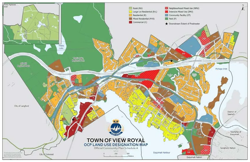
View Royal’s land use designations are described in this section. The designations identify the broad uses allowed in Town and describe each type’s general form and character. Maximum density is expressed as Floor Space Ratio or FSR. The corresponding Land Use Designations Map (Schedule A) graphically represents the planned land use pattern and distribution.
RELATIONSHIP TO THE ZONING BYLAW
The OCP establishes an overall vision, framework and distribution pattern for land use and urban design decisions in View Royal. However, the Zoning Bylaw regulates land uses and establishes permitted densities and lot sizes. These two documents work together to guide and regulate long-term change and to implement the community vision.
The previous Land Use Bylaw was repealed and replaced with the 2014 Zoning Bylaw. It is not intended that all regulations of each property and each zone be reviewed against each land use designation in this OCP. Notwithstanding any other provisions of this Plan, any policies concerning zone categories, including permitted uses and densities in this Plan, are, where necessary to achieve consistency, expanded to include the existing regulations under the previous Land Use Bylaw, and all its amendments up to and including its repeal and replacement by the zoning bylaw, including as carried forward.
For certainty, this provision is limited to the situation where the existing zoning of a property permits a use, density, or other development regulation different than otherwise identified in this Plan for that property; by virtue of this provision, this Plan incorporates and permits those zoning regulations for that property such that there is no inconsistency with this Plan. However, all subsequent amendments to the zoning bylaw must be consistent with this Plan without recourse to the regulations of the Zoning bylaw and this provision.
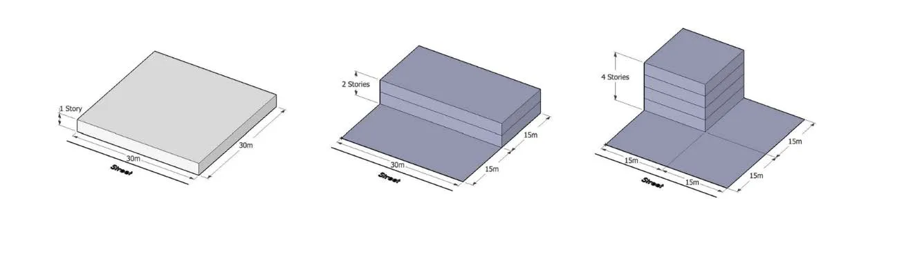
FLOOR SPACE RATIO (FSR)
FSR expresses the ratio of built (or buildable) area to land area. The definition of the buildable area varies between jurisdictions but usually includes the development footprint area plus the floor area of upper building levels. The land area is the development site or parcel(s).
FSR indicates the intensity of development and – different from the other density measurements – gives some indication of massing options. This provides both parameters and flexibility for designers and developers. FSR also considers all types of land uses, including residential and commercial – making this measurement method a preferred option in communities seeking to encourage mixed-use and transit-oriented environments.
SCHEDULE A: OFFICIAL COMMUNITY PLAN LAND USE DESIGNATIONS
DENSITY BONUSING AND PHASED DEVELOPMENT AGREEMENTS
In almost all cases, a rezoning application will be required before the FSR envisioned by the OCP can be achieved on a given site). The FSR appropriate for any site will depend on a few factors, including the location in the community, relationship to the neighbourhood, site topography and environmental features. This Plan assumes that in most circumstances, the maximum FSR will only be achieved through community amenity density bonusing or as part of Phased Development Agreements. Provision of community and neighbourhood amenities – such as affordable housing, parkland development, public art, community facilities, heritage conservation, and transportation demand management measures – will allow developments to achieve a higher density and result in additional community benefits.
View Royal has developed a Community Amenity Contribution policy, or CAC policy, which is included in Section 3: Housing. This policy enables the continued provision of neighbourhood amenities.
HOW IS FSR CALCULATED?
Amount of built/buildable area = FSR Land area
EXAMPLE 900 m² buildable area = 1.0 FSR 900 m² site
Figure 11 FSR shown over 1, 2, and 4 storeys.
LAND USE DESIGNATIONS
Note: Allowable density is expressed as a Floor Space Ratio (FSR) for mixed-use and commercial land uses. Density for all land uses will be specified in the Zoning Bylaw. Additional density may be determined for development applications with increased community amenities such as affordable housing, public art, childcare facilities, and park dedication.
| LAND USE, FORM & CHARACTER | EXAMPLES |
|---|---|
| Large-Lot Residential • Detached Homes • Large Lots and Yards • Up to 40% lot coverage |
|
| Residential • Predominantly Detached Houses and Townhouses • Up to FSR 1.25 permitted for appropriate infill |
|
| Mixed Residential • Small Lot Detached Houses, Townhouses and Low-Rise Apartments • Up to 1.4 FSR • Up to 1.6 FSR for Apartment Dwellings |
|
| Neighbourhood Mixed-Use • Commercial with Townhouses and Low-Rise Apartments • Up to 2.0 FSR |
| LAND USE, FORM & CHARACTER | EXAMPLES |
|---|---|
| Neighbourhood Centre • Commercial with Apartments • Up to 3.0 FSR |
|
| Intensive Mixed-Use • Commercial with Townhouses and Low-Rise Apartments • Up to 2.5 FSR |
|
| Commercial • Retail, Office, Technology and Service Commercial • Up to 2.5 FSR |
|
| Park, Open Space, Recreation • Local and Regional Parks and Trails • Protected Natural Areas and Open Space |
|
| Community Facility • Government Buildings & Publicly Owned Facilities, including Schools • Community Centres |
| LAND USE, FORM & CHARACTER | EXAMPLES |
|---|---|
| Rural • Agricultural, Recreation and Large Lot Residential 1 unit per 10 hectares |
|
| Comprehensive Development Areas (CDAs) • Areas with unique Comprehensive Development Designations |
COMMUNITY-WIDE OBJECTIVES AND POLICIES
The following section sets forward the Town’s community-wide Land Use and Urban Design objectives and policies for the Town to pursue to implement these portions of the OCP.
OBJECTIVE LU1
Create a more complete and sustainable community by directing most new growth into compact neighbourhood nodes, corridors and mixed-use centres connected by excellent, multimodal transportation infrastructure.
POLICIES
LU 1.1 Neighbourhood Centres Create a network of neighbourhood-serving, mixed-use centres. Encourage the majority of redevelopment, infill residential, and commercial growth into these areas to create complete neighbourhoods that are compact, walkable, cycling-friendly activity hubs.
LU 1.2 Connected Centres Ensure each neighbourhood centre is served and connected to the surrounding area by a range of transportation choices, including transit and bike and pedestrian pathways. Similarly, ensure that residential densities at neighbourhood centres support the viability of transit, bike, and pedestrian travel modes.
LU 1.3 North-South Connections Provide stronger pedestrian and cycling connections across the Trans-Canada Highway to improve access and create a unified sense of identity between View Royal’s north and south neighbourhoods.
LU 1.4 Diversity of Forms and Uses Support a variety of residential housing forms and commercial services within 400m, 10-minute walking distances to encourage socio-economic diversity and provide for the diverse needs of youth, families, and an aging population.
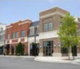
LU 1.5 Land Use Designations The OCP establishes the following land use designations, as mapped on Schedule A and visually depicted on the accompanying photos:
- Commercial – a range of commercial uses including retail, office, technology, and services up to a maximum Floor Space Ratio of 2.5.
- Intensive Mixed-Use – Commercial uses with townhouses and low-rise apartments up to a maximum Floor Space Ratio of 2.5.
- Neighbourhood Mixed-Use – Commercial uses with townhouses and low-rise apartments up to a maximum Floor Space Ratio of 2.0.
- Mixed Residential – detached homes on small lots, townhouses, and low-rise apartments. Up to a maximum Floor Space Ratio of 1.4 for townhouses; up to a maximum Floor Space Ratio of 1.6 for apartments.
- Residential – predominantly detached homes and townhouses, up to a maximum Floor Space Ratio of 1.25.
- Large Lot Residential – detached homes on large lots, up to 40% lot coverage.
- Rural – agricultural, recreation and large lot residential up to a density of one unit per 10 hectares.
- Parks, Open Space, Recreation – local and regional parks and trails; public assembly uses, indoor recreation, protected natural areas and open space.
- Community Facility – government buildings and publicly owned facilities, including schools.
LU 1.6 Community Amenities Foster the provision of community and neighbourhood amenities associated with new development through the development of amenity density bonus provision in the zoning bylaw or through negotiated Phase Development Agreements.
LU 1.7 Density Density (lot size) at the site level will be determined through the Zoning Bylaw.
LU 1.8 Temporary Use Permits Temporary Use Permits will be considered on a case-by-case basis throughout the Town.
OBJECTIVE LU2
Preserve the valued ambiance, scale, and character of established residential neighbourhoods while enhancing connections between neighbourhoods and to mixed-use centres.
POLICIES
LU 2.1 Residential Character Protect the character of established residential areas located outside the mixed-use centres by maintaining development standards through Form and Character Development Permit Areas (See Part 3).
LU 2.2 Connected Neighbourhoods Strengthen connections between existing residential neighbourhoods and the mixed-use centres through urban design, public space improvements, pedestrian, bike, and transit supportive facilities.
LU 2.3 Targeted Residential Infill Encourage residential infill as a means of providing greater housing options and addressing the demand for ground-oriented family housing. Infill should be designed to integrate into the existing neighbourhood and should adhere to Infill Guidelines to be developed by the Town following the adoption of this plan.
LU 2.4 Garden Suites and Detached Secondary Suites Consider allowing garden suites and detached secondary suites on residential properties that are greater than 350m² in size.
LU 2.5 Water and Shoreline Recognize View Royal’s watercourses and marine waterfronts as character-defining elements of the community. Work to increase public access to the water at road ends and parks, and to protect waterfront habitat and ecosystems. Encourage landowners to naturalize and restore the ecological function of disturbed shorelines.
OBJECTIVE LU3
Support the development of a new community-serving Town Centre as the economic, cultural, and civic heart of View Royal.
POLICIES
LU 3.1 Town Centre Site Recognize the Fort Victoria RV Park site as the community’s preferred location for a new Town Centre.
LU 3.2 Town Centre Vision Explore options for realizing the Town Centre vision if-and-when the preferred site becomes available for this use. Any options considered for the site should be consistent with the Community Vision and include the following elements:
- Compact, medium to high density, transit-oriented development that capitalizes on its proximity to regional transportation infrastructure, including the E&N Trail, Galloping Goose Trail, Trans-Canada Highway, and bus rapid transit route.
- A central public gathering place.
- A mix of residential, commercial, and civic/public uses, including a range of attached housing forms and shops and services.
- Strong connections to View Royal Park and the north and south neighbourhoods.
- A potential transit station.
LU 3.3 Town Centre Master Plan and Community Consultation Ensure a Town Centre master plan is developed in consultation with the community in advance of any rezoning of the preferred site. The master plan should specify the use, density, form and character of development, and address infrastructure, servicing, and phasing issues.
OBJECTIVE LU4
Support high-quality development and design that creates safe, dynamic, and sustainable places for people to meet their daily needs and enjoy life, providing a strong sense of place and identity for View Royal.
POLICIES
LU 4.1 Form and Character Development Permit Areas Establish Form and Character Development Permit Areas for areas designated as Residential, Mixed Residential, Neighbourhood Mixed-use, Intensive Mixed-use, and Commercial (See Part 3).
LU 4.2 Support Walking, Cycling, and Transit Encourage higher density and mixed-use development at neighbourhood centres and along major transit corridors to promote walkability, cycling and transit use. Support higher residential density, commercial intensity and reduced parking requirements in areas well served by transit.
LU 4.3 Complete Streets Promote “complete streets” that provide safe and attractive pedestrian and cycling amenities and are well connected to adjacent areas. Examples of pedestrian and cycling amenities include street trees and landscaping; wide sidewalks with comfortable building enclosure; street furnishings and pedestrian scale lighting; fenestration with transparent glazing; bike racks; and weather protection.
LU 4.4 Connected Community Invest in complete streets with highest priority community connections to public facilities, including regional trails, the E&N trail and Galloping Goose, schools, community halls, municipal buildings, and the hospital.
LU 4.5 High-quality Development Promote high-quality design, planning, construction and maintenance of public and private development and infrastructure projects.
LU 4.6 Street-oriented Buildings Encourage street-oriented buildings where practical in terms of physical terrain and street configuration.
LU 4.7 Place-based Community Development Apply a place-based approach to community development that responds to the unique social, cultural, and environmental characteristics of each area of the Town. This applies particularly to development in the mixed-use areas. Land use and urban design decisions in these areas should build on the existing characteristics of the neighbourhoods and address the needs of current and future area residents.
LU 4.8 Public Gathering Places and Outdoor Markets Support public and outdoor markets in the Eastern Gateway Community Corridor, the Northern Gateway Community Corridor and the future Town Centre site through streamlined permitting and reduced parking requirements.
LU 4.9 Community-wide Standards Encourage the development of public gathering places such as parks, plazas and landscaped seating areas near activity-generating uses and mixed-use centres.
LU 4.10 Universal Design Apply universal design principles and guidelines to public space design and improvements.
LU 4.11 Reuse of Historic Buildings, Structures and Sites Support reuses and retrofitting of historically significant buildings, structures, and sites.
LU 4.12 Nuisance Require light and noise mitigation to be incorporated into the design of new buildings to prevent conflicts, discomfort, and nuisance, especially along major transportation routes.
LU 4.13 Crime Prevention Through Environmental Design Integrate Crime Prevention Through Environmental Design (CPTED) principles and best practices into all design guidelines.
LU 4.14 Sustainable Structures and Buildings Encourage the design and construction of sustainable and environmentally responsible structures and buildings that reduce demand for services, create less waste, make efficient use of resources, and create healthier living environments.
OBJECTIVE LU5
Protect and enhance natural features and resources and parks.
POLICIES
LU 5.1 Conservation Designations Maintain all protected natural areas through existing conservation and park designations and the establishment and enforcement of Environmentally Sensitive Areas Development Permit Areas (See Part 3).
LU 5.2 Sustainable Development Patterns Direct new growth away from environmentally sensitive areas and promote sustainable development patterns and building forms that result in more efficient use of limited land.
LU 5.3 Green Infrastructure Promote “green” infrastructure and building systems to create a more sustainable built environment and reduce adverse impacts on natural systems and resources. Plan for adaptability by ensuring new buildings and infrastructure can be easily retrofitted over time.
LU 5.4 Urban Containment Boundary Maintain the Urban Containment Boundary (UCB) and continue to direct urban development and improvements to occur within the boundary.
LU 5.5 Subdivision of Waterfront Property Closely regulate the subdivision of waterfront lots to protect the integrity of the shoreline, aquatic environments, and ecologically sensitive areas.
NEIGHBOURHOOD OBJECTIVES AND POLICIES
The following are the neighbourhood-specific land use and urban design objectives and policies.
ATKINS NEIGHBOURHOOD
OBJECTIVE LU6
Support the Atkins Neighbourhood in becoming a complete and inclusive neighbourhood with a wide range of complementary uses and amenities, and dynamic mixed-use centres.
POLICIES
LU 6.1 Mill Hill Residential Area Continue to support the completion of developments planned for the Mill Hill Residential Area. New development proposals should be consistent with the land use designations for the area and connect with the 6 Mile neighbourhood node.
HARBOUR NEIGHBOURHOOD
OBJECTIVE LU7
Preserve the residential scale and character of the Harbour Neighbourhood while accommodating new housing options, shops, and amenities closer to where people live.
POLICIES
LU 7.1 Harbour-Helmcken Community Corridor Support the development of the Harbour-Helmcken Community Corridor along the portion of the Island Highway located between Burnett Road and Beaumont Avenue.
The Community Corridor area includes lots fronting the Island Highway and some adjoining lots on the north and south side of the Island Highway. Limited mixed-use intensification and public space improvement should be concentrated at the Helmcken Intersection, with residential uses occupying the other portions of the corridor.
Development in the Harbour-Helmcken Community Corridor should be carefully reviewed to consider the following:
- Mixed-use intensities appropriate for the corridor’s lot sizes and adjacent residential areas. Commercial uses should be neighbourhood-serving and limited to properties located near the Helmcken Intersection.
- Circulation, access, and parking.
- Right-of-way conditions and pedestrian safety, including connections across the Island Highway and Helmcken Road.
- Placemaking and the quality of the built environment.
- Strong and safe connections to surrounding residential areas, the waterfront, Helmcken Road, View Royal Elementary School, and the planned Town Centre.
- Opportunities to consolidate and rezone lots fronting the Island Highway to higher residential densities.
- The Harbour-Helmcken Community Corridor should be planned to complement and not compete with the future Town Centre. Planning decisions in the Harbour and Helmcken neighbourhoods should recognize the community’s aspiration for the development of the Town Centre and ensure that land use planning in other areas does not inhibit the eventual development of the Fort Victoria site. Development outside the Community Corridor shall be discouraged.
HELMCKEN NEIGHBOURHOOD
OBJECTIVE LU8
Support the revitalization of the Helmcken Neighbourhood through the creation of vibrant mixed-use areas and improved community connections and amenities, while preserving the scale and character of existing residential areas.
POLICIES
LU 8.1 Integrated Planning Approach Encourage an integrated approach to planning in the Helmcken Neighbourhood that recognizes and relates the significant opportunities planned for the neighbourhood, including:
- Harbour-Helmcken Community Corridor mixed-use area.
- View Royal Town Centre.
- View Royal Park improvements.
- E&N Rail Trail and the possibility of commuter rail on this corridor.
- Stronger pedestrian and cycling connections across the Trans-Canada Highway.
- New initiatives in the Helmcken Neighbourhood should be planned to connect and interrelate with the neighbourhood’s residential areas, View Royal School, Centennial Park, and other adjacent neighbourhoods.
LU 8.2 View Royal Park Recognize View Royal Park as an important community-gathering place, and support ongoing implementation of the View Royal Park Master Plan and connections to this public amenity.
LU 8.3 Portage Inlet Continue to pursue improved public access to Portage Inlet.
HOSPITAL NEIGHBOURHOOD
OBJECTIVE LU9
Support the revitalization of the Hospital Neighbourhood through the development of vibrant mixed-use areas, and improved community connections and amenities.
POLICIES
LU 9.1 Northern Gateway Community Corridor Support developing the Northern Gateway Community Corridor mixed-use area along Helmcken Road south of Burnside Road.
The Community Corridor will be predominantly mixed residential with ancillary commercial permitted near, and south of, Watkiss Way. New development will be focused on lots fronting Helmcken Road. Infill development on adjacent lots in the transition area will be considered on a case-by-case basis.
Development in the Northern Gateway Community Corridor should be carefully reviewed to consider the following:
- Uses and densities that benefit from the Corridor’s proximity to the Victoria General Hospital and the planned regional rapid transit stop. Attached housing, including townhomes and apartments, should be encouraged throughout the Corridor. Ground level commercial uses should be encouraged on the large parcel at the northwest corner of Helmcken Road and Watkiss Way and the southeast corner of Helmcken Road and Chancellor Avenue. Acceptable commercial uses include medical offices and related facilities, small format retail, restaurants, food stores, and accommodations. Unacceptable uses include big box retail and wholesale outlets.
- Access and circulation.
- Quality of the built environment.
- Wayfinding and placemaking elements that reinforce the Hospital Neighbourhood as the northern gateway to View Royal and create a strong sense of place in the area surrounding the hospital and leading into the southern areas of the Town.
- Connections to the planned hospital rapid transit stop, Galloping Goose Regional Trail, Trans-Canada Highway and established residential area east of Helmcken Road.
LU 9.2 Hospital Neighbourhood Centre Explore possibilities for developing a transit-oriented Hospital Neighbourhood Centre on the land immediately west of the Victoria General Hospital and abutting the planned regional rapid transit stop.
Development in the Hospital Neighbourhood Centre should be carefully reviewed to consider the following:
- Uses and development forms that benefit from and support the Victoria General Hospital.
- Potential economic development opportunities that exist in proximity to the hospital.
- Appropriate land uses and densities for supporting transit use.
- Location and design of parking facilities to minimize surface parking and promote a safe and enjoyable pedestrian environment.
- Access and circulation.
- Logistical and engineering issues related to the transit stop and right-of-way.
- Quality of the built environment.
- Connections to planned hospital rapid transit stop, Galloping Goose Regional Trail, Trans-Canada Highway and established residential area east of Helmcken Road.
- Potential noise, light, smell, and nuisance issues related to the site’s proximity to VGH, the laundry facility and the Trans-Canada Highway.
THETIS NEIGHBOURHOOD
OBJECTIVE LU10
Preserve the recreational and environmental integrity of Thetis Lake Regional Park and adjoining natural areas.
POLICIES
LU 10.1 Thetis Lake Regional Park Continue to support the preservation of Thetis Lake Regional Park as an important recreational amenity and significant natural resource. Support planning initiatives that:
- Improve local and regional access and connections to the park.
- Expand the park boundaries.
- Enhance the recreational amenities within the park without compromising critical habitat or sensitive species.
LU 10.2 Urban Containment Boundary Support the intentions of the regional Urban Containment Boundary and View Royal’s Urban Containment Boundary by promoting conservation and discouraging development in the natural and rural areas north of Thetis Lake Regional Park.
Any new development proposed for north of Thetis Lake Regional Park should be carefully reviewed to consider the following:
- How it fits within the Regional Growth Strategy and the Development Framework set out in the OCP.
- Potential impacts on the natural environment.
- Infrastructure and servicing costs and impacts.
- Uses and densities appropriate for a service and access limited area.
- Opportunities for rural uses such as agriculture.
- Conservation easements and park land dedication.
- Public access to lakes, streams, creeks, and lookouts.
WILFERT NEIGHBOURHOOD
OBJECTIVE LU11
Support the revitalization of the Wilfert Neighbourhood and View Royal’s western gateway through land use intensification and improvements along the Island Highway.
POLICIES
LU 11.1 Western Gateway Community Corridor Support the development of the Western Gateway Community Corridor as a high intensity mixed-use area, with an emphasis on commercial uses and high-quality urban design.
Development in the Western Gateway Community Corridor should be carefully reviewed to consider the following:
- High intensity commercial and mixed uses that support an attractive street-level environment and multimodal transportation.
- Quality of the built environment.
- Quantity and location of parking to ensure that street frontages are people-friendly and designed for the comfort of those arriving by foot, bike, and transit, as well as by car. Specifically, buildings should be designed closer the Island Highway and include sidewalk entries. Parking should be located behind the building, away from the Island Highway, or in underground garages and parking structures.
- Housing densities and design that are compatible with high intensity commercial development.
- Adjacencies and interfaces with Millstream Creek, trails and established residential areas.
- Roadway, sidewalk, and other public space enhancements that will create a safe and enjoyable street-level environment, and a sense of place and continuity along the Community Corridor.
- Increasing parkland along Millstream Creek and providing pedestrian connections.
ACTION LU10 Explore developing a food security strategy that includes the identification of suitable sites for agriculture, urban farming, community gardens and farmers’ markets.
2 | Transportation & Mobility
OVERVIEW
Transportation is one of the major contributors to greenhouse gas emissions (GHG) in View Royal. View Royal can effectively reduce its GHG emissions and meet ambitious targets by advancing actions that will support alternative ways of getting around and electrifying transportation. This chapter sets out goals, objectives, policies and implementing actions for developing a multi-modal transportation system in View Royal to support compact and sustainable development, provide greater transportation choice, and reduce car use and greenhouse gas emissions (GHGs).
GOALS
- Confirm View Royal as an environmentally responsible community committed to taking action to reduce greenhouse gas emissions from transportation.
- Create an inclusive community that provides housing and transportation options, services and facilities for families and individuals of diverse backgrounds, cultures, ages, and economic means.
- Recognize the regional role of the community as a link in major transportation and environmental systems and cooperate with other municipalities and governments to address regional issues while also protecting local values and promoting long-term sustainability.
VIEW ROYAL TODAY
In the past, View Royal functioned as a suburb of Victoria. Today, residents often must travel long distances by car to go to work and to access goods, services, and other amenities. The Town’s proximity to regional trails and transit provides excellent opportunities for connected, active, and multi-modal transportation. There is an opportunity for View Royal to provide more transportation options that better accommodate community needs and support community wellbeing. View Royal’s Transportation Master Plan prioritizes pedestrian, active transportation, and public transit, with private vehicles as the lowest priority. Objectives, policies, and actions in this section support an intentional shift toward investing in a low carbon future.
EXISTING TRANSPORTATION INFRASTRUCTURE
View Royal’s location between the region’s Urban Core and West Shore communities has resulted in the Town being well served by transportation infrastructure. The Town boasts good access to regional trails, transit routes, the E&N railway corridor, highways, and arterial and local roads.
WALKING AND CYCLING
Over the past decade, View Royal has made significant progress in developing continuous and safe pedestrian and bicycle routes within and through the community. This includes introducing traffic calming improvements on busy roads, improving crossings near schools, providing new sidewalks, creating trail connections, and adding bike lanes on commuter routes. Despite this progress and the Town’s ongoing work to enhance the safety and comfort of cyclists and pedestrians through prioritized improvements, many neighbourhoods in View Royal are yet to have adequate connections. The lack of a safe and inviting connection across the Trans-Canada Highway causes fragmentation that affects the entire community. The Casino Highway Improvement Project and Island Highway Improvement Project have closed some significant gaps in cycling infrastructure in the Town.
REGIONAL TRAILS
The Galloping Goose Trail and several regional bike routes connect View Royal locally and regionally. These routes are widely used by bike commuters and for recreation purposes. The Galloping Goose extends east‐west through View Royal via Colwood from Sooke and connects to Victoria and the Peninsula trails that extend past Sidney. Another regional trail, the E&N Rail Trail, connects View Royal on the East and West. In addition to the E&N trail, the CRD adopted a Regional Pedestrian & Cycling Master Plan (PCMP) in 2016.
BUS AND RAPID TRANSIT
Several bus routes provide transit service in View Royal, which is expanding. The Town works with BC Transit to plan appropriate bus routes and bus stop locations. BC Transit also provides feedback on anticipated service needs and routing for proposed developments in View Royal. A goal of BC Transit is to ensure that transit stops are spaced along a transit corridor at appropriate intervals between 300m – 500m (about a 10-minute walk). The existing transit stops provide excellent coverage based on these parameters.
In response to BC Transit’s long-term Transit Future Plan in 2014-15, transit services made seasonal service changes. The new program increases service to tourism destinations, improves system reliability, and reduced post-secondary and secondary school services. Changes were also made to Route 53 - Colwood / Langford via Atkins Road based on community input.
E&N CORRIDOR
The existence of the E&N railway corridor presents a unique opportunity to connect multiple communities in the CRD and Vancouver Island. The corridor runs from Victoria, through the West Shore, all the way to Courtenay, connecting southern Vancouver Island with up-island communities. View Royal is one of the many communities that advocates for preserving the E&N corridor to accommodate future transportation options that could carry passengers travelling for employment, education, shopping, and excursion purposes. Although there is currently no formal planning or funding for this project, View Royal joins communities such as Langford and Colwood in identifying commuter rail service on the E&N as a part of its long-term vision. The Town will continue to lobby other levels of government to make commuter rail a regional priority.
MAJOR ROADS
The Town is traversed by two major east-west roads – Highway 1 (Trans-Canada Highway) and the Island Highway. While residents of View Royal travel on these roads, most users live beyond the Town’s boundaries. These two high-volume highways have separated View Royal’s neighbourhoods from each other. In particular, the Trans-Canada Highway separates neighbourhoods to the north of the highway from those to the south. On weekdays, “rush hour” traffic begins piling up on the Island Highway. This daily gridlock dramatically slows down local access to homes and businesses and creates significant noise, air, and visual impacts.
Other major roads in View Royal include Admirals, Helmcken Road, Six Mile Road, Watkiss Way and Burnside Road. All these roads experience high volumes of traffic at peak times. Some are busy for most of the day. Traffic and noise generated by these roadways often detract from the ambience of adjacent neighbourhoods or inhibit comfortable social interactions on the bordering sidewalks and properties. Like the Island Highway and Trans-Canada Highway, major roads can be barriers between and within neighbourhoods. View Royal will continue to prioritize the needs of residents and local businesses over the needs of commuter traffic.
MAJOR TRANSPORTATION ROUTES
| Major Roads | Regional Trails |
|---|---|
| Trans-Canada Highway (Highway 1) | Galloping Goose Trail |
| Watkiss Way | E & N Rail Trail |
| Burnside Road | |
| Six Mile Road | Rapid Transit and Commuter Rail |
| Helmcken Road | Regional Rapid Transit Alignment (Planned) |
| Admirals Road | E & N Rail Alignment (Future Opportunity) |
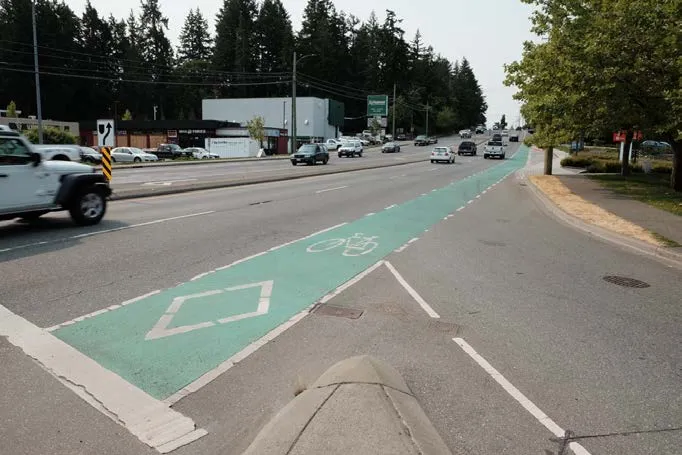
TRANSPORTATION PLANS
TRANSPORTATION MASTER PLAN
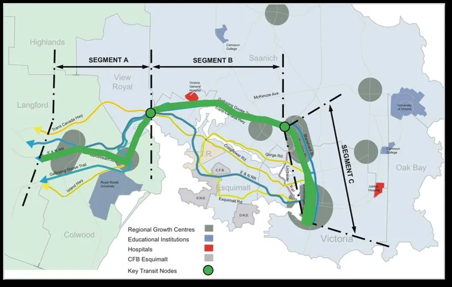
The View Royal Transportation Master Plan was adopted in 2016 to guide transportation decisions and investments in the Town. The Master Plan includes an analysis of existing conditions, recommendations for improvements and implementation strategies. Overall, the Master Plan establishes a strong direction to prioritize walking, biking, and transit; reduce automobile dependency; and improve safety and comfort on local roadways.
Recommendations in the Master Plan include:
- Improving bike and pedestrian infrastructure.
- Working with BC Transit to improve transit service through View Royal.
- Encouraging the development of zoning bylaws that promote mixed-use, transit‐oriented development. Exploring possible diversion routes to support calm and efficient traffic through View Royal.
CRD TRANSPORTATION PLANS
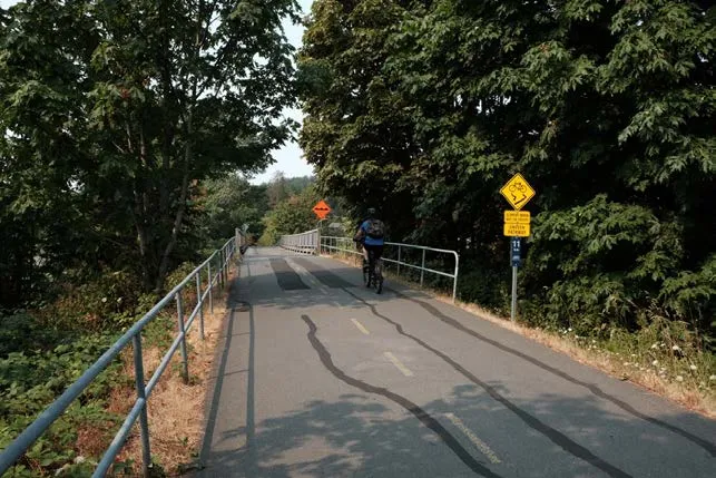
The TravelChoices Strategy was adopted by the CRD as the region’s long-range transportation planning framework. The Strategy aims to promote a balanced, sustainable, and affordable transportation system and achieve the goals and targets identified by the Regional Growth Strategy (RGS).
The Strategy’s broad vision is to “significantly increase the proportion of people walking, cycling, using transit, ride-sharing or using other alternatives to driving alone.” More specific elements of the strategy seek to:
- Integrate land use and transportation policies.
- Enhance alternatives to driving alone.
- Manage transportation systems.
- Manage transportation investments.
In 2016, the CRD developed a Regional Pedestrian and Cycling Master Plan. The Plan builds on the RGS and sets out specific priorities for improvements to the regional pedestrian and cycling networks. View Royal will continue to partner in regional transportation investments.
PLANNING FOR CHANGE
Transportation planning is entering a new era. The wide-reaching and long-term impacts of transportation decisions are better understood, and communities actively seek new solutions to their transport and mobility needs. Instead of being limited by a primary goal of moving people and goods as efficiently as possible, planners, engineers and communities are now working within the context of climate change and reducing GHG emissions. View Royal is supportive of non-motorized and electric options, other transportation modes, investment in safer walkways/ streets, and promotion of healthy lifestyles.
Sustainable transportation planning is closely tied to land use. Sustainable settlement patterns are designed for proximity to where people live, work and play, which reduces the need for private automobiles to get around. In turn, land use decisions today should ensure that new development is directed to areas well-served by transportation infrastructure and that population densities provide the ridership numbers required to make transit service financially viable. This is especially important in areas surrounding transit stops.
Concentrating new growth in the neighbourhood centres and community corridors will reduce the need to travel long distances and provide population densities necessary for further investments in frequent transit service. Targeted infill development will support transportation improvements in established neighbourhoods. The Transportation Master Plan supports planning land use in harmony with transportation and sets out strategies for improving transit, cycling, and walking networks. View Royal’s Active Transportation Network Plan and Community Climate Action Strategy will guide a viable, multimodal transportation system that will meet the evolving needs of residents, businesses, and visitors.
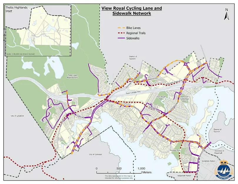
MAP: CYCLING LANES AND SIDEWALK NETWORK
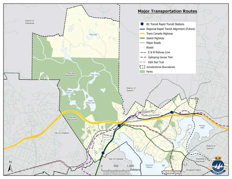
MAP 5: MAJOR TRANSPORTATION ROUTES

OBJECTIVES AND POLICIES
The following are objectives and policies for directing transportation decisions in View Royal. The content in this section should be reviewed alongside the recommendations and implementation strategies contained in the Transportation Master Plan and Active Transportation Network Plan. These policies are also closely linked to policies contained in other OCP sections, including Chapter 1: Land Use & Urban Design, Chapter 3: Housing and Chapter 4: Economic Development.
OBJECTIVE TR1
Recognize walking, cycling and transit as priority modes of transportation in View Royal. Support the expansion of these transportation networks as a means of reducing dependency on car travel and associated greenhouse gas emissions and promoting a healthy, walkable community.
POLICIES
TR1.1 Multimodal Transportation System Support and encourage the development of View Royal’s pedestrian, cycling, and public transit networks as part of an interconnected multimodal transportation system.
Roads within View Royal shall be viewed as a “community resource” for the benefit of all, not just motor vehicle users. New measures to enhance opportunities for walking and cycling will increase their appeal, convenience, and safety for all residents. Walking, cycling, bus transit, and other alternatives to the motor vehicle will be integrated into the Town’s regulations, plans, budgets, programs, and operations.
TR1.2 Pedestrian Improvements Enhance pedestrian access and movement through the development of a system of sidewalks, multi-use trails and pedestrian paths integrated with public transit in all areas. Improvements should be carried out according to the Active Transportation Network Plan.
TR1.3 Cycling Infrastructure Promote cycling for commuting, personal transport, and recreation purposes through improvements to infrastructure and facilities as identified in the Active Transportation Network Plan. The inclusion of bicycle parking areas and facilities such as showers, lockers, and change rooms shall be encouraged at commercial, institutional, public, recreational, and multi-family residential development sites.
TR1.4 Transit Services Promote transit use as a viable alternative to car travel. Advocate for increased transit service and options to meet the diverse needs of the community, including youth, working adults, seniors, and people with mobility challenges. Continue to work with BC Transit to improve the level of service to View Royal’s neighbourhoods, particularly in the Thetis Vale area.
TR1.5 Rapid Transit Work cooperatively with BC Transit and other stakeholders to develop and implement a rapid transit corridor that will link View Royal to Victoria and the West Shore communities. Ensure that the corridor includes stops in View Royal and that planning for those locations considers land uses and amenities necessary to support mixed-use development and fit within the Vision of the OCP.
Rapid transit stops and stations should be planned and designed to enhance the local area and function as transportation hubs – well connected to other trails, transit routes and roadways. Extensive surface parking lots and “park-and-ride” facilities without activity-generating amenities and land uses are not supported.
Advocate for the preservation of the rail corridor as a transportation corridor. If provincial and federal funding is made available, support the reinstatement of rail service on this corridor.
TR1.6 Trail System Support the development of a comprehensive multiple-use trail system in View Royal. This includes continued improvements to the Galloping Goose Trail and local trails and the development of the E&N Rail Trail.
Trails should be planned and developed in accordance with regional plans, the Active Transportation Network Plan and a parks and trail master plan. Considerations for trail planning include:
- Meeting the needs of a variety of users through regional multiple-use trails as well as local connectors, footpaths, and nature trails.
- Ensuring trails provide safe connections to destinations such as parks, schools, neighbourhoods, amenity areas and other trails.
- Securing land dedications or statutory right-of-ways from private owners at the time of subdivision or development, in order to create high-quality pedestrian and cycling-friendly neighbourhoods.
- Utilizing surplus road or railway rights-of-way.
- Co-operating with community organizations, non-profit organizations, and other public agencies.
- Ensuring that development does not preclude the use of former railroad rights-of-way or easements as transportation or recreation corridors.
- Ensuring consistency with existing and planned trails in adjacent municipalities.
TR1.7 Transportation Demand Management Encourage Transportation Demand Management (TDM) measures for new developments and existing areas that could benefit from TDM, particularly large employers and multi-family residential development. TDM plans and strategies should include education, incentives and disincentives, and travel options to support walking, cycling, ridesharing, and transit, and reduce single-occupancy vehicle trips and private car ownership.
Consider decreasing parking requirements for development proposals that incorporate site-specific TDM strategies, and that can demonstrate a decrease in the demand for car travel and an increase in the use of other travel options.
TR1.8 Greenways Continue to support the implementation of a “greenways system” to provide alternative ways to navigate the Town’s neighbourhoods and connect to regional greenways networks.
TR1.9 Wayfinding Work to improve wayfinding systems (signage and other methods) to connect active transportation networks and encourage the use of View Royal’s trails, greenways, major cycling corridors and shared-use paths.
TR1.10 Small Boat Launch Support non-motorized water transportation in View Royal. Investigate opportunities to expand infrastructure for canoes, kayaks and small boats in Esquimalt Harbour and Portage Inlet. This includes identifying and pursuing opportunities for providing public boat launches, docks, and associated facilities.
OBJECTIVE TR2
Plan transportation infrastructure to support a more compact and sustainable settlement pattern. Ensure Neighbourhood Centres, Community Corridors, neighbourhoods, parks and public facilities, and the future Town Centre site is well connected through pedestrian, bike, and transit networks.
POLICIES
TR2.1 Land Use and Transportation Ensure all transportation planning supports the development of the Neighbourhood Centres and Community Corridors as compact, walkable places. These areas should function as neighbourhood transportation hubs where local travel routes connect, and many transportation modes can be accessed.
TR2.2 Access to Services Prioritize new local pedestrian, cycling and transit improvements to enhance access to Neighbourhood Centres, Community Corridors, parks, shopping areas, schools, and residential areas with higher population densities.
TR2.3 Connecting Neighbourhoods Support the development of improved north-south connections in View Royal to better link neighbourhoods on either side of the Trans-Canada Highway and Island Highway, enhance the Town’s sense of identity, and create safe connections for pedestrians and cyclists. In exploring new or improved connections, the Town should consider locations that maximize access to View Royal Park and other recreation areas, Neighbourhood Centres, Community Corridors, the future Town Centre site, rapid transit stops, and existing and planned trails and transit routes.
TR2.4 Connecting to the Juan de Fuca Recreation Complex Improve multimodal connections and wayfinding between View Royal and the Juan de Fuca Recreation Complex.
TR2.5 Development Density Near Transit Focus new development, particularly within 400 metres of existing transit service.
TR2.6 Mixed Use Density Near Transit Allow for a mix of commercial, residential, and institutional uses within 400 metres of existing or planned frequent transit network or rapid transit network. Locate new affordable housing in neighbourhood centres and community corridors, adjacent to transit services.
OBJECTIVE TR3
Ensure that transportation in and through View Royal is safe, comfortable, and efficient, and that negative impacts on local residents and businesses are minimized.
POLICIES
TR3.1 Transportation Master Plan & Active Transportation Network Plan Support the safe and efficient movement of vehicles, cyclists, and pedestrians throughout View Royal in accordance with the priorities and strategies established in the Transportation Master Plan and Active Transportation Network Plan.
TR3.2 Minimize Neighbourhood Traffic Continue to prioritize local needs in the development of a regional transportation system that serves the travelling public and minimizes the negative impacts of through traffic on View Royal neighbourhoods. Prioritize resident needs over commuter traffic.
TR3.3 Commuter Traffic Encourage regional commuter and truck traffic to use TransCanada Highway 1 to minimize impacts on local neighbourhoods. Prioritize resident needs over commuter traffic.
TR3.4 Accessible Transportation Apply transportation design and servicing standards that support universal access and allow people of all mobility levels to use sidewalks, trails, and transit. Prioritize accessibility improvements in locations with higher concentrations of young children, seniors and people with disabilities and places where residents go to access essential goods and services.
TR3.5 Safe Routes to Schools and Parks Support and prioritize safety improvements on roads, walking and biking routes adjacent to schools and parks. Encourage the school district and parent associations to develop and periodically update safe route-to-school plans in consultation with the Town.
TR3.6 Traffic Calming Incorporate traffic calming techniques and controls in road design to ensure safe and non-congested roadways while facilitating ease of movement for pedestrians, vehicles, and bicycles. Monitor traffic calming interventions to ensure effectiveness over time.
TR3.7 Beautify Streets Beautify the appearance of the major transportation corridors in conjunction with traffic calming.
TR3.8 Neighbourhood Streets Ensure that roads, pathways, and trails are designed to contribute to neighbourhood character and livability. Roads, pathways, and trails should be designed to support day-to-day social interactions and increase the sense of community within and between neighbourhoods.
TR3.9 Sound Attenuation Address existing and potential traffic noise impact and ensure noise mitigation is considered in new developments.
TR3.10 Community Engagement Encourage the involvement of residents in both identifying transportation issues and finding solutions.
TR3.11 Encourage Environmentally Friendly Transportation Encourage more environmentally friendly vehicular alternatives to single-occupancy vehicles and private car ownership. This includes encouraging vanpooling, carpooling, and ridesharing; car co-ops; and high efficiency or clean energy vehicles, e-bikes and scooters. Invest in active transportation connections through neighbourhoods.
TR3.12 Electric Vehicle Infrastructure Continue to support current infrastructure and expand the network to serve plug-in electric or hybrid vehicles, ebikes and scooters.
TR3.13 Electrification in new developments Require new development to include vehicle and bicycle parking electrification as part of their TDM offerings.
TR3.14 Car-Share Encourage new development to include car-share as part of their Transportation Demand Management strategy. TDM strategies, such as developer-provided car-share vehicles and dedicated car-share parking spaces, may be used to reduce vehicle parking requirements at the time of rezoning.
TR3.14 Transit Passes Encourage new development to include transit passes for residents as part of their Transportation Demand Management strategy. TDM strategies, such as transit passes for residents for a minimum period of 5 years from the date of occupancy, may be used to reduce vehicle parking requirements at the time of rezoning.
3 | Housing
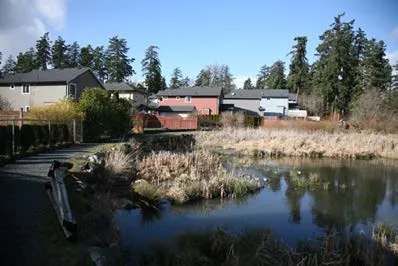
OVERVIEW
This chapter identifies the Town’s priorities for residential development that promote increased housing choice and planning for an inclusive community with diverse lifestyles and housing needs. Many View Royal residents are struggling with a current housing situation that is not meeting their needs. Rapidly rising costs of housing, land, and construction, along with a growing population and changing demographics, are all factors in this topic. View Royal’s population is aging, resulting in smaller household sizes. Older residents often prefer the option of staying in their community and moving to a smaller home to support their good health, connections, and independence. Housing that is both affordable and spacious enough for families is also a challenge. Inadequate housing and homelessness continue to increase and is a risk for more residents. View Royal will need a greater diversity of housing types and sizes with market and non-market housing to support residents’ essential needs.
Note that redevelopment directions for commercial mixed-use neighbourhoods are discussed in Chapter 4: Economic Development. Building energy efficiency is discussed in Chapter 5: Natural Environment, Energy, and Climate Change.
GOALS
- Create an inclusive community that provides housing and transportation options, services and facilities for families and individuals of diverse backgrounds, cultures, ages, and economic means.
- As the community grows and changes, protect the unique relationships between the highly valued natural environments and residential characteristics of View Royal.
VIEW ROYAL TODAY
There is little vacant land remaining within the Urban Containment Boundary for new development. Residential growth will need to be accommodated through redevelopment in transition areas and targeted infill housing in existing neighbourhoods. This is discussed in the Land Use and Urban Design section.
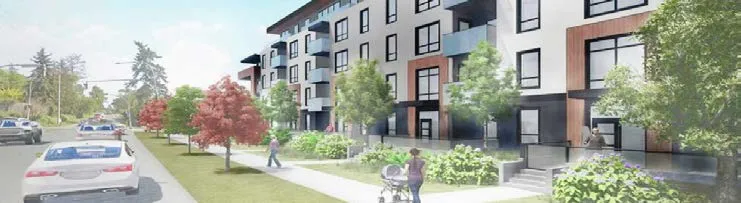
An inclusive community that suits the diverse housing needs of View Royal includes a range of housing options. Growth, affordability, and aging factor into View Royal’s housing needs. The 2020 Housing Needs Assessment Report outlined the context for housing in View Royal.
HIGHLIGHTS
- View Royal’s population grew faster between 2006 and 2016 than other communities in the Capital Regional District.
- View Royal has an aging demographic and increasing median age, which means supporting age-appropriate housing, housing that accommodates younger people, and supporting “aging-in-place” design considerations.
- Increases in housing costs have been outpacing the increase in household incomes, which has resulted in fewer families (in particular, younger families just starting out) being able to afford housing in View Royal.
- Single-family (detached residential) homes are the primary form of housing in View Royal.
- More affordable housing, including options like duplexes, triplexes, townhomes, garden suites and larger apartments that help serve the needs of older residents looking to downsize (1–2-bedroom homes) and younger families (3+ bedrooms) are needed.
- The rental vacancy rate is low in View Royal, which means there is a shortage of available rental housing to meet demand.
- While a significant number of new rental units have been built over the past several years, there is a large proportion of renters in secondary suites, indicating a demand and need for additional purpose-built rental housing (e.g. for students, seniors, families).
- The number of both owner and renter households spending 30% or more of their income on housing increased between 2006 and 2016.
- Households making the median income cannot afford the average single-detached home in View Royal.
- The private housing market is not able to provide housing for a significant portion of View Royal’s residents, and more are at risk of unsustainable housing and homelessness. There is a need for more than 200 non-market rental units, as well as supportive and emergency housing in View Royal.
PLANNING TO MEET OUR HOUSING NEEDS
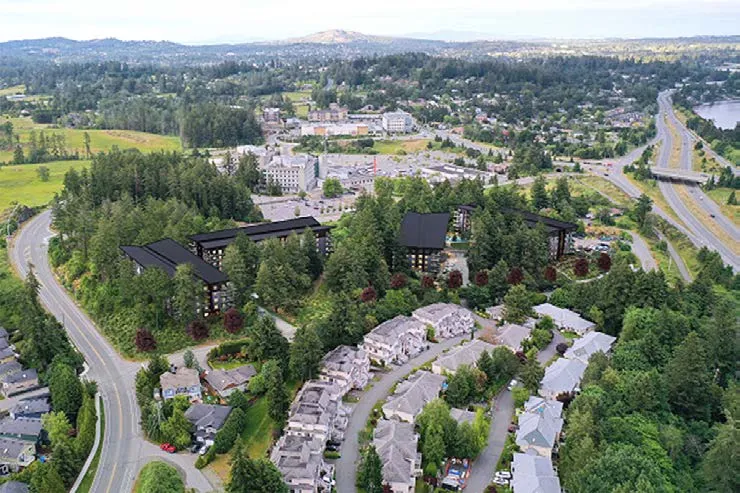
The OCP consultation confirmed public support for more varieties of housing incorporated in neighbourhoods across View Royal. Future directions to meet View Royal’s housing needs include:
- Increasing the diversity of housing options in View Royal, including new types of housing identified as “missing middle” (e.g., townhomes, apartments).
- Support housing to meet the needs of various ages, family types and incomes, including smaller 1–2-bedroom market units, purpose-built rental, townhomes, carriage homes, garden suites and supportive housing for specific demographics (e.g., seniors and families).
- Support sensitive and strategic infill development within existing neighbourhoods that maintains the character, scale, and livability of place.
- Ensure new housing options and infill development is in areas that are within walking distance to services, transportation options (e.g., transit, bike routes, trails), attention to quality design of public spaces with furnishings and shelter, to support more vibrant, healthy neighbourhoods.
- Diverse housing options, including new types of housing identified as “missing middle.”
- Housing that supports the needs of various ages, family types and incomes.
- Infill development that fits existing neighbourhoods, maintaining the character and livability of place.
- New housing that is in areas that are walking distances to services and transportation options and that support vibrant neighbourhoods.
HOUSING CHOICE
Participants in the OCP consultation identified the need to expand the quantity and range of housing options to support a diverse population and ensure residents can remain in the community as their housing needs change. Participants requested increased housing choices for young families, seniors, and low-income households. Each of these groups has varying housing needs. For example, ground-oriented housing near schools and parks may be attractive to young families, while smaller apartment units located near shops and transit, may better suit smaller households, who can have the option to walk or bike rather than use vehicles.
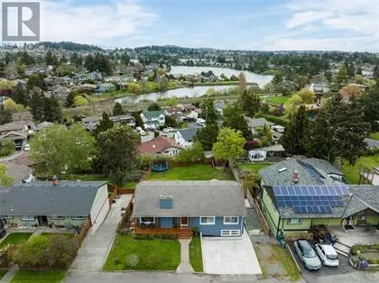
GROUND-ORIENTED HOUSING
In supporting greater housing choice, it is important for the Town to recognize the continued demand for ground-oriented, family housing. This represents the largest forecasted demand for View Royal and the surrounding municipalities. The demand for ground-oriented housing can be addressed through the inclusion of townhouses and stacked units in the transition areas and new infill housing in existing residential neighbourhoods. Infill housing may include small lot detached houses, carriage houses, duplex and multiplex houses, and secondary suites.
HOUSING AFFORDABILITY
In View Royal, rapidly escalating land and building costs have made much of the existing housing stock unavailable for many segments of the population. Over time, this can result in a community where young families, students, young adults, and seniors cannot afford to live. To ensure that View Royal is a diverse and inclusive place for both existing and future residents, the Town should use its legislative powers to increase the supply of affordable rental and ownership units in all neighbourhoods.
Accomplishing this will require the Town to be creative, develop partnerships and explore options that have demonstrated success in View Royal or elsewhere. These may include density bonuses, permitting incentives, encouragement of compact housing forms, alternative tenures (cooperative rental and ownership housing, life lease, etc.), and non-market projects. This topic is also discussed, with associated policies contained in the Economic Development section.
Affordable Housing
The OCP applies a broad interpretation as to what constitutes “affordable housing”. There are three factors that directly impact housing affordability in every community – the price of housing, household income and, for aspiring homeowners, the costs of borrowing. Typically, households who spend less than 30% of their gross incomes on housing have “affordable housing”. Households that do not have a choice and must spend 30% or more of their gross incomes for suitable, adequate housing are considered in “core housing need”.
The 2016 Census indicated that 35% of renters and 19% of homeowners of View Royal residents spent more than 30% of their gross income on housing in View Royal.
LIVABILITY AND SUSTAINABILITY
Two fundamental components of View Royal’s Community Vision are preserving the character, form, and scale of established residential areas and take action on reducing emissions by investing in energy-efficient low carbon buildings and transportation systems. These aspirations can be met in relation to housing through well-designed redevelopment and infill. This is further discussed in the Land Use and Urban Design section.
By directing higher density residential development into the mixed-use transition areas, the Town will support the creation of activity hubs that place housing close to amenities, jobs, and transit, reducing the need to drive and increasing opportunities for community interaction.
Targeted infill in established residential areas will provide much-needed grounded-oriented housing without compromising the prevailing character and scale of the neighbourhoods or consuming land outside the Urban Containment Boundary. Infill development will also support the viability of the Neighbourhood Centres by increasing the number of local customers and the municipal tax base required to fund public amenities.
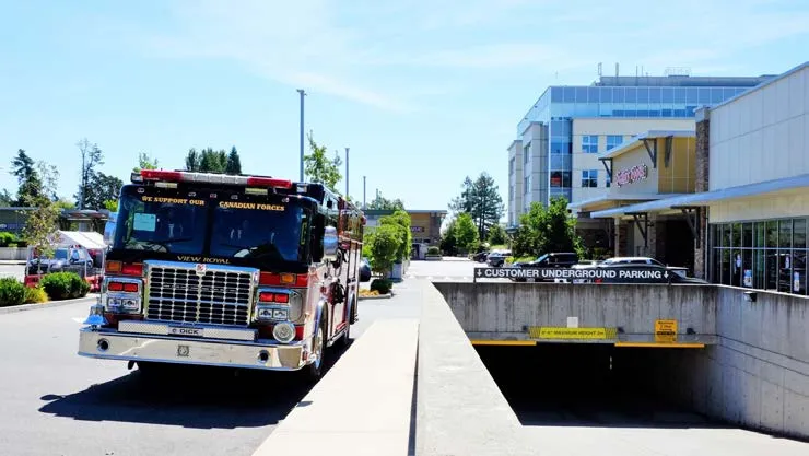
OBJECTIVES AND POLICIES
The following section sets forward the Town’s objectives and policies for improving housing choice and accommodating the changing housing needs of residents in View Royal.
OBJECTIVE HS1A
Create and maintain a range of housing types and tenures to meet the needs of current and future View Royal residents, including families, seniors, people with diverse abilities, physical disabilities, and low-income households.
POLICIES
HS1.0 Innovative Approaches Support innovative approaches to creating affordable housing, including market rental, cooperative housing and other forms of shared ownership, mixed market and non-market projects, and public-private partnerships.
OBJECTIVE HS1B
Work toward an increase in the housing supply that is affordable to young families and encourages existing residents to remain in the community as their lifestyles and income levels change.
POLICIES
HS1.1 Range of Housing Types Ensure the policies of this Plan and the regulations of the Zoning Bylaw support a range of housing, including detached homes, garden suites, small lot subdivisions, apartments, townhouses, secondary suites, and other typologies that meet the housing needs of current and future residents.
HS1.2 Ground-Oriented Units Special consideration will be given to the provision of ground-oriented units to accommodate the continued demand for family housing. Increasing the number of garden suites, townhomes, small lot detached houses, and other housing forms with ground-level entries is essential to realizing the Town’s Vision.
HS1.3 Family housing in New Developments Require that a diversity of housing types and unit sizes be provided in all new residential developments and rezoning applications. The Town strongly encourages designs that provide 10% of units suitable for families (3 bedrooms or greater in size).
HS1.4 Aging in Place Encourage appropriate housing – both market and non-market – for seniors to allow residents to age-in-place within the View Royal community. This includes promoting the development of 10% of units designed to meet accessible and adaptable standards for those with mobility aids.
HS1.5 Contribute to Regional Affordable Housing Funding Continue annual financial contribution to the Regional Housing Trust Fund, administered by the Capital Regional District Housing Secretariat, in support of the Fund’s ongoing initiatives to provide capital grants for “bricks and mortar” in the acquisition, development and retention of housing that is affordable to households with low or moderate incomes.
HS1.6 Housing Amenity Contributions Consider below-market rental units as priority amenities when negotiating Community Amenity Contributions in rezoning applications for multi-residential projects.
OBJECTIVE HS2
Protect tenants and properties from rental conversion – Applications for converting existing occupied multi-residential rental buildings to strata ownership require Council approval when rental vacancy rates, as provided by Canada Mortgage and Housing Corporation for Greater Victoria, are at 4% or lower for a period of two consecutive years.
POLICIES
HS 2.1 Redevelopment of Affordable Housing Where redevelopment of existing affordable housing (i.e., older housing stock) forms part of an application for rezoning and subdivision, the applicant will work with the Town in the preparation of a plan to mitigate the loss of existing affordable units, as well as a plan to address the potential compensation to existing tenants to minimize the loss of affordable housing stock.
Document Images
(51)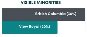
Map silhouette of British Columbia with labels showing average ages: BC 42.3, View Royal 42.8
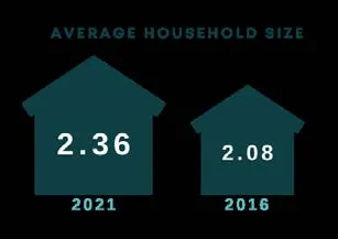
Bar chart comparing visible minority percentages in British Columbia (30%) and View Royal (20%)
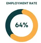
Infographic showing average household size of 2.36 in 2021 decreasing to 2.08 by 2036
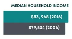
Circular progress bar chart showing a 64% employment rate
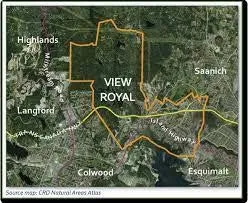
Comprehensive housing dashboard showing various statistics: - Number of Private Dwellings: 4637 (2019), 4299 (2016) - Ownership Rate: 72% View Royal, 63% CRD (2016) - Aging population trend: 1/3 households led by adults >65 by 2038 - Housing Types: 40% single-detached - Median home prices by type: $998,000 and $551,000
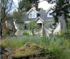
Diagram illustrating how the same FSR (1.0) can be achieved through different building heights (1, 2, or 4 storeys) on the same site
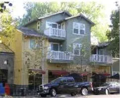
Photos of three detached homes on large, landscaped lots
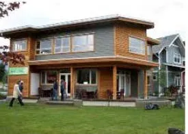
Photos of suburban houses and a townhouse development
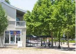
Photos of modern townhomes and a low-rise apartment building
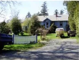
Photos showing mixed-use buildings with commercial on the ground floor
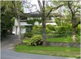
Photos of high-quality mixed-use urban buildings
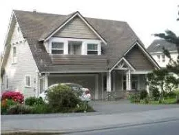
Photos of larger scale mixed-use developments with urban plazas
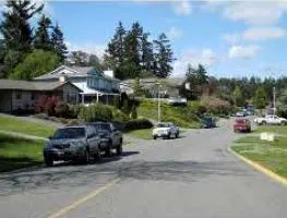
Photos showing various commercial and office building styles
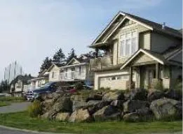
Photos of a playground, a swimming area, and a trail with pedestrians
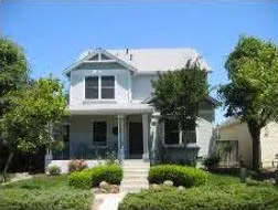
Photos of a medical building, a community hall, and a daycare facility
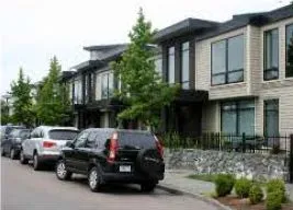
Photos showing a farm house, a rural road, and horses in a field
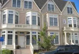
Photos of various landmark developments like the Casino and modern multi-family housing
Divider page showing a person bicycling along a multi-use regional trail
Map showing the major transportation network connecting View Royal to the broader Capital Region
Cover of the View Royal Transportation Master Plan
Cover of the CRD Regional Pedestrian and Cycling Masterplan
Map detailing View Royal's current cycling lanes and sidewalk infrastructure
Map highlighting major highways, arterial roads, and transit routes through View Royal
Divider page showing a modern multi-family apartment complex
Scenic photo of homes situated along a shoreline with a private dock
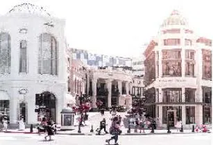
Architectural rendering of a new multi-family rental building with pedestrian spaces and landscaping
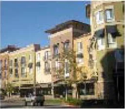
Aerial architectural rendering of a multi-building housing development proposal on Erskine Lane
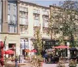
Graphic box containing the definition and statistics for Affordable Housing
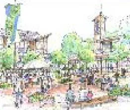
Aerial landscape photo showing a developed residential neighborhood in View Royal