This site is in beta — data may be incomplete and features are still being added.
Special Council/Documents/Appendix A: Regional Context Statement Policy Analysis
Appendix

Appendix A: Regional Context Statement Policy Analysis

February 7, 2023Pages 390–3964 sections

An analysis of how the View Royal OCP aligns with the Capital Regional Growth Strategy (RGS) vision and population projections.

8.1a Draft Official Community Plan Update - Restart Plan
Projected population of nearly 15,000 by 2038Need for 6,700 dwelling unitsGoal of 42% of trips via active transportation by 2038Target of 61% community-based GHG emission reduction by 2038

Draft Official Community Plan Strategic Review

Council Meeting – February 7, 2023

Page 390–396

Land Use Designations

Proposed Land Use Designation Change - Wilfert Road Area
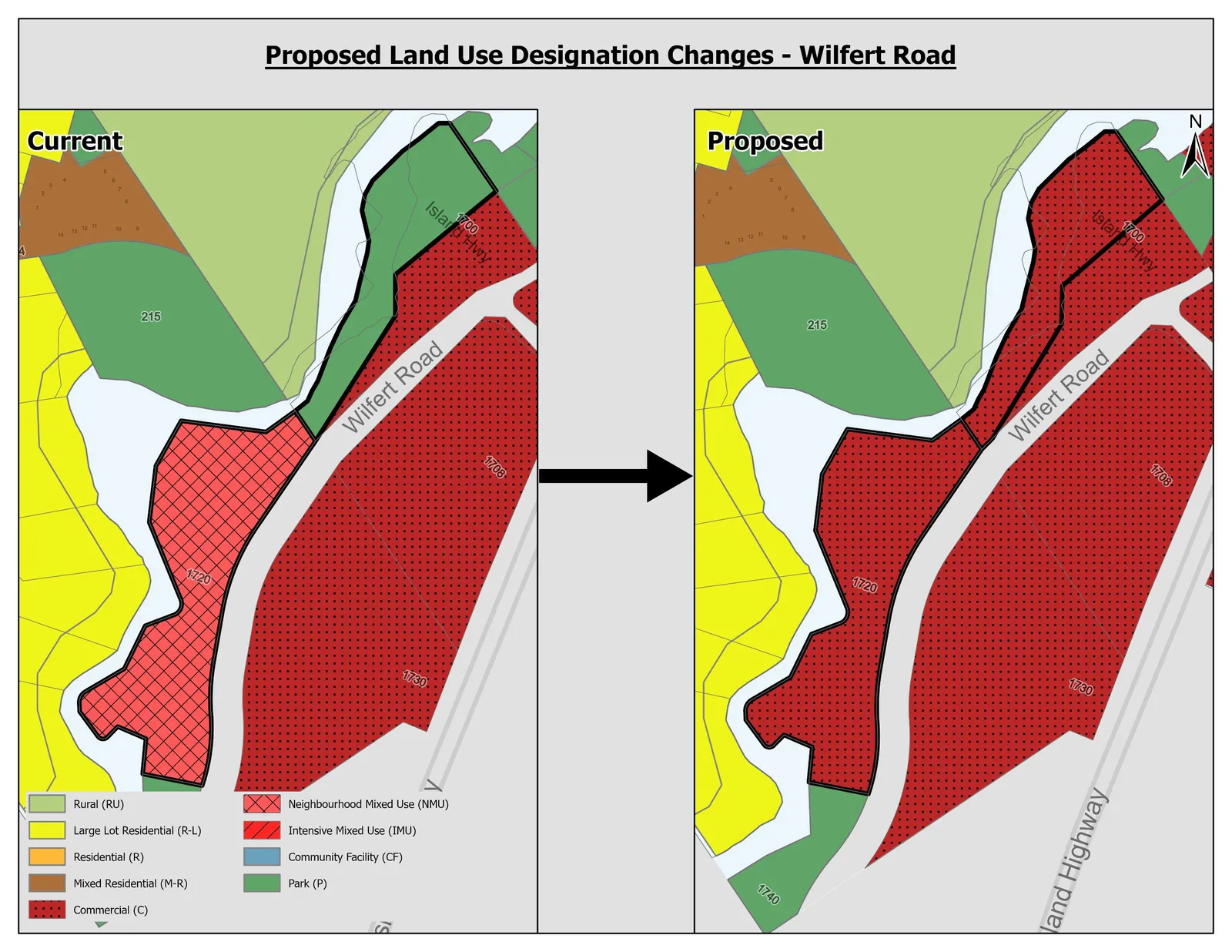
Map showing the current and proposed land use designation changes for the Wilfert Road Area, depicting a transition from Neighbourhood Mixed Use to Commercial for specific parcels.

Proposed Land Use Designation Change - Harbour Neighbourhood Area
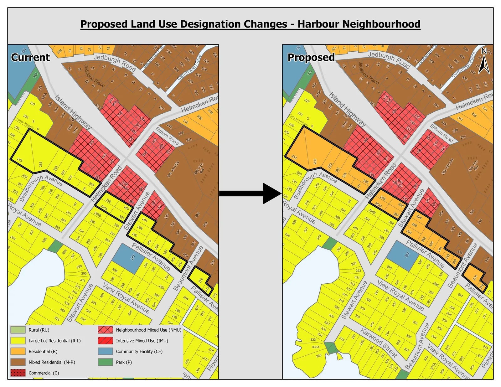
Map showing the current and proposed land use designation changes for the Harbour Neighbourhood Area, with various parcels along Bessborough Avenue, Stewart Avenue, and Pallisier Avenue being re-designated to Residential or Mixed Residential.

Proposed Land Use Designation Change - Admirals Road Area
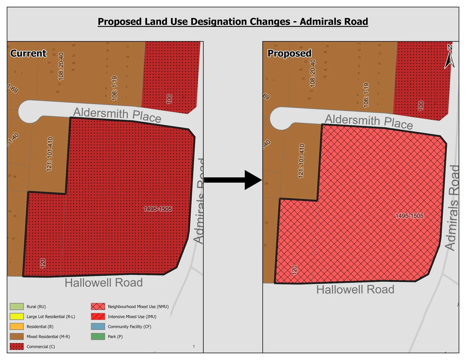
Map showing the current and proposed land use designation changes for the Admirals Road Area, specifically parcel 1495-1505 changing from Commercial to Neighbourhood Mixed Use.

Proposed Land Use Designation Change - Watkiss Way Area
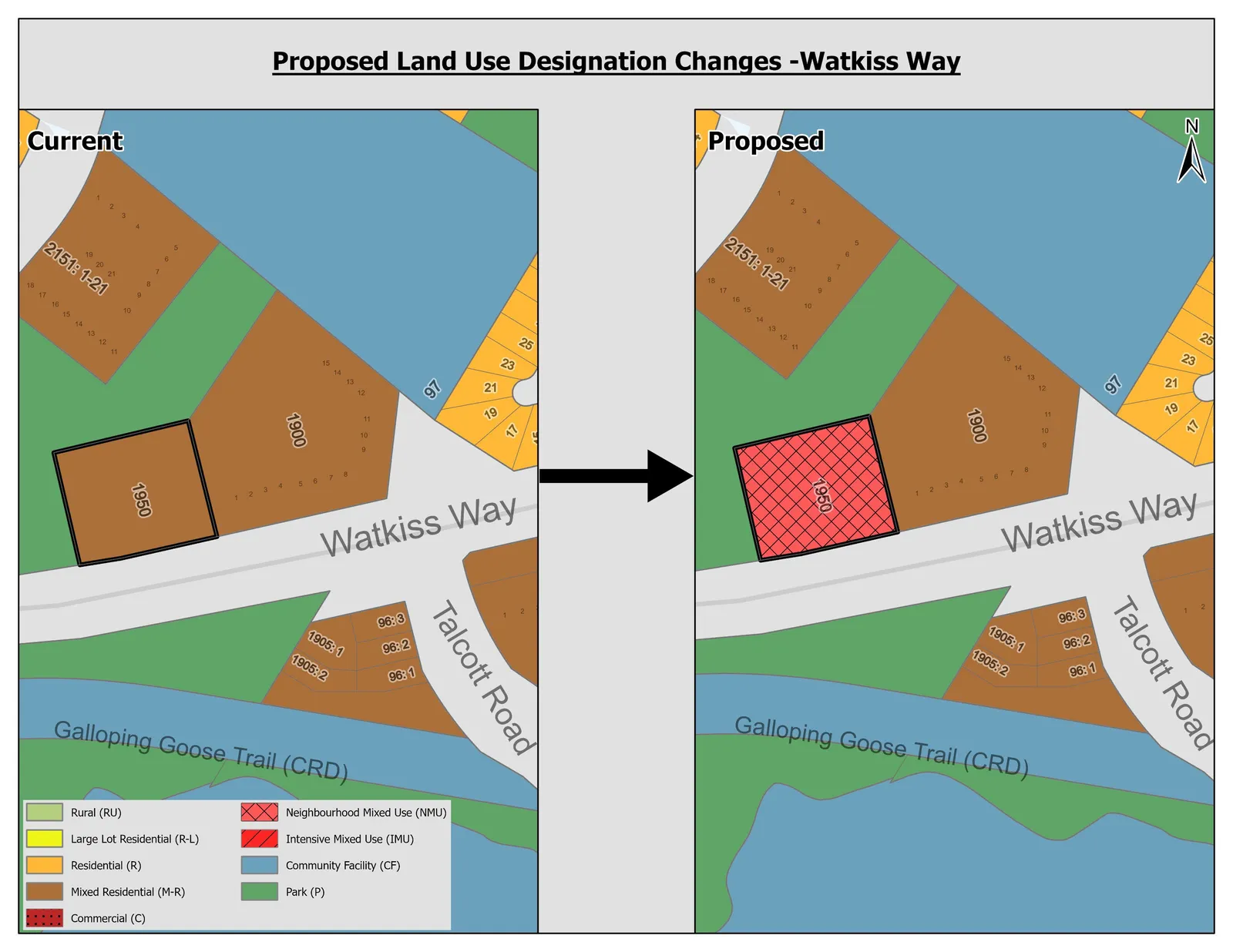
Map showing the current and proposed land use designation changes for the Watkiss Way Area, specifically parcel 1950 changing from Mixed Residential to Neighbourhood Mixed Use.

Proposed Land Use Designation Change - Erskine Lane Area
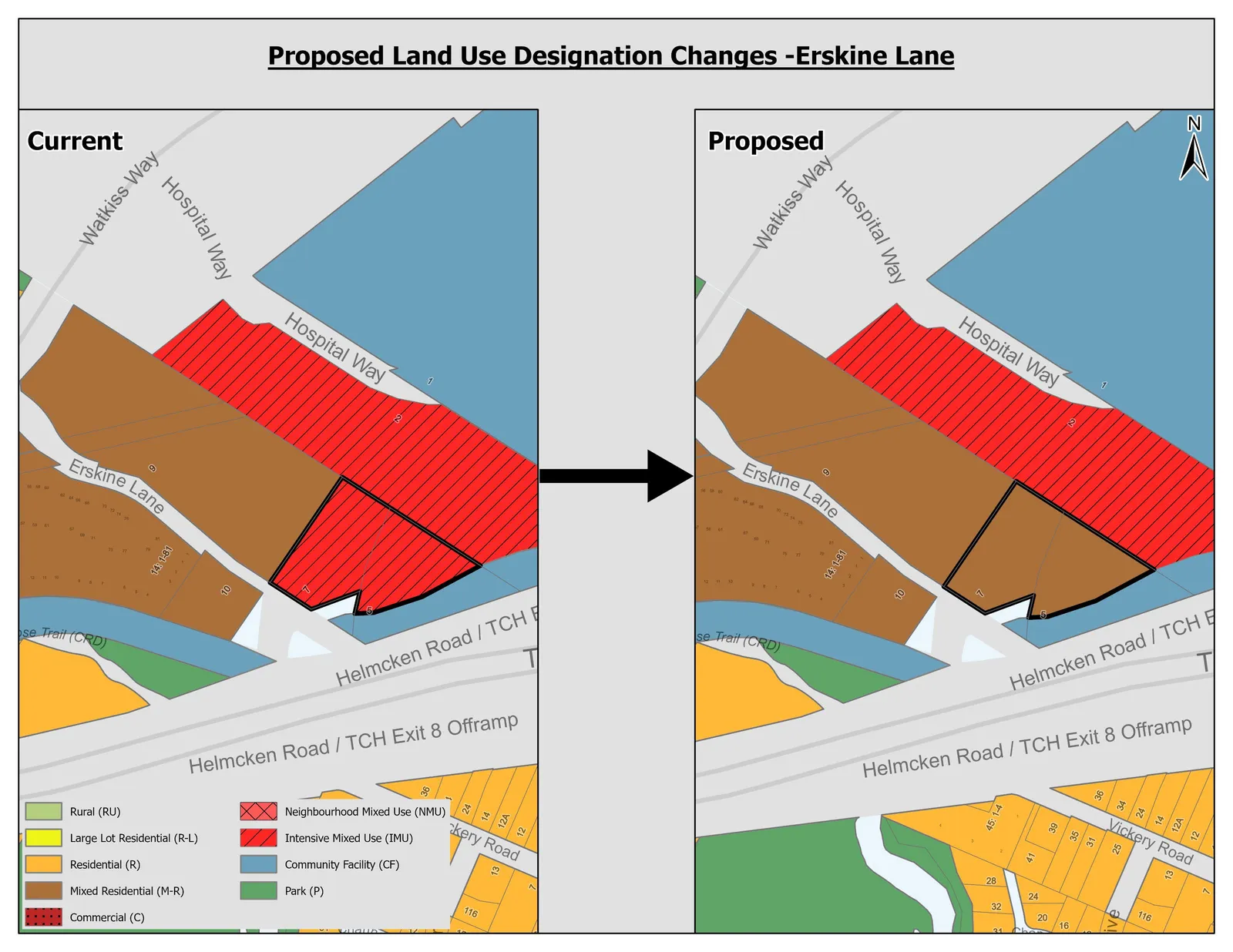
Map showing the current and proposed land use designation changes for the Erskine Lane Area, highlighting a parcel changing from Intensive Mixed Use to Mixed Residential.
Page 390–396

Development Permit Areas

Design Guidelines

  • Consolidation of design guidelines from existing DPAs
  • Incorporated new design guidelines that focus on Siting and Massing, Urban Design, and Sustainability
Page 390–396

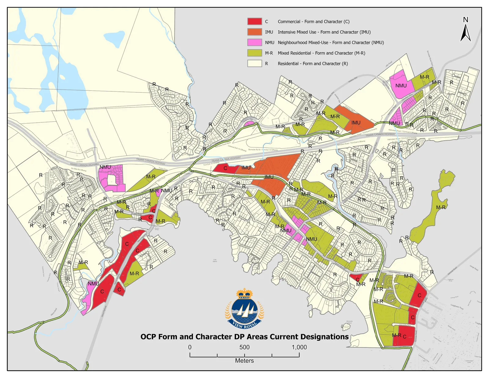
Existing Development Permit Areas

Development Permit Areas – Form & Character:

  • Commercial
  • Intensive Mixed Use
  • Neighbourhood Mixed Use
  • Mixed Residential
  • Residential
Map of "OCP Form and Character DP Areas Current Designations" showing the location of Commercial, Intensive Mixed Use, Neighbourhood Mixed Use, Mixed Residential, and Residential permit areas across the municipality.
Page 390–396

Document Images

(1)
Document image
Extracted from: 2023 02 07 Council Agenda - Agenda - Pdf