Maps and framework designations including Land Use, Community Development, and Development Permit Areas.
Schedule A: OCP Land Use DesignationsSchedule B: Community Development FrameworkSchedule C: Form & Character DPAsSchedule D: Environmental Protection & Natural Hazard DPAs
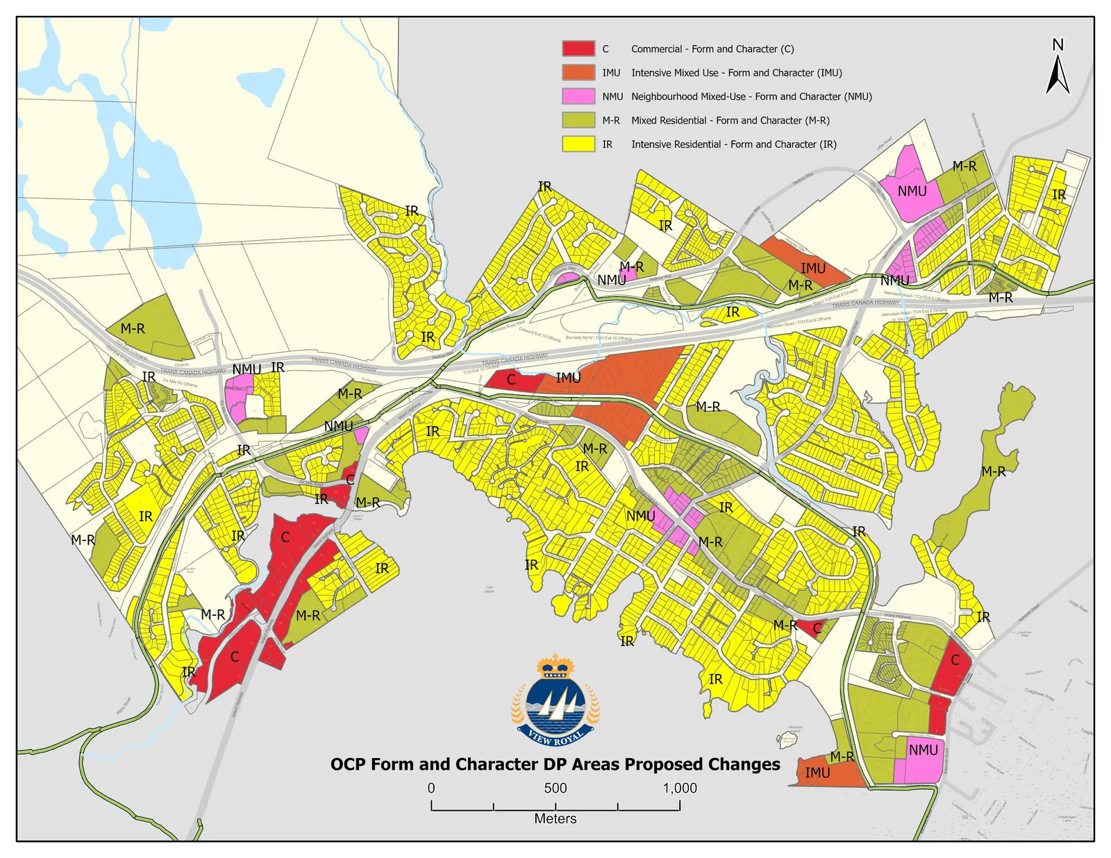
Proposed Development Permit Areas
Development Permit Areas – Form & Character:
- Commercial
- Intensive Mixed Use
- Neighbourhood Mixed Use
- Mixed Residential
- Intensive Residential (new)
Page 397–401
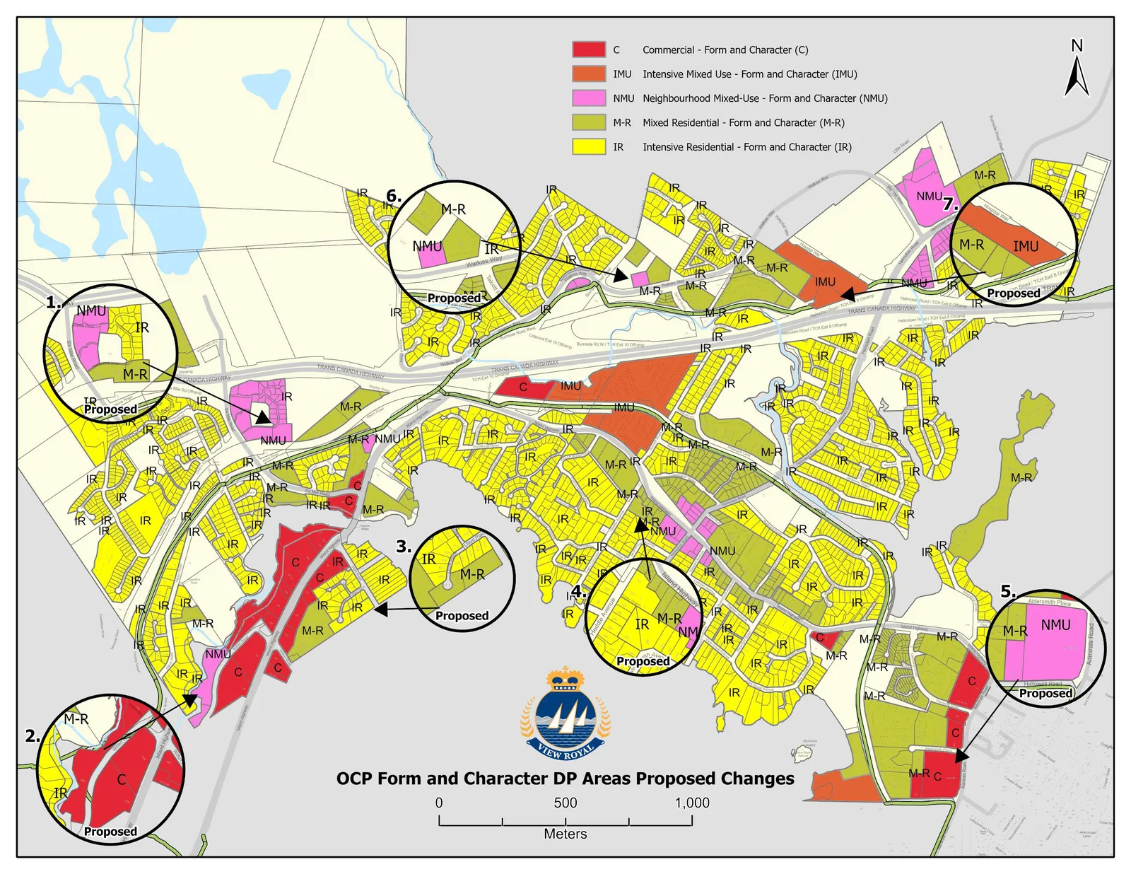
Proposed Changes to Development Permit Areas
Development Permit Areas – Form & Character:
- Commercial
- Intensive Mixed Use
- Neighbourhood Mixed Use
- Mixed Residential
- Intensive Residential (new)
Page 397–401
Development Permit Areas
Environmental Protection and Natural Hazard Development Permit Areas
- Created a new DPA – Natural Hazards Wildfire Interface
- Added additional guidelines to focus on fire prevention
- Added additional guidelines regarding federal and provincial regulations for docks
- Added additional guidelines to further environmental protection and preservation
Page 397–401
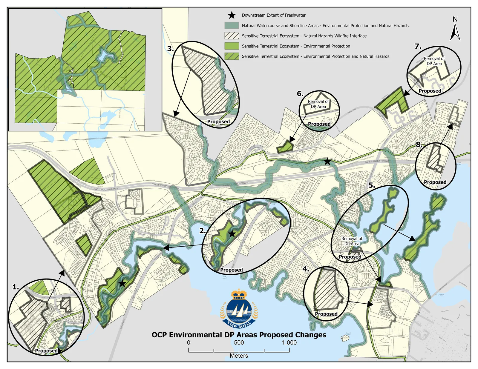
Proposed Changes to Development Permit Areas
Development Permit Area – Environmental
- Natural Watercourse and Shoreline Area (Environmental Protection and Natural Hazards)
- Sensitive Terrestrial Ecosystem (Natural Hazards Wildfire Interface) (new)
- Sensitive Terrestrial Ecosystem (Environmental Protection)
- Sensitive Terrestrial Ecosystem (Environmental Protection and Natural Hazards)
Page 397–401
NEXT STEPS AND OPPORTUNITIES FOR ENGAGEMENT:
To move forward with the final phase of the OCP update, the following work is planned to be completed:
- Two staff-driven public open houses
- Further consultation with the Esquimalt and Songhees Nations
- Further edits and refinements to policies following external agency, community and legal review and feedback
- Updates to the Development Permit Areas and associated design guidelines.
Page 397–401
Document Images
(1)
Extracted from: 2023 02 07 Council Agenda - Agenda - Pdf