Active Transportation Network Plan: What We Heard Report #2 - January 2023
A comprehensive engagement summary report prepared by WATT Consulting Group detailing feedback from 337 survey responses and 29 bikeshop participants regarding active transportation priorities.
This report summarizes the second round of public engagement for the Town of View Royal Active Transportation Network Plan (ATNP).
Active Transportation Network Plan
What We Heard Report #2 TOWN OF VIEW ROYAL January 2023
TOWN OF VIEW ROYAL ACTIVE TRANSPORTATION NETWORK PLAN Round 2 Engagement – What We Heard Report
Prepared For: Town of View Royal Date: January 27, 2023 Our File No: 3274.B01
WATT VICTORIA 302 – 740 Hillside Ave Victoria, BC V8T 1Z4 250-388-9877
LAND ACKNOWLEDGEMENT
The Town of View Royal acknowledges with respect that it is within the unceded traditional territories of the Lekwungen peoples, known today as the Esquimalt and Songhees Nations, and that their historic connections to these lands continue to this day.
TABLE OF CONTENTS
- LAND ACKNOWLEDGEMENT..................................................................................I
- FIGURES................................................................................................................III
- 1.0 OVERVIEW....................................................................................................1
- 1.1 Background...................................................................................................1
- 2.0 WHAT WE DID..............................................................................................3
- 2.1 Bikeshops......................................................................................................3
- 2.2 Online Survey no.2 ........................................................................................6
- 3.0 WHO WE HEARD FROM ...............................................................................6
- 3.1 Geographic Representation ...........................................................................6
- 3.2 Age ...............................................................................................................8
- 4.0 WHAT WE HEARD........................................................................................9
- 4.1 Vision & Goals ...............................................................................................9
- 4.2 Short-term Priority Projects – Critical Corridor Improvements..................... 12
- 4.3 Short-term Priority Projects – Additional Corridor Improvements................ 21
- 4.4 Intersection Improvement Reviews ............................................................. 25
- 5.0 KEY TAKEAWAYS .......................................................................................31
- 6.0 NEXT STEPS................................................................................................31
1.0 OVERVIEW
The Town has requested an Active Transportation Network Plan (ATNP) to further enhance active transportation networks that are safe, accessible, and convenient for all ages and abilities to support active, healthy lifestyles and reduce greenhouse gas (GHG) emissions. The purpose of this plan is to:
- Document and review existing network and infrastructure conditions and identify gaps and deficiencies within the active transportation network
- Develop a set of visions and goals to counter these gaps and deficiencies within the network
- Support implementation of the Community Climate Action Strategy goals
- Create an implementation strategy which will guide critical project needs, policies, and educational initiatives for the short-term (5-year horizon) and a longer-term (10-year+ horizon)
1.1 Background
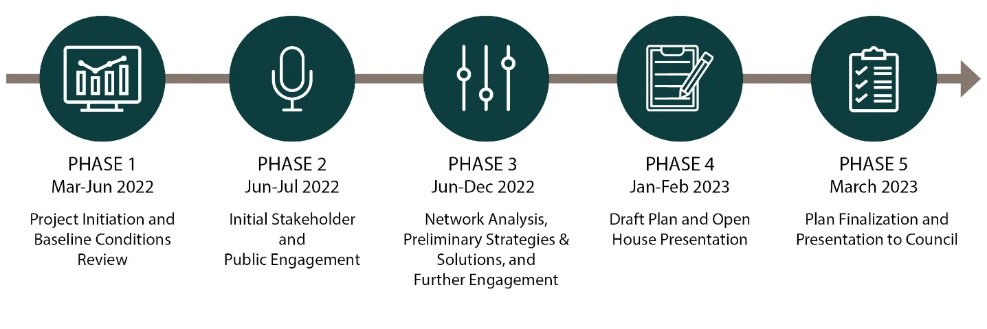
The View Royal Active Transportation Network Plan is being developed in a five-phase process, as shown below:
- Phase 1 – Network Summary & Baseline Conditions Assessment involves reviewing relevant Town policies, existing data, collecting data where gaps exist, assessing existing active transportation conditions, and development of materials that will be utilized throughout the project
- Phase 2 – Initial Stakeholder and Public Engagement involves online and in-person engagement to understand current active transportation strengths, challenges, and opportunities, while informing and educating the public to shape the overall network vision, direction, and goals
- Phase 3 – Network Analysis & Preliminary Strategies and Solutions involves identifying potential improvements and detailing the future network and design recommendations. This phase involves a second round of stakeholder and public consultation to obtain feedback on the preliminary recommendations
- Phase 4 – Draft Plan will be developed after receiving feedback from the public and staff in the third phase. The draft plan will then be presented to the public in an open house format for final feedback
- Phase 5 – Plan Finalization will occur and the Final ATNP will be presented to Town Council
This report summarizes the work completed for the second round of engagement under Phase 3 – Network Analysis & Preliminary Strategies and Solutions, which took place in November and December 2022. It includes:
- An overview of the engagement activities undertaken and who we have heard from
- A summary of the feedback we have heard from the community on the preliminary strategies and recommendations
- Key takeaways from the second round of engagement and next steps
2.0 WHAT WE DID
The View Royal community was invited to share their feedback on the preliminary network strategies and recommendations for the Active Transportation Network Plan including the vision, goals, and short-term priority projects. More specifically, the purpose of this second round of engagement was to gather input on:
- The draft vision statement and goals
- Critical corridor improvements
- Short-term infrastructure projects
- Major and minor intersection improvement reviews
An online survey and bikeshops were conducted as part of this second round of engagement. Public engagement opportunities were promoted using the following tools:
- The Town’s project webpage
- Social media (Facebook, Instagram, and Twitter)
- Eventbrite for inviting participants to the bikeshops
- Local media outreach
- Posters around the community
Additionally, both the consulting team and staff notified key stakeholders engaged in the first round of engagement about the opportunities in this round.
Engagement by the numbers…
- 337 survey responses
- 29 bikeshop participants
2.1 Bikeshops
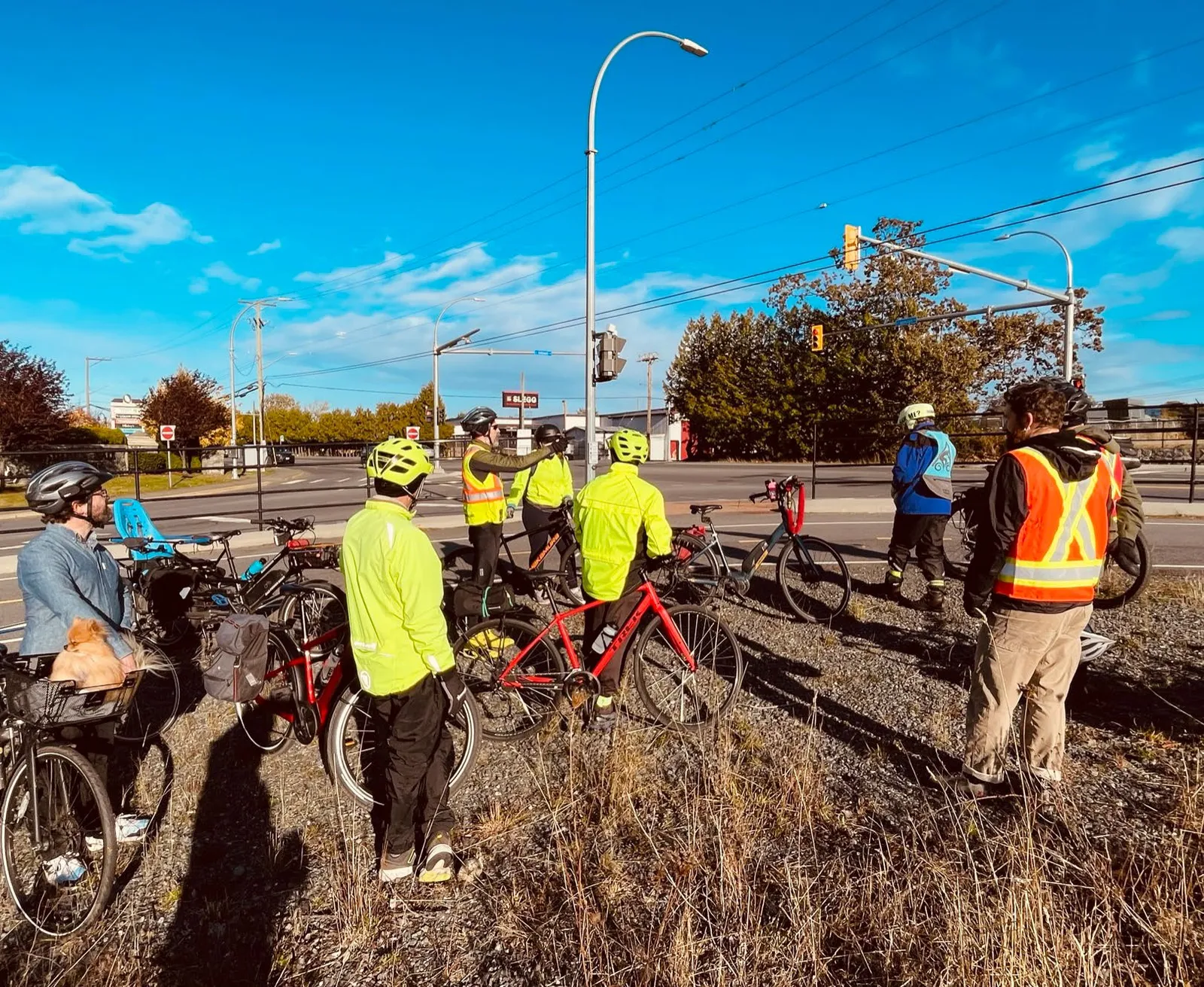
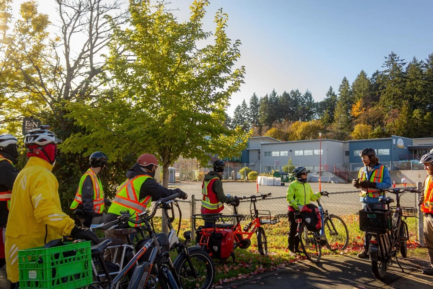
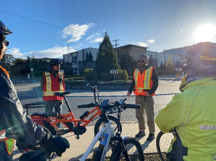
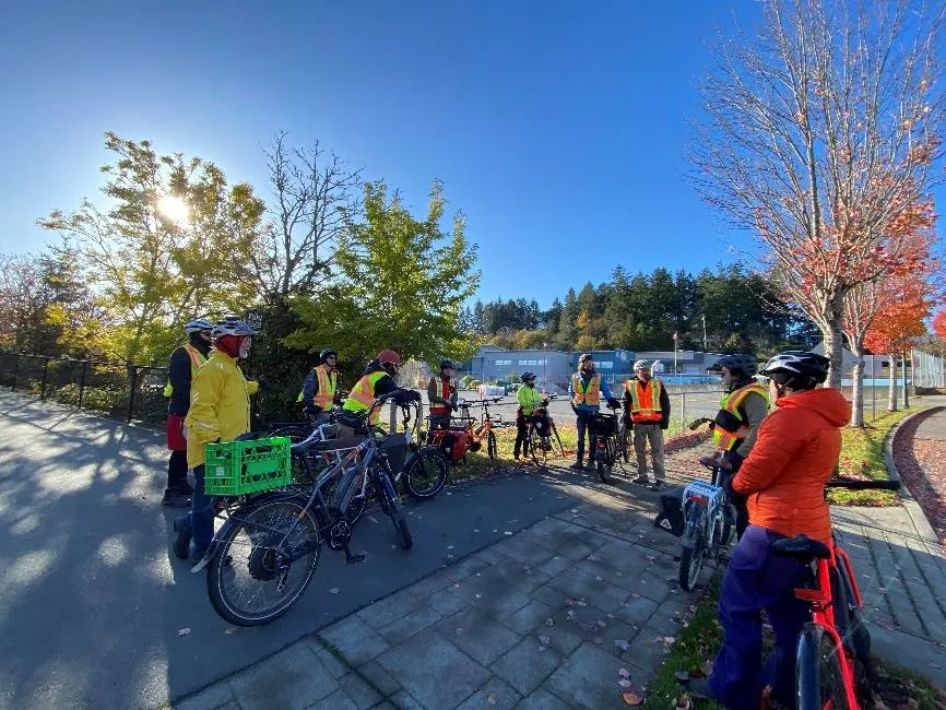
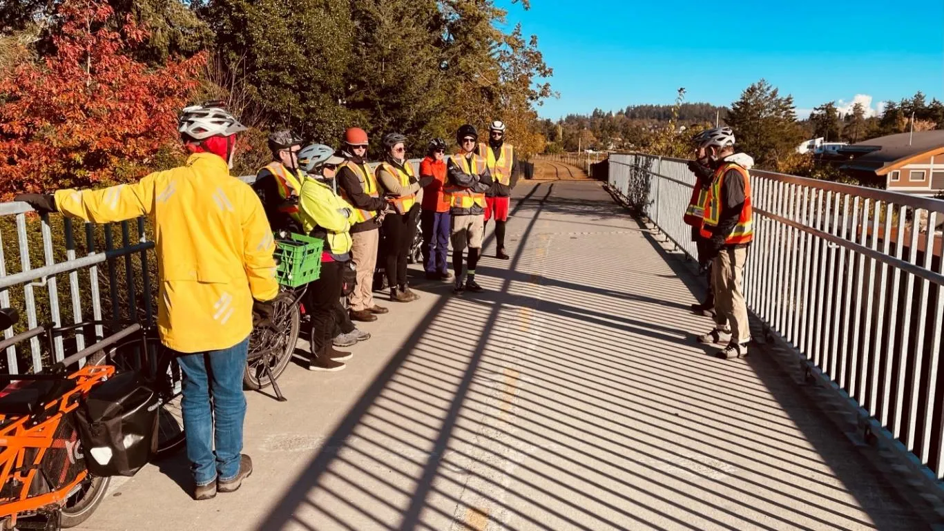
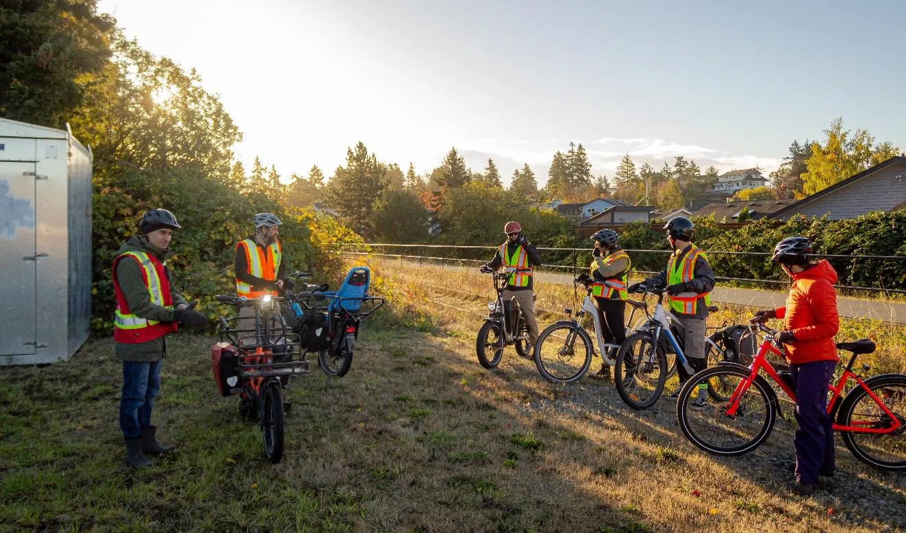
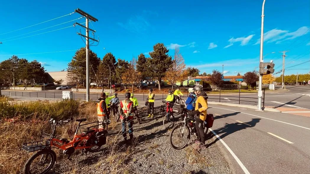
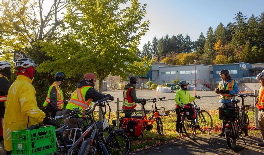
The bikeshops offered the community an opportunity to explore the state of transportation infrastructure across View Royal. Ultimately, the purpose of the bikeshops was to present elements of the network analysis including different improvement options for the pedestrian and cycling infrastructure that are being considered in the draft ATNP. The specific objectives of this engagement activity were three-fold:
- Show the community (in-person) where the higher priority (i.e., short-term) active transportation improvements are recommended.
- Receive feedback from the community on the proposed improvements.
- Promote active transportation—and raise general awareness of the project—to community members.
A total of three bikeshops were held on the following dates and times:
- Event #1 | Saturday November 5th, 2022, 9:00am-11:00am
- Event #2 | Saturday November 5th, 2022, 1:00pm-3:00pm
- Event #3 | Sunday November 6th, 2022, 9:00am-11:00am
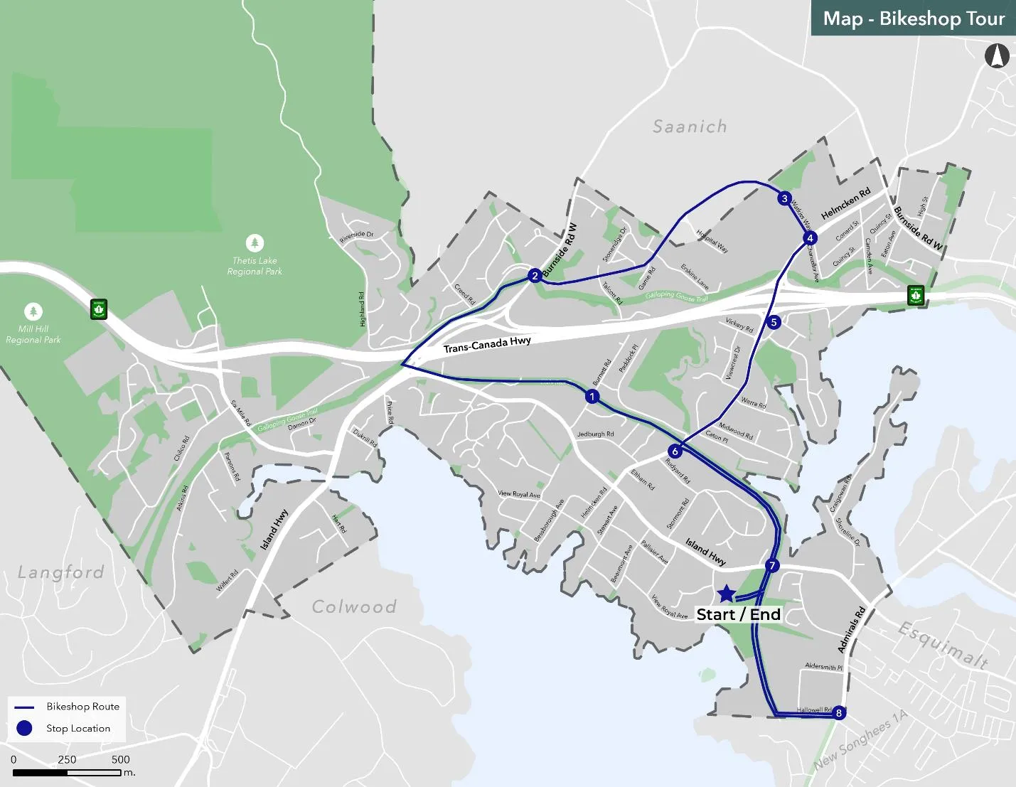
The community was invited to participate in the events through Eventbrite. A total of 29 participants engaged in this engagement activity. Figure 2 below illustrates the bikeshop tour route that was followed for all three events.
2.2 Online Survey no.2
The online survey was hosted on a survey platform called Alchemer. It was primarily targeted towards View Royal residents and those who work in the Town. The survey was available from November 24 to December 15, 2022. It included several close-ended questions and some open-ended questions about draft goals, vision, and the proposed short-term infrastructure improvements.
A total of 337 survey responses were received.

3.0 WHO WE HEARD FROM
Community members and stakeholders from a range of backgrounds participated in the second round of engagement. While demographics were not formally recorded at the bikeshops, a variety of participants were observed including older adults and parents with young children.
3.1 Geographic Representation
Most of the survey respondents (73%) live in View Royal, with 19% in another Core municipality, 3% in a Westshore municipality, 3% in the Songhees Nation, 1% in the Esquimalt Nation, and 2% in Other.
Among those who live in View Royal, the top three neighbourhoods were Helmcken (33%), Thetis (22%), and Craigflower (16%).
3.2 Age
Most respondents (29%) are in the 40-49 years age group, followed by the 30-39 and 50-59 age groups (21% each). The lowest age group represented in the survey is under 19, at 1%.
4.0 WHAT WE HEARD
4.1 Vision & Goals
4.1.1 Vision
The online survey included the draft vision for the ATNP:
View Royal is a dynamic, inclusive, and connected community that recognizes the impacts of climate change. Its active transportation network allows residents and visitors alike to move around the community safely by walking, cycling, or rolling. The active transportation network connects neighbourhoods, schools, employment destinations, natural environments including parks and green spaces, and with regional trails. A connected, compact, and safe network of active transportation facilities make driving the least attractive option, helping View Royal reduce GHG emissions, boost its local economy, and enhance its overall resilience—helping meet the needs of the present and future generations.
Majority of respondents (84%) are supportive or strongly supportive of the vision statement.
4.1.2 Goals
The draft goals are outlined below:
- Increase the number of active transportation trips to align with the corporate mode share target of 25% of all trips to work and school by an active mode and the climate target of a 36% reduction below 2007 levels by 2030.
- Provide all ages and abilities facilities—inclusive to children, seniors, families, and other vulnerable road users—on Collector and Arterial roads that protect people walking, cycling, and rolling from motor vehicle traffic.
- Strengthen the connections of the active transportation to the Town’s natural environments and assets including parks and regional trails.
- Take a regional approach to active transportation planning by collaborating with neighbouring municipalities and the Capital Regional District.
Nearly 50% of respondents indicated strong support for these goals.
Excerpts from the online survey – draft vision & goals
- “Please get it done! Sooner is better!”
- “I'd like to see bolder mode share targets.”
- “I'm concerned that this will create bottle necks in vehicle traffic... It should be accessible for everyone regardless of mode of transportation.”
- “Ensure active transportation infrastructure is prioritized in public and private development projects.”
- “The active transportation network needs to be continuous. Currently there are too many gaps in the network.”
4.2 Short-term Priority Projects – Critical Corridor Improvements
Three corridors were flagged from the first round of public engagement as the most unsafe for active transportation users: Admirals Road, Island Highway, and the Helmcken Road Interchange.
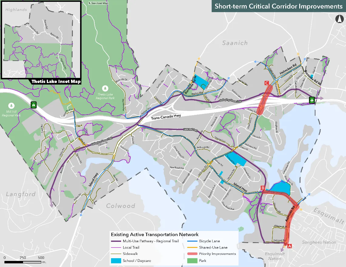
Overall, there is more support than opposition for each of the critical corridor improvements.
4.2.1 Admirals Road
271 respondents provided input on the proposed short-term critical corridor improvement on Admirals Road (from Hallowell Road to the Island Highway / Craigflower Road intersection).
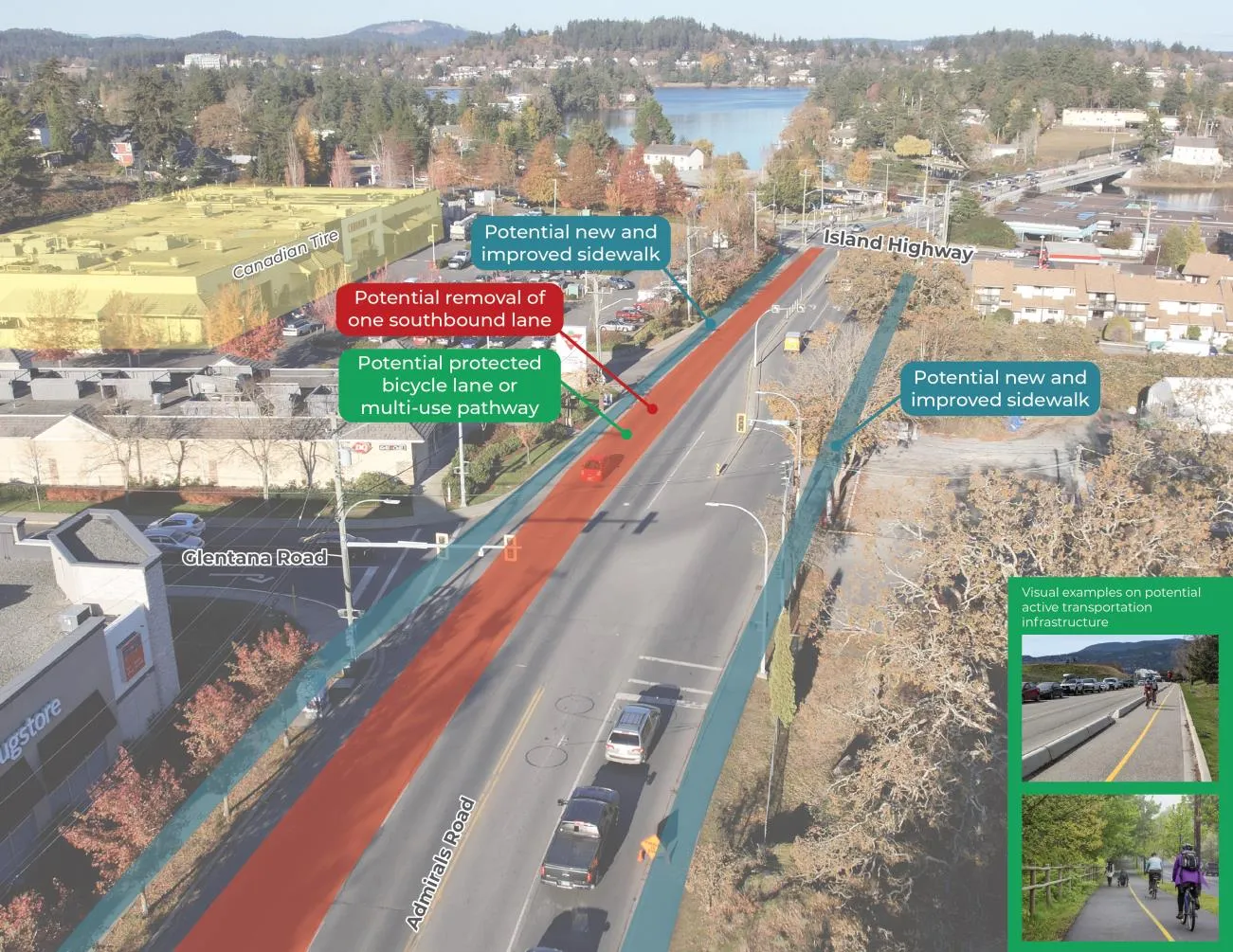
Potential changes:
- Removal of a southbound travel lane
- Removal of channelized right-turn at Admirals Road / Hallowell Road
- A bi-directional cycling facility or multi-use pathway
- New and improved sidewalk facilities on both sides of the road
- New signals at the Glentana Road and Aldersmith Place intersections
Potential impacts / tradeoffs:
- Removal of a southbound travel lane may have a minor effect on traffic performance.
- Safe connections through the intersections for people using active transportation.
- An increase in people using active transportation, reducing the number of people driving alone.
Most respondents (72%) are supportive or strongly supportive of these improvements.
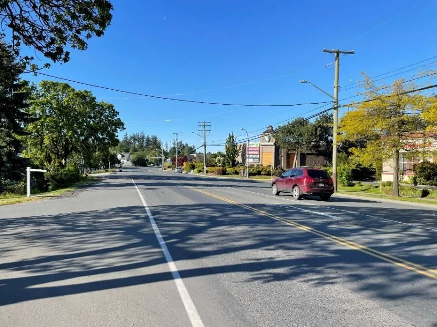
4.2.2 Island Highway
273 respondents indicated their level of support for proposed improvements on Island Highway (from Admirals Road to the E&N Regional Trail).
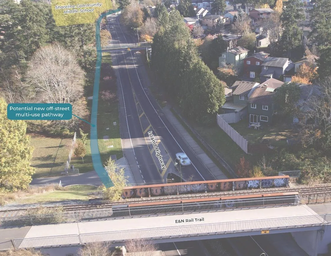
Potential changes:
- An off-street multi-use pathway on the north side of the road
- A new ramp to improve access / connection to the E&N Rail Trail
84% of respondents are supportive or strongly supportive of the proposed improvements on Island Highway.
4.2.3 Helmcken Road Interchange
The Helmcken Road Interchange received the most responses (275) among critical corridors.
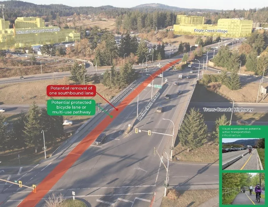
Potential changes:
- Removal of a southbound travel lane
- A bi-directional cycling facility or multi-use pathway to improve connections to Eagle Creek, the Galloping Goose Regional Trail, and View Royal Elementary School.
Potential impacts / tradeoffs:
- Minor effect on traffic performance from removing a lane.
- Safe connections through intersections.
- Increase in active transportation use.
65% of respondents are supportive or strongly supportive.
4.2.4 Highest Ranked Corridor
Admirals Road was identified as the highest priority among the three critical corridors.
Table 1. General Feedback on Proposed Critical Corridor Improvements
| Themes |
|---|
| Concerns of traffic congestion upon removal of traffic lanes |
| Separated bike lanes and sidewalks instead of multi-use paths |
| Consider other corridors for improvements (Six Mile Road, Burnside Road, other segments of the Island Highway) |
| Improve safety at Admirals / Island Hwy intersection |
| Improve signage and lighting for bike lanes / multi-use paths |
| Do not move / interfere with existing bus stops |
| Improve pedestrian facilities (wider sidewalks, more crosswalks) |
Excerpts from the online survey – critical corridor improvements
- “Access to Shoreline is KEY. This spot is so incredibly dangerous right now... It is TRULY not safe for kids to walk/wheel to school.”
- “For the Helmcken upgrade, I support this if it doesn't remove the left turn lane onto the highway.”
- “Removing lanes for bikes is a non-starter. Traffic is already jammed and backed up at rush hour.”
4.3 Short-term Priority Projects – Additional Corridor Improvements
Ten additional locations were identified for potential short-term priority projects based on criteria such as public safety concerns, traffic volume, and network connectivity gaps.
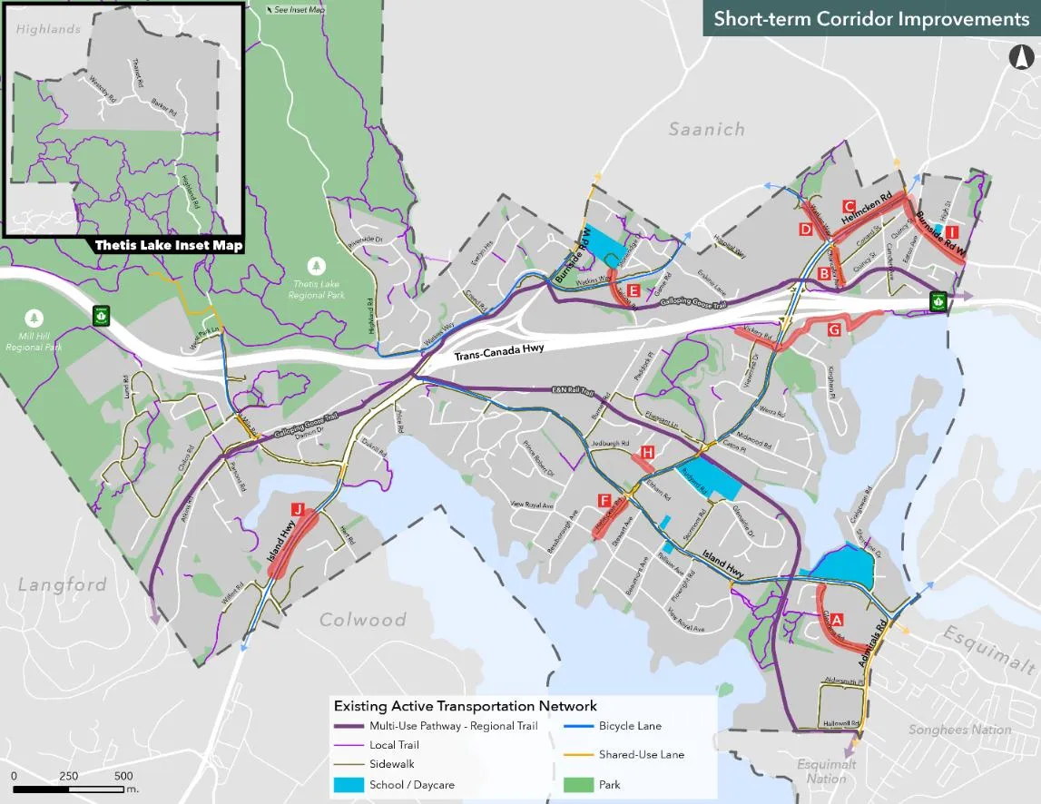
- (A) Glentana Road (Island Highway to Admirals Road)
- (B) Chancellor Avenue (Helmcken Road to Galloping Goose Regional Trail)
- (C) Helmcken Road (Watkiss Way to Burnside Road)
- (D) Watkiss Way (roundabout to Helmcken Road)
- (E) Talcott Road (Galloping Goose Regional Trail to Eagle View Elementary)
- (F) Helmcken Road (Island Highway to View Royal Avenue)
- (G) Vickery Road / St. Giles Street
- (H) Jedburgh Road (Jedburgh Place to Helmcken Road)
- (I) Burnside Road W (Helmcken Road southwards towards the Saanich border)
- (J) Island Highway (Wilfert Rd to Hart Rd)
4.3.1 Ranking Results
Option C (Helmcken Road: Watkiss Way to Burnside Road) was ranked as the highest priority among additional corridor improvements.
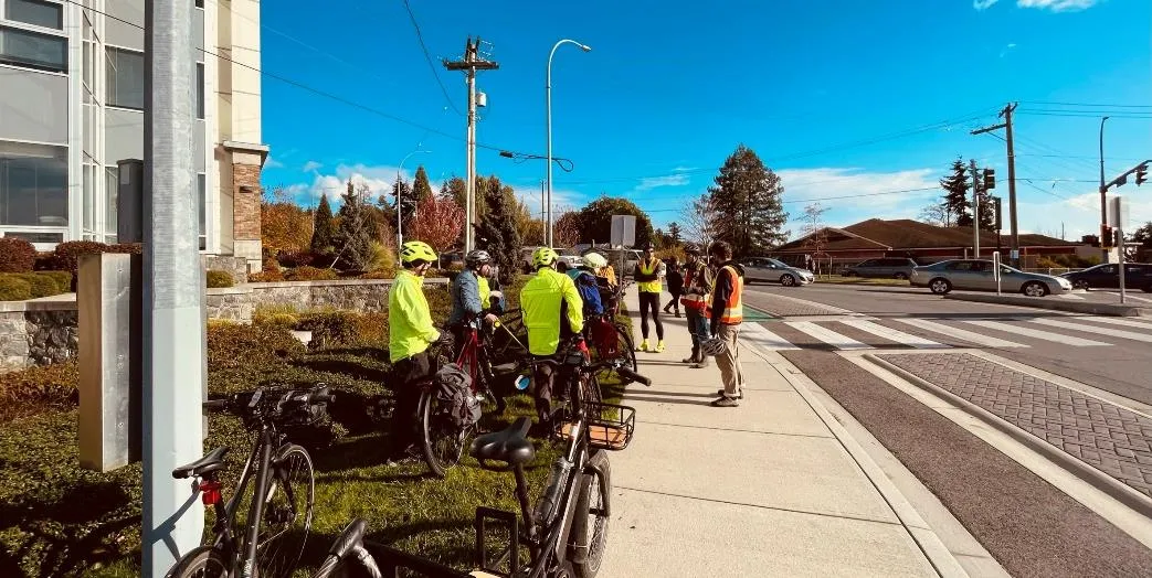
Table 2. Rankings of Short-term Priority Projects - Additional Corridor Improvements
| Overall Rank | Corridor | Number of Rankings* |
|---|---|---|
| 1 | C. Helmcken Road (Watkiss Way to Burnside Road) | 188 |
| 2 | D. Watkiss Way (roundabout to Helmcken Road) | 177 |
| 3 | I. Burnside Road W (Helmcken Road southwards towards the Saanich border) | 178 |
| 4 | B. Chancellor Avenue (Helmcken Road to Galloping Goose Regional trail) | 176 |
| 5 | F. Helmcken Road (Island Highway to View Royal Avenue) | 170 |
| 6 | A. Glentana Road (Island Highway to Admirals Road) | 174 |
| 7 | J. Island Highway (Wilfert Road to Hart Road) | 170 |
| 8 | E. Talcott Road (Galloping Goose Regional Trail to Eagle View Elementary) | 160 |
| 9 | H. Jedburgh Road (Jedburgh Place to Helmcken Road) | 163 |
| 10 | G. Vickery Road / St. Giles Street | 160 |
4.4 Intersection Improvement Reviews
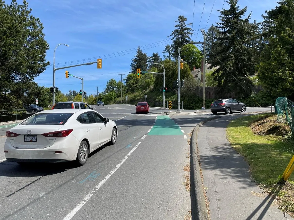
Locations were flagged for both "major" intersection reviews (two major roadways) and "minor" reviews (local road crossing a major road or a trail crossing).
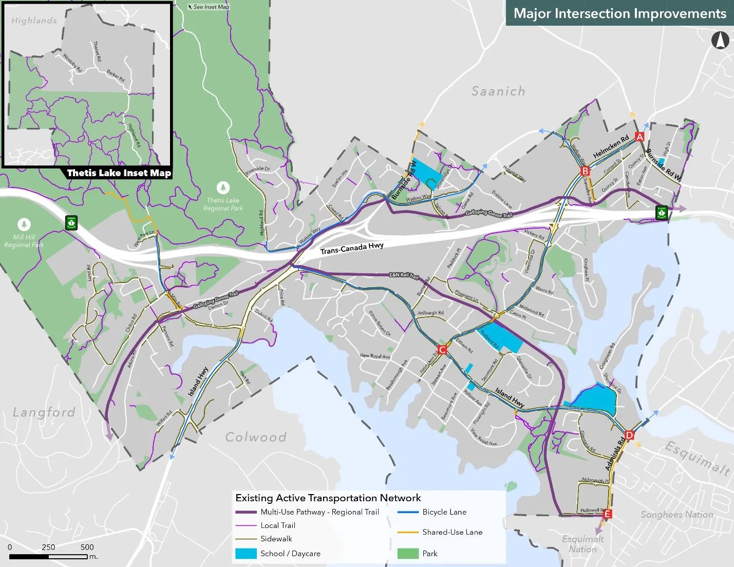
A. Burnside Road W / Helmcken Road B. Helmcken Road / Watkiss Way C. Helmcken Road / Island Highway D. Admirals Road / Island Highway E. Admirals Road / Hallowell Road
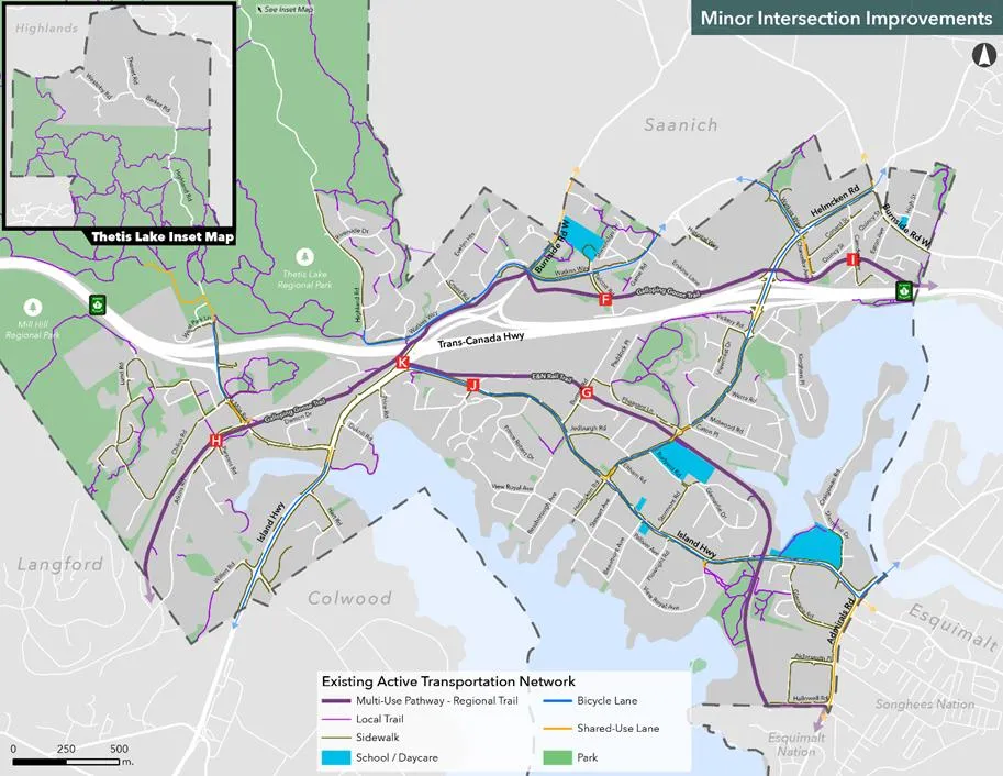
F. Galloping Goose Regional Trail / Talcott Road G. E&N Rail Trail / Burnett Road H. Galloping Goose Regional Trail / Atkins Road I. Galloping Goose Regional Trail / Camden Avenue J. E&N Rail Trail / Adams Place K. E&N Rail Trail / Island Highway / Colwood Interchange
4.4.1 Major Intersection Improvements
Intersection location D (Admirals Road / Island Highway) was ranked as the highest priority for major intersection improvements.
Table 3. Rankings of Priorities for Major Intersection Improvement Reviews
| Overall Rank | Major Intersection | Number of Rankings* |
|---|---|---|
| 1 | D. Admirals Road / Island Highway | 197 |
| 2 | A. Burnside Road W / Helmcken Road | 190 |
| 3 | C. Helmcken Road / Island Highway | 193 |
| 4 | B. Helmcken Road / Watkiss Way | 191 |
| 5 | E. Admirals Road / Hallowell Road | 183 |
4.4.2 Minor Intersection Improvements
Location K (E&N Rail Trail / Island Highway / Colwood Interchange) was ranked the highest for minor improvements.
Table 4. Rankings of Priorities for Minor Intersection Improvement Reviews
| Overall Rank | Minor Intersection | Number of Rankings* |
|---|---|---|
| 1 | K. E&N Rail Trail / Island Highway / Colwood Interchange | 186 |
| 2 | H. Galloping Goose Regional Trail / Atkins Road | 168 |
| 3 | G. E&N Rail Trail / Burnett Road | 167 |
| 4 | F. Galloping Goose Regional Trail / Talcott Road | 166 |
| 5 | J. E&N Rail Trail / Adams Place | 167 |
| 6 | I. Galloping Goose Regional Trail / Camden Avenue | 165 |
Excerpts from the online survey – intersection improvements
- “Please prioritize Watkiss and Burnside, it is so dangerous as is.”
- “The helmcken intersection needs a specific walk signal. I've been extremely close to getting hit by vehicles daily while crossing.”
- “Please consider our children's safety on the roundabouts near View Royal Elementary... Speed is a massive issue.”
5.0 KEY TAKEAWAYS
- There is a general level of support for the draft vision statement and goals for the Active Transportation Network Plan.
- More support than opposition exists for critical corridor improvements on Admirals Road, Island Highway, and the Helmcken Road Interchange. Admirals Road is ranked as the highest priority to improve.
- For additional corridor improvements, the top priorities are Helmcken Road (Watkiss to Burnside), Watkiss Way (roundabout to Helmcken), and Burnside Road W.
- The highest ranked major intersection for prioritized review is Admirals Road / Island Highway.
6.0 NEXT STEPS
- Revise the short-term priority projects based on community feedback.
- Draft the full Active Transportation Network Plan.
- Develop the implementation strategy with cost estimates.
The community will be invited to a public open house in late February / early March 2023 to review the draft ATNP.
Document Images
(2)