Vancouver Island Rail Transit Proposal
A comprehensive proposal for passenger rail service on Vancouver Island, including cost estimates, route maps, rolling stock details, and travel time tables.
Vancouver Island Rail Transit
Written by Gwyer Webber (2018-2023)
July 2023
The Island Rail Corridor would be preserved for Passenger Rail Service and a Multi-Use Trail alongside the rail line. The rail line would be upgraded with new rail and concrete ties to allow for scheduled passenger rail service throughout the day. The rail line would be built in phases when funding is available.
[System Map: Diagram of the Vancouver Island Rail Transit network showing stations and distances from Victoria]
Stations and Distances (from Victoria):
- Campbell River (263km)
- Courtenay (225km)
- Buckley Bay (203km)
- Qualicum Beach (163.8km)
- Parksville (153.2km)
- Lantzville (134.2km)
- Nanaimo (116.7km)
- YCD (102.7km)
- Ladysmith (94km)
- Chemainus (82km)
- Duncan (63.8km)
- Cobble Hill (49.8km)
- Shawnigan Lake (44.7km)
- Langford (12.7km)
- View Royal (7.75km)
- Esquimalt (4.25km)
- Victoria (0km)
Branch Lines:
- Parksville to Coombs (7km)
- Coombs to Port Alberni (63.4km)
Phase 1: Victoria - Duncan
- Negotiate with the Songhees, Esquimalt, and Cowichan First Nations to allow Passenger Rail to run through the reserve.
- Stations at Duncan, Cobble Hill, Shawnigan Lake, Langford Exchange, View Royal, Esquimalt, and Victoria. Platform Length TBD.
- Initially two trains would run every 90 minutes in each direction with both vehicles starting in Duncan. Additional trains would allow for a frequency of 30 minute from Langford to Victoria.
- The travel time between Duncan and Victoria is around 66 minutes with the station west of the Johnson St Bridge. Travel time would be reduced to 60 minutes if the line was extended underground to Douglas St.
Nanaimo Waterfront
- The existing freight rail operations would be moved to Duke Point including the propane depot. Harmac has a rail barge dock which may be feasible. This keeps the mainline clear for passenger rail service and the Nanaimo Waterfront can be redeveloped. The right of way can then be returned to Snuneymuxw First Nations.
Additional First Nations Negotiations
- The existing right of way can be returned to the Halalt First Nations and a new right of way built to the west of the reserve.
- Negotiate with the Stz’uminus First Nations to allow or move the existing right of way farther west.
Cost
- The cost of the Ultimate Phase in the IRCCA Report from Victoria to Duncan was $151 million dollars.
- The cost of three Stadler Flirt trains (1 spare) would be around $60 million dollars.
- Additional cost for a maintenance building near Duncan and a signaling system.
[Map: Linear station map for Phase 1 showing Duncan, Cobble Hill, Shawnigan Lake, Langford Exchange, View Royal, Esquimalt, and Victoria]
Fare Zones
| Zones | 1 | 2 | 3 |
|---|---|---|---|
| Fares | $2.50 | $5.00 | $7.50 |
| Zone | 1 | 2 | 3 |
|---|---|---|---|
| City | CRD | Shawnigan Lake, Cobble Hill | Duncan |
| Concessions | ||
|---|---|---|
| Family 1 | 1 parent plus their own kids under 18 | 1.5 x Zones |
| Family 2 | 2 parents plus their own kids under 18 | 2.5 x Zones |
| Monthly Pass | Minimum $70.00 | 14 x Zones |
Rolling Stock
The rail vehicles would be Stadler Flirt Battery Electric Multiple Units (BEMU). The BEMU would be similar to the pictured DEMU shown bellow.
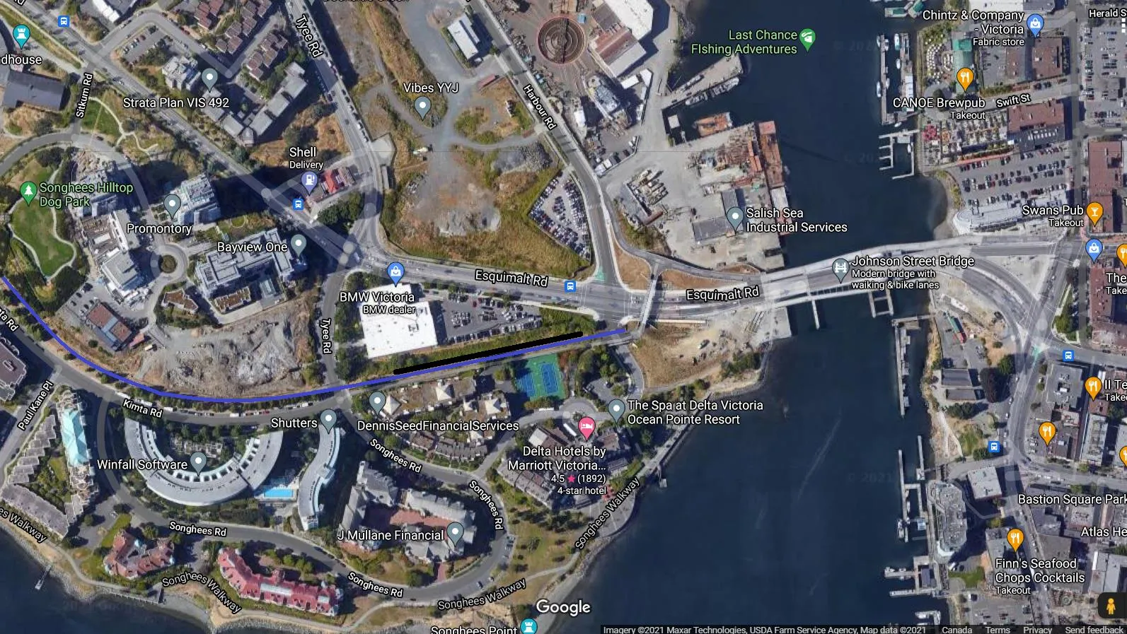
Victoria Station Option 1
Travel time from Langford to Victoria would be 24 minutes. Travel time from View Royal to Victoria would be 17 minutes. Travel time from Duncan to Victoria would be 66 minutes.
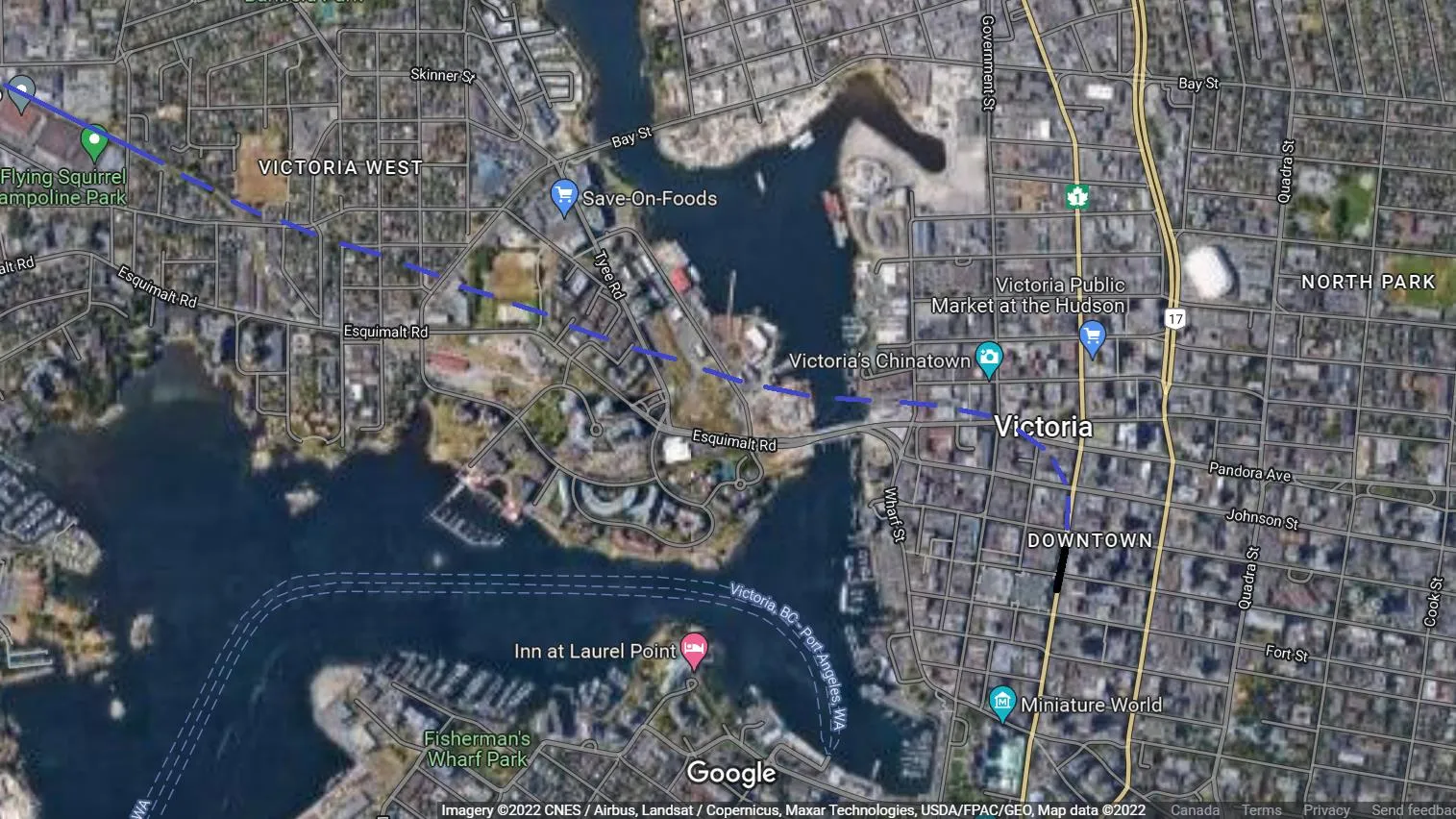
Victoria Station Option 2
A single track underground tunnel to a double platform would eliminate 7 level crossings and reduces travel time. Travel time from Langford to Victoria would be 18 minutes. Travel time from View Royal to Victoria would be 12 minutes. Travel time from Duncan to Victoria would be 60 minutes.
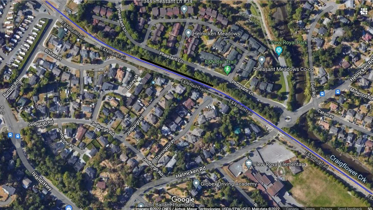
View Royal
This allows connection to Bus # 14 and the Victoria General Hospital.
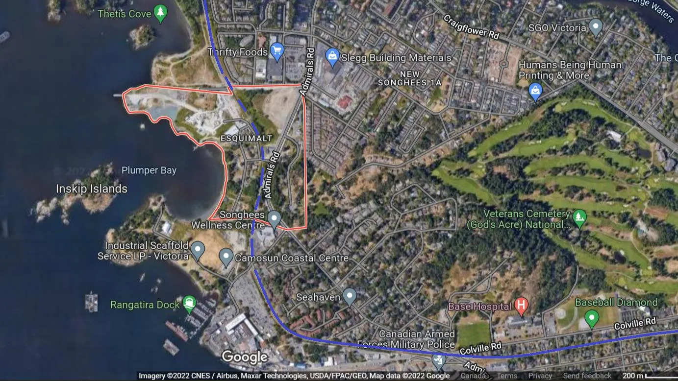
Esquimalt and Songhees Reserve
If required, the line would run underground (cut and cover) through Esquimalt and Songhees First Nations reserves.
Travel Times
Travel times are based on the Victoria station located west of the Johnson St Bridge.
Southbound
| Station to Station | km | Minutes | Avg. Sp. |
|---|---|---|---|
| Courtenay - Buckley | 22 | 17 | 80km/hr |
| Buckley - Qualicum | 39 | 30 | 80km/hr |
| Qualicum - Parksville | 10.6 | 8 | 80km/hr |
| Parksville - Lantzville | 22 | 17 | 80km/hr |
| Lantzville - Nanaimo | 14.5 | 11 | 80km/hr |
| Nanaimo - YCD | 14 | 11 | 80km/hr |
| YCD - Ladysmith | 9 | 7 | 80km/hr |
| Ladysmith - Chemainus | 12 | 9 | 80km/hr |
| Chemainus - Duncan | 18 | 14 | 80km/hr |
| Duncan - Shawnigan | 19.2 | 15 | 80km/hr |
| Shawnigan - Langford | 31 | 27 | 70km/hr |
| Langford - View Royal | 5.1 | 7 | 45km/hr |
| View Royal - Esquimalt | 3.4 | 6 | 40km/hr |
| Esquimalt - Victoria | 4.2 | 11 | 24km/hr |
Northbound
| Station to Station | km | Minutes | Avg. Sp. |
|---|---|---|---|
| Victoria - Esquimalt | 4.2 | 11 | 24km/hr |
| Esquimalt - View Royal | 3.4 | 6 | 40km/hr |
| View Royal - Langford | 5.1 | 7 | 45km/hr |
| Langford - Shawnigan | 31 | 27 | 70km/hr |
| Shawnigan - Duncan | 19.2 | 15 | 80km/hr |
| Duncan - Chemainus | 18 | 14 | 80km/hr |
| Chemainus - Ladysmith | 12 | 9 | 80km/hr |
| Ladysmith - YCD | 9 | 7 | 80km/hr |
| YCD - Nanaimo | 14 | 11 | 80km/hr |
| Nanaimo - Lantzville | 14.5 | 11 | 80km/hr |
| Lantzville - Parksville | 22 | 17 | 80km/hr |
| Parksville - Qualicum | 10.6 | 8 | 80km/hr |
| Qualicum - Buckley | 39 | 30 | 80km/hr |
| Buckley - Courtenay | 22 | 17 | 80km/hr |
Eastbound
| Station to Station | km | Minutes | Av. Sp. |
|---|---|---|---|
| Port Alberni - Coombs | 56.4 | 48 | 70km/hr |
| Coombs - Parksville | 7 | 6 | 70km/hr |
Westbound
| Station to Station | km | Minutes | Av. Sp. |
|---|---|---|---|
| Parksville - Coombs | 7 | 6 | 70km/hr |
| Coombs - Port Alberni | 56.4 | 48 | 70km/hr |
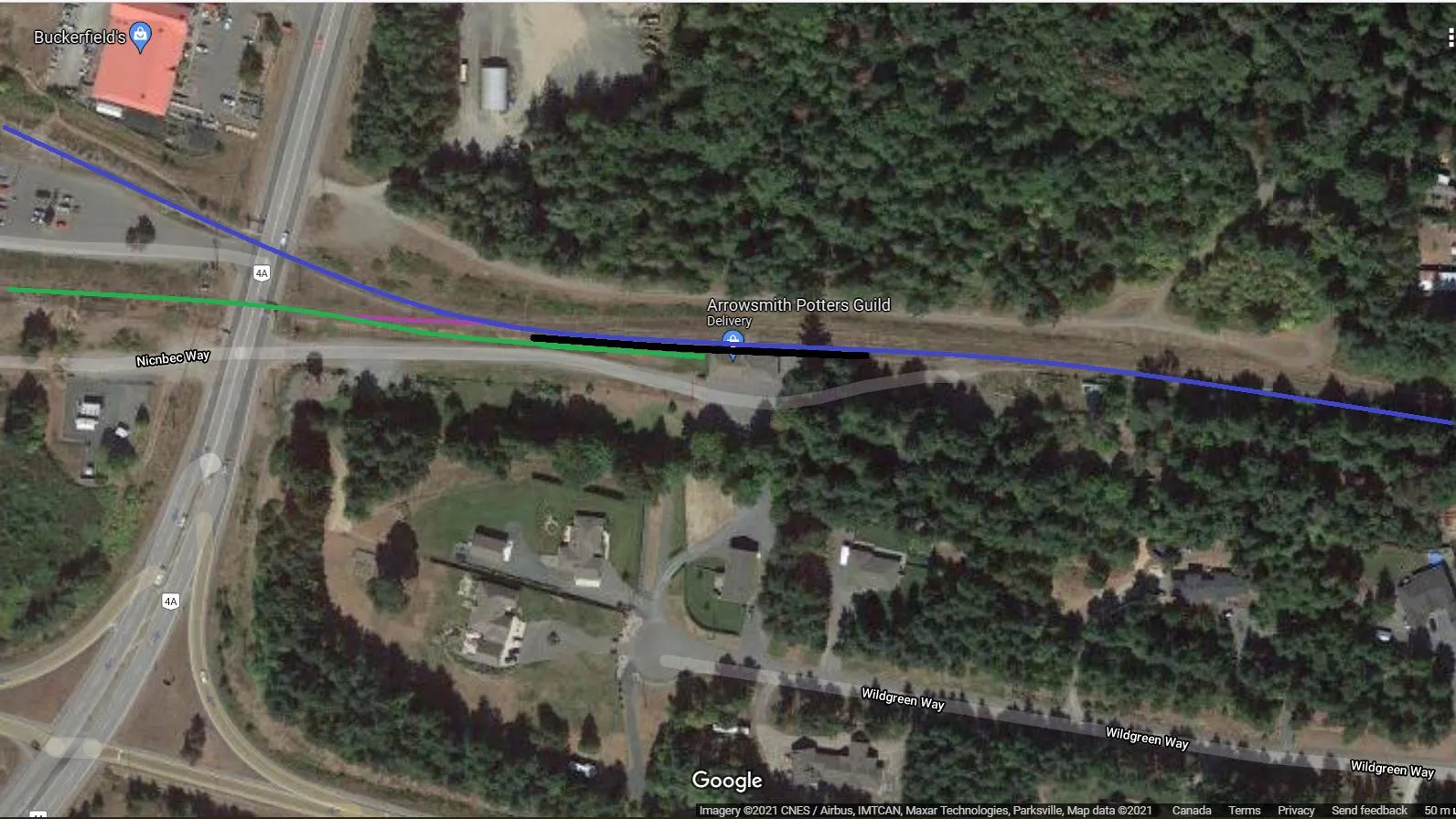
Parksville Station
Blue denotes Victoria Sub and Green denotes Port Alberni Sub. Purple denotes Maintenance Link.
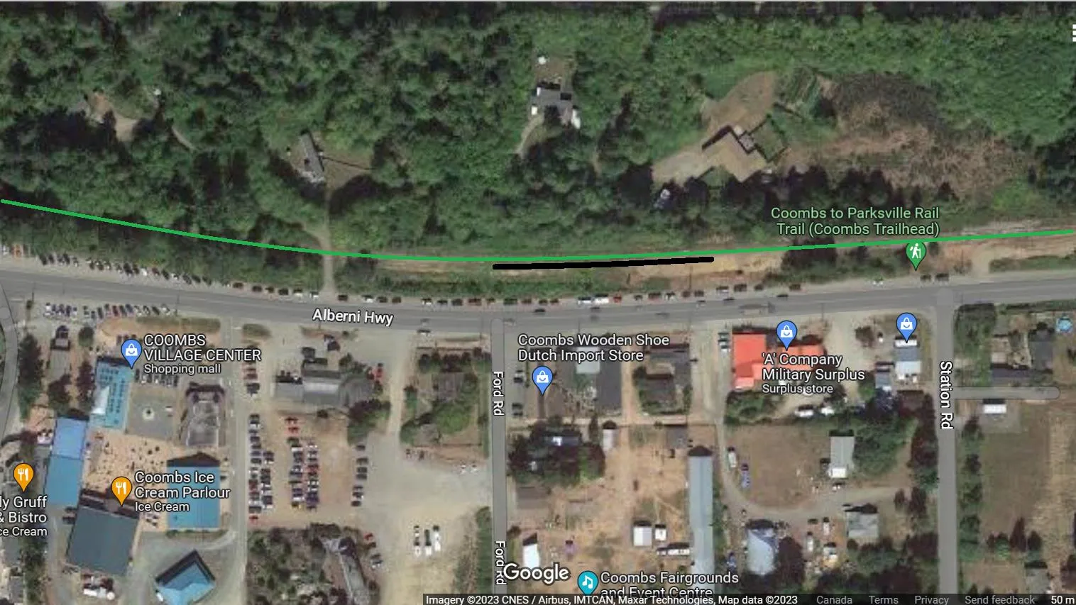
Coombs Station
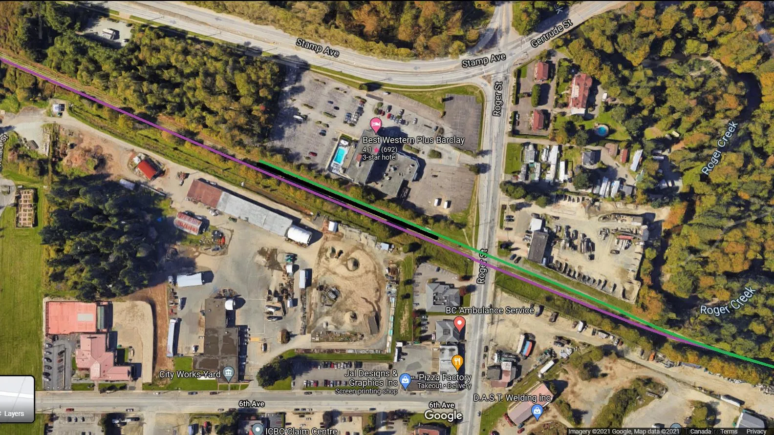
Port Alberni Station
The location at Rogers St would allow access to two bus lines.
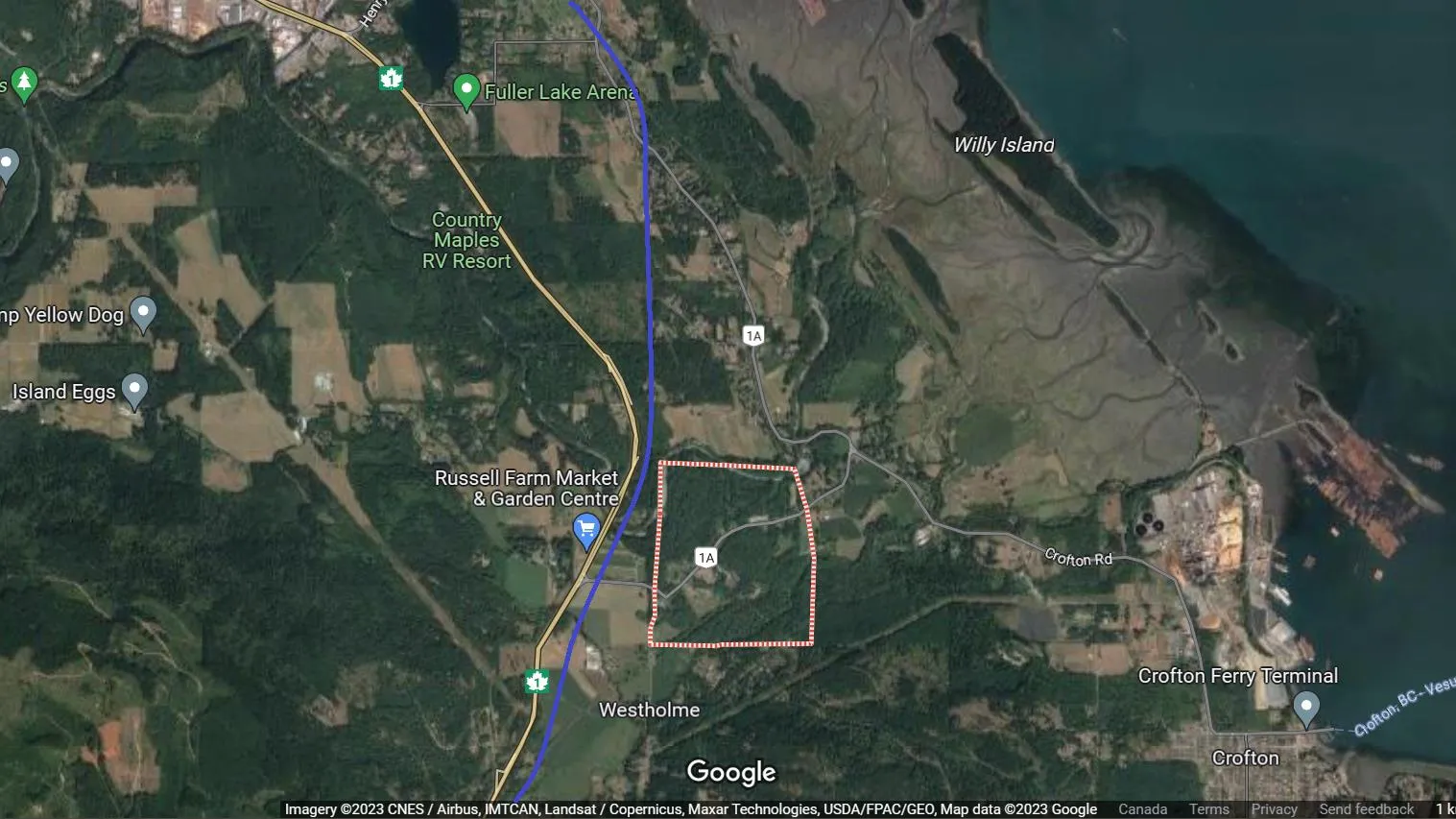
Halalt First Nation
The line would go around the reserve.
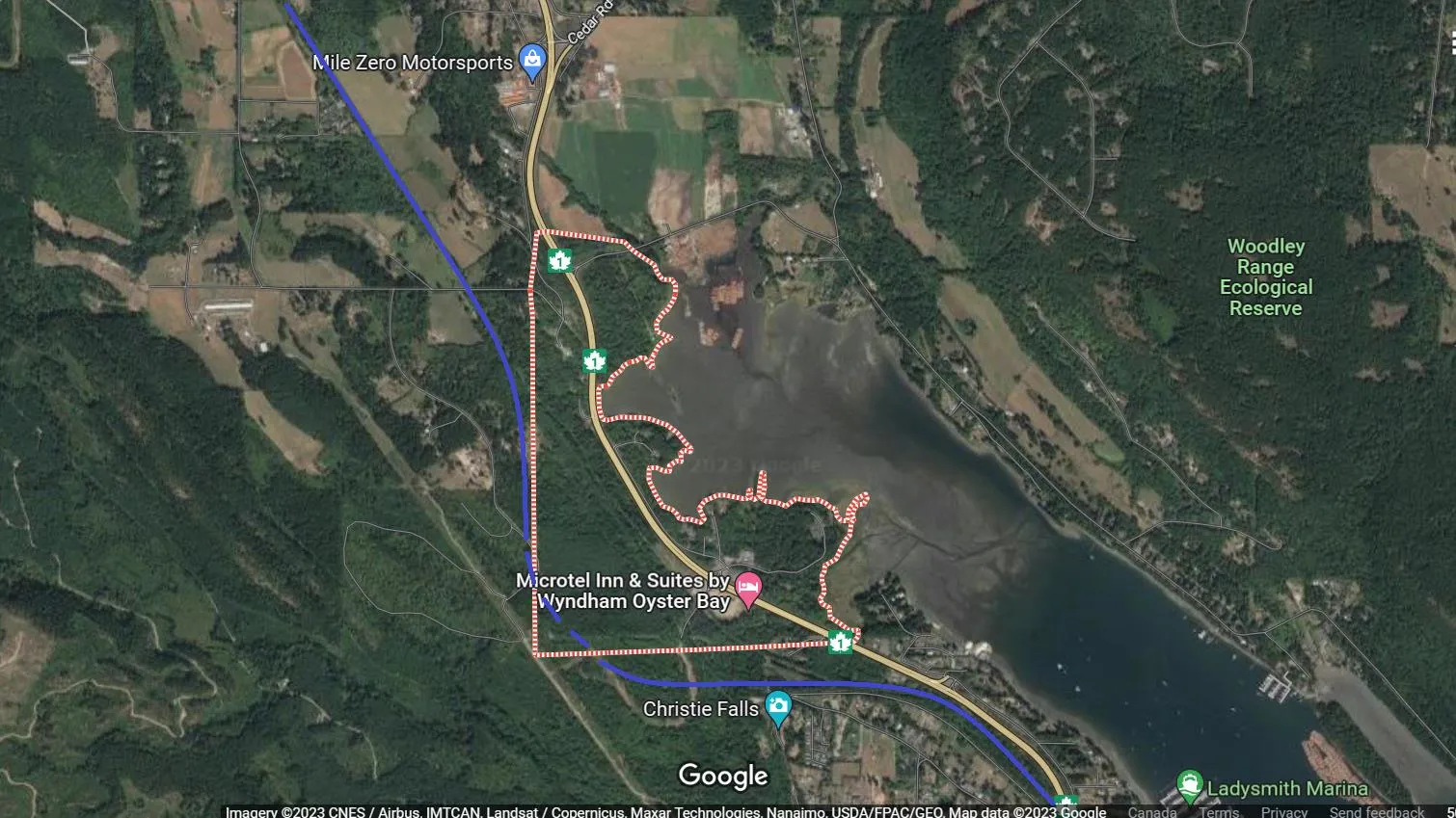
Stz’uminus First Nation
The line would be underground around the reserve.
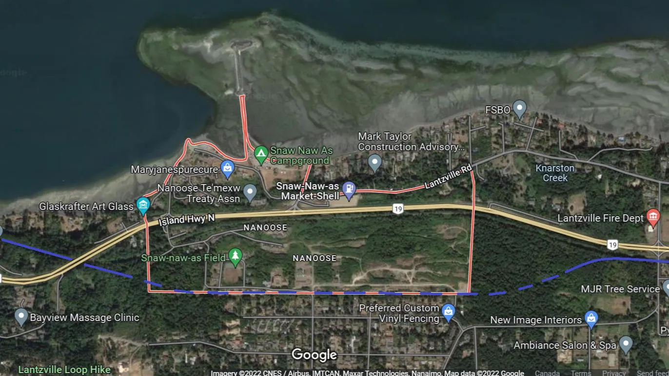
Snaw-Naw-As First Nation
The line would be underground around the reserve.
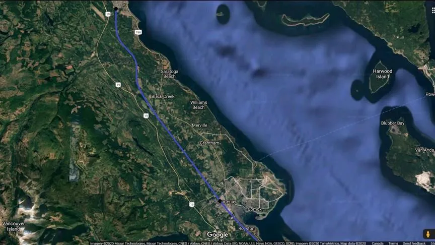
Extension to Campbell River
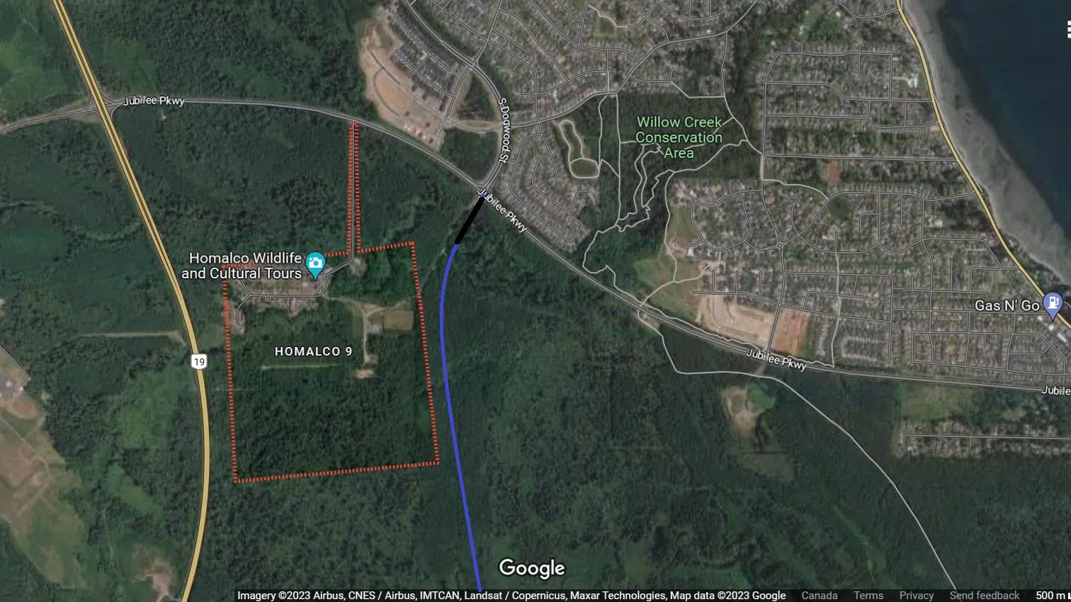
Campbell River Station
All Fare Zones
| Zones | 1 | 2 | 3 | 4 | 5 | 6 | 7 | 8 | 9 | 10 |
|---|---|---|---|---|---|---|---|---|---|---|
| Fares | $2.50 | $5.00 | $7.50 | $10.00 | $12.50 | $15.00 | $17.50 | $20.00 | $22.50 | $25.00 |
| Zone | 1 | 2 | 3 | 4 | 5 | 6 | 7 | 8 | 9 | 10 |
|---|---|---|---|---|---|---|---|---|---|---|
| City | CRD | Shawnigan | Duncan | Chemainus | Ladysmith | Nanaimo | Parksville | Buckley Bay | Courtenay | Campbell River |
| YCD | Lantzville | Qualicum | Coombs | Pt Alberni |
| Concessions | ||
|---|---|---|
| Family 1 | 1 parent plus their own kids under 18 | 1.5 x Zones |
| Family 2 | 2 parents plus their own kids under 18 | 2.5 x Zones |
| Monthly Pass | Minimum $70.00 | 14 x Zones |
Example
- Individual Ticket: Courtenay-Victoria $22.50 / Nanaimo-Victoria $15.00 / Parksville-Duncan $12.50
- Family 1 Ticket: Courtenay-Victoria $33.75 / Nanaimo-Victoria $22.50 / Parksville-Duncan $18.75
- Family 2 Ticket: Courtenay-Victoria $56.25 / Nanaimo-Victoria $37.50 / Parksville-Duncan $31.25
- Monthly Pass: Duncan-Victoria $105
Disclaimer
The author is not a professional planner, consultant, or a member of any group and the options are an idea for upgrading the E&N.
Average Speed
The table below shows the average speed of some rail transit systems being built or are in service in Canada.
| City | Toronto Streetcar | Toronto LRT | Toronto LRT | Toronto Metro | Toronto Metro | Vancouver Skytrain | Montreal REM |
|---|---|---|---|---|---|---|---|
| Line | Tram 501 | Finch West | Eglinton | Line 2 | Line 4 | Expo Line | Deux-Montagnes to Gare Central |
| Average Speed | 14.5km/hr | 20km/hr | 28km/hr | 33km/hr | 41km/hr | 45km/hr | 49km/hr |
| Average Distance Between Stations | 275m | 650m | 800m | 873m | 1375m | 1500m | 2000m |
Note: The average speed is calculated using the distance of the line and the time it takes to travel that distance including the station stops. Travel time is based on the TTC Trip Planner and Metrolinx estimates on Finch LRT and Eglinton LRT.
Disclaimer
The author is not a professional planner or affiliated with any transportation body, consulting group, lobby group, or committee. The document is written to show a rail transit option with the calculations as accurate as possible based on information online.