Appendix
Subject Property Map - Helmcken Centennial Park
March 3, 2015Page 1571 section
A neighborhood map identifying the location of Helmcken Centennial Park and surrounding residential lots.
Helmcken Centennial ParkP153
Subject Property Map - Helmcken Centennial Park
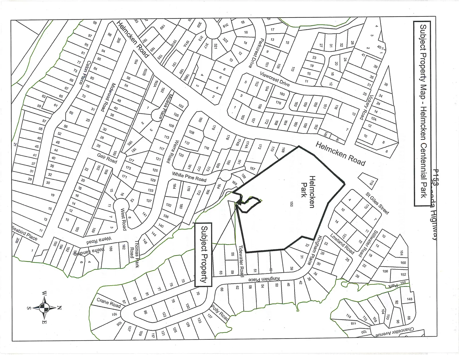
Map Features
Key Locations:
- Helmcken Park: Large central park area designated as Lot 150.
- Subject Property: Identified with a callout box pointing to a lot located south of Helmcken Park, between White Pine Road and Tidewater Road.
Major Streets and Roads:
- Helmcken Road
- Vickery Road
- St Giles Street
- Stillwater Road
- Lowland Road
- Chancellor Avenue
- Kingham Place
- Tidewater Road
- Polly Road
- Crane Road
- Thomas Park Road
- Werra Road
- West Road
- White Pine Road
- Gair Road
- Micasa Place
- Midwood Road
- Caton Place
- Viewcrest Drive
- Parkcrest Drive
- Seabird Place
Other Details:
- A compass rose indicates North is oriented toward the top of the map.
- Text at the top of the page includes "P153" and "Canada Highway".
Page 157
Extracted from: 2015 03 03 Council Agenda