Appendix
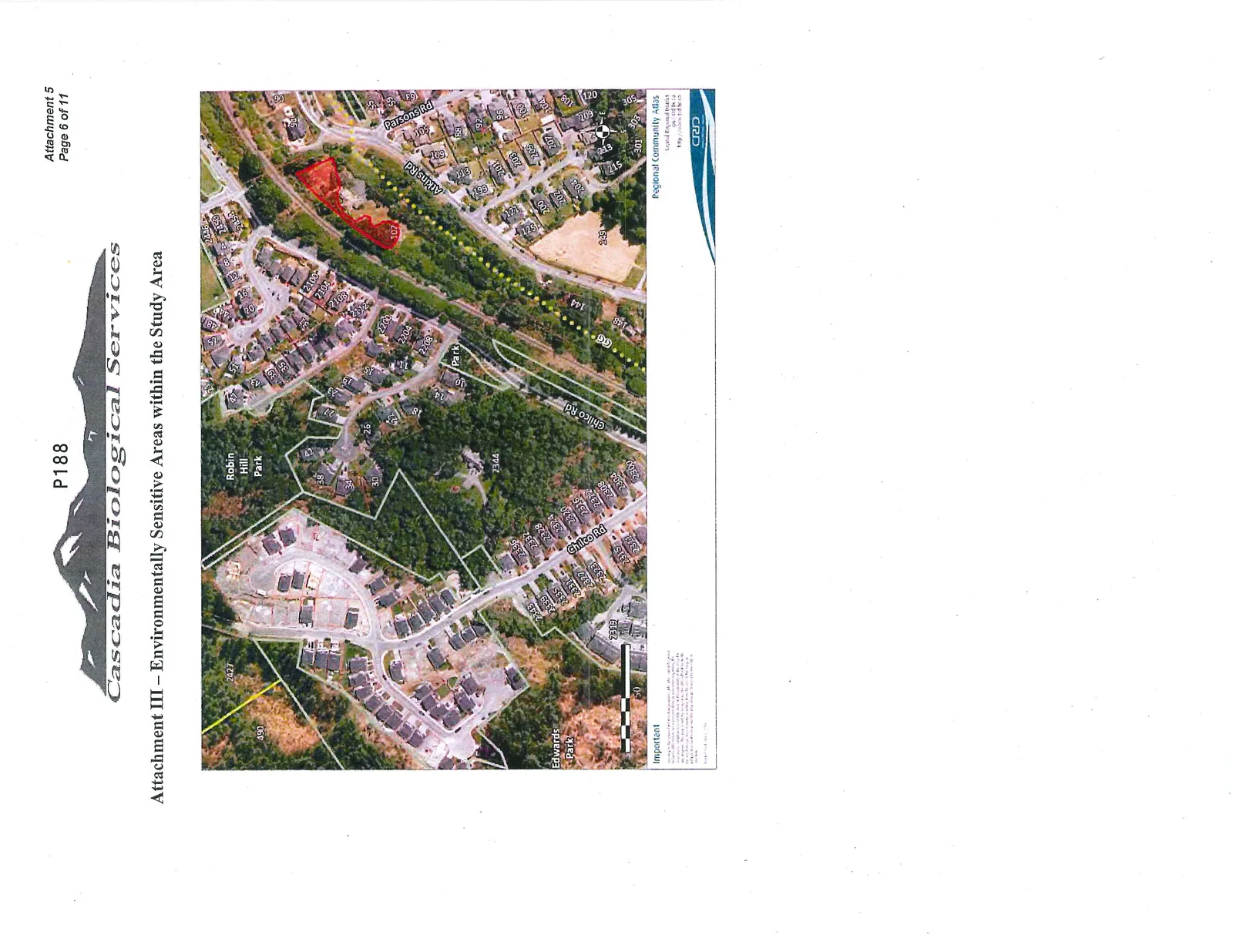
Attachment III – Environmentally Sensitive Areas within the Study Area
March 3, 2015Page 1921 section
An aerial map identifying specific environmentally sensitive areas on and near the 102 Atkins Road property.
Attachment III – Environmentally Sensitive Areas within the Study Area
Important
This map is for information purposes only. While every effort has been made to ensure the accuracy of the information shown on this map, the Capital Regional District cannot guarantee the accuracy of information provided by others and any map users should refer to original documents for final verification. For legal property boundaries always refer to the Plan on file at the Land Title Office.
Regional Community Atlas Capital Regional District http://atlas.crd.bc.ca
Page 192
Extracted from: 2015 03 03 Council Agenda