Appendix
Conceptual Layout - To be refined at Development Permit stage
March 3, 2015Page 2211 section
A site planning diagram showing the conceptual layout for a development at 102 Atkins Road, including access roads and its proximity to the Galloping Goose Trail.
102 Atkins RoadOctober 25, 2014Prepared by Dunster & Associates Environmental Consultants Ltd.
Conceptual Layout
To be refined at Development Permit stage
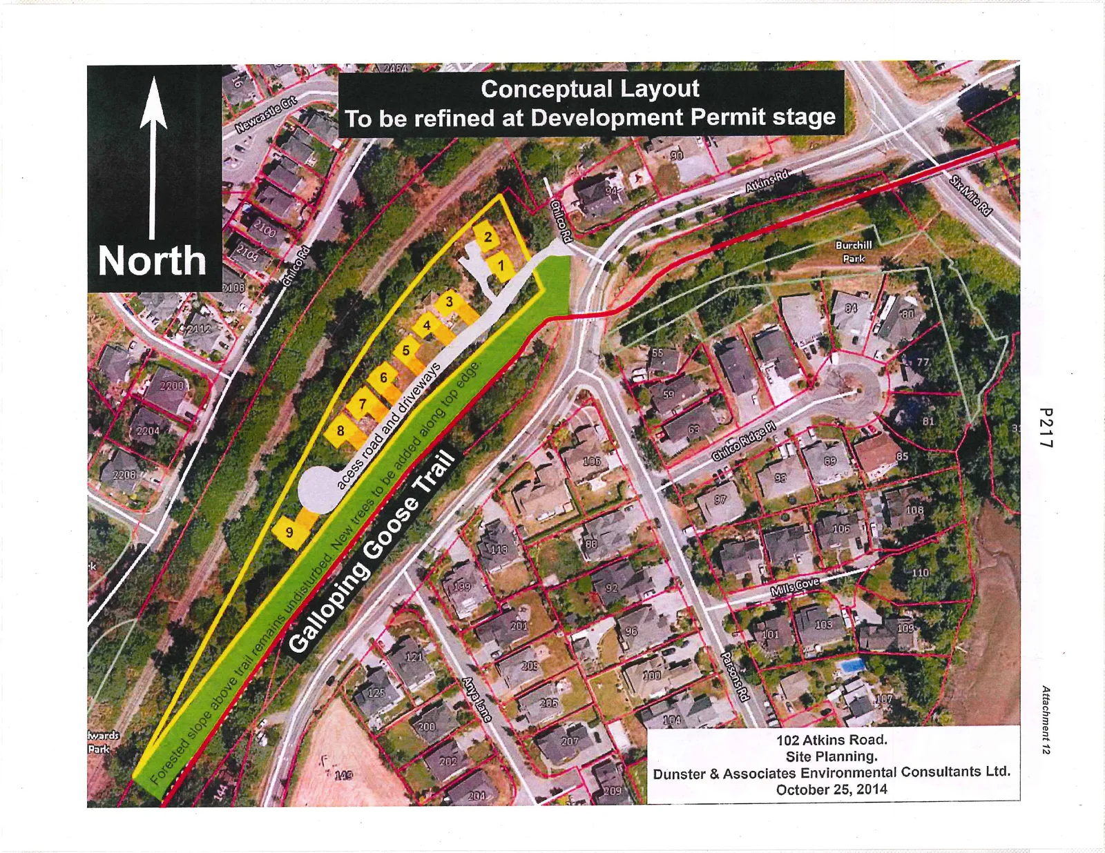
102 Atkins Road. Site Planning. Dunster & Associates Environmental Consultants Ltd. October 25, 2014
Map Annotations and Features
- Proposed Lots: 1, 2, 3, 4, 5, 6, 7, 8, 9
- Infrastructure and Development Notes:
- acess road and driveways
- New trees to be added along top edge.
- Forested slope above trail remains undisturbed.
- Parks:
- Burchill Park
- Edwards Park
- Trails:
- Galloping Goose Trail
- Surrounding Roads:
- Newcastle Crt
- Chilco Rd
- Atkins Rd
- Six Mile Rd
- Chilco Ridge Pl
- Parsons Rd
- Mills Cove
- Anya Lane
- Orientation: North arrow pointing towards the top-left of the image.
Page 221
Extracted from: 2015 03 03 Council Agenda