This site is in beta — data may be incomplete and features are still being added.
Council Meeting/Documents/Subject Property Orthophoto - 315 Stewart Ave
Appendix

Subject Property Orthophoto - 315 Stewart Ave

March 17, 2015Page 651 section

Aerial image of 315 Stewart Avenue showing the existing dock and shoreline vegetation.

8.1b Environmental Development Permit No. 2015/01 - 315 Stewart Avenue
315 Stewart AvenueVisual confirmation of waterfront access

315 Stewart Ave

Subject Property Orthophoto
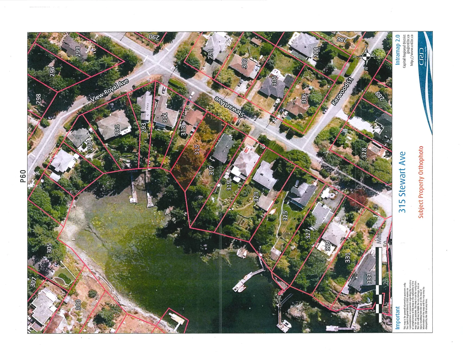
Aerial orthophoto map centered on the property at 315 Stewart Ave. The map shows red-outlined property boundaries and house numbers for the surrounding area. Properties shown include 315, 317, 319, 323, 325, 327, 329, 331, and 333 along the shoreline. Street names visible are View Royal Ave, Stewart Ave, and Kerwood St. The map includes a scale in metres and a north arrow.

Important This map is for general information purposes only. The Capital Regional District (CRD) makes no representations or warranties regarding the accuracy or completeness of this map or the suitability of the map for any purpose. This map is not for navigation. The CRD will not be liable for any damage, loss or injury resulting from the use of the map or information on the map and the map may be changed by the CRD at any time.

Page 65
Extracted from: 2015 03 17 Council Agenda