Appendix
Existing Conditions - Surveys of Existing Dock at 315 Stewart Avenue
March 17, 2015Pages 68–694 sections
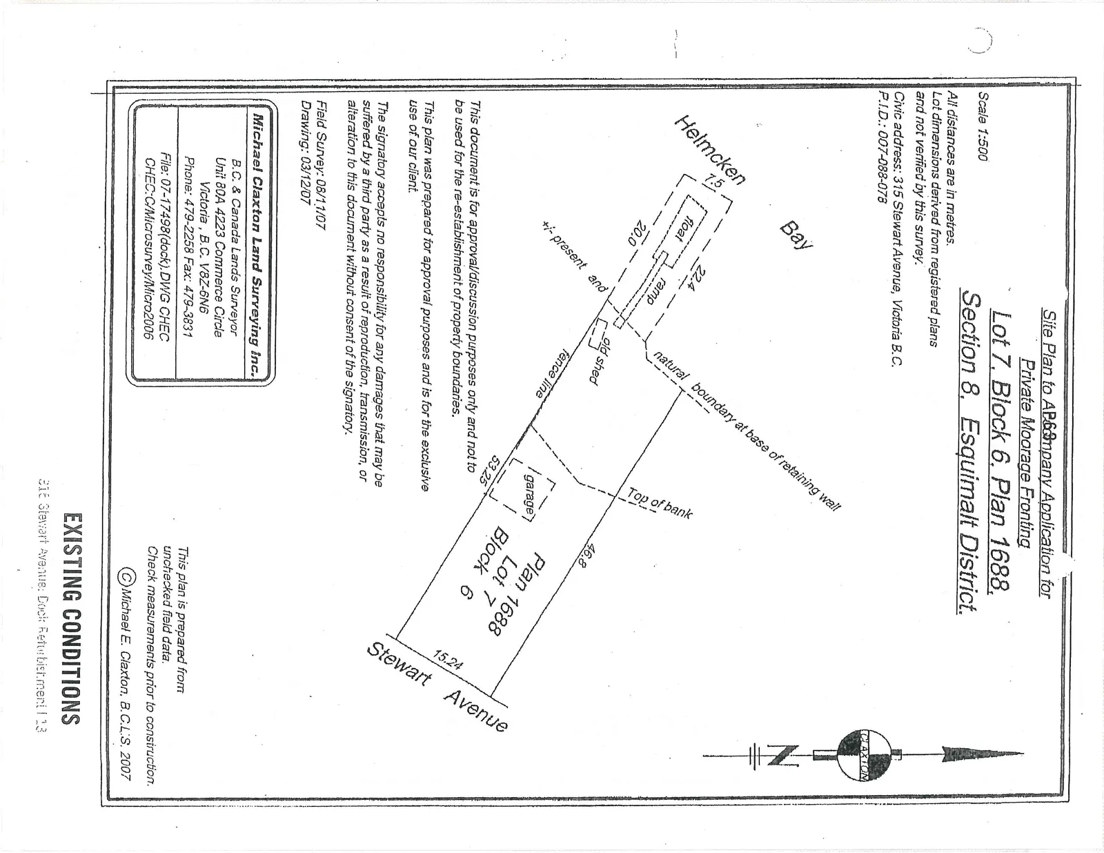
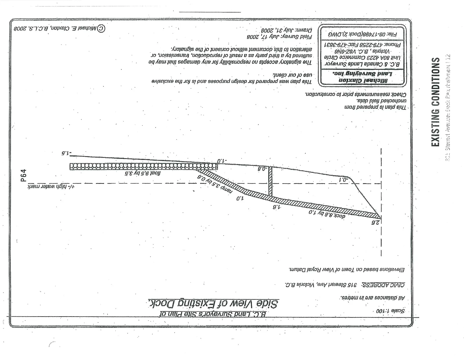
Site plan and side view elevation drawings of the existing dock and mooring at 315 Stewart Avenue, prepared by Michael Claxton Land Surveying Inc.
315 Stewart AvenueLot 7, Block 6, Plan 1688Drawings dated 2007 and 2008
Site Plan to AP63mpany Application for Private Moorage Fronting Lot 7, Block 6, Plan 1688, Section 8, Esquimalt District.
Scale 1:500
- All distances are in metres.
- Lot dimensions derived from registered plans and not verified by this survey.
- Civic address: 315 Stewart Avenue, Victoria B.C.
- P.I.D.: 007-088-078
Plan Notes
- This document is for approval/discussion purposes only and not to be used for the re-establishment of property boundaries.
- This plan was prepared for approval purposes and is for the exclusive use of our client.
- The signatory accepts no responsibility for any damages that may be suffered by a third party as a result of reproduction, transmission, or alteration to this document without consent of the signatory.
- This plan is prepared from unchecked field data. Check measurements prior to construction.
Survey Information
- Field Survey: 08/11/07
- Drawing: 03/12/07
- Michael Claxton Land Surveying Inc.
- Unit 80A 4223 Commerce Circle, Victoria, B.C. V8Z-6N6
- Phone: 479-2258 Fax: 479-3831
- File: 07-17498(dock).DWG CHEC
- CHEC:C/Microsurvey/Micro2006
Page 68–69
EXISTING CONDITIONS
315 Stewart Avenue: Dock Refurbishment | 13
Page 68–69
B.C. Land Surveyor's Site Plan of Side View of Existing Dock.
Scale 1:100
- All distances are in metres.
- CIVIC ADDRESS: 315 Stewart Ave, Victoria B.C.
- Elevations based on Town of View Royal Datum.
Plan Notes
- This plan is prepared from unchecked field data. Check measurements prior to construction.
- This plan was prepared for design purposes and is for the exclusive use of our client.
- The signatory accepts no responsibility for any damages that may be suffered by a third party as a result of reproduction, transmission, or alteration to this document without consent of the signatory.
Survey Information
- Field Survey: July 17, 2008
- Drawn: July 31, 2008
- Michael Claxton Land Surveying Inc.
- Unit 80A 4223 Commerce Circle, Victoria, B.C. V8Z-6N6
- Phone: 479-2258 Fax: 479-3831
- File: 08-17498(Dock 2).DWG
Page 68–69
EXISTING CONDITIONS
315 Stewart Avenue: Dock Refurbishment | 12
Page 68–69
Extracted from: 2015 03 17 Council Agenda