Appendix
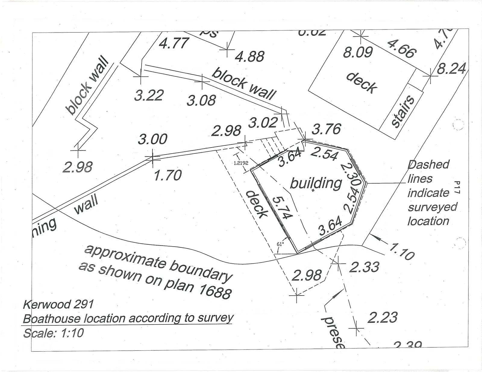
Boathouse location according to survey
April 21, 2015Page 211 section
A zoomed-in survey plan specifically showing the boathouse's relationship to the property boundary and shoreline.
Scale 1:110Approximate boundary as shown on plan 168B
Kerwood 291
Boathouse location according to survey
Scale: 1:10
Survey Notes
- Dashed lines indicate surveyed location
- approximate boundary as shown on plan 1688
- P17
Building and Structures
- Building Dimensions: 3.76, 2.54, 2.30, 2.54, 3.64, 5.74, 3.64
- Deck (attached to building): Includes a dimension of 1.2192 and a 61° angle.
- Main Deck: Dimensions 8.09, 4.66, 0.02, 4.7...
- Stairs: Dimension 8.24
- Block Walls: Measurements of 4.77, 4.88, 3.22, 3.08, 3.02, 2.98, 3.00, 1.70, and 2.98
- Other features: wall, ning wall (retaining wall), prese (present shoreline)
Additional Survey Points and Offsets
- 1.10
- 2.33
- 2.98
- 2.23
- 2.39
Page 21
Extracted from: 2015 04 21 Council Agenda