This site is in beta — data may be incomplete and features are still being added.
Council Meeting/Documents/Hallowell Road No Parking Zones Map
Appendix

Hallowell Road No Parking Zones Map

April 21, 2015Page 371 section

An aerial map delineating the proposed no-parking zones on Hallowell Road.

Admirals Road intersectionHallowell Road corridor

Hallowell Road

No Parking Zones
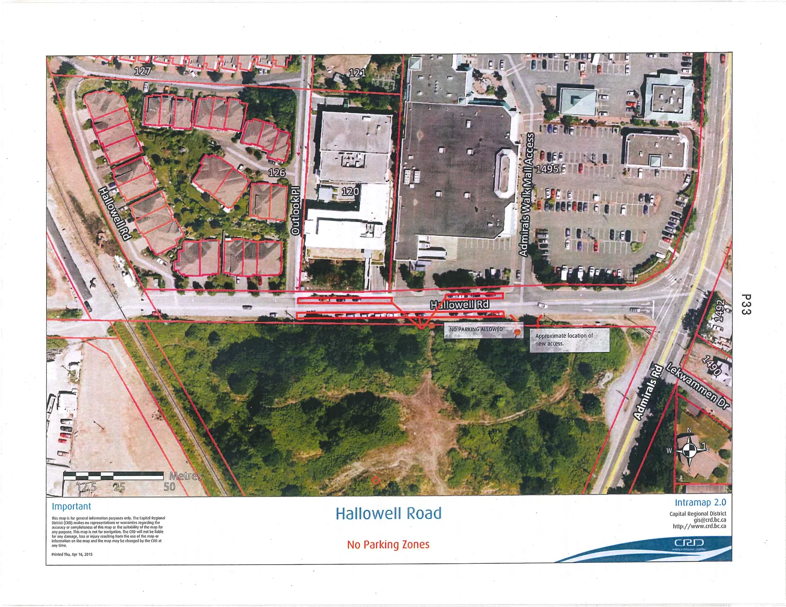
Aerial map of Hallowell Road showing designated "No Parking Zones" outlined in red. The map includes street names such as Hallowell Rd, Admirals Walk Mall Access, Outlook Pl, Admirals Rd, and Lekwammen Dr. Address numbers 120, 121, 126, 127, 1490, 1492, and 1495 are visible. Annotations indicate "NO PARKING ALLOWED" and the "Approximate location of new access."

Important

This map is for general information purposes only. The Capital Regional District (CRD) makes no representations or warranties regarding the accuracy or completeness of this map or the suitability of the map for any purpose. This map is not for navigation. The CRD will not be liable for any damage, loss or injury resulting from the use of the map or information on the map and the map may be changed by the CRD at any time.

Printed Thu, Apr 16, 2015

Intramap 2.0 Capital Regional District gis@crd.bc.ca http://www.crd.bc.ca

Page 37
Extracted from: 2015 04 21 Council Agenda