This site is in beta — data may be incomplete and features are still being added.
Council Meeting/Documents/Schedule 'A' to Bylaw No. 922 - Map of Fagan Place
Appendix

Schedule 'A' to Bylaw No. 922 - Map of Fagan Place

May 19, 2015Page 811 section

Map illustrating the specific location of the highway portion renamed from Chilco Road to Fagan Place.

1 CALL TO ORDER
Location at the intersection of Atkins Road and Chilco Road

P78 SCHEDULE 'A' TO BYLAW NO. 922, 2015
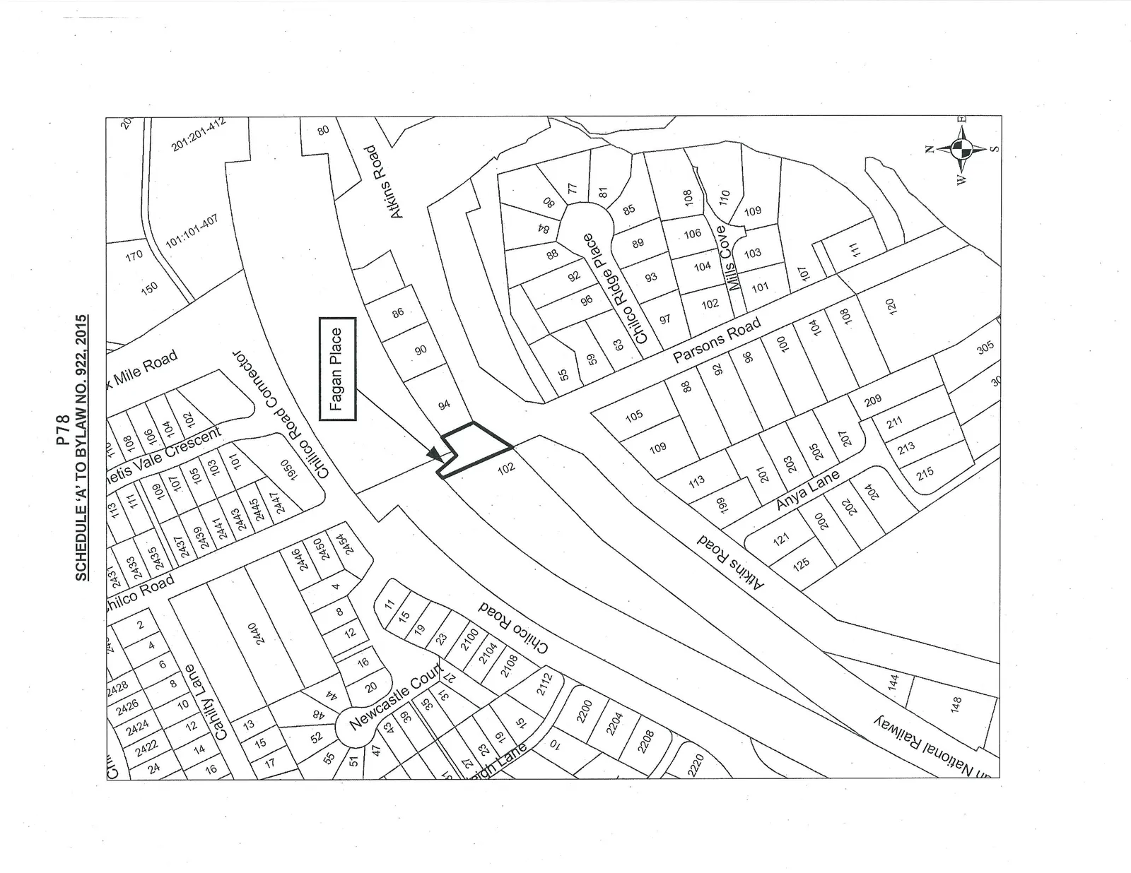
Parcel map showing residential lot layouts and street names. Street names include Chilco Road, Cahilty Lane, Newcastle Court, Leigh Lane, Atkins Road, Chilco Road Connector, Thetis Vale Crescent, Mile Road, Fagan Place, Chilco Ridge Place, Parsons Road, Mills Cove, Anya Lane, and National Railway. Lot 102 is highlighted with a bold outline and an arrow pointing from the "Fagan Place" label.
Page 81
Extracted from: 2015 05 19 Council Agenda