Appendix
SITE PLAN OF LOT 12, SECTION 29, ESQUIMALT DISTRICT, PLAN 13751
February 17, 2015Page 361 section
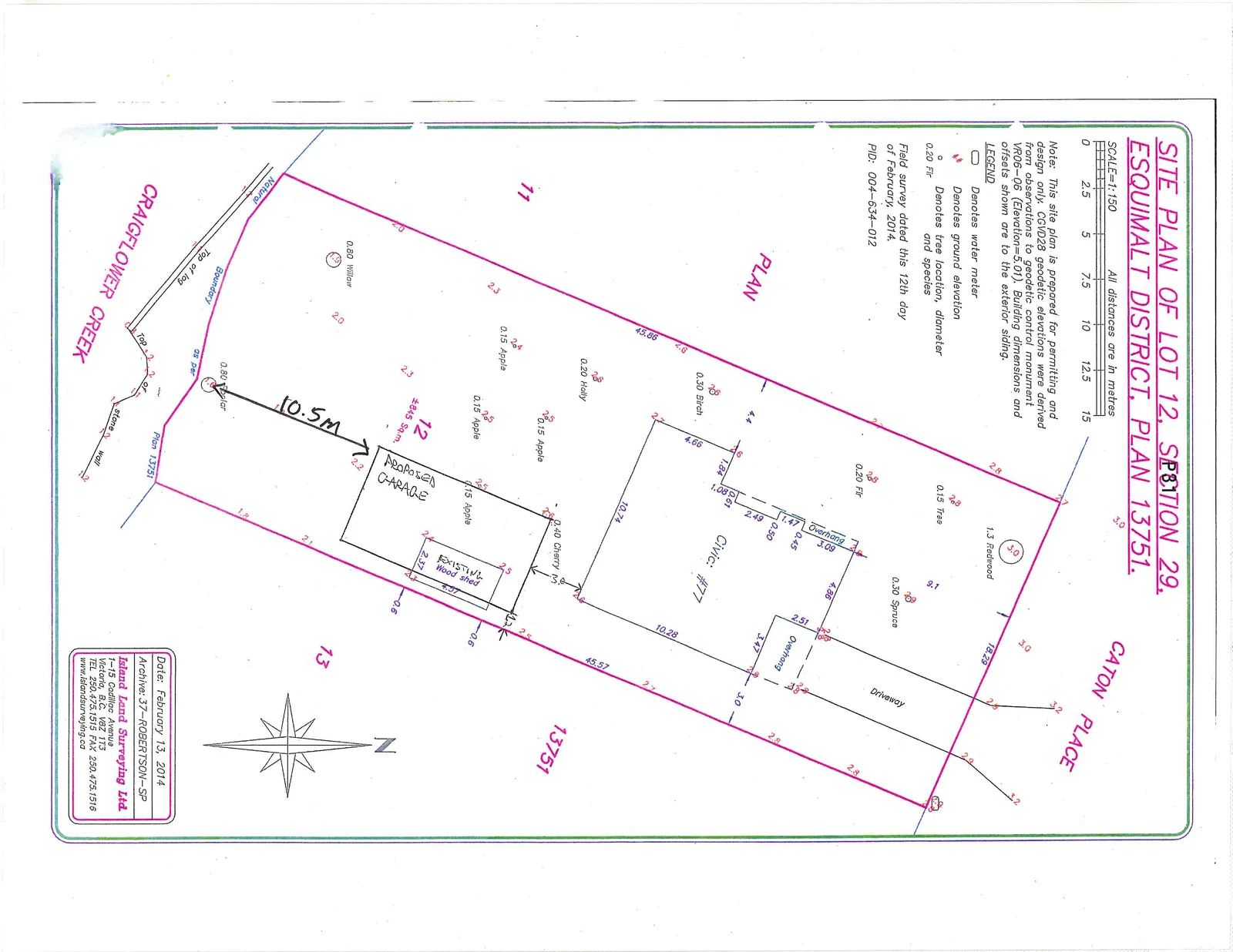
A professional survey plan for 77 Caton Place showing the footprint of the proposed garage and distance from the natural boundary.
Surveyed by Island Land Surveying Ltd.Dated February 13, 2014
SITE PLAN OF LOT 12, SECTION 29, ESQUIMALT DISTRICT, PLAN 13751.
SCALE=1:150 All distances are in metres.
Note: This site plan is prepared for permitting and design only. CGVD28 geodetic elevations were derived from observations to geodetic control monument VR06-06 (Elevation=5.01). Building dimensions and offsets shown are to the exterior siding.
LEGEND
| Symbol | Description |
|---|---|
| (Circle with horizontal line) | Denotes water meter |
| (Number with superscript circle) | Denotes ground elevation |
| (Circle with dot) | Denotes tree location, diameter and species (e.g., 0.20 Fir) |
Field survey dated this 12th day of February, 2014. PID: 004-634-012
Site Details
- Civic Address: #77
- Lot: 12
- Area: ±845 Sq. m.
- Access: Driveway from Caton Place.
- Existing Structures:
- Main residence with labeled overhangs.
- Existing wood shed (2.37 x 4.27).
- Proposed Improvements: Proposed Garage.
- Environmental Features:
- Craigflower Creek along the southern boundary.
- Labels: Natural Boundary, Top of log, stone wall.
- Tree Inventory:
- 1.3 Redwood
- 0.15 Tree
- 0.30 Spruce
- 0.20 Fir
- 0.30 Birch
- 0.20 Holly
- 0.15 Apple (x3)
- 0.40 Cherry
- 0.80 Willow
- 0.80 Poplar (located 10.5m from the Proposed Garage)
Surveyor Information
Island Land Surveying Ltd. 1-15 Cadillac Avenue Victoria, B.C. V8Z 1T3 TEL 250.475.1515 FAX 250.475.1516 www.islandsurveying.ca
- Date: February 13, 2014
- Archive: 37-ROBERTSON-SP
Page 36
Extracted from: 2015 02 17 Council Agenda