This site is in beta — data may be incomplete and features are still being added.
Council Meeting/Documents/EIA Supporting Graphics and Photos - 77 Caton Place
Appendix

EIA Supporting Graphics and Photos - 77 Caton Place

February 17, 2015Pages 41–481 section

Maps, figures, and photographs supporting the Environmental Impact Assessment, including DPA shading and site photos.

8.1.a Environmental Development Permit with Variances No. 2014/08 - 77 Caton Place
Identifies 15m Natural Shoreline setbackShows shoreline conditions and sediment control options

Environmental Impact Assessment for 77 Caton Place, Victoria, BC
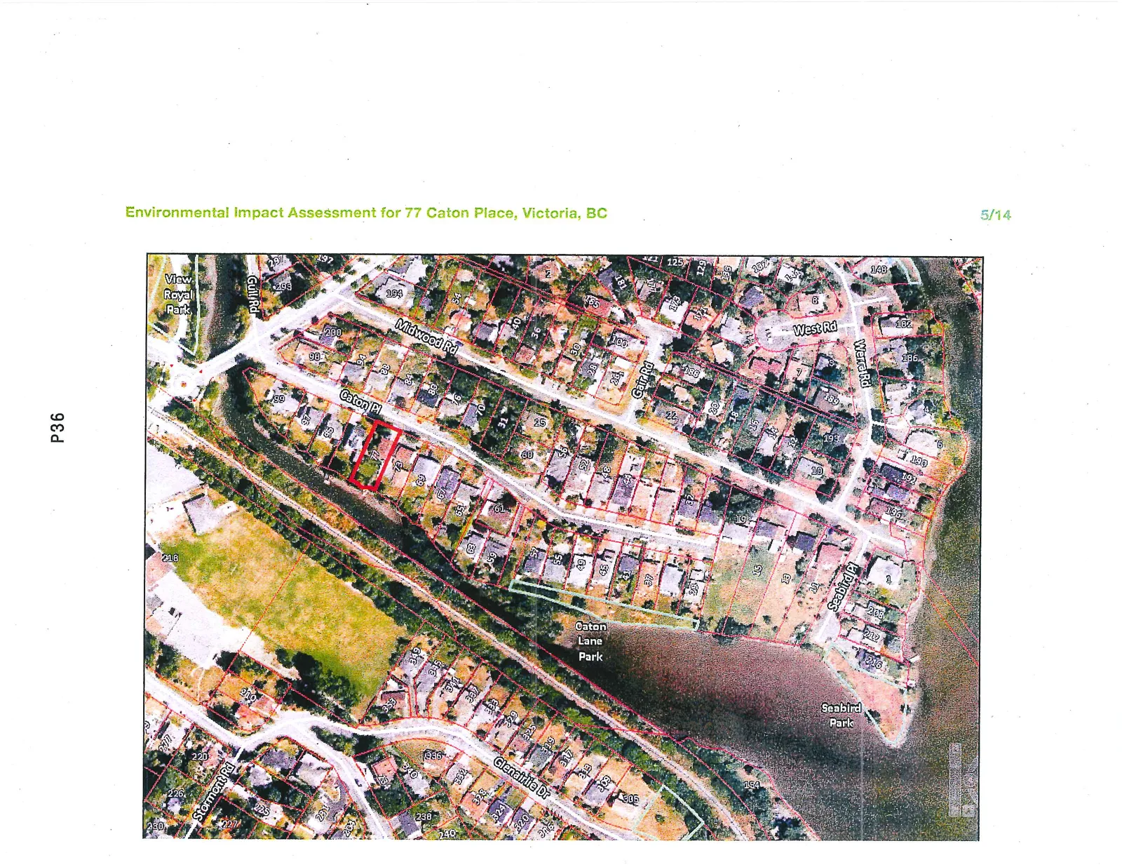
Aerial map view showing the subject property at 77 Caton Place within its neighborhood context, including proximity to Caton Lane Park and Seabird Park.
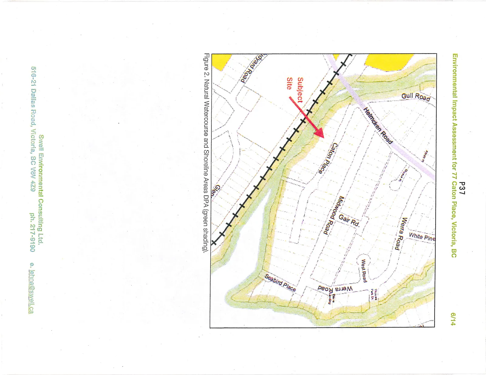
Map of the subject site showing the extent of the Natural Watercourse and Shoreline Areas Development Permit Area (DPA) marked with green shading.

Figure 2. Natural Watercourse and Shoreline Areas DPA (green shading).
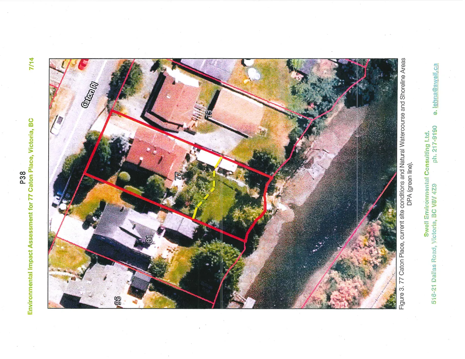
Detailed aerial photograph of 77 Caton Place showing current site conditions and the Natural Watercourse and Shoreline Areas DPA boundary indicated by a green line.

Figure 3. 77 Caton Place, current site conditions and Natural Watercourse and Shoreline Areas DPA (green line).

SITE PLAN OF LOT 12, SECTION 29, ESQUIMALT DISTRICT, PLAN 13751
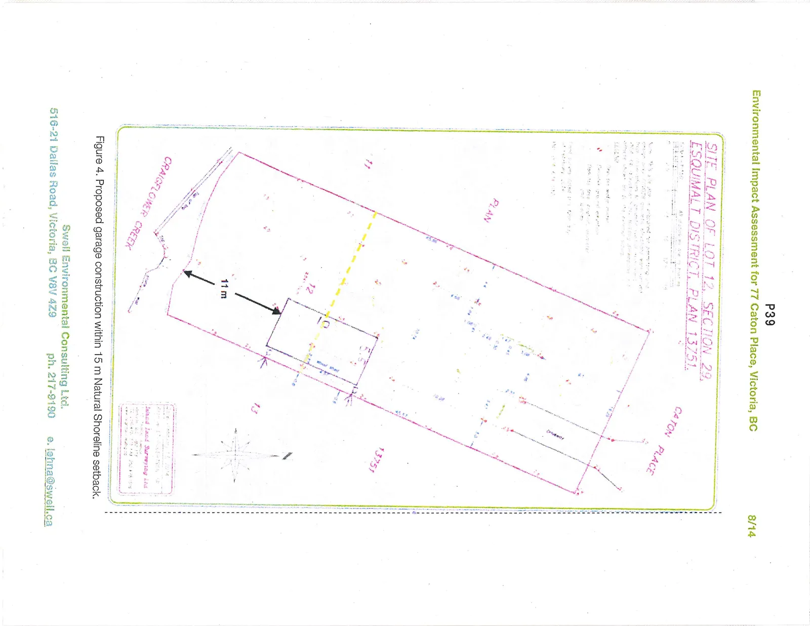
Proposed site plan for a garage construction on lot 12, showing an 11 m setback from Craigflower Creek.

Figure 4. Proposed garage construction within 15 m Natural Shoreline setback.
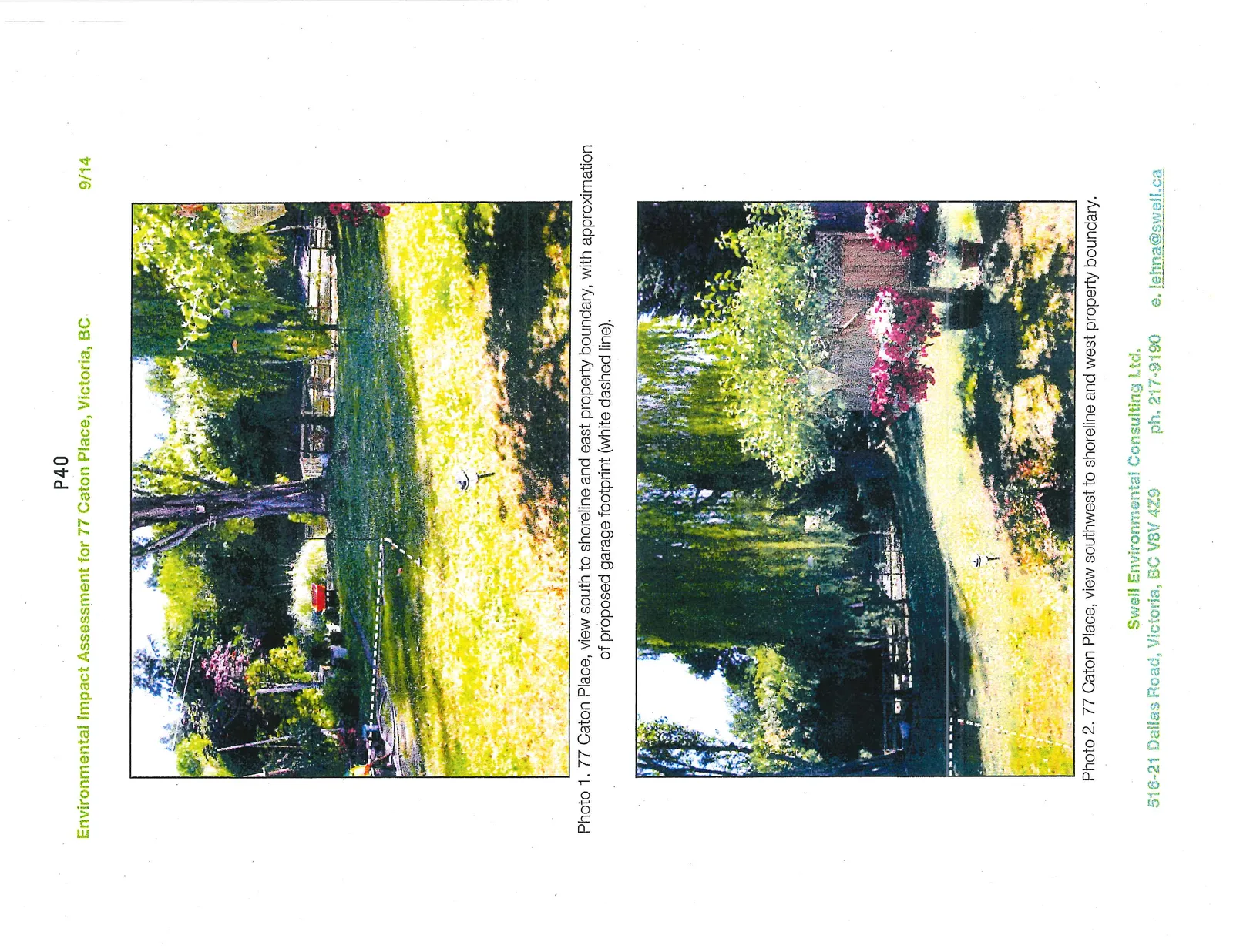
Photo 1 showing a view south toward the shoreline and the east property boundary, with the proposed garage footprint indicated by a white dashed line.
Photo 2 showing a view southwest toward the shoreline and the west property boundary.

Photo 1. 77 Caton Place, view south to shoreline and east property boundary, with approximation of proposed garage footprint (white dashed line).

Photo 2. 77 Caton Place, view southwest to shoreline and west property boundary.
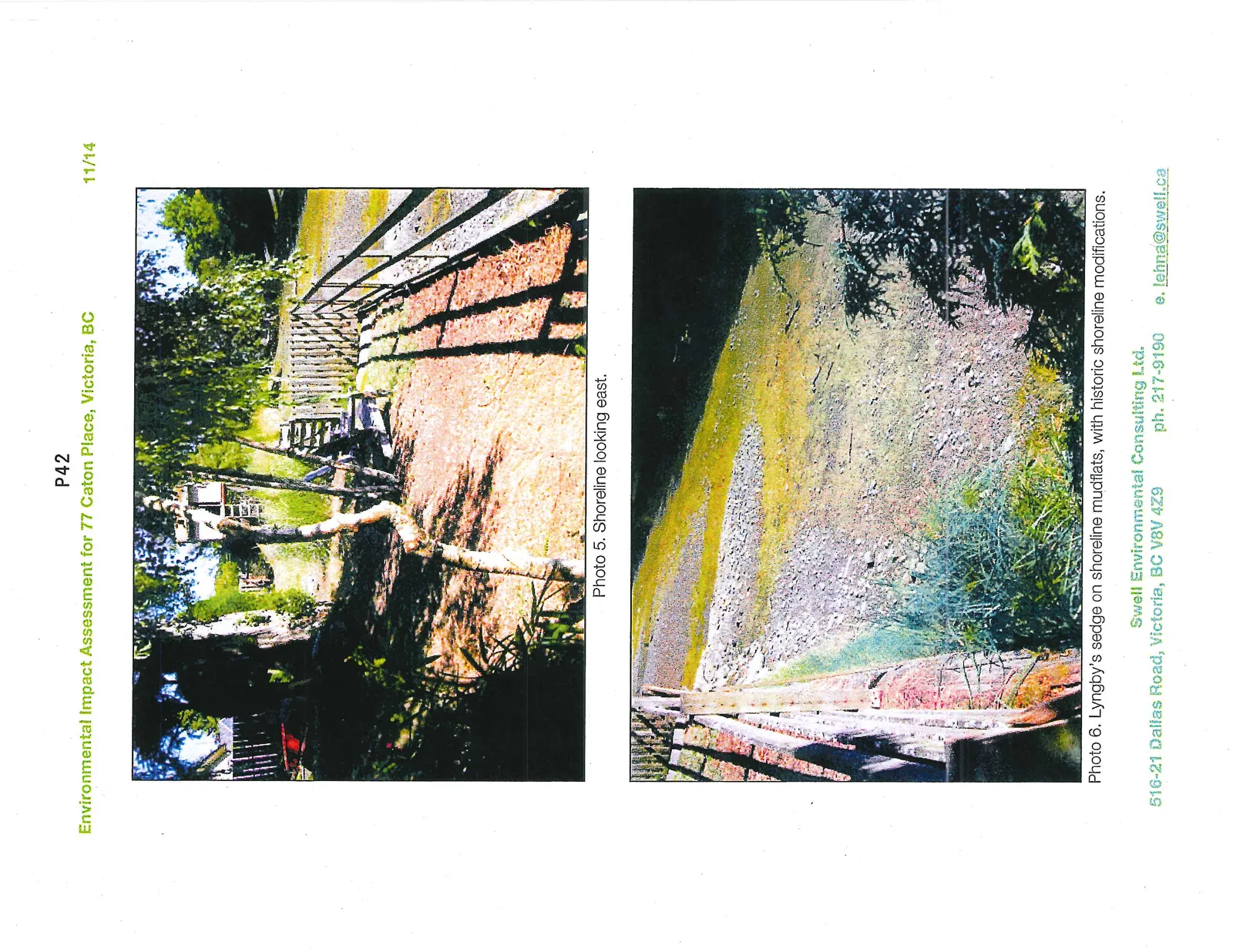
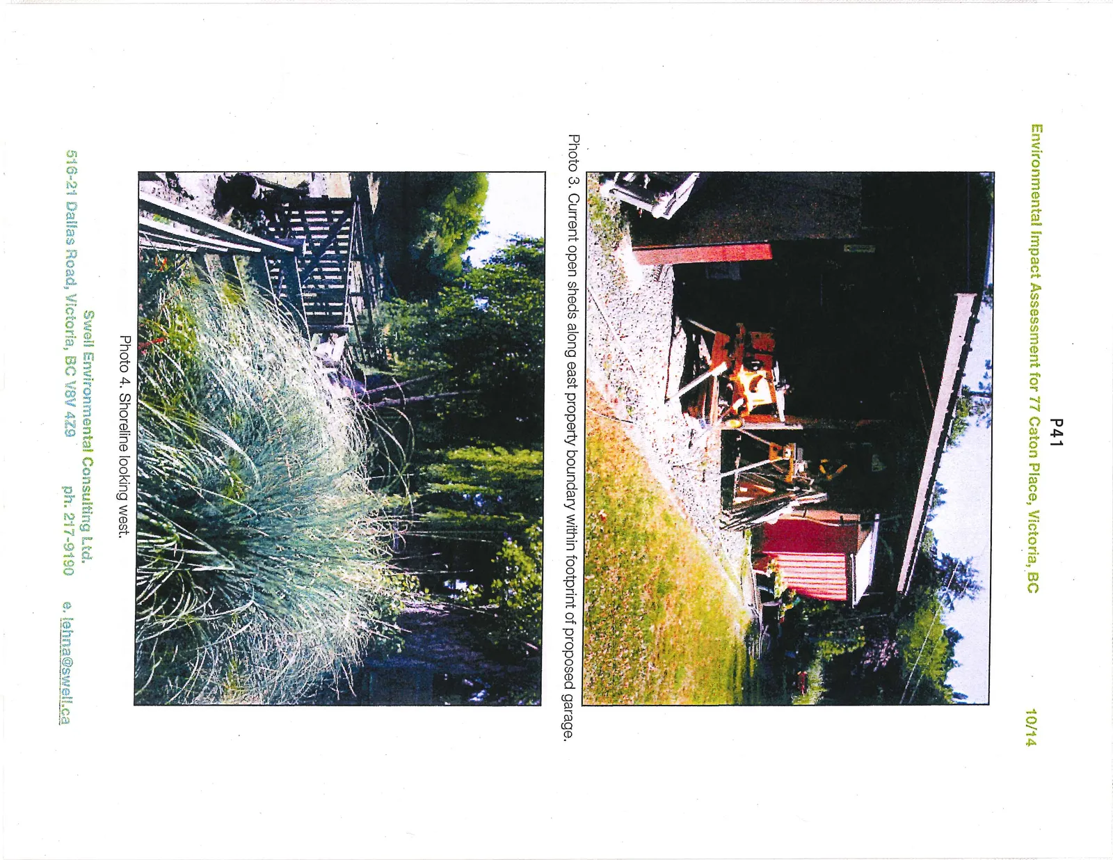
Photo 3 showing current open sheds on the property along the east boundary, within the footprint of the proposed garage.
Photo 4 showing a view of the shoreline looking west.

Photo 3. Current open sheds along east property boundary within footprint of proposed garage.

Photo 4. Shoreline looking west.

Photo 5. Shoreline looking east.

Photo 6. Lyngby's sedge on shoreline mudflats, with historic shoreline modifications.

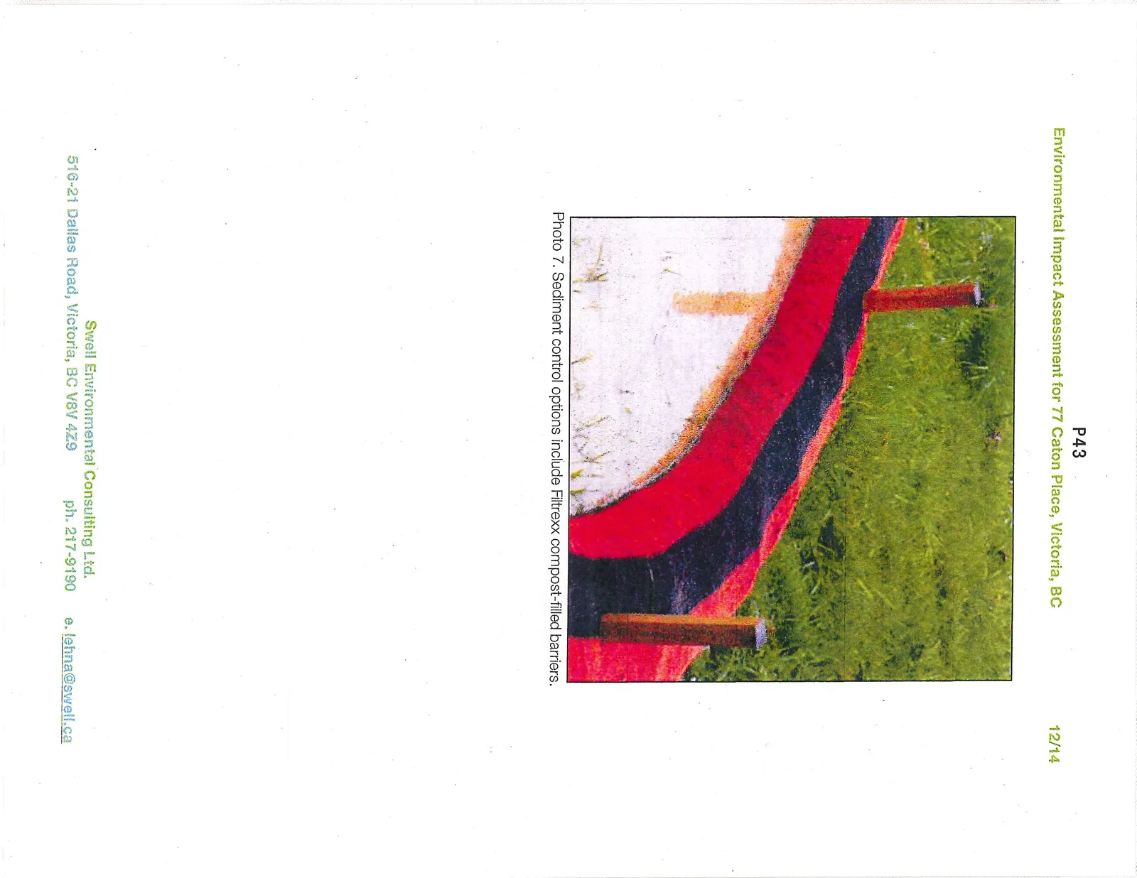
Photo 7. Sediment control options include Filtrexx compost-filled barriers.

Page 41–48
Extracted from: 2015 02 17 Council Agenda