A detailed parcel map showing legal lot numbers and infrastructure markers around Hovey Crescent and Bessborough Avenue.
Shows municipal sewer line easements.
Cadastral Map - Ovey Crescent and View Royal Avenue
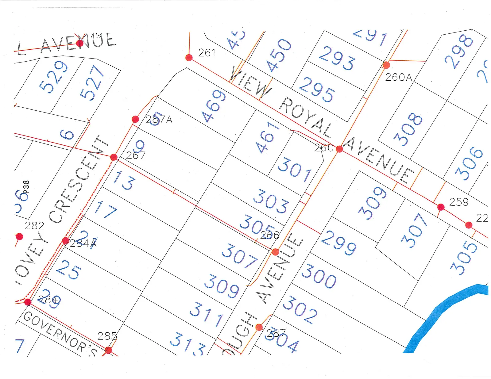
Street Names
- L AVENUE
- OVEY CRESCENT
- VIEW ROYAL AVENUE
- OUGH AVENUE
- GOVERNOR'S
Property Identifiers and Survey Points
The following numerical identifiers are marked on the parcels and along the road networks:
Street Address / Survey Points (Red Dots):
- 22
- P38
- 259
- 260
- 260A
- 261
- 266
- 267
- 282
- 284A
- 285
- 287
- 289
Lot Numbers:
- 6
- 7
- 13
- 17
- 21
- 25
- 29
- 257A
- 291
- 293
- 295
- 298
- 299
- 300
- 301
- 302
- 303
- 304
- 305 (multiple instances)
- 306
- 307 (multiple instances)
- 308
- 309 (multiple instances)
- 311
- 313
- 450
- 451
- 461
- 469
- 527
- 529
A blue line representing a water feature is visible at the bottom of the map section, adjacent to lots 304 and 305.
Page 41
Extracted from: 2015 10 20 Council Agenda