This site is in beta — data may be incomplete and features are still being added.
Council Meeting/Documents/Subject Property Map - 17A Jedburgh Rd
Other

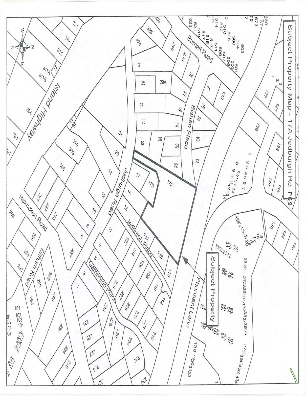
Subject Property Map - 17A Jedburgh Rd

July 21, 2015Page 751 section

Location map for the Jedburgh Road development site.

1 CALL TO ORDER
17A Jedburgh Road

Subject Property Map - 17A Jedburgh Rd

A cadastral map showing property parcels and street layouts. The "Subject Property" is highlighted with a bold outline at 17A Jedburgh Road, indicated by an arrow. Surrounding streets include Jedburgh Road, Jedburgh Place, Garrington Place, Pheasant Lane, Bishan Place, Burnett Road, Island Highway, Helmcken Road, and Eltham Road. Individual lots are labeled with street numbers or parcel identifiers.
Page 75
Extracted from: 2015 07 21 Council Agenda