Other
Proposed Subdivision Plan - 17A Jedburgh Road
July 21, 2015Pages 77–782 sections
Surveyor's draft plan showing the proposed 7 lots and common property roadway.
April 11, 2015Wey Meyenburg Land Surveying Inc.
Preliminary Lot Layout - Jedburgh
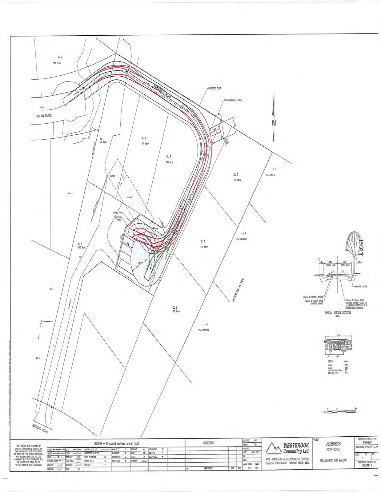
Project Information
- Project: Jedburgh - John Koren
- Consultant: Westbrook Consulting Ltd.
- Date: July 2013
- Project No.: P-0503
- Figure: 4
- Scale: Horiz. 1:250
Legend - Proposed services shown bold
| Symbol | Description | Symbol | Description |
|---|---|---|---|
| ---- W ---- | WATER | ---- | EXISTING U/G UTIL. |
| ---- S ---- | SEWER | ---- | PROPOSED U/G UTIL. |
| ---- D ---- | DRAIN | ¤ | LAMP STANDARD |
| ---- H ---- | HYDRO/TEL | ○ | POWER POLE |
| - - - - | NATURAL GRADE | ⚐ | ROAD SIGN |
| [ ] | CULVERT | ⛑ | HYDRANT |
| 🧱 | HEADWALL | ⧖ | VALVE |
| ⌖ | MONUMENT | × | CUT PIN |
| ⏺ | LEAD PLUG | ▣ | CATCH BASIN |
| ⧓ | REDUCER |
Typical Cross Section Details
- Surface: 50mm of Asphalt Paving
- Base: 200mm of 20mm minus crushed gravel placed on a subgrade approved by a Geotechnical Engineer.
- Lane Widths: Includes a 3.0m travel lane, a 2.5m travel lane, and a 1.5m sidewalk.
General Notes The location and elevation of existing underground services on this drawing may not be accurate or complete. The actual horizontal and vertical locations must be confirmed by utility companies and the contractor prior to the start of any excavation.
Page 77–78
Proposed Subdivision Plan Of: Lot A, Section 8, Esquimalt District, Plan VIP71776
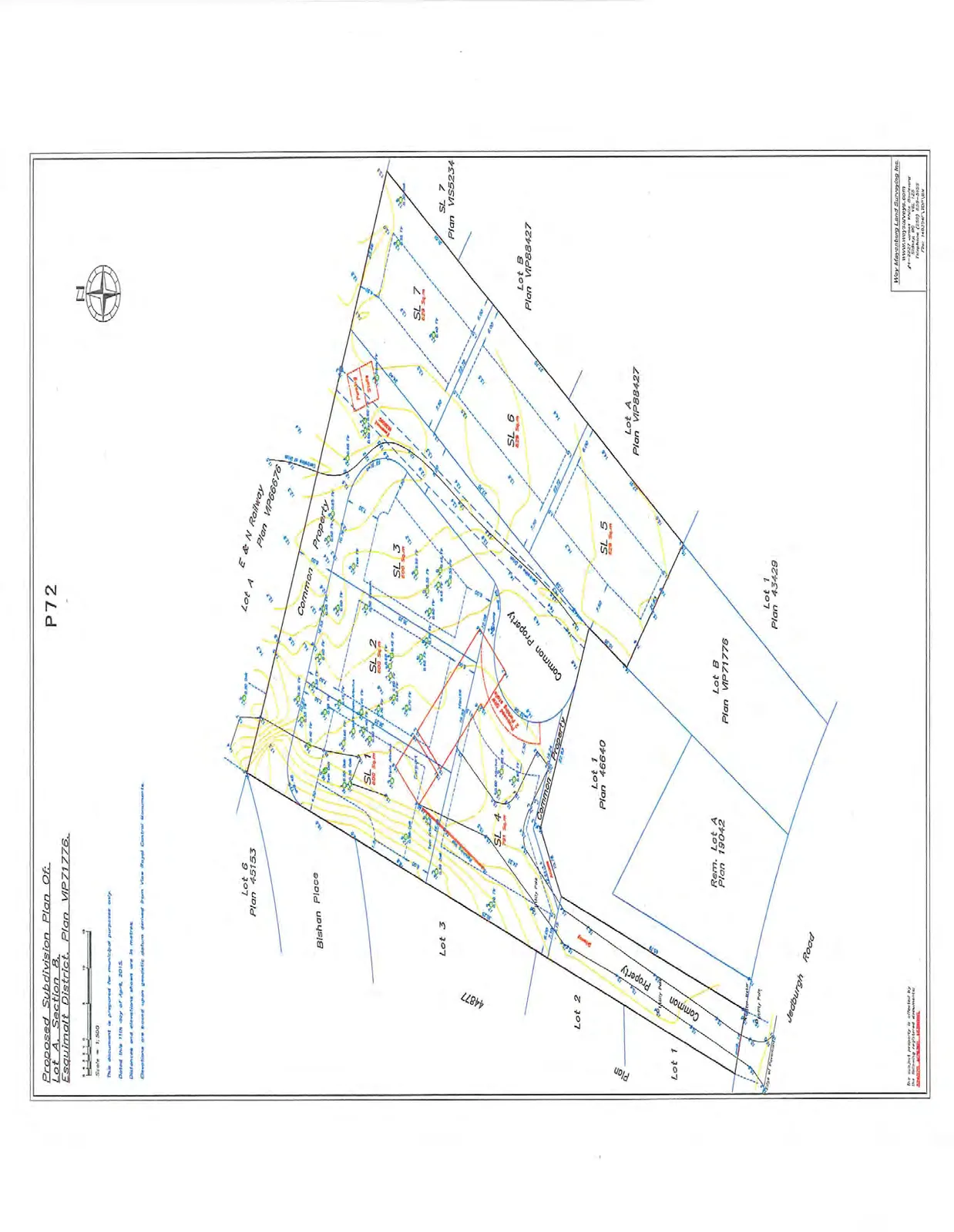
Plan Details
- Date: 11th day of April, 2015
- Scale: 1:500
- Surveyor: Wey Mayenburg Land Surveying Inc.
- Notes: Distances and elevations shown are in metres. Elevations are based upon geodetic datum derived from View Royal Control Monuments.
Lot Area Summary
- SL 1: 600 Sq.m
- SL 2: 600 Sq.m
- SL 3: 600 Sq.m
- SL 4: 701 Sq.m
- SL 5: 629 Sq.m
- SL 6: 629 Sq.m
- SL 7: 629 Sq.m
Adjacent Properties and Features
- North/East: Lot A E & N Railway Plan VIP66676; Lot 7 Plan VIS5234
- South/East: Lot B Plan VIP88427; Lot 1 Plan 43429
- South: Lot B Plan VIP71776; Rem. Lot A Plan 19042; Lot 1 Plan 46640
- West: Lot 6 Plan 45153; Lot 3; Lot 2; Lot 1
- Access: Connects to Bishan Place and Jedburgh Road via designated Common Property.
Page 77–78
Extracted from: 2015 07 21 Council Agenda