COUNCIL REPORT: ENVIRONMENTAL DEVELOPMENT PERMIT APPLICATION 2015/10 - 333 Stewart Avenue
Staff report for a permit to legalize an existing accessory boathouse encroaching over the natural boundary of Esquimalt Harbour.
TOWN OF VIEW ROYAL
Council Report
TO: Mayor and Council DATE: July 15, 2015 FROM: Jeff Chow, MCIP, RPP, Senior Planner MEETING: July 21, 2015 FILE NO.: 3060-20-2015/10
ENVIRONMENTAL DEVELOPMENT PERMIT APPLICATION 2015/10 - 333 Stewart Avenue
RECOMMENDATION:
That the July 15, 2015 report from the Senior Planner titled "Environmental Development Permit Application 2015/10 - 333 Stewart Avenue" be received.
CHIEF ADMINISTRATIVE OFFICER'S COMMENTS:
I concur with the recommendation.
DIRECTOR OF DEVELOPMENT SERVICES' COMMENTS:
I concur with the recommendation.
PURPOSE
The purpose of this report is to introduce a development permit application for the siting of an existing accessory building that is in the Natural Watercourse and Shoreline Areas Development Permit Area and encroaches over the natural boundary of Esquimalt Harbour.
BACKGROUND
The 1190 m² parcel is located on Esquimalt Harbour and is zoned R-1: Detached Residential (Large Lot). A 1930s single family dwelling on the parcel was renovated with a major addition in 2008.
The applicant is in the process of renewing a license of occupation from the Department of National Defense for a dock (including moorage and float), boat house and associated structures. A 1950s era boat house was situated over small cove in the foreshore until it was destroyed by storm action and replaced with a new accessory building in 2012 as shown in Figure 1 and Attachment 2.
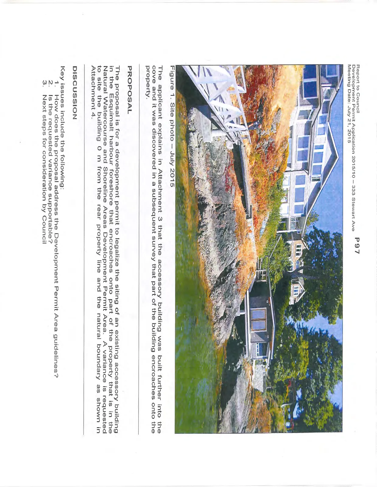
Figure 1. Site photo – July 2015
The applicant explains in Attachment 3 that the accessory building was built further into the cove and it was discovered in a subsequent survey that part of the building encroaches onto the property.
PROPOSAL
The proposal is for a development permit to legalize the siting of an existing accessory building in the Esquimalt harbour foreshore that encroaches onto part of the property that is in the Natural Watercourse and Shoreline Areas Development Permit Area. A variance is requested to site the building 0 m from the rear property line and the natural boundary as shown in Attachment 4.
DISCUSSION
Key issues include the following:
- How does the proposal address the Development Permit Area guidelines?
- Is the requested variance supportable?
- Next steps for consideration by Council
1. Development Permit considerations
The proposal generally addresses the relevant Development Permit Area guidelines (see Attachment 5) given that it is for a small encroachment into the upland portion of the development permit area, as shown in page 5 of Attachment 6. A registered professional biologist’s report (Attachment 6) concludes there are no present or future marine foreshore environmental impacts from the construction. The report states that "as it sits now, the structure provides some overhead cover for a variety of marine and upland wildlife and has not resulted in any significant disturbances to the existing upland vegetation."
Much of the surrounding area is rock with shallow soils that are only suitable for moss and grass. Removal of invasive species such as Himalayan Blackberry upland of the accessory building (see Figure 2) and replanting with suitable native plant species would be appropriate as a condition of the development permit, given the small scale of the encroachment.
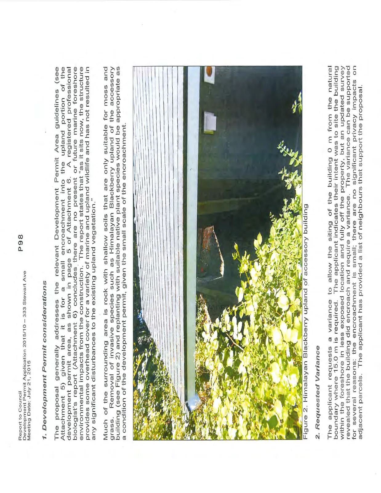
Figure 2. Himalayan Blackberry upland of accessory building
2. Requested Variance
The applicant requests a variance to allow the siting of the building 0 m from the natural boundary where 15.0 m is required. The applicant indicates their intent was to site the building within the foreshore in less exposed location and fully off the property, but an updated survey revealed that the building did encroach and require a variance. The variance can be supported for several reasons: the encroachment is small; there are no significant privacy impacts on adjacent parcels. The applicant has provided a list of neighbours that support the proposal.
The Province estimates a one metre rise in sea level for British Columbia by 2100. The building would not be expected to last until that date but in combination with tidal action and storm surge, the life of the building could be reduced. The Department of National Defence in issuing licenses of occupation requires that property owners have insurance for structures in the foreshore. If the Town were to approve the variance or issue a building permit, it would be appropriate to do so on the condition that the Town receive an indemnity from the risks this previously constructed building may face. Options will be presented for Council's consideration.
Alternatively, if Council were to reject the variance, the corner of the structure would have to be relocated or removed from the property. The work required to do so would not be of no benefit to the Town or to the marine environment.
3. Next Steps
Council may consider the application at an upcoming meeting following notification of residents and owners of nearby properties as required by the Local Government Act and Development Procedures Bylaw No. 730, 2009, and pending the receipt of any additional relevant information that may be requested by Council arising from this report.
RECOMMENDATION:
That the July 9, 2015 report from the Senior Planner titled "Environmental Development Permit Application 2015/10 - 333 Stewart Avenue" be received.
SUBMITTED BY: Jeff Chow, MCIP, RPP Senior Planner
REVIEWED BY: Lindsay Chase, MCIP, RPP Director of Development Services
ATTACHMENTS
- Subject Property Map
- Letter from Applicant – June 23, 2015
- Building Plan 053-1-1 – T-Square holdings Inc.- June 16, 2015
- Site Plan – Brad Cunnin Surveying – April 4, 2012
- Review of Natural Watercourse and Shoreline Areas Development Permit Guidelines
- Biologists Report – Cascadia Biological Services - June 3, 2015 (5 pages)
- Letters of Support – June 22, 2015 (2 pages)
Document Images
(2)