Other
Site Plan - Outdoor Playground (100 Aldersmith Place)
July 21, 2015Page 1261 section
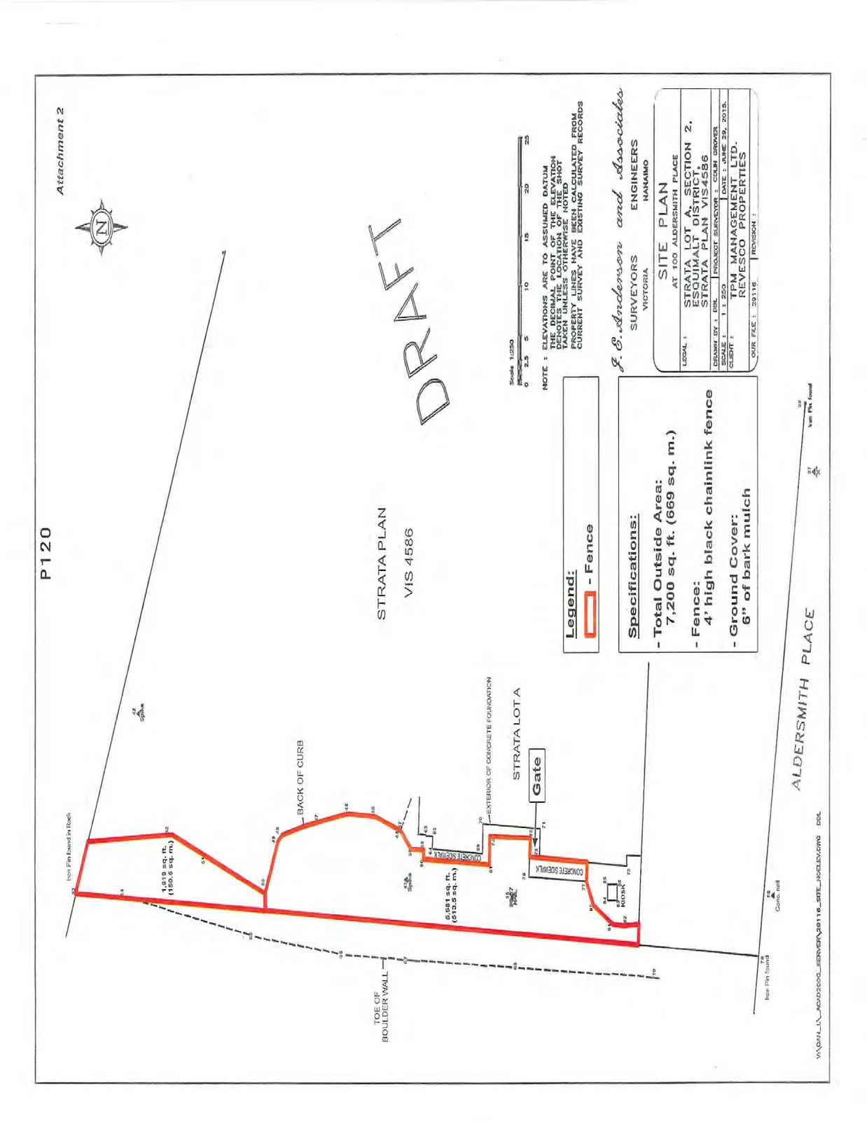
Design plan for the daycare playground showing fencing, mulch, and buffer zones.
June 29, 2015J.E. Anderson and Associates
SITE PLAN AT 100 ALDERSMITH PLACE
Legend
- Red Line: Fence
Specifications:
- Total Outside Area: 7,200 sq. ft. (669 sq. m.)
- Fence: 4' high black chainlink fence
- Ground Cover: 6" of bark mulch
Notes:
ELEVATIONS ARE TO ASSUMED DATUM. THE DECIMAL POINT OF THE ELEVATION DENOTES THE LOCATION OF THE SHOT TAKEN UNLESS OTHERWISE NOTED. PROPERTY LINES HAVE BEEN CALCULATED FROM CURRENT SURVEY AND EXISTING SURVEY RECORDS.
Project Information
J.E. Anderson and Associates SURVEYORS ENGINEERS VICTORIA | NANAIMO
| Field | Detail |
|---|---|
| SITE PLAN | AT 100 ALDERSMITH PLACE |
| LEGAL | STRATA LOT A, SECTION 2, ESQUIMALT DISTRICT, STRATA PLAN VIS4586 |
| CLIENT | TPM MANAGEMENT LTD. REVESCO PROPERTIES |
| DRAWN BY | DDL |
| PROJECT SURVEYOR | COLIN GROVER |
| SCALE | 1:250 |
| DATE | JUNE 29, 2015 |
| OUR FILE | 29116 |
| REVISION |
Page 126
Extracted from: 2015 07 21 Council Agenda